
A Blueprint for Car Culture.
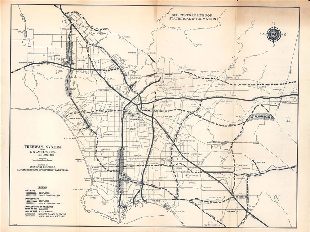
Freeway System in the Los Angeles Area.
sold
This is a 1960 map of the existing and proposed freeway system in the Los Angeles area compiled by the Automobile Club of Southern California. It is a snapshot of a period when infrastructure construction was racing to keep pace with explosive regional population growth. (more details)
Kennedy Space Center the year the Space Shuttle entered testing.
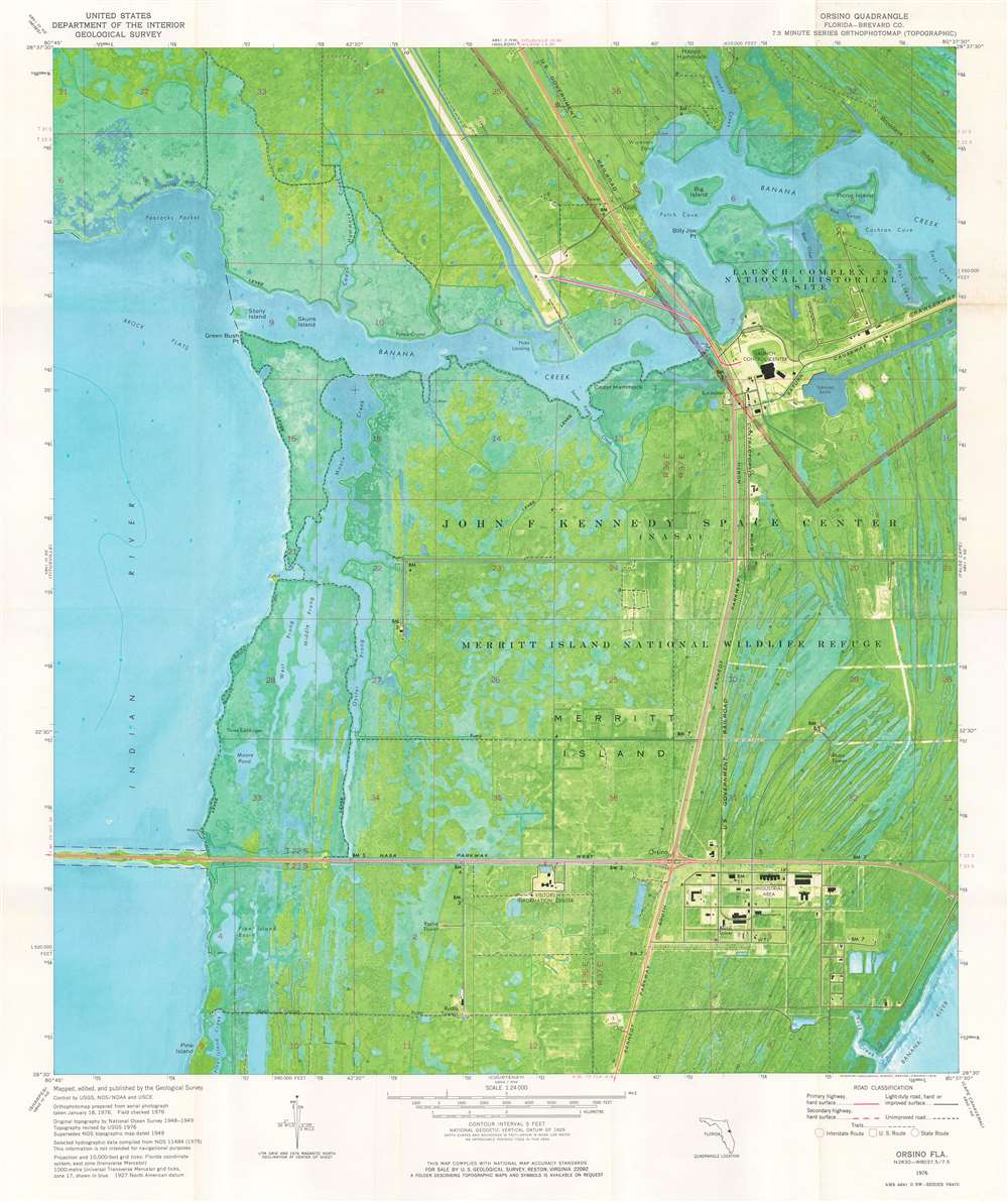
Orsino Quadrangle. Florida - Brevard Co. 7.5 Minute Series Orthophotomap.
sold
This is a 1976 U.S. Geological Survey topographic 'orthophotomap' map of John F. Kennedy Space Center in Florida. Sites around Kennedy Space Center are illustrated, including the Vehicle Assembly Building and the runway later used by the Space Shuttle. Launch Complex 39 is identified, along with the Crawler Causeway, but none of the launch pads themselves are within the depicted area. The visitor's center appears just below NASA Parkway West. Information concerning the map's creation is included below the bottom border. (more details)
After the embarrassing British defeat in Afghanistan.
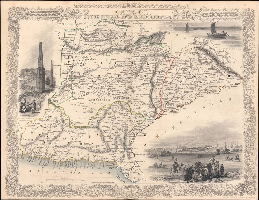
Cabool, the Punjab and Beloochistan.
sold
- Digital Map Information
- Suitable for large format printing
- Full resolution TIFF file
- ICC color profile embedded
- Delivered instantly via download link
This is a rare 1851 John Tallis map of present-day Afghanistan and Pakistan drawn and engraved by John Rapkin for Tallis's Illustrated Atlas and Modern History of the World. A contemporary audience, particularly a British audience, would have viewed this map through the prism of the First Anglo-Afghan War (1839 - 1842), an abject disaster for the British, and the wider context of 'Great Game' imperial competition with Russia. (more details)
Highlights Clark's Grant and the Donation Lands east of Vincennes.
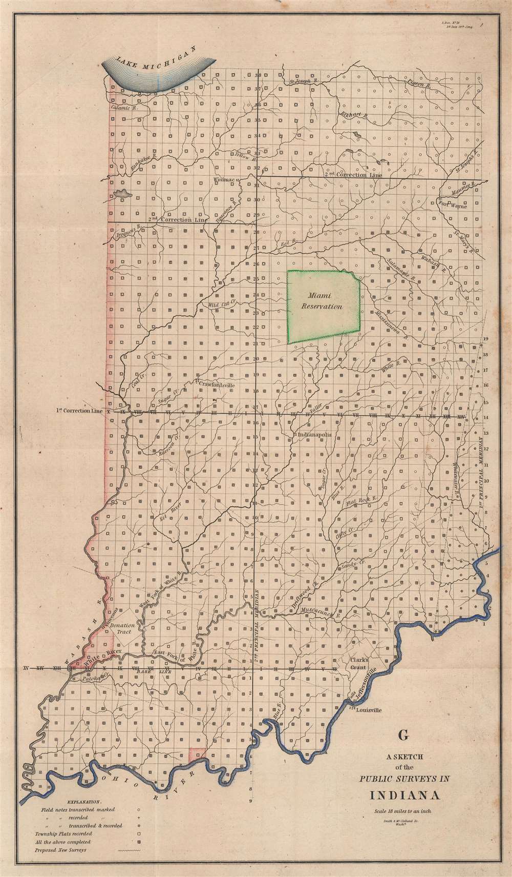
G. A Sketch of Public Surveys in Indiana.
sold
- Digital Map Information
- Suitable for large format printing
- Full resolution TIFF file
- ICC color profile embedded
- Delivered instantly via download link
This is an 1845 General Land Office map of Indiana. The entirety of Indiana is platted into townships, with the exception of Clark's Grant, the Miami Reservation, and the 'Donation Tract' (east of the Wabash River and north of the White River in western Indiana just east of Vincennes). Jeffersonville, Fort Wayne, Winimac, Indianapolis, Vincennes, and Crawfordsville are labeled. Creeks and rivers are illustrated throughout. (more details)
Visit Florida's many incredible attractions!
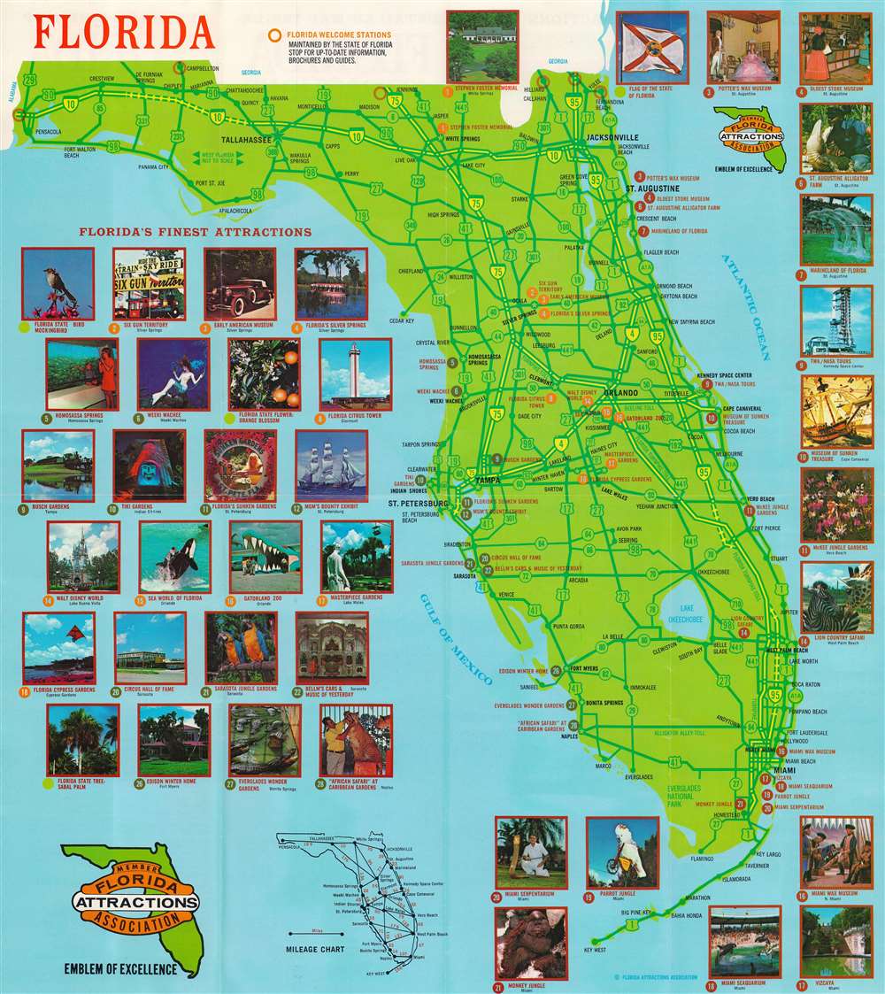
Official Guide Map Florida Attractions.
sold
This is a c. 1978 Florida Attractions Association tourist map of Florida. Some 40 color photographs of tourist sites frame the map, including Walt Disney World, Sea World, Parrot Jungle, Marineland, and Kennedy Space Center. (more details)
A rare limited edition serio comic map of Europe just after the outbreak of World War II.
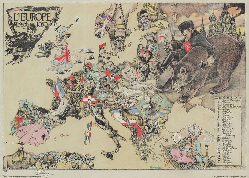
L'Europe en Sept. 1939.
sold
- Digital Map Information
- Suitable for large format printing
- Full resolution TIFF file
- ICC color profile embedded
- Delivered instantly via download link
This is a striking 1939 André Vlaanderen serio-comic map of 'Europe in September 1939' just after the outbreak of World War II - hand colored and signed by the author in a limited release of 150 (this is no. 10). Vlaanderen adopts the serio-comic map genre to convey the violence, chaos, and fear then enveloping Europe. He pays tribute to Fred Rose, the popularizer of the serio-comic map, by drawing Norway and Sweden (Nos. 13 and 14) as dogs, following Rose's 1899 Angling in Troubled Waters. Instead of providing our own explication of this map, we offer Vlaanderen's words in translation from a French version of the accompanying typewritten Dutch text. (more details)
The metropolis of Edo, near the end of the Tokugawa period.
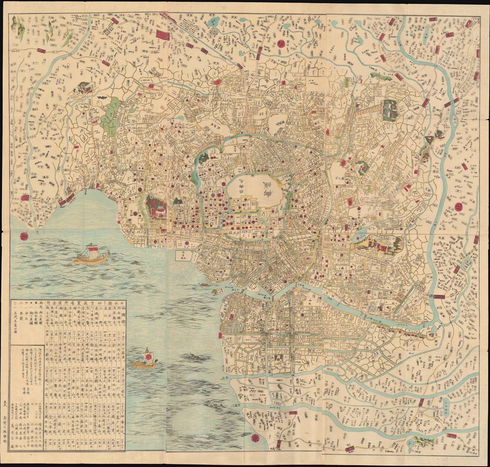
安政改正 府鄉御江戶繪圖 / [Sketch Map of the City and Villages of Edo, Ansei Revised Edition].
sold
- Digital Map Information
- Suitable for large format printing
- Full resolution TIFF file
- ICC color profile embedded
- Delivered instantly via download link
This is a large, stunning, and detailed c. 1855 Takashiba San'yū map of Edo, the capital of the Tokugawa Shogunate. It shows the sprawling urban center of Edo and its environs on the eve of dramatic changes that would unsettle Japanese society and lead to the 1868 downfall of the Tokugawa. (more details)
The earliest map of California to illustrate Viticulture!
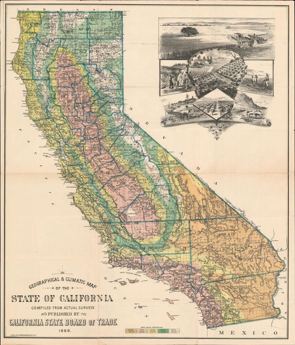
Geographical and Climatic Map of the State of California.
sold
- Digital Map Information
- Suitable for large format printing
- File Size: 54.31 MB
- File Type: ZIP / TIFF
- ICC color profile embedded
- Delivered instantly via download link
One of the earliest depictions of viticulture (wine-making) in California, this is the 1888 Henry Smith Crocker and California State Board of Trade map of California. The large cartouche in the upper right features centrally large fields of grapes. The map itself offers color-coding to highlight different areas of the state based on the mean annual temperature. Thick blue lines outline counties, and individual townships are illustrated. Railroad lines and major roads snake their way across the state, and rivers, lakes, mountains are represented and labeled as well. (more details)
Iconic Tolkien promotional poster map.
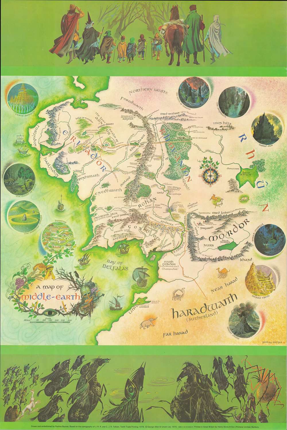
A Map of Middle-Earth.
sold
This is the 1978 edition of the iconic 1970 poster map of J. R. R. Tolkien's Middle Earth drawn by Pauline Diana Baynes to promote the George, Allen and Unwin release of the Lord of the Rings. Tolkien heaped praise upon Baynes' work, saying 'They are more than illustrations, they are a collateral theme. I showed them to my friends whose polite comment was that they reduced my text to a commentary on the drawings.' (more details)
The new reality in the wake of the 1755 Earthquake.
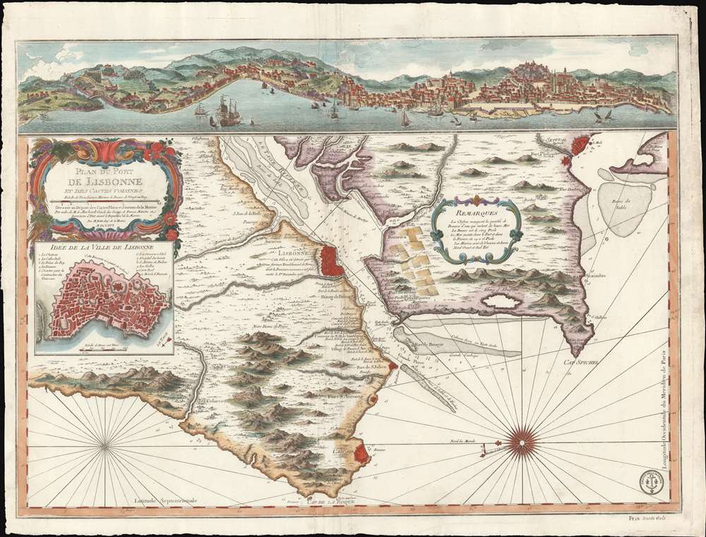
Plan du Port de Lisbonne et es Costes Voisines.
sold
- Digital Map Information
- Suitable for large format printing
- Full resolution TIFF file
- ICC color profile embedded
- Delivered instantly via download link
A scarce 1756 J. N. Bellin nautical map of Lisbon, reflecting the aftermath of the disastrous 1755 mega-earthquake that all but destroyed golden-age Lisbon and the surrounding lands. Oriented to the East - as a ship world approach the Tage - the map depicts the city of Lisbon and entrances to the port on both sides of the Tage River, extending south to Setuval and north beyond Colares. A dramatic view of Lisbon as it would have appeared just before the earthquake surmounts the map. An inset near the rococo title cartouche details the walled city of Lisbon - as it appeared before the quake, but as this is primarily a nautical chart, such would not have affected navigation. (more details)
One of the earliest contemporaneous depictions of the city of Jerusalem.
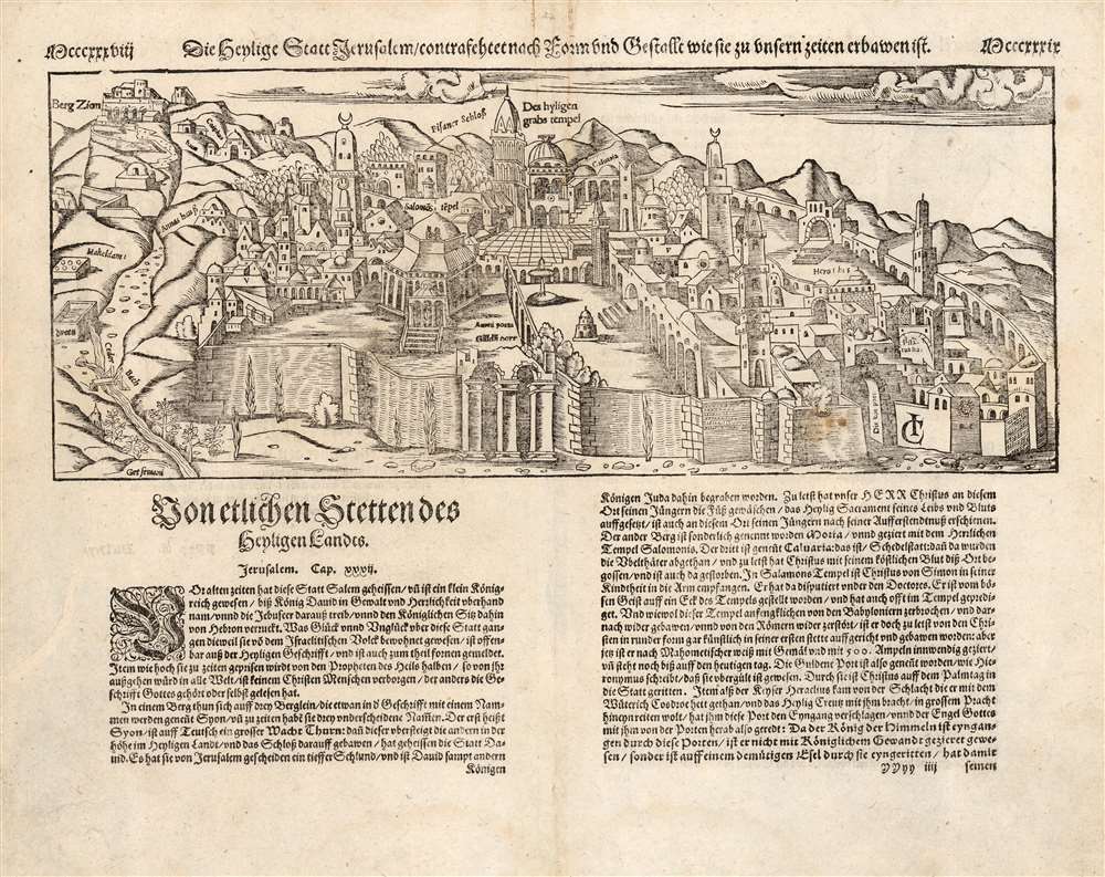
Die heylige Statt Ierusalem / contrafehtet nach Form und Gestallt wie sie zu unsern zeiten erbawen ist.
sold
- Digital Map Information
- Suitable for large format printing
- Full resolution TIFF file
- ICC color profile embedded
- Delivered instantly via download link
One of the earliest printed views of Jerusalem, executed in woodcut by Jacob Clauser for Sebastian Munster's Cosmographia, from a 1598 German edition. Unlike most early depictions, this bird’s-eye view is not a purely retrospective depiction of the ancient city, but rather a modern view, showing the city at the time of publication. As explained in the view's title, it is meant to depict the Holy City in the 'form and shape as it was built in our times'. In its initial 1550 printing, this was one of the earliest contemporaneous images of the city.
The map is the design of a devout Christian, and so many of the features emphasized would be of primary interest to Christian pilgrims, whether actual or armchair travelers. Named are Mount Zion, the Church of Saint Anne, and King David's Tomb. The temple of the Knights of the Holy Sepulchre is shown. The court of Pilate, the palace of Herod, the Garden of Gesthemane, and the Akeldama are also marked. At the time, Jerusalem was occupied by the Ottoman Empire. As such, the Dome of the Rock is depicted centrally, and is clearly a mosque, but retains the name of the 'Temple of Solomon'. The whole of the city is embraced by its ancient walls, with several of its iconic gates named. (more details)
The map is the design of a devout Christian, and so many of the features emphasized would be of primary interest to Christian pilgrims, whether actual or armchair travelers. Named are Mount Zion, the Church of Saint Anne, and King David's Tomb. The temple of the Knights of the Holy Sepulchre is shown. The court of Pilate, the palace of Herod, the Garden of Gesthemane, and the Akeldama are also marked. At the time, Jerusalem was occupied by the Ottoman Empire. As such, the Dome of the Rock is depicted centrally, and is clearly a mosque, but retains the name of the 'Temple of Solomon'. The whole of the city is embraced by its ancient walls, with several of its iconic gates named. (more details)
A stunning decorative sea chart detailing Madeira.
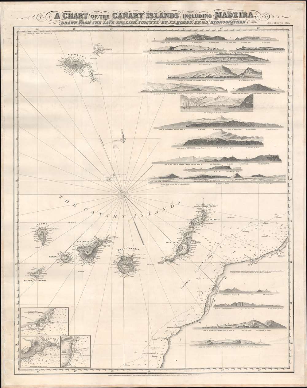
A Chart of the Canary Islands Including Madeira.
$850.00
Acquire
- Digital Map Information
- Suitable for large format printing
- File Size: 32.97 MB
- File Type: ZIP / TIFF
- ICC color profile embedded
- Delivered instantly via download link
An exceptionally beautiful 1867 James Norie and Charles Wilson nautical chart or maritime map of the Canary Islands and Madeira, including part of western Africa. As a whole the map offers excellent detail with inland topography on all of the islands as well as countless depth soundings. There are three inset detail maps in the lower left focusing on Arrecife, Funchal, and Santa Cruz. An additional seventeen land profile charts filling the upper right and lower right. The title is set in an elaborate typeface just outside the map's upper border. (more details)
Visit the Centre Pompidou and the Musée Carnavalet in this popular Parisian district.
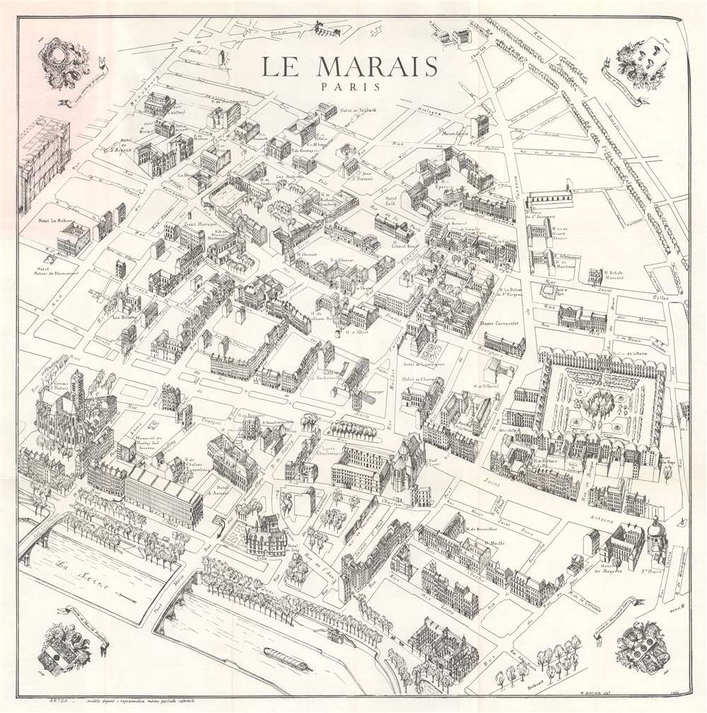
Le Marais. Paris.
sold
This is a 1979 Félix Gatier pictorial map of the Marais District (Le Marais), Paris, France. The map depicts from the Rue Beaubourg and the Centre Pompidou to the Place des Vosges, and from the intersection of the Boulevard du Temple and the Rue Charlot to the Seine River. Buildings are illustrated in profile and labeled, including banks, churches, and private homes. Other specifically identified places include the Centre Pompidou, the Place des Vosges, the Mémorial du Martyr Juif Inconnu (today's Mémorial de la Shoah), the Musée Carnavalet, the Archives Nationales, and the Église Saint-Gervais. (more details)
An Israeli map of the 1956 Suez Crisis.

מפת האגן המזרחי של הים התיכון : המערכה על חצי האי סיני / [Map of the Eastern Basin of the Mediterranean: The Battle of the Sinai Peninsula].
sold
This is a 1956 Joseph Shapiro (Szapiro) Hebrew map of the Middle East centered on Israel during the 1956 Suez Crisis, also known as the Second Arab-Israeli War. It highlights the advances of Israeli forces across the Sinai Peninsula during the brief conflict. (more details)
A post war map of Alaska promoting tourism to the territory.
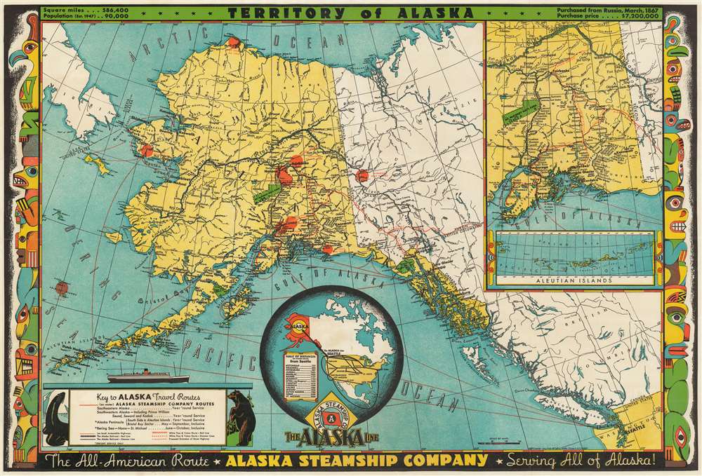
Territory of Alaska. The All-American Route - Alaska Steamship Company - Serving All of Alaska!
sold
- Digital Map Information
- Suitable for large format printing
- File Size: 50.11 MB
- File Type: ZIP / TIFF
- ICC color profile embedded
- Delivered instantly via download link
This is a 1949 Frank McCaffrey map of Alaska. The map depicts the region from Russia and the Bering Sea to British Columbia and Washington State and from the Arctic Ocean to the Pacific Ocean and Olympia, Washington. Created for the Alaska Steamship Company, sea routes between Seattle and numerous cities and towns in Alaska are highlighted by red lines, including the route up the Inside Passage. Juneau, Sitka, Anchorage, Fairbanks, Dutch Harbor, and Nome are all labeled, as are numerous smaller towns and villages. Myriad rivers and streams are also illustrated, as are Mt. McKinley (Denali) National Park and Glacier Bay National Park. The Alaska Highway is also noted, as are gold placers and oil fields. The Alaska Peninsula and some of the Aleutian Islands are illustrated and labeled, as are innumerable points, capes, and bays along the Alaska coast along with small islands throughout the region. (more details)
Stay overnight in the Everglades!
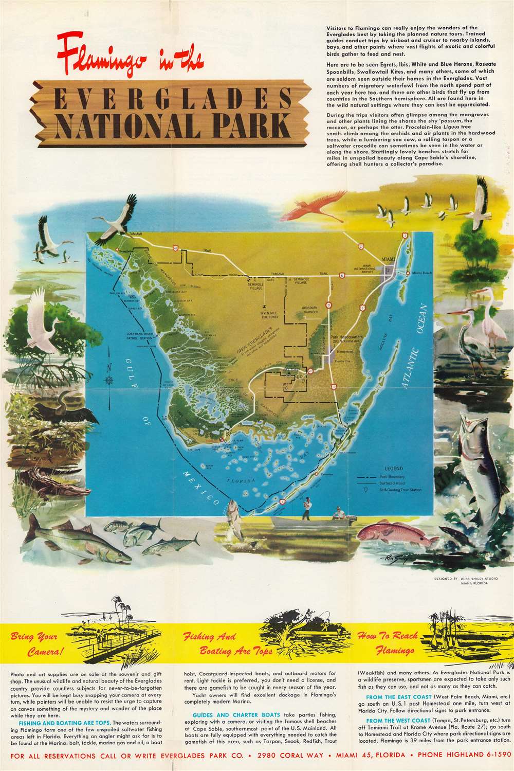
Flamingo in the Everglades National Park.
sold
This is a c. 1960 National Park Service pictorial map of Everglades National Park featuring illustrations by Florida wildlife artist Russ Smiley. Depicting southern Florida from the Tamiami Trail south to Jewfish Key, a black dashed line highlights the boundary of Everglades National Park. Highway 1, 41, and 27, are illustrated and landmarks within the park, such are Seven Mile Fire Tower and Pine Key Fire Tower, are marked. Rookeries, ponds, streams, bays, keys, and other natural sites are identified throughout. The map is surrounded by Russ Smiley's illustrations of Florida's birds, fish, and an alligator. (more details)
Previously uncataloged. Promotes the successor to the failed Tanganyika groundnut scheme.
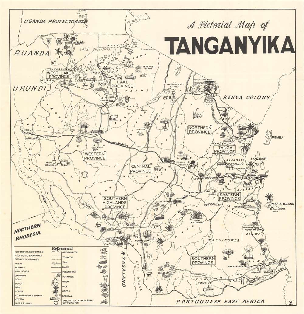
A Pictorial Map of Tanganyika.
sold
This is a c. 1955 pictorial map of Tanganyika, then a British African trust territory, and today part of modern-day Tanzania. Pictorial icons highlight important agricultural products, including potatoes, wheat, rice, corn, and groundnuts. Mineral resources, including mica, tin, and copper, are also marked. Other icons illustrate Africa's iconic wildlife, with rhinoceros, zebra, giraffe, and elephant, all making appearances. Tanganyika's celebrated natural wonders, such as the Serengeti Plains, the Ngorongoro Crater, Mt. Kilimanjaro, and Lake Malawi (Lake Nyasa) also contribute to the map's overall aesthetic. (more details)
First scientific map of Slovenia, Croatia, Bosnia-Herzegovina, and Montenegro.
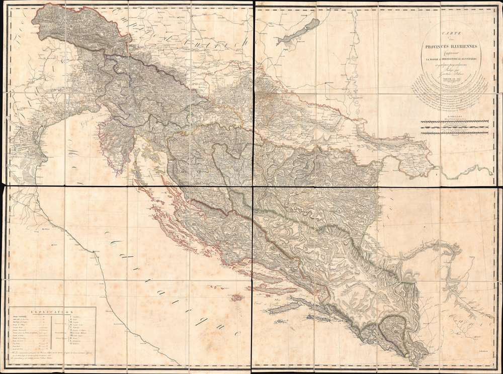
Carte des Provinces Illyriennes Comprenant La Bosnie L'Herzegovine le Monténéro et quelques pays adjacens.
sold
- Digital Map Information
- Suitable for large format printing
- Full resolution TIFF file
- ICC color profile embedded
- Delivered instantly via download link
This detailed and expansive 1812 Gaetan Palma map of the short-lived Illyrian Provinces, a Napoleonic subordinate state embracing modern day Slovenia, Croatia, Bosnia-Herzegovina, and Montenegro. Coverage extends along the Adriatic from Venice to Albania and inland as far as Serbia and Hungary. It is the first specific map of this region to be compiled based on a detailed trigonometrical survey. The map is one of two commissioned by Marshal August de Marmont (1774 - 1852), first Governor-General of the Illyrian Provinces, in anticipation of a Napoleonic invasion of the Ottoman Empire. (more details)
A rare city plan of Farmington, Maine.
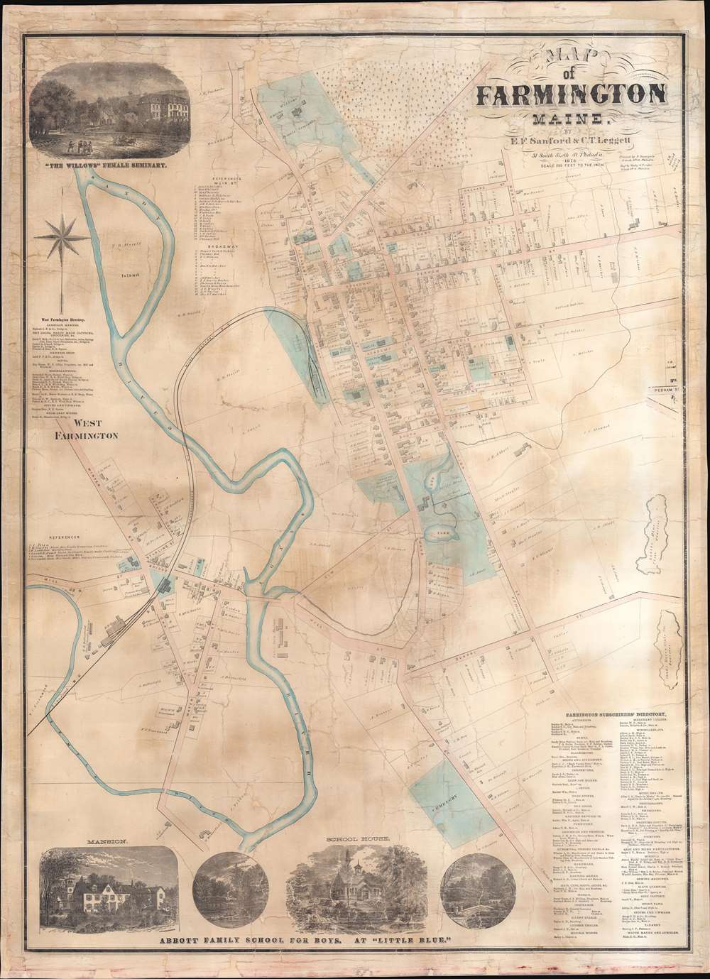
Map of Farmington Maine.
sold
- Digital Map Information
- Suitable for large format printing
- Full resolution TIFF file
- ICC color profile embedded
- Delivered instantly via download link
This is an 1874 E.F. Sanford and C.T. Leggett city plan or map of Farmington, Maine. Created by soliciting subscriptions from the town's businesspeople and residents, the map depicts from the Willows Female Seminary to S. Norton's house south of the cemetery on Main Street and from the railroad shops in West Farmington to the slate quarries east of town. Houses throughout town are illustrated and identified by the owner's name and the lots are delineated. Schools (including the State Normal School), churches, and offices are labeled throughout town as well. Other illustrated locations around town include the railroad depot (serviced by the Androscoggin Division of the Maine Central Railroad), the sweet corn factory, the brick yard, the cattle yards, S.R. Leland's Apple Orchard, and the H.R. Butterfield shovel handle factory. References for thirty-five numerically identified locations along Main Street and Broadway in Farmington occupy a space in the upper left quadrant. A directory for West Farmington appears along the left border. A view of the Willows Female Seminary occupies the upper left corner. A series of four views along the bottom border highlight different scenes associated with the Abbott Family School for Boys. (more details)
Unusual circular panorama of Rome for the 'Grand Tour' set.

Panorama de Rome, pris du Clocher du Capitole.
sold
- Digital Map Information
- Suitable for large format printing
- Full resolution TIFF file
- ICC color profile embedded
- Delivered instantly via download link
This is an unusual c. 1750 panoramic view of Rome as seen from the bell tower of the Senatorial Palace or Palazzo Senatorio on the Capitoline Hill. 191 buildings throughout Rome are illustrated as they would be viewed from the belltower, including parts of the Palazzo Senatorio and the Piazza del Campidoglio, which are the largest illustrations (Nos. 50 and 51) on the right side of the panorama. Churches, cathedrals, and basilicas appear alongside ancient ruins. The Colosseum (No. 143), Trajan's Column (No. 99), St. Peter's Basilica (No. 43), and The Vatican (No. 47) are illustrated. (more details)