
Terrors of mother nature!

Tableau de Météorologie Représentant les Divers Phénomènes de l'Atmosphère, Tels que le Tonnere, l'Aurore Boréale, Aréolythes, l'Arc-en-ciel, les Trombes, le Feu St. Elme, les Etoiles filantes et Aréolythes, le Halo, les Parhélies, le Mirage, les Marées, etc., etc.
sold
- Digital Map Information
- Suitable for large format printing
- DPI: 600
- File Size: 33.95 MB
- File Type: ZIP / TIFF
- ICC color profile embedded
- Delivered instantly via download link
This is an 1844 Aristide Michel Perrot chart of weather phenomena. The chart combines illustrations of over two dozen different weather phenomena, including lightning, tornadoes, rainbows, the Northern Lights, and clouds. Different phenomena are identified below the central image, with the name of each phenomenon and a short explanation provided, some of which even refer to a specific part of the central image and provide the corresponding number. Various figures are included along the left and right borders, the first of which, the atmosphere, is provided as a basis for understanding of all the phenomena explained in the chart. A wind compass, snowflakes, and a lightning rod are depicted along the left side, while thermometers and the rainbow effect are explained along the right. (more details)
A French WWII regiment route map!

2° Dragons Campagne 1944 - 1945.
sold
- Digital Map Information
- Suitable for large format printing
- File Size: 20.89 MB
- File Type: ZIP / TIFF
- ICC color profile embedded
- Delivered instantly via download link
This is a c. 1945 route map of the French 2nd Dragoon Regiment (2e Régiment de Dragons) in Western Europe during World War II. Such commemoratives route maps were published for many American regiments and divisions, but were not universally adopted by other Allied forces. We have occasionally seen British route maps, but comparable French maps, as here, are exceedingly rare. (more details)
Highlights of Paris.
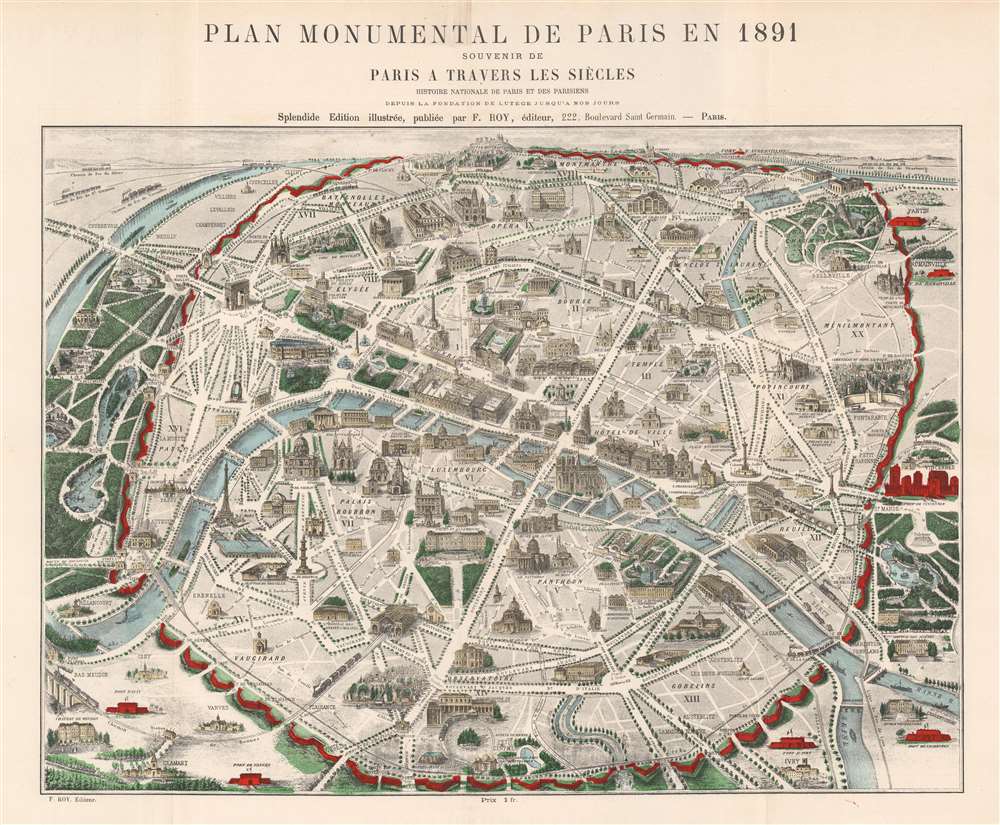
Plan Monumental de Paris en 1891.
sold
- Digital Map Information
- Suitable for large format printing
- File Size: 35.41 MB
- File Type: ZIP / TIFF
- ICC color profile embedded
- Delivered instantly via download link
This is an 1891 F. Roy pictorial map of Paris, France highlighting the city's historical architecture. The Eiffel Tower, opened only two years earlier, appears along the Seine not far from the Bois de Boulogne (shaded a lovely green) and the Palais du Trocadéro (destroyed in 1936). The rest of Paris's gardens and parks, including the Jardin des Tuileries, the Parc des Buttes-Chaumont, and the Jardin du Luxembourg, are shaded the same striking shade of green. The Arc de Triomphe, the Louvre, Notre Dame, the Panthéon, and Les Invalides are illustrated, along with Paris's churches, museums, government buildings, and train stations. Pere Lachaise, the famous cemetery, is situated to the right of Paris. Paris's walls (now replaced by the Boulevard Périphérique) stand out in bright red. (more details)
Bold Venture by a Disastrous Real Estate Man.
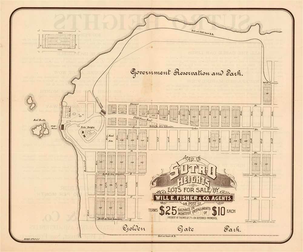
Map of Sutro Heights Lots for Sale by Will E. Fisher and Co. Agents.
$650.00
Acquire
- Digital Map Information
- Suitable for large format printing
- File Size: 20.12 MB
- File Type: ZIP / TIFF
- ICC color profile embedded
- Delivered instantly via download link
This is an elegant 1893 lithograph map of the Vista Del Mar neighborhood of San Francisco - at that time promoted as Sutro Heights. The lots for sale on this map fall between what is now Geary Boulevard and Fulton Street, west of the Richmond district. (more details)
Typical Chinese walled city of the late imperial era.

寧國縣 / [Ningguo County].
sold
- Digital Map Information
- Suitable for large format printing
- Full resolution TIFF file
- ICC color profile embedded
- Delivered instantly via download link
This is a very rare c. 1825 manuscript map of Ningguo, Anhui, China. Ningguo in this period was an archetypal Chinese walled city, situated near a river amidst mountains and forests, and home to a variety of government offices, temples, and pavilions. (more details)
Londoner's take on the Wild West.
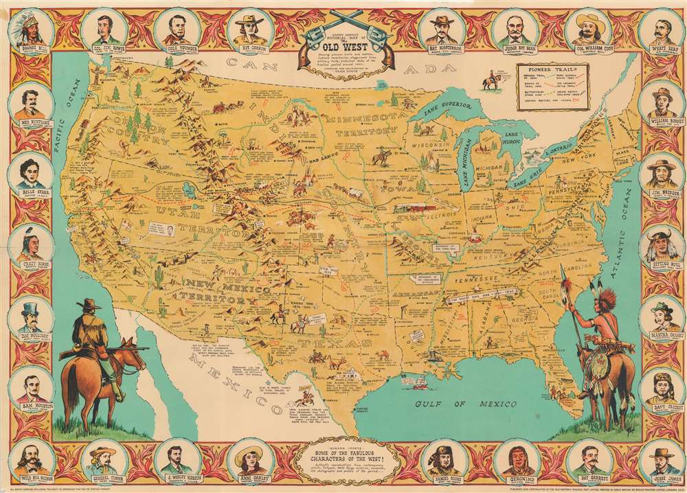
Danny Arnold's Pictorial Map of the Old West Showing pioneer trails and battles, Indian's territories, stagecoach lines, military forts, historical data of the frontier period around 1840.
sold
- Digital Map Information
- Suitable for large format printing
- File Size: 39.6 MB
- File Type: ZIP / TIFF
- ICC color profile embedded
- Delivered instantly via download link
This is a c. 1950 Fran Dowie pictorial map of the United States highlighting American frontier history. Captioned illustrations mark important historical events: Battles during the Indian Wars, acts of frontier justice against outlaws such as Jesse James and Billy the Kid, and the shootout at the O.K. Corral, are just a few of the events noted. Pioneer trails, such as the Oregon Trail, the Santa Fe Trail, and the Pony Express Route, are illustrated as well. The Grand Canyon, the Rocky Mountains, and the Sierra Nevada Mountains evoke the majesty of the rugged terrain. The whole is surrounded by a pictorial border incorporating portraits of frontier personalities: Doc Holliday, Crazy Horse, Jim Bowie, Wyatt Earp, Davy Crockett, and Jesse James. (more details)
The heartland of Chinese Buddhism.

雲中郡圖 / [Yunzhong Prefecture Map].
sold
- Digital Map Information
- Suitable for large format printing
- Full resolution TIFF file
- ICC color profile embedded
- Delivered instantly via download link
This is a very rare c. 1830 manuscript map of Datong Prefecture, stylized using its ancient name Yunzhong (雲中), a historically important city in northern Shanxi Province, China. Yunzhong/Datong and its surroundings have served as a capital for various historic dynasties and was central to the diffusion and florescence of Buddhism in China, evidenced by the large number of temples and grottoes in the region. (more details)
Historical Georgia.

The State of Georgia Founded February 12, 1733 by James Edward Oglethorpe. One of the Thirteen Original Colonies.
sold
This is a 1957 Clarissa Hale Poteat pictorial map of Georgia. Poteat uses pictorial vignettes to present information concerning the state's history, agriculture, and important landmarks. Many of the vignettes reference the American Civil War, with battles, generals, and important government officials and events all referenced. Georgia's educational system is also highlighted and many of its secondary schools and universities are identified. Cities and towns throughout the state are also labeled, while other illustrations depict the state's wildlife. State parks are named as well. A pictorial border consisting of portraits of famous Georgians encircles the central map. Among those personalities immortalized are: Fernando De Soto, the first European to set foot in Georgia; James Edward Oglethorpe, the founder of the Georgia colony; and Count Casimir Pulaski, a Polish nobleman, who fought on the American side during the American Revolutionary War and has been called the 'father of American cavalry'. (more details)
Tourist Delhi.

Guide Map of Delhi. Delhi The Capital City.
sold
This is a c. 1960 Directorate of Advertising and Visual Publicity pictorial tourist map of Delhi, India. Depicting the city inside the Ring Road, pictorial vignettes illustrate monuments and government buildings. Humayun's Tomb, the Lodi Tombs/Gardens, Qutb Minar (Qutub Minar), and Safdar Jang's Tomb appear, along with several others. Pictorial icons mark hotels, banks, cinemas, temples, mosques, and other locations around the city and a key situated in the lower left corner provides the viewer with this information. Neighborhoods throughout Delhi are identified, and major streets are labeled. Railroads to Jaipur, Rohtak, Ambala, Kolkata (Calcutta), and Agra are illustrated and labeled. A map of Connaught Place and of the region surrounding Delhi appear on the verso, along with a location index with telephone numbers. (more details)
Come buy a house on Key Colony!
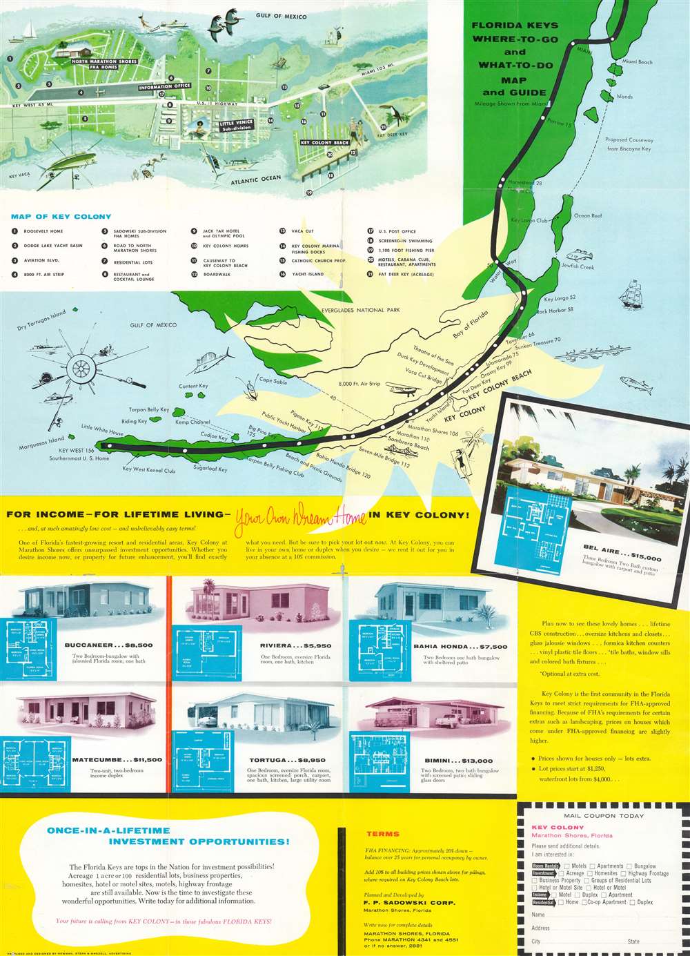
Florida Keys Map and Guide. Vacationland of Presidents.
sold
This is a c. 1957 Newman, Stern, and Mandell pictorial tourist map of Key Colony and the Florida Keys. A map of the Florida Keys from Miami to Key West occupies the upper portion of the sheet with individual keys and cities on peninsular Florida labeled. An inset in the upper left corner illustrates Key Colony and Key Colony Beach. Twenty-one locations within the inset are numerically identified and correspond with an index below the map, including restaurants, residential real estate lots, the Key Colony marina, and Fat Deer Key. The lower half of the sheet bears advertising for housing and other real estate investment opportunities in Key Colony Beach, a 'once-in-a-lifetime investment'. Generic illustrations of different houses and their floorplans are provided. Printed photographs and further persuasive text appears on the verso. (more details)
One of only 3 state maps issued by Walling.
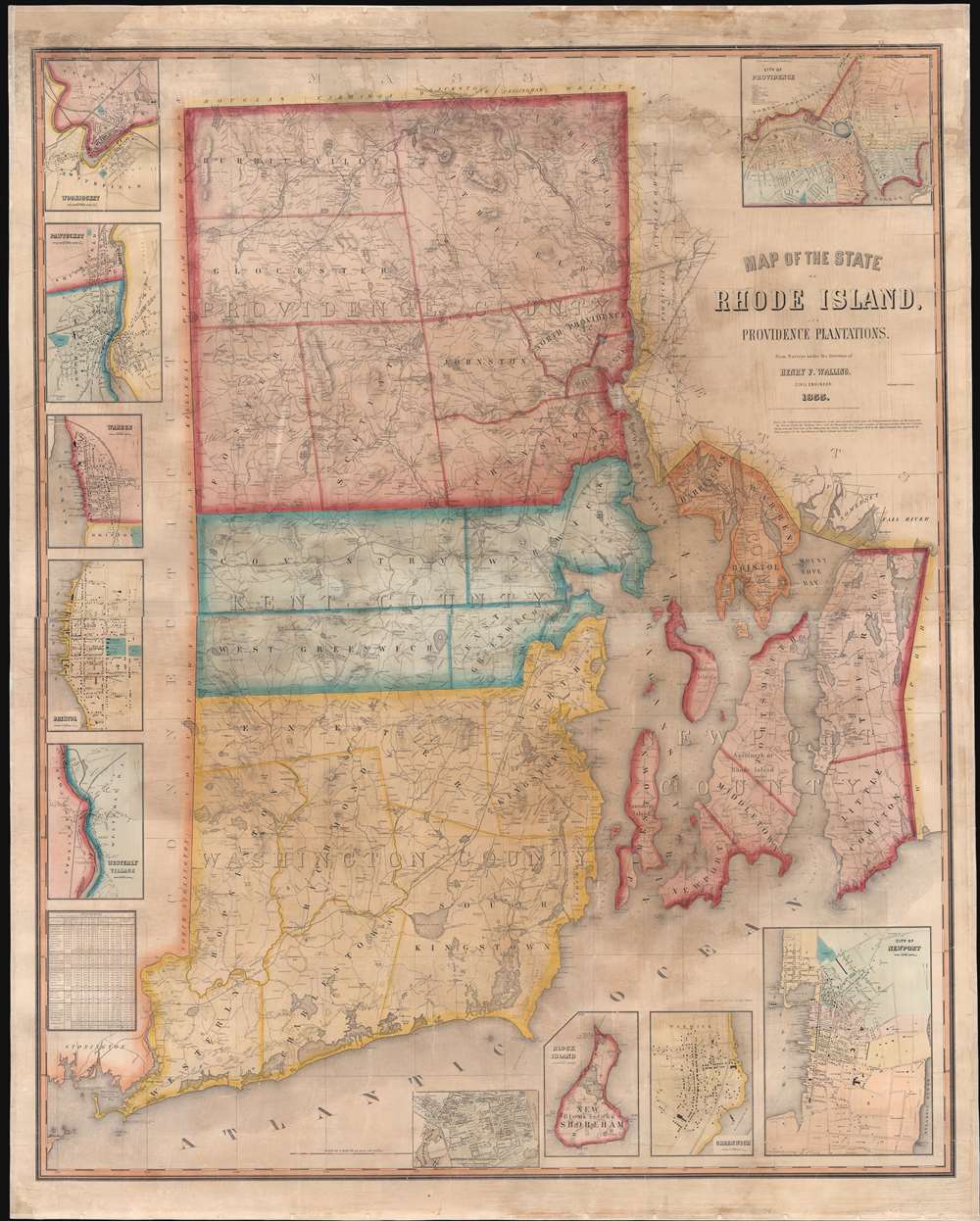
Map of the State of Rhode Island and Providence Plantations.
sold
- Digital Map Information
- Suitable for large format printing
- File Size: 103.61 MB
- File Type: ZIP / TIFF
- ICC color profile embedded
- Delivered instantly via download link
A scarce 1855 wall map of Rhode Island by the civil engineer Henry F. Walling. Centered on Narragansett Bay, the map covers the state and offers eleven detailed insets of various cities. Walling identifies countless individual estates and homesteads throughout - making this a treasure for anyone researching family history or mid-19th Rhode Island land holdings. Roads, counties, topography, railroads, lakes, and rivers are noted. Narragansett Bay features numerous depth soundings, no doubt drawn from the work of the U.S. Coast Survey. The insets, from top left detail Woonsocket, Pawtucket, Warren, Bristol, Westerly Village, Smithville (Scituate), Wickford, Block Island, Greenwich, Newport, and of course Providence. In the Providence inset the campus of Brown University is identified. (more details)
Napoleon defends the 'Liberty of the Sea.'

Liberté des Mers. La Libertad de Los Mares.
sold
A striking c. 1799 - 1801 fan-map of Europe illustrating Napoleon riding a clamshell chariot brandishing a 'Liberté des Mers' or 'Freedom of the Seas' banner. The banner is written in both French and Spanish. France and Spain where allies in the War of the Second Coalition, and Napoleon was keen to propagandize his message of maritime freedom throughout Spain, whose declining navy was the only force that might stand against British maritime power. (more details)
'Cart-hog-graphy' at its best!

Nicknames of the States.
sold
- Digital Map Information
- Suitable for large format printing
- File Size: 18.3 MB
- File Type: ZIP / TIFF
- ICC color profile embedded
- Delivered instantly via download link
A most ‘pignominious’ map, this is a scarce 1884 chromolithograph epitomizing the small but adored genre of pig-themed maps. This charming thematic map of the United States was issued on behalf of H.W. Hill and Company to promote their signature product - 'hog ringers', a sturdy porcine nose piercing meant to prevent instinctual rooting behavior. Although some geographical liberties have been taken, the map features humorous anthropomorphized pigs for each state representative of that state's nickname. For example, North Carolina, known as the 'Tar Heel State' features a pig stirring a vat of tar. In California, the 'gold state', a pig works a mine with pick and shovel. Some nicknames remain in use today, like Knickerbocker for New York, while others are less than complimentary and have long fallen out of fashion. Missouri, for example, is here identified as the 'Puke State' with the representational pig vigorously vomiting. All the pigs depicted wear the distinctive H. W. Hill Hog Ringer. (more details)
First Acquirable Map of the British Colonies from Virginia to New England.
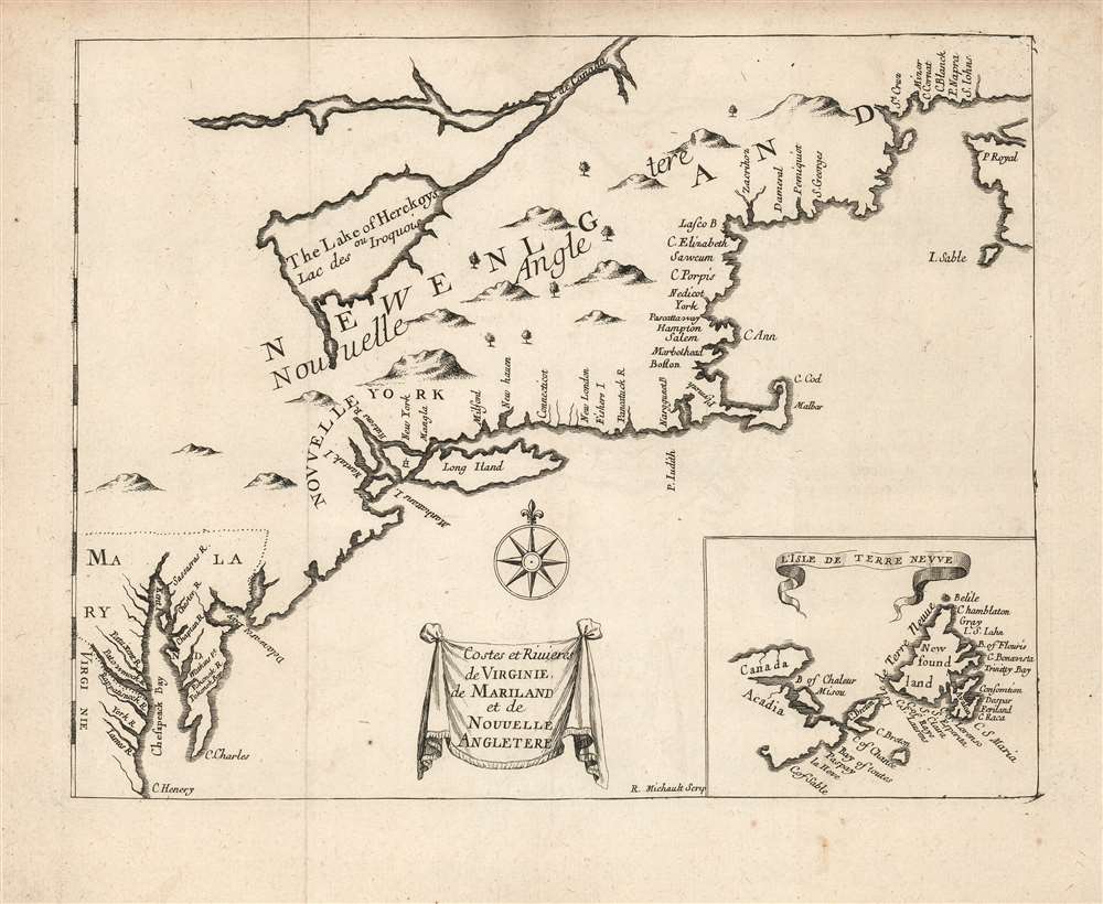
Costes et Rivieres de Virginie de Mariland et de Nouvelle Angletere.
sold
- Digital Map Information
- Suitable for large format printing
- Full resolution TIFF file
- ICC color profile embedded
- Delivered instantly via download link
This is the 1674 Justel edition of Richard Blome's map of Virginia, Maryland, and New England. Blome's rare 1672 A Draught of the Sea Coast and Rivers of Virginia, Maryland and New England Taken from the latest Surveys was the first English map to focus on the British colonies in North America from Virginia up through New England, just preceding the explosion of geographical knowledge represented by the works of Herrman (1673) and Seller (1676.) This French edition of the map is also scarce, but more acquirable to the collector than the Blome. It is a valuable addition to any collection pertaining to colonial Virginia and New England, in that it shows the starting point for the expansion of those colonies that followed in the late seventeenth century. (more details)
'An orientalist's fantasy...'
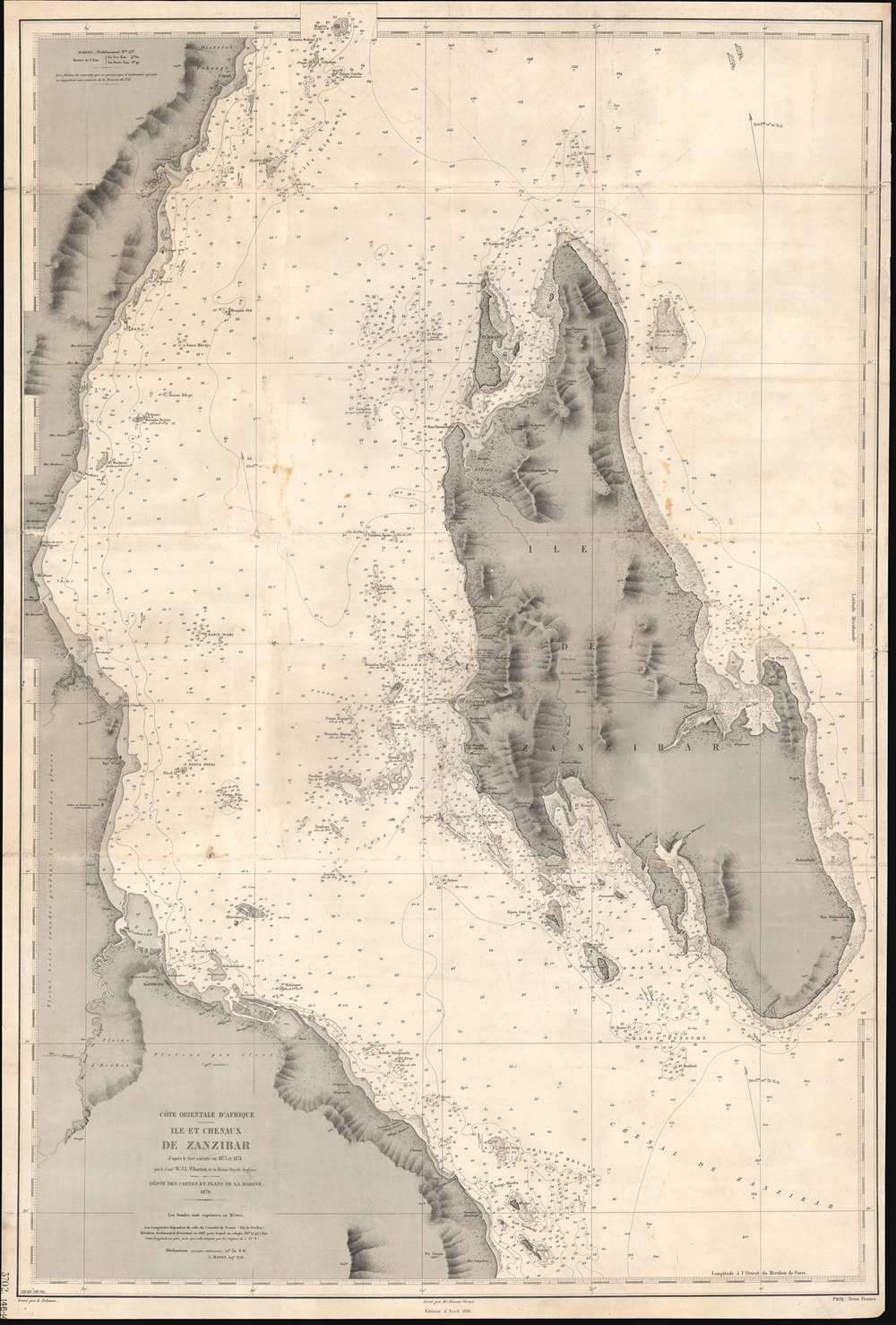
Côte Orientale d'Afrique. Ile et Chenaux de Zanzibar d'aprés le levé exécuté en 1873 et 1874.
sold
- Digital Map Information
- Suitable for large format printing
- File Size: 40.13 MB
- File Type: ZIP / TIFF
- ICC color profile embedded
- Delivered instantly via download link
An extremely rare 1891 French spice trade nautical chart or maritime map of Zanzibar Island or Unguja, off the coast of modern-day Tanzania. This is among the most detailed 19th century maps focusing on Zanzibar we have encountered. Coverage embraces the entire island as well as, the Zanzibar Channel, and the modern-day Tanzania coast from just south of Pemba Island to just north of Dar es Salaam. The largest town shown on the Africa coast is Bagamoyo. On the island, spice plantations are marked by clusters of palm trees and buildings. There are some manuscript updates and revisions around Stone Town. (more details)
Uses cathedrals and monuments to mark cities.

[France]. Crédit Lyonnais. Fondé en 1863.
sold
This is a c. 1960 Lucien Boucher art deco pictorial map of France created for the French bank Credit Lyonnais (at the time the largest bank in France). Pictorial vignettes and yellow banners highlight French cities where a main Credit Lyonnais branch operated. Cathedrals mark many of these cities, including Chartres, Amiens, Reims, and Rennes. Other monuments illustrate other cities, including the Eiffel Tower and the Arc de Triomphe in Paris, the arena and the Pont du Gars in Nimes, and several Loire Valley chateaux. Cities and towns with smaller bank branches throughout France are indicated by small white stars. Green banners identify branches in foreign countries, including ones in Brussels (Bruxelles), Anvers, and London. (more details)
5 years before the Pearl Harbor Attack.

東亞太平洋地圖 / 非常時國防一覽 / East Asia Pacific Map / A National Defense View at a Special Time. / Hijōji kokubō ichiran tōa-taiheiyō-zu.
sold
- Digital Map Information
- Suitable for large format printing
- File Size: 78.23 MB
- File Type: ZIP / TIFF
- ICC color profile embedded
- Delivered instantly via download link
This is a fascinating and important 1935 (Showa 10) Nakata Fukuzou Pre-World War II Japanese propaganda map of the Pacific foreshadowing the Pearl Harbor attack, the Aleutian Islands Campaign, and the Philippine Campaign. Covering the entire Pacific, from the Bay of Bengal to New York and from the Bering Strait to New Zealand, this map anticipates the overarching Japanese strategy for World War II in surprising detail. (more details)
Twenty-four seals bearing Union Civil War mottos.

Union Mottoes.
sold
- Digital Map Information
- Suitable for large format printing
- File Size: 1.03 MB
- File Type: ZIP / TIFF
- ICC color profile embedded
- Delivered instantly via download link
A rare find, this is a c. 1862 uncut half sheet of twenty-four C. Y. Haynes and Company envelope seals featuring Union mottos from the American Civil War (1861 - 1865). Used to seal envelopes, these 'wafer seals' would have made plain the sender's feelings on the war. Some, such as 'Eternal Vigilance is the Watch Word of Liberty' and 'The Eyes of the World are Upon Us' are overtly patriotic but not overtly hostile. Others, such as 'The Union Must and Shall Be Preserved', 'Strike for the Government and the Union', and 'Let Us Die for Our Country Never Surrender' evoke the hostilities engulfing the country. Stamps reading 'Glory Shrouds the Heroes Grave', and 'He That Falls in His Country's Cause Dies Nobly' remember the dead. Some are even illustrated. One stamp reads 'The Traitors Doom' around an illustration of a corpse hanging from the gallows. An illustration of a snake appears on another with the text 'Crush the Serpent of Rebellion'. Three bear illustrations of the Stars and Stripes. One reads 'Remember Fort Sumter'. The second states 'Wipe Out the Insults Heaped Upon Me' around an illustration of the flag, while the third has two flags and reads' Oh Long May It Wave'. (more details)
The Mexican Revolution...
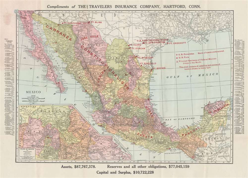
Compliments of The Travelers Insurance Company, Hartford, Conn.
sold
- Digital Map Information
- Suitable for large format printing
- Full resolution TIFF file
- ICC color profile embedded
- Delivered instantly via download link
This is a 1913 Travelers Insurance Company and Rand McNally map of Mexico during the Mexican Revolution (1910 - 1920). The map, intended for American customers of Travelers, was meant to assure investors that their insured assets in Revolutionary Mexico were protected. Coverage extends from the Pacific Ocean to the Atlantic Ocean and from the southern United States to Guatemala, Honduras, and the Gulf of Tehuantepec. The situation in Mexico is presented by using red overprinting identifying which factions controlled various parts of Mexico. Areas controlled by Venustiano Carranza, Jose 'Poncho' Villa, and Emiliano Zapata, all important figures in the Mexican revolution, are labeled, as are all the garrisons of Mexican federal troops. U.S. forts along the U.S.-Mexico border are also highlighted using the red overprinting, reinforcing the notion that the United States was protected against the chaos to its south. As this is a Rand McNally map, myriad cities, towns, and villages are labeled and the principal cities are underscored in red. An inset map of Mexico City and its environs is situated in the lower left. (more details)
Irrigation in Nepal.

Nepal.
$500.00
Acquire
This is a 1974 Department of Irrigation, Hydrology, and Meteorology ferro-gallic map of Nepal. This is a working map likely issued in an exceedingly small run - less than 30 - for internal administration of Nepalese irrigation projects. Fifteen irrigation zones are numerically identified throughout Nepal, all of which have projects that have been completed, are underway, or are being planned. Each irrigation zone is identified in a series of tables below the map, which also name projects within each zone. The dates provided in the tables are given in the Vikram Samvat, also known as the Hundi Vikrami calendar, which is still the official calendar of Nepal. Color shading indicates the current production phase of each project. Individual projects are either numerically identified or labeled by name. An inset situated in the upper right details the Kathmandu Valley, naming nine 'small' completed projects. Pictorial icons mark temples and airfields, while other notations mark roads, holy places, rivers, and streams. (more details)