
Barcelona in the early 1920s.
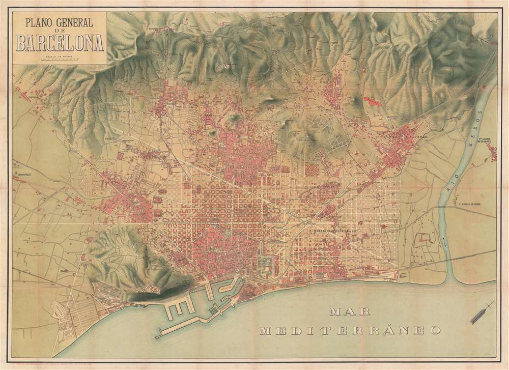
Plano General de Barcelona.
sold
- Digital Map Information
- Suitable for large format printing
- File Size: 53.32 MB
- File Type: ZIP / TIFF
- ICC color profile embedded
- Delivered instantly via download link
This is a c. 1920 Segui city plan or map of Barcelona, Spain, and its environs. With the Mediterranean at the bottom of the sheet and part of the Catalan Pre-Coastal Range at the top, Barcelona fills the plain between the sea and the mountains. Central Barcelona is illustrated in detail, with streets (even minor ones) labeled. Hospitals, churches, and other sites are identified, including the Hospital Santa Cruz and the Mercado de San José. Outside Barcelona's old town center (and the centers of the older suburbs), a street grid dominates, contrasting the old, organic city building with modern urban planning. The Besos River cuts diagonally through the right side and separates Santa Coloma de Gramanet from the rest of the burgeoning metropolis. (more details)
Atlantis (in 3 places), Lemuria (in 2)! And we are turning blue!
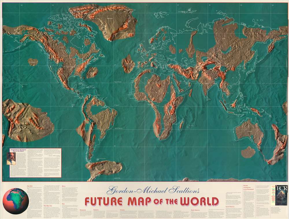
Gordon-Michael Scallion's Future Map of the World.
sold
A striking first edition example of Gordon-Michael Scallion's 1996 doomsday map of the world. Scallion (1942 - ?) is a futurist, spiritualist, and 'prophet' who predicted a series of cataclysmic astronomical and seismic events would occur between the issue date of this map, 1996 and 2012 (missed that one), reforming the surface of the Earth. A detailed outline of Scallion's predictions fills the lower quadrants. (more details)
Virginia's most important 19th century railway.
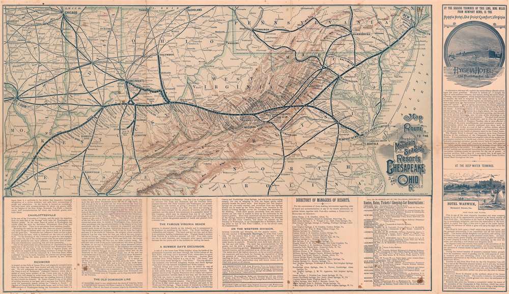
Map Showing the Route to the Mountain and Sea Side Resorts Chesapeake and Ohio Route.
sold
- Digital Map Information
- Suitable for large format printing
- Full resolution TIFF file
- ICC color profile embedded
- Delivered instantly via download link
This is a c. 1885 Matthews Northrup railroad map of Virginia and Kentucky highlighting the Chesapeake and Ohio Route, also known as the Chesapeake and Ohio Railway. Connecting Memphis, Tennessee and Newport News and Old Point Comfort, Virginia, a thick black line highlights the route of the Chesapeake and Ohio Railway. Stops along the route, including Richmond, Charlottesville, and Louisville, are identified. The routes of connecting railroads, including the Philadelphia, Wilmington, and Baltimore Railroad, the Pennsylvania Railroad, and the Baltimore and Ohio Railroad, are traced by thinner black lines. Very thin black lines detail the rest of the region's railway network. Cities, towns, and villages are labeled throughout, along with mountain ranges and rivers. Information about the railroad and potential destinations is included along the bottom border and on the verso. Advertisements for the Hygeia Hotel in Old Point Comfort and the Hotel Warwick in Newport News occupy the space to the right of the right border. (more details)
One of the most beautiful parts of Maine.
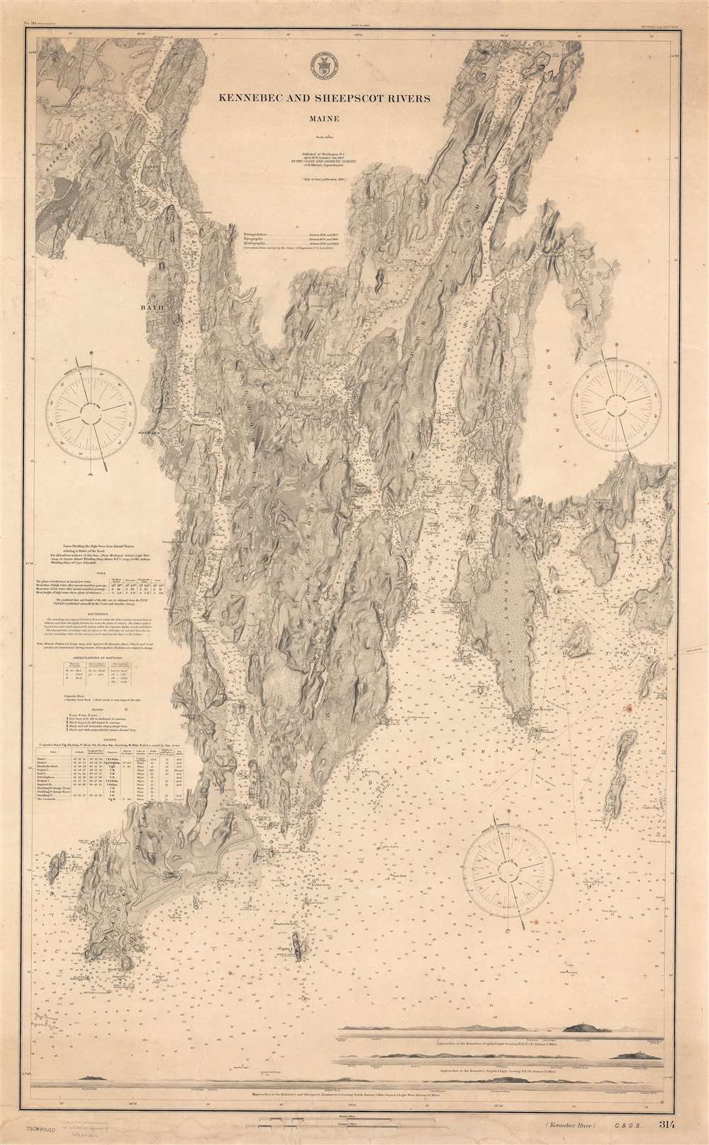
Kennebec and Sheepscot Rivers Maine.
sold
- Digital Map Information
- Suitable for large format printing
- File Size: 62.13 MB
- File Type: ZIP / TIFF
- ICC color profile embedded
- Delivered instantly via download link
A striking 1910 nautical chart or maritime map of the Kennebec and Sheepscot Rivers, Maine. Representing the culmination of the Coast and Geodetic Survey's work in the region, coverage extends from Cape Small and the mouths of both rivers, north as far as Wiscasset (considered one of Maine's most beautiful small towns). Named towns include Bath, a regional shipbuilding center, and the fishing port of Boothbay Harbor. Along the bottom there are three land profiles offering different views of Seguin Light. Countless depth sounding and practical information for the mariner fill the waters. This is a separate issue nautical chart, intended for maritime use, and is thus considerably more developed than earlier folding examples of the chart issued for the Survey's annual reports. (more details)
Partition of Africa as it happened.
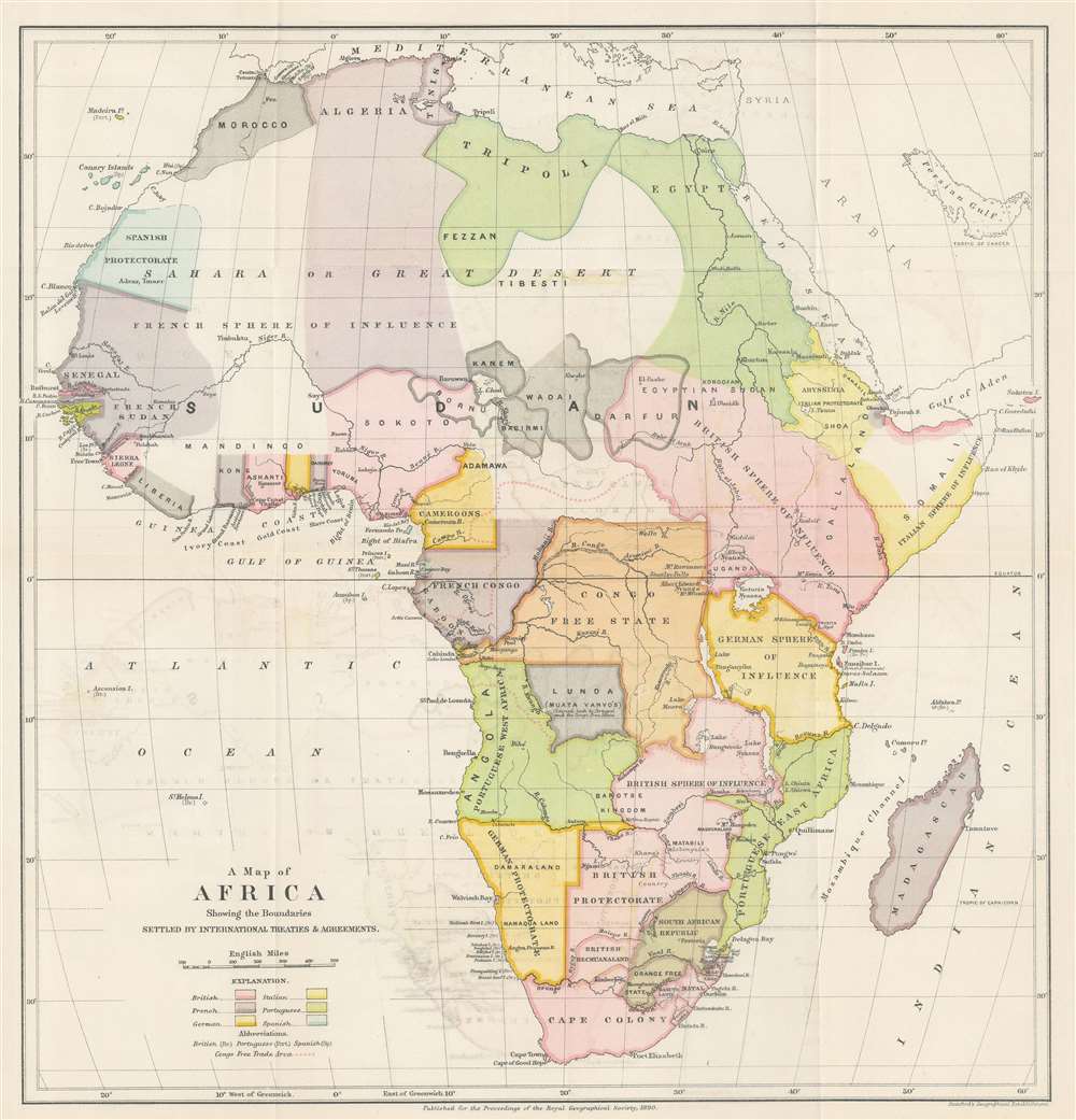
A Map of Africa Showing the Boundaries Settled by International Treaties and Agreements.
sold
- Digital Map Information
- Suitable for large format printing
- File Size: 10.02 MB
- File Type: ZIP / TIFF
- ICC color profile embedded
- Delivered instantly via download link
This is an 1890 Edward Stanford and Royal Geographical Society map of Africa. The map was created as a visual summary of the international treaties and agreements governing the partition of Africa by the European powers. Various colors correspond with different European spheres of influence: British territory is pink, while French territory is purple, etc. Portuguese, Italian, German, and Spanish claims are also delineated. 'Independent' nations supposedly free of European influence / suzerainty are colored black. The Congo Free State, which roughly corresponds with today's Democratic Republic of the Congo, is shaded orange and is not referenced as being claimed by any specific country as it was personally owned by King Leopold II of Belgium. (more details)
Charming pictorial map promoting Cameroon.

A Map of Cameroun.
sold
- Digital Map Information
- Suitable for large format printing
- File Size: 97.65 MB
- File Type: ZIP / TIFF
- ICC color profile embedded
- Delivered instantly via download link
This is a 1951 Léon Craste pictorial map of Cameroon, created for the French Ministère de la France Outre-Mer (Ministry of Overseas France). Coverage extends from French West Africa and Nigeria to French East Africa and from Lake Chad to Gabon and Spanish Guinea. Elephants, rhinos, lions, and hippos, some of the most recognizable animals in the world, are included, adding to the exotic aesthetic. This aesthetic, however, is encapsulated by the depiction of a native village in the upper left. Partially clothed natives stand staring at the 'camera' going about their daily activities surrounded by 'everyday' African objects, including a lion-skin rug and two elephant tusks. Huts and a lush green forest complete the vision. Exoticism had always been an important part of French promotion of the colonies, with a particularly good example being the 1931 Colonial Exposition in Vincennes. (more details)
The 'District of Maine' and the Connecticut Western Reserve!
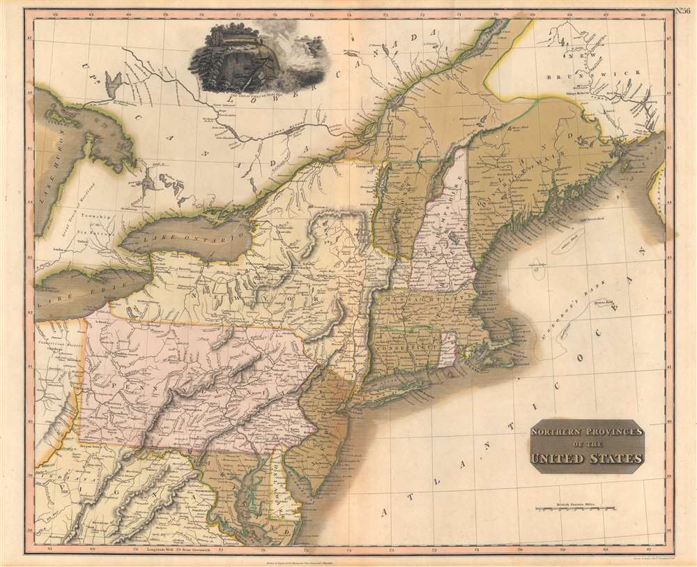
Northern Provinces of the United States.
sold
- Digital Map Information
- Suitable for large format printing
- Full resolution TIFF file
- ICC color profile embedded
- Delivered instantly via download link
A scarce first edition example of John Thomson's 1817 map of the northeastern parts of the United States, including New York, Massachusetts, Connecticut, Vermont, New Hampshire, Maine, Pennsylvania, New Jersey, Maryland, Rhode Island, and parts of adjacent Virginia, Canada, and the Great Lakes. There appears a large inset of Niagara Falls along the top border. (more details)
Japanese World War II map of Malay and Singapore.

標準大東亞分圖. マライ. / Greater East Asia Co-Prosperity Sphere. Malay.
sold
- Digital Map Information
- Suitable for large format printing
- Full resolution TIFF file
- ICC color profile embedded
- Delivered instantly via download link
This is a stunning 1943 or Showa 18 large format map of the Malaya Peninsula (Malaysia) and Singapore Island. Issued by the Japanese during World War II, this map is part of a series of maps promoting the Japanese imperialist concept of the Greater East Asia Co-Prosperity Sphere and illustrates the peninsula in considerable detail noting both physical and political elements. An inset city plan in the lower left quadrant depicts Singapore, labeled here as Shonan City. Superb detail regarding both topographical and political elements is provided throughout. Cities and roads are noted, along with air, sea and land trade routes. Shading displays oceanic depths. While Allied World War II maps of this region are fairly common, it is extremely rare to come across their Japanese counterparts. All text is in Japanese. (more details)
A stunning pictorial map of Jerusalem.

Jerusalem.
sold
This is a 1969 first edition Herman Bollmann bird's eye view pictorial map of Jerusalem. The map depicts the city from the Old City to Hebrew University. Buildings throughout Jerusalem are illustrated in detail, including the Dome of the Rock, the Western Wall, the Al-Aqsa Mosque, the Church of the Redeemer, and the Church of the Holy Sepulcher in the Old City, which is surrounded by its ancient walls. Numerous gates in the walls are identified. Myriad small buildings are illustrated within the Old City, and the Jewish Quarter, Christian Quarter, Muslim Quarter, and Armenian Quarter are each labeled. Buildings and other sites outside the Old City are also illustrated and labeled, including the Church of the Tomb of the Virgin, Gethsemane, David's Tomb, the Church of Dormition, and the Yemin Moshe Synagogue. The Catholic, Protestant, Jewish, and Muslim cemeteries are all identified. Numerous streets are labeled. The whole is surrounded by a border bearing the name of Jerusalem translated into sixteen different languages. (more details)
The longest bridge in the world...

Virginia Seashore A Year Round Playground - Among Historic Shrines.
sold
- Digital Map Information
- Suitable for large format printing
- Full resolution TIFF file
- ICC color profile embedded
- Delivered instantly via download link
This is an attractive c. 1929 view map of the James River and the entrance to the Chesapeake Bay. Coverage extends from Williamsburg and Yorktown at upper left to Cape Charles at upper right; from Suffolk at lower left to Back Bay and Virginia Beach at lower right. The image combines characteristics of a map and a view, presenting towns, cities, and historic sites pictorially, while maintaining the projection and function of a road map. The James River Bridge, opened just one year earlier, is highlighted in red. (more details)
American presidents from Washington to Eisenhower.

The Woman's Day Chart of Presidents of the United States.
sold
- Digital Map Information
- Suitable for large format printing
- File Size: 56.35 MB
- File Type: ZIP / TIFF
- ICC color profile embedded
- Delivered instantly via download link
This is a 1952 Bernard DeVoto and Isa Barnett pictorial chart of the presidents of the United States. Presidents from George Washington to Dwight D. Eisenhower appear in chronological order along a timeline from before 1770 to 1953. Vertical blue lines mark each decade. Every row is the same length, represents a single president, and includes important information, such as date of birth and death (if applicable), education, and career trajectory. The president's lifetime is colored either green or yellow (we have been unable to determine what, if any, significance the green and yellow have). Red denotes presidential terms. The progression of the American flag, American territorial acquisitions and population increase, and the geographical changes appear along the top. Bars along the bottom place important world events within the timeline, including U.S. wars, major foreign wars, major inventions, transportation milestones, and other events. Important American affairs of state, such as Constitutional amendments, landmark legislation, and influential foreign policy decisions, are included as well. Presidential portraits create the chart's border. (more details)
Highlights two puppet states - Manchukuo and Tannu Tuva.
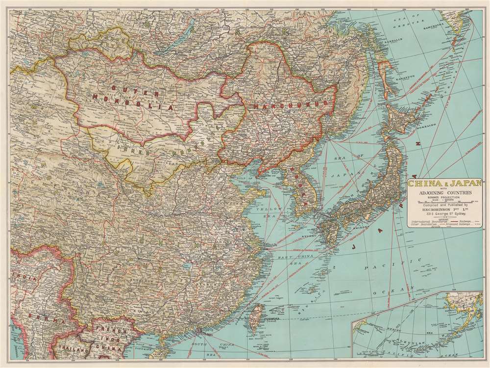
China and Japan with Adjoining Countries.
sold
- Digital Map Information
- Suitable for large format printing
- File Size: 55.93 MB
- File Type: ZIP / TIFF
- ICC color profile embedded
- Delivered instantly via download link
This is a c. 1940 H.E.C. Robinson map of east Asia including China, Japan, Mongolia, Manchukuo (the Japanese puppet state), and Tannu Tuva (a Soviet puppet state) during the Second Sino-Japanese War. Black lines trace railroad lines, including the Trans-Siberian Railway. Solid red lines mark shipping lanes. (more details)
Three days after the Six-Day War.

A Complete Map of Jerusalem. / מפת ירושלים השלמה.
sold
This is a 1967 Maariv pictorial city plan or map of Jerusalem, Israel, published on June 13, 1967, only three days after the end of the Six-Day War. Buildings throughout the city are illustrated in profile. The Old City's walls are immediately eye-catching, and the Dome of the Rock and the Temple Mount are recognizable. Other identified locations include the Monastery of the Cross, the Knesset, Hadassah Hospital, and the Jerusalem Biblical Zoo (officially known as the Tisch Family Zoological Gardens), marked by a giraffe. (more details)
Pictorial map of Martinique.
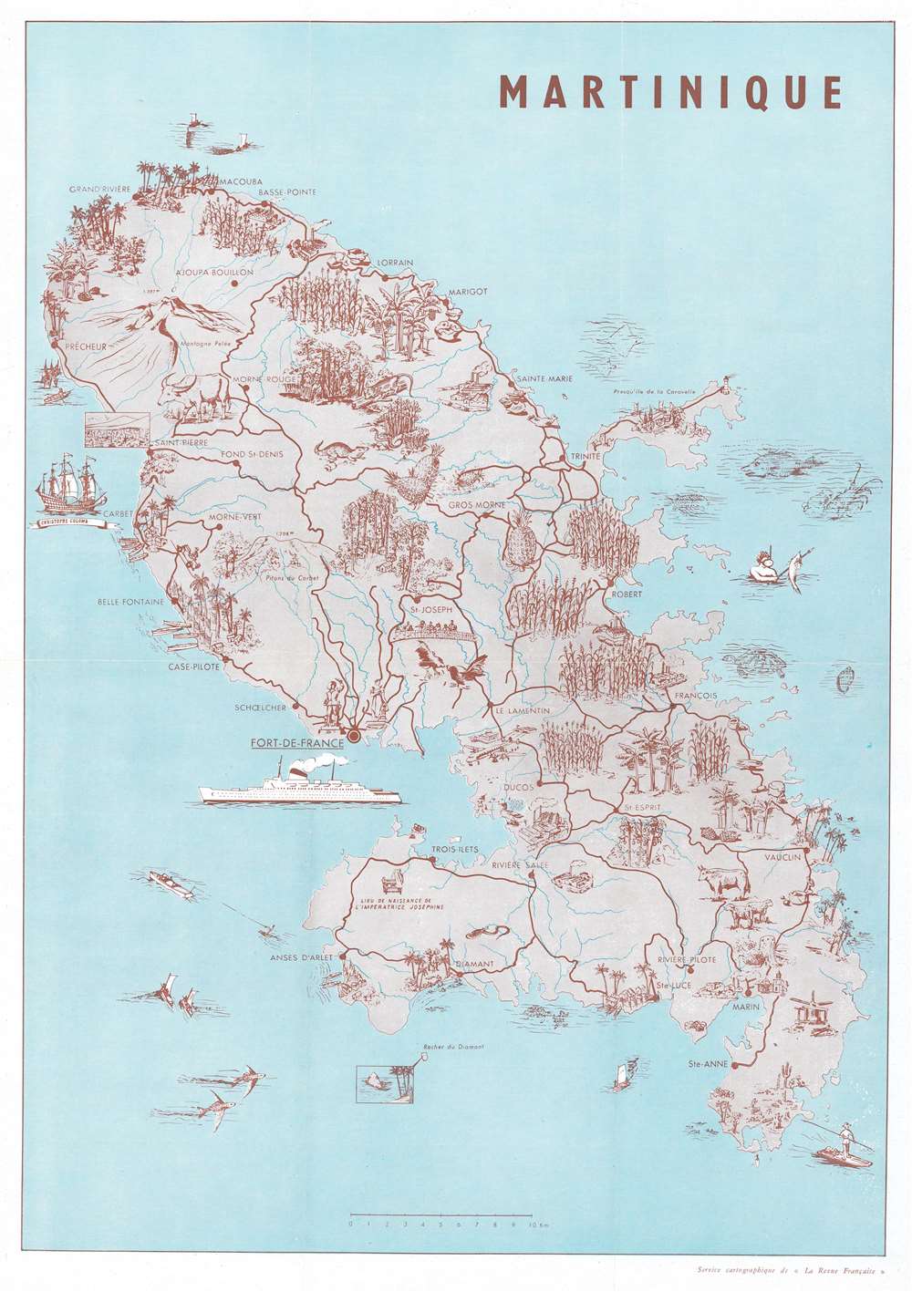
Martinique.
sold
This is a 1958 La Revue Francaise pictorial map of Martinique. Pictorial vignettes populate the map, highlighting the island's beautiful forests, rich agriculture, and other tropical charms. Cities and towns are identified, including Fort-de-France, Basse-Pointe, and Grand Rivière. One of Christopher Columbus's ships appears off the coast of Carbet, while the birthplace of Empress Josephine is marked not far from Trois-Ilets. Steam ships and airplanes reinforce the island's accessibility, while people waterskiing, kayaking, and spearfishing underscore the island as a vacation destination. (more details)
Valencia published in Valencia!
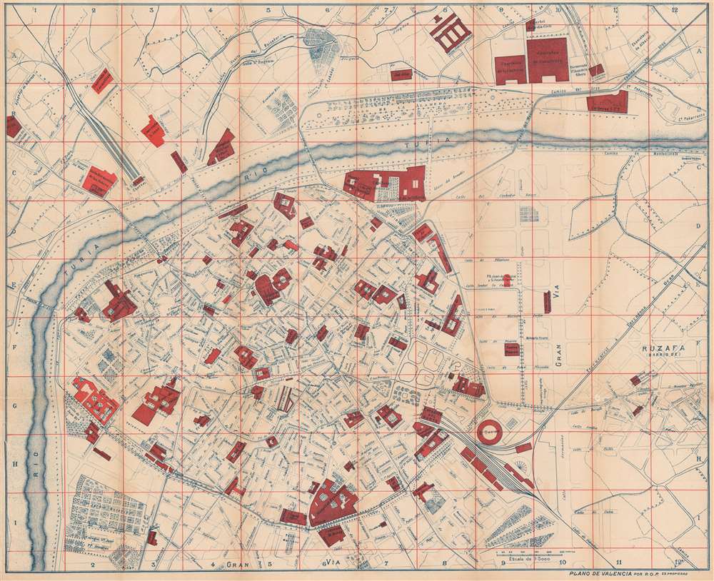
Plano de Valencia.
sold
- Digital Map Information
- Suitable for large format printing
- Full resolution TIFF file
- ICC color profile embedded
- Delivered instantly via download link
This is an 1898 Ramón Ortega Paredes city plan or map of Valencia, Spain, published in Valencia. Red highlights important buildings around the city, including hospitals, train stations, asylums, the cathedral, and the university. Streets are labeled throughout along with the bridges crossing the Turia River. The botanical garden appears in the lower left corner next to the Colegio San José. (more details)
Unique first person espionage archive of the Great Game.

[Brigadier General Frederick William Henry Walshe Archive].
sold
This is a fascinating, unrecorded archive of secret British Indian Army espionage documentation, dating from first decade of the 20th century, providing the modern reader a unique fly-on-the-wall view of the geopolitical, military, and social history of the frontiers of British India as the Great Game came to a close and as the Great War loomed. The documents predominantly date from 1906 to 1910, contain privileged information intended for an audience of prospective intelligence officers in the British Indian Army, and were mainly produced in Peshawar, headquarters of the British Indian army on the frontier with Afghanistan. Peshawar was an espionage hub, crucial to British efforts to counter threats by Russia and China to destabilize India, the Jewel in the Crown of the British Empire. (more details)
Rare Nautical Chart and City Map of Havana and its harbor.
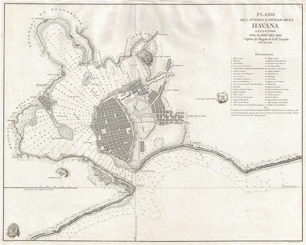
Plano del puerto y ciudad de la Havana levantado por D. José Del Rio Capitan de Fragata de la R. Armada. 1798.
sold
- Digital Map Information
- Suitable for large format printing
- DPI: 300
- File Size: 6.74 MB
- File Type: ZIP / TIFF
- ICC color profile embedded
- Delivered instantly via download link
This is a rare separate issue 1798 Spanish nautical chart and city map of Havana, Cuba, was produced from surveys undertaken by José Del Rio, a captain in the Spanish Royal Navy. The chart covers the city of Havana as well as the harbor. The depiction of the harbor and the coastline is very detailed, offering depth soundings and noting minor variations in the coast. At the upper-right, a list of 37 locations are identified. (more details)
An extremely rare map of the Tian Shan Mountains and the first to accurately locate Khan Tengri.
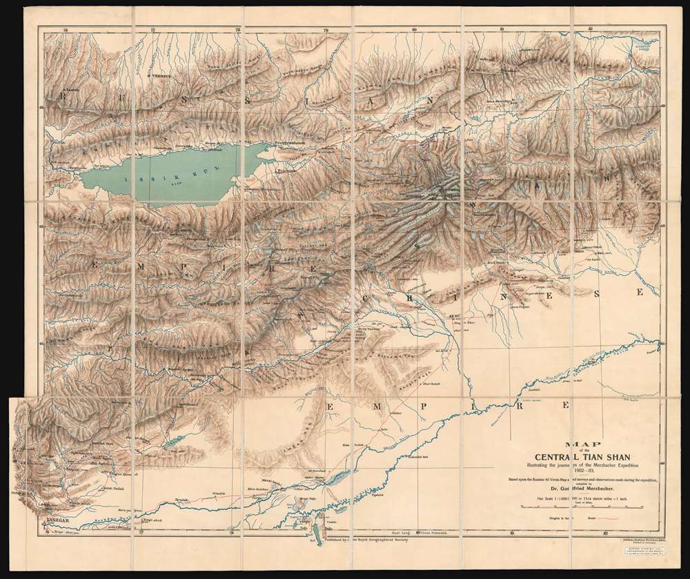
Map of the Central Tian Shan illustrating the journeys of the Merzbacher Expedition 1902 - 03.
sold
- Digital Map Information
- Suitable for large format printing
- File Size: 34.25 MB
- File Type: ZIP / TIFF
- ICC color profile embedded
- Delivered instantly via download link
This is an extremely rare 1905 Dr. Gottfried Merzbacher map of the central Tian Shan Mountains in modern-day western China and Kyrgyzstan. It is the first map to accurately locate Khan Tengri, a nearly 23,000-foot peak known but not mapped. The map depicts the region from Kashgar to the Shakh Yar River, and from the Kunges River to Khol Kol (Khol Lake). Red lines trace the Merzbacher expedition's peregrinations through the region over a period of two years, with their ultimate goal being determining an accurate location for Khan Tengri. Settlements, rivers, and lakes encountered along their routes are labeled, but detail becomes scarcer the farther away from territory physically explored by the expedition. During their two years in the region, Merzbacher and his associates collected a trove of data, most of which is not represented here due to the desire to quickly publish the map to accompany Merzbacher's book. Glaciers, some of which the team explored on foot, while others they simply observed, are illustrated throughout. Khan Tengri, the expedition's stated goal, is illustrated and labeled above and to the right of center and is surrounded by glaciers. Unfortunately, the label on this example is bisected by the linen fold line. Issyk-Kul (Issik Kul), an endorheic lake in eastern Kyrgyzstan that is the second largest saline lake in the world, is also illustrated and labeled. (more details)
Rare, separately issued map of Woods Hole, Cape Cod - near Martha's Vineyard!

The Harbor of Wood's Hole Massachusetts.
sold
- Digital Map Information
- Suitable for large format printing
- File Size: 13.75 MB
- File Type: ZIP / TIFF
- ICC color profile embedded
- Delivered instantly via download link
This is a rare separately issued 1857 U.S. Coast Survey nautical chart or map of Woods Hole, Massachusetts, near Martha's Vineyard. The map depicts the southwestern tip of Barnstable County, Nonameseset Island, and parts of nearby Naushon Island. Exceptional detail is displayed, down to the level of individual buildings and streets. The Woods Hole blacksmith shop, a 'yellow house,' and the 'new church' are among the sites identified. Woods Hole itself, the passage for ships between Vineyard Sound and Buzzards Bay known for its extremely strong current, is illustrated with numerous depth soundings. Sailing instructions and other practical information for the mariner appear in the lower right. (more details)
A nautical chart of the Hudson River.
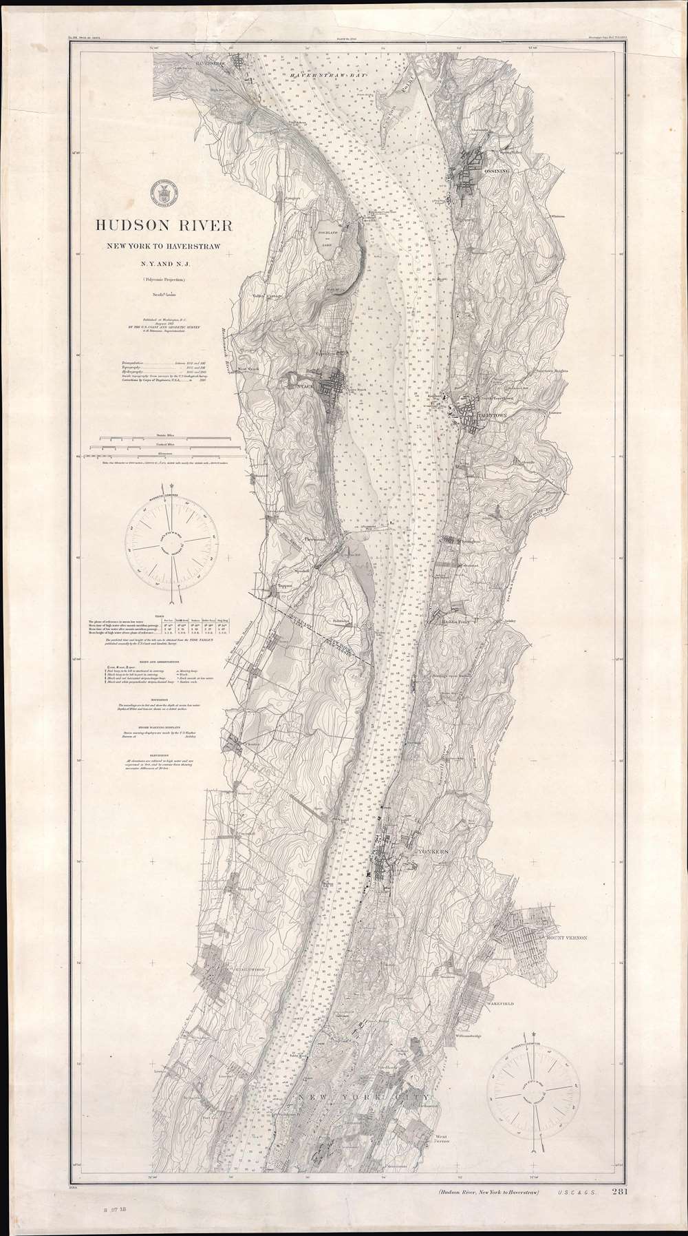
Hudson River New York to Haverstraw N.Y. and N.J.
sold
- Digital Map Information
- Suitable for large format printing
- File Size: 44.86 MB
- File Type: ZIP / TIFF
- ICC color profile embedded
- Delivered instantly via download link
This is a 1911 U.S. Coast and Geodetic Survey nautical chart of maritime map of the Hudson River. Detailed coverage extends from Haverstraw, New York, south to just below Fort Washington Point (where the George Washington Bridge stands today). Outside New York City, the towns of Ossining, Nyack, Tarrytown, Dobbs Ferry, Yonkers, Mount Vernon, Englewood, and Wakefield are all labeled. Within New York City, Fordham, Belmont, West Farms, Tremont, Claremont, Morrisania, and Inwood are identified. Depth soundings in feet appear throughout. Railroads along the river's banks, including the New York Central and Hudson River Railroad , are illustrated as well. The Croton Aqueduct is noted. (more details)