
Keep on trucking...
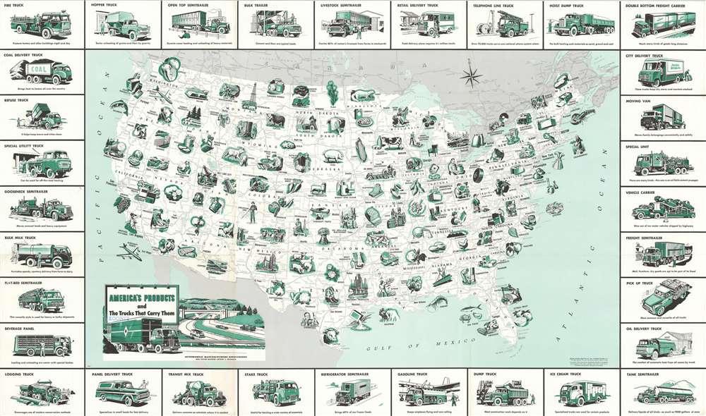
America's Products and the Trucks that Carry Them.
sold
This is a 1958 General Drafting Company pictorial map of the United States, its industry, and the transportation network used to move its products . Pictorial vignettes highlight American production, from agricultural goods to aircraft parts and automobiles. Corn, potatoes, walnuts, citrus fruit, and flour appear among the nation's agricultural products. Coal, lead, uranium ore, copper, aluminum, and phosphates are only a few of the minerals excavated across the country. Farm machinery, shoes, synthetic rubber, textiles, and paper represent handful of the products manufactured. America's highway network, illustrated below the green vignettes in shades of gray, severs as arteries of trade and commercial production. The trucks that create the map's border carry it all. Many of which were designed with specific purposes in mind: Logging trucks, beverage panel trucks, telephone line trucks, bulk milk trucks, ice cream trucks, and vehicle carriers, etc. (more details)
How the world comes together to build a car.
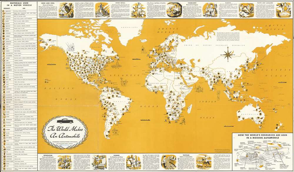
The World Makes an Automobile.
sold
This is a 1956 General Drafting map of the world highlighting the worldwide effort necessary to build an automobile. Symbols spread throughout the world note where metals (iron, copper, antimony, manganese, nickel, platinum…), petroleum, rubber, and materials for textiles (wool, cotton, jute, and nylon) are mined, drilled, tapped, or harvested for use by the automobile industry. Meant for use in schools, short texts and two-tone vignettes along the top and bottom borders provide explanations about the use of these materials, including the smelting steel from iron and other metals, the use of other metals in cars, and how oil and rubber are gathered and used by the auto industry. A table along the left lists over sixty materials used in automobile manufacturing and acts as a map key. A diagram of a car in the lower right highlights some common car parts and names materials used in its manufacture. (more details)
Reverend Alexander Williamson's 1860s travels through Manchuria.
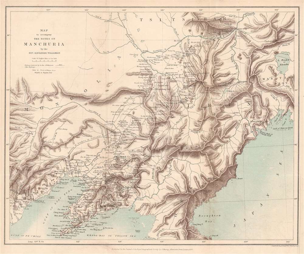
Map to accompany the Notes on Manchuria by the Rev. Alexander Williamson.
$300.00
Acquire
- Digital Map Information
- Suitable for large format printing
- File Size: 8.25 MB
- File Type: ZIP / TIFF
- ICC color profile embedded
- Delivered instantly via download link
This is an 1870 John Murray map of Manchuria, China - a region that within 20 years would become the stage for a global power struggle between Imperial Japan, Qing China, and Tzarist Russia. The map was drawn to accompany a paper written by Reverend Alexander Williamson and published in The Journal of the Royal Geographical Society. Parallel lines trace Williamson's travels through the region. Cities, towns, and villages are labeled throughout, including Mukden (Shenyang). The region's impressive topography leaps off the page, and its extensive river network is well illustrated. Part of the Willow Palisade (labeled here as Barrier of Stakes or Palisade) appears and traverses a southwest-northeast line through the map's center. The Willow Palisade, a system of embankments and ditches planted with willows, was built by the Qing in the late 17th century and separated traditionally Manchu areas from Mongol territory. (more details)
...with every building recognizable!

The Exposition City San Francisco.
sold
- Digital Map Information
- Suitable for large format printing
- File Size: 122.73 MB
- File Type: ZIP / TIFF
- ICC color profile embedded
- Delivered instantly via download link
An extraordinary bird's-eye view perspective view and map of San Francisco, risen from the ashes of the 1906 earthquake and fire, ready to retake the world stage by hosting of the Panama-Pacific International Exposition. The view looks westward on San Francisco from a fictional highpoint above today's San Francisco-Oakland Bay Bridge with California Street running dead center. The Embarcadero and docks appear in the foreground, while Golden Gate Park and the Pacific are recognizable in the distance. The Panama-Pacific Exposition, displayed here prospectively, appears at right, near the Golden Gate. Across the bay, in the distance, Mount Tamalpais, with a winding road ascending, is recognizable. The view presents a city fully recovered from a disaster that, just six years prior, destroyed eighty percent of the city. Cartographically the map is noteworthy as it illustrates and names nearly every single building - an astounding achievement and an invaluable record of San Francisco c. 1912. (more details)
Japanese immigration guide to America!
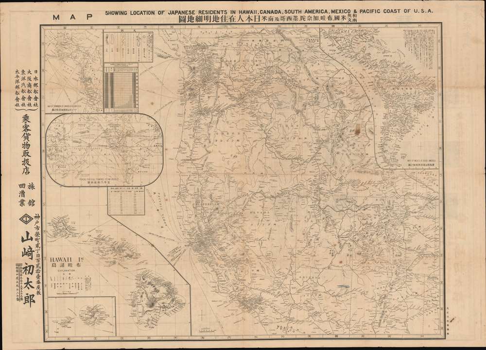
Map Showing Location of Japanese Residents in Hawaii, Canada, South America, Mexico and the Pacific Coast of USA. / 和英両文米国, 布哇, 加奈陀, 墨西哥及南米日本人在住地明細地圖
sold
- Digital Map Information
- Suitable for large format printing
- Full resolution TIFF file
- ICC color profile embedded
- Delivered instantly via download link
This is a fascinating large scale 1917 Yamazaki Hatsutaro map of the western United States and Hawaii designed act as a guide for Japanese immigrants to the America. The map is centered on California - then the hub of Japanese immigration and cultural life in North America - and extends eastward roughly to Nebraska and Texas. A large inset in the lower left details the Hawaiian Islands, also a center of Japanese immigration. Smaller insets detail global shipping routes, South America, and the Pacific northwest including British Columbia and Alaska. Smaller tables offer statistics on Japanese population density broken down by state, with California having the highest concentration of émigrés. The verso features a comprehensive bi-lingual index and promotional material for Japanese-friendly hotels, steamers, newspapers, and other services. (more details)
An island in a sea of war.
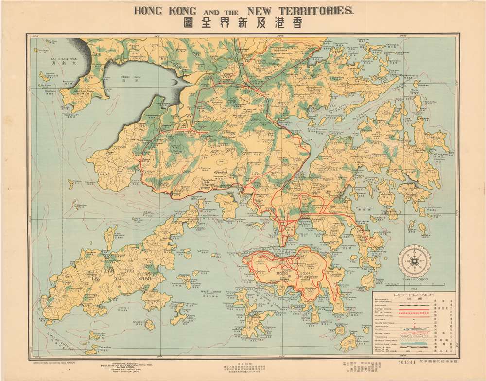
Hong Kong and the New Territories. 香港及新界全圖
sold
- Digital Map Information
- Suitable for large format printing
- File Size: 27.55 MB
- File Type: ZIP / TIFF
- ICC color profile embedded
- Delivered instantly via download link
A scarce and well executed bi-lingual map of Hong Kong and the New Territories issued in 1939, or Minguo 28. Centered on Kowloon and Hong Kong Island, coverage extends from the border with mainland China and Tai Chan Wan, south to include all of Lan Tao and Lamma. The cartographer, Kong San (江山), has introduced a sophisticated coding system to illustrate population density, railways, boundaries, motor and military roads, topography, and more. While most text is in English, Chinese content at bottom center advertises a real-estate firm. (more details)
Denby's prescient warning of Taiwan's strategic and trade significance.
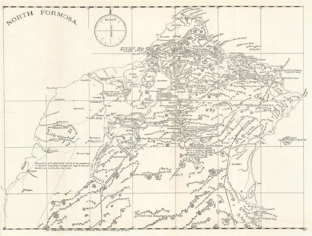
North Formosa.
sold
- Digital Map Information
- Suitable for large format printing
- File Size: 15.01 MB
- File Type: ZIP / TIFF
- ICC color profile embedded
- Delivered instantly via download link
This is an 1886 Charles Denby map of northern Taiwan or Formosa. Impressive detail appears throughout, with towns and villages identified. Cultivated areas are labeled by the crops they produce: tea, indigo, hemp, and sugar cane. The British Consulate (labeled 'H.B.M.'s Consulate), customs house, Chinese beacon, and other landmarks also appear. The region's topography is illustrated and elevations for several peaks are given. A double line delineates between the area controlled by the Chinese and the area 'claimed by the Aborigines'. Denby's commentary adds another dimension to this work. Some of his labels include ' 'audacious' rocks', 'very superior Tea grows on these Hills' and 'this pathway cannot be recommended'. (more details)
Promoting Martinique rum.

Martinique L'Ile du Rhum.
sold
This is a c. 1960 Old Nick Rum pictorial map of Martinique. Created to promote Old Nick rum in France, an idyllic map of Martinique dominates the broadside and evokes Caribbean paradise. Bananas, pineapples, parrots, palm trees, beach umbrellas, and, of course, sugar cane, likely had Parisians dreaming of lounging on a beach, cocktail in hand. Conveniently, cocktail recipes create the map's left border, along with a short, very flattering description of sugar cane and its distillation. Advertisements for various kinds of Old Nick rum appear on the right, many of which are 'exotic' premixed drinks, including a 'new' grapefruit flavored rum. (more details)
Brilliant, data rich depiction of early mid-century New York City.

The City of New York.
sold
- Digital Map Information
- Suitable for large format printing
- File Size: 53.01 MB
- File Type: ZIP / TIFF
- ICC color profile embedded
- Delivered instantly via download link
This 1939 Richard Edes Harrison map of New York City - published in conjunction with the New York World’s Fair – represents a triumph of the visual display of quantitative information. Its aesthetic impact is all the more impressive in its clear expression of municipal and demographic data, making this a map of the people of New York City, as much as of the physical city itself. All five boroughs are represented in the primary map. On it, Harrison’s masterful use of vivid color to distinguish between residential, commercial, industrial, and federal use of land is clear yet supple, able to make distinction (for example) of low-income housing projects using the same palette. Parks and cemeteries both appear as green spaces, with white spots - evoking headstones - indicating the difference between the two. The two major airports (Floyd Bennett Field and North Beach Airport) are given their own color as well. The city’s industrial areas, shown in black, dominate the East River and Hudson coastlines, a reminder of the centrality of trade to the city’s development and history. (more details)
Freedom for civilian aviation after World War II?
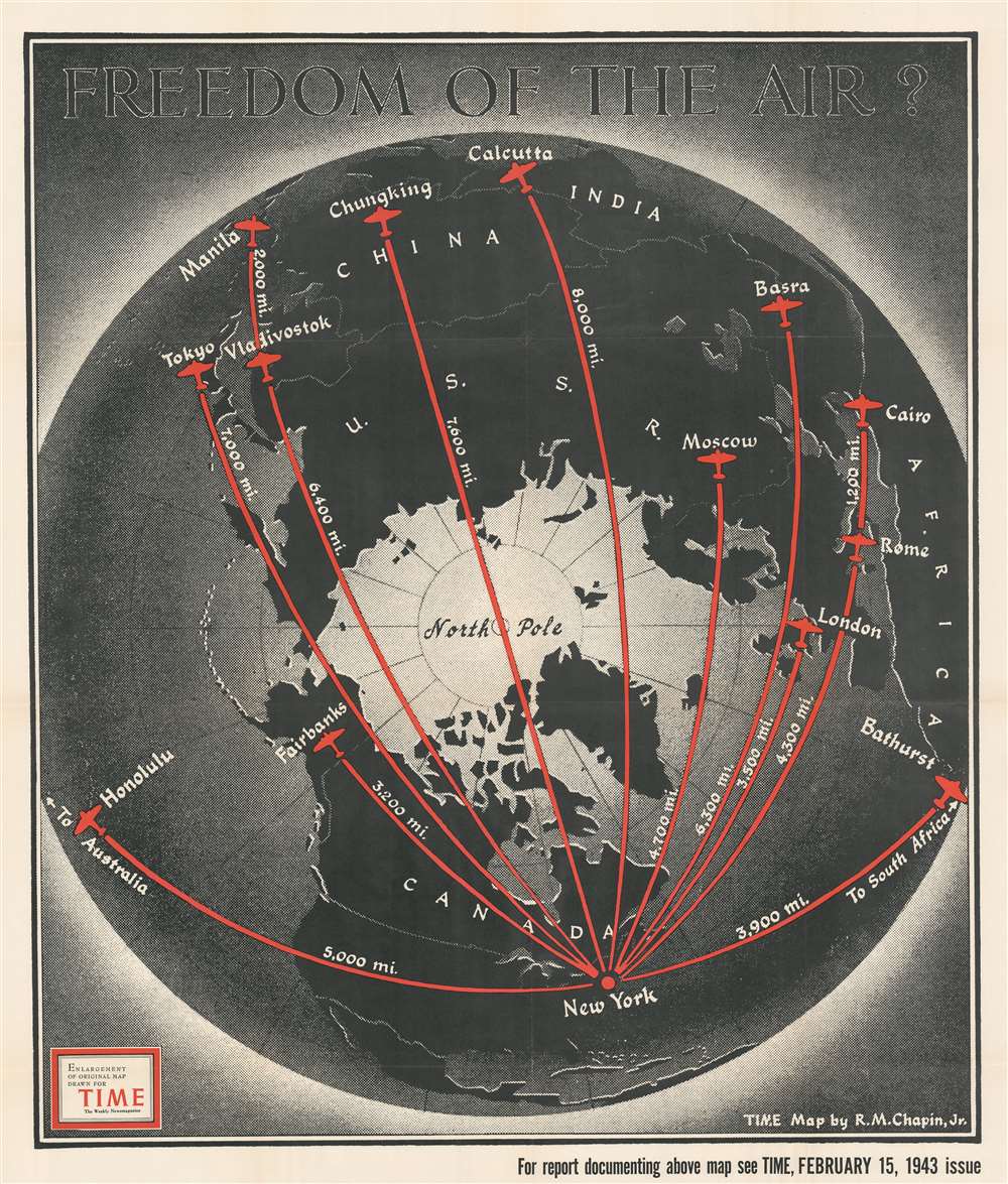
Freedom of the Air?
sold
- Digital Map Information
- Suitable for large format printing
- File Size: 87.48 MB
- File Type: ZIP / TIFF
- ICC color profile embedded
- Delivered instantly via download link
This is a 1943 Robert M. Chapin, Jr. map of the Northern Hemisphere and its great circle aviation routes. Red lines highlight eleven great circle routes from New York to points across the hemisphere, including London, Rome, Tokyo, Moscow, Calcutta, Fairbanks, and Honolulu. Each route's distance from New York appears in miles and silhouettes of the iconic DC-3 / C-47 mark each city. (more details)
Fascinating Depiction of Siberia based on a Hard-to-Find Source.
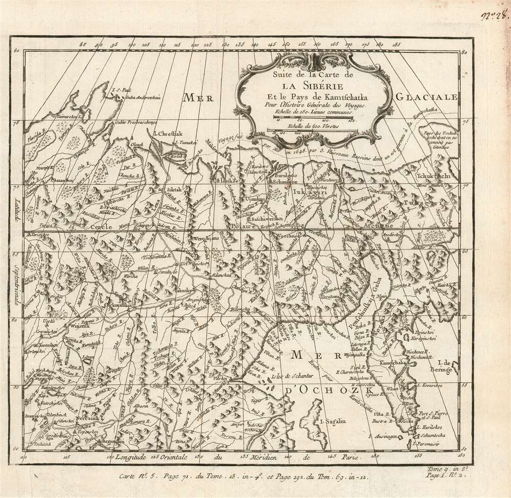
Suite de la Carte de La Siberie Et le Pays de Kamtschatka Pour l'Histoire Générale des Voyages.
$450.00
Acquire
- Digital Map Information
- Suitable for large format printing
- Full resolution TIFF file
- ICC color profile embedded
- Delivered instantly via download link
This is a beautifully engraved 1780 map of northeastern Asia, including Siberia and the Kamchatka Peninsula. Executed by Bellin, the map's details are drawn from the Asian portions of Gerhard Friedrich Müller's landmark 1754 Nouvelle Carte Des Decouvertes. Although Müller is lionized for its revelations of the voyages of Vitus Bering (1681 - 1741) and Aleksei Chirikov (1703 -1748), it also provided remarkably state-of-the-art details for the northeastern extremes of Siberia and Kamchatka. Müller's map was intended to counter the fraudulent maps produced of the same regions by fellow Academians Joseph-Nicolas De l’Isle (1688 - 1768) and Phillippe Buache (1700 - 1773), and the adoption of his geography by no lesser a figure than Bellin is a sign of his success. While mountains are shown pictorially, the delineation of the Sea of Ochosk, Sakhalin Island and the Kamchatka Peninsula is remarkably accurate. The Tschukschi Peninsula is shown in vague hachure, with a note explaining that its size is not understood. (more details)
French Colonial Map of Hispaniola.
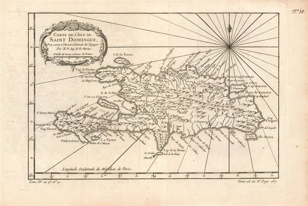
Carte de l'Isle de Saint Domingue, Pour servir a l'Histoire Générale des Voyages Par M.B. Ing. de la Marine.
sold
- Digital Map Information
- Suitable for large format printing
- Full resolution TIFF file
- ICC color profile embedded
- Delivered instantly via download link
This is a beautifully engraved 1780 map of the island of Hispaniola or Saint Domingue, modern-day Haiti and the Dominican Republic. The map shows topographical features pictorially. Lakes, rivers and towns are marked and named, including Santo Domingo and Port-au-Prince. In the central part of the island is the town of Hinche (Hincha). This village, founded by Spanish settlers in 1704, was in an economically driven population boom when this map was engraved: it was a cattle town able to capitalize on selling beef to the neighboring French colony (Haiti) where it was more than seven times as expensive. (more details)
Follows the founder of the Denver and Rio Grande Railroad.
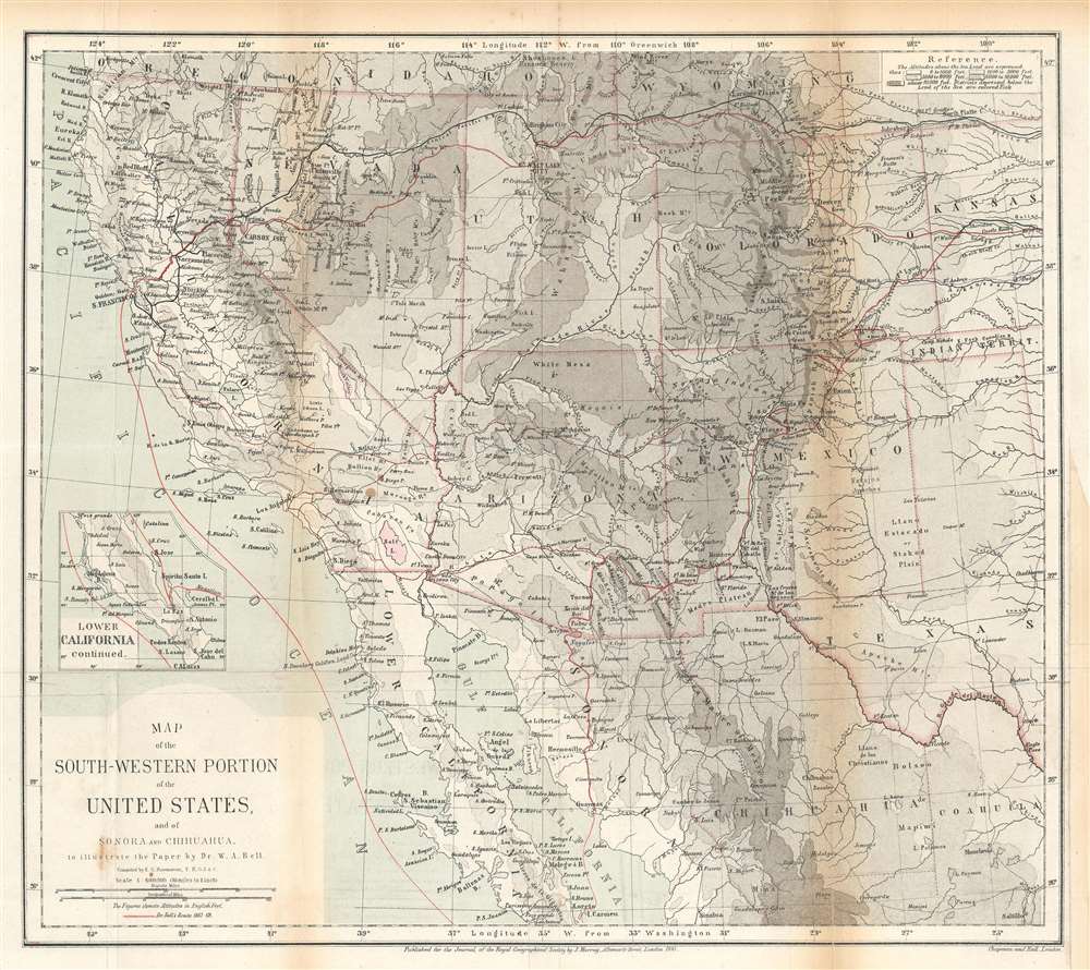
Map of the Southwestern Portion of the United States, and of Sonora and Chihuahua.
sold
- Digital Map Information
- Suitable for large format printing
- File Size: 14.77 MB
- File Type: ZIP / TIFF
- ICC color profile embedded
- Delivered instantly via download link
This is an 1870 Ernst Georg Ravenstein map of the southwestern United States. The map traces William Abraham Bell's travels in the region, including his time with the Kansas Pacific Railroad Survey. A red line illustrates Bell's peregrinations from Kansas west to the Pacific Ocean, his voyage up the Pacific coast to San Francisco, and his overland trek back to Kansas. From Kansas, Bell headed east where he booked passage across the Atlantic to England. After the expedition Bell co-founded the Denver and Rio Grande Railway. (more details)
Farthest north...
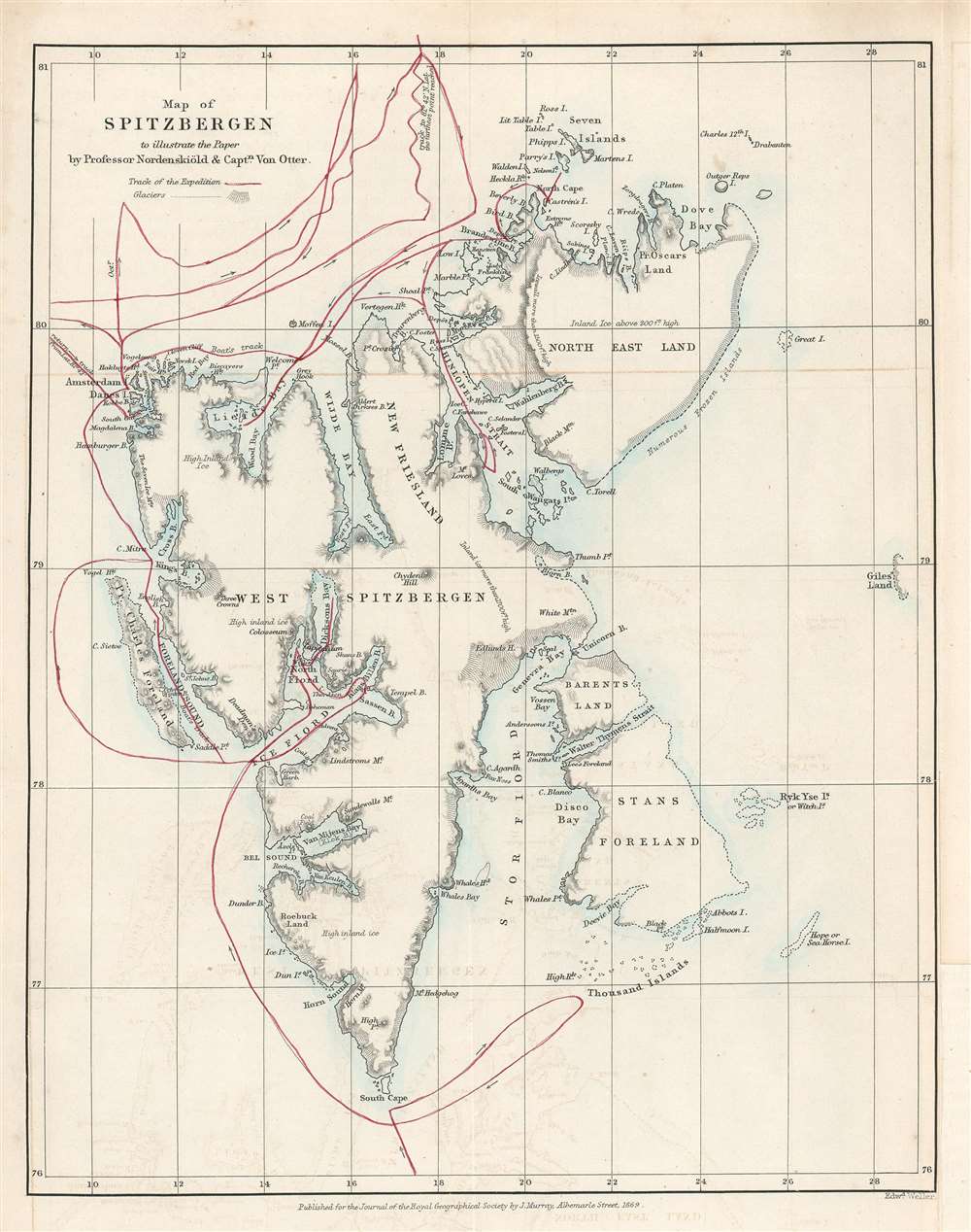
Map of Spitzbergen to illustrate the Paper by Professor Nordenskiöld and Captain Von Otter.
sold
- Digital Map Information
- Suitable for large format printing
- File Size: 3.25 MB
- File Type: ZIP / TIFF
- ICC color profile embedded
- Delivered instantly via download link
This is an 1868 John Murry Map of Spitsbergen in the Svalbard Archipelago, Norway, drawn to illustrate the 1868 Arctic expedition led by Adolf Erik Nordenskiöld and Frederick Wilhelm von Otter. Situated off the northern coast of Norway, Spitsbergen is the only permanently inhabited island in the archipelago. Numerous bays, points, coastal islands, fjords, and other important coastal locations are identified. Red lines trace the expedition's route. Its goals were to study the region's fauna, flora, geography, and geology. Its most notable achievement is that Nordenskiöld and Von Otter reached the highest latitude ever visited by humans in the Eastern Hemisphere up until that time, 81°40' North Latitude. Nordenskiöld and Von Otter both contended that if their ship, the Sofia had not been damaged by ice at that latitude, they would have been able to travel significantly further north, perhaps even to 83°N. (more details)
The beginning of events leading to the Second Anglo-Afghan War.
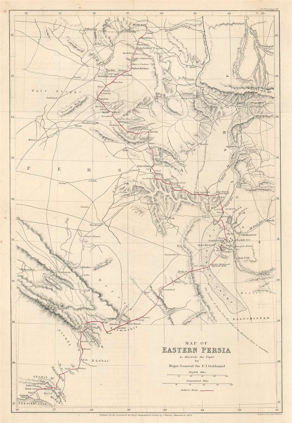
Map of Eastern Persia to illustrate the Paper by Major General Sir F. J. Goldsmid.
$350.00
Acquire
- Digital Map Information
- Suitable for large format printing
- File Size: 6.04 MB
- File Type: ZIP / TIFF
- ICC color profile embedded
- Delivered instantly via download link
This is an 1873 John Murray map of eastern Persia, or modern-day south-central Iran. A thin red line highlights Sir Frederic John Goldsmid's route through the region from Bandar Abbas on the Strait of Hormuz north to Mash-had. Goldsmid was dispatched to this region in order to enforce a British-negotiated Selstan frontier boundary settlement, a move in the 'Great Game' intended to secure Persia and Afghanistan as buffer provinces between Russia and British India. (more details)
Highlights an extensive street trolley network.
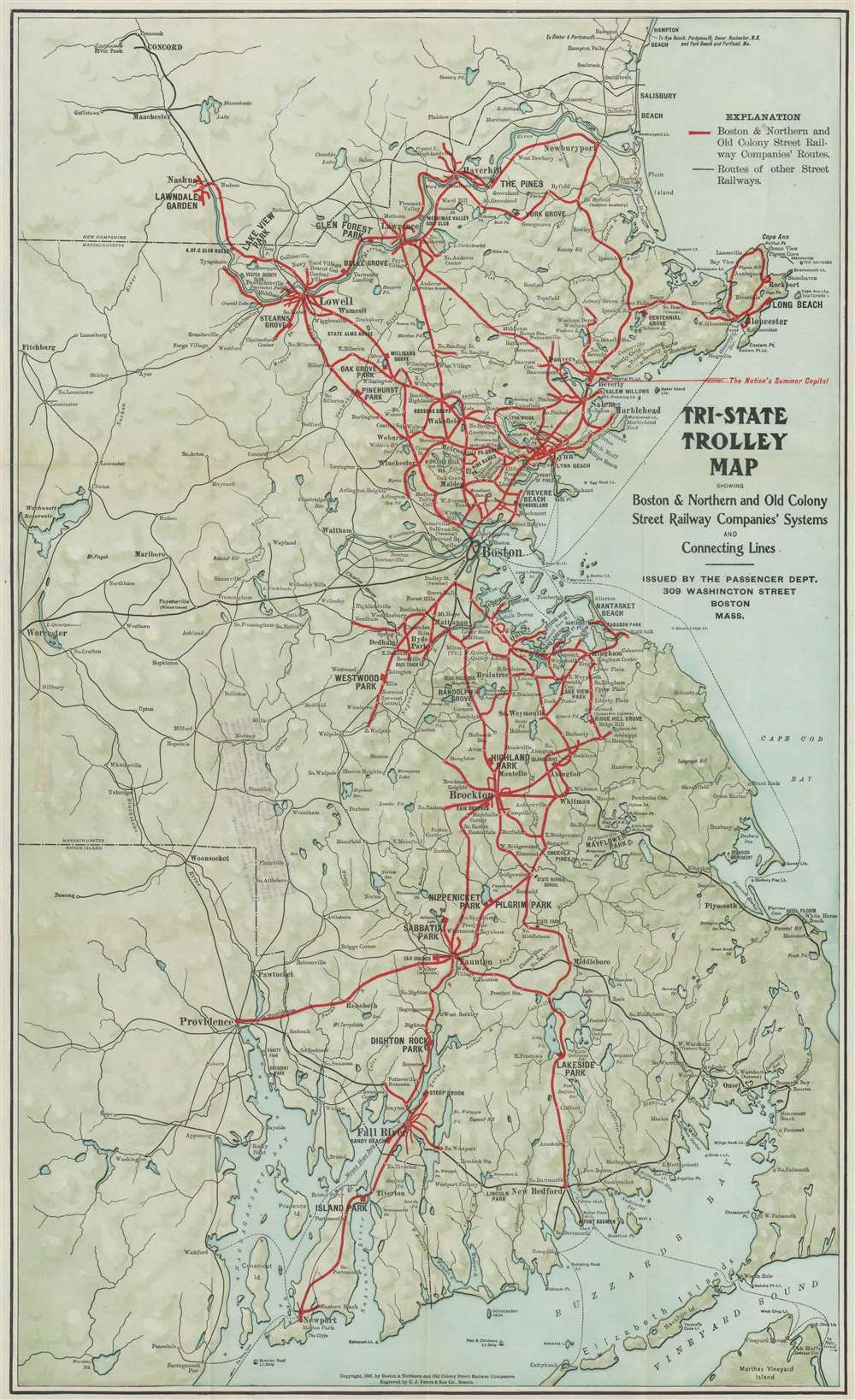
Tri-State Trolley Map Showing Boston and Northern and Old Colony Street Railway Companies' Systems and Connecting Lines.
sold
- Digital Map Information
- Suitable for large format printing
- File Size: 19.49 MB
- File Type: ZIP / TIFF
- ICC color profile embedded
- Delivered instantly via download link
This is a 1907 C.J. Peters and Son map of Massachusetts, New Hampshire, and Rhode Island trolley lines. Thick red lines trace the Boston and Northern and Old Colony Street Railway Companies' routes throughout the region from Newburyport, Massachusetts south to Newport, Rhode Island. Thin black lines follow other street railway routes, allowing viewers a more general understanding of the street railway network in this part of the United States around the turn of the 20th century. Cities and towns along these routes are labeled. Among the cities served by these two railways are Boston, Providence, Newport, Salem, Marblehead, and Nashua. Lakers and rivers are illustrated and shading is used to subtly include the region's topography. (more details)
One of the first and most comprehensive public tram networks in Asia.
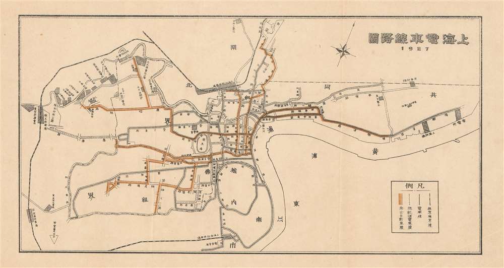
Shanghai Tram Line Map. / 上海電車線務圖
sold
- Digital Map Information
- Suitable for large format printing
- File Size: 3 MB
- File Type: ZIP / TIFF
- ICC color profile embedded
- Delivered instantly via download link
An uncommon 1927 Sugie Fusazo map of Shanghai, China, illustrating transportation networks. The map focuses on Shanghai's developing electric tram line - which is here highlighted in yellow. Shanghai's tram network, one of the first in Asia, offered comprehensive public transport through the Foreign Concessions. (more details)
Published on December 9, 1941 - the day after the Japanese first attacked the archipelago.
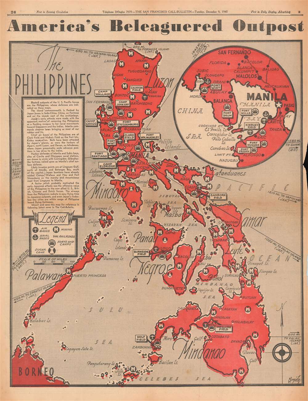
America's Beleaguered Outpost. The Philippines.
sold
- Digital Map Information
- Suitable for large format printing
- File Size: 23.77 MB
- File Type: ZIP / TIFF
- ICC color profile embedded
- Delivered instantly via download link
Published on December 9, 1941, this Bannister map of the Philippines likely introduced many of The San Francisco Call-Bulletin's readers to the archipelago. The Japanese attacked the American Pacific Fleet at Pearl Harbor on December 7 and American bases in the Philippines on December 8, pushing the United States into a war that it had long wanted to avoid. The archipelago's major islands are all labeled along with many of its major cities, including Manila, Davao, Cebu, and Iloilo. Icons mark air and naval bases, mining regions, railroads, American forts and camps, and, curiously, areas cultivating sugar cane. A circular inset in the upper right focuses on Manila, Manila Bay, and the immediate vicinity, placing particular importance on American military installations. Corregidor Island at the mouth of Manila Bay is prominently labeled and would play a critical role during the coming Japanese invasion. (more details)
One of Italy's most celebrated cities.
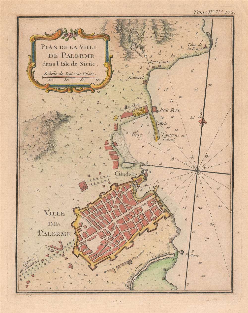
Plan de la Ville de Palerme dans l'isle de Sicile.
$250.00
Acquire
- Digital Map Information
- Suitable for large format printing
- Full resolution TIFF file
- ICC color profile embedded
- Delivered instantly via download link
This is a beautiful 1764 Jacques-Nicolas Bellin city plan or map of Palermo, Italy. The city occupies the bottom portion of the map, with its citadel and shore battery both labeled. its city walls are clearly illustrated. The Chemin de Montreal (the road to Monreale) is labeled to the left of the city and heads west.The Oreto River appears south of Palermo, while the city's port is to its north. A small fort and storage facilities near the port are both illustrated and labeled, along with a signal lantern. An aqueduct brings water from the nearby mountains to a site labeled 'Aqua Santa', which would translate to 'Holy Water'. Today, Palermo is the economic and tourist capital of Sicily and draws people because of its history, art, culture, music, and food. Its Mediterranean climate, incredible architecture, and nightlife all appeal to tourists. The city is also home to eight UNESCO World Heritage sites dating from the era of the Norman Kingdom of Sicily (1130 - 1194): three cathedrals, two palaces, and a bridge. Two other cathedrals, in Cefalù and Monreale, are also part of the UNESCO World Heritage Site designation. (more details)
Israel's technological and economic center.
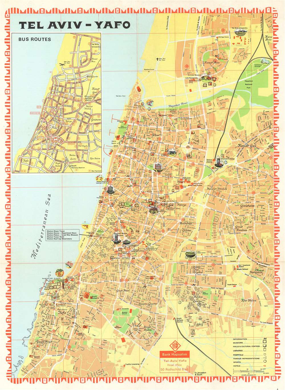
Tel Aviv - Yafo.
sold
This is a 1974 Carta pictorial city plan or map of Tel Aviv, Israel. Depicting the city from Tel Aviv University to Givat Aliya, streets throughout the city are illustrated and labeled. Pictorial vignettes highlight buildings around the city, including Tel Aviv University, the F. Mann Auditorium, Laski Planetarium, and Shalom Mayer Tower. Museums, libraries, cultural centers, and hotels are identified as well. Red diamond shapes mark branches of the Bank Hapoalim throughout the city. An inset highlighting the city's many bus routes occupies the upper left quadrant. (more details)