
The Young People's Society for the Christian Endeavor!
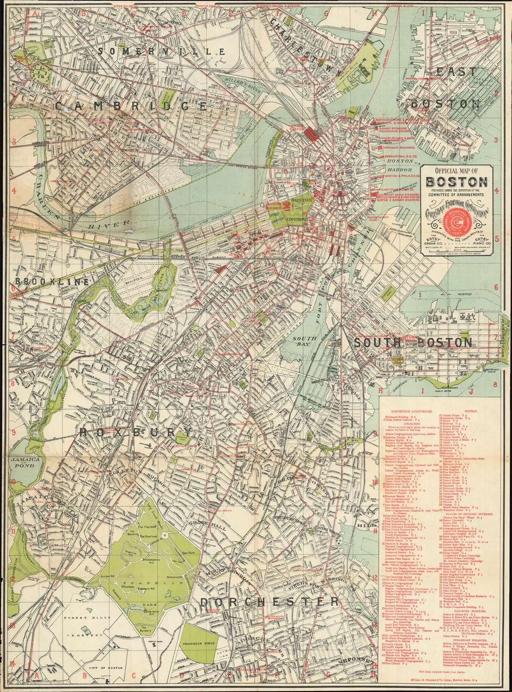
Official Map of Boston.
sold
- Digital Map Information
- Suitable for large format printing
- File Size: 39.37 MB
- File Type: ZIP / TIFF
- ICC color profile embedded
- Delivered instantly via download link
Published for the Fourteenth International Convention of the Young People's Society for the Christian Endeavor, this is an 1895 George H. Walker and Company city plan or map of Boston, Massachusetts. Red overprinting highlights over 100 different locations around the city, including hotels, churches, historic sites, and railroad stations. Seventy-nine of these are numerically labeled, while others are identified by name. Two massive tents erected on Boston Common, named Walliston and Endeavor, hosted many of the convention's events. (more details)
Coastal Maine's shipbuilding heritage.

A Map of the Maine Coast from the Kennebec to Rockland.
sold
Focusing on the role historically played by the region, this c. 1960 Ruth Rhoads Lepper pictorial map of the Maine coast promotes the historic sailing ships built here and the region's many historic buildings. Over a dozen illustrations of ocean-going vessels highlight mid-coast Maine's shipbuilding prowess. Lepper provides each ship's name, its tonnage, the year it was launched, and either where it was built or other facts about the ship. Views of historic buildings, including St. Patrick's, the oldest Catholic church in Maine and the Lincoln County Jail and Museum, also lend an air of history to the piece. Cities and towns throughout the region are labeled, many of which are also accompanied by their year of incorporation. Charming views of New Harbor, Round Pond, and the Boothbay Harbor Yacht Club also appear. (more details)
Depicts Greece during its fight for independence from the Ottoman Empire.

Greece and the Ionian Republic.
sold
- Digital Map Information
- Suitable for large format printing
- File Size: 15.15 MB
- File Type: ZIP / TIFF
- ICC color profile embedded
- Delivered instantly via download link
An excellent 1855 first edition example of Colton's map of Greece. Like most of Colton's Europe maps, this map was derived from an earlier wall map of the world produced by Colton and D. Griffing Johnson. The map covers from Corfu to Thera and Lesbos. (more details)
A striking tourist road map published during the Great Depression.
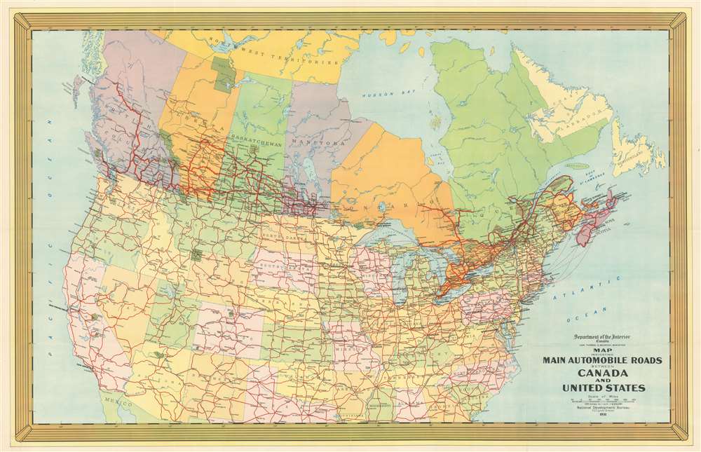
Map Indicating Main Automobile Roads Between Canada and United States.
sold
- Digital Map Information
- Suitable for large format printing
- File Size: 102.82 MB
- File Type: ZIP / TIFF
- ICC color profile embedded
- Delivered instantly via download link
Published during the National Development Bureau's first year, this is a 1931 tourist road map of Canada and the United States. The map offers bright, striking colors and a very welcoming aesthetic designed to appeal to potential vacationers. When compared with an example of the previous year's map (also available on our website), these colors become even more striking. Meant to emphasize road connections between the two countries, red lines trace highways throughout Canada, and the United States. Eye-catching green splotches highlight national parks in both countries, including Prince Albert National Park, Banff National Park, Glacier National Park (which crosses the border), Yellowstone, and Yosemite. (more details)
Highlights road connections between Canada and the Northeastern United States.
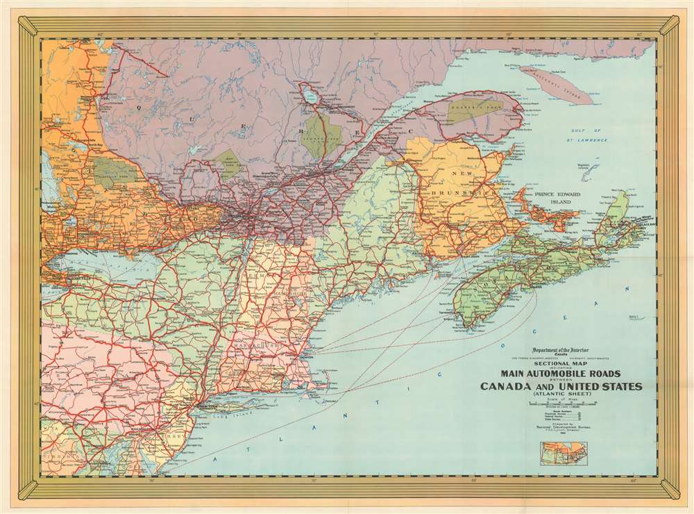
Sectional Map Indicating Main Automobile Roads Between Canada and United States (Atlantic Sheet).
sold
- Digital Map Information
- Suitable for large format printing
- File Size: 110.06 MB
- File Type: ZIP / TIFF
- ICC color profile embedded
- Delivered instantly via download link
This is a National Development Bureau road map of New England and Ontario, Quebec, and the Maritime Provinces. Depicting the region from Georgian Bay to the Atlantic Ocean and from Iroquois Falls, Ontario, to Washington, D.C., the map highlights road connections between the two countries. Red lines representing major highways meander their way across the continent. Green splotches marking provincial and national parks in Canada stand out against the multicolored Canadian provinces. Dashed lines trace sea lanes between New York, Boston, and Philadelphia and New Brunswick and Nova Scotia. (more details)
Promoting the 'Great American Road Trip'!
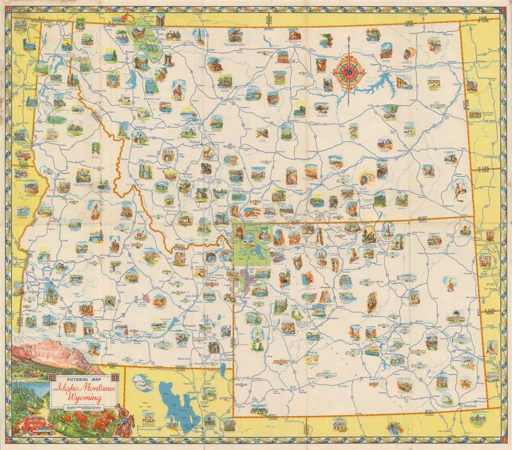
Pictorial Map Idaho Montana Wyoming.
sold
- Digital Map Information
- Suitable for large format printing
- File Size: 24.51 MB
- File Type: ZIP / TIFF
- ICC color profile embedded
- Delivered instantly via download link
Centered on Yellowstone National Park, this c. 1930 Rand McNally pictorial map of Idaho, Montana, and Wyoming promotes a romantic view of the American West. Yellowstone, the first national park in the U.S., fascinates people across the U.S. and the world and is famous for its geothermal activity, especially Old Faithful, illustrated here. The 'great outdoors' is synonymous with the American West, and Rand McNally uses that connotation to their advantage. People are depicted fishing, working cattle ranches, and taking in the fantastic scenery. National parks, monuments, and forests are all labeled, while the flora, fauna, and landscapes they were created to protect are front and center. The region's state and national highways crisscross the map, allowing vacationers to plan which sites to visit and how best to access each one. After spending some time looking at this map, one can't help but want to take a 'Great American Road Trip'! (more details)
An attractive map of an independent Greece.
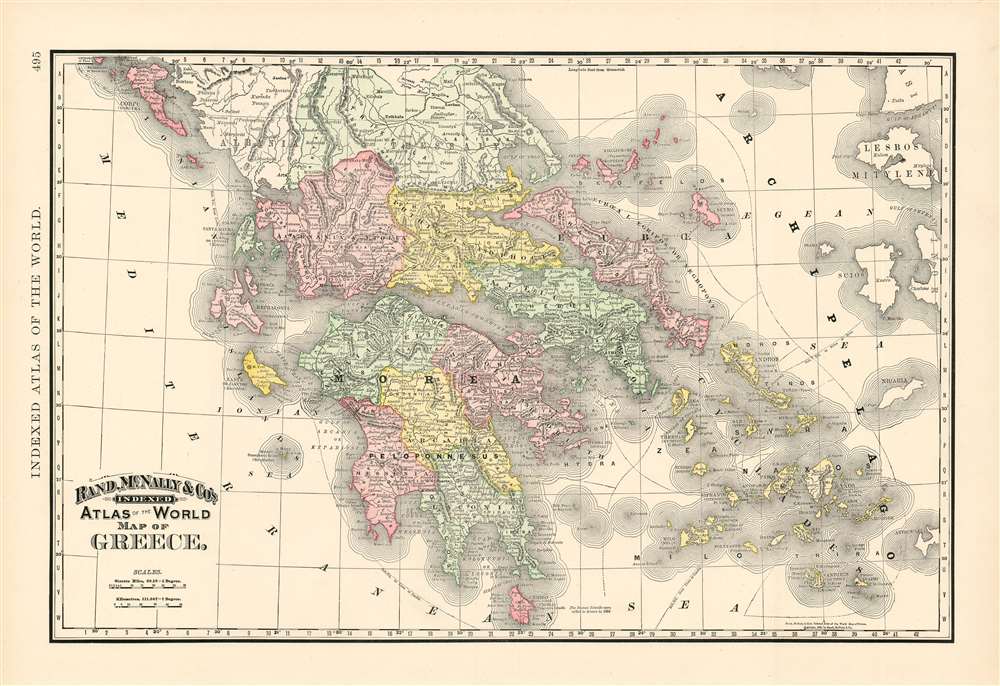
Map of Greece.
sold
- Digital Map Information
- Suitable for large format printing
- File Size: 26.33 MB
- File Type: ZIP / TIFF
- ICC color profile embedded
- Delivered instantly via download link
This is Rand McNally and Company's 1892 map of Greece. It covers from Corfu to Cythera and includes the Cyclades. Territories are distinguished from one another with original wash color, and topographical detail is shown with hachure. Greece gained independence from the Ottoman empire in 1832 under the Treaty of Constantinople; independence was followed by decades of internal conflict over topics ranging from constitutional issues to questions of which version of the Greek would be 'official.' All Greeks were united, however, in their determination to liberate the Hellenic lands under Ottoman rule. These efforts were playing out diplomatically over the period leading up to the production of this map: the cession of the Ionian Islands to Greece in 1864 is noted on the map. In 1897, five years after the publication of this map, Greece would declare war on the Ottomans Empire over control over Crete. (more details)
The Classic Dutch Cartes-à-Figures Map of Africa.

Africae nova descriptio. Auct: Guiljelmo Blaeuw.
sold
- Digital Map Information
- Suitable for large format printing
- DPI: 600
- File Size: 41.31 MB
- File Type: ZIP / TIFF
- ICC color profile embedded
- Delivered instantly via download link
This is a lovely, original-color example of Willem Blaeu's atlas map of Africa. It is one of the most desirable maps of the Dutch Golden Age of mapmaking. Norwich hailed it rightly as 'one of the most decorative and popular of all the early maps of Africa.' The seas are filled with ships and sea monsters; the land teems with elephants, ostriches, lions, and other beasts. And the borders of this superb carte à figure map depict the greatest African cities of the day along the top, while on each side the borders display the natives of ten parts of the continent, in their traditional dress. Although separated from Europe only by the Mediterranean Sea, Europeans were nearly as ignorant of this massive continent as they were of the remote portions of Asia, or of the Americas, so maps such as this one provided a glimpse into what amounted to a different world. (more details)
Highly decorative world map full of cartographic speculation.
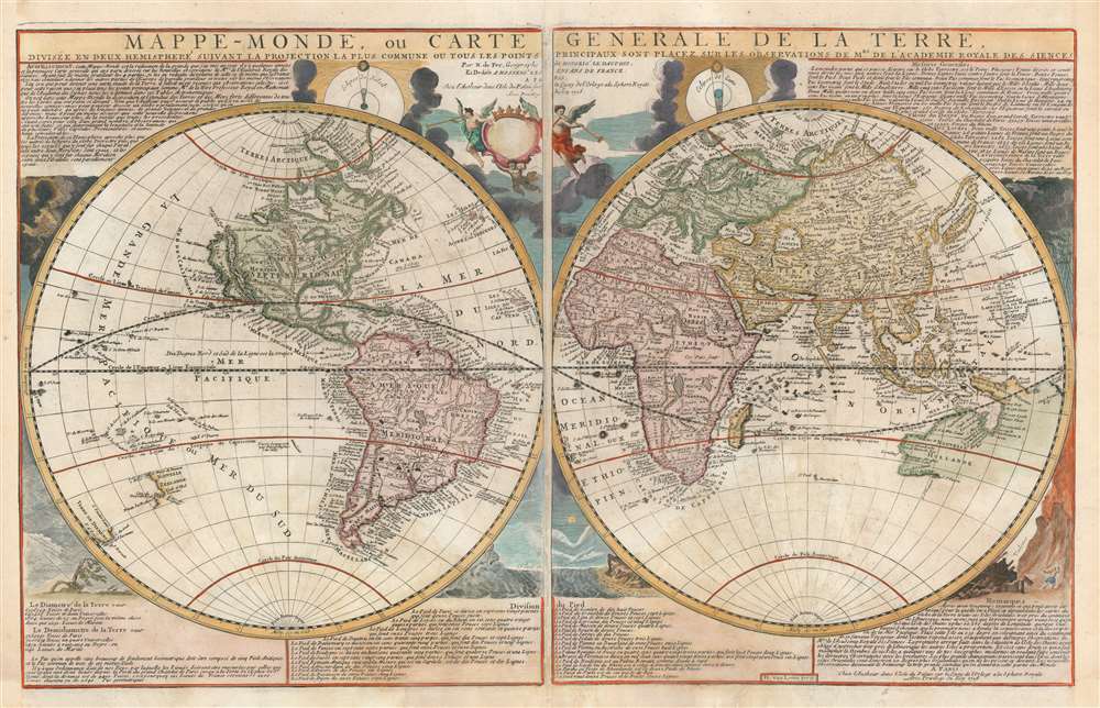
Mappe-Monde, ou Carte Generale de la Terre, divisée en deux himisphere suivant la Projection la plus commune ou tous les points principaux sont placez sur les observations de Mes. de L'Academie Royale Des Sciences.
sold
- Digital Map Information
- Suitable for large format printing
- DPI: 600
- File Size: 46.66 MB
- File Type: ZIP / TIFF
- ICC color profile embedded
- Delivered instantly via download link
An attractive example of Nicolas de Fer's c. 1718 map of the world in two hemispheres. This map is an intermediate proof state of a map first published in 1700. Note the empty cartouche at top center - representing a transitional phase between the 1708 and 1718 editions. The map features numerous interesting cartographic anomalies, among them 'California as an Island', a speculative pacific northwest and Siberian Arctic, and partial pre-Cook mappings of New Zealand, New Guinea, and Australia. The whole is surrounded by beautiful decorative engraving by Herman van Loon illustrating tides, volcanos, and extreme weather. (more details)
Extremely rare Greenwich, Connecticut pictorial.

Northern Greenwich in Connecticut in Ye Olden Days before 1875.
sold
- Digital Map Information
- Suitable for large format printing
- File Size: 61.05 MB
- File Type: ZIP / TIFF
- ICC color profile embedded
- Delivered instantly via download link
A rare pictorial map of the northern part of Greenwich, Connecticut issued in 1948 by Roger H. Selchow. This is a companion piece to an earlier 1939 map of coastal Greenwich issued by the same artist. Coverage extends roughly from what is today Route 1 north to the New York border, and from Rye to Stamford, including the communities of Round Hill, Riversville, Stanwich, North Greenwich, and South Stanwich. (more details)
The earliest modern map to clearly depict Poland and Hungary.
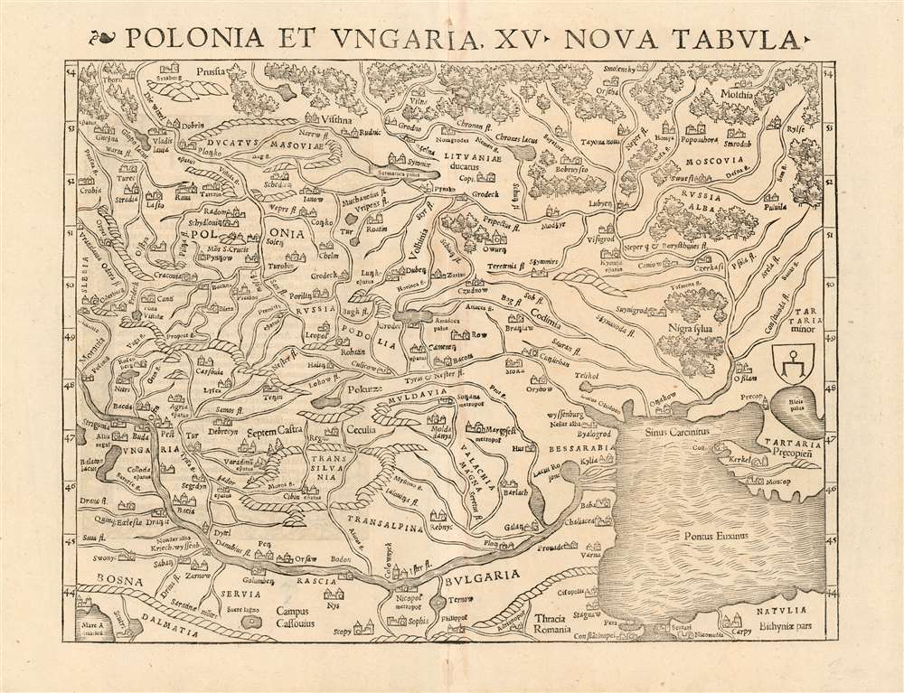
Polonia et Ungaria, XV. Nova Tabula.
sold
- Digital Map Information
- Suitable for large format printing
- DPI: 600
- File Size: 37.24 MB
- File Type: ZIP / TIFF
- ICC color profile embedded
- Delivered instantly via download link
This is the scarce 1540 first state of Sebastian Münster's map of Poland and Hungary, the first map to focus on the region using contemporary place names and geographical knowledge. The only earlier printed maps to focus at all on the region were iterations of Ptolemy's maps of Sarmatia in Europe; the nearest contender for an earlier modern map of the region is Waldseemüller's 1513 Tabula moderna Sarmatie which was of broader scope (reaching as far west as Germany and the Bavarian Alps) and whose geography for the region is far more primitive. Münster's map is the first of this region to present the reader with a largely recognizable depiction of Poland and Hungary. (more details)
A railroad map of the United States that traces American expansion and lauds cessions and annexations following the Spanish-American War.
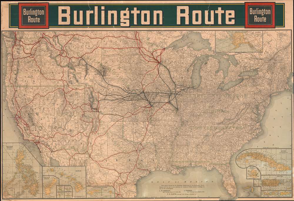
Burlington Route.
sold
- Digital Map Information
- Suitable for large format printing
- File Size: 194.82 MB
- File Type: ZIP / TIFF
- ICC color profile embedded
- Delivered instantly via download link
Upon first glance, this 1902 Poole Brothers railroad map of the United States details the country's extensive rail network and gives pride of place to the Burlington Northern. Thick black lines trace the Burlington's main routes and dots mark all its whistle stops, while thinner lines identify nearly all the small railroads in operation across the county. However, when more closely examined, green overprinting jumps off the page and block lettering proclaims the history of America's westward expansion. (more details)
A brilliant, data rich depiction of early mid-century New York City.

The City of New York.
sold
- Digital Map Information
- Suitable for large format printing
- File Size: 78.19 MB
- File Type: ZIP / TIFF
- ICC color profile embedded
- Delivered instantly via download link
This 1939 Richard Edes Harrison map of New York City - published in conjunction with the New York World’s Fair – represents a triumph of the visual display of quantitative information. Its aesthetic impact is all the more impressive in its clear expression of municipal and demographic data, making this a map of the people of New York City, as much as of the physical city itself. All five boroughs are represented in the primary map. On it, Harrison’s masterful use of vivid color to distinguish between residential, commercial, industrial, and federal use of land is clear yet supple, able to make distinction (for example) of low-income housing projects using the same palette. Parks and cemeteries both appear as green spaces, with white spots - evoking headstones - indicating the difference between the two. The two major airports (Floyd Bennett Field and North Beach Airport) are given their own color as well. The city’s industrial areas, shown in black, dominate the East River and Hudson coastlines, a reminder of the centrality of trade to the city’s development and history. (more details)
Chronicling Jesuit Activity in and around the Rio de la Plata.
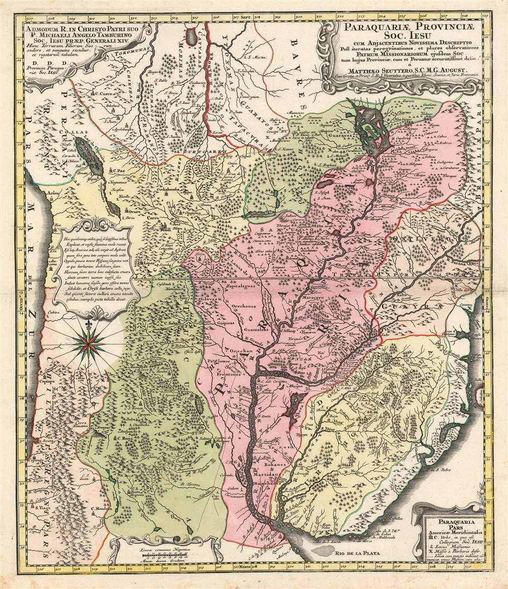
Paraquariae Provinciae Soc. Iesu com Adjacentibus Novissima Descriptio Post iteratas peregrinationes, et plures observationes Patrum Missionariorum eiusdem Soc. tom huius Provinciae cum et Peruvanae accuratissime delin. a Matthaeo Seuttero, S.C.M.G. August.
sold
- Digital Map Information
- Suitable for large format printing
- DPI: 600
- File Size: 28.85 MB
- File Type: ZIP / TIFF
- ICC color profile embedded
- Delivered instantly via download link
This is Matthias Seutter's 1730 map of Paraguay, showing specifically the Jesuit province of Paraguay and the surrounding regions including present-day Uruguay, and parts of Argentina and Brazil. This map, commonly given a date of 1730, is a faithful copy of a 1722 map of the same area produced by Juan Francisco D'Avila, which substantially improved from earlier maps of the region and provided what was the most complete map of the Rio de la Plata watershed available at the time. Furlong, in his Cartografia jesuttica del Rio de la Plata hailed the D'Avila map as 'without doubt the most complete and most comprehensive map undertaken by the Jesuits up to the middle of the eighteenth century' (Buenos Aires, 1936, p. 44). This map does not exhibit any of the added missionary tracks that appear on Antonio Marchoni's corrected 1732 iteration of the map, supporting a 1730 date. The map shows the full length of the Rio de la Plata from its source at the mythical Lake Xarayes (see below) to its mouth, at Buenos Aires and Montevideo. The map embraces central South America, and includes the Pacific coast from Peru to Coqimbo in Chile. Lake Titicaca (Chiquito, on the map) is shown, as is the famous Cerro Potosi, location of the Spanish Colonial silver mint - source of the massive wealth of silver drawn from South America by Spain via slave labor throughout the sixteenth and seventeenth centuries. Throughout the map are shown Jesuit missions - both active, and those destroyed by the indigenous population. Cities with Jesuit colleges are shown as well. As is not atypical for Jesuit maps, the locations of martyrdoms are also shown. (more details)
Criticizes President Cleveland and his slow response to economic depression.

Going Backward - The Democratic Policy.
sold
- Digital Map Information
- Suitable for large format printing
- File Size: 15.53 MB
- File Type: ZIP / TIFF
- ICC color profile embedded
- Delivered instantly via download link
Using the 1893 Chicago World's Fair as its setting, this 1893 Bernhard Gillam political cartoon blasts the government's slow and outdated response to the Panic of 1893, at that point, the worst economic disaster in American history. In many ways this cartoon is also pertinent to the current times, when we are once again facing record unemployment - this time due to a poor government response to the Covid-19 virus. (more details)
Details both the North and South Poles and attempts to explain Earth's magnetic properties.
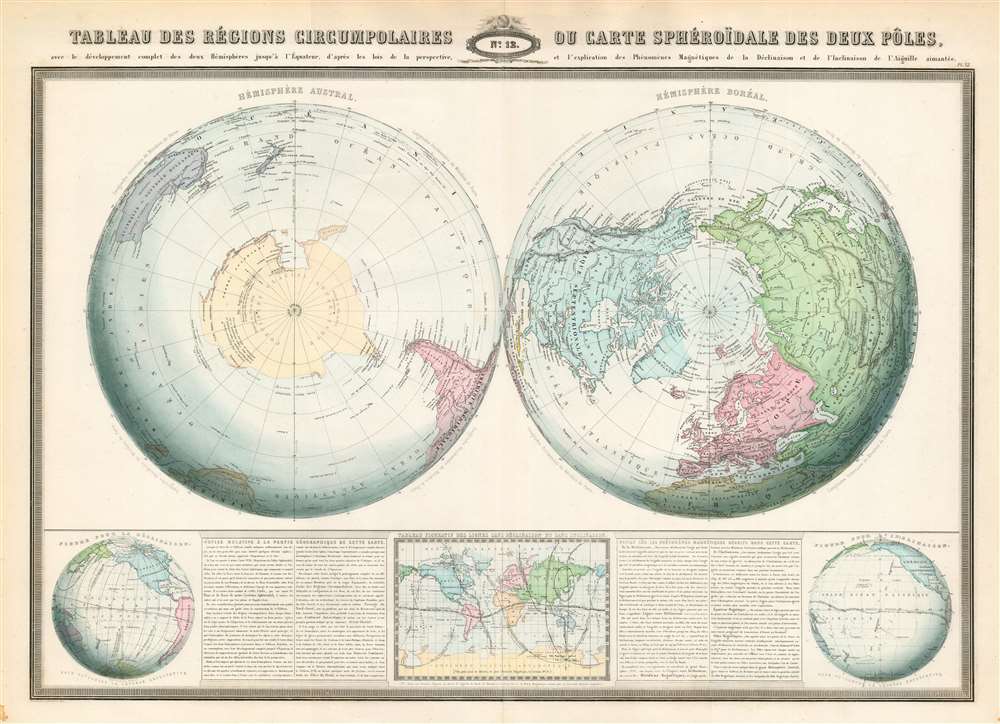
Tableau des régions circumpolaires ou carte sphéroïdal des deux pôles.
sold
- Digital Map Information
- Suitable for large format printing
- File Size: 52.31 MB
- File Type: ZIP / TIFF
- ICC color profile embedded
- Delivered instantly via download link
This is an 1860 F.A. Garnier map of the North and South Poles in two hemispheres. Depicting the Earth as if cut in half along the Equator, both poles are illustrated in detail, and features nearing the Equator are distorted. Numerous locations are identified around the poles, particularly around the still relatively unknown Antarctic continent. Garnier includes a detailed description of the map's geography along the bottom border. (more details)
Depicts Wrigley Field and Soldier Field in profile.

A Profile of Chicago Host City to the Nation.
sold
- Digital Map Information
- Suitable for large format printing
- File Size: 69.2 MB
- File Type: ZIP / TIFF
- ICC color profile embedded
- Delivered instantly via download link
Created in the euphoria just after World War II, this 1948 Robert McCall pictorial map of Chicago captures the era's gaiety. A promotional piece meant to draw vacationers to the city, muted colors evoke warmth and comfort. Chicago's institutions, including the University of Chicago, the Museum of Science and Technology, the Shedd Aquarium, and the Newberry Library are all prominently illustrated. Wrigley Field, Soldier Field, Comiskey Park, and Navy Pier also take pride of place. The detailed inset of the business district, The Loop, emphasizes the newfound prosperity of the post-war years and Chicago's economic importance. An additional sixty-three locations are numerically identified between the two maps and correspond with an index situated along the bottom border. An even larger index catalogs hotels, department stores, theaters, skyscrapers, and other places of interest to potential visitors. (more details)
Published two years into the Great Depression.
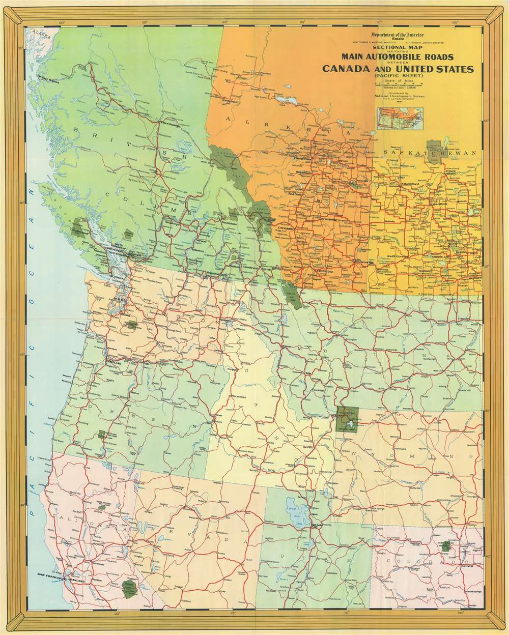
Sectional Map Indicating Main Automobile Roads Between Canada and United States (Pacific Sheet).
sold
- Digital Map Information
- Suitable for large format printing
- File Size: 140.22 MB
- File Type: ZIP / TIFF
- ICC color profile embedded
- Delivered instantly via download link
This is a National Development Bureau road map of western Canada and the western United States. Depicting the region from Notikewen, Alberta to Pueblo, Colorado, and from the Pacific Ocean to Cheyenne, Wyoming, the map highlights road connections between the two countries. Red lines representing major highways meander their way across the continent. Green splotches marking national parks stand out against the multicolored American states and Canadian provinces. (more details)
The Swiss Alps mapped during the first geometrically accurate survey of Switzerland.

Brieg-Airolo Blatt XVIII.
sold
- Digital Map Information
- Suitable for large format printing
- DPI: 600
- File Size: 62.06 MB
- File Type: ZIP / TIFF
- ICC color profile embedded
- Delivered instantly via download link
This superbly detailed 1854 Dufour map of the municipalities of Brig-Glis and Airolo in the Lepontine Alps of Switzerland, from the first geometrically accurate map of the Swiss Confederation. It spans from the canton of Valais to the canton of Ticino; in the upper right corner can be seen Göschenen (San Gottardo on the map) and Airolo, prior to the construction of the Gotthard tunnel. The lower left includes the town of St. Niklaus. The riotously mountainous terrain embraced between these locations includes Monte Leone, the highest peak of the Lepontine range. (more details)
Everyone's favorite WWI cephalopod map monster, the Prussian Octopus!
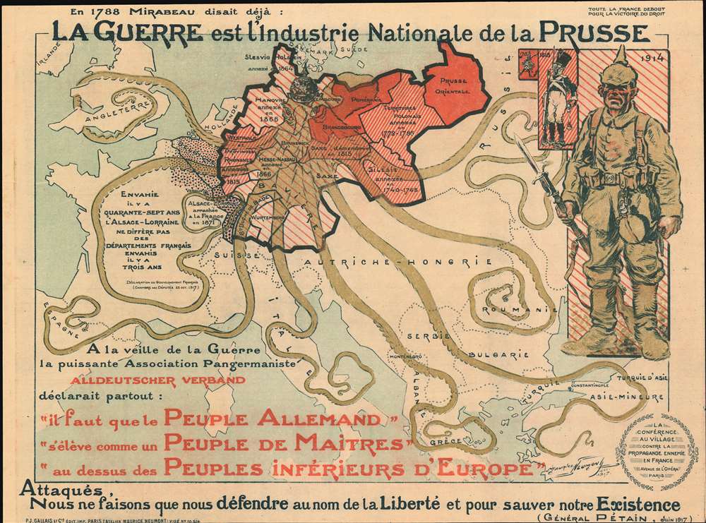
La Guerre est l'industrie Nationale de la Prusse. [War is the Prussian National Industry.]
sold
- Digital Map Information
- Suitable for large format printing
- File Size: 49.33 MB
- File Type: ZIP / TIFF
- ICC color profile embedded
- Delivered instantly via download link
This is a 1917 Maurice Neumont World War I propaganda map of Europe incorporating everyone's favorite cephalopod map monster, the Prussian Octopus, to highlight two centuries of Prussian aggression across Central and Western Europe. It is overprinted with pictorial imagery including the Prussian octopus grasping all of Europe in its clutches and a Prussian soldier. (more details)