
Mapping American credit in 1916.

Babson's Map of North America for Merchants and Bankers.
sold
- Digital Map Information
- Suitable for large format printing
- File Size: 15.82 MB
- File Type: ZIP / TIFF
- ICC color profile embedded
- Delivered instantly via download link
This rarity is Babson's Statistical Organization map of the United States highlighting American industries and their market outlook in 1916. The map was most likely prepared with banks and other lending institutions in mind. Red overprinting identifies twelve different industries corresponding to text surrounding the map. These numbers are then printed all over the U.S., in circles (signaling a decline compared to last year) and squares (signaling an improvement over last year), with lines associating industries with geographical zones. Much of the focus is on agricultural markets, including cotton, oats, spring wheat, and corn. Manufacturing, the chemical industry, shipbuilding, mining, and smelting are also discussed. The colors used also relate to the map's economic message. Yellow areas indicate areas of better economic conditions, while green areas illustrate areas that may only be considered fair. Blue areas signify areas that are in 'poorer condition' relative to other parts of a given country, and, so says the map, 'CREDIT MEN should especially watch collections there'. (more details)
The Postwar revitalization of Hannover by one of the great 20th century cartographers.

Hannover.
sold
This is Hermann Bollmann’s 1959 map of Hanover, Germany. Executed in Bollmann’s characteristic axonometric projection, this bird’s eye view (or as Bollmann called it, ‘helicopter perspective’) combines accurate mapmaking with the enhancement of both aerial and ground photography to create a clear yet realistic view of the city. Bollmann began producing such views in 1949, and by this time was approaching the prime of his career. Documenting the Cost of War, and the ‘German Economic Miracle’ Bollmann’s first post-war city plans he named Trümmerkarte, or ‘Debris Maps,’ for their focus was the damage done by Allied air raids during the war; his first of these was Brunswick, printed in 1949. These views showed the shells of bombed-out buildings, and blocks flattened by the raids. The 1955 Hannover, too, chronicled the war damage the city suffered. So it is notable the extent to which this 1959 edition of the same map records the reconstruction of the city. This 1959 edition was not just a reprinting. The view was updated, with new roads and construction appearing all over the city. Palaces like the Leineschloss, and Neustadter and Paulus Kirchen are shown rebuilt. Some blocks shown almost completely cleared in 1955 - such as the one south of Ostermannstrasse, and the neighborhoods directly northeast of the railway station - in 1959 show new buildings: apartments, offices, schools, and the notionally iconic VW Tower overlooking the Hamburger Allee – itself a boulevard which does not exist on the 1955 view. The view includes, in red dotted line, the prospective route of the equally-new Berliner Allee, which now merges into the Hamburger Allee. Other traces of the war - for example, the 1955 has barracks appearing on the grounds of the Schutzen Fest-Platz, site of Hanover’s annual marksman’s fun fair; on the 1959 these are removed leaving the fields clear, with only the existing Festival offices at the entrance to the Fest-Platz visible. Likewise at the corner of Klagesmarkt and Theodorstrasse, a block of barrack-style housing with a guard post entry appears on the 1955 view, on a lot which is clear on the 1959.
The revitalized content of the map is accompanied by a refreshing of the colors used in printing this 1959 edition, which is overall a richer and brighter palette than that used on 1955 map. The title of the map is shown on a banner in the upper right, and is surmounted by the arms of the city - which, as a dedicated map collector ought to know from the famous Bunting world map, are a cloverleaf. (more details)
The revitalized content of the map is accompanied by a refreshing of the colors used in printing this 1959 edition, which is overall a richer and brighter palette than that used on 1955 map. The title of the map is shown on a banner in the upper right, and is surmounted by the arms of the city - which, as a dedicated map collector ought to know from the famous Bunting world map, are a cloverleaf. (more details)
Derived from maps produced by France's embassies to the Kingdom of Siam.
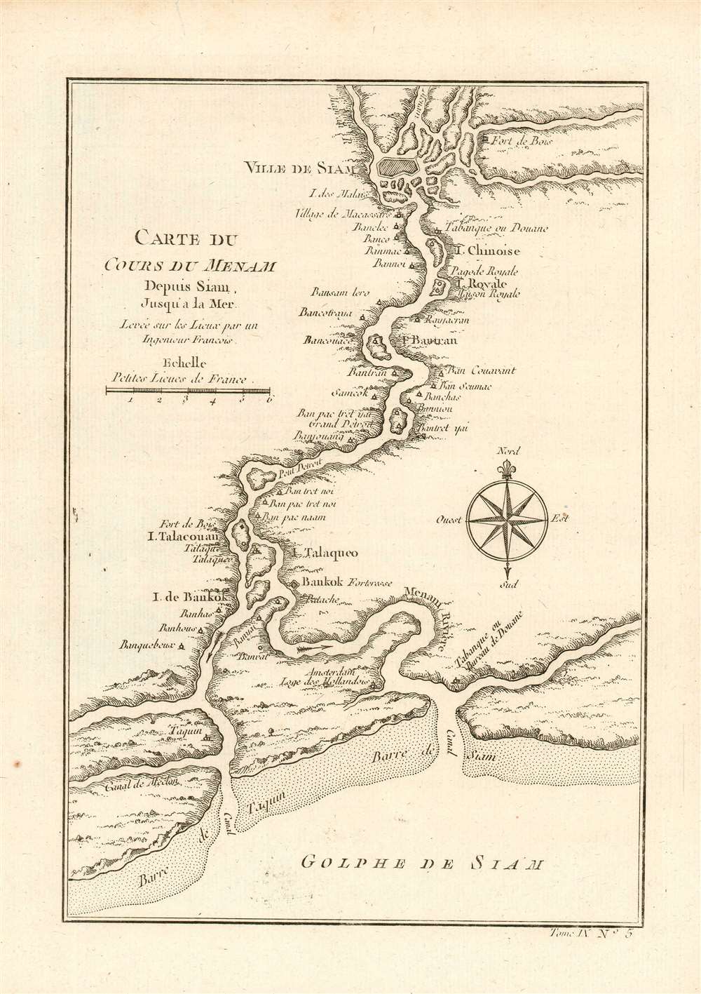
Carte du Cours Du Menam Depuis Siam Jusqu'a La Mer Levee sur los Lieux par un Ingenieur Francois
sold
- Digital Map Information
- Suitable for large format printing
- DPI: 600
- File Size: 2.75 MB
- File Type: ZIP / TIFF
- ICC color profile embedded
- Delivered instantly via download link
This is an elegant 1752 Bellin map of Bangkok and its surroundings. It details the course of the Chao Phraya River from the former Thai royal capital Ayutthaya (known to Europeans as the 'Ville de Siam'), past the small trading post of 'Bankok,' (Bangkok) to the Gulf of Thailand. Menam, or Mae Nam, literally means 'river.' Places identified along the river include the Royal Pagoda, the Bankok Fortress, and Dutch headquarters. This is among the excellent maps produced by Bellin for inclusion in Abbe Prevost's L'Histoire Generale des Voyages, in spite of that being a work whose entertainment value outstripped its veracity. Bellin's cartography is drawn from a similarly-named map appearing in French Jesuit Guy Tachard's 1688 Voyage de Siam, recounting the 1687 mission of Simon de la Loubère to Ayutthaya. That map was credited to one 'Monsieur de la Mare, Ingénieur François' who had been assigned to the mission. (This 1688 map appears to be extremely rare: we see no separate examples of the de la Mare map having reached the market.) (more details)
Extraordinary and rare map of Mallorca with decorative borders.

Mapa de la Isla de Mallorca sacado en escala menor del que publico el E.S. Cardenal Despuig El Año 1785.
sold
- Digital Map Information
- Suitable for large format printing
- DPI: 600
- File Size: 40.81 MB
- File Type: ZIP / TIFF
- ICC color profile embedded
- Delivered instantly via download link
An exceptionally rare 1814 / 1829 separately issued broadside map of Majorca (Mallorca), Spain, with fully illustrated surround. The map covers all of Mallorca with an inset illustrating the nearby islands of Cabrera and Conejara. It is based upon an earlier 1785 map surveyed at the order of Cardinal Antonio Despuig y Dameto. Manuel Briton, the island's Artillery Commissioner, partnered with Lorenzo María Muntaner (1782 - 1848), son of the original engraver, to revise the map for sale to tourists in 1814. The map is in Spanish, as are the caption on the surrounding views, but the imprint of Briton and Muntaner is in Catalan. The base map is quite rare and beautiful, but what makes this example special is the decorative surround featuring 34 captioned views of Majorcan towns and villages. (more details)
Likely created by American intelligence officials from a Japanese map captured on Okinawa, this map illustrates Japanese defensive positions in southern Okinawa during the Battle of Okinawa.
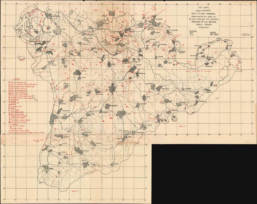
XXIV Corps. Enemy Defenses South of Naha-Yohabaru. From Photos of 1 April to 28 April 1945 and TICC Reports.
sold
- Digital Map Information
- Suitable for large format printing
- File Size: 29.55 MB
- File Type: ZIP / TIFF
- ICC color profile embedded
- Delivered instantly via download link
A rare 1945 World War II military intelligence map of southern Okinawa likely created by American intelligence officers from a captured Japanese map. This 1945 XXIV Corps Intelligence Section map was prepared to support what would become the last major battle of the Pacific War. Red overprinting highlights the known Japanese defensive positions from Yonabaru to the southern tip of the island. A legend situated along the left border details twenty-six types of Japanese military installations, including coastal guns, three different types of artillery emplacements, pillboxes, mortars, machine guns, and command posts. Japanese trenches and anti-tank defenses are also marked. Two text notes printed along the coastline near Itarashiku and Mesato, respectively, read 'Suicide Boat Area', which refer to Japanese Shin'yō-class motorboats. These boats were part of a Japanese program to create suicide craft, which included kamikaze planes, kaiten submarines, fukuryu suicide divers, and the shinyo boats. They were operated by one man, could travel up to thirty knots, and carried up to 300 kilograms (660 pounds) of explosives in their bow, which could either be detonated by the driver or on impact. (more details)
A rare map of the environs of Suzhou made with a new device invented to survey the region's network of canals, rivers, streams, and creeks.
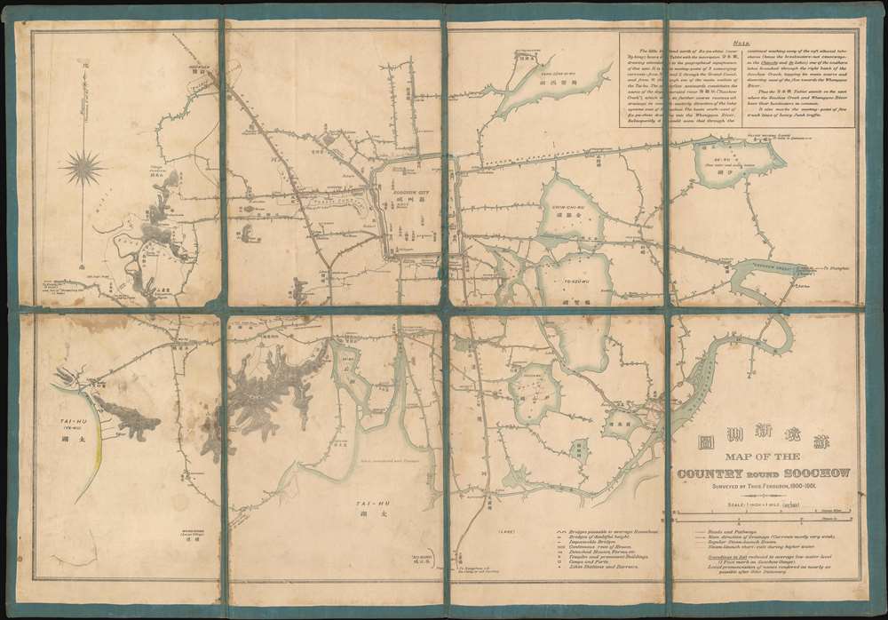
蘇境新測圖. Map of the Country round Soochow.
sold
- Digital Map Information
- Suitable for large format printing
- File Size: 17.96 MB
- File Type: ZIP / TIFF
- ICC color profile embedded
- Delivered instantly via download link
This is a 1901 Thomas Ferguson map of the garden city of Suzhou (Soochow), China and environs. Focusing on Suzhou's broad network of canals, the map encompasses the region from Lake Tai (Tai-Hu) to 'Soochow Creek' and from Yangcheng Lake (Yang-Sêng-Si-Wu) to the Grand Canal and 'Ng-Kong. The map serves the dual purpose of expanding military intelligence in the Yangtze Valley, and highlighting the usefulness of Ferguson's invention, the 'hodograph.' Ferguson used the hodograph to 'automatically' survey the canals, creeks, rivers, and other waterways in the region and then converted that data into his map. Arrows indicate the direction of some of the canals, which likely means that others supported two-way traffic. Suzhou's canals have always played a critical role in the local economy and even today are a major attraction for tourism. The Suzhou section of The Grand Canal passes through ten city gates and is traversed by more than twenty stone bridges. (more details)
English map highlighting the achievements of English Navigation in the 18th century
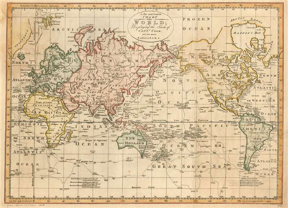
A New and Complete Chart of the World; Displaying the Tracks of Captn. Cook and other Modern Navigators.
sold
- Digital Map Information
- Suitable for large format printing
- DPI: 600
- File Size: 16.52 MB
- File Type: ZIP / TIFF
- ICC color profile embedded
- Delivered instantly via download link
This is a 1796 Bowen map of the world, centered on the Pacific Ocean and highlighting the tracks of famous (and courant) English nautical explorations of the latter part of the 18th century. The map illustrates the routes of nautical explorers, speculative routes through North America, names the Sea of Korea, and the legendary Chinese colony of Fusang. (more details)
'The crowning achievement of fifty years of exploration and research in the geography of Palestine' -Yehoshua Ben-Arieh
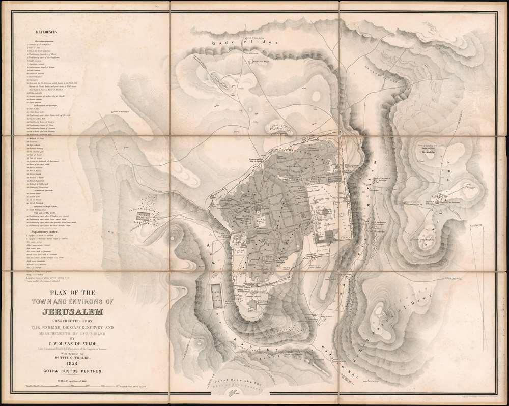
Plan of the Town and Environs of Jerusalem Constructed From the English Ordnance Survey and Measurements of Dr. T. Tobler.
sold
- Digital Map Information
- Suitable for large format printing
- File Size: 54.5 MB
- File Type: ZIP / TIFF
- ICC color profile embedded
- Delivered instantly via download link
Considered to be the most accurate map of Jerusalem published at the time, this is Charles William Meredith van de Velde's 1858 city plan or map of Jerusalem and its environs. Presenting the region in exceptional detail, the map covers from the Tombs of the Martyrs to Mount of Olives and from the Tomb of Simon the Just to the Hill of Evil Counsel. Important sites are labeled throughout, with the Dome of the Rock, the Al-Aqsa Mosque, the Church of the Holy Sepulcher, and the Church of the Tomb of the Virgin among them, and a further fifty-one sites are numerically identified and correspond with an index situated along the left border. Relief is indicated by hachure. (more details)
A detailed and rare city map of Chattanooga.
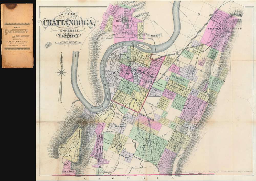
City of Chattanooga, Tennessee and Vicinity
sold
- Digital Map Information
- Suitable for large format printing
- File Size: 25.24 MB
- File Type: ZIP / TIFF
- ICC color profile embedded
- Delivered instantly via download link
This is an uncommon 1889 G.M. Hopkins city plan or map of Chattanooga, Tennessee. The map depicts the city from Lookout Mountain to Sherman Heights and from Hill City to Georgia, and the Tennessee River meanders its way across the sheet, with Chattanooga situated in one of its bends. City wards in Chattanooga are color coded to allow for easy differentiation and numerous streets are labeled, although the only building identified is the Hamilton County Court House. Chattanooga's many railroad lines are illustrated and labeled, including the electric railroad and the Mount Lookout Narrow Gauge Railroad. The city's topography is illustrated and both Mississippi Ridge and Stringer's Ridge are labeled. (more details)
Paradise! The U.S. Virgin Islands!
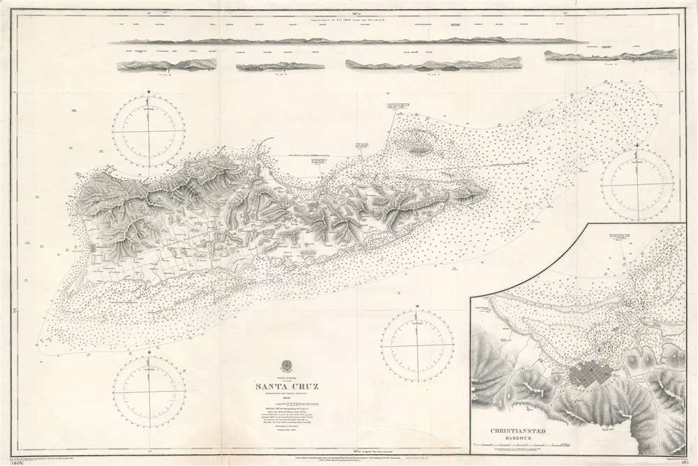
West Indies. Santa Cruz.
sold
- Digital Map Information
- Suitable for large format printing
- File Size: 38.94 MB
- File Type: ZIP / TIFF
- ICC color profile embedded
- Delivered instantly via download link
This is a beautiful 1903 British Admiralty nautical chart or maritime map depicting the island of Saint Croix (Santa Cruz) in the U.S. Virgin Islands. Unlike most Admiralty charts, a surprising level of inland detail is presented here. Both Frederiksted and Christiansted are labeled and illustrated with streets and city blocks. Homesteads across the island are identified as well, many of which are marked by windmills. Major roads are also included. Myriad depth soundings are noted all along the island's coast and extend east of the island to Lang Bank. A detailed inset map of Christiansted city and harbor is situated in the lower right corner. Five coastal views are included along the top border. (more details)
Includes an image of the mushroom cloud over Hiroshima.

NEWSMAP For the Armed Forces. V-E Day + 15 Weeks - 192nd Week of U.S. Participation in the War.
sold
- Digital Map Information
- Suitable for large format printing
- File Size: 143.71 MB
- File Type: ZIP / TIFF
- ICC color profile embedded
- Delivered instantly via download link
This is the chilling Atomic Bomb issue from the iconic World War II Newsmap series. Issued in 1945 as the 'Army Information Branch Newsmap of eastern China and Japan' shortly after the bombing of Hiroshima and Nagasaki, this edition the Japanese surrender to the Allies to end the War in the Pacific during World War II by less than a week. (more details)
The first successful ascent of Aconcagua, the tallest mountain in America.
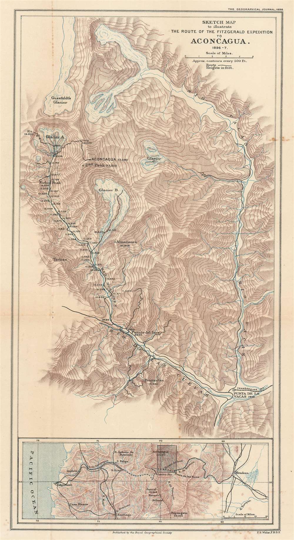
Sketch Map to illustrate the Route of the Fitzgerald Expedition to Aconcagua 1896 - 7.
$700.00
Acquire
- Digital Map Information
- Suitable for large format printing
- File Size: 14.7 MB
- File Type: ZIP / TIFF
- ICC color profile embedded
- Delivered instantly via download link
This is an 1898 Francis Sidney Weller map of This is an 1898 Francis Sidney Weller map of Mount Aconcagua, Mendoza Province, Argentina. The map depicts the region around Aconcagua, principally the Horcones Valley and the Vacas Valley. Black lines trace the 1896 – 1897 expedition financed and led by Edward Fitz Gerald (FitzGerald) that made the first successful ascent of Aconcagua. Aconcagua, labeled here in large block characters, is the tallest mountain outside Asia, as such it is also the tallest mountain in the Americas and in the Western and Southern Hemispheres. The region's topography is illustrated by hachure, and the area's glaciers and other major peaks are identified. An inset map along the bottom border situates Aconcagua in the larger region, placing it between Valparaiso, Chile and Mendoza, Argentina, where Fitz Gerald's team started their ascent. The proposed Trans-Andine Railway is illustrated here as well, with black lines detailing its progress through the mountains. (more details)
An extremely rare map of Holyoke, Massachusetts published by the owner of the Holyoke Street Railway Company.

Map of the City of Holyoke.
sold
- Digital Map Information
- Suitable for large format printing
- File Size: 16.58 MB
- File Type: ZIP / TIFF
- ICC color profile embedded
- Delivered instantly via download link
This is a c. 1874 William Loomis and Edwin Kirtland city plan or map of Holyoke, Massachusetts, a historic mill town on the Connecticut River. Holyoke is located in the famous 'Five Colleges' region of the Pioneer Valley, including Amherst College, Hampshire College, Mount Holyoke College, Smith College, and the University of Massachusetts Amherst. Holyoke is divided into wards, each of which is shaded a different color to allow for easy differentiation. Buildings are illustrated throughout the city, many of which are labeled, including the grammar school, high school, city hall, as well as numerous businesses and churches. Three canals cut through the city, and the Connecticut River Railroad traverses a few city wards before reaching running along the bank of the Connecticut River. The whole is surrounded by a beautiful border. (more details)
Kurdistan as mapped by a British diplomat and spy!
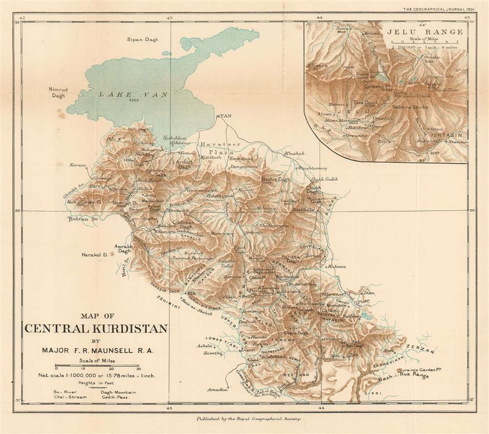
Map of Central Kurdistan.
sold
- Digital Map Information
- Suitable for large format printing
- File Size: 5.69 MB
- File Type: ZIP / TIFF
- ICC color profile embedded
- Delivered instantly via download link
This is a 1901 Francis Richard Maunsell map of central Kurdistan, in what is today the southeastern part of modern-day Turkey. Depicting the region south and east of Lake Van, the area's complex topography is illustrated in detail. Its many streams and two major rivers, the Bohtan and the Great Zab, are identified and mountain peaks are labeled. Inhabited mostly by nomads, the few settlements located here are identified, while the larger city of Van is illustrated along the eastern banks of Lake Van. An inset of the Jelu Range, which makes up the southern portion of the depicted region, is situated in the upper right corner. A glossary of local names used on the map is included below the title along the bottom border. Maunsell was serving in the British Consulate at Van when he created this piece. (more details)
Promoting Tourism in the American Southwest.
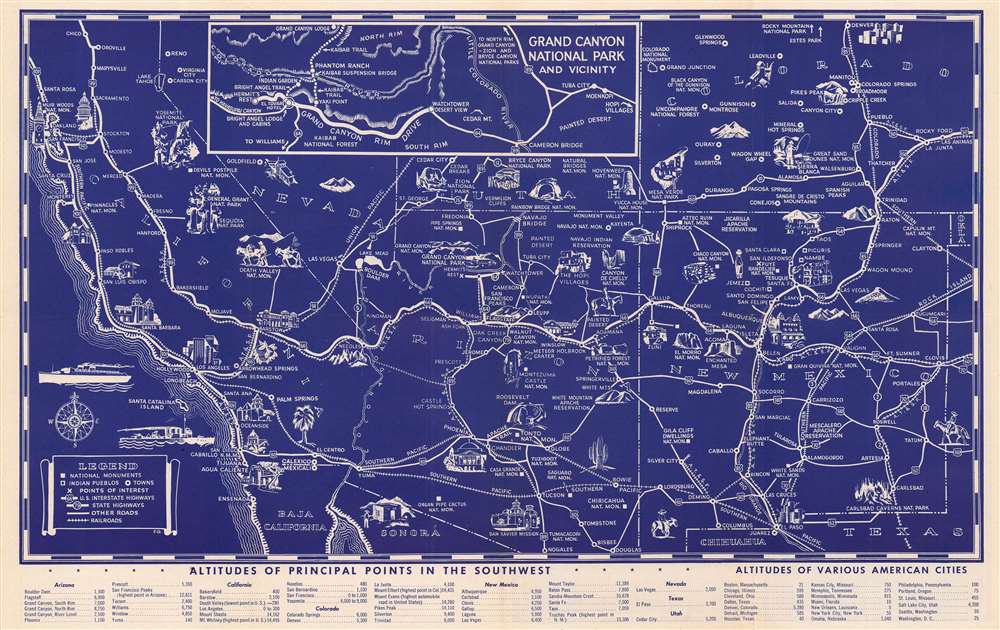
(Illustrated Map of the Great Southwest Including Points of Interest in New Mexico and Arizona Published by Fred Harvey.)
sold
- Digital Map Information
- Suitable for large format printing
- File Size: 18.35 MB
- File Type: ZIP / TIFF
- ICC color profile embedded
- Delivered instantly via download link
This attractive 1946 pictorial map of the American Southwest was produced by the Fred Harvey Company, the concessioner for the Atchison Topeka and Santa Fe Railroad. The map promotes not only the famous geological attractions of the Southwest, but also 'Harvey Car' cultural tourism to both Native American historic sites and living villages. (more details)
The popular Automobile Green Book Map!

Automobile Green Book. The All-in-One Guide.
sold
- Digital Map Information
- Suitable for large format printing
- File Size: 51.78 MB
- File Type: ZIP / TIFF
- ICC color profile embedded
- Delivered instantly via download link
This is a 1933 Scarborough Motor Guide Company road map of the eastern United States published in their celebrated Automobile Green Book. Printed on both sides of the same sheet, the map depicts the United States east of the Mississippi River to Lake Champlain and from southern Lake Superior to New Orleans and along the Gulf Coast to Key Largo. A key printed on the side depicting the southeastern U.S., explains that four different notations are used to differentiate between four different types of roads. The principal trunk lines are marked by thick black lines, while fully improved roads are indicated by thin solid black lines. Dashed black and white lines highlight roads that have only been partially improved, while this while tines mark important connecting roads, which, one imagines, have not been improved at all. Federal and state highway numbers are indicated as well. An inset map situated in the lower right corner of the side detailing the northeastern U.S. focuses on the area surrounding New York City that includes a tip for motorists that are trying to avoid New York City traffic as much as possible. Insets included on the southeastern U.S. side highlight the Florida panhandle between Pensacola and Tallahassee and the whole of peninsular Florida. A third, smaller map, situated in the lower left corner outside the principal map's border, focuses on trunk lines between Montreal and Miami and Eau Claire, Wisconsin and Burlington, Vermont. (more details)
Eccentric genius cryptanalysist L. D. Callimahos' pedagogical puzzle, 'The Zendian Problem,' representing a 'Top Secret' proxy war game anticipating the invasion of Cuba.
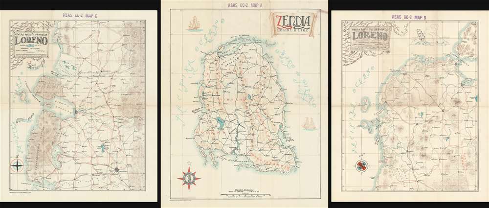
Zendia Respubliko (ASAS 60-2 MAP A)/ Norda Parto de la Provinco Loreno (ASAS 60-2 MAP B)/ Centra Parto de la Provinco Loreno (ASAS 60-2 MAP C).
sold
These three maps are extraordinary relics of a top-secret (now declassified) U.S. Army Cold War program to train code-breakers and invade Cuba, devised by the flamboyant maverick genius cryptanalyst Lambros D. Callimahos. Here in the only known surviving examples, this is a set of three, undated maps of the fantasy nemesis Republic of Zendia, with the northern part, and the central part of the Zendian province of Loreno. It has been argued, by Charles Varga and others, that Zendia is a proxy of the Isle of Pines (Cuba), and that the 'Zendian Problem', as it was known, was a training exercise for the 1961 Cold War invasion of Cuba (see below). (more details)
The Most Unique Early Map of the World
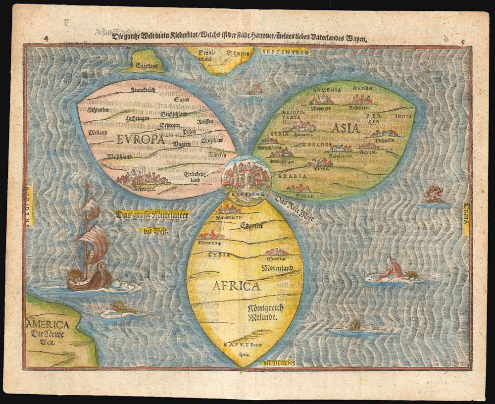
Die gantze Welt in ein Kleberblat, Welchs ist der stadt hannover, meines lieben Vaterlandes Wapen.
sold
- Digital Map Information
- Suitable for large format printing
- DPI: 600
- File Size: 12.76 MB
- File Type: ZIP / TIFF
- ICC color profile embedded
- Delivered instantly via download link
This is Heinrich Bünting's map of the world, dramatically presented as a clover leaf. No other early map utilized this configuration. This beautiful woodcut appeared in Bünting's Itinerarium Sacrae, the first and for many years the only complete work of biblical geography. As such, this map's central positioning of Jerusalem and the Red Sea - recalling medieval mappamundae - is appropriate. The map's puzzling trefoil shape, with Asia, Africa and Europe each given a leaf, invokes Ptolemy's three parts of the world, as well as the medieval T-O map's tripartite form. The map's title, however, gives insight to Bünting's motivation for producing so singular an image: Die gantze Welt in ein Kleeberblat, welches ist der Stadt Hannover, Meines lieben Vaterlandes Wapen translates to:
The Whole World in a Cloverleaf, Which is the Arms of my Dear Fatherland, Hanover.Bünting is using the centerpiece map of his book to tip his hat to his home town. (more details)
Paris takes on the automobile!

Accident d'Automobile.
sold
- Digital Map Information
- Suitable for large format printing
- File Size: 5.17 MB
- File Type: ZIP / TIFF
- ICC color profile embedded
- Delivered instantly via download link
A fascinating c. 1900 French manuscript gameboard that doubled as educational tool in the field of civic planning. Entitled Accident d'Automobile, the board consists of four panels, each representing a different 'traffic' problem, all of which were pertinent to Paris in the late 19th and early 20th century. The panels, each of which are mounted on sheets of cork, assemble according to a key found on the inside cover of the binder. The binder itself is a beautifully constructed French book box with the title embossed in gilt on the spine. This set is a testament to the fact that sometimes the best pedagogical tool is a game that models real-life scenarios. (more details)
The first official map of Cook's voyages.
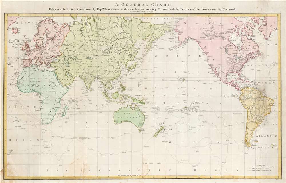
A General Chart: Exhibiting the Discoveries made by Captn. James Cook in this and his two preceding Voyages; with the Tracks of the Ships under his Command.
sold
- Digital Map Information
- Suitable for large format printing
- DPI: 600
- File Size: 28.22 MB
- File Type: ZIP / TIFF
- ICC color profile embedded
- Delivered instantly via download link
An attractive full original color example of Henry Robert's 1784 map of the world drawn to exhibit Captain James' Cook's voyages. This is the official chart of the voyages, published with the official account, and when it was issued, was the most sophisticated map of the world yet introduced, exhibiting heretofore unknown discoveries in the high arctic, and elsewhere. Coverage, as the title suggests, is expansive, underscoring the extensiveness of Cook's voyages ranging from the polar extremes to the Equator and circumnavigate the globe. The tracks of all three voyages are noted, with dating identifying important moments and annotations in Cook's journals. (more details)