
A Hungarian anti-fascist poster printed soon after the liberation of Budapest.

Saját Barlangjában Végzünk a Fasiszta Fenevaddal! / We'll Finish the Fascist Beast in His Own Cave!
sold
- Digital Map Information
- Suitable for large format printing
- File Size: 135.86 MB
- File Type: ZIP / TIFF
- ICC color profile embedded
- Delivered instantly via download link
This is a 1945 Sándor Ék anti-fascist propaganda poster created shortly after the liberation of Budapest by the Soviet Red Army. Centered on a large Nazi helmet with significant sections missing, Ék is making it apparent that the Nazis are losing the war. Large numbers of Allied bombs are illustrated in the top corners, with American and British bombs on the left and Soviet bombs on the right. Graphically, this poster is definitely pro-Soviet (which is not surprising, seeing as it was made by a Red Army soldier), suggesting that the forces brought to bear by the Soviet armed forces outweigh those of the other Allies. Hitler is illustrated with a broken hand and arm trying to escape from underneath the destroyed helmet and is met by a phalanx of sharpened bayonets. There would be no escape. (more details)
The first map of the Upper West Side!
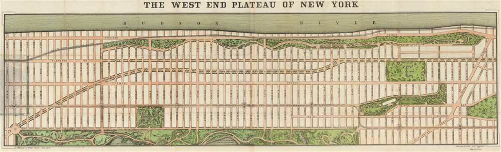
The West End Plateau of New York.
sold
- Digital Map Information
- Suitable for large format printing
- File Size: 61.55 MB
- File Type: ZIP / TIFF
- ICC color profile embedded
- Delivered instantly via download link
This is the first separately published map of the Upper West Side of Manhattan (New York City) and arguably the first printed map of the Upper West Side. Published in 1879 by Herman Knickerbocker Vielé, son of the prominent New York mapmaker and politician Egbert Ludovicus Vielé, this map was issued to promote real estate investment in the high ground of the Upper West Side. The map covers Manhattan from roughly Columbus Circle (58th Street) to 130th Street, between the Hudson River and Central Park. It includes all of Riverside Park, the Western side of Central Park, Morningside Park, the future site of Columbia University (Bloomingdale Lunatic Asylum), and Manhattan Square (American Museum of Natural History). Along 9th Avenue (Columbus Ave), the map illustrates the West Side and Yonkers Patent Railway Company, service along which opened in June of 1879 as far as 104th Street, and by December of the same year, to 155th Street. (more details)
Includes one of the most stunning depictions of Florida as an archipelago in cartographic history.
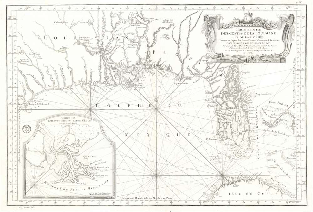
Carte Reduite des Costes de la Louisiane et de la Floride.
sold
- Digital Map Information
- Suitable for large format printing
- DPI: 600
- File Size: 32.79 MB
- File Type: ZIP / TIFF
- ICC color profile embedded
- Delivered instantly via download link
This is a 1764 Jacques-Nicolas Bellin map of the Gulf Coast of the United States featuring an exceptional depiction of Florida as an archipelago. Illustrating the Gulf region from Galveston Bay (Baye St. Louis) to the Bahamas and from the southern United States to Cuba, numerous coastal useful for navigation are incorporated. Coastal islands, capes, bays, and river mouths are all noted, including Mobile Bay, the St. John's River, and the Mississippi Delta. Depth soundings are present where they have been taken. St. Augustine and New Orleans are labeled, as are several coastal forts. Indian villages are identified in the interior, as are rivers and a lead mine in modern-day Texas. Rhumb lines appear throughout, and Dry Tortugas in the Florida Keys and individual islands in the Bahamas are notated. An inset map in the lower left corner illustrates the mouth of the Mississippi River. (more details)
The earliest specific large scale map of Georgia, issued just 15 years after the colony's founding.

A New Map of Georgia with Part of Carolina, Florida and Louisiana.
sold
- Digital Map Information
- Suitable for large format printing
- DPI: 600
- File Size: 16.7 MB
- File Type: ZIP / TIFF
- ICC color profile embedded
- Delivered instantly via download link
One of the finest and most important large-scale maps of Georgia ever produced, this is Emmanuel Bowen's 1748 map of the colony of Georgia, considered the first obtainable specific map of that region. The map covers the Atlantic coast from Charleston (South Carolina) to Cape Canaveral (Florida) and extends westward to just beyond the Mississippi River, covering the Gulf Coast and the Mississippi Delta. It extends north along the Mississippi to about 35° N Latitude. This map was drawn by Bowen just 15 years after General James Oglethorpe received the Georgia charter from King George II, for whom the colony is named (April 21, 1732). It was intended to accompany the expanded 1748 edition of John Harris's work Navigantium atque Itinerantium Bibliotheca, which included a new chapter on the founding of Georgia. (more details)
A lovely pictorial map of the campus of the University of Virgiinia.
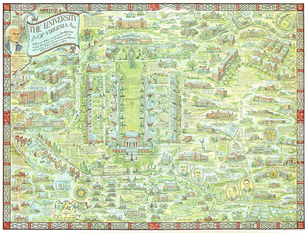
The University of Virginia A Pictorial Map portraying Mr. Jefferson's original Architectural Creation with the surrounding Halls of Learning and Cognate Institutions erected to date
sold
- Digital Map Information
- Suitable for large format printing
- File Size: 79.73 MB
- File Type: ZIP / TIFF
- ICC color profile embedded
- Delivered instantly via download link
This is a 1960 Laura and Sydney Britton pictorial map of the University of Virginia. The map depicts the campus from the medical school to Scott Stadium and from the U.S. Army's Judge Advocate General School and faculty housing to Copeley Hill, housing for married students. Highly detailed, myriad buildings are illustrated and labeled in profile throughout the campus Alderman Library, The Rotunda, and Old Cabel Hall. Others include halls dedicated to law, engineering, and physics, along with all the residence halls, which are illustrated along the right border. Streets and pathways run across the campus, allowing for easier access to the buildings, most of which are labeled. An attractive portrait of Thomas Jefferson is situated in the upper left corner near the title cartouche. Quotes from individuals, both famous and every-day, are scattered throughout the map lending it an air of gravitas. (more details)
Illustrates the U.S. Capital, the Washington Monument, and the Lincoln Memorial, among other famous Washington, D.C. sites.
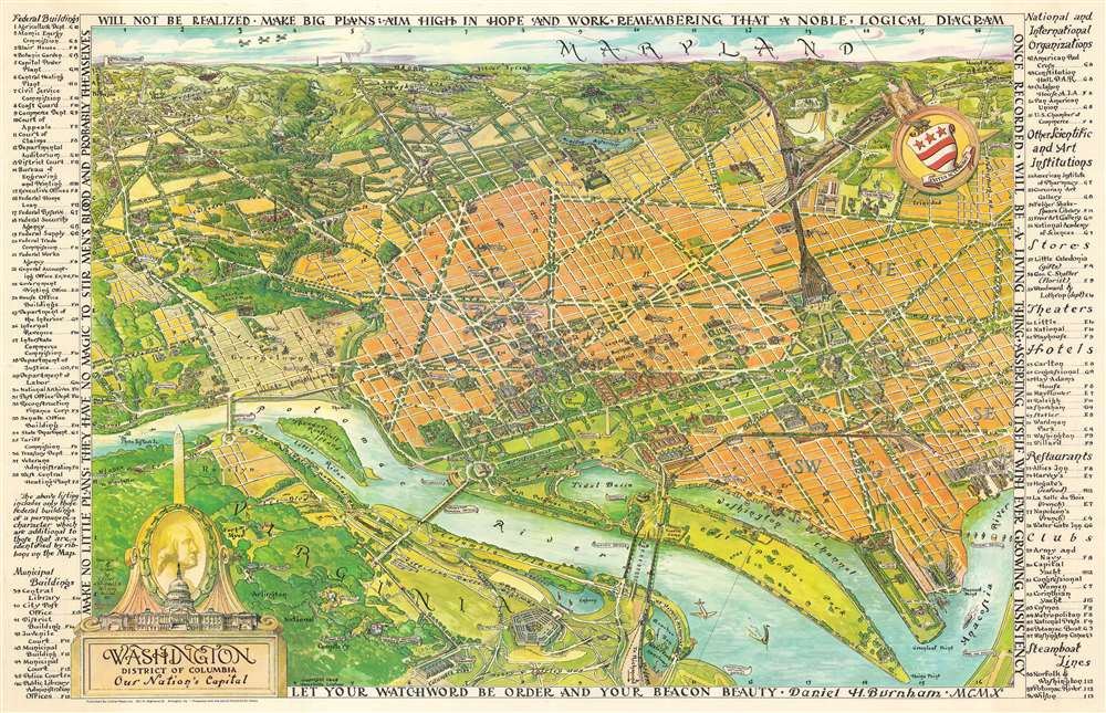
Washington District of Columbia Our Nation's Capital.
sold
- Digital Map Information
- Suitable for large format printing
- File Size: 84.64 MB
- File Type: ZIP / TIFF
- ICC color profile embedded
- Delivered instantly via download link
This is a 1949 Oliver Whitwell Wilson pictorial bird's eye view of Washington, D.C. The map depicts the region from the southeast, looking from Virginia across Washington, D.C. to Maryland. Numerous government buildings monuments and throughout the city are illustrated and labeled, including the Capital Building, the White House, the Supreme Court, the Washington Monument, the Lincoln Memorial, and the Jefferson Memorial. Other landmarks are identified, including the Smithsonian Institution, the National Gallery of Art, the Reflecting Pool, Ford's Theater, and the Library of Congress. Other fixtures around Washington, D.C. are also highlighted, such as George Washington University, Georgetown University, the Naval Observatory, and Union Station. Streets are illustrated, although not all are labeled. Across the river in Virginia, Arlington National Cemetery, complete with the Tomb of the Unknown Soldier, the U.S.S. Maine mast, and Arlington House. The Pentagon, not even ten years old at the time, is also illustrated. Rosslyn is labeled. Outside Washington to the north, several roads are labeled, as are Rock Creek Park, the Army Medical Center, the U.S. Soldier's Home, Catholic University, and, along the horizon, Bethesda, Maryland. George Washington's coat of arms is illustrated in the upper right quadrant at the center of a compass. In the lower right sits a decorative title cartouche featuring an illustration of the Capital, the Washington Monument, and a portrait of George Washington, the first President of the United States. An index of ninety different locations throughout the city is situated along both the left and right borders and includes federal buildings, municipal buildings, scientific and art institutions, stores, theaters, hotels, and restaurants. Each is numerically identified both in the index and on the map, and the index also provides each building's grid location on the map. (more details)
The most desirable and thorough 19th century Coast Survey chart of the Martha's Vineyard, Nantuckt, Buzzard Bay corridor.

Preliminary Coast Charts Nos. 12, 13 and 14. Coast of the United States Monomoy and Nantucket Shoals to Block Island. / No. 14 From Entrace to Buzzard's Bay Mass. to Block Island Sound R.I. / No. 13 From Muskeget Channel to Buzzard's Bay and Engrance to Vineyard Sound Mass. / No. 12 From Monomoy and Nantucket Shoals to Muskeget Channel Mass.
sold
- Digital Map Information
- Suitable for large format printing
- Full resolution TIFF file
- ICC color profile embedded
- Delivered instantly via download link
A scarce composite set of three large format U.S. Coast Survey 1860 / 1883 nautical charts covering from Block Island and Buzzard Bay eastward to include all of Martha’s Vineyard and Nantucket. This set consists of three maps, here joined into a single sheet. (more details)
A detailed street map of 1950s St. Petersburg, Florida.
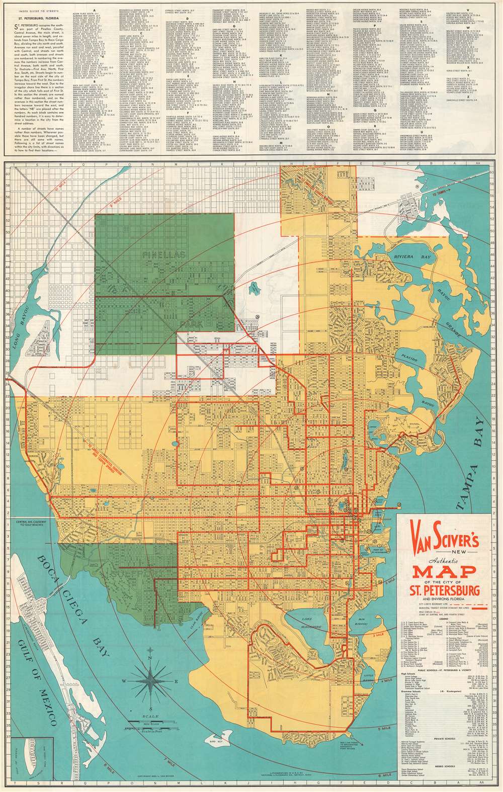
Van Sciver's New Authentic Map of the City of St. Petersburg and Environs Florida.
sold
- Digital Map Information
- Suitable for large format printing
- File Size: 53.01 MB
- File Type: ZIP / TIFF
- ICC color profile embedded
- Delivered instantly via download link
This is a c. 1950 George L. Van Sciver city map or plan of St. Petersburg, Florida. The map depicts the region from Saint Petersburg Beach and the Gulf of Mexico and from the Gandy Bridge to Pinellas Point. Highly detailed, myriad streets and avenues are illustrated and labeled throughout the city. Bayous, lakes, and creeks are labeled as well. Thirty-nine locations are numerically identified on the map and correspond with an index situated along the right border just below the title. Among these sites are post offices, fire stations, hospitals, municipal facilities, and city parks. An index of public schools, private schools, and negro schools is situated just below the index of city buildings as well. An alphabetical street index is included along the top border. (more details)
A rare original example of Rummel's panoramic bird's-eye view of Yale Univeristy.

Yale University.
sold
- Digital Map Information
- Suitable for large format printing
- File Size: 35.31 MB
- File Type: ZIP / TIFF
- ICC color profile embedded
- Delivered instantly via download link
A scarce 1906 signed bird's-eye view of Yale University drawn by Richard Rummell and published by W. T. Litting of New York. The view is centered on Osborne Hall (now demolished and replaced with Bingham Hall) with its distinctive chapel-like façade. Chapel Street runs in front of the hall and Temple Street can be seen running northward towards East Rock. Many of the extant buildings of the historic Old Campus, including Connecticut Hall (1752), are easily recognizable. Welch Hall and Lawrance Hall stand alongside College street, across from the New Haven Green which is complete with the three chapels that still stand today: United Church on the Green (Congregational, 1814), Center Church (Congregational, 1812), and Trinity Episcopal Church on the Green (1816). In the distance the heights of East Rock, with its distinctive Soldiers and Sailors Monument, is clearly visible. (more details)
Illustrates an approximation of Wyoming identifying it simply as 'Attached to Dacotah'.
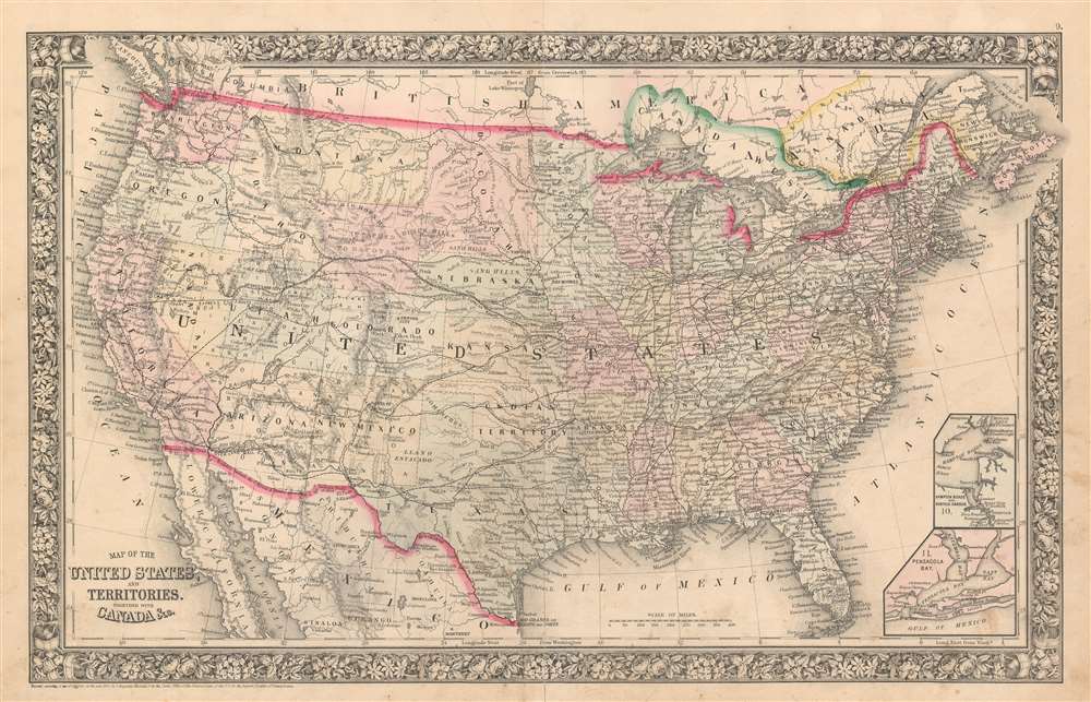
Map of the United States and Territories. Together with Canada etc.
sold
- Digital Map Information
- Suitable for large format printing
- File Size: 26.17 MB
- File Type: ZIP / TIFF
- ICC color profile embedded
- Delivered instantly via download link
This is the first of two states of Samuel Augustus Mitchell Jr.'s 1865 map of the United States. Depicting the entire continental United States and including parts of Canada and Mexico, all the states and territories are identified, and myriad cities and towns are labeled from coast to coast. Rivers and lakes are also labeled. Two inset maps situated in the lower right corner illustrate Hampton Roads and Pensacola Bay. (more details)
A comical and incredibly detailed pictorial map of Frankfurt, Germany created by a U.S. Army master sergeant.
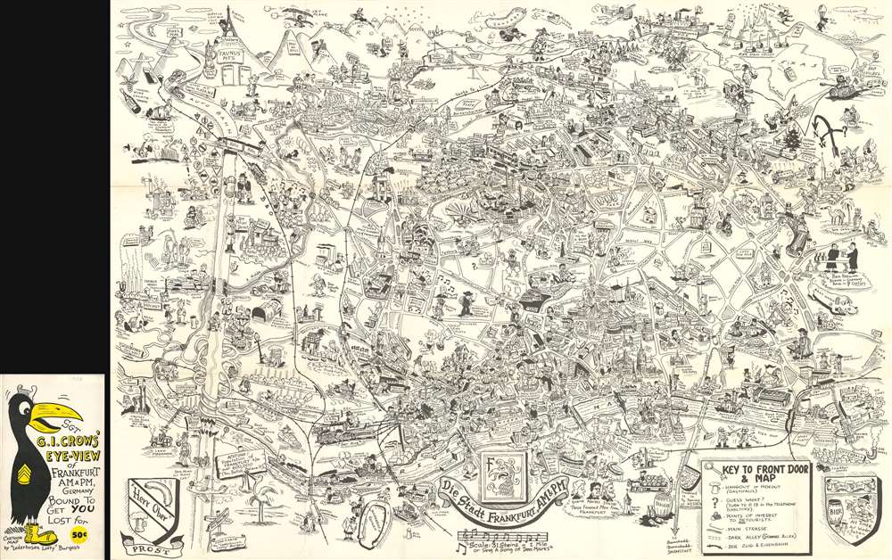
Sgt. G.I. Crows' Eye View of Frankfurt AM and PM, Germany. Bound to Get You Lost for 50 cents.
sold
This is a 1954 Byrel 'Lefty' Burgess humorous pictorial map of Frankfurt, Germany, published by Stars and Stripes in Darmstadt, Germany. The map depicts the city from the Höchst district of Frankfurt to the town of Bad Vilbel and from the Harheim district of Frankfurt to Offenbach. Myriad locations throughout Frankfurt are illustrated, with special attention paid to those associated with the American military presence in the city. Several barracks are noted throughout the city, as is the 97th Hospital and the quarters of the WACs (Women's Army Corps). The American school (referred to by its students simply as Frankfurt High) is also labeled, as is the area where dependents lived, as is the PX (Post Exchange). Numerous districts within Frankfurt are also identified, including Heddernheim, Bonames, Eschersheim, and Seckbach. G.I.s are present all over the city. Going about their lives and official army business, but also carousing with women, in beer halls, and simply wandering the city. Military Police are also shown, perhaps in an attempt to help remind the soldiers that there is a need for decorum.
Streets throughout the city are labeled, some of which are marked by comical vignettes, such as a devil next to Dante Strasse saying 'He wrote about me!' or Beethoven Platz and Mendelssohn Strasse, which are accompanied by caricatures of the famous composers. Historic sites are also illustrated, labeled, and usually dated, such as the Dom which dates to the 13th century and, as Burgess notes, is 300 feet high. The Saalhof, the Karmeliter Kloster, and the Dominikaner Kloster are also labeled. Other sites, such as the Drei Königs Kirche, are highlighted by comical vignettes. As are certain historical facts, like the 'Roman Tourist' from 900 or the spa in Bad Homburg where, apparently, 'Wilhelm II bathed'. Perhaps the most pervasive reference, though, is to beer 'bier', a German cultural treasure. References to locations around the United States are situated along the map's top border, including Pike's Peak in Colorado and the Rocky Mountains as a whole, Texas, the 'Los Angeles City Limit', and Chicago is shown in the upper right corner. (more details)
Streets throughout the city are labeled, some of which are marked by comical vignettes, such as a devil next to Dante Strasse saying 'He wrote about me!' or Beethoven Platz and Mendelssohn Strasse, which are accompanied by caricatures of the famous composers. Historic sites are also illustrated, labeled, and usually dated, such as the Dom which dates to the 13th century and, as Burgess notes, is 300 feet high. The Saalhof, the Karmeliter Kloster, and the Dominikaner Kloster are also labeled. Other sites, such as the Drei Königs Kirche, are highlighted by comical vignettes. As are certain historical facts, like the 'Roman Tourist' from 900 or the spa in Bad Homburg where, apparently, 'Wilhelm II bathed'. Perhaps the most pervasive reference, though, is to beer 'bier', a German cultural treasure. References to locations around the United States are situated along the map's top border, including Pike's Peak in Colorado and the Rocky Mountains as a whole, Texas, the 'Los Angeles City Limit', and Chicago is shown in the upper right corner. (more details)
Includes an incredible depiction of Mt. Etna.
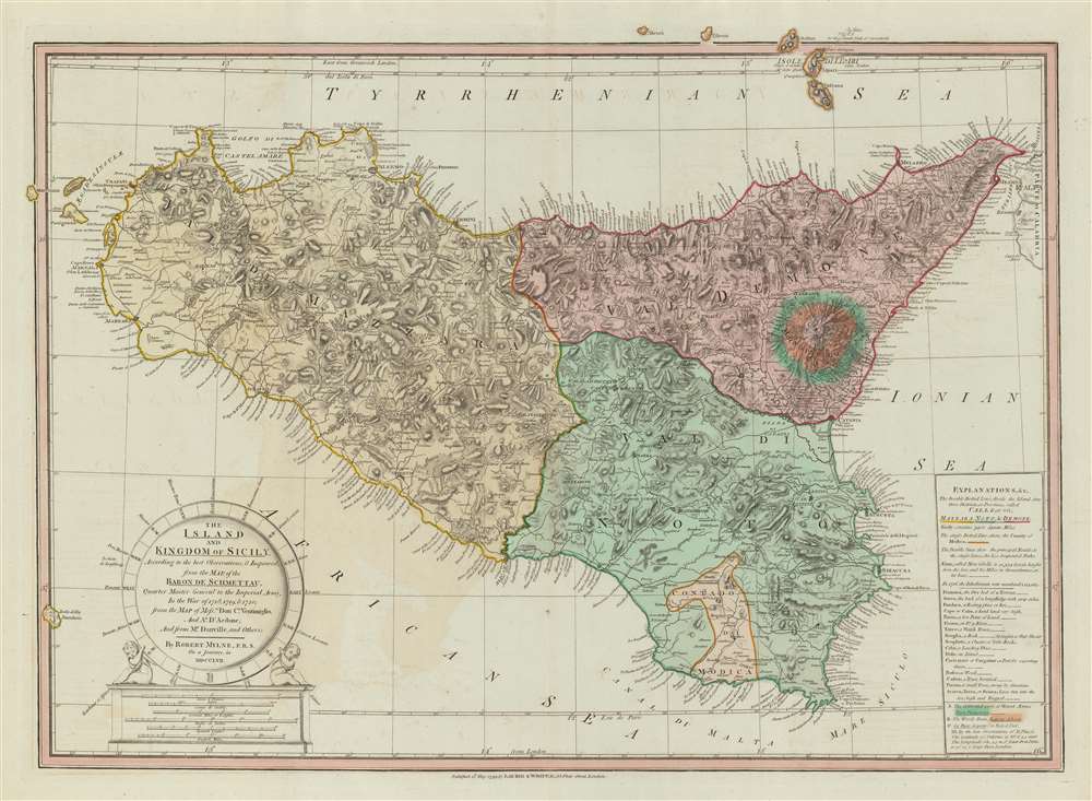
The Island and Kingdom of Sicily, According to the best Observations, and Improved; from the Map of the Baron de Schmettau, Quarter Master General to the Imperial Army, in the War of 1718, 1719, and 1720; from the Map of Messrs. Don Co. Ventimiglio, and Ao. D'Aedone; And from Mr. Danville, and Others.
sold
- Digital Map Information
- Suitable for large format printing
- DPI: 600
- File Size: 39.73 MB
- File Type: ZIP / TIFF
- ICC color profile embedded
- Delivered instantly via download link
This is a 1799 Robert Mylne and Laurie and Whittle map of Sicily. The map depicts the region from Marettimo (Maretimo) to Calabria and from Alieuri to the Canal of Malta. Innumerable cities, towns and villages are labeled throughout, including Messina, Syracuse, and Palermo, along with myriad points along Sicily's coast. A detailed illustration of Mount Etna is situated along the island's eastern coast, with the 'cultivated parts', the 'Woody Parts', and the 'Naked Part' each illustrated and alphabetically labeled. These letters correspond with an index included in a cartouche that is situated in the lower right corner. Above the 'Mt. Etna Index', explanations of notations used on the map also are included, along with some commentary on population size, etc. A decorative title cartouche is situated in the lower right corner. (more details)
A beautiful 18th century map of Iceland - known as the Land of Fire and Ice.

Carte de l'Islande, Pour Servir à la Continuation de l'Histoire générale des Voyages.
sold
- Digital Map Information
- Suitable for large format printing
- DPI: 600
- File Size: 13.56 MB
- File Type: ZIP / TIFF
- ICC color profile embedded
- Delivered instantly via download link
This is a 1759 Jacques-Nicolas Bellin map of Iceland. The map depicts the entirety of the island and divides it into four regions. Numerous rivers are illustrated, as are groups of mountains. Two ' villes episcopales ' are noted, Skalhol and Helum , which an ... (more details)
A charming map of the Saint Lawrence River from Quebec City to the river's mouth.
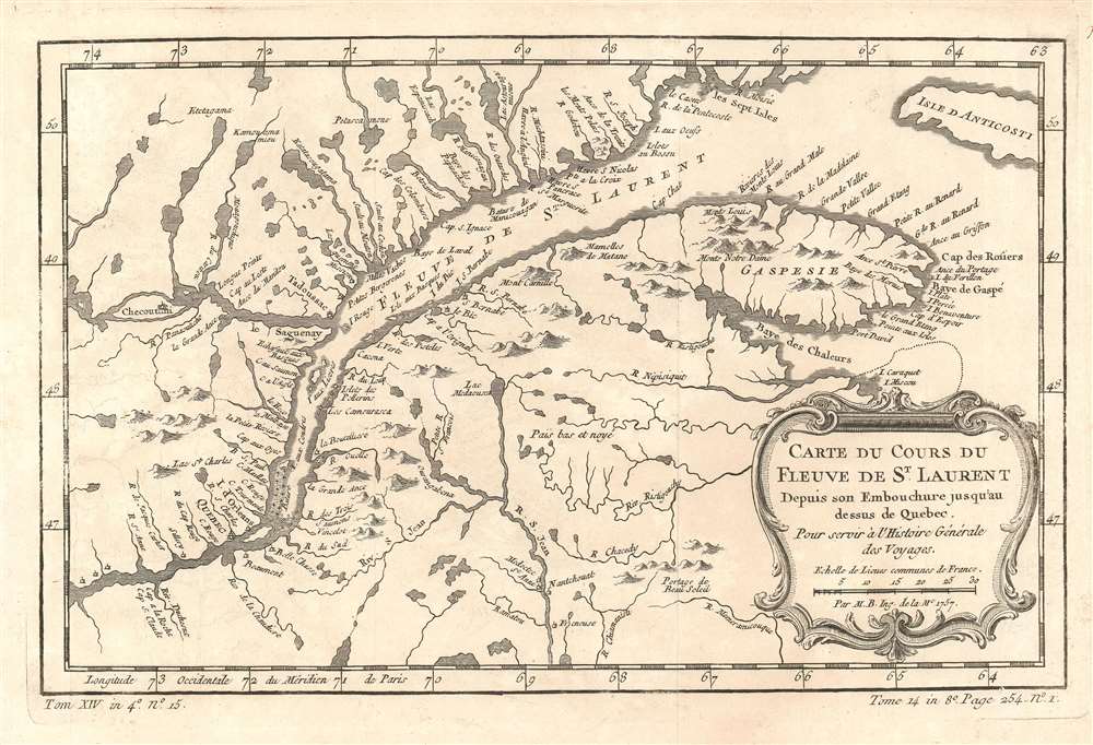
Carte du Cours du Fleuve de St. Laurent Depuis son Embouchure jusqu'au dessus de Québec.
sold
- Digital Map Information
- Suitable for large format printing
- DPI: 600
- File Size: 6.73 MB
- File Type: ZIP / TIFF
- ICC color profile embedded
- Delivered instantly via download link
This is a 1757 Jacques-Nicolas Bellin map of part of the Saint Lawrence River and Québec, Canada. The map depicts the region from the Sainte Anne River to Anticosti Island and from Sept-Iles to the village of Freneuse. Numerous towns and villages are labeled, including Québec City and Tadoussac. Myriad small rivers leading into the Saint Lawrence are illustrated along both banks of the river from west of Québec City to the Gaspésie Peninsula. Innumerable lakes are also depicted. (more details)
Counties and county seats are labeled.
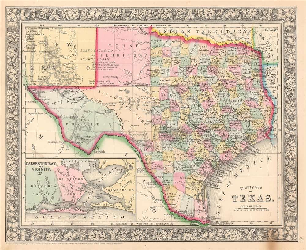
County Map of Texas.
sold
- Digital Map Information
- Suitable for large format printing
- File Size: 12.46 MB
- File Type: ZIP / TIFF
- ICC color profile embedded
- Delivered instantly via download link
This is S. A. Mitchell Junior's 1863 map of Texas and part of New Mexico. The map depicts the region from western New Mexico to Arkansas and Louisiana and from the Indian Territory and northern Texas to the Rio Grande River and Mexico. Highly detailed, notations concerning railroads, topographical features, and cities are included. Color coded at the county level, each county is labeled and includes the county seat. Bexar, Young, Presidio, and El Paso Counties exhibit primitive, but recognizable, configurations. An inset map of Galveston Bay and Vicinity is situated in the lower left corner. One of the most attractive atlas maps of Texas to appear in the mid 19th century, the whole is surrounded by the attractive floral border common to Mitchell atlases between 1860 and 1866. (more details)
A beautiful view of Les Invalides in Paris, a complex of military buildings in the center of the city with an iconic dome.

Hôtel et Esplanade des Invalides.
sold
- Digital Map Information
- Suitable for large format printing
- DPI: 600
- File Size: 13.23 MB
- File Type: ZIP / TIFF
- ICC color profile embedded
- Delivered instantly via download link
This is a c. 1845 Jules Arnout view of Les Invalides in Paris, France. Looking south across the Esplanade des Invalides, the view depicts the north façade of the Hôtel des Invalides, with Bruant's door and arched pediment easily recognizable below Hardouin-Mansart's chapel dome. Drawn after a snowfall in Paris, snow blankets the esplanade and the façade and dome of Les Invalides. A horse drawn cart moves slowly up the esplanade in the foreground, with several carriages evident further in the background. Wheel tracks weave their way through the slushy street, which are apparently well traveled since the sidewalks are still blanketed in a fresh snow. Also, pairs and small groups of people are illustrated wandering their way through the neighborhood. (more details)
Detailed map of Florida and Tortugas Island including early survey notations

Sketch F Showing the Progress of the Survey in Section VI. With a General Reconnaissance of the Coast of Florida 1848-57.
sold
- Digital Map Information
- Suitable for large format printing
- File Size: 14.5 MB
- File Type: ZIP / TIFF
- ICC color profile embedded
- Delivered instantly via download link
This is a rare 1857 U.S. Coast Survey chart of the Florida coast. The map depicts the region from Appalachee Bay to the Atlantic Ocean and from Amelia Island to the Miami River and Gullivan's Bay, not quite reaching the southern tip of Florida. Triangulation surveys are indicated in Tampa Bay, St. Joseph's Bay, and off the coast of St. James' Island. An inset in the lower left quadrant details Tortugas Island. An interesting swath of inland detail between St. Mary's and the Cedar Keys is present – indicating a rather early state of the Florida survey. Several interesting notations along the eastern coast of Florida reference bottles being dropped and retrieved, which is presumably an early technique for measuring currents. Sailing instructions for Charlotte Harbor and Tampa Bay are situated in the lower left quadrant. The upper right quadrant features a table of latitudes and longitudes for important points along the coast. (more details)
A broadside created by a Polish merchant shipping company promoting its new line between Poland and the United States.

[MS Piłsudski. Gdynia-America Line.]
sold
- Digital Map Information
- Suitable for large format printing
- File Size: 23.54 MB
- File Type: ZIP / TIFF
- ICC color profile embedded
- Delivered instantly via download link
This is a c. 1936 Polish Gdynia-America Line promotional broadside of the MS Piłsudski, a Polish ocean liner named after the Polish statesman that served the trans-Atlantic route from Gdynia, Poland to New York City. The Polish Coat of Arms is depicted along the bottom of the view and is flanked by the draped flags of Poland and the United States and views of New York City and Gdynia. (more details)
Manuscript notebook of a navigation student with masterful drawing of the cosmos, weather, and astrological phenomena.

[Navigation Workbook]
sold
A c. 1790 Italian manuscript notebook with meticulous sketches related to training in geometry, navigation, and astronomy. The ... (more details)
The earliest obtainable specific map of Nantucket.
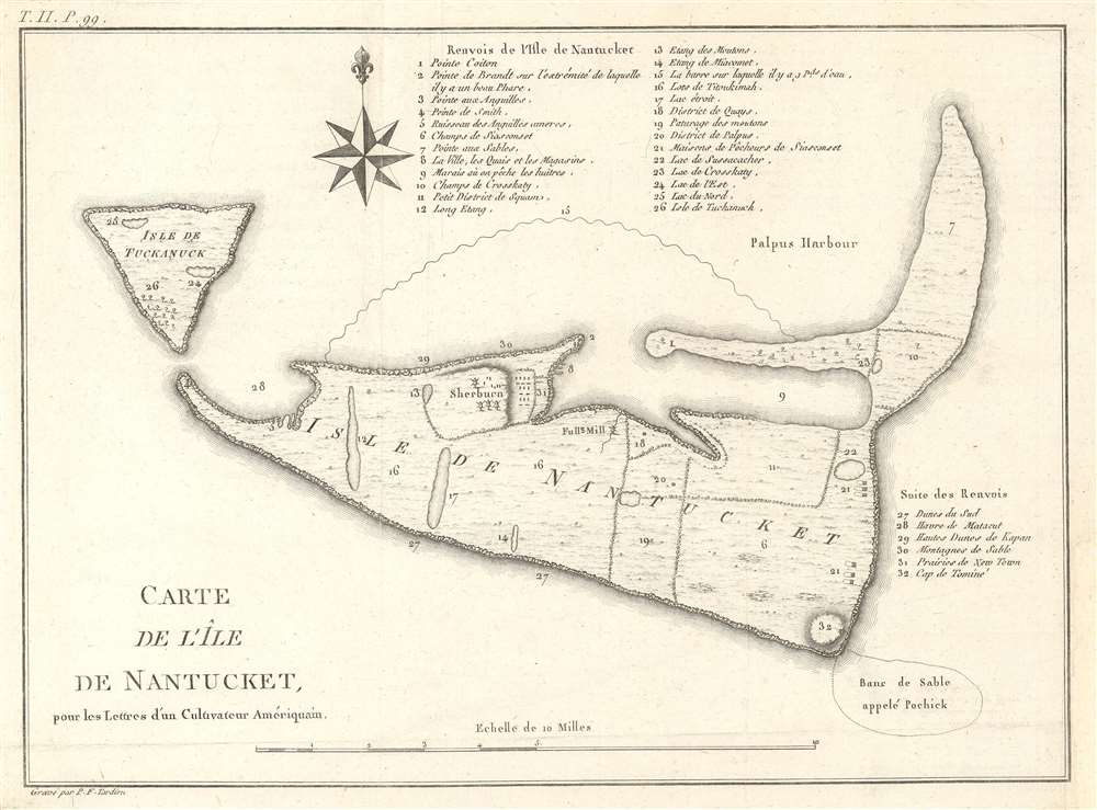
Carte de L'Ile de Nantucket, pour les Lettres d'un Culuvateur Ameriquain.
sold
- Digital Map Information
- Suitable for large format printing
- DPI: 600
- File Size: 4.67 MB
- File Type: ZIP / TIFF
- ICC color profile embedded
- Delivered instantly via download link
This small but important map by P. F. Tardieu is the earliest obtainable separate map of Nantucket Island, Massachusetts. It covers Nantucket in full as well as the adjacent island of Tuckanuck (Tuckernuck Island). Throughout some 32 locations are identified via a numeric coding system associated with tables above and to the right of the main map. Property divisions on the island are noted as well as a few important buildings, mills, and villages. (more details)