
The finest 19th century chart of Cape Fear and Bald Head Island!
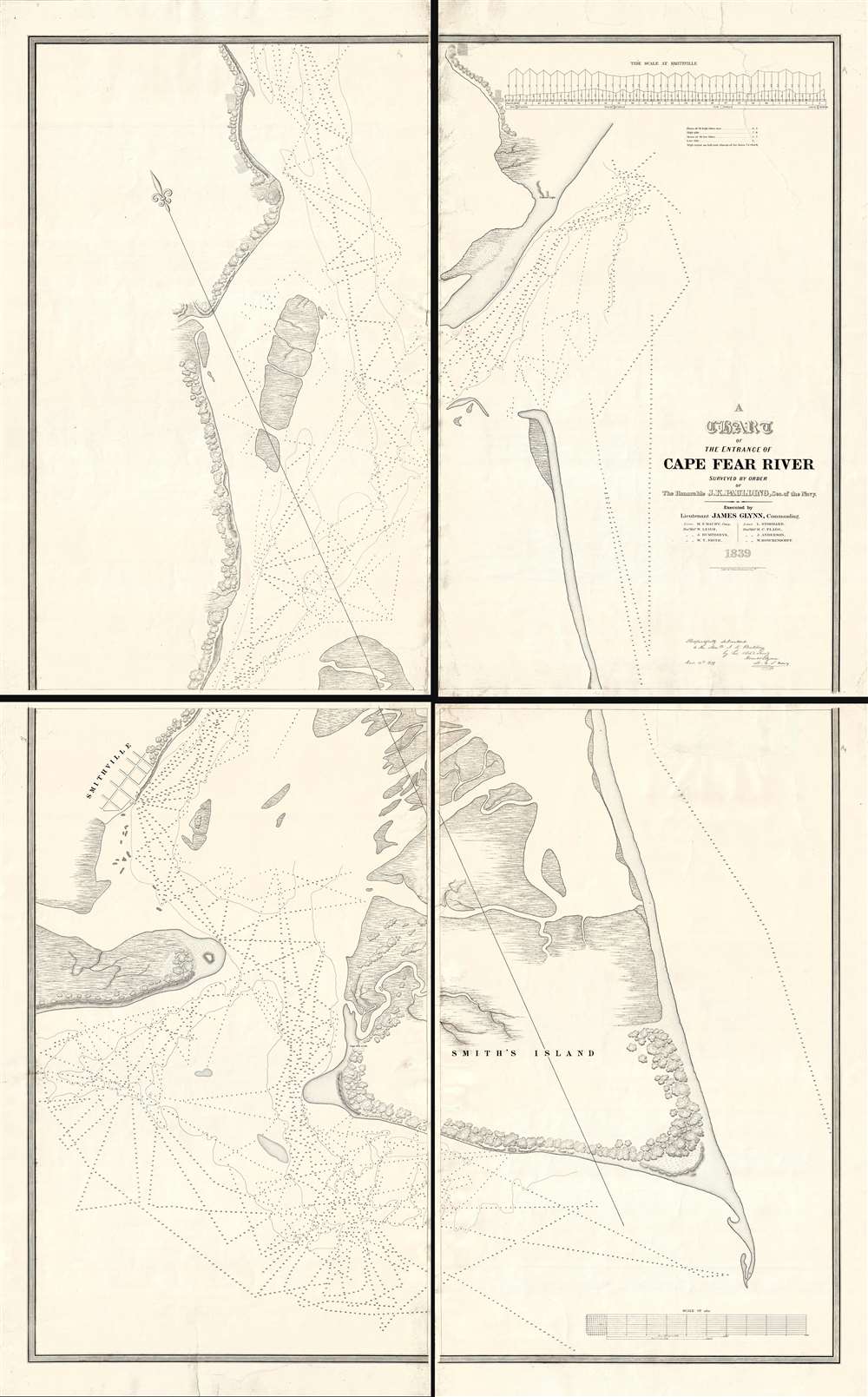
A Chart of the Entrance of Cape Fear River.
sold
- Digital Map Information
- Suitable for large format printing
- DPI: 300
- File Size: 52.16 MB
- File Type: ZIP / TIFF
- ICC color profile embedded
- Delivered instantly via download link
Without a doubt, this 1839 wall-map sized chart by James Glynn is the finest map of Cape Fear and vicinity to appear in the 19th century. Although much changed from repeat storms, this 1839 chart covers roughly from Kure Beach and Fort Fish Historic Site to the southern part of Bald Head Island (Smith Island) and from Southport (Smithville) to the Atlantic. The map exhibits a wealth of detailed soundings as well as some landside information including the course of rivers and streams, the positions of the Federal Point and Cape Fear lighthouse, and the street grid of Smithville / Southport. (more details)
A wonderful pictorial woodcut print celebrating the New York City Marathon by renowned artist James Grashow.

The New York Times New York City Marathon.
sold
This is a 1983 James Grashow limited edition woodcut print created for the New York City Marathon. The print depicts the marathon's route through all five boroughs in blue with runners illustrated all along it. Buildings and other landmarks throughout the city are ... (more details)
Extraordinary 13 sheet Manga map of Japan!

日本全国漫画旅行 中村楳泉 横山啓 井上精二合作 / [Japanese Travel Manga Map]
sold
- Digital Map Information
- Suitable for large format printing
- Full resolution TIFF file
- ICC color profile embedded
- Delivered instantly via download link
An extraordinary set of 13 c. 1930s manga maps that, when combined, create an enormous cartoon map of Japan. The maps are densely packed with manga images illustrating local folklore, industry, sports, historic sites, social activities, flora, fauna, topography, aquatic life, farm animals, demons, and more. The national rail network is illustrated in some detail, with color coding and different styles of rendering tracks indicative of various rail companies and different track gauges. Each panel bears a railroad timetable. In total, 13 panels, illustrate the four main island of Japan, as well as some of the surrounding seas and smaller islands. (more details)
The finest map of London issued in 1823.
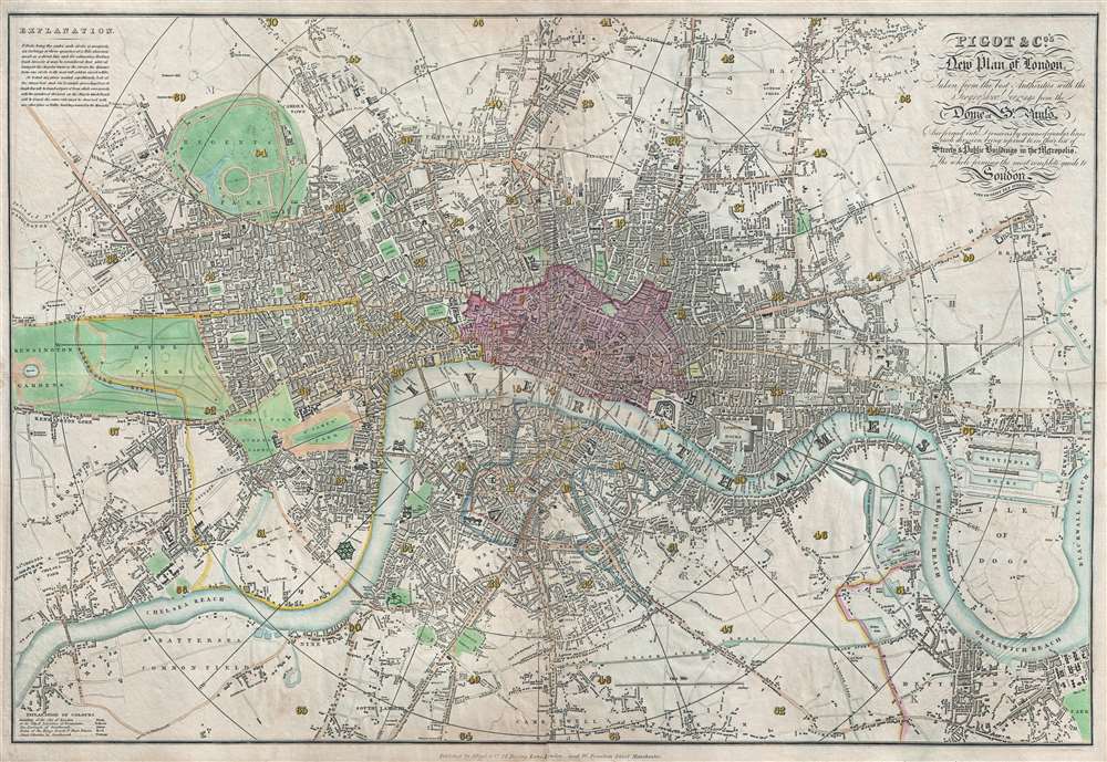
Pigot and Co's New Plan of London, Taken from the best Authorities with the Geographical bearings from the Dome of St. Paul's And formed into Divisions by means of circular lines each division being referred to in their list of Streets and Public Buildings in the Metropolis, The whole forming the most complete guide to London and ITS VICINITY YET PUBLISHED.
sold
- Digital Map Information
- Suitable for large format printing
- DPI: 300
- File Size: 19.16 MB
- File Type: ZIP / TIFF
- ICC color profile embedded
- Delivered instantly via download link
An attractive first edition example of James Pigot's 1823 map of London, England. Centered on the Thames River, Pigot's map covers from Islington to the East India Dock and from Camberwell to Kensington Gardens. The City of London is highlighted in red and the various parks in green. All streets, bridges, and important buildings are meticulously identified. Circular distance markers appear each 3/4th mile from Charing Cross. (more details)
A map of Florida published only two years after Florida became a U.S. territory.
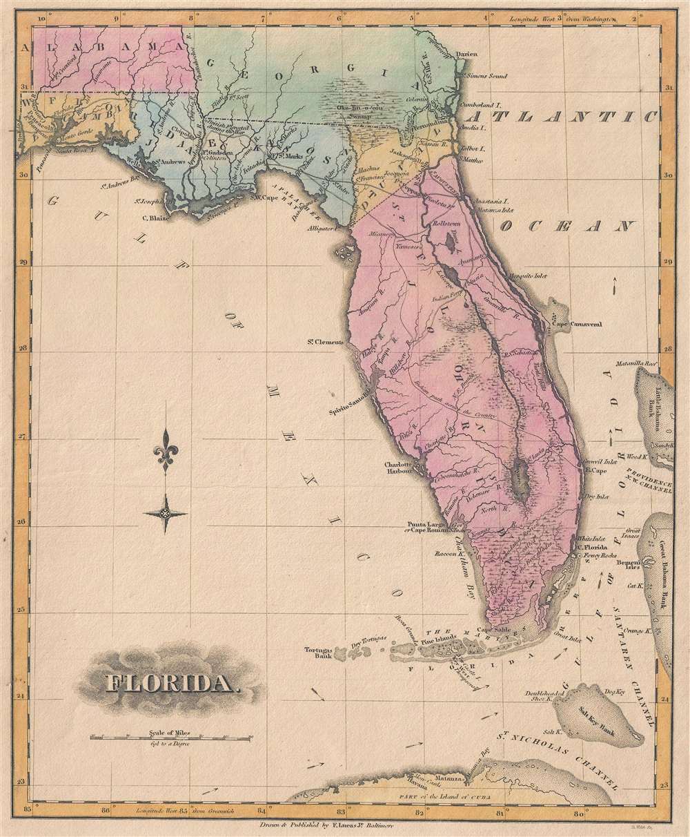
Florida.
sold
- Digital Map Information
- Suitable for large format printing
- DPI: 300
- File Size: 2.49 MB
- File Type: ZIP / TIFF
- ICC color profile embedded
- Delivered instantly via download link
This is an 1823 Fielding Lucas, Jr. map of Florida published only two years after Florida's incorporation into the United States as a territory. The map depicts the region from the Perdido River to the Great Bahama Bank and from Georgia and Alabama to Cuba. Reminiscent of the 1823 map of Florida by H.S. Tanner, Florida's coastline is illustrated in significant detail, with numerous inlets and capes labeled, including Cape Canaveral. Tampa Bay is also illustrated, although here it is labeled as Spirito Santo Bay. Pensacola, Jacksonville, and St. Augustine are identified, as are numerous smaller settlements. (more details)
Florida at the height of the Seminole Wars.
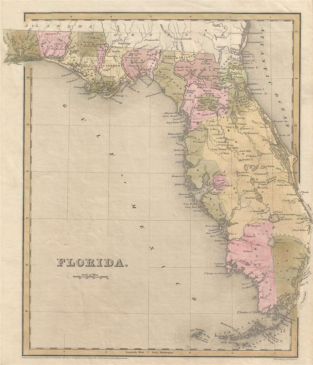
Florida.
sold
- Digital Map Information
- Suitable for large format printing
- DPI: 300
- File Size: 3.6 MB
- File Type: ZIP / TIFF
- ICC color profile embedded
- Delivered instantly via download link
This is a scarce 1838 T.G. Bradford map of Florida. The map depicts all of Florida as it appeared at the height of the Second Seminole War (1835 - 1842). An early Florida county structure is presented with Mosquito County occupying most of eastern Florida. An inset map illustrates the western part of the Florida Panhandle. (more details)
Published near the end of the Third Seminole War.
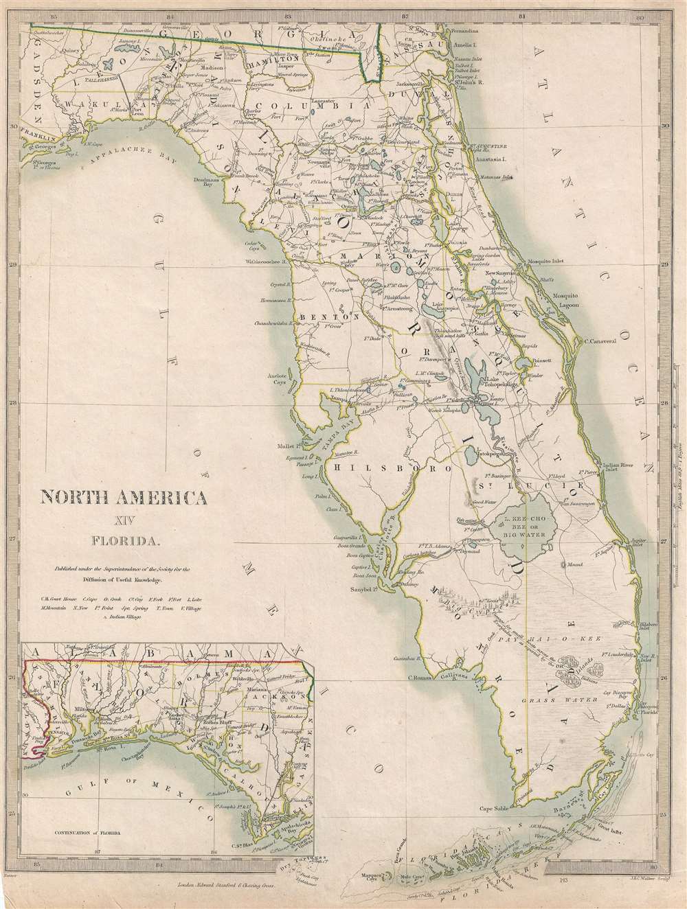
North America XIV Florida.
sold
- Digital Map Information
- Suitable for large format printing
- File Size: 4.36 MB
- File Type: ZIP / TIFF
- ICC color profile embedded
- Delivered instantly via download link
This is an 1857 Society for the Diffusion of Useful Knowledge map of Florida. The map depicts the region from Gadsden County to the Atlantic Ocean and from Georgia to the Florida Keys. This is a later edition of an early map of Florida bearing the imprint of ... (more details)
A tourist map of the summer capital of Jammu and Kashmir Province in India.
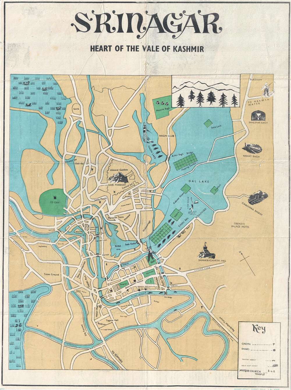
Srinagar Heart of the Vale of Kashmir.
sold
- Digital Map Information
- Suitable for large format printing
- File Size: 8.45 MB
- File Type: ZIP / TIFF
- ICC color profile embedded
- Delivered instantly via download link
This is a c. 1940s Ashok city map or plan of Srinagar, the summer capital of Jammu and Kashmir province in India. The map depicts the city from the Parim Pora Bridge to Dal Lake and from Naseem Bagh and Burzhom to the Jehlum River. Situated in the stunning Kashmir Valley, Srinagar is one of the cities that has gained the moniker 'Venice of the East' due to the sheer number of lakes in its vicinity, including Dal Lake and Nagin Lake. Srinagar is also known for its houseboats, with houseboat agencies depicted by small icons. Several floating gardens are also illustrated in Dal Lake. Sites around the city are depicted by vignettes, including Chashma Shahi, Nishat Bagh, Shalimar Bagh, and the Hari Parbhat. Cinemas and banks are also noted, as are mosques, churches, and temples. Several locations throughout the city are also labeled on the map itself. (more details)
A charming tourist map of the Kashmir Valley highlighting the many outdoor activities popular in the region.
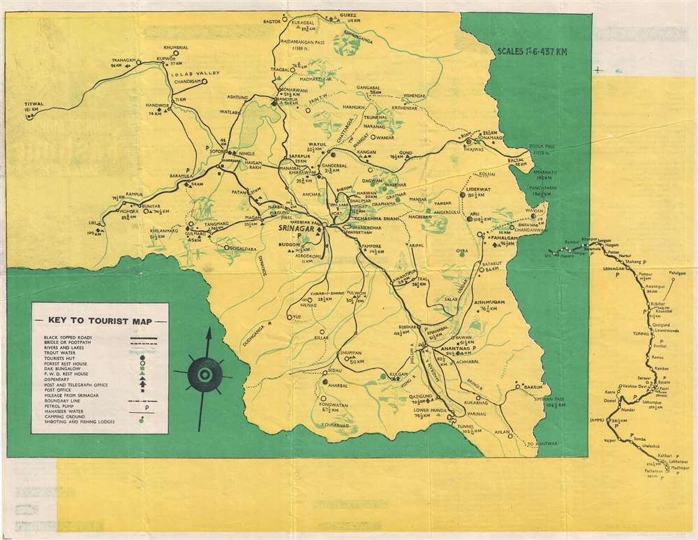
Tourist Map of Kashmir Valley.
$375.00
Acquire
- Digital Map Information
- Suitable for large format printing
- File Size: 5.92 MB
- File Type: ZIP / TIFF
- ICC color profile embedded
- Delivered instantly via download link
This is a c. 1950s Ashok tourist map of the Kashmir Valley in India. Centered on Srinagar, the map depicts the region from Titwal to Zojila Pass and from Bagtor and Burez to Ahlan. Numerous cities, towns, and villages are labeled throughout the region, and the transportation network is clearly marked. Black topped roads are illustrated by the solid black lines, while bridle and foot paths are noted by dashed lines, allowing the traveler to know exactly where they can and cannot drive. Petrol stations are also marked, as are post and telegraph offices. Various types of accommodations are also indicated, including tourist huts, forest rest houses, dak bungalows, and P.W.D. rest houses. Campgrounds and hunting and fishing lodges are also noted. Vignettes of various outdoor activities, including fishing, horseback riding, and hunting, populate the map and led it an air of fun. (more details)
Dates from the beginning of the Second Italo-Ethiopian War.
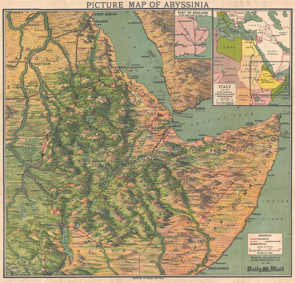
Picture Map of Abyssinia.
sold
- Digital Map Information
- Suitable for large format printing
- File Size: 17.63 MB
- File Type: ZIP / TIFF
- ICC color profile embedded
- Delivered instantly via download link
This is a 1935 George Philip and Son pictorial map of East Africa at the outset of the Second Italo-Ethiopian War. The map depicts the region from the White Nile in Anglo-Egyptian Sudan to Cape Guardafui and from Port Sudan on the Red Sea to Uganda, Kenya, and southern Somalia, including Mogadishu. Beautifully illustrated, the region's mountainous terrain is highlighted, labeling several mountain summits, and their elevations provided. Myriad cities, towns, and other settlements throughout the region are identified, including Addis Ababa. Railroads are noted and easily identified. An inset map in the upper right corner situates the region with regard to Italy and her other African colonies. A second, smaller, inset map provides the Daily Mail's audience with some understanding of how great the distances are in East Africa by providing a map of England on the same scale. (more details)
A BMT subway map promoting the 1939 New York World's Fair.
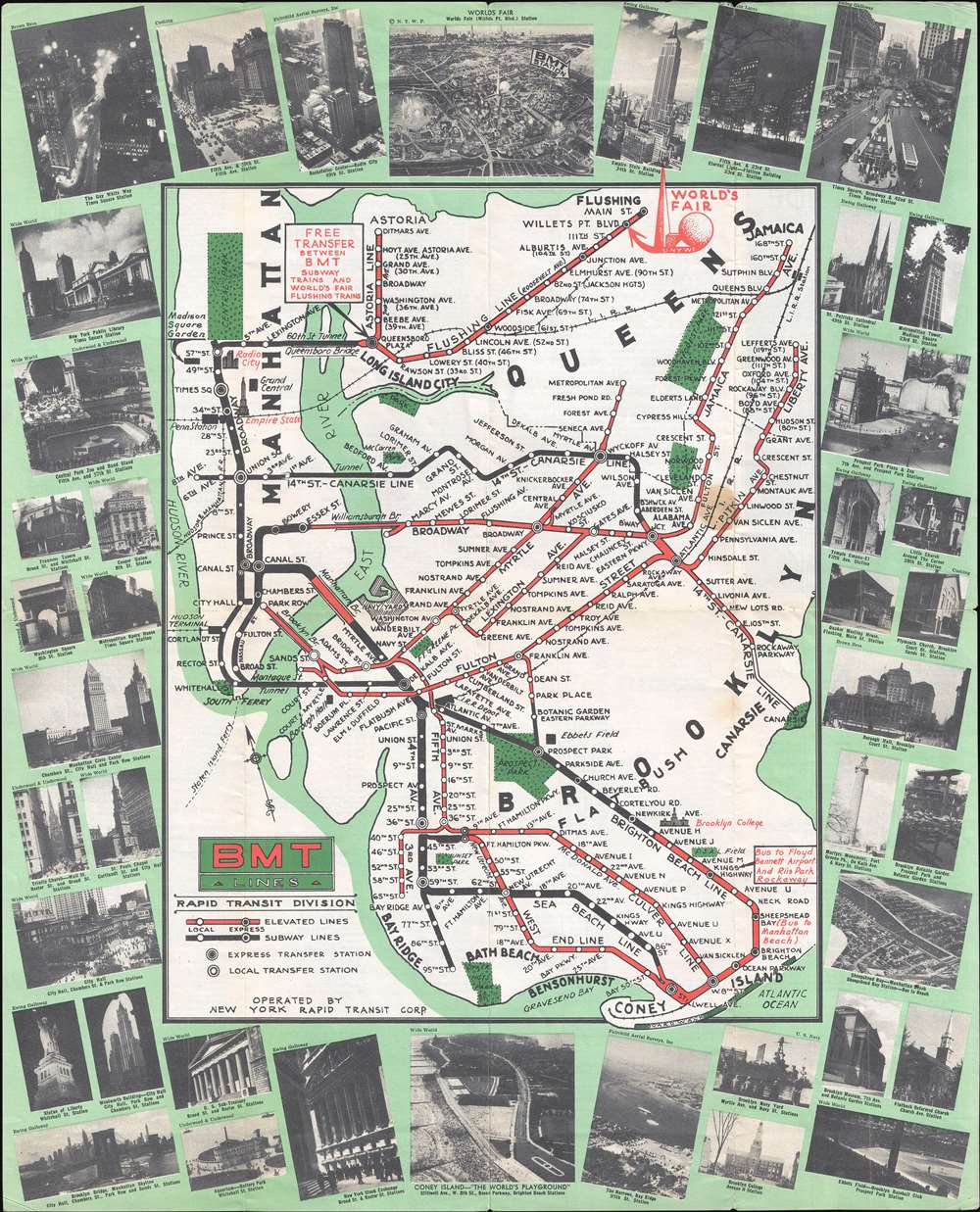
BMT Lines Rapid Transit Division.
sold
- Digital Map Information
- Suitable for large format printing
- File Size: 10.01 MB
- File Type: ZIP / TIFF
- ICC color profile embedded
- Delivered instantly via download link
This is a 1939 Brooklyn-Manhattan Transit Corporation (BMT) map of the BMT subway system promoting ridership to get to the 1939 New York World's Fair. The map depicts the region from Manhattan to Jamaica in Queens and from the East River to Coney Island. Very few locations around the city are labeled, although a few, such as the Empire State Building, Radio City Music Hall, Brooklyn College are illustrated in profile. The whole is surrounded by a green border overlaid by photographs of numerous New York City landmarks, including the Empire State Building, Coney Island, Rockefeller Center, Times Square, the New York Public Library, and Coney Island. (more details)
A pictorial tourist map of Yugoslavia made by a Partisan!
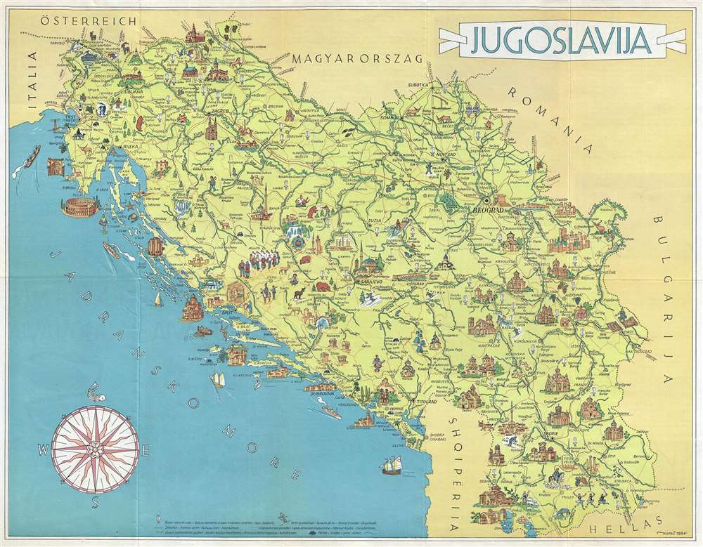
Jugoslavija.
sold
- Digital Map Information
- Suitable for large format printing
- File Size: 7.45 MB
- File Type: ZIP / TIFF
- ICC color profile embedded
- Delivered instantly via download link
This is a 1954 Vlasto Kopac pictorial map of Yugoslavia. The map depicts the region from Italy to Bulgaria and from Austria and Hungary to Albania and Greece. Published as part of a tourist brochure, myriad cities, towns, and villages are labeled, including Ljubljana, Zagreb, Belgrade (Beograd), Podgorica (Titograd), Dubrovnik, Skopje, Trieste, and Sarajevo. Several buildings are illustrated in profile, including the Emperor's Mosque in Sarajevo, Ljubljana Castle in Ljubljana, and the Muralles de Dubrovnik. Numerous islands along the Dalmatian Coast are also illustrated. Roads and rivers snake their way throughout, and vignettes of local people and wildlife lend the map an undeniable charm. (more details)
The only known traditional Vietnamese map outside of Vietnam. Illustrates the Long Wall of Quảng Ngãi, lost until 2005!

Plan du Huyen de Nghia Hanh. / [Untitled]
sold
- Digital Map Information
- Suitable for large format printing
- Full resolution TIFF file
- ICC color profile embedded
- Delivered instantly via download link
This fascinating c. 1819 Vietnamese manuscript map on linen depicts the huyên or district of Nghĩa Hành, located in the rural South-Central Coast region of Vietnam. This is the only known indigenous Vietnamese map to illustrate the Long Wall of Quảng Ngãi, one of the lost wonders of Southeast Asia. The map is fascinating and offers much else of interest. It follows the course of the Song Vé River from its mouth, to its intersection with the early 19th century Route Mandarine, to a great wall, also known as the Long Wall of Quảng Ngãi. The map identifies 14 villages, some quite large, others little more than familial homesteads, and has notations on local taxation. The overlaying late 19th century French text describes the situation of each village, how it can be reached, and notes that it is available for sale. (more details)
The first accurate map of Siam (Thailand) from the secret maps of a Siamese-'Mohammedan' mariner!
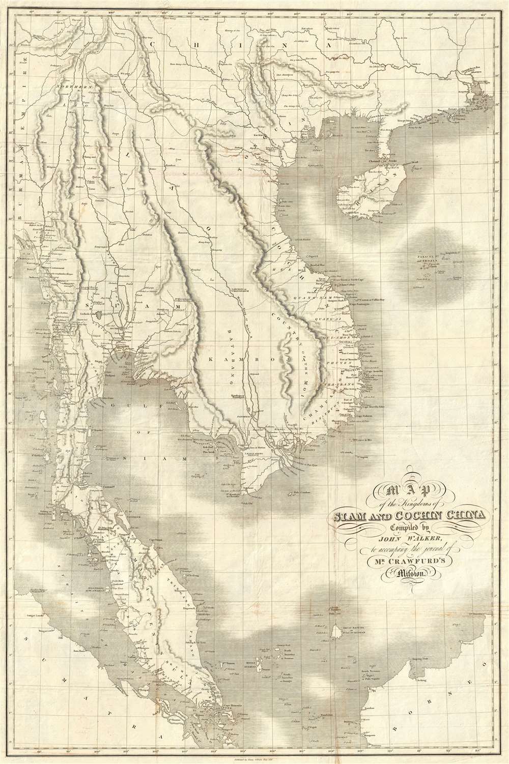
Map of the Kingdoms of Siam and Cochin China.
sold
- Digital Map Information
- Suitable for large format printing
- DPI: 300
- File Size: 25.85 MB
- File Type: ZIP / TIFF
- ICC color profile embedded
- Delivered instantly via download link
This rare large-format 1828 map of Southeast Asia, compiled by John Walker to illustrate John Crawfurd’s mission to Siam (Thailand) is the first accurate survey of the coasts of Siam. Coverage extends from China to Singapore and from the Gulf of Martaban (Burma) to Vietnam and Hainan. Siam at the time was inaccessible to European merchants and even diplomats with its coasts and interior were largely unknown. This map is an amalgam of European sources, but with regard to Siam, derived primarily from secretly acquired early 19th century Siamese surveys previously unknown to Europeans and, for all intent and purposes, still lost. (more details)
An incredible map of Guatemala.
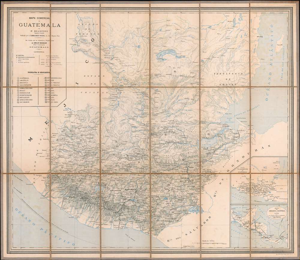
Mapa Comercial de Guatemala.
sold
- Digital Map Information
- Suitable for large format printing
- File Size: 84.77 MB
- File Type: ZIP / TIFF
- ICC color profile embedded
- Delivered instantly via download link
This is a rare separately issued F. Bianconi map of Guatemala. The map depicts the region from Mexico to the Atlantic Ocean and from Tikal to El Salvador. Highly detailed, myriad cities, towns, and villages are labeled throughout. Roads, railroads, lakes, ... (more details)
An idylic fantastical land created by Bernard Sleigh at the end of the Great War and which then stood in sharp justaposition to bomb-blasted Europe.
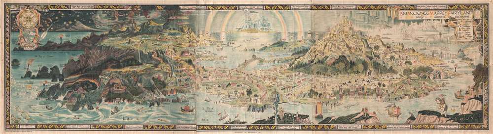
An Anciente Mappe of Fairy Land newly discovered and set forth.
sold
- Digital Map Information
- Suitable for large format printing
- File Size: 55.17 MB
- File Type: ZIP / TIFF
- ICC color profile embedded
- Delivered instantly via download link
An extraordinary 6-foot-long edition of Bernard Sleigh's 1918 fantastical map of Fairy Land. This wonderful map offers a wide birds-eye view style panorama of the island of 'Fairy Land' which it describes as 'newly discovered and set forth'. Fairy ... (more details)
A pocket tourist map of Suzhou, China, highlighting the historic city center.

Map of Soochow for Travelers.
sold
- Digital Map Information
- Suitable for large format printing
- File Size: 14.1 MB
- File Type: ZIP / TIFF
- ICC color profile embedded
- Delivered instantly via download link
This is an extremely rare 1931 WenYu Press of Suzhou city map or plan of Soochow (Suzhou), China. The map depicts the center of Suzhou surrounded by the Waicheng River. Highly detailed, myriad streets throughout the city are labeled, as are several ... (more details)
Scarce decorative Wall Map of the World.
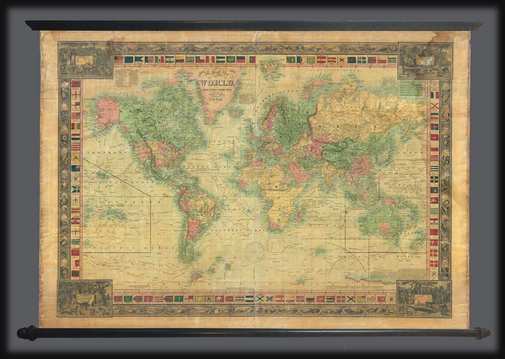
Map of the World, on Mercators Projection.
sold
- Digital Map Information
- Suitable for large format printing
- Full resolution TIFF file
- ICC color profile embedded
- Delivered instantly via download link
An attractive 1850 wall map of the world by the New York firm of Ensign and Thayer. The map presents the entire world on a Mercator Projection. It is surrounded by ensigns or flags of major maritime powers as well as an unusual decorative border defined by seashell vignettes. Different countries are highlighted by color, except the United States, wherein the individual states have their own color defination. The map meticulously details the routes of important explorers, including Christopher Columbus’ first voyage John and Sebastian Cabot, Vasco de Gama, Magellan, Sir Francis Drake, Commodore Anson, Captain James Cook, Captain Jean de la Perouse, Captain George Vancouver, and the United States Exploring Expedition (U.S. Ex. Ex.). In California, the Gold Region, reflecting general interest in the 1849 California Gold Rush, is noted. Texas is illustrated according to the Compromise of 1850, thus underscoring the cartographers' meticulousness in updating their maps. (more details)
A city map of Beirut, Lebanon published a little over ten years after Lebanon gained independence.
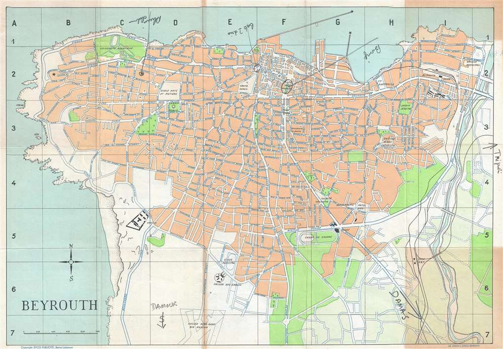
Beyrouth.
sold
- Digital Map Information
- Suitable for large format printing
- File Size: 6.77 MB
- File Type: ZIP / TIFF
- ICC color profile embedded
- Delivered instantly via download link
This is a 1954 Syco Publicité city map or plan of Beirut (Beyrouth), Lebanon. The map depicts the city from the Mediterranean Sea to the Beirut River and from the Mediterranean Sea to the old Bir Hassan Airfield. Created just over ten years after ... (more details)
A wonderful pictorial tourist map of Manhattan published by the Waldorf-Astoria Hotel.
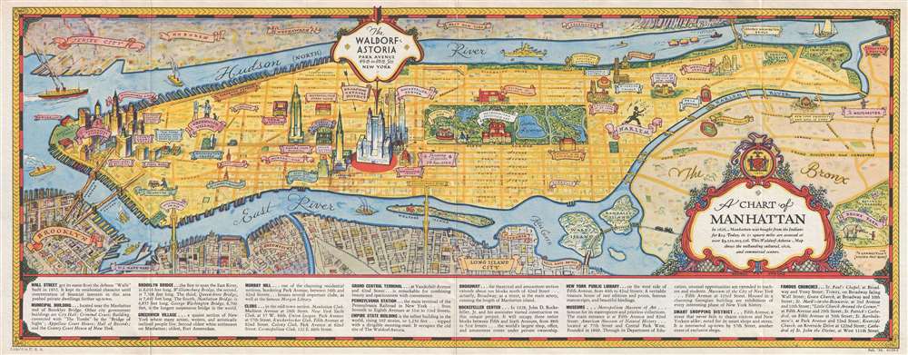
A Chart of Manhattan.
sold
- Digital Map Information
- Suitable for large format printing
- File Size: 6.3 MB
- File Type: ZIP / TIFF
- ICC color profile embedded
- Delivered instantly via download link
This is a 1936 George Annand pictorial map of the borough of Manhattan in New York City. The map depicts the region from Battery Park and New York Harbor to the Bronx and from New Jersey to Brooklyn and Queens. Originally published by the Waldorf ... (more details)