
The border of Arizona runs along the 37th parallel to California.
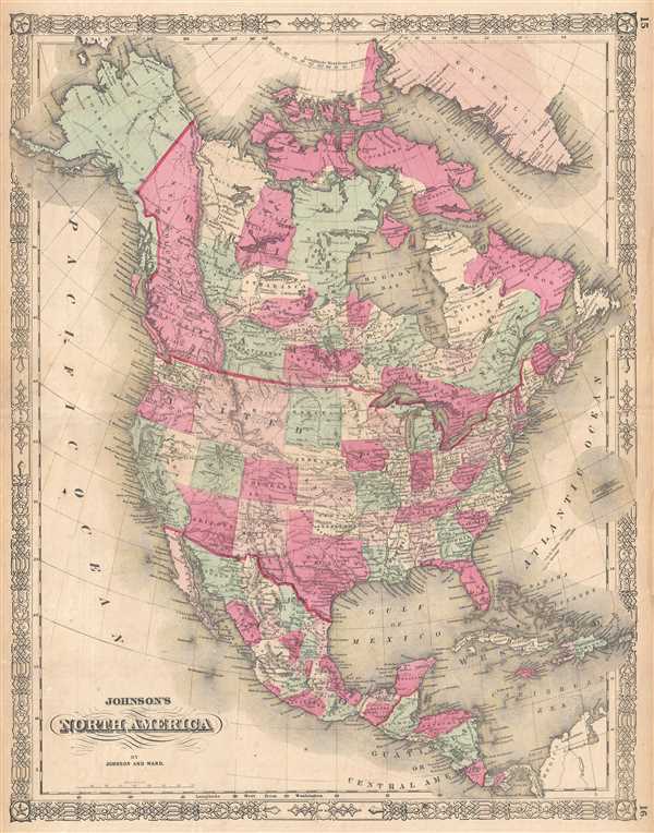
Johnson's North America.
sold
- Digital Map Information
- Suitable for large format printing
- File Size: 14.59 MB
- File Type: ZIP / TIFF
- ICC color profile embedded
- Delivered instantly via download link
This is an 1864 A. J. Johnson map of North America. The map depicts the continent of North America from the Arctic Ocean to South America and from the Pacific Ocean to the Atlantic Ocean, Greenland, and the West Indies. The United States is depicted as it was ... (more details)
The routes of Captains Cook and Wilkes are depicted and the site of Cook's death is noted.

Johnson's Map of the World on Mercator's Projection.
sold
- Digital Map Information
- Suitable for large format printing
- File Size: 13.13 MB
- File Type: ZIP / TIFF
- ICC color profile embedded
- Delivered instantly via download link
This is an 1864 A. J. Johnson map of the world on Mercator's Projection. The map depicts the entire world with the Americas at the center. Africa is largely 'unexplored' and both Lake Victoria and Lake Tanganyika have yet to appear. The Antarctic continent is ... (more details)
Depicts Lake Uniamési, an early interpretation of Africa's Great Lakes.

Johnson's Western Hemisphere. / Johnson's Eastern Hemisphere.
sold
- Digital Map Information
- Suitable for large format printing
- File Size: 13.94 MB
- File Type: ZIP / TIFF
- ICC color profile embedded
- Delivered instantly via download link
This is an 1864 A. J. Johnson map of the world on a hemispherical projection. The map depicts all seven continents and offers a fascinating snapshot of the world during a period of rapid globalization and discovery. Africa is largely 'unexplored,' though ... (more details)
Detailed inset map of the environs of Jerusalem.

Palestine and Adjacent Countries.
sold
- Digital Map Information
- Suitable for large format printing
- DPI: 300
- File Size: 5.71 MB
- File Type: ZIP / TIFF
- ICC color profile embedded
- Delivered instantly via download link
An extremely attractive example of Samuel Augustus Mitchell Sr.'s 1853 map of Palestine, Israel or the Holy Land. The map depicts the entire region in considerable detail from the Mediterranean to the Dead Sea and from Lebanon to Arabia. When this map ... (more details)
Features an inset of Liberia and Morovia.
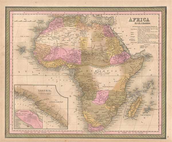
Africa.
sold
- Digital Map Information
- Suitable for large format printing
- DPI: 300
- File Size: 5.97 MB
- File Type: ZIP / TIFF
- ICC color profile embedded
- Delivered instantly via download link
This is a Samuel Augustus Mitchell 1850 map of Africa and Liberia. The map depicts the continent of Africa from the Mediterranean Sea to the Cape of Good Hope and from the Atlantic Ocean and the Cape Verde Islands to Arabia and the Indian Ocean. At ... (more details)
Labels Niagara Falls!
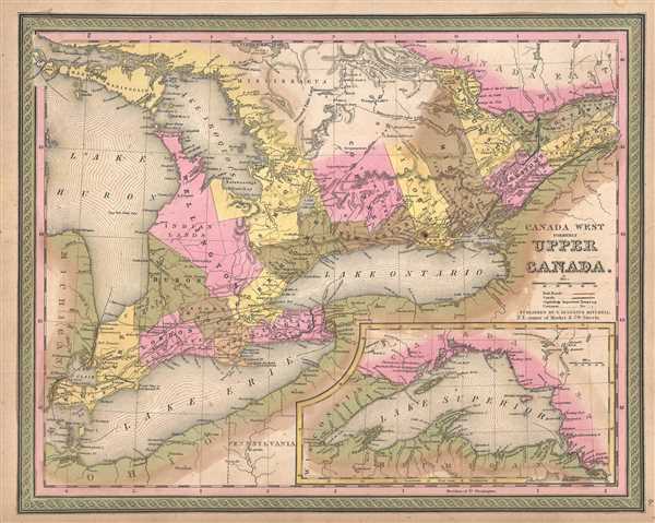
Canada West formerly Upper Canada.
sold
- Digital Map Information
- Suitable for large format printing
- DPI: 300
- File Size: 6.36 MB
- File Type: ZIP / TIFF
- ICC color profile embedded
- Delivered instantly via download link
This is an 1850 Samuel Augustus Mitchell map of the Canadian province of Ontario, or Canada West. Centered on Lake Ontario, this map depicts from Lake Erie, Detroit, Michigan and Lake Huron to Quebec. Lake Huron and Lake Ontario are labeled, and ... (more details)
The Yucatan Peninsula is shaded a different color than the rest of Mexico.
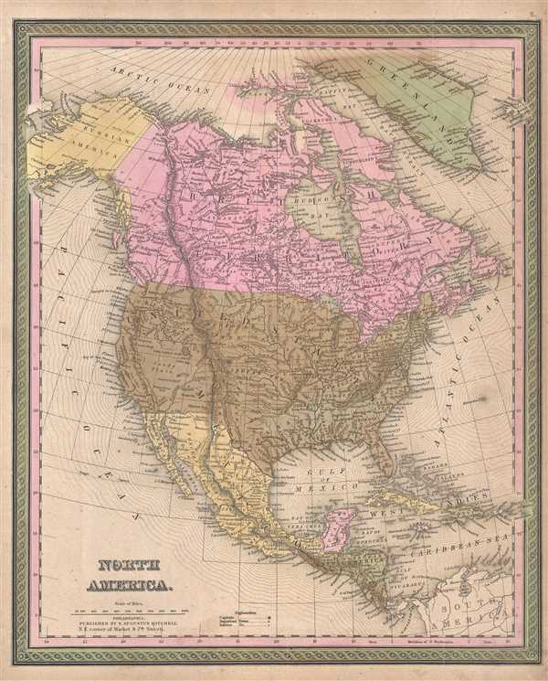
North America.
sold
- Digital Map Information
- Suitable for large format printing
- DPI: 300
- File Size: 7.26 MB
- File Type: ZIP / TIFF
- ICC color profile embedded
- Delivered instantly via download link
This is an 1850 Samuel Augustus Mitchell map of North America. The map depicts from the Arctic Ocean to South America and from the Pacific Ocean to the Atlantic Ocean, Greenland, and the extreme western reaches of Iceland along the right border. ... (more details)
Enormous and rare map of the Confederate States at the outbreak of the American Civil War.
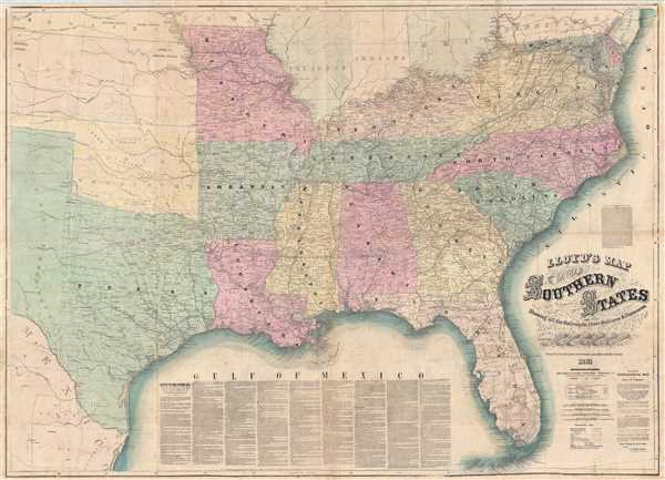
Lloyd's Map of The Southern States Showing all the Railroads, their Stations & Distances, Also The Counties, Towns, Villages, Harbors, Rivers And Forts. Compiled from the latest Government and other reliable Sources. 1861.
sold
- Digital Map Information
- Suitable for large format printing
- Full resolution TIFF file
- ICC color profile embedded
- Delivered instantly via download link
A very attractive example of J. T. Lloyd's extremely scarce railroad map of the Southern or Confederate States. Printed on a monumental scale, this map was issued in 1861 at the outset of the American Civil War and illustrates those states ... (more details)
A foundational map and the first to name 'Texas'.
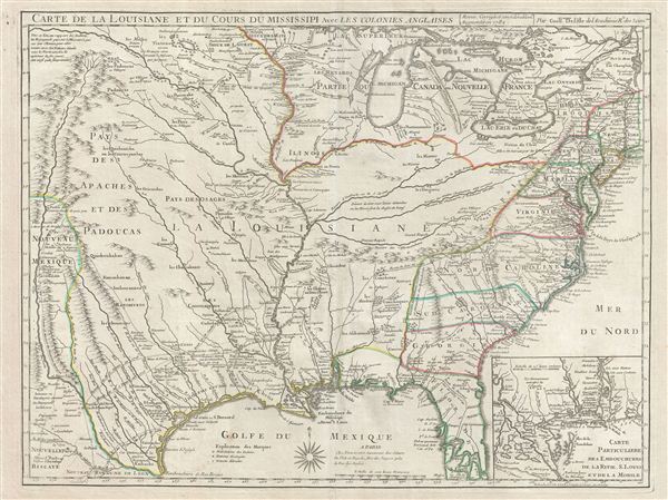
Carte De La Louisiane Et Du Cours Du Mississipi Avec Les Colonies Anglaises.
sold
- Digital Map Information
- Suitable for large format printing
- DPI: 300
- File Size: 22.82 MB
- File Type: ZIP / TIFF
- ICC color profile embedded
- Delivered instantly via download link
A foundational map and one of the most important illustrations of North America ever published, this the 1782 Dezauche edition Guillaume De L'Isle's influential Carte de la Louisiane et du Cours du Mississipi . Originally issued in 1718, ... (more details)
Fantasy map covered in vignettes of the most popular fairy tales and nursery rhymes - including the Cow Who Jumped Over the Moon!
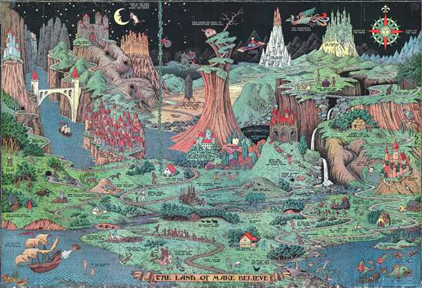
The Land of Make Believe.
sold
- Digital Map Information
- Suitable for large format printing
- File Size: 35.81 MB
- File Type: ZIP / TIFF
- ICC color profile embedded
- Delivered instantly via download link
This is a 1930 Jaro Hess pictorial map of the Land of Make Believe. The map is derived from over fifty nursery rhymes, fairy tales, and children's stories with creative, entertaining, and attractive illustrations. Some of the many stories ... (more details)
Two-sided U.S. Army publication detailing the the action of the first week of May 1944 - created for military use, not for public consumption!
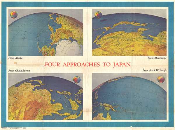
NEWSMAP. For the Armed Forces. 243rd Week of the War - 125th Week of U.S. Participation. Volume III No. 3F / Four Approaches to Japan. Volume III No. 3B
sold
- Digital Map Information
- Suitable for large format printing
- File Size: 49.06 MB
- File Type: ZIP / TIFF
- ICC color profile embedded
- Delivered instantly via download link
This is a 1944 Army Information Branch double-sided Newsmap for the week of April 27 to May 4, 1944. It was issued in May 8, 1944. One side of the map features four Richard Edes Harrison maps or views depicting the four approaches to ... (more details)
Double sided map featuring vignettes of the American Revolution, Westward Expansion, the Civil War, and World War II.
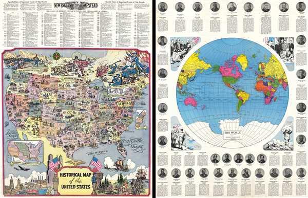
Historical Map of the United States / The World.
sold
- Digital Map Information
- Suitable for large format printing
- Full resolution TIFF file
- ICC color profile embedded
- Delivered instantly via download link
This is a 1959 R.L. McCollister pictorial map of the United States. The map depicts the continental United States from the Pacific Ocean to the Atlantic Ocean and from the Canadian border to the border with Mexico and the Gulf of ... (more details)
Attractive and highly detailed city map / view of San Francisco.

Official San Francisco Map.
sold
- Digital Map Information
- Suitable for large format printing
- File Size: 4.62 MB
- File Type: ZIP / TIFF
- ICC color profile embedded
- Delivered instantly via download link
This is a c. 1930 San Francisco Convention and Tourist League city map or plan of San Francisco, California, also presenting some elements of a view. The map depicts the city of San Francisco from San Francisco Bay to Golden Gate ... (more details)
Details the extent of U.S. survey work in the Philippines.
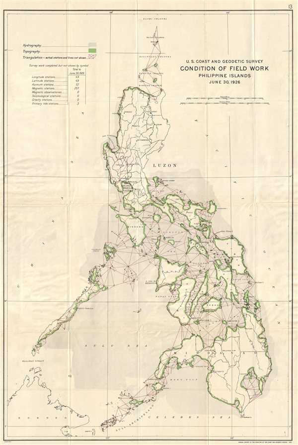
U.S. Coast and Geodetic Survey. Condition of Field Work Philippine Islands. June 30, 1926.
sold
- Digital Map Information
- Suitable for large format printing
- File Size: 8.03 MB
- File Type: ZIP / TIFF
- ICC color profile embedded
- Delivered instantly via download link
This is a 1926 U.S. Coast and Geodetic Survey map of the Philippines. The map depicts the Philippine Archipelago from Bashi Channel to Borneo, the Sulu Archipelago, and the Celebes Sea and from the China Sea to the Pacific Ocean. ... (more details)
Illustrates the extent of survey work completed by the U.S. Coast and Geodetic Survey around the Hawaiian Islands.
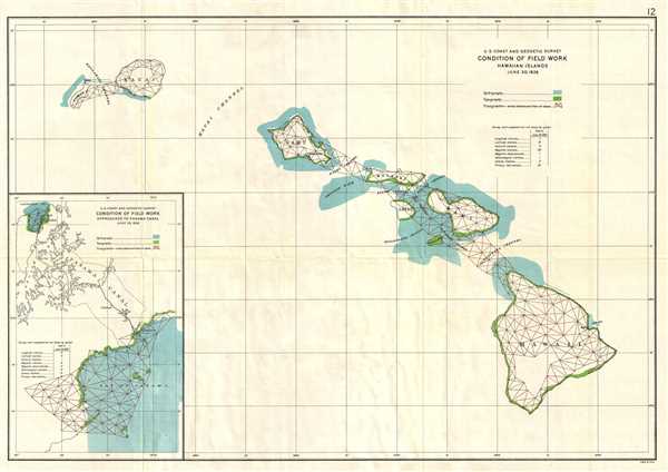
U.S. Coast and Geodetic Survey. Condition of Field Work Hawaiian Islands. June 30, 1926.
sold
- Digital Map Information
- Suitable for large format printing
- File Size: 4.37 MB
- File Type: ZIP / TIFF
- ICC color profile embedded
- Delivered instantly via download link
This is a 1926 U.S. Coast and Geodetic Survey map of the Hawaiian Islands. The map depicts the Hawaiian archipelago, including the islands of Hawaii, Maui, Kahoolawe, Lanai, Molokai, Oahu, Kauai, and Nihau. Created for the Annual ... (more details)
Detailed map of Indian Reservations across the U.S. - includes symbols indicating the number of schools on each reservation.
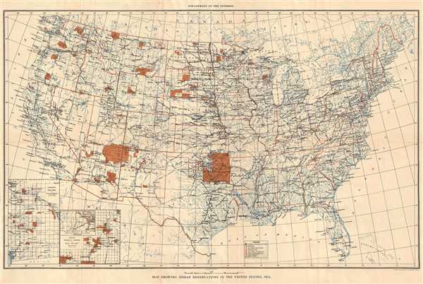
Map Showing Indian Reservations in the United States, 1915.
sold
- Digital Map Information
- Suitable for large format printing
- File Size: 10.86 MB
- File Type: ZIP / TIFF
- ICC color profile embedded
- Delivered instantly via download link
This is a 1915 U.S. Department of the Interior map of the United States. The map depicts the United States from the Pacific Ocean to the Atlantic Ocean and from Canada to Mexico and the Gulf of Mexico. Illustrated on the map are ... (more details)
Comments on the location of the treasure held by the Cossack Army.
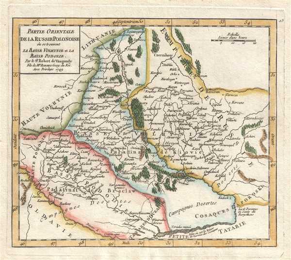
Partie Orientale de la Russie Polonoise où se trouvent la Basse Volhynie et la Basse Podolie. Par le Sr. Robert de Vaugondy Fils de Mr. Robert Geog. du Roi.
sold
- Digital Map Information
- Suitable for large format printing
- DPI: 300
- File Size: 1.65 MB
- File Type: ZIP / TIFF
- ICC color profile embedded
- Delivered instantly via download link
This is a hand colored 1749 Didier Robert de Vaugondy map of European Russia. This map depicts from Moldova ( Moldavie ) and Haute Volhynie to the Russian Empire and from Lithuania ( Lithuanie ) and this Russian Empire to Basse ... (more details)
Gorgeous hand colored map of European Russia.

Partie Occidentale de la Russie Polonoise où se trouve la Russie Noire, la Haute Volhynie, et la Haute Podolie. Par le Sr. Robert de Vaugondy, Fils de Mr. Robert Geog. du Roi.
sold
- Digital Map Information
- Suitable for large format printing
- DPI: 300
- File Size: 2 MB
- File Type: ZIP / TIFF
- ICC color profile embedded
- Delivered instantly via download link
This is a hand colored 1749 Didier Robert de Vaugondy map of European Russia. The map depicts from Haute Pologne and Hungary to Basse Volhynie and Basse Podolie and from Lithuania ( Grand Duché de Lithuanie ) to Moldova ( ... (more details)
Incredible depiction of Lake Champlain and Cape Breton Island.

Partie du Canada où se trouvent le Fleuve St. Laurent et la Nouvelle Ecosse. Par le Sr. Robert de Vaugondy, Fils de Mr. Robert Geogr. ordin. du Roi.
sold
- Digital Map Information
- Suitable for large format printing
- DPI: 300
- File Size: 1.79 MB
- File Type: ZIP / TIFF
- ICC color profile embedded
- Delivered instantly via download link
This is a hand colored 1749 Didier Robert de Vaugondy map of Canada and New England. The map depicts from the Saint Lawrence River to Cape Breton Island and from Quebec to Lake Champlain and Acadia. Myriad tributaries of ... (more details)
Stunning hand colored map of West Africa.

Partie Orientale de la Haute Guinee. Par le Sr. Robert de Vaugondy Fils de Mr. Robert Geog. du. Roi.
sold
- Digital Map Information
- Suitable for large format printing
- DPI: 300
- File Size: 1.23 MB
- File Type: ZIP / TIFF
- ICC color profile embedded
- Delivered instantly via download link
This is a hand colored 1749 Didier Robert de Vaugondy map of West Africa. The map depicts from the Royaume de Juida to Haute Ethiopie and from the Desert de la Nigritie to the Royaume de Loango , or, in modern terms, ... (more details)