
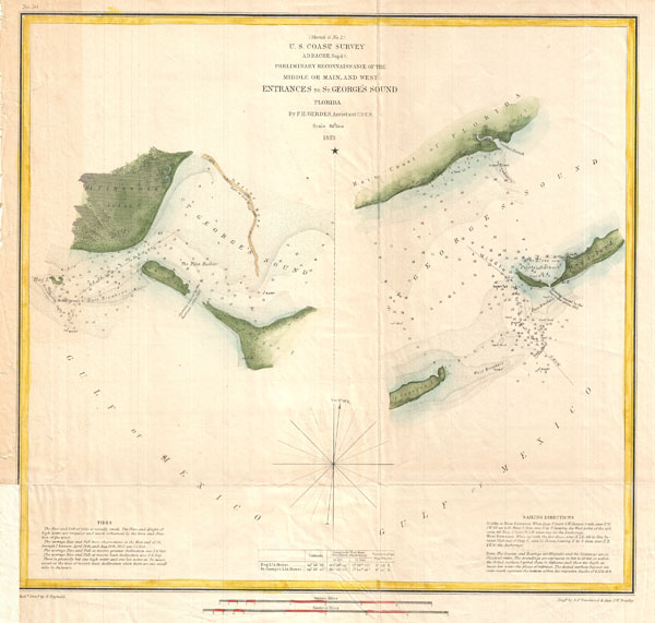
(Sketch G No. 2) Preliminary Reconnaissance of the Middle or Main, and West Entrances to St. George's Sound, Florida.
sold
- Digital Map Information
- Suitable for large format printing
- Full resolution TIFF file
- ICC color profile embedded
- Delivered instantly via download link
A very nice example of the U.S. Coast Survey's 1853 chart or map of the entrances to St. George Sound, Florida. Essentially two maps in one. The left map depicts the western Entrance to the sound between St. Vincent's Island and Georges Island. The right hand ... (more details)
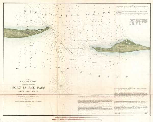
H No. 4 Horn Island Pass Mississippi Sound
sold
- Digital Map Information
- Suitable for large format printing
- Full resolution TIFF file
- ICC color profile embedded
- Delivered instantly via download link
A very nice example of the U.S. Coast Survey's 1852 chart or map of the Horn Island Pass. Depicts the East End of Horn Island and the West End of Petit Bois Island with Horn Island Pass running between the two. Horn Island Pass offers an exceptionally ... (more details)

Europa Selon les Auth. les plus Modernes.
sold
- Digital Map Information
- Suitable for large format printing
- Full resolution TIFF file
- ICC color profile embedded
- Delivered instantly via download link
A very scarce, c. 1706, example of a map of Europe first issued by Daniel de La Feuille in 1702. Features the continent of Europe as far west as Greenland (Groenlande) and as far east as the Black Sea and Asia Minor. Extends north to include Lapland ... (more details)
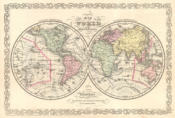
A New Map of the World on Globular Projection.
sold
- Digital Map Information
- Suitable for large format printing
- File Size: 5.55 MB
- File Type: ZIP / TIFF
- ICC color profile embedded
- Delivered instantly via download link
A fine example of Charles Desilver's 1856 double hemisphere map of the World. Covers the entire world with color coding according to continents. The map shows recent discoveries in the Antarctic as well as the routes of various prominent explorers ... (more details)
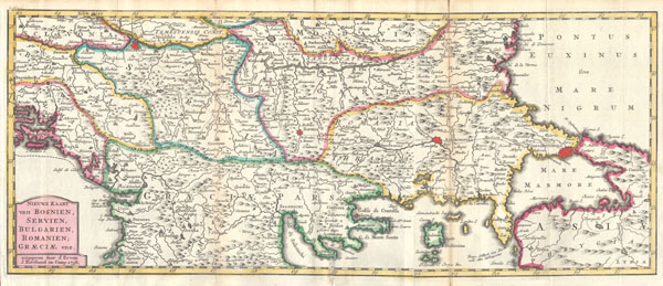
Nieuwe Kaart van Bosnien, Servien, Bulgarien, Romanien; Graeciae enz..
sold
- Digital Map Information
- Suitable for large format printing
- Full resolution TIFF file
- ICC color profile embedded
- Delivered instantly via download link
This is a rare and unusual 1738 map of the Balkans by J. Ratelband. Likely revised and updated from earlier charts by the De La Feuille family. Depicts from modern day Albania (Dalmatia) eastward through Bosnia, Serbia, Bulgaria and Rumania to ... (more details)
One of the first accurate maps of the Caspian Sea.
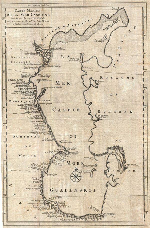
Carte Marine de la Mer Caspiene levee Suivant les ordres de S. M. Cz: en 1718, 1720, et 1721.
sold
- Digital Map Information
- Suitable for large format printing
- DPI: 300
- File Size: 6.15 MB
- File Type: ZIP / TIFF
- ICC color profile embedded
- Delivered instantly via download link
An uncommon variant on Carl Van Verden's important 1719 – 1721 mapping of the Caspian Sea. Around 1718 the Russian Tzar, Peter the Great, sponsored a number of cartographic expeditions to the farthest reaches of his vast empire. Most of these ... (more details)
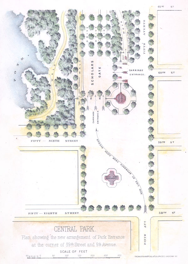
Central Park. Plan showing the new arrangement of Park Entrance at the corner of 59th and 5th Avenue
sold
- Digital Map Information
- Suitable for large format printing
- File Size: 0.85 MB
- File Type: ZIP / TIFF
- ICC color profile embedded
- Delivered instantly via download link
An unusual little map of the southeastern corner of New York City's Central Park. Depicts from 61st Street south to the intersection of 58th street and 5th Avenue . Shows the planned ornamentation and redirection of traffic to accommodate the ... (more details)
Pristine pocket map of Victorian London.

Reynolds's Map of Modern London Divided into Quarter-Mile Sections for Measuring Distances.
sold
- Digital Map Information
- Suitable for large format printing
- File Size: 28.62 MB
- File Type: ZIP / TIFF
- ICC color profile embedded
- Delivered instantly via download link
A pristine example of James Reynolds' 1662 pocket map of London, England. Covers the center of London from Notting Hill to the Isle of Dogs and from Kentish Town to Battersea Park. Details every street, parks, train station, bridge, monument, ... (more details)

The Terrace
sold
- Digital Map Information
- Suitable for large format printing
- File Size: 4.34 MB
- File Type: ZIP / TIFF
- ICC color profile embedded
- Delivered instantly via download link
An unusual little view of Bethesda Terrace, Central Park. Bethesda Terrace is located at roughly 72nd street in the heart of New York City's Central Park. Depicts the Terrace from a south facing perspective over 'the Lake' towards the ... (more details)

Etats du Grand-Seigneur en Asie, Empire de Perse, Pays des Usbecs, Arabie et Egypte.
sold
- Digital Map Information
- Suitable for large format printing
- DPI: 300
- File Size: 17.77 MB
- File Type: ZIP / TIFF
- ICC color profile embedded
- Delivered instantly via download link
This is Robert de Vaugondy's spectacular 1753 map of the Ottoman Empire. Vaugondy maps the empire at its height, with territory spanning from the Black Sea to the southernmost extension of Arabia and west, inclusive of Persia, as far ... (more details)
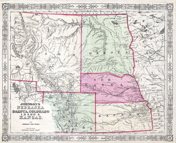
Johnson’s Nebraska Dakota, Colorado, Idaho & Kansas.
sold
- Digital Map Information
- Suitable for large format printing
- File Size: 4.04 MB
- File Type: ZIP / TIFF
- ICC color profile embedded
- Delivered instantly via download link
This is a beautifully hand colored 1863 lithograph map of what today consists of the states of Idaho, Wyoming, Colorado, Montana, North Dakota, South Dakota, Nebraska and Kansas. Extends west as far as the Great Salt Lake and east ... (more details)
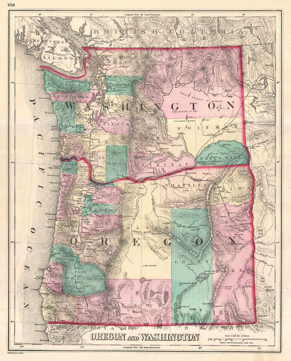
Oregon and Washington.
sold
- Digital Map Information
- Suitable for large format printing
- File Size: 9.02 MB
- File Type: ZIP / TIFF
- ICC color profile embedded
- Delivered instantly via download link
A visually stunning 1875 map of Oregon and Washington by Ormando Gray. Offers beautiful engraving and vivid hand color at the county level. Shows cities and railways as well as topographical features such as lakes, rivers, valleys ... (more details)

A Diagram Exhibiting the difference of time between the places shown & Washington.
sold
- Digital Map Information
- Suitable for large format printing
- File Size: 8.08 MB
- File Type: ZIP / TIFF
- ICC color profile embedded
- Delivered instantly via download link
A very attractive example of Johnson's 1866 diagram of the world's time zones. Consists of a circular engraving in which numerous clocks are drawn, each representing a major world city. At the center is clock representing the time ... (more details)
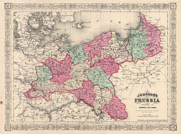
Johnson's Prussia.
sold
- Digital Map Information
- Suitable for large format printing
- File Size: 7.92 MB
- File Type: ZIP / TIFF
- ICC color profile embedded
- Delivered instantly via download link
This is Johnson and Ward's 1866 map of Prussia, Germany. Prussia attained its greatest importance in the 18th and 19th centuries when it dominated northern Germany politically, economically, and in population. During the 19th ... (more details)
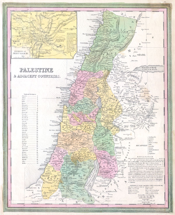
Palestine & Adjacent Countries.
sold
- Digital Map Information
- Suitable for large format printing
- DPI: 300
- File Size: 3.85 MB
- File Type: ZIP / TIFF
- ICC color profile embedded
- Delivered instantly via download link
A fine and rare 1836 S. A. Mitchell map depicting Palestine, Israel or the Holy Land. Includes From Gaza North as far as modern day Lebanon. The regions claimed by the various tribes of Israel are noted. In the upper right ... (more details)

Johnson's Ireland. Johnson's Scotland.
sold
- Digital Map Information
- Suitable for large format printing
- File Size: 18.04 MB
- File Type: ZIP / TIFF
- ICC color profile embedded
- Delivered instantly via download link
This is Johnson and Ward's 1866 map of Ireland and Scotland. Essentially two maps on one sheet with the left hand map covering Ireland and the right hand map covering Scotland. Both regions are divided into their ... (more details)
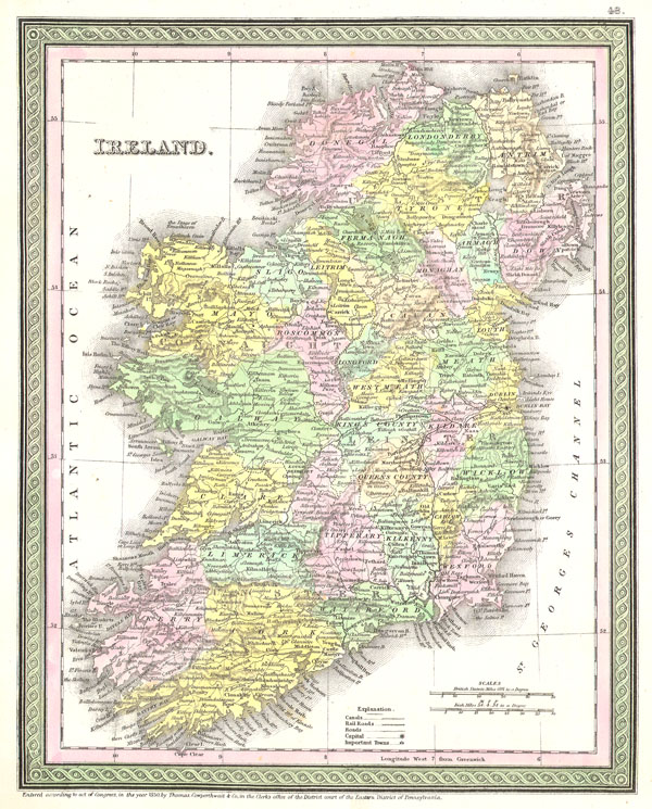
Ireland.
sold
- Digital Map Information
- Suitable for large format printing
- Full resolution TIFF file
- ICC color profile embedded
- Delivered instantly via download link
This beautiful hand colored map is a lithographic engraving of Ireland, dating to 1850, by the legendary American map publisher S.A. Mitchell, the elder. Dated and copyrighted 'Entered according to act of Congress ... (more details)
Map of the United States just after the close of the American Civil War.

Johnson's United States.
sold
- Digital Map Information
- Suitable for large format printing
- File Size: 17.14 MB
- File Type: ZIP / TIFF
- ICC color profile embedded
- Delivered instantly via download link
This is A. J. Johnson's 1866 map of the United States. It covers the entirety of the United States as well as adjacent parts of Canada and Mexico, revealing the country at a critical historical junction just ... (more details)
An 18th century treasure map of the West Indies and Caribbean.
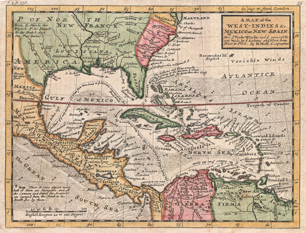
A Map of the West-Indies & c. Mexico or New Spain. Also ye Trade Winds, and ye Several Tracts made by ye Taleons and Flota from Place to Place.
sold
- Digital Map Information
- Suitable for large format printing
- DPI: 300
- File Size: 3.93 MB
- File Type: ZIP / TIFF
- ICC color profile embedded
- Delivered instantly via download link
This is Herman Molls small but significant c. 1732 map of the West Indies. Moll's map covers all of the West Indies, eastern Mexico, all of Central America, the Gulf of Mexico, North America as far as the ... (more details)

The Environs of Paris
sold
- Digital Map Information
- Suitable for large format printing
- File Size: 3.93 MB
- File Type: ZIP / TIFF
- ICC color profile embedded
- Delivered instantly via download link
This rare hand colored map of Paris and Environs is a copper plate engraving dating to 1855. Produced by the respected mid 19th century American Mapmaker J. H. Colton. Map covers the Seine valley in a ... (more details)