
British interest in the American Civil War.
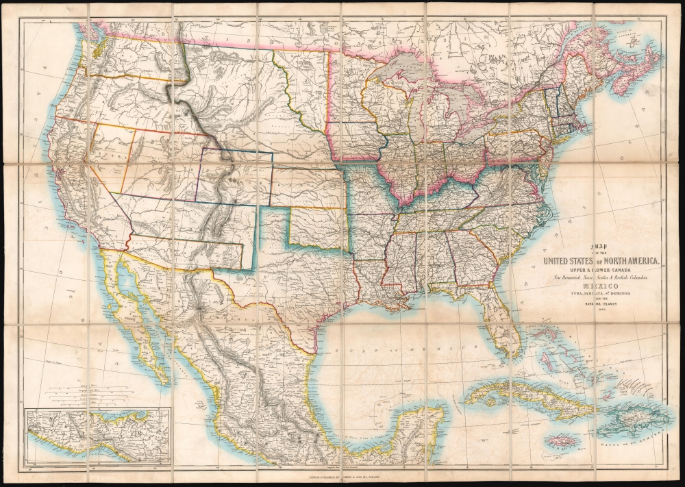
Map of the United States of North America, Upper and Lower Canada, New Brunswick, Nova Scotia and British Columbia. Mexico, Cuba, Jamaica, St. Domingo and the Bahama Islands.
sold
- Digital Map Information
- Suitable for large format printing
- File Size: 51.16 MB
- File Type: ZIP / TIFF
- ICC color profile embedded
- Delivered instantly via download link
This is an 1862 'Smith and Son' map of the United States during the American Civil War (1861 - 1865). Although ostensibly from a 'neutral' perspective, the map reflects British interest in the conflict, which was significant as the Union blockade of the Confederacy drove the important British textile industry into ruin. (more details)
Commemorates the meeting the U.S. Army and the Soviet Red Army on Elbe Day.

Special Map Showing Contact Between Gen. Hodges' First U.S. Army and Gen. Jadov's Fifth U.S.S.R. Army 25 April 1945.
sold
- Digital Map Information
- Suitable for large format printing
- File Size: 21.83 MB
- File Type: ZIP / TIFF
- ICC color profile embedded
- Delivered instantly via download link
This is a 1945 G-2 Section First U.S. Army map of eastern Germany commemorating the meeting of the U.S. Army and the Soviet Red Army along the Elbe River. With the Elbe illustrated to the right of center, the map depicts the Fifth U.S.S.R. Army sweeping across Germany from the West while the First U.S. Army charges in from the east, with the Twelfth German Army is sandwiched between them. Large Soviet and American flags mark Soviet and American sectors. A banner situated near the top border announces, 'Elements 69th U.S. Division met elements 58th U.S.S.R. Division at Torgau, Germany 25 April 1945 at 1640B. (more details)
Michigan Land Rush.
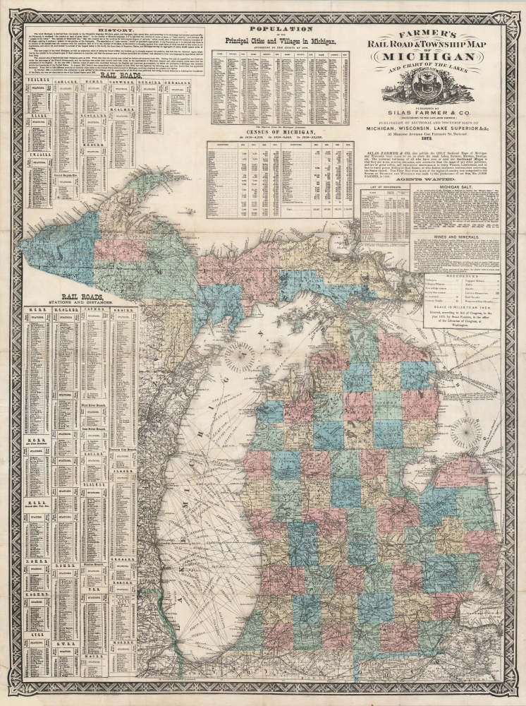
Farmer's Railroad and Township Map of Michigan and Chart of the Lakes.
sold
- Digital Map Information
- Suitable for large format printing
- File Size: 53.38 MB
- File Type: ZIP / TIFF
- ICC color profile embedded
- Delivered instantly via download link
This is an 1868 Silas Farmer railroad and township map of Michigan. Farmer's maps appeared as the federal government was privatizing over 26 million acres of Michigan land for emigration and settlement. With a veritable land rush in progress, both father, John Farmer, and son, Silas Farmer, worked assiduously to keep their maps updated, publishing editions annually and sometimes biannually. Such maps were essential for emigrants, not only for travel, but also to plan frontier life. (more details)
By a Congressman's Daughter.
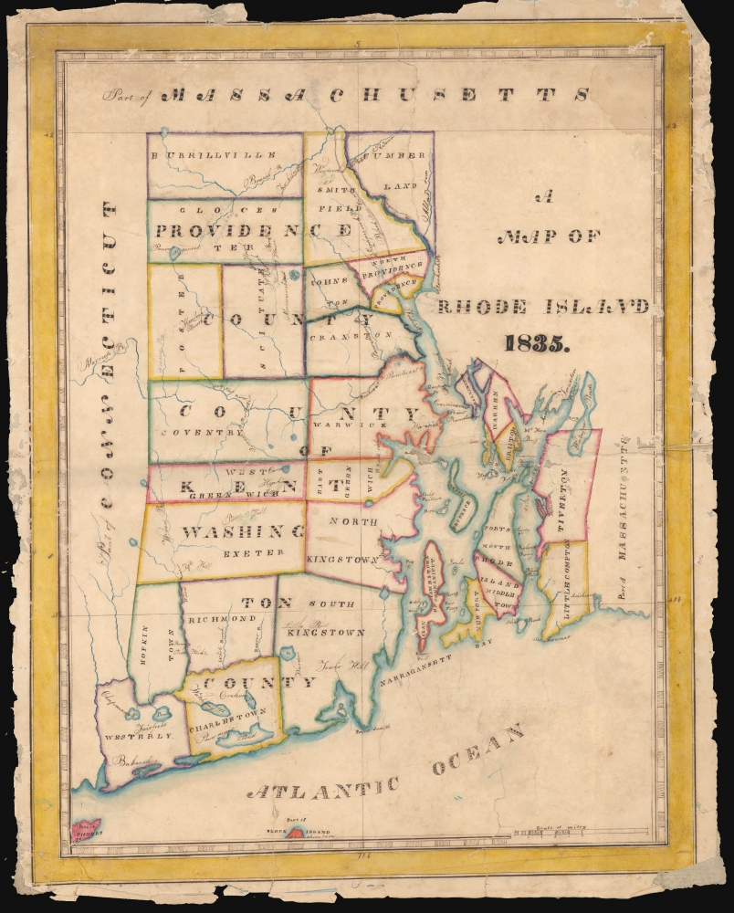
A Map of Rhode Island 1835.
sold
- Digital Map Information
- Suitable for large format printing
- DPI: 600
- File Size: 31.23 MB
- File Type: ZIP / TIFF
- ICC color profile embedded
- Delivered instantly via download link
This is a beautifully executed schoolgirl map of Rhode Island, drawn in 1835 by Lucy Durfee (conjecturally the daughter of legislator and congressman Job Durfee). (more details)
Trading centers on Borneo.
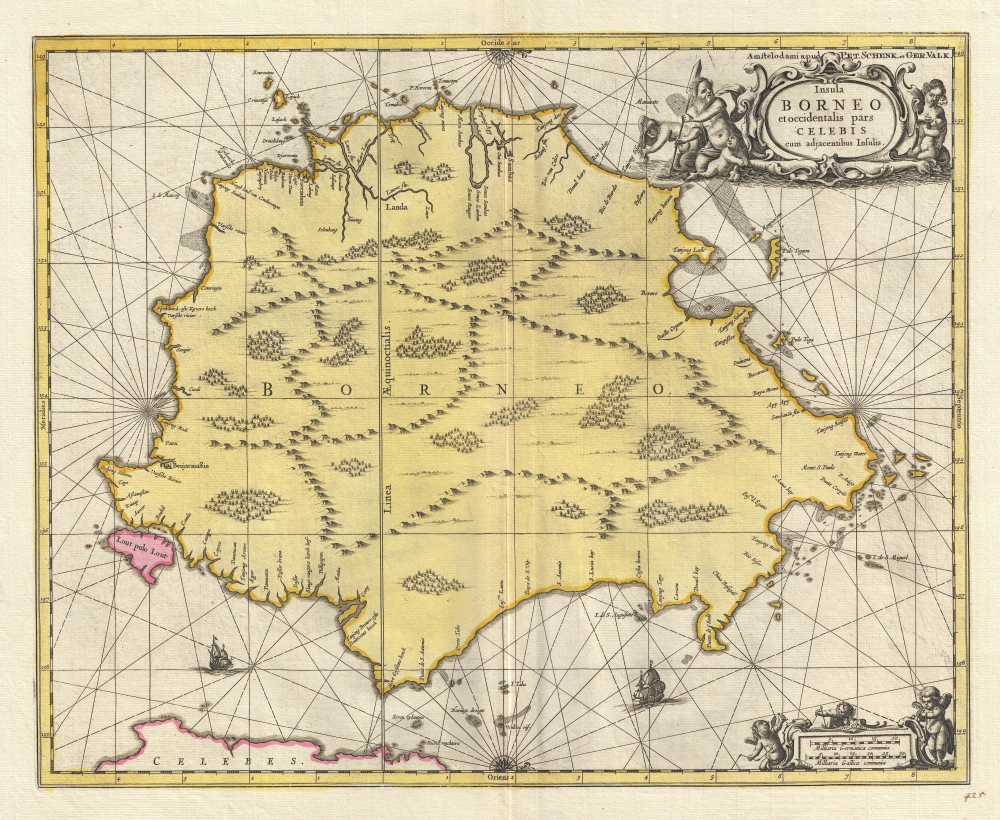
Insula BORNEO et occidentalis pars CELEBIS cum adjacentibus Infulis.
$1,300.00
Acquire
- Digital Map Information
- Suitable for large format printing
- DPI: 300
- File Size: 9.53 MB
- File Type: ZIP / TIFF
- ICC color profile embedded
- Delivered instantly via download link
A stunning full-color c. 1710 map of Borneo by Gerard Valk and Petrus Schenk under the imprint of Valk and Schenk. The map reflects tenuous knowledge of the island in the early days of VOC activity in the region. (more details)
Dutch interest in Sumatra and Malaya.
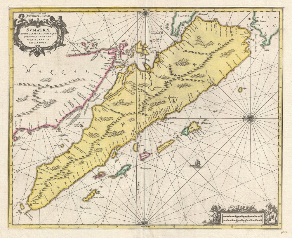
Sumatrae et Insularum Locorum que Nonnull Orum Circumiacentium Tabula Noua.
$1,300.00
Acquire
- Digital Map Information
- Suitable for large format printing
- DPI: 300
- File Size: 9.55 MB
- File Type: ZIP / TIFF
- ICC color profile embedded
- Delivered instantly via download link
A stunning full-color c. 1710 map of Sumatra, Malay, the straits of Malacca, and Singapore by Gerard Valk and Petrus Schenk under the imprint of Valk and Schenk. (more details)
By a Congressman's Daughter.
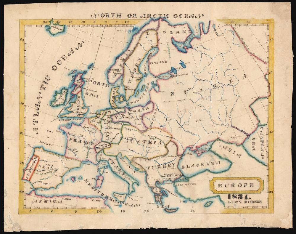
Europe 1834. Lucy Durfee.
sold
- Digital Map Information
- Suitable for large format printing
- DPI: 600
- File Size: 40.03 MB
- File Type: ZIP / TIFF
- ICC color profile embedded
- Delivered instantly via download link
This is a beautifully executed schoolgirl map of Europe, drawn in 1834 by Lucy Durfee (conjecturally the daughter of legislator and congressman Job Durfee). (more details)
Revisionist Prophecy.
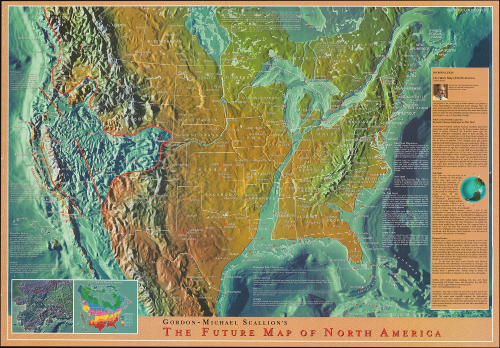
Gordon-Michael Scallion's The Future Map of North America.
sold
A striking example of Gordon-Michael Scallion's 2002 doomsday map of North America. Scallion (1942 - ?) is a futurist, spiritualist, and 'prophet' who predicted a series of cataclysmic astronomical and seismic events would occur between the issue date of this map, 2002, and 2012. This map offers an exceptionally granular breakdown of Scallion's predictions for the United States and a newly extended timeline - it is somewhat revisionary, issued one year after his earlier maps predicted these events would come to pass. (more details)
One of the first maps of the Rangeley Lake Region.

The Lakes of Franklin and Oxford Counties Maine. From Actual Surveys made during the winter of 1876. / Dill’s Survey of the Rangeley Lakes.
sold
- Digital Map Information
- Suitable for large format printing
- Full resolution TIFF file
- ICC color profile embedded
- Delivered instantly via download link
An essential work on the history and geography of western Maine, this rare 1876 pocket map by Harry P. Dill was one of the first to depict the Rangeley Lakes region in detail. (more details)
Ancient Persia.

[Tabula V. Asiae].
sold
- Digital Map Information
- Suitable for large format printing
- Full resolution TIFF file
- ICC color profile embedded
- Delivered instantly via download link
This is Laurent Fries' Ptolemaic map of Persia, one of the earliest generally acquirable maps of what would become Iran and Iraq. The map spans from Mesopotamia - the Tigris and Euphrates Rivers valleys - to a mountain range roughly corresponding with the Masjed Mountains of easternmost Persia, embracing modern-day Iran, Iraq, the Caspian Sea, and the Persian Gulf. (more details)
Visit the Centre Pompidou and the Musée Carnavalet in this popular Parisian district.

Le Marais.
sold
This is a full color 1985 Félix and Sylvie Gatier pictorial map of the Marais District (Le Marais), Paris, France. The map depicts from the Rue Beaubourg and the Centre Pompidou to the Place des Vosges, and from the intersection of the Boulevard du Temple and the Rue Charlot to the Seine River. Buildings are illustrated in profile and labeled, including banks, churches, and private homes. Other specifically identified places include the Centre Pompidou, the Place des Vosges, the Mémorial du Martyr Juif Inconnu (today's Mémorial de la Shoah), the Musée Carnavalet, the Archives Nationales, and the Église Saint-Gervais. Numerous hôtel particuliers, urban mansions built by Paris's nobility in the 1600s, are labeled as well. (more details)
Missionary Mapping of East Africa.
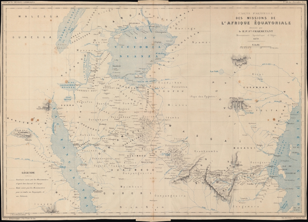
Carte partielle des Missions de l'Afrique Équatoriale.
sold
- Digital Map Information
- Suitable for large format printing
- File Size: 17.17 MB
- File Type: ZIP / TIFF
- ICC color profile embedded
- Delivered instantly via download link
An interesting map of 'Equatorial Africa' by the French missionary Félix Charmetant, taking in parts or the entirety of the present-day countries of Tanzania, Kenya, Uganda, Rwanda, Burundi, and the Democratic Republic of the Congo. Charmetant traces the routes of recent French missionary expeditions (which he helped plan) and provides an overview of regional geography, hitherto little known to Europeans. (more details)
Indiana's Early, Ambitious Public Works.
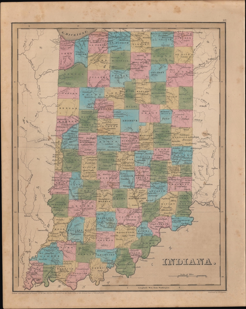
Indiana.
sold
- Digital Map Information
- Suitable for large format printing
- DPI: 600
- File Size: 23.83 MB
- File Type: ZIP / TIFF
- ICC color profile embedded
- Delivered instantly via download link
An example of Thomas Bradford's 1846 map of Indiana, published in his Universal Illustrated Atlas. (more details)
The Waning Days of Dallas' Streetcars.
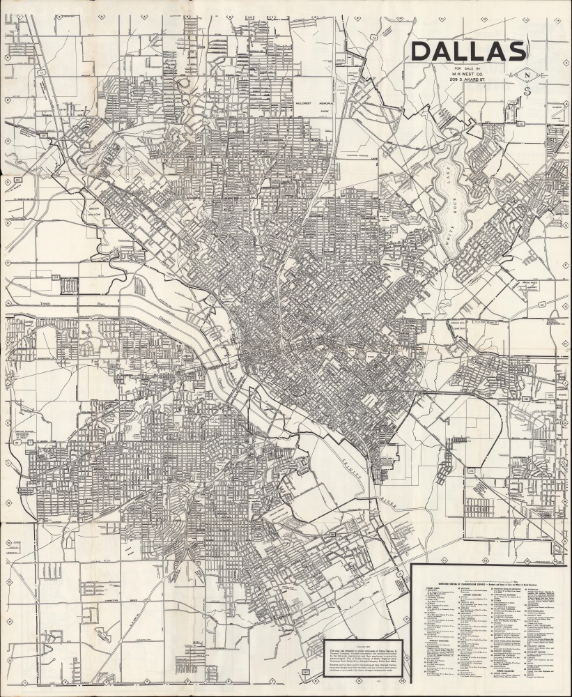
Dallas.
sold
- Digital Map Information
- Suitable for large format printing
- Full resolution TIFF file
- ICC color profile embedded
- Delivered instantly via download link
A large and detailed folding map of Dallas, Texas, produced in 1953 by the Dallas Railway and Terminal Co. and published by M. H. West. Co. The map captures Dallas during its post-WWII economic boom. (more details)
By a Congressman's Daughter.
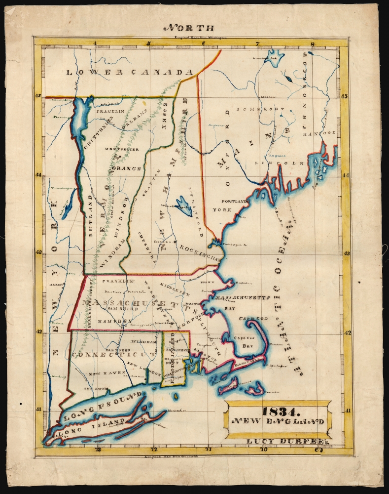
1834. New England Lucy Durfee's.
sold
- Digital Map Information
- Suitable for large format printing
- DPI: 600
- File Size: 33.81 MB
- File Type: ZIP / TIFF
- ICC color profile embedded
- Delivered instantly via download link
This is a beautifully executed schoolgirl map of New England, drawn in 1834 by Lucy Durfee (conjecturally the daughter of legislator and congressman Job Durfee). (more details)
Beginning of the Numbered Treaties.

Ethnographische Karte von Britisch America.
sold
- Digital Map Information
- Suitable for large format printing
- File Size: 1.61 MB
- File Type: ZIP / TIFF
- ICC color profile embedded
- Delivered instantly via download link
This is an important c. 1871 ethnographic manuscript map of Canada. The map corresponds to the ratification of the first of the Numbered Treaties (1871 - 1921), an ongoing attempt by the Canadian government to reconcile with First Nations while at the same time opening indigenous lands to European settlement. (more details)
Trade missions to Siam and the 1688 Siamese Revolution.
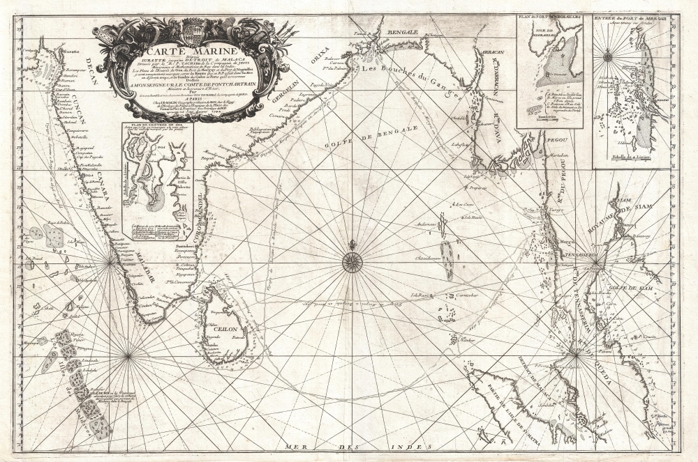
Carte Marine depuis Suratte jusqu'au Detroit de Malaca Dressee par le R.P. Tachard de la Compagnie de Jesus Missionaire et Mathematicien du Roy dans les Indes.
sold
- Digital Map Information
- Suitable for large format printing
- DPI: 300
- File Size: 15.5 MB
- File Type: ZIP / TIFF
- ICC color profile embedded
- Delivered instantly via download link
An impressive separately-issued 1742 nautical map of the Bay of Bengal, India, and Southeast Asia (Thailand, Cambodia) by J. B. Nolin. The map chronicles the travels of the Jesuit Priest Guy Tachard in his attempts to establish a Siamese-French alliance, the eventual collapse of that alliance, and anti-French Siamese Revolution of 1688. (more details)
The May 1851 San Francisco Fire.

Fire in San Francisco. In the Night, 3rd- 4th May, 1851, Loss $20,000,000.
sold
- Digital Map Information
- Suitable for large format printing
- DPI: 300
- File Size: 74.25 MB
- File Type: ZIP / TIFF
- ICC color profile embedded
- Delivered instantly via download link
An extremely rare Justh, Quirot and Co. 1851 letter sheet or broadsheet view of San Francisco during the San Francisco Fire of May 3-4, 1851. It looks down on the burning city from a pastoral overlook. This letter sheet was issued in San Francisco just days after the May 3-4rd conflagration. The small size of this letter-sheet is reflective of the small press that the firm, one of San Francisco's first printers, was able to salvage from the conflagration. It would not be until 1852 that they finally acquired a larger format press. (more details)
Depicting the Hellenic Conquest of Persia.
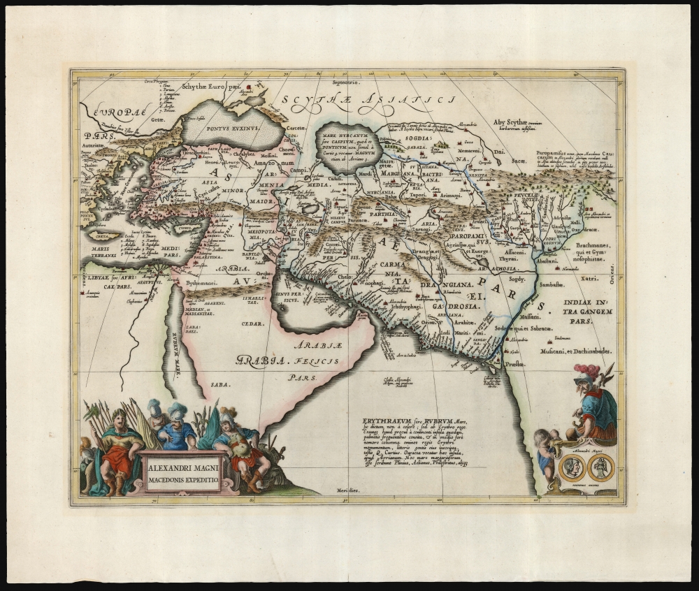
Alexandri Magni Macedonis Expeditio.
sold
- Digital Map Information
- Suitable for large format printing
- DPI: 600
- File Size: 48.68 MB
- File Type: ZIP / TIFF
- ICC color profile embedded
- Delivered instantly via download link
This is Jan Jansson's 1652 map depicting the ancient empire of Alexander the Great of Macedonia. The map depicts Alexander's empire at its height, spanning from Greece to the Indus Valley. The map combines ancient toponymy with the geographical information known to the map's author, Abraham Ortelius. Jansson's map hews closely to Ortelius's composition while updating it aesthetically to suit its 17th-century audience. (more details)
From Nippon to New Jersey.

[New York City Property Investment Map].
sold
- Digital Map Information
- Suitable for large format printing
- Full resolution TIFF file
- ICC color profile embedded
- Delivered instantly via download link
This rare Japanese-language map of New York City and vicinity was issued in the 1920s, before the 1929 Black Tuesday stock market crash, by the Japanese-American Prosperity Company, a real estate developer catering to Japanese-Americans. (more details)