
New York (sold)
Exceptional complete example of the First American Road Atlas!
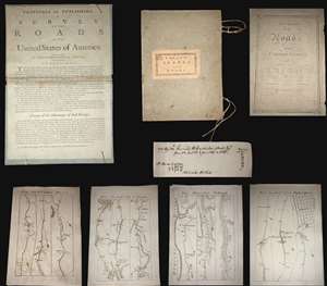
A superb example, entirely complete, of Christopher Colles' 1789 - 1790 A Survey of the Roads of the United States of America. This is the First American Road atlas, wherein at least some of the plates represent the first American maps engraved by a female - Colles' 13-year-old daughter Eliza. Covering depictions from Albany, New York to Williamsburg, Virginia, Colles' atlas consists of a prospectus, a title page, and 83 separate strip maps, each covering some 12 miles of roads and offering invaluable detail about the natural and human landscape of late 18th-century America, and was published in commemoration of the founding of the new republic in 1789. (more details)
The Colton Map - one of the largest and most beautiful maps of New York City pulished in the 19th century - in an unrecorded state.
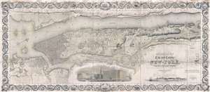
Topographical Map of the City and County of New-York, and the adjacent Country: With Views in the border of the principal Buildings and interesting Scenery of the Island.
sold
- Digital Map Information
- Suitable for large format printing
- DPI: 300
- File Size: 74.68 MB
- File Type: ZIP / TIFF
- ICC color profile embedded
- Delivered instantly via download link
Known as 'The Colton Map,' this is an unrecorded state of an 1840 map of New York City (Manhattan) by David H. Burr and John Hutchins Colton considered to be the finest and most decorative map of the city to appear in the 19th century. According to map historian ... (more details)
Significant pre-Revoutionary War map of Manhattan.
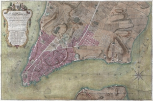
To His Excellency Sr. Henry Moore, Bart. Captain General and Governour in Chief in and over the Province of New York and the Territories depending thereon in America Chancellor and Vice admiral of the same, This Plan of the City of New York, is most HUmbly INscribed, by His Excellency's Most Obedient Servant, Bernd. Ratzen.
sold
- Digital Map Information
- Suitable for large format printing
- DPI: 300
- File Size: 28.36 MB
- File Type: ZIP / TIFF
- ICC color profile embedded
- Delivered instantly via download link
Known as the 'Ratzen Plan,' this is one of the most important, beautiful, and iconic colonial era maps of New York City, offered here in its rare first state. It is the among the most important pre-Revolutionary War maps of Manhattan. (more details)
First printed English Nautical Chart of the East Coast
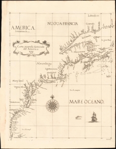
Carta Seconda Generale del' America. XXII.
sold
- Digital Map Information
- Suitable for large format printing
- File Size: 10.87 MB
- File Type: ZIP / TIFF
- ICC color profile embedded
- Delivered instantly via download link
This is the 1661 edition of Robert Dudley's general map of the east coast of North America. According to Burden, this is the 'first printed sea chart of North America by an Englishman and the first to record soundings.' It is a great rarity on the market and a keystone map for any collection of early American cartography. (more details)
One of the most beautiful, important, and enduring maps of Manhattan ever published.
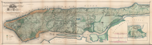
Sanitary and Topographical Map of the City and Island of New York Prepared for the Council of Hygiene and Public Health, of the Citizens Association.
sold
- Digital Map Information
- Suitable for large format printing
- Full resolution TIFF file
- ICC color profile embedded
- Delivered instantly via download link
This is Egbert L. Viele's large-format 1865 topography and waterways map of Manhattan, or the City of New York as it was then. It is one of the scarcest, most important, and most enduring maps of New York City ever published. This particular example is a rare variant appearing in the Report of the Council of Hygiene and Public Health of the Citizens' Association of New York upon the Sanitary Condition of the City and also has the esteemed provenance of being connected to the French Consulate in New York City. (more details)
One of the most beautiful, important, and enduring maps of Manhattan ever published.
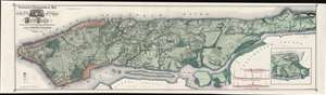
Topographical Map of the City of New York Showing Original Water Courses and Made Land.
sold
- Digital Map Information
- Suitable for large format printing
- File Size: 86.7 MB
- File Type: ZIP / TIFF
- ICC color profile embedded
- Delivered instantly via download link
This is a very beautiful and fine example of Egbert L. Viele's 1865 topography and waterways map of Manhattan, one of the scarcest, most important, and most enduring maps of New York City ever published. Covering the entirety of Manhattan Island, Viele's map details the canals, swamps, rivers, ditches, ponds, meadows, and drainage basins of Manhattan as they existed prior to the city's urban development. A version of the Viele map remains in use today by architects and contractors who need to be certain they are not building over underground rivers and swamps that may destabilize a new construction's foundation. (more details)
Earliest Acquirable, Separate Issue.
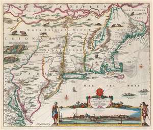
Novi Belgii Novaeque Angliae nec non Partis Virginiae Tabula multis in locis emendata a Nicolao Joannis Visschero.
sold
- Digital Map Information
- Suitable for large format printing
- Full resolution TIFF file
- ICC color profile embedded
- Delivered instantly via download link
This is the rare, c. 1656 second state of the Jansson/ Visscher map of the New Netherlands and New England. It is the earliest acquirable state of this work: the first, 'proof state', of this masterwork is an unobtainable rarity, known in only four examples in institutional and private collections. (more details)
Unusual fisheye view of New York with early Baseball imagery in the Elysian Fields.
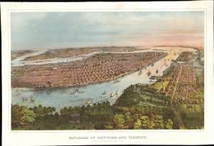
Panorama of New York and Vicinity.
sold
- Digital Map Information
- Suitable for large format printing
- File Size: 74.95 MB
- File Type: ZIP / TIFF
- ICC color profile embedded
- Delivered instantly via download link
A rich and striking large-format 1866 John Bachmann panoramic three-color chromolithograph view of New York City as seen from a point high over the Elysian Fields (baseball) of Hoboken. The view is expansive and utilizes an unusual fish-eye perspective. It looks on Manhattan from the west, with the area of focus roughly corresponding to 32nd Street. Coverage extends north to Central Park, south to Sandy Hook, and east to include parts of Brooklyn and Queens. Manhattan's major parks are recognizable, including Madison Square, Gramercy, Washington Square, City Hall, and the still under construction Central Park. Vast swathes of lotted but undeveloped land are evident along Park Avenue north of Bryant Park. Along the Hudson, there are also a number of large gentlemanly estates - survivors of a bygone era that would soon disappear entirely. The Hudson River is busy with an assortment of sail and steamships. On the right side of the map, Hoboken and beyond, Jersey City, are evident. In the foreground there is a prominent display of the Elysian Fields, where two different baseball games are in progress. (more details)
The Earliest Acquirable, Separate Issue.

Novi Belgii Novaeque Angliae nec non Partis Virginiae Tabula multis in locis emendata a Nicolao Joannis Visschero.
sold
- Digital Map Information
- Suitable for large format printing
- Full resolution TIFF file
- ICC color profile embedded
- Delivered instantly via download link
This is the rare, c. 1656 second state of the Jansson/ Visscher map of the New Netherlands and New England. It is the earliest acquirable state of this work: the first, 'proof state', of this masterwork is an unobtainable rarity, known in only four examples in institutional and private collections. (more details)
Best map of the Hudson Valley at the outset of the American Revolution.
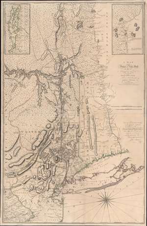
A Map of the Province of New-York, with Part of Pensilvania, and New England.
sold
- Digital Map Information
- Suitable for large format printing
- Full resolution TIFF file
- ICC color profile embedded
- Delivered instantly via download link
This is John Montresor's striking 1775 map of New York and the surrounding regions - considered the best and most authoritative map of the region at the beginning of the American Revolutionary War (1775 - 1783). (more details)
A study in contrast.
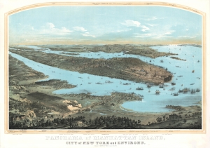
Panorama of Manhattan Island, City of New York and Environs.
sold
- Digital Map Information
- Suitable for large format printing
- DPI: 600
- File Size: 157.36 MB
- File Type: ZIP / TIFF
- ICC color profile embedded
- Delivered instantly via download link
John Bornet presents a sweeping panoramic bird's-eye view of New York City on the cusp of its monumental expansion northwards in the second half of the 19th century. The view looks east on Manhattan, Queens, and Brooklyn from a high point to the west of Hoboken, New Jersey. Bornet purports to have drawn the view 'from nature', likely from Bergen Hill, New Jersey, a popular high point used by other viewmakers of the period. (more details)
Mars, the God of War, look on as Fame proclaims the of the Birth of the United States.
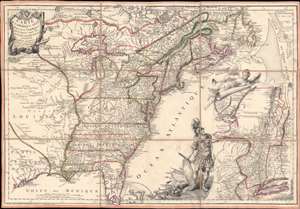
Carte de l'Amerique Septle. pour Servir a l'Intelligence de la Guerre Entre les Anglois et les Insurgents.
sold
- Digital Map Information
- Suitable for large format printing
- Full resolution TIFF file
- ICC color profile embedded
- Delivered instantly via download link
This is a rare 1777 Jean-Baptiste Jacques de Beaurain map of the United States during the American Revolutionary War, issued in anticipation of French entry into the war on the side of the revolutionaries. The map includes a bold illustration of the goddess Ossa (fame) unrolling an expansive map of the Theater of War in the Hudson corridor, proclaiming the newly formed United States. Mars, the god of War, looks on, shield and torch in hand, his arsenal ready - much like France itself. This map is thus an instrument of propaganda intended to prepare the public for French participation in the American Revolution - an event which followed in early 1778. (more details)
Exceptional early manuscript map of the Financial Center of the World - Wall Street!
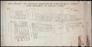
Map Shewing the Property Benefited by Widening Wall Street from Broadway to Nassau Street.
sold
- Digital Map Information
- Suitable for large format printing
- DPI: 300
- File Size: 11.96 MB
- File Type: ZIP / TIFF
- ICC color profile embedded
- Delivered instantly via download link
A unique once-in-a-lifetime discovery for the New York City collector, this is a one-of-a-kind 1851 manuscript cadastral survey map of New York City's Wall Street between Broadway and Pearl Street – including the site of the New York Stock Exchange and numerous ... (more details)
Iconic view of New York with Spectacular Chromolithograph Color.
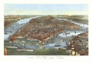
The City of New York.
sold
- Digital Map Information
- Suitable for large format printing
- File Size: 48.95 MB
- File Type: ZIP / TIFF
- ICC color profile embedded
- Delivered instantly via download link
This is a beautiful example of the iconic 1870 Currier and Ives chromolithograph view of New York City, specifically Manhattan. It is the first edition of this famous view to include the Brooklyn Bridge, in the year construction on the wonder began, but 13 years before it opened! This example also has the richest original chromolithograph color we have seen in any example. (more details)
The most important and influential 18th century Colonial Era map of New England.
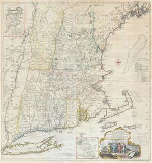
A Map of the most Inhabited part of New England containing the Provinces of Massachusets Bay and New Hampshire, with the Colonies of Connecticut and Rhode Island, divided into Counties and Townships: The whole composed form Actual Surveys and its Situation adjusted by Astronomical Observations.
sold
- Digital Map Information
- Suitable for large format printing
- Full resolution TIFF file
- ICC color profile embedded
- Delivered instantly via download link
A highly significant map, this is the 1774 'Jefferys' Map' of the Most Inhabited Part of New england . Centered on the Massachusetts Bay Colony, this map covers from Long Island to Lake Champlain and from the Hudson River to Cape Cod and Kennebec Bay, Maine. ... (more details)
The most important and influential 18th century Colonial Era map of New England.
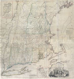
A Map of the most Inhabited part of New England containing the Provinces of Massachusets Bay and New Hampshire, with the Colonies of Connecticut and Rhode Island, divided into Counties and Townships: The whole composed form Actual Surveys and its Situation adjusted by Astronomical Observations.
sold
- Digital Map Information
- Suitable for large format printing
- Full resolution TIFF file
- ICC color profile embedded
- Delivered instantly via download link
A highly significant map, this is the 1774 'Jefferys' Map' of the Most Inhabited Part of New england . Centered on the Massachusetts Bay Colony, this map covers from Long Island to Lake Champlain and from the Hudson River to Cape Cod and Kennebec Bay, Maine. ... (more details)
Iconic view of New York with spectacular chromolithograph color.
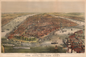
The City of New York.
sold
- Digital Map Information
- Suitable for large format printing
- File Size: 57.82 MB
- File Type: ZIP / TIFF
- ICC color profile embedded
- Delivered instantly via download link
This is a beautiful example of the iconic 1870 Currier and Ives chromolithograph view of New York City, specifically Manhattan. It is the first edition of this famous view to include the Brooklyn Bridge, in the year construction on the wonder began, but 13 years before it opened! (more details)
One of the most beautiful, important, and enduring maps of Manhattan ever published.
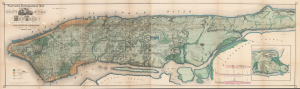
Topographical Map of the City of New York Showing Original Water Courses and Made Land.
sold
- Digital Map Information
- Suitable for large format printing
- Full resolution TIFF file
- ICC color profile embedded
- Delivered instantly via download link
This is a beautiful example of Egbert L. Viele's 1865 topography and waterways map of Manhattan, one of the scarcest, most important, and most enduring maps of New York City ever published. Viele's map details the canals, swamps, rivers, ditches, ponds, meadows, and drainage basins of Manhattan as they existed prior to the city's urban development. A version of the Viele map remains in use today by architects and contractors who need to be certain they are not building over underground rivers and swamps that may destabilize a new construction's foundation. (more details)
A most important map of eastern Canada detailing British settlement and colonization in the early 19th century.
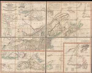
A Map of Cabotia; Comprehending The Provinces of Upper and Lower Canada, New-Brunswick And Nova-Scotia, with Breton Island, Newfoundland, &c. And Including also, The Adjacent Parts of the United States. Compiled from a great Variety of Original Documents. By John Purdy.
sold
- Digital Map Information
- Suitable for large format printing
- DPI: 300
- File Size: 72.87 MB
- File Type: ZIP / TIFF
- ICC color profile embedded
- Delivered instantly via download link
A fine example of Purdy's important 1821 map of Cabotia or Canada and New England – at the time the largest and finest map of that region. Cabotia is Purdy's manufactured term for eastern Canada or those lands discovered by John Cabot in 1497. The map covers from Lake Michigan to Newfoundland and from Labrador to New York City. Within Canada, it includes all of Ontario, Quebec, Nova Scotia, New Brunswick and Nova Scotia, and Newfoundland. In the United States, it includes all of New England, Michigan, and New York, as well as parts of Ohio and Pennsylvania. There are no fewer than 10 inset detail maps including a map of the Great lakes, the environs of Quebec, the St. Lawrence River, Niagara and vicinity, Newfoundland, Nova Scotia, Halifax, St. John, and New York Harbor. (more details)
One of the most beautiful, important, and enduring maps of Manhattan ever published.
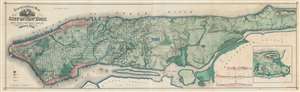
Topographical Map of the City of New York showing original water courses and made land.
sold
- Digital Map Information
- Suitable for large format printing
- Full resolution TIFF file
- ICC color profile embedded
- Delivered instantly via download link
This is a very beautiful and fine example of Egbert L. Viele's 1865 topography and waterways map of Manhattan, one of the scarcest, most important, and most enduring maps of New York City ever published. Covering the entirety of Manhattan Island, Viele's map details the canals, swamps, rivers, ditches, ponds, meadows, and drainage basins of Manhattan as they existed prior to the city's urban development. A version of the Viele map remains in use today by architects and contractors who need to be certain they are not building over underground rivers and swamps that may destabilize a new construction's foundation. (more details)
Iconic early map of New England and New York with 'Visscher View' of New Amsterdam.
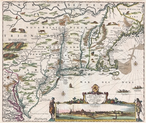
Novi Belgii Novaeque Angliae Nec Non Pennsylvaniae et Partis Virginiae Tabula multis in locis emendata.
sold
- Digital Map Information
- Suitable for large format printing
- DPI: 300
- File Size: 15.13 MB
- File Type: ZIP / TIFF
- ICC color profile embedded
- Delivered instantly via download link
A map of extreme importance, this is a fine example of Nicholaas Visscher's 1684 Novi Belgii or map of New York, New England, Pennsylvania, and Virginia. This is the first map in the Jansson-Visscher Series here presented in its 4th state (Burden, 315). Like ... (more details)
Iconic early map of New England and New York with 'Visscher View' of New Amsterdam.
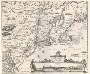
Novi Belgii Novaeque Angliae Nec Non Pennsylvaniae et Partis Virginiae Tabula multis in locis emendata.
sold
- Digital Map Information
- Suitable for large format printing
- DPI: 300
- File Size: 14.86 MB
- File Type: ZIP / TIFF
- ICC color profile embedded
- Delivered instantly via download link
A map of extreme importance, this is a fine example of Nicholaas Visscher's 1684 Novi Belgii or map of New York, New England, Pennsylvania, and Virginia. This is the first map in the Jansson-Visscher Series here presented in its 4th state (Burden, 315). Like ... (more details)
Possibly the only surviving example of this remarkable 19th century Manhattan Birds-Eye View.
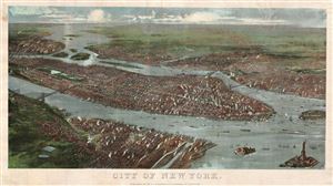
City of New York.
sold
- Digital Map Information
- Suitable for large format printing
- File Size: 4.87 MB
- File Type: ZIP / TIFF
- ICC color profile embedded
- Delivered instantly via download link
A rare possibly unique find, this is G. W. and C. B. Colton's magnificent 1897 panoramic birds-eye view of New York City. Presented in chromolithograph color this map reveals Manhattan, Brooklyn, and Queens as seen from high above Jersey City and Hoboken, ... (more details)
One of the most beautiful, important, and enduring maps of Manhattan ever published.
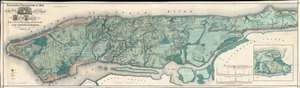
Sanitary and Topographical Map of the City and Island of New York Prepared for the Council of Hygiene and Public Health, of the Citizens Association.
sold
- Digital Map Information
- Suitable for large format printing
- File Size: 74.33 MB
- File Type: ZIP / TIFF
- ICC color profile embedded
- Delivered instantly via download link
This is a very beautiful and fine example of Egbert L. Viele's 1865 topography and waterways map of Manhattan, one of the scarcest, most important, and most enduring maps of New York City ever published. Covering the entirety of Manhattan Island, Viele's map details the canals, swamps, rivers, ditches, ponds, meadows, and drainage basins of Manhattan as they existed prior to the city's urban development. A version of the Viele map remains in use today by architects and contractors who need to be certain they are not building over underground rivers and swamps that may destabilize a new construction's foundation. (more details)
An even greater New York.
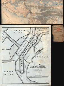
[New Manhattan] / City of New Manhattan.
sold
- Digital Map Information
- Suitable for large format printing
- Full resolution TIFF file
- ICC color profile embedded
- Delivered instantly via download link
This is a bold and futuristic 1911 - 1931 proposal to transform Manhattan with a landfill extending 8 miles into New York Harbor by T. Kennard Thomson, one of the founding fathers of American structural engineering and a pioneer of the Skyscraper Age. These two maps comprehend the first and last iteration of Kennard Thomson's 'New Manhattan': a preliminary partial manuscript plan dating to March 22, 1911 (predating the official release of the proposal in May) and the final 1930 iteration, in full manuscript. (more details)
The largest-scale pioneering aerial map of New York City.
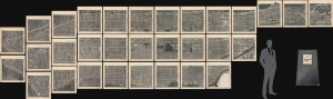
Hamilton Aerial Map Manhattan.
sold
- Digital Map Information
- Suitable for large format printing
- File Size: 164.67 MB
- File Type: ZIP / TIFF
- ICC color profile embedded
- Delivered instantly via download link
This is the rare William L. Hamilton 1927 aerial map of Manhattan, New York City. It is one of the earliest and certainly the largest aerial map of New York produced in the pioneering days of aerial cartography. The map was issued as a loose-leaf folio atlas of thirty-one sheets. (more details)
Rare Colton edition of an iconic New York City map.
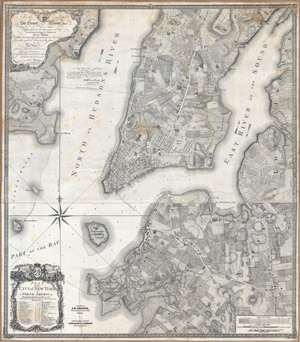
Plan of the city of New York in North America : surveyed in the years 1766 and 1767.
sold
- Digital Map Information
- Suitable for large format printing
- DPI: 300
- File Size: 61.52 MB
- File Type: ZIP / TIFF
- ICC color profile embedded
- Delivered instantly via download link
Known as the 'Ratzer Plan,' this is one of the most important, beautiful, and iconic colonial era maps of New York City, offered here in a stunning 1853 Colton restrike. This map was originally surveyed in 1767 by Bernard Ratzer, a lieutenant in the 'Royal American' regiment at the behest of Sir George Moore, governor of New York, who is sited in the cartouche. The map, which covers the southern part of Manhattan to about modern day 57th street, is a revision and expansion upon the flawed John Montresor plan of 1767. Across East River, a portion of Long Island is depicted, including most of Brooklyn and Parts of Long Island City. (more details)
One of the most beautiful, important, and enduring maps of Manhattan ever published.
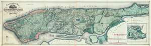
Topographical Map of the City of New York showing original water courses and made land.
sold
- Digital Map Information
- Suitable for large format printing
- File Size: 92.32 MB
- File Type: ZIP / TIFF
- ICC color profile embedded
- Delivered instantly via download link
This is Egbert L. Viele's 1865 topography and waterways map of Manhattan, one of the scarcest, most important, and most enduring maps of New York City ever published. Covering the entirety of Manhattan Island, Viele's map details the canals, swamps, rivers, ditches, ponds, meadows, and drainage basins of Manhattan as they existed prior to the city's urban development. A version of the Viele map remains in use today by architects and contractors who need to be certain they are not building over underground rivers and swamps that may destabilize a new construction's foundation. (more details)
The Eddy Map.' One of the most important early maps of New York City ever printed.
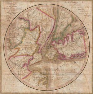
Map of the country Thirty Miles Round the City of New York.
sold
- Digital Map Information
- Suitable for large format printing
- DPI: 300
- File Size: 15.89 MB
- File Type: ZIP / TIFF
- ICC color profile embedded
- Delivered instantly via download link
Known as 'The Eddy Map,' this is an extremely rare and important circular map of New York City and vicinity, dated 1823. Covers the New York City area in roughly a thirty mile radius of Manhattan, extending north to Tarrytown, south to Monmouth, west to ... (more details)
One of the most beautiful, important, and enduring maps of Manhattan ever published.
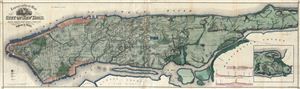
Topographical Map of the City of New York Showing Original Water Courses and Made Land.
sold
- Digital Map Information
- Suitable for large format printing
- File Size: 47.88 MB
- File Type: ZIP / TIFF
- ICC color profile embedded
- Delivered instantly via download link
This is Egbert L. Viele's 1865 topography and waterways map of Manhattan, one of the scarcest, most important and most enduring maps of New York City ever published. Covering the entirety of Manhattan Island, Viele's map details the canals, swamps, ... (more details)
One of the most beautiful, important, and enduring maps of Manhattan ever published.
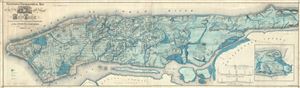
Sanitary and Topographical Map of the City and Island of New York Prepared for the Council of Hygene and Public Health, of the Citizens' Association under the direction of Egbert L. Viele, Topographical Engineer.
sold
- Digital Map Information
- Suitable for large format printing
- File Size: 51.42 MB
- File Type: ZIP / TIFF
- ICC color profile embedded
- Delivered instantly via download link
This is Egbert L. Viele's 1865 topography and waterways map of Manhattan, one of the scarcest, most important and most enduring maps of New York City ever published. Covering the entirety of Manhattan Island, Viele's map details the canals, swamps, ... (more details)
Recording the First Naval Battle of the American Revolution.
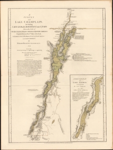
A Survey Of Lake Champlain, including Lake George, Crown Point And St. John. /A Particular Plan of Lake George.
sold
- Digital Map Information
- Suitable for large format printing
- File Size: 22.53 MB
- File Type: ZIP / TIFF
- ICC color profile embedded
- Delivered instantly via download link
This is a premier example of William Furness Brasier's 1762 map of Lakes Champlain and George, in its 1776 second state. The map overall is the first separate map of Lake Champlain and Lake George. Both this and its earlier state would certainly have been in the hands of the British officers leading the Fall 1777 campaign during the American Revolutionary War (1775 - 1783) culminating in a pivotal American victory at Saratoga. (more details)