
Arrowsmith Family (sold)
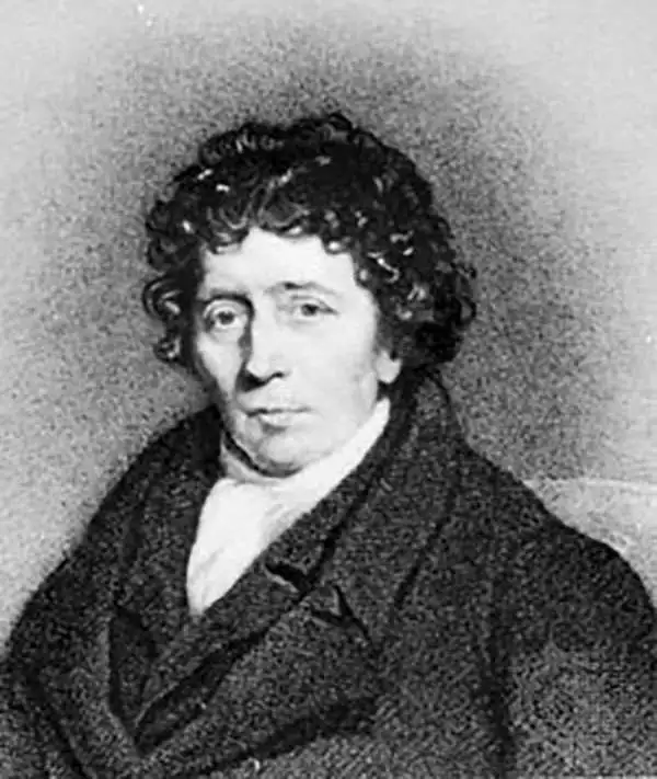
Aaron Arrowsmith (1750-1823), John Arrowsmith (1790-1873), and Samuel Arrowsmith. The Arrowsmith family were noted map engravers, publishers, geographers, and cartographers active in the late 18th and early 19th century. The Arrowsmith firm was founded by Aaron Arrowsmith, who was trained in surveying and engraving under John Cary and William Faden. Arrowsmith founded the Arrowsmith firm as a side business while employed by Cary. The firm specialized in large format individual issue maps containing the most up to date and sophisticated information available. Arrowsmith's work drew the attention of the Prince of Wales who, in 1810, named him Hydrographer to the Prince of Wales, and subsequently, in 1820, Hydrographer to the King. Aaron Arrowsmith was succeeded by two sons, Aaron and Samuel, who followed him in the map publication business. The Arrowsmith firm eventually fell to John Arrowsmith (1790-1873), nephew of the elder Aaron. John was a founding member of the Royal Geographical Society. The firm is best known for their phenomenal large format mappings of North America. Mount Arrowsmith, situated east of Port Alberni on Vancouver Island, British Columbia, is named for Aaron Arrowsmith and his nephew John Arrowsmith.
Height of the French Revolutionary Wars.
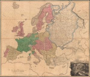
Map of Europe, Drawn from all the Best Surveys, and Rectified by Astronomical Observations.
sold
- Digital Map Information
- Suitable for large format printing
- DPI: 600
- File Size: 373.55 MB
- File Type: ZIP / TIFF
- ICC color profile embedded
- Delivered instantly via download link
This Aaron Arrowsmith map of Europe illustrates a continent at war with Britain the only remaining power left standing against Napoleon's French Revolutionary armies. The map was published on June 1, 1798, near the end of the War of the First Coalition (1772 - 1797). (more details)
One of the first maps to depict Tasmania as an island following the circumnavigation of Tasmania by this map's creator.
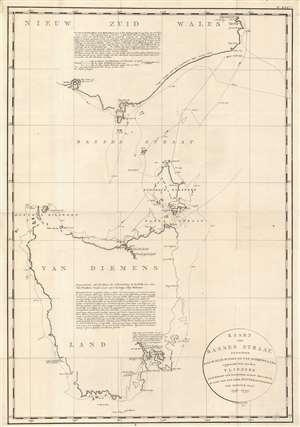
Kaart van Basses Straat Tusschen Nieuw Zuid Wales en Van Diemens-Land.
sold
- Digital Map Information
- Suitable for large format printing
- DPI: 600
- File Size: 31.3 MB
- File Type: ZIP / TIFF
- ICC color profile embedded
- Delivered instantly via download link
Created by Captain Matthew Flinders during his circumnavigation of Tasmania or Van Diemens Land, this c. 1800 map is one of the first to depict Tasmania as a separate island. Resulting from the first circumnavigation of the island, Tasmania is illustrated in some detail, but it is also evident that Flinders was not exceptionally confident about his reconnaissance of the entire coastline. He uses gaps and ghosting to mark uncertainties, particularly along the northwest coast. The eastern coast is much more tenuously sketched, probably due to the distance from shore Flinders maintained. Two large block texts, one situated in New South Wales and the other in the interior of Tasmania, furnish more information, with all text in Dutch. (more details)
The African Continent on the Eve of the Scramble for Africa
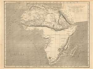
Africa.
sold
- Digital Map Information
- Suitable for large format printing
- DPI: 600
- File Size: 13.19 MB
- File Type: ZIP / TIFF
- ICC color profile embedded
- Delivered instantly via download link
This fascinating 1802 Arrowsmith map of Africa shows the results of first African expeditions of Scottish explorer Mungo Park, contrasting these with the vast expanses of Africa of which Europeans remained utterly ignorant. Virtually all of the information in this map pertaining to Western Africa reflects Park's 1795-97 exploration up the Gambia, into the interior, and along the Niger River. Park hard presumed the Niger to have its headwaters in a mountain range separating the Gold, Ivory and Slave coasts from north Africa: this mythical range, the Mountains of Kong, are shown here prominently; they extend eastward and connect with the equally mythical Mountains of the Moon, which were presumed by Ptolemy, and virtually every cartographer until well into the 19th century, to be the location of the source of the Nile. (more details)
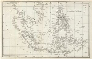
Chart of the East India Islands.
sold
- Digital Map Information
- Suitable for large format printing
- DPI: 300
- File Size: 6.77 MB
- File Type: ZIP / TIFF
- ICC color profile embedded
- Delivered instantly via download link
This is a fine example of the 1804 A. Arrowsmith map of the east Indies. Covers from the southern tip of Taiwan (Formosa) to the Indonesian island of Timor and from the Andaman and Nicobar Islands in the Indian Ocean as far east as Papua New Guinea. Includes ... (more details)
Great Salt Lake identifed according to American Indian reports as 'Pearl Shell Lake'.
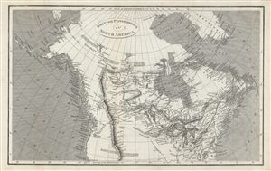
British Possessions in North America.
sold
- Digital Map Information
- Suitable for large format printing
- DPI: 300
- File Size: 9.16 MB
- File Type: ZIP / TIFF
- ICC color profile embedded
- Delivered instantly via download link
This is a fine example of the 1809 A. Arrowsmith map of the British possessions in North America, or Canada. Covers Canada, Alaska, and part of the United States from the Baffin Bay south as far as San Francisco - then an insignificant Spanish fortification. ... (more details)
First 'Great Game' Map.
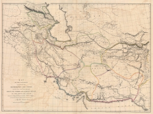
Map of the Countries lying between then Euphrates and Indus on the East and West, and the Oxus and Terek and Indian Ocean on the North and South.
sold
- Digital Map Information
- Suitable for large format printing
- File Size: 91.04 MB
- File Type: ZIP / TIFF
- ICC color profile embedded
- Delivered instantly via download link
This is John Macdonald Kinneir and Aaron Arrowsmith's 1813 large-scale map of Persia and parts of Afghanistan, Iraq, and Pakistan. This was the best obtainable map of Persia and Central Asia available in the leadup to the Great Game (1813 - 1895), and indeed, might be considered the first Great Game Map. It was issued at the end of the Russo-Persian War (1804 - 1813) and coincided with the Treaty of Gulistan, which opened up Persia for Russian invasion and set the stage for decades of Anglo-Russian conflict. (more details)
A detailed map of India as it came under company rule.
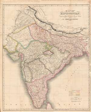
Map of Hindoostan drawn for Mill's History of British India.
sold
- Digital Map Information
- Suitable for large format printing
- DPI: 600
- File Size: 70.34 MB
- File Type: ZIP / TIFF
- ICC color profile embedded
- Delivered instantly via download link
Here is a vivid 1817 map of India made by Aaron Arrowsmith and engraved by Sidney Hall for the first edition of James Mill's The History of British India. This map was made as the British East India Company (E.I.C.) was quickly acquiring territory in India, mostly at the expense of the Maratha Confederacy, and gaining allies (protectorates) among the smaller 'princely states.' (more details)
Extremely rare early Mexican map of San Diego. Only four known examples!
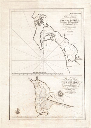
Plano del Puerto de San Diego de la California Septentrional. Plano del Puerto de San Blas en Las Costas del Estado de Xalisco.
sold
- Digital Map Information
- Suitable for large format printing
- Full resolution TIFF file
- ICC color profile embedded
- Delivered instantly via download link
This is an exceptionally rare and early map of San Diego Bay, California, and San Blas, Mexico, published in 1825 by order of Senor Don Guadalupe Victoria, the first president of the Republic of Mexico. Essentially two maps on a single sheet, this map ... (more details)
First printed map to focus on Oaxaca and Chiapas States.
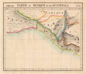
Partie du Mexique et de Guatemala. Amer. Sep. no. 71.
sold
- Digital Map Information
- Suitable for large format printing
- Full resolution TIFF file
- ICC color profile embedded
- Delivered instantly via download link
This is the 1827 Vandermaelen map of southern Mexico and western Guatemala. Vandermaelen's Atlas Universel was the first lithograph atlas as well as the first whose maps were printed on a universal scale. The present map was the first lithograph map of its region, and it is the earliest map to focus so narrowly on the states of Chiapas and Oaxaca. The map also includes the southern part of Tabasco, part of Veracruz, and part of Guatemala. The precursor is Arrowsmith's 1810 A New Map of Mexico and Adjacent Provinces Compiled from Original Documents, one of the first maps to present Alexander von Humboldt's mapping of Mexico. (more details)
First lithograph map of Guzarat and the region around Mumbai, India.
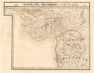
Guzerate, Chandeish et Aurungabad. Asie no. 93.
sold
- Digital Map Information
- Suitable for large format printing
- Full resolution TIFF file
- ICC color profile embedded
- Delivered instantly via download link
This is the 1827 Vandermaelen map of the Indian province of Gujarat, and the coastal part of what is now Maharashtra. It is the first large-scale atlas map to focus on the area, and the first to be executed in lithography. It includes the cities of Mumbai (Bombay on the map,) Surat (Soorut,) and Bhuj (Bhooj.) In the north, it shows part of the Great Rann of Kutch (the massive salt marsh in the Thar Desert) and extends as far south as Mhasala (Mheysala). The eastern reaches of the map include the cities of Ahmednagar, Aurangabad, and Indore in Madhya Pradesh. Topography is pictorial, illustrating the mountains and wetlands with hachures. Vandermaelen appears to have drawn heavily, but not universally, from the maps of Aaron Arrowsmith to inform his work here. (more details)
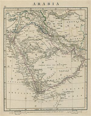
Arabia.
sold
- Digital Map Information
- Suitable for large format printing
- DPI: 300
- File Size: 4.34 MB
- File Type: ZIP / TIFF
- ICC color profile embedded
- Delivered instantly via download link
This is a rare example of Aaron Arrowsmith's 1828 map of Arabia. Centered on the Arabian Desert, the map covers from Caspian Sea and Syria to the Indian Ocean and Somalia. It shows Arabia and Parts of Persia, Syria and Kurdistan. The regional ... (more details)
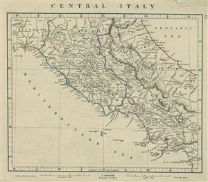
Central Italy.
sold
- Digital Map Information
- Suitable for large format printing
- DPI: 300
- File Size: 4.27 MB
- File Type: ZIP / TIFF
- ICC color profile embedded
- Delivered instantly via download link
This is a rare example of Aaron Arrowsmith's 1828 map of Central Italy. The map covers the central part of the Italy which includes parts of Tuscany, State of the Church and the Kingdom of Naples. The regional boundaries are colored and relief ... (more details)
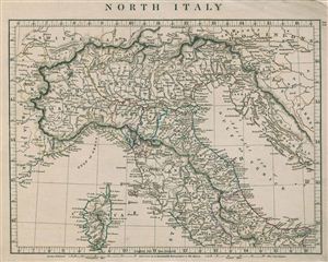
North Italy.
sold
- Digital Map Information
- Suitable for large format printing
- DPI: 300
- File Size: 4.87 MB
- File Type: ZIP / TIFF
- ICC color profile embedded
- Delivered instantly via download link
This is a rare example of Aaron Arrowsmith's 1828 map of Northern Italy. The map covers the island of Corsica and Northern Italy, depicting the territories of Tuscany, Modena, Parma, Kingdom of Sardinia, Lombardy, Venice and the State of the ... (more details)
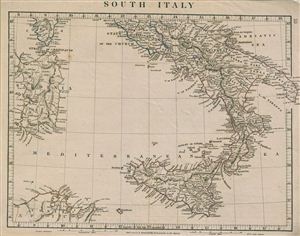
South Italy.
sold
- Digital Map Information
- Suitable for large format printing
- DPI: 300
- File Size: 4.3 MB
- File Type: ZIP / TIFF
- ICC color profile embedded
- Delivered instantly via download link
This is a rare example of Aaron Arrowsmith's 1828 map of Southern Italy. The map covers the Kingdom of Naples (a common reference for the 'Kingdom of the Two Sicilies'), which extended from the Papal States south to include all of Sicily. ... (more details)
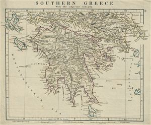
Southern Greece With the adjacent Islands.
sold
- Digital Map Information
- Suitable for large format printing
- DPI: 300
- File Size: 4.79 MB
- File Type: ZIP / TIFF
- ICC color profile embedded
- Delivered instantly via download link
This is a rare example of Aaron Arrowsmith's 1828 map of Southern Greece and adjacent Islands. The map covers the entire Peloponnese peninsula (known as 'Morea' in the Ottoman era) including the Islands of Cerigo, Zante, Ceppalonia and ... (more details)
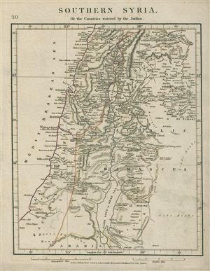
Southern Syria, or the countries watered by the Jordan.
sold
- Digital Map Information
- Suitable for large format printing
- DPI: 300
- File Size: 4.83 MB
- File Type: ZIP / TIFF
- ICC color profile embedded
- Delivered instantly via download link
This is a rare example of Aaron Arrowsmith's 1828 map of Southern Syria and the countries watered by the River Jordan. Centered on the River Jordan, the map covers the course of the river from Lake Hula to the Dead Sea and shows the ... (more details)
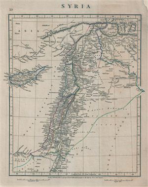
Syria.
sold
- Digital Map Information
- Suitable for large format printing
- DPI: 300
- File Size: 4.95 MB
- File Type: ZIP / TIFF
- ICC color profile embedded
- Delivered instantly via download link
This is a rare example of Aaron Arrowsmith's 1828 map of Syria. Centered on Syria, covers from Asia Minor to Egypt and Cyprus. During this time in history, Syria was part of the Ottoman Empire and was largely ignored by world ... (more details)
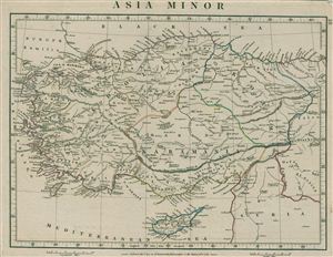
Asia Minor.
sold
- Digital Map Information
- Suitable for large format printing
- DPI: 300
- File Size: 4.86 MB
- File Type: ZIP / TIFF
- ICC color profile embedded
- Delivered instantly via download link
This is a rare example of Aaron Arrowsmith's 1828 map of Asia Minor. This map covers from the Grecian Archipelago to Syria and from the Black Sea to the Mediterranean Sea and Cyprus. The map shows many colonies under the ... (more details)
The only known example of an unrecorded 1838 American issue of A. Arrowsmith's Globular Map of the World. Shows Republic of Texas.
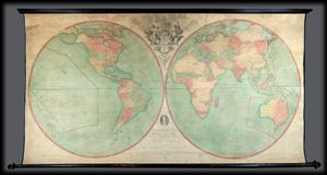
Arrowsmith's Map of the World on a Globular Projection, Exhibiting particularly the Nautical Researches of Captain James Cook, with all the recent Discoveries to the present Time, The Whole Engraved under the immediate Superintendence of, corrected and improved , by Samuel Lewis, Geographer.
sold
- Digital Map Information
- Suitable for large format printing
- File Size: 1.76 MB
- File Type: ZIP / TIFF
- ICC color profile embedded
- Delivered instantly via download link
A late unrecorded state of Arrowsmith's double hemisphere map of the world on a globular projection. Dating to 1838 and published well after the death of both Aaron Arrowsmith and Samuel Lewis, this is without a doubt ... (more details)
The only published map to exhibit the Jedediah Smith's seminal explorations in the American west.
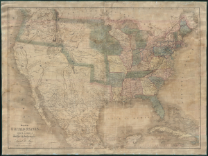
Map of the United States Of North America With parts of the Adjacent Countries.
sold
- Digital Map Information
- Suitable for large format printing
- DPI: 300
- File Size: 81.27 MB
- File Type: ZIP / TIFF
- ICC color profile embedded
- Delivered instantly via download link
This is David H. Burr's unobtainable 1839 wall map of the United States. Burr's map is significant as the only published example of Jedediah Smith's cartography, considered by C. I. Wheat a 'tour-de-force unprecedented and never equaled in the annals of Western exploration.' Smith's 'mountain man' cartography filled a gap in the mapping of the Transmississippi West - after Lewis and Clark (1804 - 06) but before the government-funded expeditions of Fremont (1840). (more details)
One of the earliest maps of the colony of New Zealand.
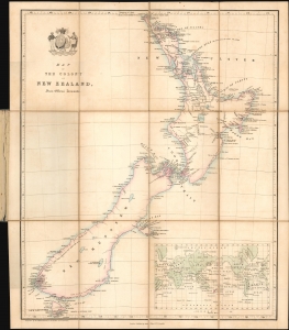
Map of the Colony of New Zealand from Official Documents.
sold
- Digital Map Information
- Suitable for large format printing
- File Size: 8.8 MB
- File Type: ZIP / TIFF
- ICC color profile embedded
- Delivered instantly via download link
This is a rare c. 1841 Smith, Elder and Company map of New Zealand issued soon after it became a British colony. Reduced from John Arrowsmith's May 2, 1841 map of the same title, this is among the earliest maps of the New Zealand colony. This Smith, Elder and Company edition was published by the New Zealand Company, as part of their efforts to promote settlement in the colony. Despite being derived from the first issue of Arrowsmith's map, the present work predates most examples of the Arrowsmith, which had a very long publication history. (more details)
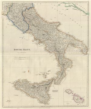
South Italy.
sold
- Digital Map Information
- Suitable for large format printing
- DPI: 300
- File Size: 12.92 MB
- File Type: ZIP / TIFF
- ICC color profile embedded
- Delivered instantly via download link
This is a scarce example of J. Arrowsmith's 1842 map of southern Italy. It covers the Kingdom if Naples (a common reference for the 'Kingdom of the Two Sicilies'), which extended from the Papal States south to include ... (more details)
Clear and specific map of the Virgin Islands and the Leeward Islands.
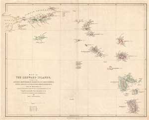
Map of the Leeward Islands; Comprising Antigua, Montserrat, Barbuda, St. Christopher, Nevis, Anguilla, Virgin Islands, and Dominica.
sold
- Digital Map Information
- Suitable for large format printing
- DPI: 300
- File Size: 7.18 MB
- File Type: ZIP / TIFF
- ICC color profile embedded
- Delivered instantly via download link
This is an 1842 John Arrowsmith map of the Virgin Islands and the Leeward Islands. The map depicts the Caribbean Sea from Anegada (a British possession) to Dominica (also a British possession) and from Puerto Rico ... (more details)
The earliest obtainable map of Wellington, capital of New Zealand. Shows Maori land grants.
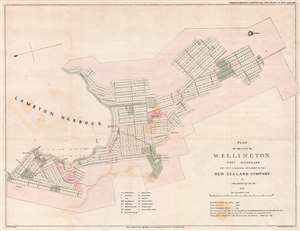
Plan of the City of Wellington Port Nicholson the First and Principal Settlement of the New Zealand Company.
sold
- Digital Map Information
- Suitable for large format printing
- DPI: 300
- File Size: 9.17 MB
- File Type: ZIP / TIFF
- ICC color profile embedded
- Delivered instantly via download link
This rare 1841 map of Wellington is one of the earliest obtainable plans of the modern-day capital of New Zealand. The map was surveyed on behalf of the New Zealand Land Company in 1840 by the first Surveyor-General of New Zealand, Felton Mathew. Mathew laid out the new city's road and grid system in precise detail. The street grid shown here is still reflected in the modern city. This map was issued in 1842 for the House of Commons, probably in conjunction with the Spain Commission, and based upon Mathew's 1840 manuscript survey. (more details)
New Zealand on the cusp of an immigration boom.
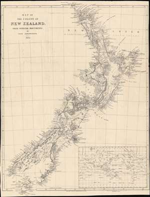
Map of the colony of New Zealand, from official documents.
sold
- Digital Map Information
- Suitable for large format printing
- DPI: 600
- File Size: 58.33 MB
- File Type: ZIP / TIFF
- ICC color profile embedded
- Delivered instantly via download link
This is a striking 1850 map of New Zealand by John Arrowsmith. It shows the colony in the early days of a surge of immigration from Britain and other British colonies that would drastically alter New Zealand society and environment. (more details)
Extremely rare English map of the Philippines.
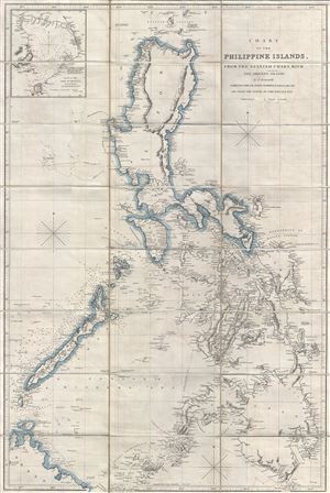
Chart of the Philippine Islands, from the Spanish Chart, witht Adjacent Islands.
sold
- Digital Map Information
- Suitable for large format printing
- File Size: 33.24 MB
- File Type: ZIP / TIFF
- ICC color profile embedded
- Delivered instantly via download link
An attractive example of Aaron Arrowsmith's scarce 1862 map of the Philippine Islands (Philippines). Centered on Manila, Arrowsmith's map covers the entirety of the Philippine Islands from northern Luzon to the ... (more details)