
Colton, Joseph Hutchins (sold) (J. H. Colton, Colton Ohman, G. W. and C. B. Colton)
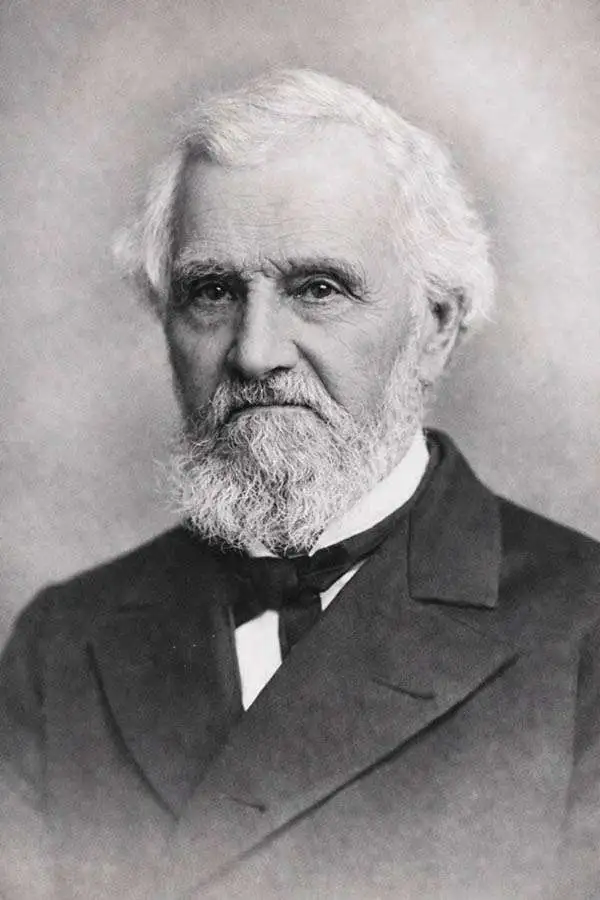
Joseph Hutchins Colton (July 5, 1800 - July 29, 1893), often publishing as J. H. Colton, was an important American map and atlas publisher active from 1833 to 1897. Colton's firm arose from humble beginnings when he moved to New York in 1831 and befriended the established engraver, Samuel Stiles. He worked under Stiles as the 'Co.' in Stiles and Co. from 1833 to 1836. Colton quickly recognized an emerging market in railroad maps and immigrant guides. Not a cartographer or engraver himself, Colton's initial business practice mostly involved purchasing the copyrights of other cartographers, most notably David H. Burr, and reissuing them with updated engraving and border work. His first maps, produced in 1833, were based on earlier Burr maps and depicted New York State and New York City. Between 1833 and 1855, Colton proceeded to publish a large corpus of guidebooks and railroad maps, which proved popular. In the early 1850s, Colton brought his two sons, George Woolworth Colton (1827 - 1901) and Charles B. Colton (1832 - 1916), into the map business. G. W. Colton, trained as a cartographer and engraver, was particularly inspired by the idea of creating a large and detailed world atlas to compete with established European firms for the U.S. market. In 1855, G.W. Colton issued volume one of the impressive two-volume Colton's Atlas of the World. Volume two followed a year later. Possibly because of the expense of purchasing a two-volume atlas set, the sales of the Atlas of the World did not meet Colton's expectations, and so, in 1856, the firm also issued the atlas as a single volume. The maps contained in this superb work were all original engravings, and most bear an 1855 copyright. All of the maps were surrounded by an attractive spiral motif border that would become a hallmark of Colton's atlas maps well into the 1880s. In 1857, the slightly smaller Colton's General Atlas replaced the Atlas of the World. Most early editions of the General Atlas published from 1857 to 1859 do not have the trademark Colton spiral border, which was removed to allow the maps to fit into a smaller format volume. Their customers must have missed the border because it was reinstated in 1860 and remained in all subsequent publications of the atlas. There were also darker times ahead; in 1858, Colton was commissioned at a sum of 25,000 USD by the government of Bolivia to produce and deliver 10,000 copies of a large format map of that country. Although Colton completed the contract in good faith, delivering the maps at his own expense, he was never paid by Bolivia, which was at the time in the midst of a series of national revolutions. Colton would spend the remainder of his days fighting with the Bolivian and Peruvian governments over this payment, and in the end, after a congressional intervention, he received as much as 100,000 USD in compensation. Nonetheless, at the time, it was a disastrous blow. J. H. Colton and Company is listed as one of New York's failed companies in the postal record of 1859. This led Colton into the arms of Alvin Jewett Johnson and Ross C. Browning. The 1859 edition of Colton's General Atlas lists Johnson and Browning as the 'Successor's to J. H. Colton' suggesting an outright buyout, but given that both companies continued to publish separately, the reality is likely more complex. Whatever the case may have been, this arrangement gave Johnson and Browning access to many of Colton's map plates and gave birth to Johnson's New Illustrated (Steel Plate) Family Atlas. The Johnson's Atlas was published parallel to Colton's atlases well into the 1880s. The Colton firm itself subsequently published several other atlases including an Atlas of America, the Illustrated Cabinet Atlas, the Octavo Atlas of the Union, and Colton's Quarto Atlas of the World. They also published a large corpus of wall maps, pocket maps, and guides. The last known publications of the Colton firm date to 1897 and include a map and a view, both issued in association with the Merchant's Association of New York. Alice M. Colton married August R. Ohman (May 3, 1859 - April 22, 1934) on January 5, 1897. In 1898, Ohman joined the Colton firm, which continued to publish as Colton, Ohman & Co. until 1901.
Colton, Joseph Hutchins (sold) is also known as: J. H. Colton, Colton Ohman, G. W. and C. B. Colton
Rare Colton edition of an iconic New York City map.
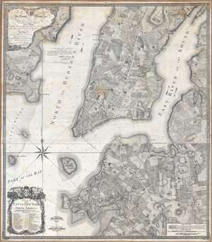
Plan of the city of New York in North America : surveyed in the years 1766 and 1767.
sold
- Digital Map Information
- Suitable for large format printing
- DPI: 300
- File Size: 61.52 MB
- File Type: ZIP / TIFF
- ICC color profile embedded
- Delivered instantly via download link
Known as the 'Ratzer Plan,' this is one of the most important, beautiful, and iconic colonial era maps of New York City, offered here in a stunning 1853 Colton restrike. This map was originally surveyed in 1767 by Bernard Ratzer, a lieutenant in the 'Royal American' regiment at the behest of Sir George Moore, governor of New York, who is sited in the cartouche. The map, which covers the southern part of Manhattan to about modern day 57th street, is a revision and expansion upon the flawed John Montresor plan of 1767. Across East River, a portion of Long Island is depicted, including most of Brooklyn and Parts of Long Island City. (more details)
Beers / Colton edition of the most important printed map of New York compiled during the Pre-Amercian Revolutionary War colonial period.
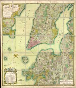
To his excellency Sr. Henry Moore, bart., captain general and governour in chief, in and over his majesty's province of New York and the territories depending thereon in America, chancellor and vice admiral of the same : This plan of the city of New York and its environs, survey'd and laid down ; is most humbly dedicated by his excellency's most obedt. humble servant B. Ratzer.
sold
- Digital Map Information
- Suitable for large format printing
- File Size: 111.61 MB
- File Type: ZIP / TIFF
- ICC color profile embedded
- Delivered instantly via download link
Known as the 'Ratzer Plan,' this is one of the most important, beautiful, and iconic colonial era maps of New York City, offered here in a stunning 1874 Colton / Beers restrike. This map was originally surveyed in 1767 by Bernard Ratzer, a lieutenant in the 'Royal American' regiment at the behest of Sir George Moore, governor of New York, who is sited in the cartouche. The map, which covers the southern part of Manhattan to about modern day 57th street, is a revision and expansion upon the flawed John Montresor plan of 1767. Across East River, a portion of Long Island is depicted, including most of Brooklyn and Parts of Long Island City. (more details)
The most significant map of Long Island in the 19th century.
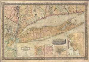
Map of Long Island, with the Environs of New-York and the Southern Part of Connecticut, compiled from Various Surveys and Documents.
sold
- Digital Map Information
- Suitable for large format printing
- DPI: 300
- File Size: 236.68 MB
- File Type: ZIP / TIFF
- ICC color profile embedded
- Delivered instantly via download link
A fine first edition example of John Calvin Smith and J. H. Colton's 1836 map of Long Island – one of Colton's first published maps. This is the largest, most significant, and most beautiful map of Long Island to be issued in the 19th century. Covering all of ... (more details)
The Colton Map - one of the largest and most beautiful maps of New York City pulished in the 19th century - in an unrecorded state.
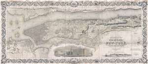
Topographical Map of the City and County of New-York, and the adjacent Country: With Views in the border of the principal Buildings and interesting Scenery of the Island.
sold
- Digital Map Information
- Suitable for large format printing
- DPI: 300
- File Size: 74.68 MB
- File Type: ZIP / TIFF
- ICC color profile embedded
- Delivered instantly via download link
Known as 'The Colton Map,' this is an unrecorded state of an 1840 map of New York City (Manhattan) by David H. Burr and John Hutchins Colton considered to be the finest and most decorative map of the city to appear in the 19th century. According to map historian ... (more details)
'Duty, Honor, Country'.
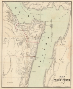
Map of West Point.
sold
- Digital Map Information
- Suitable for large format printing
- File Size: 9.18 MB
- File Type: ZIP / TIFF
- ICC color profile embedded
- Delivered instantly via download link
A rare 1844 map of the U.S. Military Academy at West Point, New York, by J. H. Colton. (more details)
Fascinating and influential representation of world history.
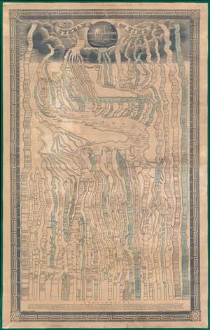
Stream of Time or Chart of universal history, from the original German of Strass.
sold
- Digital Map Information
- Suitable for large format printing
- Full resolution TIFF file
- ICC color profile embedded
- Delivered instantly via download link
A remarkable 1845 chart of world history covering the passage of time from creation (4004 BC) to roughly 1845. (more details)
A highly decorative map of New York City.
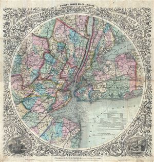
Map of The Country Thirty Three Miles Around The City of New York.
sold
- Digital Map Information
- Suitable for large format printing
- File Size: 27.42 MB
- File Type: ZIP / TIFF
- ICC color profile embedded
- Delivered instantly via download link
This is the extremely rare 1878 edition of one of the most beautiful pocket maps of New York made in the 19th century: Colton's Thirty Three Miles Around the City of New York . Covers New York City and vicinity as far south as Ocean County, NY, as far east as ... (more details)
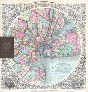
Map Of The Country Thirty Three Miles Around The City Of New York.
sold
- Digital Map Information
- Suitable for large format printing
- File Size: 12.08 MB
- File Type: ZIP / TIFF
- ICC color profile embedded
- Delivered instantly via download link
This is the extremely rare 1879 edition of one of the most beautiful pocket maps of New York made in the 19th century: Colton's Thirty Three Miles Around the City of New York. Covers New York City and vicinity as far south as Ocean County, NY, as far east as ... (more details)
An early example of one of the most unusal and attractive maps of New York City every printed.

Map of The Country Thirty Three Miles Around The City of New York.
sold
- Digital Map Information
- Suitable for large format printing
- DPI: 300
- File Size: 22.93 MB
- File Type: ZIP / TIFF
- ICC color profile embedded
- Delivered instantly via download link
This is the extremely rare 1848 edition of one of the most beautiful pocket maps of New York made in the 19th century: Colton's Thirty Three Miles Around the City of New York . Covers New York City and vicinity as far south as Ocean County, New Jersey, as ... (more details)
'First Colton map showing the gold fields.' - Streeter
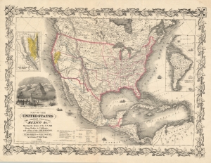
Map of the United States The British Provinces Mexico and c. Showing the Routes of the U.S. Mail Steam Packets to California and a Plan of the Gold Region.
sold
- Digital Map Information
- Suitable for large format printing
- DPI: 600
- File Size: 72.59 MB
- File Type: ZIP / TIFF
- ICC color profile embedded
- Delivered instantly via download link
This is J. H. Colton and J. M. Atwood's 1849 map of the United States, issued to illustrate routes to the newly discovered gold fields in California. Issued immediately in the wake of the gold discovery at Sutter's Mill, this is the first Colton map to illustrate the California Gold Fields. It also Texas in its largest configuration, immediately after the Treaty of Guadalupe Hidalgo. (more details)
Earliest known iternation of Colton's iconic Comparative Mountains and Rivers Chart.
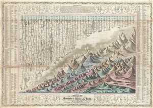
A Combined View of the Principal Mountains and Rivers in the World with Tables showing their relative Heights and Lengths.
sold
- Digital Map Information
- Suitable for large format printing
- Full resolution TIFF file
- ICC color profile embedded
- Delivered instantly via download link
A scarce 1849 pocket format edition of Colton's Mountains and Rivers chart. This is the earliest known iteration of Colton's iconic Mountains and Rivers chart which would later be popularized in his 1855 Atlas of the World and in Johnson's 1860 New Family ... (more details)
The Mosquito Kingdom question.
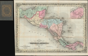
Map of Central America 1851.
sold
- Digital Map Information
- Suitable for large format printing
- DPI: 600
- File Size: 25.59 MB
- File Type: ZIP / TIFF
- ICC color profile embedded
- Delivered instantly via download link
A rare map easily dismissed but of great significance, this is J. H. Coton's 1851 separate-issue map of Central America illustrating the Mosquito Coast / Miskito Kingdom conflict associated with the development of an interoceanic canal. (more details)
Earliest known iternation of Colton's iconic Comparative Mountains and Rivers Chart.
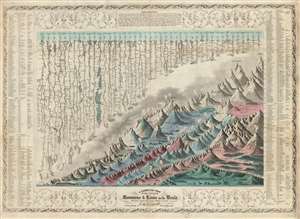
A Combined View of the Principal Mountains and Rivers in the World with Tables showing their relative Heights and Lengths.
sold
- Digital Map Information
- Suitable for large format printing
- DPI: 600
- File Size: 46.9 MB
- File Type: ZIP / TIFF
- ICC color profile embedded
- Delivered instantly via download link
The first 1852 separate-issue edition of Colton's Mountains and Rivers chart. This is the earliest known iteration of Colton's iconic comparative infographic chart illustrating relative sizes of great mountains and rivers. The chart was subsequently reduced in 1855 and reissued in multiple editions for Colton's popular n his 1855 Atlas of the World and later in in Johnson's 1860 New Family Atlas. The map is surrounded by decorative embellishments and several layers of border. To the right and left of the map there is a table identifying the individual mountains via a numerical cross reference system.
This is the finest American Mountains and Rivers chart of the mid-19th century. It depicts the relative distances of the world's great rivers and the relative heights of the world's great mountains. Included are a multitude of details regarding the heights of important cities, glaciers, volcanoes, and tree lines. Also shows Niagara Falls, the Great Pyramid, St. Peter's Basilica in Rome and St. Paul's in London. The chart notes curiosities that would have been relevant at the time, such as 'The Greatest Altitude of the Growth of Peruvian Bark', 'The Glacier of Maladetts', the 'Table Land of Pamar', and the 'Greatest Altitude attained by Humboldt 19400 ft'. Replete with additional geographical errors and misconceptions common to the period. (more details)
This is the finest American Mountains and Rivers chart of the mid-19th century. It depicts the relative distances of the world's great rivers and the relative heights of the world's great mountains. Included are a multitude of details regarding the heights of important cities, glaciers, volcanoes, and tree lines. Also shows Niagara Falls, the Great Pyramid, St. Peter's Basilica in Rome and St. Paul's in London. The chart notes curiosities that would have been relevant at the time, such as 'The Greatest Altitude of the Growth of Peruvian Bark', 'The Glacier of Maladetts', the 'Table Land of Pamar', and the 'Greatest Altitude attained by Humboldt 19400 ft'. Replete with additional geographical errors and misconceptions common to the period. (more details)
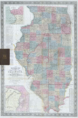
Colton's New Sectional Map of the State of Illinois. Complied from the United States Surveys. Also exhibiting the Internal Improvements, distances between Towns, Villages, & Post Offices: the outlines of Prairies, woodlands, Marshes & the lands donated to the State by the Genl. Govt for the purpose of Internal Improvement.
sold
- Digital Map Information
- Suitable for large format printing
- DPI: 300
- File Size: 28.42 MB
- File Type: ZIP / TIFF
- ICC color profile embedded
- Delivered instantly via download link
This is an extremely scarce 1852 pocket issue map of the state of Illinois by published by J. H. Colton and prepared by J. M Peck, John Messinger, and A. J. Mathewson. Depicts the whole of Illinois with inset maps of 'the vicinity of Galena, the Lead ... (more details)
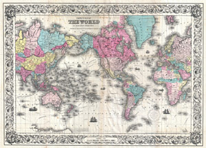
Colton's Map of the World on Mercator's Projection. / Printed for J. & H. Miller, Columbus, Ohio.
sold
- Digital Map Information
- Suitable for large format printing
- DPI: 300
- File Size: 31.26 MB
- File Type: ZIP / TIFF
- ICC color profile embedded
- Delivered instantly via download link
A rare and extremely attractive folding map of the world by J. H. Colton. This map, comprising the entire world, was prepared by Colton in 1852 for issue in J. & H. Miller publication in the 1855 edition of Blake's Volume of the World… . In ... (more details)
Spectacular dissected wall map of the Untied State revealing a remarkable and ephemeral deportment of the Plains States.

Colton's map of the United States of America, the British provinces, Mexico and the West Indies. Showing the country from the Atlantic to the Pacific Ocean.
sold
- Digital Map Information
- Suitable for large format printing
- DPI: 300
- File Size: 126.09 MB
- File Type: ZIP / TIFF
- ICC color profile embedded
- Delivered instantly via download link
This is a large 1853/54 J. H. Colton dissected wall map of the United States with significant Trans-Mississippi and Great Plains content. This is the largest and most significant of the three separate issue maps of the United States Colton ... (more details)
Spectacular dissected wall map of the Untied State revealing a remarkable and ephemeral deportment of the Plains States.
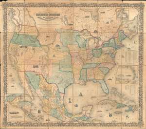
Colton's map of the United States of America, the British provinces, Mexico and the West Indies. Showing the country from the Atlantic to the Pacific Ocean.
sold
- Digital Map Information
- Suitable for large format printing
- DPI: 600
- File Size: 272.72 MB
- File Type: ZIP / TIFF
- ICC color profile embedded
- Delivered instantly via download link
This is a large 1853/54 J. H. Colton dissected wall map of the United States with significant Trans-Mississippi and Great Plains content. This is the largest and most significant of the three separate issue maps of the United States Colton issued in the 1850s. It covers the entire United States as well as most of Mexico, parts of southern Canada, and the Greater Antilles. Central America and the lower Antilles appear in insets. There are numerous ethnographical, geographical, and historical vignettes throughout including a wagon train, American Indians hunting, ships, palm trees, volcanoes, and more. (more details)
Early edition of the most unusual and decorative pocket maps of New York City to appear in the 19th century.
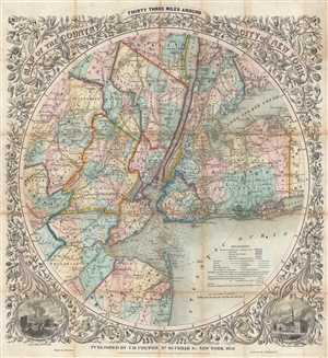
Map of The Country Thirty Three Miles Around The City of New York.
sold
- Digital Map Information
- Suitable for large format printing
- DPI: 300
- File Size: 23.06 MB
- File Type: ZIP / TIFF
- ICC color profile embedded
- Delivered instantly via download link
This is the extremely rare 1853 edition of one of the most beautiful pocket maps of New York made in the 19th century: Colton's Thirty Three Miles Around the City of New York . The map depicts New York City and vicinity as far south as ... (more details)
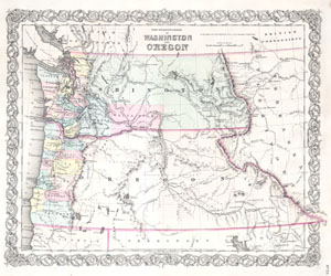
The Territories of Washington and Oregon.
sold
- Digital Map Information
- Suitable for large format printing
- DPI: 300
- File Size: 3.73 MB
- File Type: ZIP / TIFF
- ICC color profile embedded
- Delivered instantly via download link
An attractive 1853 Colton Map Washington and Oregon, inclusive of the modern day states of Idaho, Montana & Wyoming. Colton maps of this region exhibit dramatic changes from year to year, indicating actual changes in the expansion and ... (more details)
An ephemeral period in the American West following the Kansas-Nebraska Act.
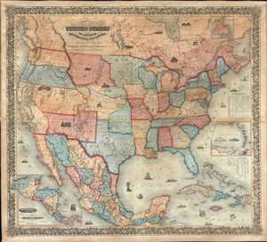
Colton's map of the United States of America, the British provinces, Mexico and the West Indies. Showing the country from the Atlantic to the Pacific Ocean.
sold
- Digital Map Information
- Suitable for large format printing
- DPI: 600
- File Size: 205.98 MB
- File Type: ZIP / TIFF
- ICC color profile embedded
- Delivered instantly via download link
This is a large 1854 J. H. Colton wall map of the United States with significant Trans-Mississippi and Great Plains content. This is the largest and most significant of the three separate issue maps of the United States Colton issued in the 1850s. It covers the entire United States as well as most of Mexico, parts of southern Canada, and the Greater Antilles. Central America and the lower Antilles appear in insets. There are numerous ethnographical, geographical, and historical vignettes throughout including a wagon train, American Indians hunting, ships, palm trees, volcanoes, and more. (more details)
Remarkable and highly decorative early American wall sized map of the world.
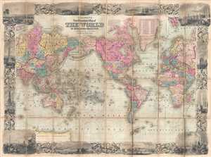
Colton's New Illustrated Map of the World on Mercator's Projection.
sold
- Digital Map Information
- Suitable for large format printing
- DPI: 300
- File Size: 37.61 MB
- File Type: ZIP / TIFF
- ICC color profile embedded
- Delivered instantly via download link
A rare and highly attractive dissected case-map edition of Colton's New Illustrated Map of the World . Centered on America, this grand map presents the entire world on a Mercator Projection. Countries, continents, and sometimes ... (more details)
Utilizes ancient Biblical nomenclature when labeling locations around the region.
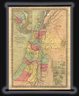
This is an 1858 Joseph Hutchins Colton wall map of Israel, Palestine, or the Holy Land. The map depicts the region from modern-day Lebanon and Syria to southern Israel and from the Mediterranean Sea to western Jordan. The clear ... (more details)
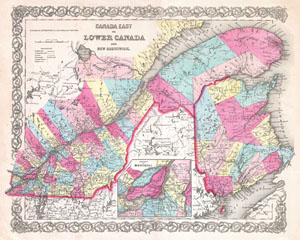
Canada East or Lower Canada and New Brunswick.
sold
- Digital Map Information
- Suitable for large format printing
- File Size: 10.28 MB
- File Type: ZIP / TIFF
- ICC color profile embedded
- Delivered instantly via download link
This is the very rare 1854 issue of J. H. Colton map of Canada East or Lower Canada. Covers what is today Montreal, Quebec, and New Brunswick. Follows the St. Lawrence River Valley from Montreal eastward to the Gulf of St. ... (more details)
The transmississippi in transition.
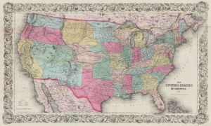
The United States of America 1854.
sold
- Digital Map Information
- Suitable for large format printing
- File Size: 70.8 MB
- File Type: ZIP / TIFF
- ICC color profile embedded
- Delivered instantly via download link
A rare example of J.H. Colton's 1854 map of the United States of America. This is the first iteration of Colton's United States map, issued separately and predating its reduced issue in the iconic atlas of 1855. Among other features, it is notable for providing a snapshot of the rapid territorial changes on the Great Plains and the Western U.S. The early manifestation of Nebraska Territory with unusual territorial, a late curious appearance of Northwest Territory, and the still-uncertain status of the lands acquired through the Gadsden Purchase are particularly noteworthy. (more details)
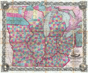
Colton's Railroad & Township Map of the Western States compiled from the United States Surveys.
sold
- Digital Map Information
- Suitable for large format printing
- Full resolution TIFF file
- ICC color profile embedded
- Delivered instantly via download link
An extremely attractive example of Colton's 1854 pocket map format railroad and township map of the Western States. Covers the states of Ohio, Kentucky, Illinois, Indiana, Missouri Iowa Michigan and Wisconsin with parts of ... (more details)
By stage, canal, and railroad from Ohio to Iowa.
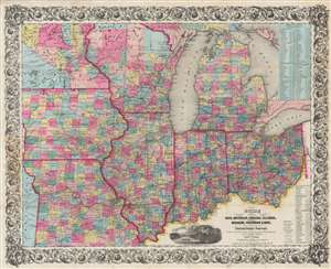
Guide Through Ohio, Michigan, Indiana, Illinois, Missouri, Wisconsin, and Iowa. Showing the Township lines of the United States Surveys, Location of Cities, Towns, Villages, Post Hamlets, Canals, Rail and Stage Roads.
sold
- Digital Map Information
- Suitable for large format printing
- DPI: 600
- File Size: 101.01 MB
- File Type: ZIP / TIFF
- ICC color profile embedded
- Delivered instantly via download link
This is an 1854 John Calvin Smith and John H. Colton map of Ohio, Michigan, Indiana, Illinois, Missouri, Wisconsin, and Iowa, along with part of Minnesota. Counties are shaded and township grids are illustrated where they have been surveyed. Cities and towns are labeled throughout, along with rivers, lakes, and creeks. (more details)
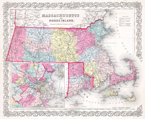
Massachusetts and Rhode Island.
sold
- Digital Map Information
- Suitable for large format printing
- File Size: 6.37 MB
- File Type: ZIP / TIFF
- ICC color profile embedded
- Delivered instantly via download link
This is Colton's 1855 hand colored map of the states of Massachusetts and Rhode Island. Covers the region in considerable detail including Nantucket and Marthas Vineyard. Large inset of the Environs of Boston. Dated and ... (more details)
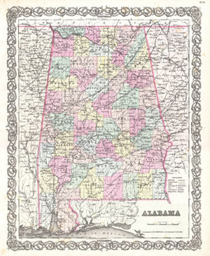
Alabama.
sold
- Digital Map Information
- Suitable for large format printing
- File Size: 8.05 MB
- File Type: ZIP / TIFF
- ICC color profile embedded
- Delivered instantly via download link
A beautiful 1855 first edition example of Colton's map of Mississippi. Covers the entire state as well as adjacent parts of Georgia and Mississippi. Like most of Colton's state maps, this map is largely derived from an ... (more details)
Railroads of New England.
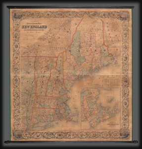
Colton's Railroad and Township Map of New England with Portions of the State of New York, The British Provinces, and co.
sold
A large and impressive 1855 wall map of New England published jointly by Joseph H. Colton of New York and Charles C. Hall of Portland, Maine. The map highlights the region's burgeoning railroad network, perhaps to illuminate the public on the new potential for travel. (more details)
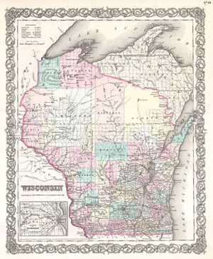
Wisconsin.
sold
- Digital Map Information
- Suitable for large format printing
- File Size: 7.53 MB
- File Type: ZIP / TIFF
- ICC color profile embedded
- Delivered instantly via download link
A beautiful 1855 first edition example of Colton's map of Wisconsin. Covers the entire state as well as adjacent parts of Minnesota and upper Michigan. Like most of Colton's state maps, this map is largely derived from ... (more details)
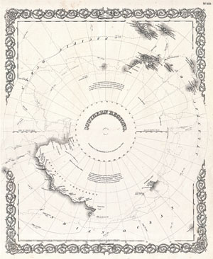
Southern Regions.
sold
- Digital Map Information
- Suitable for large format printing
- File Size: 6.02 MB
- File Type: ZIP / TIFF
- ICC color profile embedded
- Delivered instantly via download link
An excellent example of Colton's c. 1855 map of the South Pole, Antarctica, or the Southern Polar Regions. Sows the Great Southern Continent with both solid and tentatively sketched in borders. Notes the travels of ... (more details)
Colton's depiction of Argentina, Chile and Uruguay.
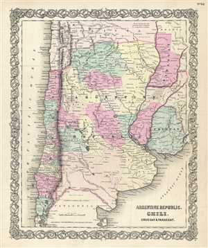
Argentine Republic, Chili, Uruguay and Paraguay.
sold
- Digital Map Information
- Suitable for large format printing
- File Size: 7.83 MB
- File Type: ZIP / TIFF
- ICC color profile embedded
- Delivered instantly via download link
An excellent 1856 edition example of Colton's map of Chile, Argentina, Paraguay and Uruguay. This map covers from Bolivia to Patagonia and from the Pacific to the Atlantic. Colton notes Bolivia's claims to the ... (more details)
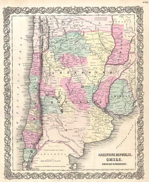
Argentine Republic, Chili, Uruguay and Paraguay.
sold
- Digital Map Information
- Suitable for large format printing
- File Size: 7.54 MB
- File Type: ZIP / TIFF
- ICC color profile embedded
- Delivered instantly via download link
An excellent first edition example of Colton's rare 1855 map Chile, Argentina, Paraguay and Uruguay. Covers from Bolivia to Patagonia and from the Pacific to the Atlantic. Shows Bolivia's claims to the ... (more details)
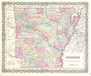
Arkansas.
sold
- Digital Map Information
- Suitable for large format printing
- File Size: 7.76 MB
- File Type: ZIP / TIFF
- ICC color profile embedded
- Delivered instantly via download link
A beautiful 1855 first edition example of Colton's map of Arkansas. Covers the state in full as well as parts of the adjacent states. Like most of Colton's state maps, this map is largely derived from ... (more details)
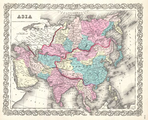
Asia.
sold
- Digital Map Information
- Suitable for large format printing
- File Size: 8.4 MB
- File Type: ZIP / TIFF
- ICC color profile embedded
- Delivered instantly via download link
A beautiful 1855 first edition example of Colton's map of Asia. Covers from the Mediterranean to Siberia and from the Arctic to Singapore. Color coded according to regions. Includes Tibet, Korea and ... (more details)
Rare first edition of Colton's important Australia series.
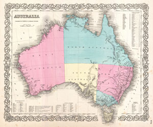
Australia.
sold
- Digital Map Information
- Suitable for large format printing
- File Size: 6.84 MB
- File Type: ZIP / TIFF
- ICC color profile embedded
- Delivered instantly via download link
A beautiful 1855 first edition example of Colton's map of Australia. Covers the entire continent including Tasmania or Van Diemen's Land. Colton's mappings of Australia, updated annually through the ... (more details)
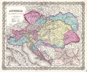
Austria.
sold
- Digital Map Information
- Suitable for large format printing
- File Size: 6.72 MB
- File Type: ZIP / TIFF
- ICC color profile embedded
- Delivered instantly via download link
This rare hand colored map of Austria is a copper plate engraving dating to 1856. Produced by the important mid 19th century American map publisher J. H. Colton. Covers the Austria, Hungary, the ... (more details)
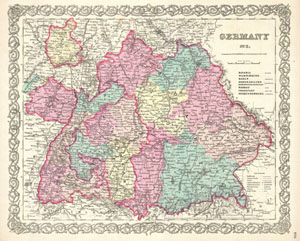
Germany No. 3.
sold
- Digital Map Information
- Suitable for large format printing
- File Size: 8.59 MB
- File Type: ZIP / TIFF
- ICC color profile embedded
- Delivered instantly via download link
A beautiful 1855 first edition example of Colton's map of southern Germany. Covers the 19th century German provinces of Bavaria, Wurttemberg, Baden and Pfalz, as well as numerous smaller regions. ... (more details)
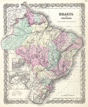
Brazil and Guayana.
sold
- Digital Map Information
- Suitable for large format printing
- File Size: 8.36 MB
- File Type: ZIP / TIFF
- ICC color profile embedded
- Delivered instantly via download link
An excellent first edition example of Colton's rare 1855 map Brazil, British Guyana, French Guyana (Cayenne), and Dutch Guyana (Surinam). Covers from Venezuela to Uruguay and from the Amazon ... (more details)
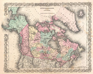
British, Russian and Danish Possessionsin North America.
sold
- Digital Map Information
- Suitable for large format printing
- File Size: 8.54 MB
- File Type: ZIP / TIFF
- ICC color profile embedded
- Delivered instantly via download link
An excellent first edition example of Colton's rare map documenting Canada, or more specifically, British, Russian, and Danish holdings in North America. Covers the continent from modern day ... (more details)
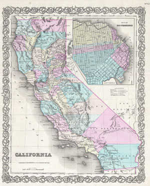
California. City of San Francisco.
sold
- Digital Map Information
- Suitable for large format printing
- File Size: 8.64 MB
- File Type: ZIP / TIFF
- ICC color profile embedded
- Delivered instantly via download link
Issued roughly six years after the 1849 California Gold Rush, this is a beautiful 1855 first edition first state example of Colton's map of California. Colton's California with its San ... (more details)
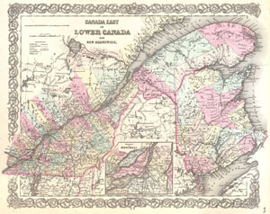
Canada East or Lower Canada and New Brunswick.
sold
- Digital Map Information
- Suitable for large format printing
- File Size: 8.26 MB
- File Type: ZIP / TIFF
- ICC color profile embedded
- Delivered instantly via download link
An excellent first edition example of Colton's rare map of Quebec and New Brunswick. Covers what at the time was called Lower or East Canada from Montreal in the southwest to the mouth ... (more details)
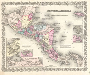
Central America.
sold
- Digital Map Information
- Suitable for large format printing
- File Size: 8.72 MB
- File Type: ZIP / TIFF
- ICC color profile embedded
- Delivered instantly via download link
A beautiful 1855 first edition example of Colton's map of the Central America and Jamaica. Covers from the Yucatan southeast as far as Panama and north as far as Jamaica. Like most ... (more details)
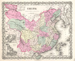
China.
sold
- Digital Map Information
- Suitable for large format printing
- File Size: 7.48 MB
- File Type: ZIP / TIFF
- ICC color profile embedded
- Delivered instantly via download link
A beautiful 1855 first edition example of Colton's map of China, Korea, and Taiwan. Covers from Mongolia to Hainan and from Tibet to Korea. Color coded according to various ... (more details)
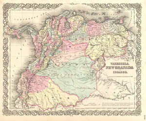
Venezuela, New Granada and Ecuador.
sold
- Digital Map Information
- Suitable for large format printing
- File Size: 7.69 MB
- File Type: ZIP / TIFF
- ICC color profile embedded
- Delivered instantly via download link
An excellent first edition example of Colton's rare 1855 map Venezuela, New Granada (Columbia), and Ecuador. Covers from the Pacific to Guyana and from Peru to the ... (more details)
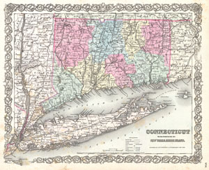
Connecticut with portions of New York and Rhode Island.
sold
- Digital Map Information
- Suitable for large format printing
- File Size: 8.86 MB
- File Type: ZIP / TIFF
- ICC color profile embedded
- Delivered instantly via download link
A beautiful 1855 first edition example of Colton's map of Connecticut and Long Island. Covers the entire state as well as the whole of Long Island, New York, Block ... (more details)
One of the most attractive American atlas maps of Cuba to appear in the 19th century.
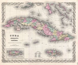
Cuba Jamaica and Porto Rico.
sold
- Digital Map Information
- Suitable for large format printing
- File Size: 8.33 MB
- File Type: ZIP / TIFF
- ICC color profile embedded
- Delivered instantly via download link
A beautiful 1855 first edition example of Colton's map of Cuba, Jamaica, Porto Rico and the Bahamas. Centered on Cuba, this map extends north to include the ... (more details)
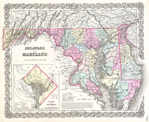
Delaware and Maryland.
sold
- Digital Map Information
- Suitable for large format printing
- File Size: 7.79 MB
- File Type: ZIP / TIFF
- ICC color profile embedded
- Delivered instantly via download link
A beautiful 1855 first edition example of Colton's map of Delaware. Covers both Delaware and Maryland as well as parts of the adjacent states. Like most of ... (more details)
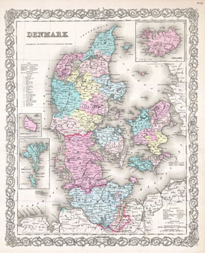
Denmark.
sold
- Digital Map Information
- Suitable for large format printing
- File Size: 9.54 MB
- File Type: ZIP / TIFF
- ICC color profile embedded
- Delivered instantly via download link
A beautiful 1855 first edition example of Colton's map of Denmark. Color coded according to region. Features three inset maps. Upper right hand inset ... (more details)
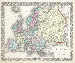
Europe
sold
- Digital Map Information
- Suitable for large format printing
- File Size: 8.61 MB
- File Type: ZIP / TIFF
- ICC color profile embedded
- Delivered instantly via download link
A beautiful 1855 first edition example of Colton's map of Europe. Covers the entire continent from the Caspian Sea to Portugal, including the British ... (more details)