
NEW ACQUISITIONS
Yokohama when it was Japan's most cosmopolitan and industrialized city.
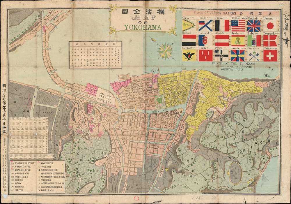
Map of Yokohama. / 横濱全圖
$750.00
Acquire
- Digital Map Information
- Suitable for large format printing
- Full resolution TIFF file
- ICC color profile embedded
- Delivered instantly via download link
This is a scarce 1892, or Meiji 25, Tomigorō Ozaki (尾崎富五郎) map of Yokohama, Japan, then Japan's primary international port. The map orients Yokohama to the northeast, with the city's shoreline at top. At the time, Yokohama was Japan's most international and industrialized city, with foreign settlements extending form the Bluff to Yokohama Chinatown. The cartographer stresses the internationality of the settlement, with a chart of flags at left center representing the largest foreign contingents in Yokohama. The vexillology chart features the flags of 18 countries, among them the United States, Persia, Rome (the Pope), and China. Despite clearly being uncomfortable with Latin characters, Ozaki has added English text here and there. He seems to have placed the capital 'D' shape backwards several times in the imprint below the flag chart. (more details)
A Maladroit Meeting between Britain and China.
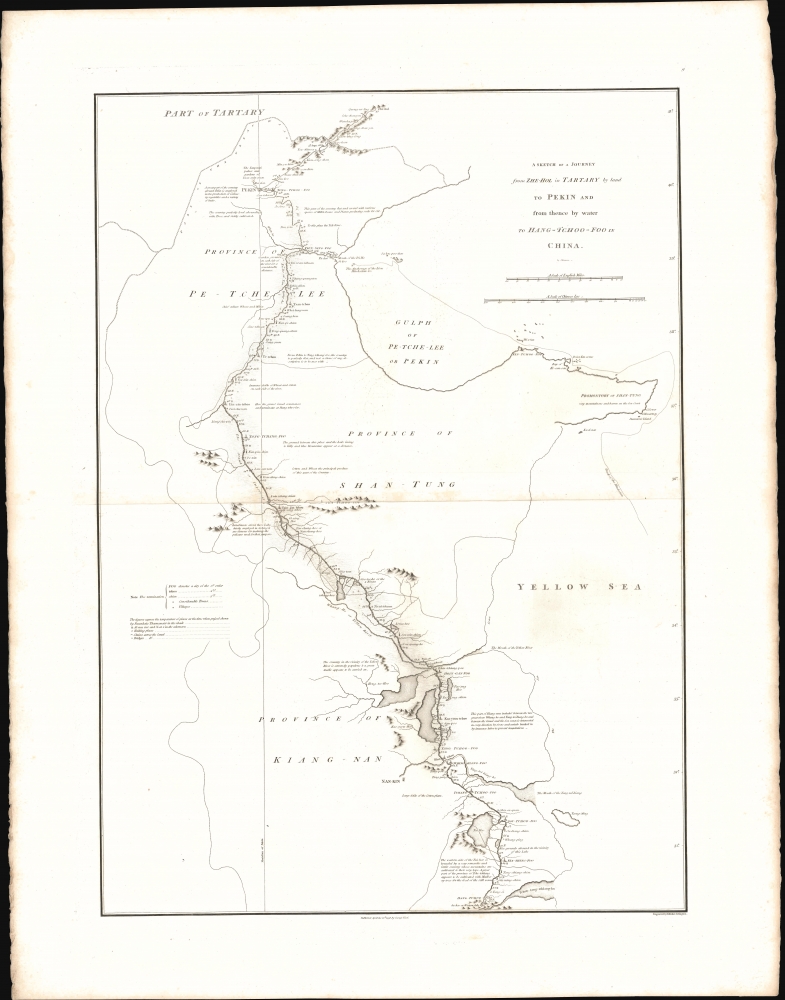
A sketch of a journey from Zhe-Hol in Tartary by land to Pekin and from thence by water to Hang-Tchoo-Foo in China.
$375.00
Acquire
- Digital Map Information
- Suitable for large format printing
- File Size: 13.55 MB
- File Type: ZIP / TIFF
- ICC color profile embedded
- Delivered instantly via download link
This important 1796 John Barrow map of China traces the course of the British Macartney Mission after its unsuccessful meeting with the Qing Emperor Qianlong. As a diplomatic effort, the embassy failed completely, the result of mutual misunderstanding and mistrust between the Qing Court and the British. But, as this map demonstrates, the mission did allow the British to gain a much better direct understanding China's geography (more details)
Rare Pictorial Map of Paris and Environs.

Ile de France.
$300.00
Acquire
- Digital Map Information
- Suitable for large format printing
- File Size: 14.46 MB
- File Type: ZIP / TIFF
- ICC color profile embedded
- Delivered instantly via download link
This colorful pictorial map of Ile-de-France, including Paris, was drawn by Jacques Liozu in 1951. (more details)
Niagara Falls! Depicts both sets of double locks in detail along with a profile diagram of a lock.
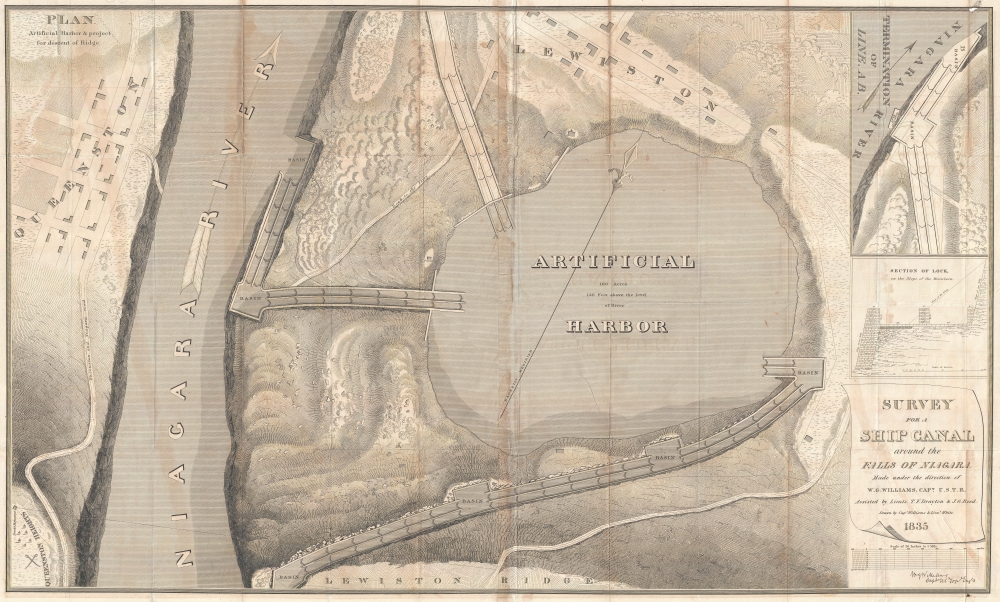
Survey for a Ship Canal around the Falls of Niagara. Plan Artificial Harbor and Project for Descent of Ridge.
$250.00
Acquire
- Digital Map Information
- Suitable for large format printing
- DPI: 300
- File Size: 46.22 MB
- File Type: ZIP / TIFF
- ICC color profile embedded
- Delivered instantly via download link
This is the 1835 William G. Williams map of a proposed artificial harbor to be used in conjunction with two of the proposed routes for a canal between Lake Erie and Lake Ontario. The harbor was ultimately constructed and is now the Niagara Water Reservoir. The map depicts the area from Queenston, Ontario, to just to the right of the proposed artificial harbor and from Lewiston, New York, to Lewiston Ridge, which the canal would have to descend. (more details)
First flight over Antarctica.

Wilkins-Hearst Antarctic Expedition 1928-1929. Map of the Antarctic.
$5,000.00
Acquire
- Digital Map Information
- Suitable for large format printing
- Full resolution TIFF file
- ICC color profile embedded
- Delivered instantly via download link
A rare 1929 American Geographical Society wall map of Antarctica issued to celebrate the 1928-29 Wilkins-Hearst Expedition (1928 - 29), wherein George Hubert Wilkins (1888 - 1958) accomplished the first Antarctic flight, revealing some 1000 miles of uncharted territory. (more details)
Dramatic view of Long Island.
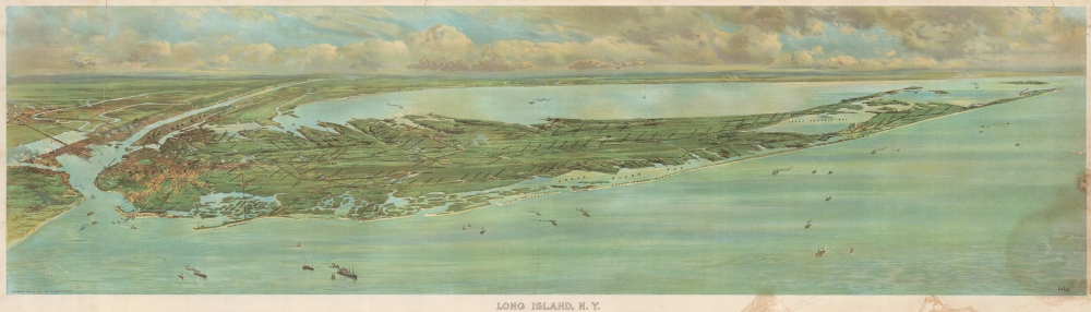
Long Island, N.Y.
$4,500.00
Acquire
- Digital Map Information
- Suitable for large format printing
- File Size: 43.06 MB
- File Type: ZIP / TIFF
- ICC color profile embedded
- Delivered instantly via download link
This is a dramatic 1902 F. W. Fells chromolithograph panoramic view of Long Island, New York. The stunning view was issued to promote the Long Island Railroad and Long Island in general, at the time undergoing an explosion of development and economic growth. (more details)
Pennsylvania Anthracite Boom - driving the Industrial Revolution.
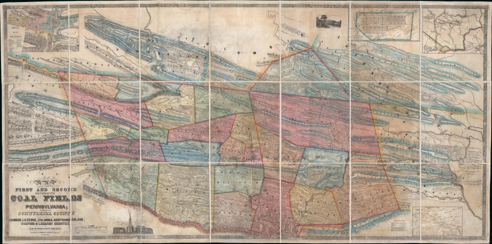
Map of the First and Second Anthracite Coal Fields in Pennsylvania; embracing Schuylkill County and parts of Carbon, Luzerne, Columbia, Northumberland, Dauphin and Lebanon Counties.
$3,500.00
Acquire
- Digital Map Information
- Suitable for large format printing
- DPI: 600
- File Size: 211.86 MB
- File Type: ZIP / TIFF
- ICC color profile embedded
- Delivered instantly via download link
This is a large-scale 1849 Peter W. Sheafer and Robert P. Smith map of northeastern Pennsylvania illustrating the peak of the Anthracite Coal Boom - one of the driving factors of American industrial development in the 19th century. (more details)
Influential, orderly view of Biblical Jerusalem.
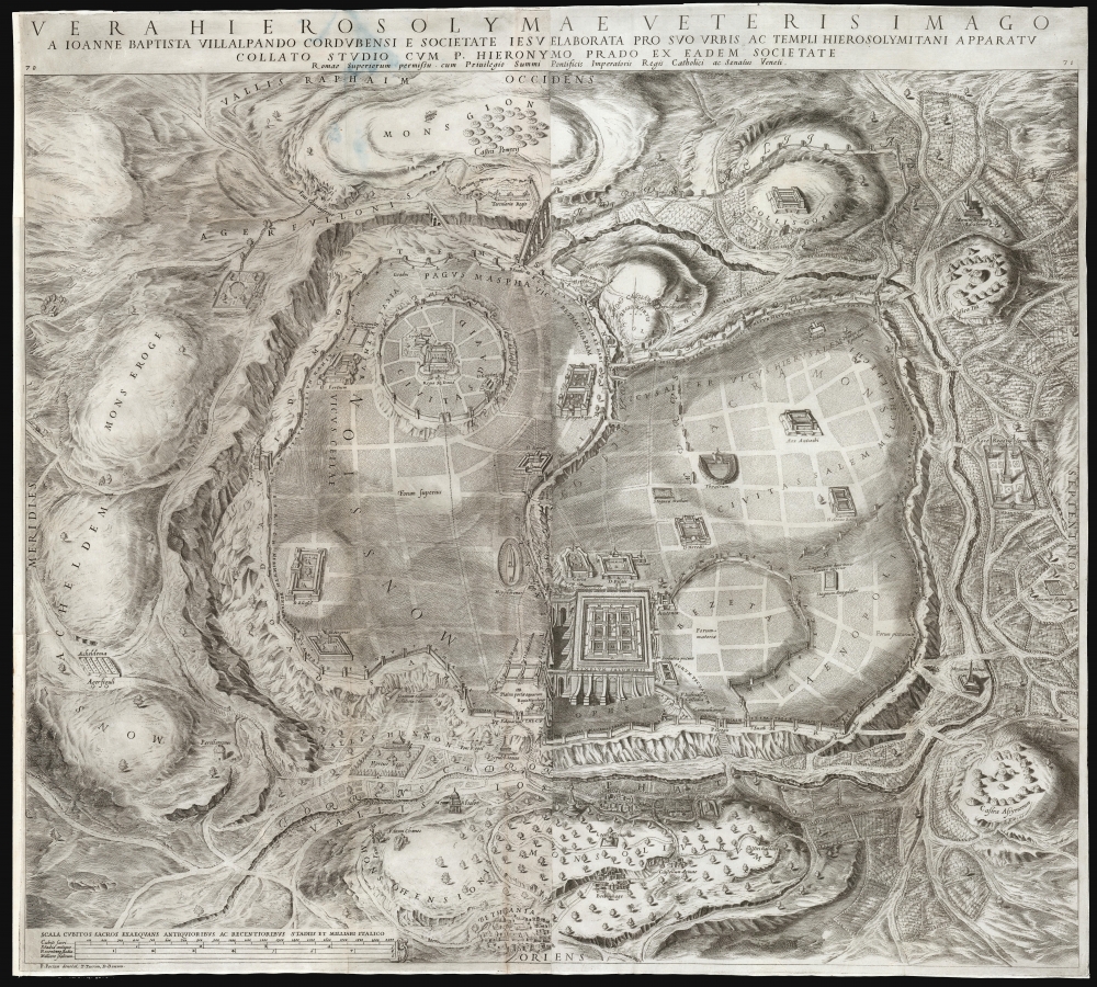
Vera Hierosolymae veteris imago.
$3,000.00
Acquire
- Digital Map Information
- Suitable for large format printing
- DPI: 600
- File Size: 154.73 MB
- File Type: ZIP / TIFF
- ICC color profile embedded
- Delivered instantly via download link
This is Juan Batista Villalpando's large 1604 map of Jerusalem. This attractive and influential plan of the Holy City appeared in his commentary on Ezekiel, published to complete the work of Hieronymus Prado. Villalpando's architectural interpretation of scripture influenced the design of monasteries, churches, and synagogues well into the 17th century. (more details)
Bowles's map of the Americas before American independence.
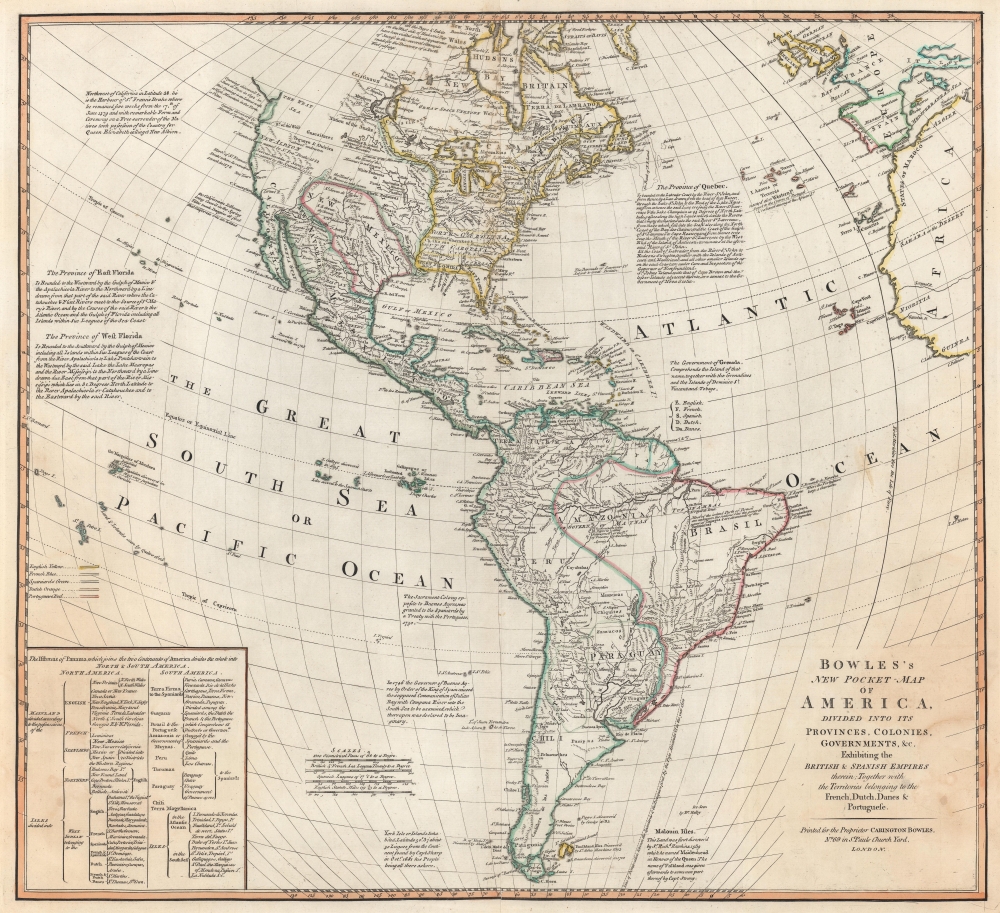
Bowles's New Pocket-Map of America, Divided into its Provinces, Colonies, Governments, etc. Exhibiting the British and Spanish Empires therein; Together with the Territories belonging to the French, Dutch, Danes, and Portuguese.
$2,950.00
Acquire
- Digital Map Information
- Suitable for large format printing
- DPI: 600
- File Size: 48.74 MB
- File Type: ZIP / TIFF
- ICC color profile embedded
- Delivered instantly via download link
This is a c. 1780 Carington Bowles map of North America and South America. The map depicts the increasingly complex and unstable political situation following the French and Indian War (1754 - 1763). It also highlights French and English ambitions for an inland Northwest Passage via Hudson Bay and speculations about a 'Sea of the West' dominating the Pacific Northwest - one of the last and greatest cartographic myths of the 18th century. (more details)
'A city undaunted by tragedy, audaciously innovative, rising to meet the challenges of the day.'
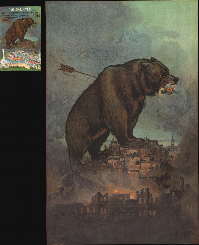
'Undaunted'.
$2,250.00
Acquire
- Digital Map Information
- Suitable for large format printing
- File Size: 62.39 MB
- File Type: ZIP / TIFF
- ICC color profile embedded
- Delivered instantly via download link
This is a rare 1911 Britton and Rey chromolithograph view of San Francisco, issued to promote the city's resurgent spirit following the 1906 San Francisco Fire. A titanic grizzly bear represents the spirit of San Francisco, 'a city undaunted by tragedy, audaciously innovative, rising to meet the challenges of the day.' (more details)
Masterpiece of chromolithography.
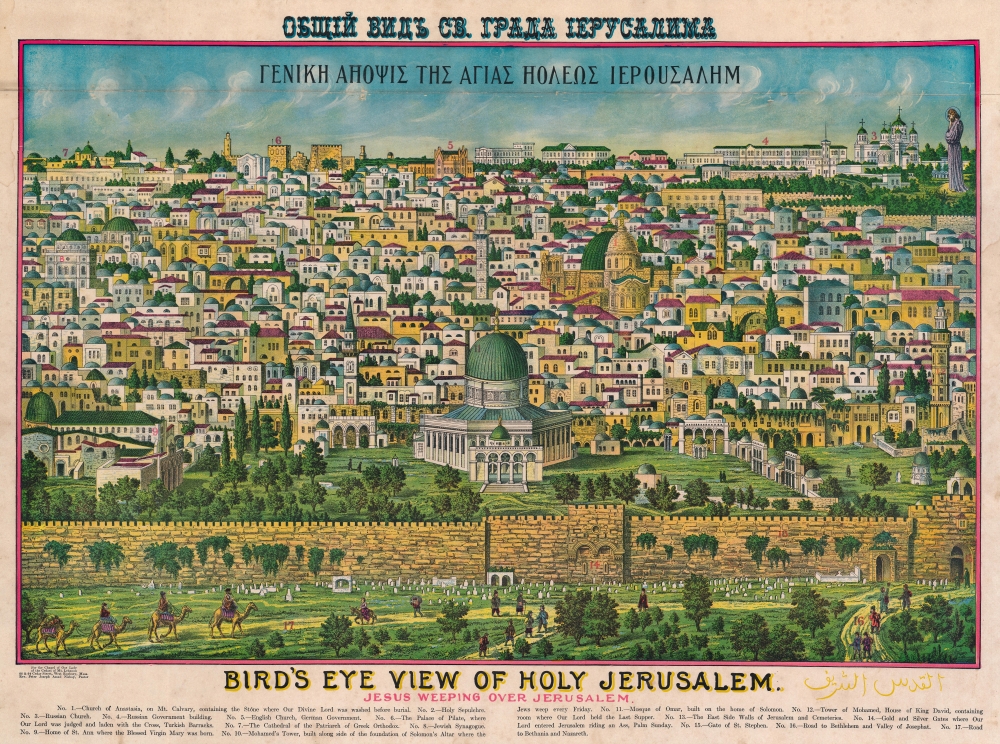
Bird's Eye View of Holy Jerusalem. Jesus Weeping Over Jerusalem. / Γενικη Αηοψις Της Αγιας Ηολεως Ιερουσαλημ. / القدس الشف
$2,000.00
Acquire
- Digital Map Information
- Suitable for large format printing
- File Size: 65.83 MB
- File Type: ZIP / TIFF
- ICC color profile embedded
- Delivered instantly via download link
A rare example of Rand McNally's 1900 chromolithograph view of Jerusalem. Although here unattributed, this view is a revised version of an earlier view issued in 1896 by the Palestinian / Syrian immigrant Aece Hage. Sometime after Hage's original printing, the view was acquired and revised by the Rand McNally Company, who updated and 'Christianized' it, adding a figure of Jesus in the upper right. They published from about 1900 both on their own account and to order - in this case, for the Chapel of Our Lady of the Cedars of Mt. Lebanon in West Roxbury, Massachusetts. The map is titled in Greek and English. Aece Hage's own title, in Arabic, also appears at the bottom right. Text below the view identifies 17 locations, which correspond to numerical assignments. The cartographer identifies Christian, Muslim, and Jewish religious sites. (more details)
The end of the Paris Commune.
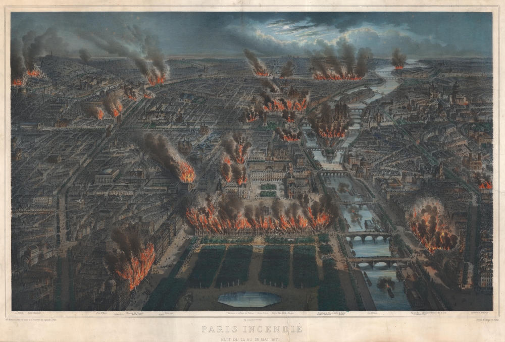
Paris Incendié Nuit du 24 au 25 Mai 1871.
$1,800.00
Acquire
- Digital Map Information
- Suitable for large format printing
- File Size: 65.9 MB
- File Type: ZIP / TIFF
- ICC color profile embedded
- Delivered instantly via download link
This is a c. 1871 Michel Charles Fichot chromolithograph view of Paris burning during the last week of the Paris Commune. Buildings, including the Palais des Tuileries, appear engulfed in flames embellished by striking hand color. (more details)
Lionizing the achievements of the French Navy!
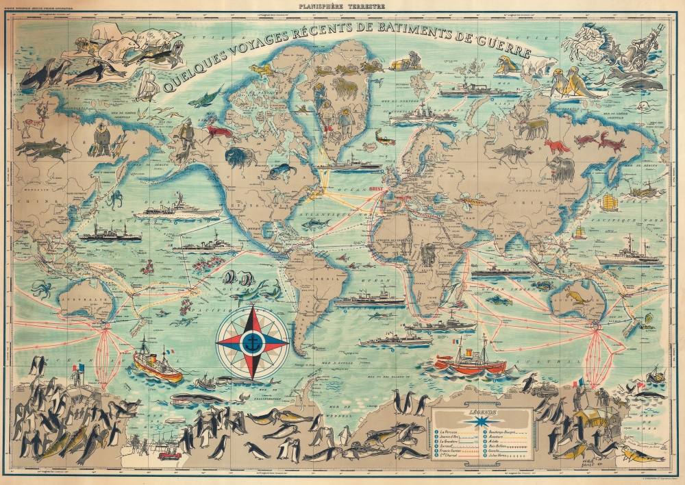
Quelques Voyages Récents de Batiments de Guerre.
$1,500.00
Acquire
- Digital Map Information
- Suitable for large format printing
- File Size: 147.91 MB
- File Type: ZIP / TIFF
- ICC color profile embedded
- Delivered instantly via download link
This is a 1954 Hervé Baille pictorial map of the world tracing voyages by French warships. Fancifully illustrated, cartoonish animals, including penguins, seals, walruses, whales, and polar bears, draw the viewer's attention, as do illustrations of a bison and an otter in North America, a giraffe and an elephant in Africa, a kangaroo in Australia, and wolves and a yak in Asia. Sharks and several different species of marine life populate the seas. (more details)
Only Homann Map to name New York City.

Belgii Pars Septentrionalis communi nomine Vulgo Hollandia nuncupata Continens Statum Potentissime Batavorum Reipublicae seu Provincias VII Foederatas.
$850.00
Acquire
- Digital Map Information
- Suitable for large format printing
- File Size: 25.71 MB
- File Type: ZIP / TIFF
- ICC color profile embedded
- Delivered instantly via download link
A beautiful, original color example of Johann Baptist Homann's 1702 map of the Netherlands, featuring inset maps and city views celebrating the 17th-century global empire of the Dutch. It is the only Homann map to name New York City. (more details)
Ides, not Izmailov.

Generalis totius imperii Moscovitici...
$750.00
Acquire
- Digital Map Information
- Suitable for large format printing
- File Size: 23.27 MB
- File Type: ZIP / TIFF
- ICC color profile embedded
- Delivered instantly via download link
This is Eberhard Isbrand Ides' map of the Russian Empire in Asia, revised and engraved in 1707 by Johann Baptist Homann. Ides produced the map in 1704 to accompany the travelogue of his experiences in 1692 as an envoy sent by Peter the Great to Kangxi China in the wake of the 1689 Treaty of Nerchinsk. Although Ides credited his map to Nicolaes Witsen, the present work is more reflective of Russian cartography at the end of the 17th century than Witsen's cartography. Homann's revision of the map - placing it on a conic projection, a sophistication lacking in the Ides - sets this map apart both from its source and from other contemporaneous maps of the region. (more details)
Naval Battle at Fort Pillow, Tennessee.
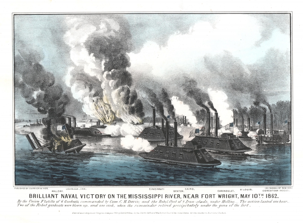
Brilliant Naval Victory on the Mississippi River, near Fort Wright, May 10, 1862.
$600.00
Acquire
- Digital Map Information
- Suitable for large format printing
- File Size: 9.35 MB
- File Type: ZIP / TIFF
- ICC color profile embedded
- Delivered instantly via download link
A rare American Civil War naval combat scene. This is an 1862 Currier and Ives view of the American Civil War naval battle of Plum Point Bend (also known as Battle of Fort Pillow), fought on the Mississippi River in Tennessee. The view illustrates the close-quarters fighting between Confederate and Federal ironclads. The Federal ironclads Cincinnati, Cairo, Benton, St. Louis, and Carondelet occupy the foreground. Multiple vessels are sinking or on fire such that the chaos of battle is almost palpable. (more details)
San Francisco for Japanese travelers.
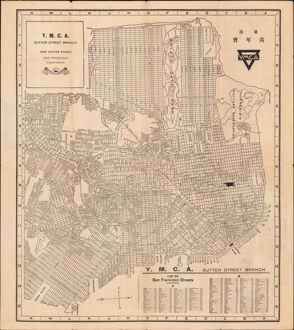
City Map of San Francisco, Cal.
$600.00
Acquire
- Digital Map Information
- Suitable for large format printing
- Full resolution TIFF file
- ICC color profile embedded
- Delivered instantly via download link
This is a unique c. 1930 bilingual Japanese/English map and guide to San Francisco, California, published by the Japanese Y.M.C.A. (桑港日本人基督教青年會). It shows the city along with grids in the margins and a corresponding list of streets and their locations on the map. (more details)
Portugal's in the War of the Spanish Succession.

Portugalliæ et Algarbiæ cum finitumus Hispaniæ regnis: Castillæ legionis Andalusiæ, Extrematuræ, Galliciæ [et] Granatæ novissima tabula : qua simul littora Brasiliæ meridional Americæ, Portugallicæ majestatis dominio subjecta nova methodo exhibentur.
$550.00
Acquire
- Digital Map Information
- Suitable for large format printing
- File Size: 22.11 MB
- File Type: ZIP / TIFF
- ICC color profile embedded
- Delivered instantly via download link
An example of Johann Baptist Homann's c. 1710 map of Portugal and Portuguese Brazil, produced for his Neuer Atlas. It reflects the Portuguese presence in South America and the kingdom's delicate position during the War of the Spanish Succession (1701 - 1714). (more details)
Staking a Claim to Spain.

Hispaniae et Portugalliae regna...
$550.00
Acquire
- Digital Map Information
- Suitable for large format printing
- File Size: 23.15 MB
- File Type: ZIP / TIFF
- ICC color profile embedded
- Delivered instantly via download link
An example of Johann Baptist Homann's c. 1710 map of Spain and Portugal, which appeared in his Neuer Atlas. The map, and particularly the powerful illustrations at the bottom-right, refer to the ongoing War of the Spanish Succession (1701 - 1714), a major crisis dividing Europe at the time. (more details)
Mr. Moses' Bridges - Both Real and Imagined.
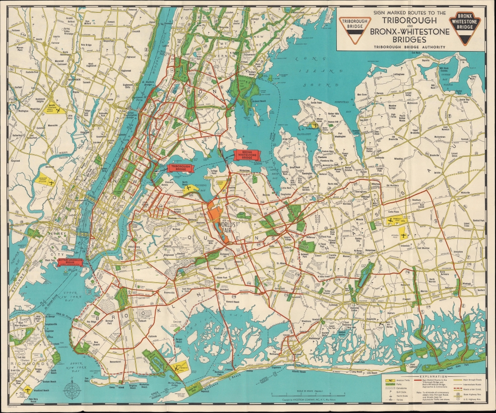
Sign marked Routes to the Triborough and Bronx-Whitestone Bridges / Triborough Bridge Authority Traffic Crossings Linking the Boroughs of Manhattan, Bronx and Queens.
$450.00
Acquire
- Digital Map Information
- Suitable for large format printing
- Full resolution TIFF file
- ICC color profile embedded
- Delivered instantly via download link
This engrossing c. 1939 folding map of New York City was prepared by local cartographic firm Hagstrom for the Triborough Bridge Authority. Meant primarily to inform motorists, it also serves as a celebration of the vision of urban planner and highway enthusiast Robert Moses. At the same time, the map chronicles one of Moses' rare defeats, the never-built 'Battery-Brooklyn Bridge.' (more details)