
NEW ACQUISITIONS
Prelude to the Opium War.
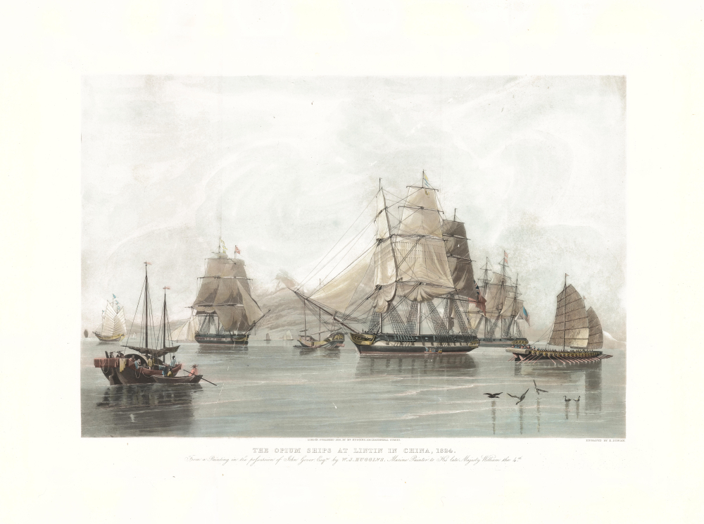
The Opium Ships at Lintin in China, 1824.
$1,800.00
Acquire
- Digital Map Information
- Suitable for large format printing
- Full resolution TIFF file
- ICC color profile embedded
- Delivered instantly via download link
This is a 1838 William John Huggins and Edward Duncan view of Chinese and Western ships engaged in the opium trade in the Pearl River Delta. It was published as opium smuggling reached unprecedented heights in the Pearl River Estuary, leading within a year to the First Opium War (1839 - 1942). (more details)
Dawn of the American Industrial Revolution.
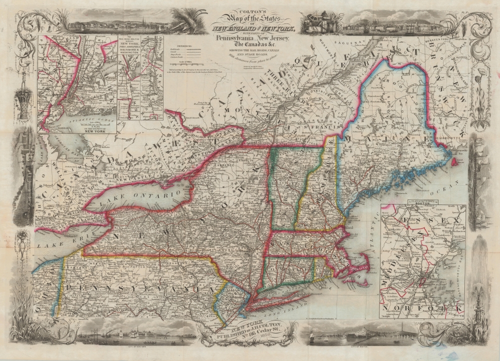
Colton's Map of the States of New England and New York, with Parts of Pennsylvania, New Jersey, the Canadas and c. Showing the Railroad, Canals and Stage Roads. With distances from place to place.
$1,500.00
Acquire
- Digital Map Information
- Suitable for large format printing
- Full resolution TIFF file
- ICC color profile embedded
- Delivered instantly via download link
A scarce and highly decorative first edition 1850 J. H. Colton and J. M. Atwood map of New York and New England. Thanks to Atwood's masterful engraving, this is one of the most decorative mid-19th-century maps of New England. It captures the northeastern United States at the beginning of the Industrial Revolution, when, fueled by Pennsylvania anthracite and a well-connected railway network, the region became the core of American manufacturing. (more details)
Striking chromolithograph of Yellowstone!
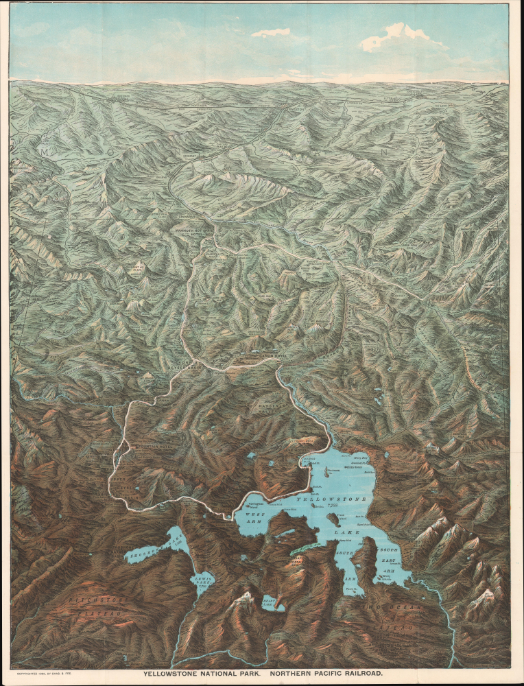
Yellowstone National Park. Northern Pacific Railway.
$1,500.00
Acquire
- Digital Map Information
- Suitable for large format printing
- Full resolution TIFF file
- ICC color profile embedded
- Delivered instantly via download link
This is an 1895 chromolithograph bird's-eye view map of Yellowstone National Park, Wyoming, prepared by Charles S. Fee, the Passenger Traffic Manager at the Northern Pacific Railroad, and printed by Poole Bros. It reflects the deep connection between the park and the railroad, which provided the first direct and relatively fast (non-stagecoach) connection between Yellowstone and the eastern United States. (more details)
One of the Earliest Maps of Scandinavia, Greenland and Ultima Thule.
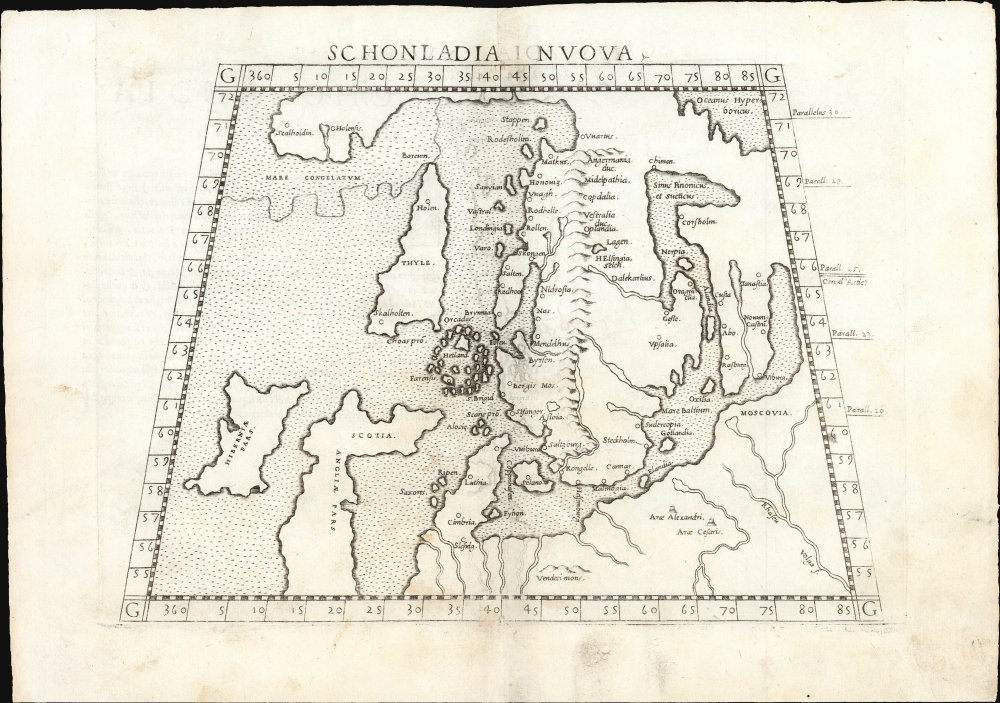
Schonlandia Nuova.
$1,000.00
Acquire
- Digital Map Information
- Suitable for large format printing
- Full resolution TIFF file
- ICC color profile embedded
- Delivered instantly via download link
This is a handsome example of Girolamo Ruscelli's 1561 map of Scandinavia, after Gastaldi. It is among the earliest generally acquirable modern maps of the northern parts of the world, capturing a period when geographers were struggling to integrate new geographical information with heretofore authoritative classical knowledge. Ruscelli's map is an expanded, more clearly-engraved and legible iteration of Gastaldi's 1548 Schonlandia Nova. (more details)
Plotting the Rio de la Plata.
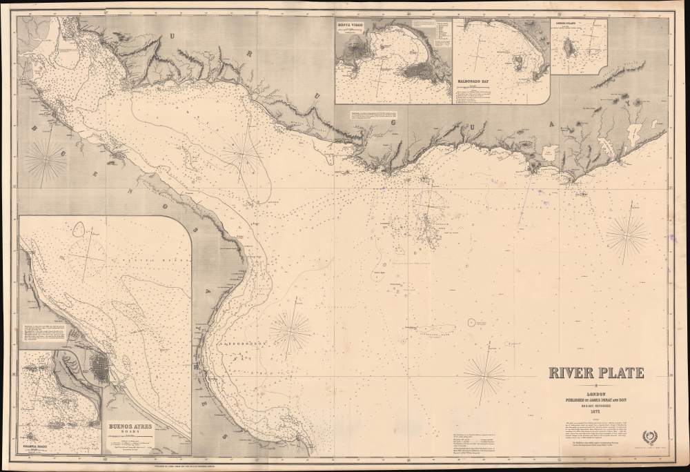
River Plate.
$975.00
Acquire
- Digital Map Information
- Suitable for large format printing
- Full resolution TIFF file
- ICC color profile embedded
- Delivered instantly via download link
This large, richly detailed, and rare work is James Imray's 1872 working, blueback nautical chart of the Río de la Plata in South America. It was surveyed during, and printed shortly after, the War of the Triple Alliance (1864 - 1870), fought by Brazil, Uruguay, and Argentina against Paraguay, largely over control of this waterway. It is the premier nautical mapping of the Río de la Plata to appear in the second half of the 19th century. (more details)
Snarky Takedown of the SDUK.

The Penny Trumpeter!
$900.00
Acquire
- Digital Map Information
- Suitable for large format printing
- Full resolution TIFF file
- ICC color profile embedded
- Delivered instantly via download link
This is a rare 1832 C. J. Grant broadsheet criticizing the Society for the Diffusion of Useful Knowledge (SDUK), a major publisher of periodicals, reference works, maps, and atlases aimed at the masses. Deeming himself a spokesman for the working class, Grant's derision seems to be born out of a sense of the SDUK as phonies. (more details)
Pictorial map of central and eastern Europe.
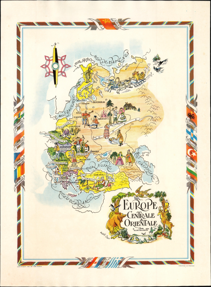
Europe Centrale et Orientale.
$350.00
Acquire
- Digital Map Information
- Suitable for large format printing
- Full resolution TIFF file
- ICC color profile embedded
- Delivered instantly via download link
This is a colorful pictorial map of Eastern Europe dominated by the Soviet Union, drawn by Jacques Liozu in 1951. It is embellished with stereotypical imagery and charming animals. (more details)
Iconic panorama of Manhattan.
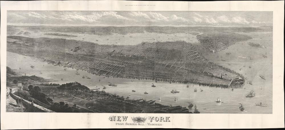
New York from Bergen Hill : Hoboken.
$5,000.00
Acquire
- Digital Map Information
- Suitable for large format printing
- Full resolution TIFF file
- ICC color profile embedded
- Delivered instantly via download link
This is a large-format (20.75 x 45.5 in.) bird's-eye view map of New York City published in 1876 as a supplement to the Illustrated London News. It captures the city the same year Central Park was completed, following decades of population growth and on the cusp of even greater transformation at the turn of the 20th century, which would bring skyscrapers, bridges, and the subway. (more details)
First Bird's-Eye View of Japan.

[日本名所之繪 / Picture of the Famous Places of Japan]
$3,500.00
Acquire
- Digital Map Information
- Suitable for large format printing
- File Size: 22.57 MB
- File Type: ZIP / TIFF
- ICC color profile embedded
- Delivered instantly via download link
This is an important c. 1805 Ukiyo-e bird's-eye view of Japan prepared by Kitao Masayoshi. It is the first artistic bird's-eye view of the Japanese archipelago, and influenced the work of Katsushika Hokusai and later Japanese bird's-eye-view artists. (more details)
Sanson Family Map of the World, Updated. Rare Edition.

Mappe-Monde ou Description du Globe Terrrestre vû en Concave ou en creux en Deux Hemispheres ou l'on trouve en General le Rapport que toutes ses Parties ont avec les Cieux, entr' Elles, et avec l'Histoire...
$3,500.00
Acquire
- Digital Map Information
- Suitable for large format printing
- Full resolution TIFF file
- ICC color profile embedded
- Delivered instantly via download link
This is Pierre Moullart-Sanson's map of the world, in its c. 1730 edition published by Gilles Robert de Vaugondy. Moullard-Sanson's 17th-century geography and elegant engraving are largely unchanged, with the notable correction to California noted below. (more details)
Outbreak of the Civil War.
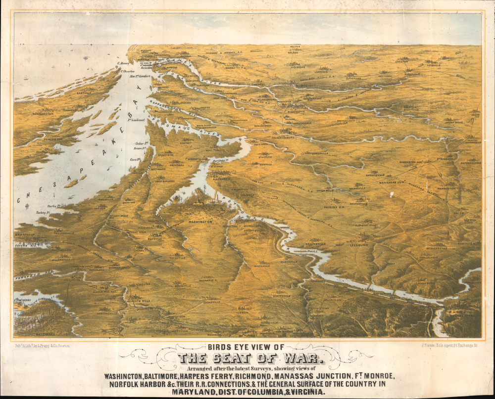
Birds Eye View of The Seat of War. Arranged after the latest Surveys, showing views of Washington, Baltimore, Harpers Ferry, Richmond, Manassas Junction, Ft. Monroe, Norfolk Harbor and c. Their Connections, and The General Surface of the Country in Maryland, Dist. of Columbia, and Virginia.
$3,400.00
Acquire
- Digital Map Information
- Suitable for large format printing
- File Size: 25.3 MB
- File Type: ZIP / TIFF
- ICC color profile embedded
- Delivered instantly via download link
This is a rare 1861 bird's-eye view of the vicinity of Washington, D.C., including Richmond, the mouth of the Chesapeake Bay, and the Potomac River in the early days of the American Civil War (1861 - 1865). The work was compiled by Boston's most talented lithographer, Louis Prang. It is novel in that it is anticipatory, a tool for Prang's audience to understand a conflict that was universally expected, but which had not yet developed. (more details)
18 Days before the Siege of Paris.
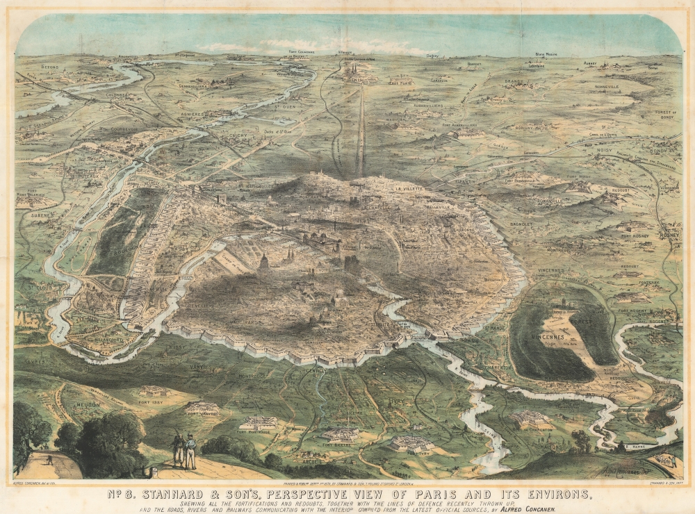
No. 8. Stannard and Son's, Perspective View of Paris and its Environs, Shewing All the Fortifications and Redoubts, Together with the Lines of Defense Recently Thrown Up, and the Roads, Rivers, and Railways Communication with the Interior.
$2,500.00
Acquire
- Digital Map Information
- Suitable for large format printing
- File Size: 61.46 MB
- File Type: ZIP / TIFF
- ICC color profile embedded
- Delivered instantly via download link
This 1870 Alfred Concanen view of Paris details the city's elaborate defensive works just 18 days before the beginning of the Franco-Prussian War Siege of Paris (September 17, 1870 - January 28, 1871). In this engagement, the enormous Enceinte de Thiers (Thiers Wall), constructed at extraordinary expense and believed to be impregnable, proved little more than a king's folly. (more details)
Make Way for... Parkland.
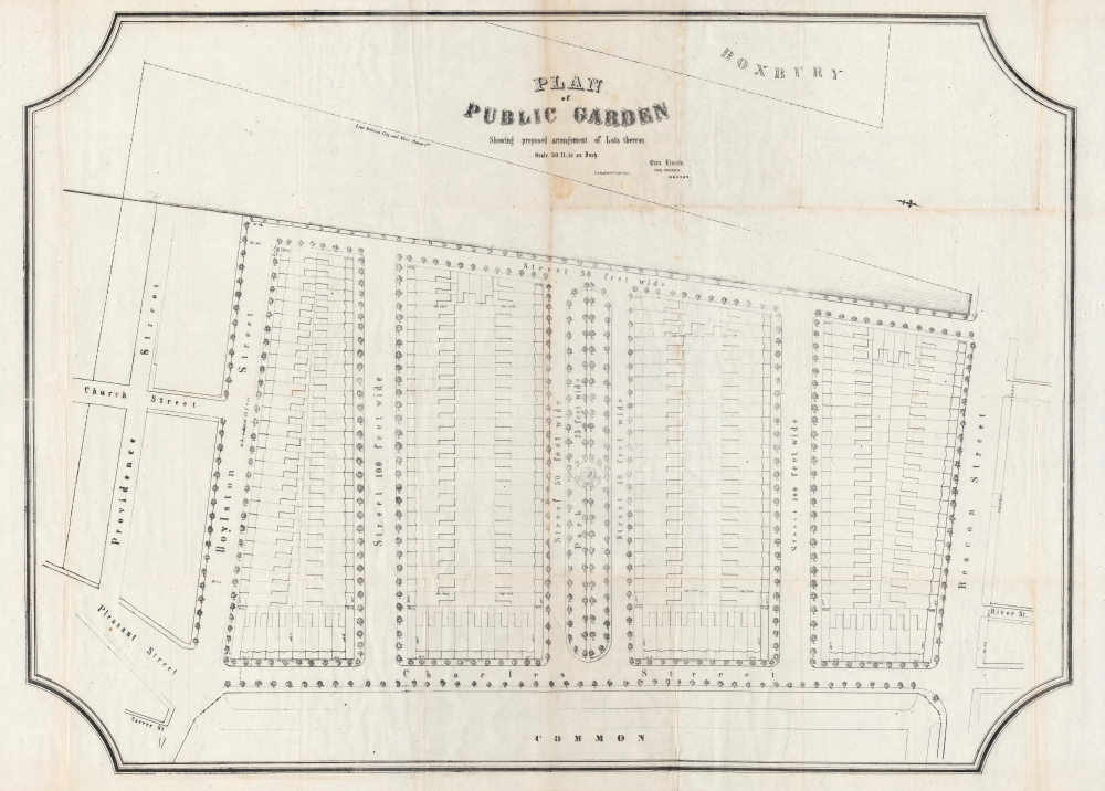
Plan of Public Garden : showing proposed arrangement of lots thereon.
$1,900.00
Acquire
- Digital Map Information
- Suitable for large format printing
- Full resolution TIFF file
- ICC color profile embedded
- Delivered instantly via download link
A curious and impressive large-scale work for the proud Bostonian, this is Ezra Lincoln's unrealized 1850 plan for the Boston Public Garden, published by John Henry Bufford. Part of a wider effort to develop the newly filled-in 'Neck Lands' connecting Boston to Roxbury, Lincoln's plan was held up by long-standing and incessant disputes, which were finally resolved in the late 1850s. (more details)
A remarkable atlas of Guangdong from the late Qing period.
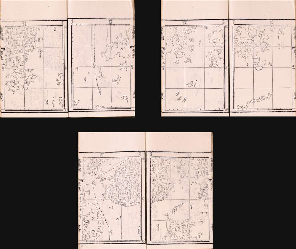
廣東圖 / [Maps of Guangdong].
$1,900.00
Acquire
This is a fascinating and historically significant portion of the 1866 Qing Era Guangdong Atlas (廣東圖) showing the Pearl River Delta, including Hong Kong and Macao. The atlas was extraordinarily detailed for its time, meticulously naming small villages and minor, uninhabited maritime features. (more details)
The Mighty Matterhorn in splendid topographic detail.
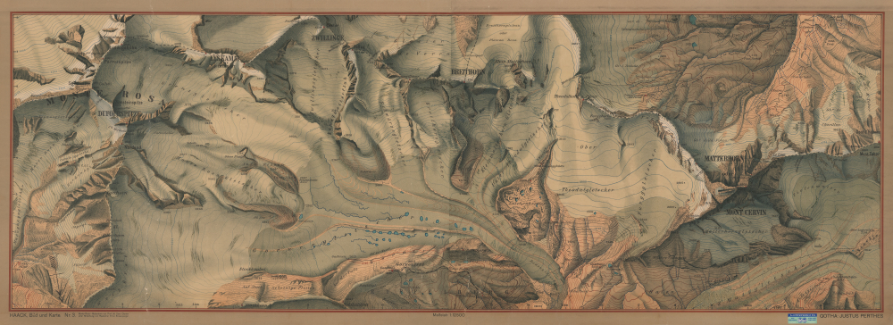
Haack Bild und Karte., No. 3. Monte Rosa - Matterhorn...
$1,800.00
Acquire
- Digital Map Information
- Suitable for large format printing
- File Size: 154.3 MB
- File Type: ZIP / TIFF
- ICC color profile embedded
- Delivered instantly via download link
This is a massive (28 x 77 in.) c. 1917 Justus Perthes wall map of a portion of the Alps along the Italian-Swiss border, including the famous Matterhorn. Published at the height of the early 20th-century alpine mountaineering boom, it provides a meticulous topographical overview of the Monte Rosa-Matterhorn region, one of the most challenging and storied areas for mountaineering in the world. (more details)
Nantucket's maritime Past and Present.
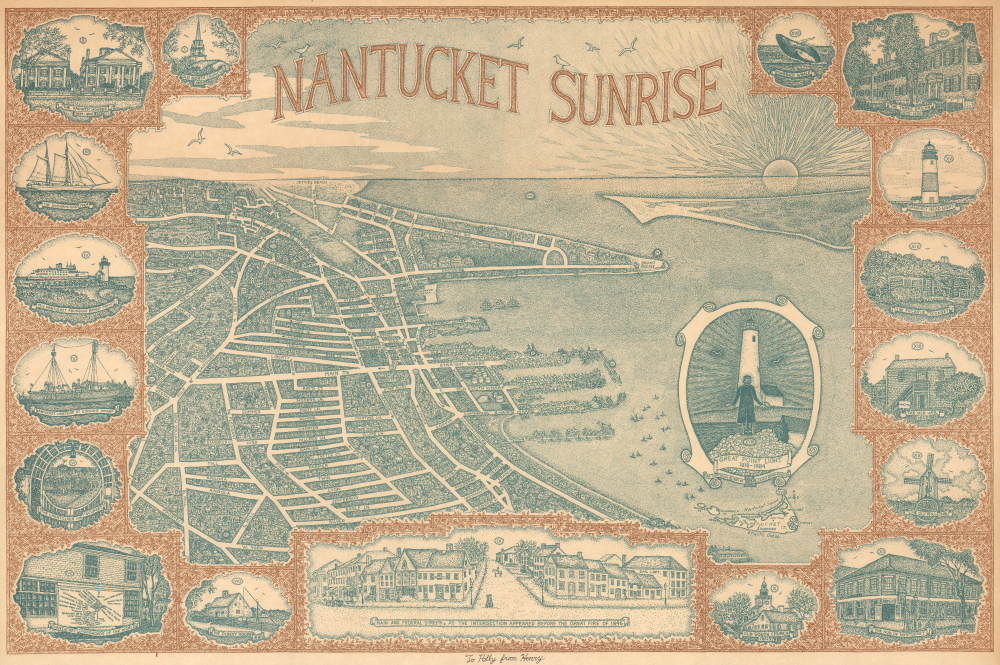
Nantucket Sunrise.
$1,800.00
Acquire
This is a rare 1984 pictorial view of Nantucket, Massachusetts, drawn by artist Joseph David Henry Ware Bryan-Royster. It depicts the town of Nantucket, the main settlement on the eponymous island, along with important historic structures and landmarks from across the island illustrated in the margins. (more details)
Rare Ukiyo-e: Building a Bridge to Modernity.
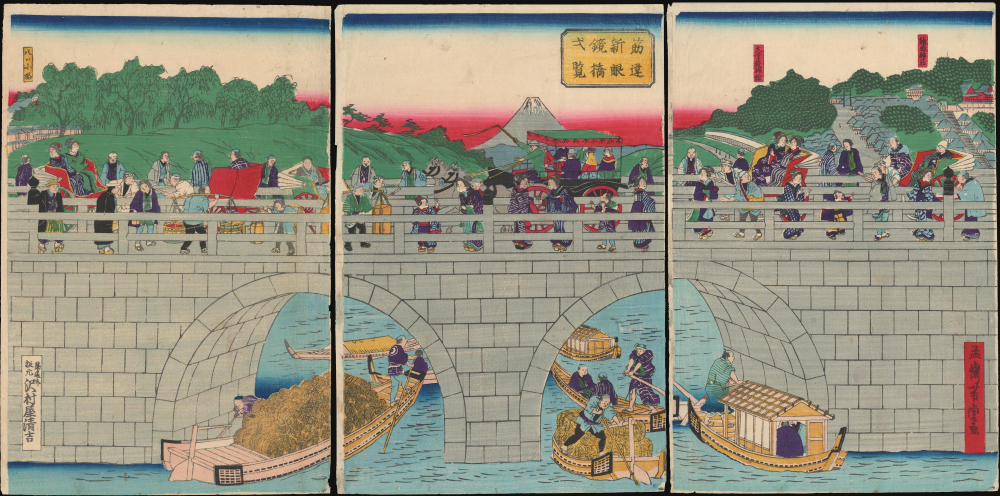
筋違新眼鏡橋弌覧 / [The New Megane Bridge at a Glance].
$1,600.00
Acquire
- Digital Map Information
- Suitable for large format printing
- File Size: 28.92 MB
- File Type: ZIP / TIFF
- ICC color profile embedded
- Delivered instantly via download link
This is Utagawa Yoshitora's c. 1873 Ukiyo-e woodblock triptych of the New Megane Bridge near Tokyo. The view presents Japanese society at the start of the Meiji era, rooted in the traditions of the Edo period but rapidly adopting new influences from abroad. (more details)
Rare Pictorial Map of Georgia's Golden Isles.

Saint Simon Island and Sea Island Georgia
$1,500.00
Acquire
- Digital Map Information
- Suitable for large format printing
- File Size: 32.82 MB
- File Type: ZIP / TIFF
- ICC color profile embedded
- Delivered instantly via download link
This is a rare 1941 Virginia Hilsman Blanton proof print historical pictorial map of St. Simons Island and Sea Island, Georgia. It colorfully recounts the long history of the islands, from the Native American era up to the present day (i.e. 1941). (more details)
Azores - the key the North Atlantic.
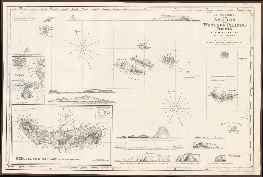
Laurie's Chart of the Azores or Western Islands.
$1,200.00
Acquire
- Digital Map Information
- Suitable for large format printing
- File Size: 2158.46 MB
- File Type: ZIP / TIFF
- ICC color profile embedded
- Delivered instantly via download link
An impressive 1859 blueback nautical map of the Azores and surrounding waters, drawn by Isaac Purdy, based on surveys by Captain A.T.E. Vidal, and published by Richard H. Laurie. This work represents the premier nautical chart of the Azores in the mid-19th century. (more details)
Most beautiful 17th century map of the Channel Islands.
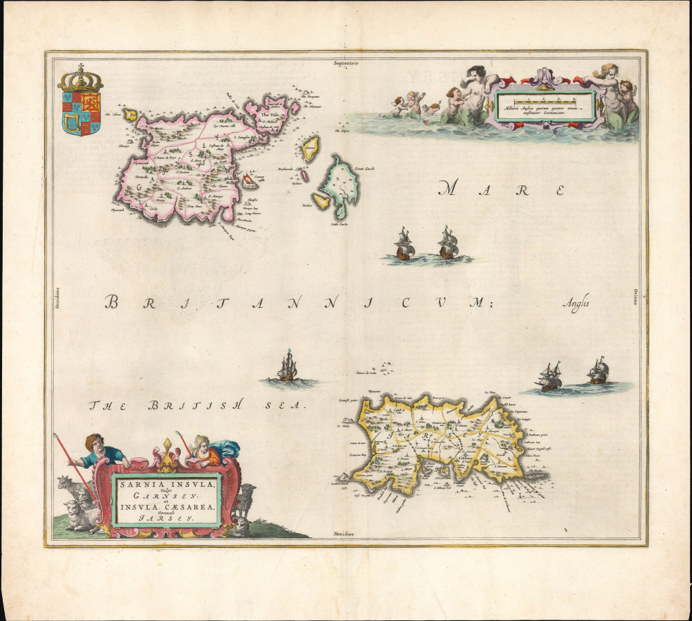
Sarnia insula, vulgo Garnsey et Insula Caesaraea, Vernacule Jarsey.
$1,200.00
Acquire
- Digital Map Information
- Suitable for large format printing
- Full resolution TIFF file
- ICC color profile embedded
- Delivered instantly via download link
This is a gorgeous, original-color example of Joan Blaeu's 1645 map of Guernsey and Jersey, the most beautiful map of the primary Channel Islands to be produced in the 17th century. (more details)