
Poole Brothers (sold) (George Amos Poole, William H. Poole)
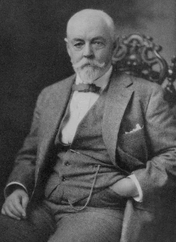
Poole Brothers (1878 - 1968) were a Chicago based firm active in the late 19th and early 20th century with an initial focus on promotional railroad maps. Poole Brothers was founded by George Amos Poole (March 20, 1843 – September 7, 1918). In 1868, Poole, along with his uncle William H. Rand (1828 - 1915) and Andrew McNally (1836 - 1904), purchased the Chicago Tribune's job printing plant and formed the firm Rand McNally. In 1878, he left Rand McNally to form, with his brother William H. Poole, Poole Brothers, a direct competitor to Rand McNally for the lucrative railroad business. Like many of its competitors, Poole Brothers maintained an office on Chicago's Printer's Row (downtown Loop district). Their earliest known work is an 1880 map of Yellowstone National Park. In 1887, Poole Brothers, Andrew McNally, and several others formed the United Typothetae of America, a master printers association. In 1848, they were cited, along with Rand McNally and George Cram, by the Federal Trade Commission for price fixing. Their earliest known work is an 1880 map of Yellowstone National Park. Afterward they went on to produce a vast range of maps and other print products including tickets, cards, coupons, and restaurant menus. In time Poole Brothers merged with Newman-Randolph, which was then acquired by the American Can Company in the early 1960s. The American Can Company liquidated its printing concerns later in the same decade.
AKA: George Amos Poole, William H. Poole
Stunning view and railroad map of the Great Lakes.
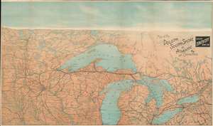
Map of the Duluth South-Shore and Atlantic Ry. And Connections. / Duluth 'Zenith City' Short Line.
sold
- Digital Map Information
- Suitable for large format printing
- File Size: 74.2 MB
- File Type: ZIP / TIFF
- ICC color profile embedded
- Delivered instantly via download link
A stunning c. 1890 chromolithograph railroad map and view of the Great Lakes region. Issued to illustrate the route of the Duluth South-Shore and Atlantic Railway, the map covers from Montreal to the Dakotas, including all five Great Lakes, and most of Michigan, Wisconsin, Minnesota, North Dakota, and South Dakota. The map takes unusual view/map form, commonly seen in New England and European maps, but uncommon in maps of the American Midwest. While the map itself is presented on a uniform scale, the cartographer uses shading and a horizon line to suggest view-like qualities. (more details)
Striking chromolithograph of Yellowstone!
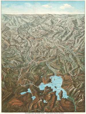
Yellowstone National Park. Northern Pacific Railway.
sold
- Digital Map Information
- Suitable for large format printing
- Full resolution TIFF file
- ICC color profile embedded
- Delivered instantly via download link
This is an 1895 Charles S. Fee chromolithograph bird's-eye view map of Yellowstone National Park, Wyoming. With Yellowstone Lake in the foreground, the view extends northward as far as Bozeman and Livingston, Montana. Fee includes impressive detail throughout, identifying mountains, plateaus, lakes, geyser basins, and hot springs. Yellowstone landmarks, such as Elephant Back, the Grand Canyon, and Old Faithful (in the Upper Geyser Basin), are labeled. The Lake Hotel, Fountain Hotel, Canon Hotel, and Mammoth Hot Springs Hotel all appear. The Yellowstone River snakes its way through the park and roads (colored white, so they stand out) wind their way from north to south. The Northern Pacific Railway runs across the top of the view and south from Livingston to Cinnabar, just outside Yellowstone. (more details)
When you want a pointer…'
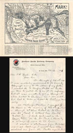
Mark! When you want a Pointer regarding your western trip…
sold
- Digital Map Information
- Suitable for large format printing
- File Size: 3.94 MB
- File Type: ZIP / TIFF
- ICC color profile embedded
- Delivered instantly via download link
An utterly charming 1896 lithograph pictorial map issued to promote travel to the Pacific Northwest via the Northern Pacific Railway. This map was issued in 1896 by Charles S. Fee, general passenger agent for the Northern Pacific Railway. It covers the western ... (more details)
The Yazoo and Mississippi Valley Railroad are featured in several songs by legendary blues masters.
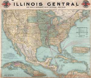
Illinois Central and Yazoo and Mississippi Valley Railroads. 4,824 miles.
sold
- Digital Map Information
- Suitable for large format printing
- File Size: 33.22 MB
- File Type: ZIP / TIFF
- ICC color profile embedded
- Delivered instantly via download link
This is an 1897 Poole Brothers railroad map of the Illinois Central and Yazoo and Mississippi Valley railroads. The map depicts the continental United States from the Pacific Ocean to the Atlantic Ocean and from the Canada to Mexico, the Gulf of Mexico, and the ... (more details)
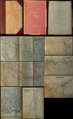
This is a beautiful railroad prospectus atlas issued by the Poole Brothers published around 1900. Designed to advertise the Poole Brothers' diversity in map making and their comprehensive knowledge of railroads, the prospectus atlas contains reduced versions ... (more details)
Railroads in the central United States at the beginning of the 20th century.
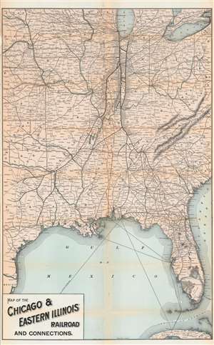
Map of the Chicago and Eastern Illinois Railroad and Connections.
sold
- Digital Map Information
- Suitable for large format printing
- File Size: 39.78 MB
- File Type: ZIP / TIFF
- ICC color profile embedded
- Delivered instantly via download link
This is a 1901 Poole Brothers / Chicago and Eastern Illinois Railroad map of the central United States. Coverage extends from San Antonio, Texas east to Charleston, South Carolina and Buffalo, New York and from Madison, Wisconsin south to Havana, Cuba. The map highlights the routes of the Chicago and Western Railroad in Illinois and Indiana, along its connections to the Louisville and Nashville Railroad. Stops throughout are identified, with La Crosse, Terre Haute, Evansville, Thebes, and Chicago emphasized. (more details)
A railroad map of the United States that traces American expansion and lauds cessions and annexations following the Spanish-American War.
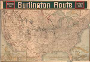
Burlington Route.
sold
- Digital Map Information
- Suitable for large format printing
- File Size: 194.82 MB
- File Type: ZIP / TIFF
- ICC color profile embedded
- Delivered instantly via download link
Upon first glance, this 1902 Poole Brothers railroad map of the United States details the country's extensive rail network and gives pride of place to the Burlington Northern. Thick black lines trace the Burlington's main routes and dots mark all its whistle stops, while thinner lines identify nearly all the small railroads in operation across the county. However, when more closely examined, green overprinting jumps off the page and block lettering proclaims the history of America's westward expansion. (more details)
Hotels and boarding houses across California.
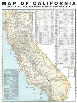
Map of California. List of Hotels, Boarding Houses and Resorts.
sold
- Digital Map Information
- Suitable for large format printing
- File Size: 25.55 MB
- File Type: ZIP / TIFF
- ICC color profile embedded
- Delivered instantly via download link
This is a 1903 Poole Brothers railroad map of California featuring an index of hotels, boarding houses, and resorts. Cities and towns throughout the state are identified, with particular attention paid to the stops along the state's many railroads, including San Francisco, Los Angeles, and Sacramento. Routes of the Southern Pacific; the Atchison, Topeka, and Santa Fe; the San Pedro, Los Angeles, and Salt Lake; and the California Northern are labeled. The index of hotels is situated along the right border and lists cities in California in alphabetical order, the location, capacity, American and European rates, and the proprietor. A text box in the lower left corner lists the representatives of the Chicago, Burlington, and Quincy Railroad from in alphabetical order by city from Atchison, Kansas to Toronto, Ontario. (more details)
Published in a 1905 time table booklet for the Chicago and Eastern Illinois Railroad.
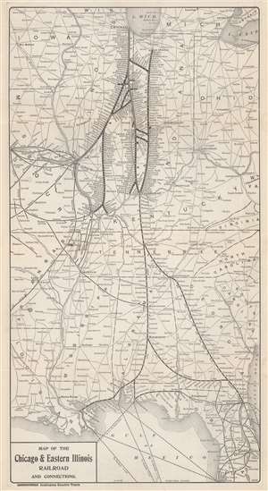
Map of the Chicago and Eastern Illinois Railroad and Connections.
sold
- Digital Map Information
- Suitable for large format printing
- File Size: 6.66 MB
- File Type: ZIP / TIFF
- ICC color profile embedded
- Delivered instantly via download link
This is a 1901 Poole Brothers and Chicago and Eastern Railroad map of the central United States. Focused on the Chicago and Eastern Railroad's network in Illinois and Indiana, the map depicts from Lake Michigan south to Tampa, Florida and from Kansas City, Missouri to Cleveland, Ohio, and Charleston, West Virginia. Thick black lines highlight the Chicago and Eastern's rail lines and every stop along their routes. As would be expected from a railroad map, connecting railroads are illustrated as well. (more details)
When you want a pointer…'
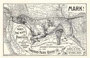
Mark! When you want a Pointer regarding your western trip…
sold
- Digital Map Information
- Suitable for large format printing
- File Size: 3.95 MB
- File Type: ZIP / TIFF
- ICC color profile embedded
- Delivered instantly via download link
An utterly charming 1896 lithograph pictorial map issued to promote travel to the Pacific Northwest via the Northern Pacific Railway. This map was issued in 1896 by Charles S. Fee, general passenger agent for the Northern Pacific Railway. It covers the western part of the United States roughly from the Great Lakes to the Pacific. Superimposed upon the map is the image of an English Pointer dog in classic 'pointer' pose. The dog's head, spine, and tail illustrate the course of the Northern Pacific Railway from Duluth, Minnesota to Olympia, Washington. Promotional copy overlaying the map reads,
Mark! When you want a Pointer regarding your western trip call on your nearest ticket agent or district passenger agent on the Northern Pacific Railway Co. or address Chas. S. Fee General Passenger Agent St. Paul, Minn.A list of passenger agents is printed on the verso. (more details)
A rare map of Texas promoting migration to the state in the early 20th century.
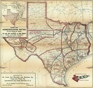
Iron Mountain Route - To all Parts of Texas. The Way to Texas.
sold
- Digital Map Information
- Suitable for large format printing
- File Size: 28.53 MB
- File Type: ZIP / TIFF
- ICC color profile embedded
- Delivered instantly via download link
This is a 1909 Poole Brothers map of Texas promoting settlement and investment in Texas. Depicting the state in detail, railroad routes across the state are highlighted and maroon overprinting promotes the various agricultural and industrial regions. Farming and grazing land, areas suited for raising livestock, and regions suited for specific crops, such as corn, melons, grain, cotton, and wheat are identified. In a bid to further diversify opportunities available to a newcomer in Texas, the state's artesian well belt is noted, as are several irrigated districts. Of course, the oil and gas districts are labeled, as this map was published in the first decade of the Texas oil boom, which most historians say began in 1901 with the discovery near Beaumont. To further promote the idea of seeking one's fortune in Texas, a block-lettered ad promotes round-trip train tickets at 'homeseekers' rates' on the first and third Tuesday of every month. The coup-de-grace is provided by an inset map detailing railroad connections to Texas from Omaha, Kansas City, and St. Louis situated in the upper left corner, which further emphasizes the ease with which the 'homeseeker' could move to Texas and find their fortune. (more details)
'The most picturesque and charming summer resort in America.'
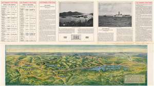
Lake Champlain and Lake George.
sold
- Digital Map Information
- Suitable for large format printing
- File Size: 155 MB
- File Type: ZIP / TIFF
- ICC color profile embedded
- Delivered instantly via download link
An impressive 1911 bird's-eye view of the Adirondack Mountains, Lake George, Lake Champlain, and environs drawn by H. H. Green and published by Poole Brothers. Sponsored by the Delaware and Hudson Company and the Champlain Transportation Company, it advertises the region's natural beauty and amenities to attract potential tourists. (more details)
Linking the Sunshine State.
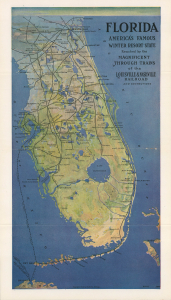
Florida America's Famous Winter Resort State... / Florida Cuba Louisville and Nashville R.R.
sold
- Digital Map Information
- Suitable for large format printing
- Full resolution TIFF file
- ICC color profile embedded
- Delivered instantly via download link
This is a rare 1915 Poole Brothers pictorial railway map of Florida, appearing in a promotional booklet for the Louisville and Nashville Railroad. It was published at a time when Florida had become well-established as a resort destination for Northerners, aided by the expansion of rail networks to the state's furthest reaches. (more details)
Includes an index of every city and town on a railroad line in Florida.
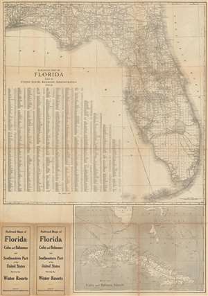
Railroad Map of Florida Issued by United States Railroad Administration 1919-20.
sold
- Digital Map Information
- Suitable for large format printing
- File Size: 58.77 MB
- File Type: ZIP / TIFF
- ICC color profile embedded
- Delivered instantly via download link
This is a 1915 Poole Brothers railroad map of Florida published by the United States Railroad Administration in 1919. The map depicts the state from Pensacola to the Atlantic Ocean and from Alabama and Georgia to Key West. Solid black lines illustrating railroad routes wind their way across Florida in every direction, connecting major cities, such as Jacksonville, Tallahassee, Tampa, Orlando, and Miami, while stopping at innumerable smaller cities and towns along the way. Every stop on every line is labeled. Counties throughout Florida are illustrated and labeled as well, as are Florida's numerous rivers and lakes. The entire state is also overlaid with the grid of the public land survey system and, allowing the viewer to precisely locate a single township anywhere in Florida. An alphabetic index of cities and towns is situated in the Gulf of Mexico and provides the grid location on the map for each locality. Below the map's bottom border a railroad map of Cuba is included that also illustrates shipping lanes between numerous Caribbean and American ports. (more details)
Promotes incredible natural wealth of Alaska and how easy it is to get there!
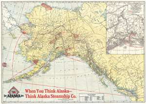
When You Think Alaska - Think Alaska Steamship Co.
sold
- Digital Map Information
- Suitable for large format printing
- File Size: 17.3 MB
- File Type: ZIP / TIFF
- ICC color profile embedded
- Delivered instantly via download link
This is a 1917 Poole Brothers map of Alaska promoting the Alaska Steamship Company and their routes. The map covers from the Bering Sea, the Bering Strait, and eastern Siberia to the Yukon Territory and from the Arctic Ocean to Seattle, Washington. Even ... (more details)
Highlights a very popular tourist rail route in Nova Scotia popularized by a love for Longfellow's epic poem Evangeline, A Tale of Acadie.
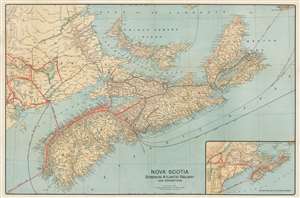
Nova Scotia Dominion Atlantic Railway and Connections.
sold
- Digital Map Information
- Suitable for large format printing
- File Size: 53.48 MB
- File Type: ZIP / TIFF
- ICC color profile embedded
- Delivered instantly via download link
This is a 1918 Poole Brothers map of Nova Scotia and the routes of the regional railroads. Depicting the region from New Brunswick to Cape Breton Island, the Dominion Atlantic Railway and the Canadian Pacific Railway (which owned the Dominion Atlantic) are highlighted by thick red lines, while Canadian government railways are illustrated by black lines. Every stop along the rail lines in Nova Scotia are labeled, with the major stations, such as Yarmouth, Digby, and Halifax, identified using bold block letters. Steamship routes, including those connecting different parts of Nova Scotia, and Nova Scotia and New Brunswick, are marked by dashed lines. Steamship routes to England, the United States, and the West Indies are also illustrated and labeled. (more details)
Scarce Klondike Gold Rush and Alaska Gold Rush Map.

The White Pass and Yukon Route Scenic Railway of the World.
sold
- Digital Map Information
- Suitable for large format printing
- File Size: 18.33 MB
- File Type: ZIP / TIFF
- ICC color profile embedded
- Delivered instantly via download link
A scarce 1919 Klondike Gold Rush map illustrating the just completed White Pass and Yukon Railway. Covering portions of Alaska, British Columbia, and Yukon Territories, this is essentially three maps on a single sheet. The leftmost map focuses on the ... (more details)
From the Midwest to Midway.
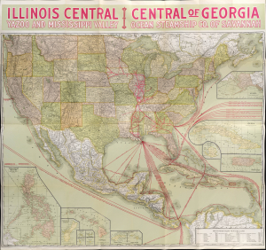
Illinois Central Yazoo and Mississippi Valley Central of Georgia Ocean Steamship Co. of Savannah.
sold
- Digital Map Information
- Suitable for large format printing
- File Size: 831.04 MB
- File Type: ZIP / TIFF
- ICC color profile embedded
- Delivered instantly via download link
This is a striking, large-format 1922 Poole Brothers map of the United States produced for the Illinois Central Railroad and affiliated railroads. In addition to promoting the Illinois Central network, the map is also notable for demonstrating the increasingly global economic reach of the United States. (more details)
One of the great National Parks.
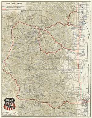
Union Pacific System Map of Rocky Mountain National (Estes) Park Denver Mountain Parks.
sold
- Digital Map Information
- Suitable for large format printing
- File Size: 68.61 MB
- File Type: ZIP / TIFF
- ICC color profile embedded
- Delivered instantly via download link
An uncommon 1924 map of Estes Park and the Rocky Mountain region west of Denver and Fort Collins issued by Poole Brothers on behalf of the Union Pacific Railroad. The map promotes travel to Denver on the Union Pacific Railroad as a means of accessing Rocky Mountain National Park (Estes Park) via car. Red overprinting illustrates potential auto routes past noteworthy town and natural wonders.
The historical significance of this map is reflected in the transition from railroad to automobile travel and the era of commercial exploitation of our National Parks. Maps such as this provide a marvelous ephemeral look at the use and development of the region and often reflect roads and commercial uses (hotels, tourist attractions, etc.) which were later closed and abandoned as the management of the park system evolved away from tourist uses and became increasingly focused on the preservation and conservation of the natural resource element of the parks. (more details)
The historical significance of this map is reflected in the transition from railroad to automobile travel and the era of commercial exploitation of our National Parks. Maps such as this provide a marvelous ephemeral look at the use and development of the region and often reflect roads and commercial uses (hotels, tourist attractions, etc.) which were later closed and abandoned as the management of the park system evolved away from tourist uses and became increasingly focused on the preservation and conservation of the natural resource element of the parks. (more details)
One of the great National Parks.
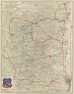
Union Pacific System Map of Rocky Mountain National (Estes) Park Denver Mountain Parks.
sold
- Digital Map Information
- Suitable for large format printing
- File Size: 62.27 MB
- File Type: ZIP / TIFF
- ICC color profile embedded
- Delivered instantly via download link
An uncommon 1924 map of Estes Park and the Rocky Mountain region west of Denver and Fort Collins issued by Poole Brothers on behalf of the Union Pacific Railroad. The map promotes travel to Denver on the Union Pacific Railroad as a means of accessing Rocky Mountain National Park (Estes Park) via car. Red overprinting illustrates potential auto routes past noteworthy town and natural wonders.
This historical significance of this map is reflected in the transition from railroad to automobile travel and the era of commercial exploitation of our National Parks. Maps such as this provide a marvelous ephemeral look at the use and development of the region and often reflect roads and commercial uses (hotels, tourist attractions, etc.) which were later closed and abandoned as the management of the park system evolved away from tourist uses and became increasingly focused on the preservation and conservation of the natural resource element of the parks. (more details)
This historical significance of this map is reflected in the transition from railroad to automobile travel and the era of commercial exploitation of our National Parks. Maps such as this provide a marvelous ephemeral look at the use and development of the region and often reflect roads and commercial uses (hotels, tourist attractions, etc.) which were later closed and abandoned as the management of the park system evolved away from tourist uses and became increasingly focused on the preservation and conservation of the natural resource element of the parks. (more details)
One of the great National Parks.
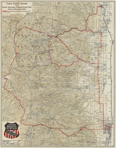
Union Pacific System Map of Rocky Mountain National (Estes) Park Denver Mountain Parks.
sold
- Digital Map Information
- Suitable for large format printing
- File Size: 123.85 MB
- File Type: ZIP / TIFF
- ICC color profile embedded
- Delivered instantly via download link
An uncommon 1924 map of Estes Park and the Rocky Mountain region west of Denver and Fort Collins issued by Poole Brothers on behalf of the Union Pacific Railroad. The map promotes travel to Denver on the Union Pacific Railroad and then continuing to Rocky Mountain National Park (Estes Park) by car. Red overprinting illustrates potential auto routes past noteworthy towns and natural wonders. (more details)
Southern - The Way to Florida!
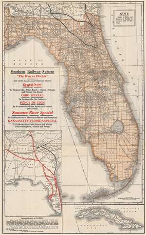
Southern Railway System 'The Way to Florida'. / Map of Florida.
sold
- Digital Map Information
- Suitable for large format printing
- Full resolution TIFF file
- ICC color profile embedded
- Delivered instantly via download link
This is a 1924 Poole Brothers railroad map of Florida published by the Southern Railway System. This is one of the few maps to illustrate the ephemeral full operating route of the Florida East Coast Railroad extending through the Keys to Key West. Routes owned by Southern Railway and its subsidiaries in northern Florida are emphasized with thick black lines. Additional competing railroad networks are depicted using thinner lines. The Peninsular and Occidental Steamship Company, which connected Tampa with Key West and Havana, Cuba, is marked by a dotted line running through the Gulf of Mexico. An inset map along the left border highlights the Southern Railway System from Cincinnati and Memphis to Miami, along with other rail lines in the American Southeast. A second inset map of Cuba is situated in the lower right corner that illustrates Cuban railways. (more details)
The Klondike Gold Rush railroad!
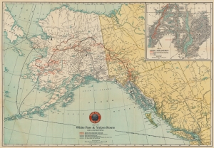
Map of the White Pass and Yukon Route and Connections.
sold
- Digital Map Information
- Suitable for large format printing
- Full resolution TIFF file
- ICC color profile embedded
- Delivered instantly via download link
This is a 1925 White Pass and Yukon Route railroad map of Alaska and northwest Canada - the major artery of access to the Klondike Gold Rush. (more details)
Ride the Rails in Canada at the height of the Roaring Twenties.
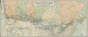
Map of the Canadian Pacific Railway The Minneapolis, St. Paul and Sault Ste. Marie Railway The Duluth, South Shore and Atlantic Railway The Spokane International Railway and Connections.
sold
- Digital Map Information
- Suitable for large format printing
- Full resolution TIFF file
- ICC color profile embedded
- Delivered instantly via download link
Travel across Canada in style at the height of the Roaring Twenties with this 1926 Poole Brothers and Canadian Pacific Railway map. Using eye-catching blue ink, the map highlights the Canadian Pacific Railway's extensive rail network and its connections into the United States. (more details)
The Louisville and Nashville Railroad line from New Orleans to Pensacola.
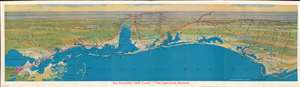
The Beautiful Gulf Coast - 'The American Riviera'.
sold
- Digital Map Information
- Suitable for large format printing
- File Size: 29.71 MB
- File Type: ZIP / TIFF
- ICC color profile embedded
- Delivered instantly via download link
This is a 1926 Poole Brothers Map of the United States Gulf Coast highlighting the Louisville and Nashville Railroad. Depicting the region from New Orleans, Louisiana to River Junction, Florida, and from Flomaton, Alabama, to the Gulf of Mexico, thick red lines trace the Louisville and Nashville Railroad. Stations along the route are labeled and marked by white dots. Some cities and towns not along the railroad's lines are labeled as well, particularly along the Florida coast from Pensacola to Apalachicola. Lake Pontchartrain, Mobile Bay, and Pensacola Bay are illustrated as well. Numerous small islands along the coast appear as well, and a handful of highways are indicated. (more details)
Traces the rail network in Florida in the early 20th century.
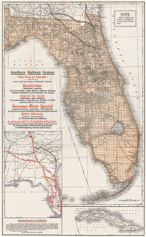
Southern Railway System 'The Way to Florida'.
sold
- Digital Map Information
- Suitable for large format printing
- File Size: 32.57 MB
- File Type: ZIP / TIFF
- ICC color profile embedded
- Delivered instantly via download link
This is a 1926 Poole Brothers railroad map of Florida published by the Southern Railway System. Routes owned by Southern Railway and its subsidiaries in northern Florida are emphasized by illustrating them with thick black lines. The rest of the railroad network in Florida is depicted using thin place lines to mark the routes, all of which are labeled with block lettering, including the Atlantic Coast Line and the Seaboard Air Line, and the Florida East Coast Line from Miami to Key West is traced in red manuscript. The Peninsular and Occidental Steamship Company, which connected Tampa with Key West and Havana, Cuba, is marked by a dotted line running through the Gulf of Mexico. An inset map along the left border highlights the Southern Railway System from Cincinnati and Memphis to Miami, along with other rail lines in the American Southeast. A second inset map of Cuba is situated in the lower right corner that illustrates Cuban railways as well. (more details)
A Klondike Gold Rush railroad!
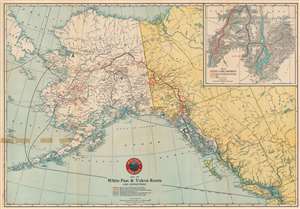
Map of the White Pass and Yukon Route and Connections.
sold
- Digital Map Information
- Suitable for large format printing
- Full resolution TIFF file
- ICC color profile embedded
- Delivered instantly via download link
This is a 1930 White Pass and Yukon Route railroad map of Alaska and northwest Canada - the major artery of access to the Klondike Gold Rush cities. (more details)