
Maine Northern Boundary Dispute.
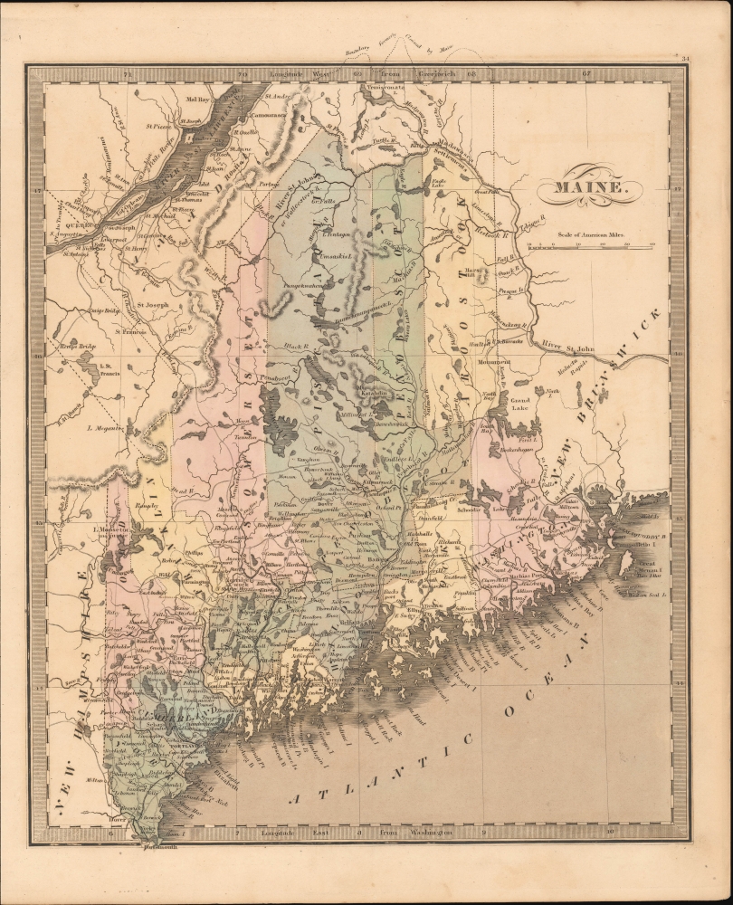
Maine.
sold
- Digital Map Information
- Suitable for large format printing
- DPI: 600
- File Size: 206.78 MB
- File Type: ZIP / TIFF
- ICC color profile embedded
- Delivered instantly via download link
This is Jeremiah Greenleaf's 1849 map of Maine. (more details)
Groundwork for the French Invasion of Madagascar.

Itineraire de Majunga a Tananarive publie par le Service Geographique de l'Armée...
sold
- Digital Map Information
- Suitable for large format printing
- Full resolution TIFF file
- ICC color profile embedded
- Delivered instantly via download link
This detailed and rare trio of military folding maps of Madagascar follow a route connecting the northwest port of Mahajanga (Majunga) and the capital at Antananarivo (Tananarive). They were produced to record the campaign of the so-called 'Second Madagascar Expedition' (1894 - 1895), which brought the Franco-Hova Wars (1834 - 1896) to a close and turned Madagascar into a French protectorate. (more details)
One of the Most Magnificent Sites in Beijing.
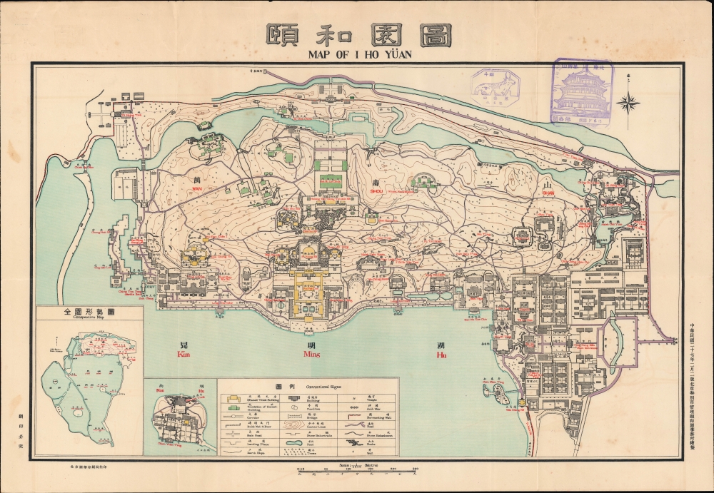
頤和園圖 / Map of I Ho Yüan.
sold
- Digital Map Information
- Suitable for large format printing
- File Size: 29.06 MB
- File Type: ZIP / TIFF
- ICC color profile embedded
- Delivered instantly via download link
This is a 1938 map of the Summer Palace (頤和園, Yiheyuan) was produced by the palace itself, then operated as a museum by the municipality of Beijing. (more details)
Mechanical Map Protesting the Dictate of Trianon.

Hungaria 896-1918.
sold
- Digital Map Information
- Suitable for large format printing
- Full resolution TIFF file
- ICC color profile embedded
- Delivered instantly via download link
This is a 1920 mechanical paper map of Hungary, produced in the Interwar Period, by the Hungarian Women's National Association. This fascinating and ingeniously constructed postcard - here including its original protective envelope - is an exemplar of post-World War I Hungarian Irredentism (referring to a policy of advocating the restoration to a country of any territory formerly belonging to it.) It is propaganda in protest of the 1920 Treaty of Trianon, known in Hungary as the Dictate of Trianon. (more details)
Homann's Depiction of Christian Europe Eclipsed by an Eclipse.
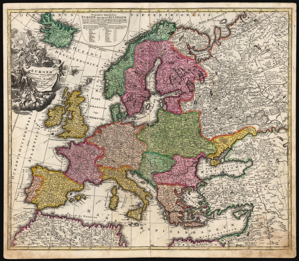
Europa Christiani Orbis Domina in sua Imperia, Regna, et Status exacte divisa per Johan Bapt. Homann Norimbergae.
sold
- Digital Map Information
- Suitable for large format printing
- DPI: 600
- File Size: 70.73 MB
- File Type: ZIP / TIFF
- ICC color profile embedded
- Delivered instantly via download link
This is a scarce early example of Johann Baptist Homann's 1707 map of Europe presenting, in collaboration with mathematician J. Gabriel Doppelmayr, the progress of the May 12, 1706 eclipse of the sun. (more details)
Losing the war in Vietnam.

越南人民抗美救国形势图. / [Vietnamese people's anti-US and national saving situation map.]
sold
This is a c. 1967 Chinese anti-American propaganda broadside created by Zhu Yu Lian. The map depicts the region from Laos and Cambodia to the South China Sea and from China to the Cà Mau Peninsula. Both North Vietnam (Orange) and South Vietnam (Red) are included. Three colors are present in South Vietnam: red, teal, and white. The red areas denote territory that to be 'liberated' by the North Vietnamese, the teal represents areas controlled by the United States, and the white regions are where guerillas were active and the territory in dispute. Major US Air Force bases are marked by airplanes inscribed in black circles, while major naval installations are noted by much the same symbol, except the airplane is exchanged for an anchor. Roads and highways are illustrated and labeled, and provinces are outlined by dotted lines. (more details)
Pigskin Panorama.

Albert Richard All-America Football Map.
sold
- Digital Map Information
- Suitable for large format printing
- Full resolution TIFF file
- ICC color profile embedded
- Delivered instantly via download link
This is a 1941 Albert Richard pictorial map of the United States highlighting college football. The map is part of a series that appeared as football was increasingly becoming a national pastime. It an era before television, most followed their teams through radio and newspapers. The 'Pigskin Panorama' was a way for sport fans to connect not only with the colors and mascots of their favorite teams, but also to visualize the increasingly complex network of regional and national leagues. The series was updated annually from roughly 1939 to 1950. (more details)
Labels a resort hotel - Neptune House.
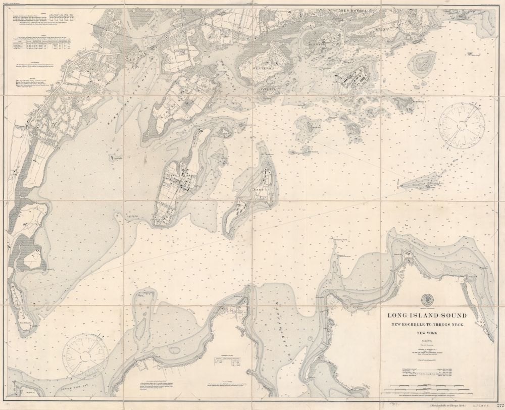
Long Island Sound. New Rochelle to Throgs Neck. New York.
sold
- Digital Map Information
- Suitable for large format printing
- File Size: 83.48 MB
- File Type: ZIP / TIFF
- ICC color profile embedded
- Delivered instantly via download link
This is an 1899 U.S. Coast and Geodetic Survey nautical map of part of Long Island Sound from Throgs Neck to New Rochelle. (more details)
Highlighting money spent by the Production and Marketing Administration.

[Department of Agriculture Spending in Florida.]
sold
- Digital Map Information
- Suitable for large format printing
- Full resolution TIFF file
- ICC color profile embedded
- Delivered instantly via download link
A manuscript George White 1952 political cartoon map of Florida lampooning government spending on agriculture. (more details)
The Florida State Fair and the launching of Explorer 1, the first U.S. satellite!

Another Bright Spot.
sold
This is a 1958 George White political cartoon of Uncle Sam distractedly and perhaps admiringly staring at Florida as the successful launch of Explorer 1 and the opening of the Florida State Fair grab his attention. (more details)
Railroad History in Michigan.
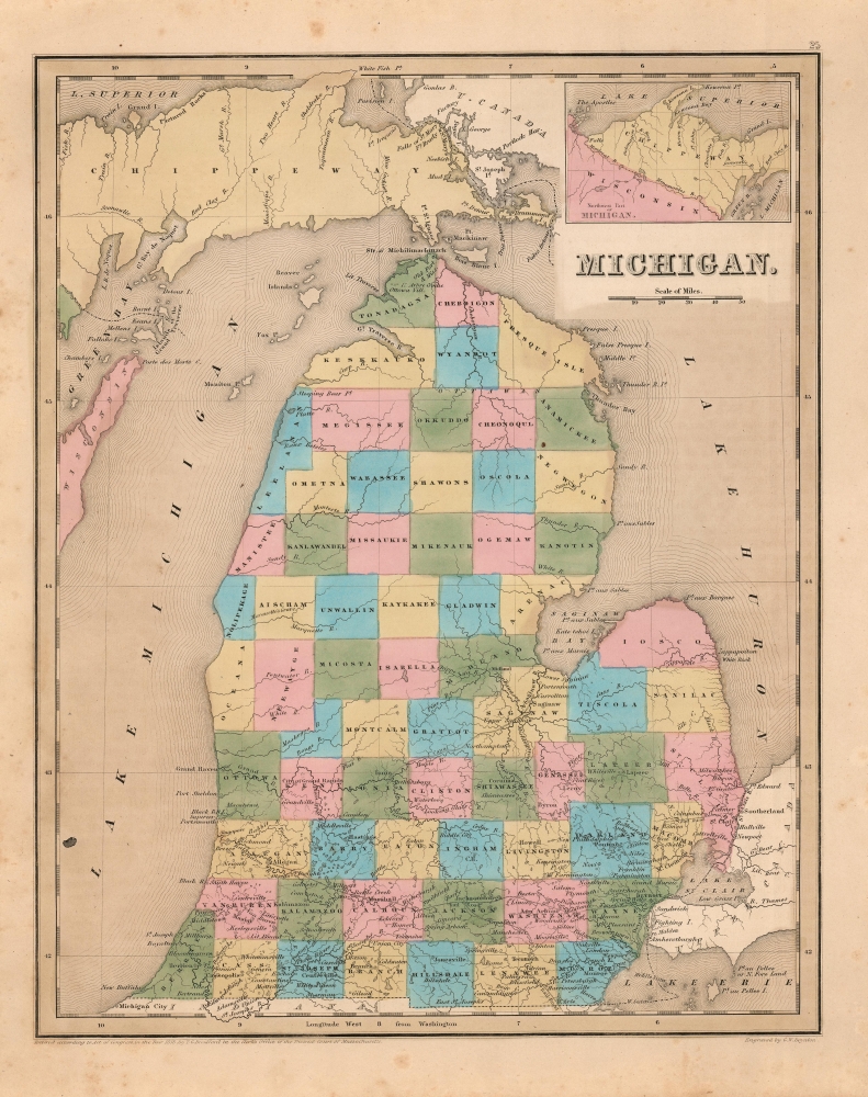
Michigan.
sold
- Digital Map Information
- Suitable for large format printing
- DPI: 600
- File Size: 23.55 MB
- File Type: ZIP / TIFF
- ICC color profile embedded
- Delivered instantly via download link
This is an 1841 Thomas G. Bradford map of Michigan. Although just four years after statehood, 1841 Michigan was already a bustling frontier region, with rapid population growth and flourishing agricultural and timber industries. (more details)
Published during the Armenian Genocide.
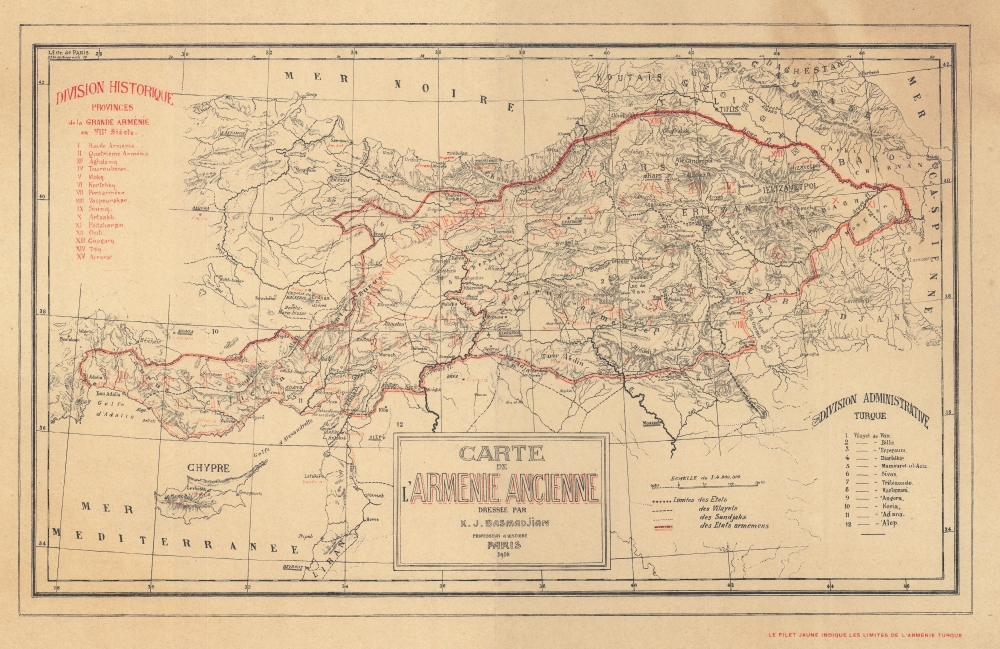
Carte de l'Armenie Ancienne.
sold
- Digital Map Information
- Suitable for large format printing
- File Size: 12.69 MB
- File Type: ZIP / TIFF
- ICC color profile embedded
- Delivered instantly via download link
Published during the Armenian Genocide, this is a 1916 Karapet Basmadjian map of ancient Armenia. An ardent Armenian nationalist, Basmadjian created this piece as part of his never-ending drive for Armenian autonomy and self-determination. (more details)
The war in Europe is won. Now to win in the Pacific.
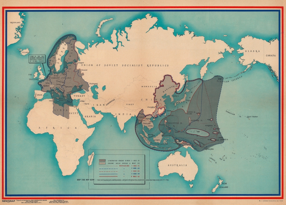
NEWSMAP Overseas Edition For the Armed Forces. V-E Day + 7 Weeks - 184th Week of U.S. Participation in the War. Monday, 2 July 1945. Week of 12 June to 19 June. Vol. IV No 10F.
$375.00
Acquire
- Digital Map Information
- Suitable for large format printing
- Full resolution TIFF file
- ICC color profile embedded
- Delivered instantly via download link
A piece of Allied propaganda created for soldiers, this is a 1945 U.S. Army Information Branch Newsmap map of the battle fronts in Europe and Asia. Published a few months after Germany surrendered, this piece celebrates the achievements of Allied armies in Europe while illustrating how much farther there is to go in Asia and the Pacific. (more details)
Shaking off the Great Depression.
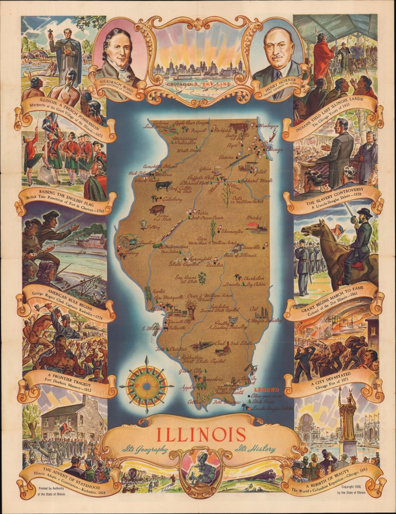
Illinois Its Geography Its History.
sold
- Digital Map Information
- Suitable for large format printing
- Full resolution TIFF file
- ICC color profile embedded
- Delivered instantly via download link
This is a striking 1938 J. Theodore Johnson pictorial map of Illinois. This map is likely one of the last pieces Johnson produced in Chicago while working with the Works Progress Administration initiative Illinois Federal Art Project. It illustrates the state as it emerged from the Great Depression (1929 - 1939) and was seeking to brand itself as an emerging hub of industry and commerce. (more details)
Warily Eyeing the Neighbors to the North.
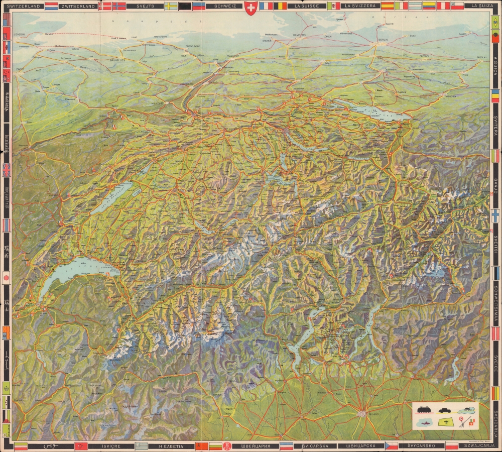
Mapa de Suíza a vista de pájaro.
sold
- Digital Map Information
- Suitable for large format printing
- Full resolution TIFF file
- ICC color profile embedded
- Delivered instantly via download link
A gorgeous 1938 bird's-eye view map of Switzerland, designed by Otto Betschmann and published by the Swiss National Tourism Office. It contains many interesting features, not least of which are blotted out German and Austrian flags along those countries' borders with Switzerland. (more details)
Your Guide to Galilee and Other Godly Lands.

Pilgrim's Map of the Holy Land for Biblical Research, the Journey's and Deed's of Jesus Christ including the Most Important Sites from the Old and New Testament.
sold
- Digital Map Information
- Suitable for large format printing
- File Size: 26.58 MB
- File Type: ZIP / TIFF
- ICC color profile embedded
- Delivered instantly via download link
A colorful 1942 map rich with historical and biblical information, this is Th. F. Mathesy's map of the Holy Land in the time of Jesus. It constitutes a comprehensive biblical reference map incorporating research from a wide range of sources. (more details)
Landstraßen...
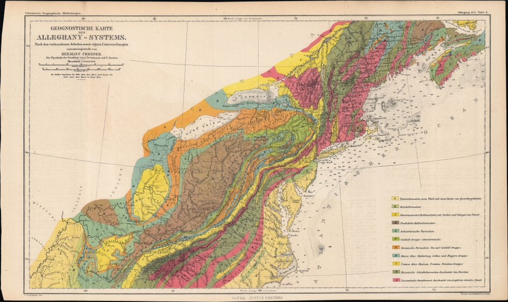
Geognostische Karte des Alleghany-Systems. Nach den vorhandenen Arbeiten sowie eignen Untersuchungen zusammengestellt von Herman Credner.
sold
- Digital Map Information
- Suitable for large format printing
- File Size: 10.45 MB
- File Type: ZIP / TIFF
- ICC color profile embedded
- Delivered instantly via download link
A colorful geologic map of the Appalachian Mountains, produced in 1871 by Augustus Petermann and published by Justus Perthes for his Petermann's geographische Mitteilungen, a leading German geographical journal of the era. (more details)
Enormous map of Ireland.

A General Map of Ireland to Accompany the Report of the Railway Commissioners shewing the Principal Physical Features and Geological Structure of the Country.
sold
- Digital Map Information
- Suitable for large format printing
- File Size: 387.8 MB
- File Type: ZIP / TIFF
- ICC color profile embedded
- Delivered instantly via download link
This is Richard Griffith's expansive geological map of Ireland, first unveiled in Dublin in 1839, here in its 1855 state. The map was Commissioned by the National Railway Commission and captures nearly 25 years of dedicated and relentless survey and compilation work. (more details)
Hydrographic projects on the River Nile, and the Prospective Suez Canal.
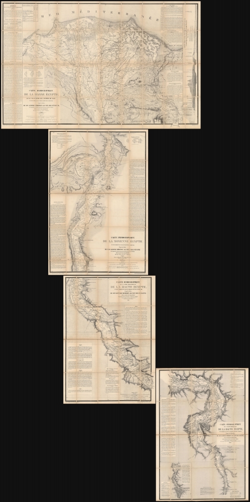
Carte Hydrographique de la Basse Égypte/ Carte Hydrographique de la Moyenne Égypte/Carte Hydrographique de la Partie Septentrionale de la Haute Egypte/ Carte Hydrographique de la Partie Méridionale de la Haute Egypte.
sold
This is a set of four large, superbly detailed maps of Egypt by Linant de Bellefonds, detailing the course of the River Nile and the prospective routes of the Suez Canal. The four maps are on a uniform scale and were sold a group by Paris mapseller Lanée, to American congregationalist preacher and professor Roswell Dwight Hitchcock, probably in 1869 in preparation for that avid traveler's 1870 visit to Egypt. These were easily the most detailed maps to cover the Egyptian Nile available at that time, and their rich detail of ancient and reference to Biblical monuments would have been compelling. Taken together, the maps illuminate the Nile continuously from the Mediterranean Sea to the cataracts upstream of Aswan. (more details)
Opening of Yokohama.

御開港横濱之全圖 / [Complete Map of the Open Port of Yokohama].
sold
- Digital Map Information
- Suitable for large format printing
- File Size: 125.22 MB
- File Type: ZIP / TIFF
- ICC color profile embedded
- Delivered instantly via download link
An epic work by one of Japan's master woodblock printers of the era, this is Utagawa Sadahide's 1859 very large panorama of the port of Yokohama - considered the first and finest early map of Yokohama. Packed with fascinating details, it depicts the city during a period of frenetic development, soon after opening as a treaty port, after which it quickly became the locus of trade and intellectual exchange with the outside world. (more details)