
Greatest Phantom Island of the Old World.

Septentrionalium Partium Nova Tabula.
sold
- Digital Map Information
- Suitable for large format printing
- Full resolution TIFF file
- ICC color profile embedded
- Delivered instantly via download link
This is Girolamo Ruscelli's 1562 edition of the 1558 Carta Da Navegar De Nicolo et Antonio Zeni Furono In Tramontana Lano MCCCLXXX by Nicoló Zeno the Younger, revealing the alleged 14th century voyages of his ancestors, Nicoló and Antonio Zeno. The fraud, seen largely as an attempt to co-opt the 1492 Columbian discovery of America, is responsible for the tenacity with which 16th and early 17th century geographers mapped the phantom islands Frisland, Icaria, Deogeo, and the coastline of Estotiland, which was taken to be the coast of Labrador. This first-plate example of Ruscelli's 1561 engraving, in its 1562 Latin text edition, which would have seen the greatest early dissemination of this image outside of Venice, and the biggest impact of its content on European geographical ideas. (more details)
India near the end of World War II.

India.
sold
- Digital Map Information
- Suitable for large format printing
- File Size: 76.94 MB
- File Type: ZIP / TIFF
- ICC color profile embedded
- Delivered instantly via download link
This is a c. 1945 Government of India Information Services map of India only a few years before independence and partition. The map highlights the geographical differences between British India and the Indian States as well as India's topography. (more details)
Utility trumps geography.
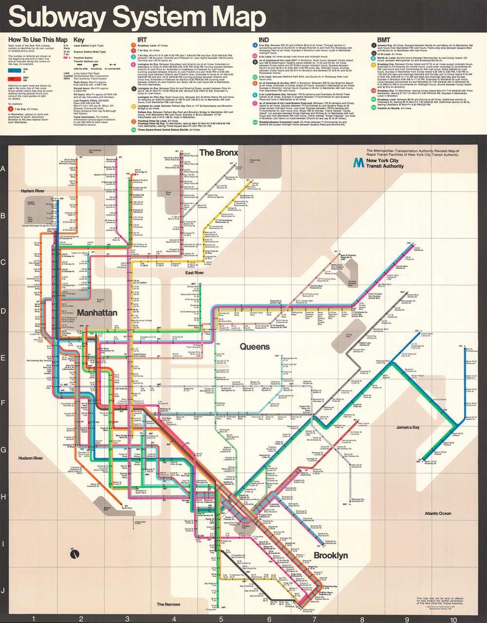
Subway System Map.
sold
A masterpiece of 20th century graphic design, this is the 1978 Massimo Vignelli map of the New York Subway system - one of just 11 surviving examples. The present example is an oversized 'station map' intended for public displayed in stations, not individual use. The current example can trace its provenance to Peter Lloyd, the published expert on Vignelli subway maps. (more details)
Up-to-Date, if fictitious.
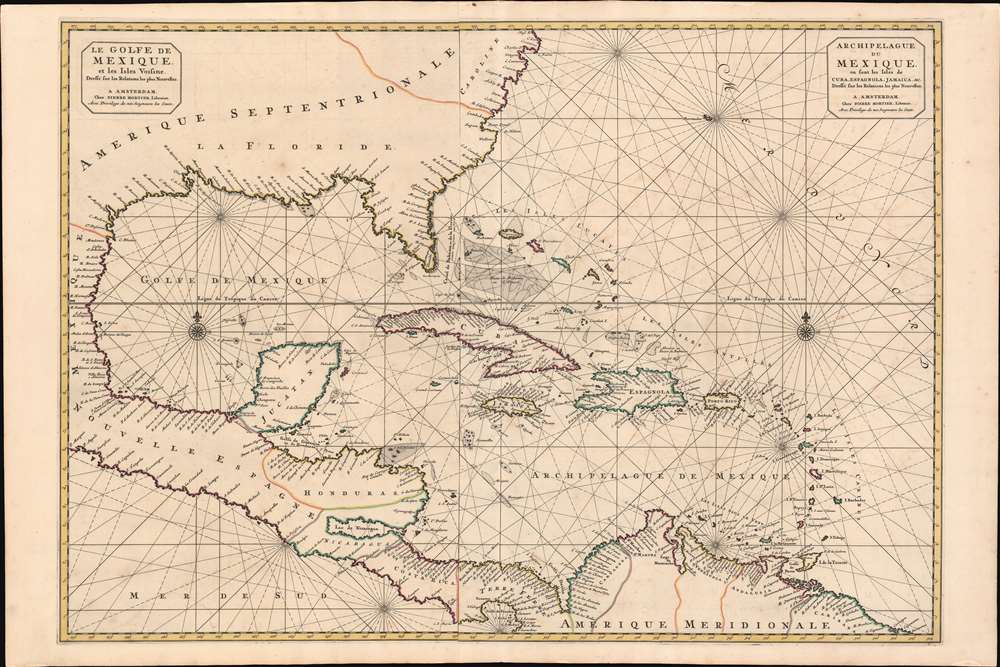
Le Golfe de Mexique et les Isles Voisine Dressé sr les Relations les plus Nouvelles. / Archipelague du Mexique, ou sont les Isles de Cuba, Espagnola, Jamaica, et c. Dressé sur les relations les plus Nouvelles.
sold
- Digital Map Information
- Suitable for large format printing
- DPI: 600
- File Size: 46.72 MB
- File Type: ZIP / TIFF
- ICC color profile embedded
- Delivered instantly via download link
A scarce and striking 1700 Pierre Mortier nautical map embracing Florida, the Gulf of Mexico, Central America, the West Indies, and the Caribbean. Presented on two sheets, joined at center by the publisher, it is centered on Cuba, but extends broadly from Cape Lookout to the Gulf of Darien and from Mexico to Bermuda, Surinam, and Barbados. (more details)
Bear wrestling.
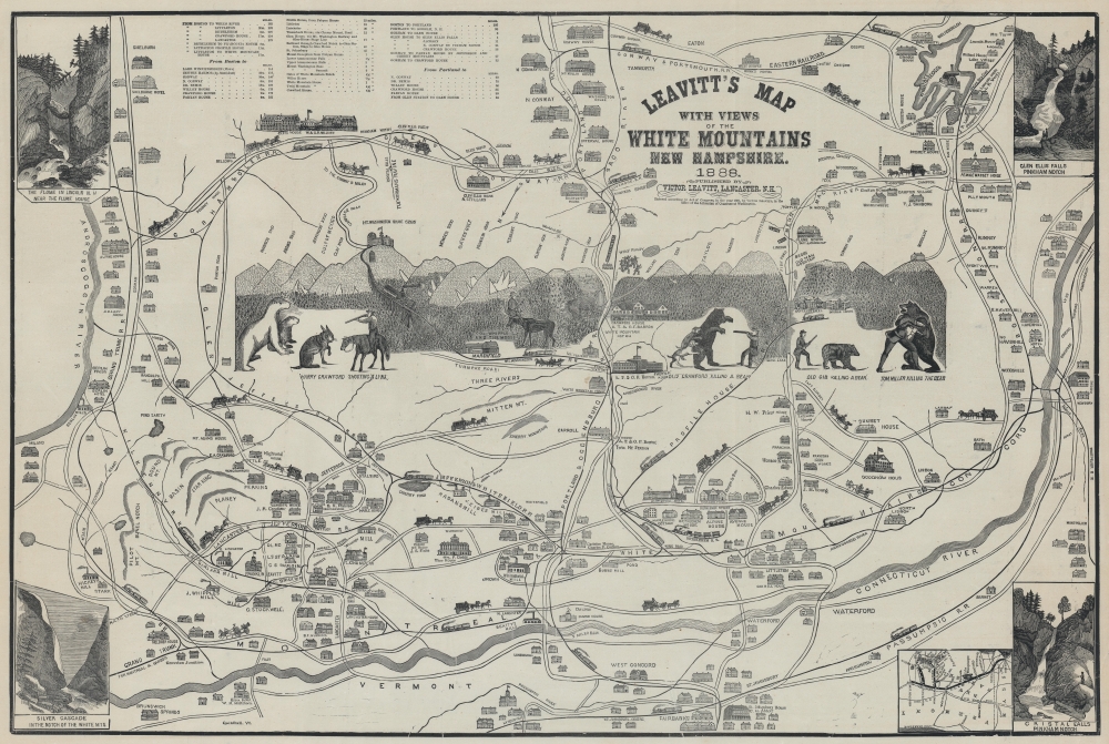
Leavitt's Map with Views of the White Mountains, New Hampshire.
sold
- Digital Map Information
- Suitable for large format printing
- File Size: 88.77 MB
- File Type: ZIP / TIFF
- ICC color profile embedded
- Delivered instantly via download link
Complete with frightening bears, this is Franklin and Victor Leavitt's idiosyncratic 1888 pictorial map of New Hampshire's White Mountains. The map is most admired for its folksy central illustration, incorporating local legends Old Crawford, Tom Miller, Old Gib, and Harry Crawford engaged in the mortal combat with bears and a lynx against the backdrop of the White Mountains. There is even one image of a particularly adventurous woodsman, Col. Whipple, relaxing in the embrace of a moose's massive antlers. (more details)
To the Ends of the Continent.
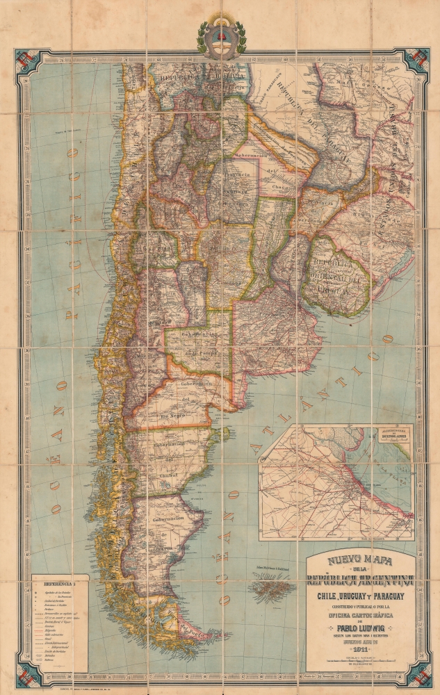
Nuevo Mapa de la República Argentina, Chile, Uruguay y Paraguay.
sold
- Digital Map Information
- Suitable for large format printing
- File Size: 82.81 MB
- File Type: ZIP / TIFF
- ICC color profile embedded
- Delivered instantly via download link
A vividly-colored large-format 1911 folding map of southern South America (Argentina, Chile, Uruguay, and Paraguay), published in Buenos Aires by Pablo Ludwig. It depicts the region in the wake of large-scale immigration and expansion of infrastructure, especially in the vicinity of Buenos Aires and in the regions to the city's south. (more details)
First separate map of any Southeast Asian island to be based on actual observation.' - Suarez
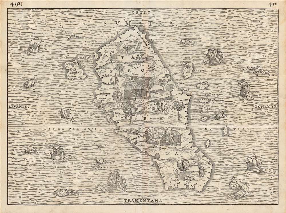
Sumatra/ Taprobana.
sold
- Digital Map Information
- Suitable for large format printing
- DPI: 600
- File Size: 35.47 MB
- File Type: ZIP / TIFF
- ICC color profile embedded
- Delivered instantly via download link
This is the seminal 1556 Giovanni Battista Ramusio map of Sumatra, 'the first separate map of any Southeast Asian island to be based on actual observation' (Suarez) and one of the first European maps to focus narrowly on so remote a part of the world. It appeared in Ramusio's i>Navigationi et Viaggi, the first collection of explorers' first-hand accounts of their travels. The source for this map came from the reports of Jean and Raoul Parmentier, who in 1529 ran the Portuguese blockade and attempted to compete with that power on behalf of the French by setting up a trading post at the Sumatran port of Ticon. It didn't work out - the Parmentier brothers died of fever, and only one ship of the expedition returned to France. The French saw no advantage in following up on this failure.
The woodcut represents the first glimpse in print of any specific Southeast Asian island, and this alone would make it desirable. It is moreover a very attractively executed woodcut: the sea around the island teems with fish, sea monsters, and ships - some of these bearing the Portuguese arms, and some flying the fleur de lis, alluding to the map's political context. There is also an element of Ramusio encouraging his French audience, suggesting that whatever the Portuguese have found in the world, the French ought to be able to take.
The map of the island is the first to entirely abandon Ptolemy's depiction of Taprobana, and along with Münster is among the first to associate that placename definitively with Sumatra rather than Ptolemy's conflation of the place with Sri Lanka. Moreover, it is the first map to approach an accurate outline of Sumatra, realistically showing river inlets and bays on the coastline. The island's inland features are presented pictorially, showing trees, dwellings, animals, and people - men leading horses and camels, armed soldiers, men on horseback, and others harvesting coconuts. The variety and specificity of the depicted denizens suggest the presence of, and the author's familiarity with, organized social structures on Sumatra: an indication that here was not an uncivilized place, (like Ramusio's demon-haunted map of Canada), but somewhere one could go to do business. (more details)
The woodcut represents the first glimpse in print of any specific Southeast Asian island, and this alone would make it desirable. It is moreover a very attractively executed woodcut: the sea around the island teems with fish, sea monsters, and ships - some of these bearing the Portuguese arms, and some flying the fleur de lis, alluding to the map's political context. There is also an element of Ramusio encouraging his French audience, suggesting that whatever the Portuguese have found in the world, the French ought to be able to take.
The map of the island is the first to entirely abandon Ptolemy's depiction of Taprobana, and along with Münster is among the first to associate that placename definitively with Sumatra rather than Ptolemy's conflation of the place with Sri Lanka. Moreover, it is the first map to approach an accurate outline of Sumatra, realistically showing river inlets and bays on the coastline. The island's inland features are presented pictorially, showing trees, dwellings, animals, and people - men leading horses and camels, armed soldiers, men on horseback, and others harvesting coconuts. The variety and specificity of the depicted denizens suggest the presence of, and the author's familiarity with, organized social structures on Sumatra: an indication that here was not an uncivilized place, (like Ramusio's demon-haunted map of Canada), but somewhere one could go to do business. (more details)
Giving hope to the revolutionary cause.
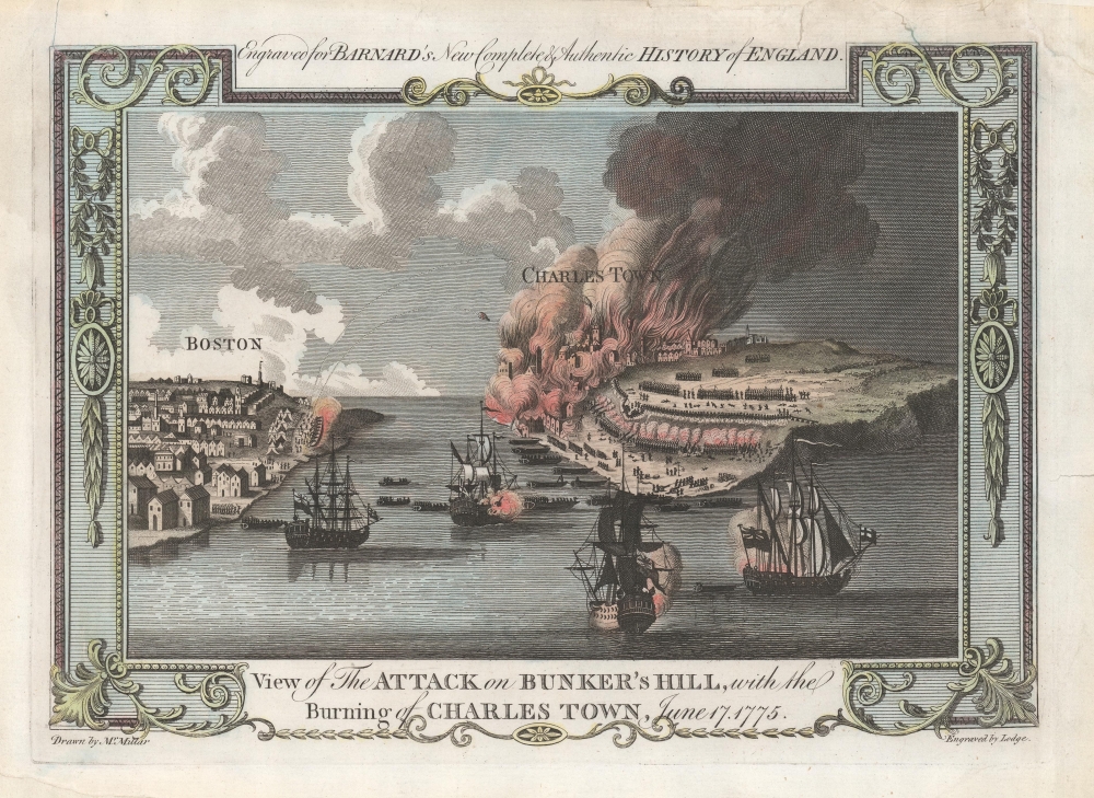
View of the Attack on Bunker's Hill, with the Burning of Charles Town, June 17, 1775.
sold
- Digital Map Information
- Suitable for large format printing
- DPI: 600
- File Size: 16.6 MB
- File Type: ZIP / TIFF
- ICC color profile embedded
- Delivered instantly via download link
One of the earliest obtainable views of the 1775 American Revolutionary War (1775 - 1783) Battle of Bunker Hill. Published in 1783, this view illustrates the June 17, 1775, Battle of Bunker Hill, near Boston, one of the first and most significant battles of the war. (more details)
Italian Map promoting the California Gold Rush.
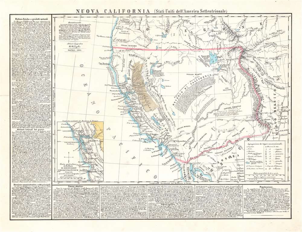
Nuova California (Stati Uniti dell'America Settentrionale).
sold
- Digital Map Information
- Suitable for large format printing
- DPI: 600
- File Size: 64.38 MB
- File Type: ZIP / TIFF
- ICC color profile embedded
- Delivered instantly via download link
This is the scarce 1851 Benedetto Marzolla map of the American West highlighting (and exaggerating) the gold-producing region of California. It was drawn to capitalize on global fascination with the American West that exploded with the news of the Gold Rush - which this map was calculated to address and amplify. (more details)
'An Excellent Map' -Wheat
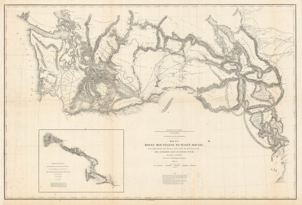
Map No. 3 Rocky Mountains to Puget Sound; from Explorations and Surveys Made Under the Direction of the Hon. Jefferson Davis Secretary of War.
sold
- Digital Map Information
- Suitable for large format printing
- File Size: 105.16 MB
- File Type: ZIP / TIFF
- ICC color profile embedded
- Delivered instantly via download link
This is a superb example of the map detailing Isaac Stevens' 1853-1854 reconnaissance of a railway route through the Rocky Mountains to the Pacific. This was part of a broad United States effort to determine a workable rail route to the Pacific through the Rockies, in the hope of opening Asian markets to American trade. Stevens, then en route to take up his new role as governor and Superintendent of Indian Affairs for the Washington Territory, successfully bid to undertake this survey of the route, which was executed over most of 1853 and part of 1854. (more details)
Comic record of the elusive 951 Aviation Engineer Topographic Company.
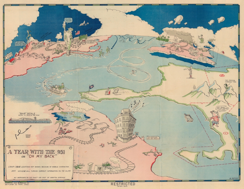
A Year with the 951 or 'Oh My Back'.
sold
- Digital Map Information
- Suitable for large format printing
- Full resolution TIFF file
- ICC color profile embedded
- Delivered instantly via download link
This is a c. 1942 W. Potter 951st Aviation Engineer Topographic Company pictorial route map of Africa, Europe, and the United States. It is one of the most comic maps in the World War II route maps genre. Loosely tracing the company's movements through the end of 1942, Potter fills the map with hilarious vignettes and inside jokes. Curiously, this map is the only known reference to the 951st Aviation Engineer Topographic Company. (more details)
Firemen or gangsters?
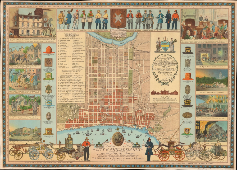
A Map of the City of Philadelphia Showing the Location of the Volunteer Fire Companies with Pictures of Some of their Engines and Equipment, Prior to, and Contemporaneous with, the Founding of the Insurance Company of North America.
sold
- Digital Map Information
- Suitable for large format printing
- File Size: 128.88 MB
- File Type: ZIP / TIFF
- ICC color profile embedded
- Delivered instantly via download link
A first edition 1938 pictorial map of the city of Philadelphia celebrating that city's 19th century volunteer fire companies and the Insurance Company of North America. Volunteer Fire Companies, active throughout the 19th century, were powerful players in Philadelphia's social, political, and even criminal organizations. (more details)
Before the Back Bay.
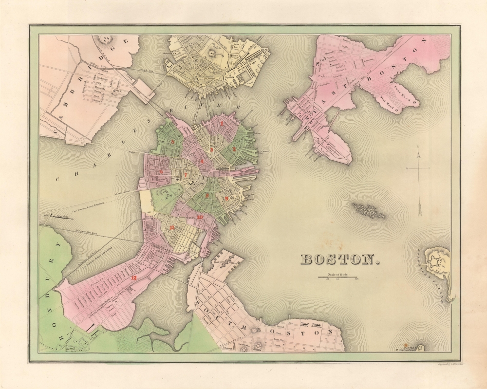
Boston.
sold
- Digital Map Information
- Suitable for large format printing
- DPI: 600
- File Size: 20.38 MB
- File Type: ZIP / TIFF
- ICC color profile embedded
- Delivered instantly via download link
This is a first edition, first state, of the 1838 Thomas G. Bradford map of Boston. The map reveals the city on the cusp of its transformation, via landfills and railroads, from a colonial port to a major metropolitan center. (more details)
Published on board the U.S.S. Bowditch in August 1945 just before the end of World War II.
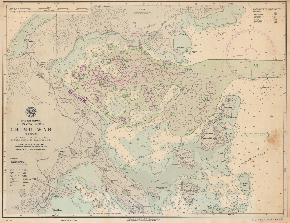
Nansei Shoto. Okinawa Shima. Chimu Wan (Kinmu Wan).
sold
- Digital Map Information
- Suitable for large format printing
- File Size: 42.74 MB
- File Type: ZIP / TIFF
- ICC color profile embedded
- Delivered instantly via download link
This is a 1945 U.S. Navy Hydrographic Office nautical chart or map of Chimu Wan, Okinawa, illustrating preparations for Operation Downfall, the planned invasion of Japan's Home Islands, through an ongoing naval buildup. Significantly, this is one of the few surviving charts published on board the U.S.S. Bowditch. It is poignant that the last update on this map is August 5, the day before the first atomic bomb was dropped on Hiroshima, underscoring uncertainty surrounding the war's potential end. (more details)
Beautifully detailed pictorial map of the Upper Penobscot Bay region.
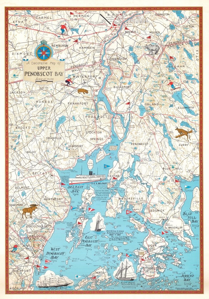
A Decorative Map of Upper Penobscot Bay.
sold
This is a charming 1972 Augustus D. Phillips pictorial map of the upper Penobscot Bay. Featuring illustrations of ships and local wildlife, Phillips's many iconic Maine maps combine practical information, history, humor, and beautiful detail, making them a favorite of 'in the know' collectors. (more details)
Published on board the U.S.S. Bowditch near the end of World War II.
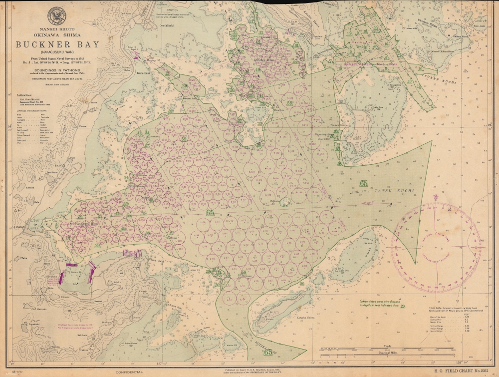
Nansei Shoto. Okinawa Shima. Buckner Bay. (Nakagusuku Wan).
sold
- Digital Map Information
- Suitable for large format printing
- File Size: 49.17 MB
- File Type: ZIP / TIFF
- ICC color profile embedded
- Delivered instantly via download link
This is a 1945 U.S. Navy Hydrographic Office nautical chart or map of Buckner Bay or Nakagusuku Wan, Okinawa illustrating preparations for Operation Downfall, the planned invasion of Japan's Home Islands. Significantly, this is one of the few surviving charts published on board the U.S.S. Bowditch. (more details)
Familiarizing American soldiers and sailors with the Western Pacific.

Guide to the Western Pacific. For the use of the Army, Navy, and Marine Corps of the United States of America.
sold
- Digital Map Information
- Suitable for large format printing
- Full resolution TIFF file
- ICC color profile embedded
- Delivered instantly via download link
This is a CinCPac (Commander in Chief Pacific) CinCPOA (Commander in Chief Pacific Ocean Area) guidebook to the Western Pacific featuring pictorial maps of many of the islands where battles were fought during World War II (1939 - 1945). The guidebook provides information on various Pacific islands including the Gilbert Islands, the Marshall Islands, the Caroline Islands (with sections dedicated to specific islands in the archipelago some of which were still occupied by the Japanese and had been left to 'wither on the vine'), the Marianas Islands, the Philippines, Taiwan (Formosa), and the Nansei Shoto (Southwestern Islands) which include Okinawa. There's also a section dedicated to the China coast from Hong Kong to Shanghai. A section is dedicated to Wake Island, which had fallen to the Japanese shortly after Pearl Harbor despite a valiant defense by American forces stationed there. (more details)
Archeological guidebook to Angkor Wat.

Guide Archéologique aux Temples d'Angkor.
sold
- Digital Map Information
- Suitable for large format printing
- Full resolution TIFF file
- ICC color profile embedded
- Delivered instantly via download link
This is Henri Marchal's landmark 1928 guidebook Guide Archéologique aux Temples d'Angkor. At over 200 pages, Marchal, then the official conservator of Angkor, provides detailed information about each temple, as well as the Royal Palace and other sites throughout the complex. Photographs and plans of the temples appear within the text. Three fold out maps are appended in the back. These include a road map of Cambodia, a map of the entire complex, and a plan of the Bayon temple. (more details)
A revolution the mapping of Japan.
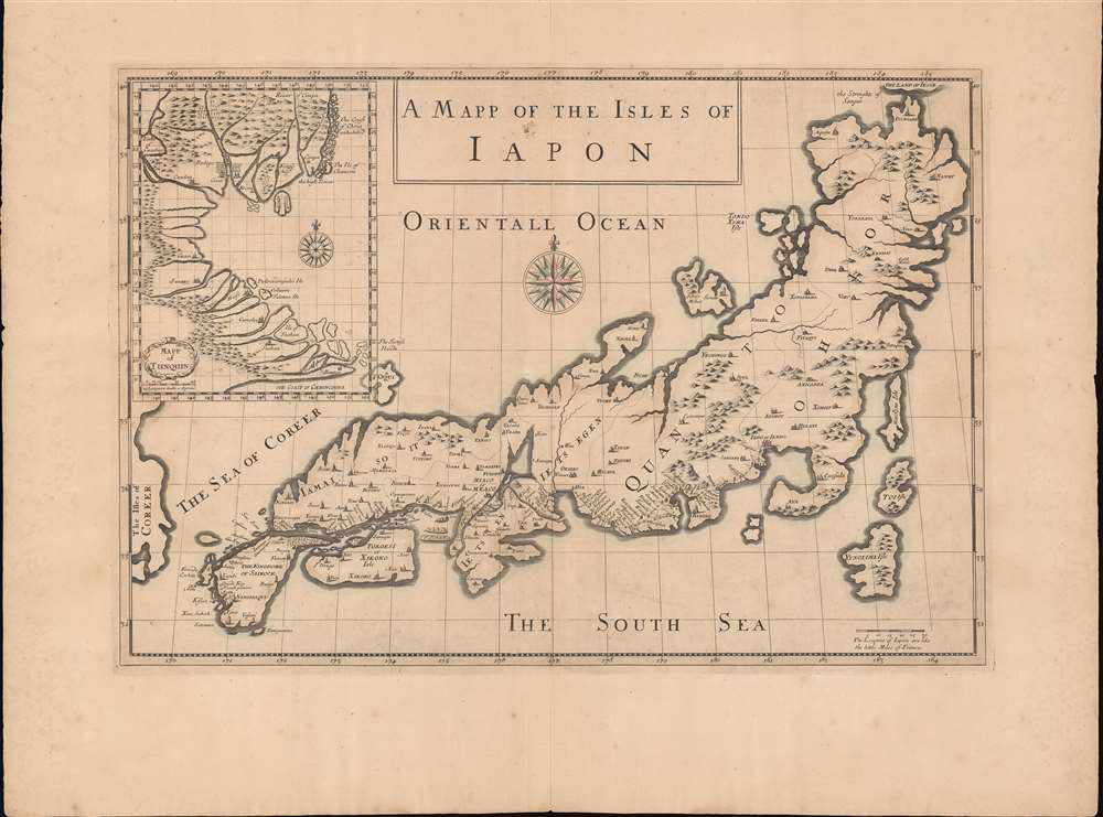
A Mapp of the Isles of Iapon. / Map of Tunquin.
sold
- Digital Map Information
- Suitable for large format printing
- DPI: 600
- File Size: 26.04 MB
- File Type: ZIP / TIFF
- ICC color profile embedded
- Delivered instantly via download link
An extremely rare work, this is the 1680 map of Japan and Vietnam (Tonkin) that accompanied the Moses Pitt edition of the travels of Daniel and Jean-Baptiste Tavernier. It is a seminal work, being among the first European maps of Japan (and Vietnam) based upon actual reconnaissance. (more details)
Southern frontiers of the British Colonies in North America.
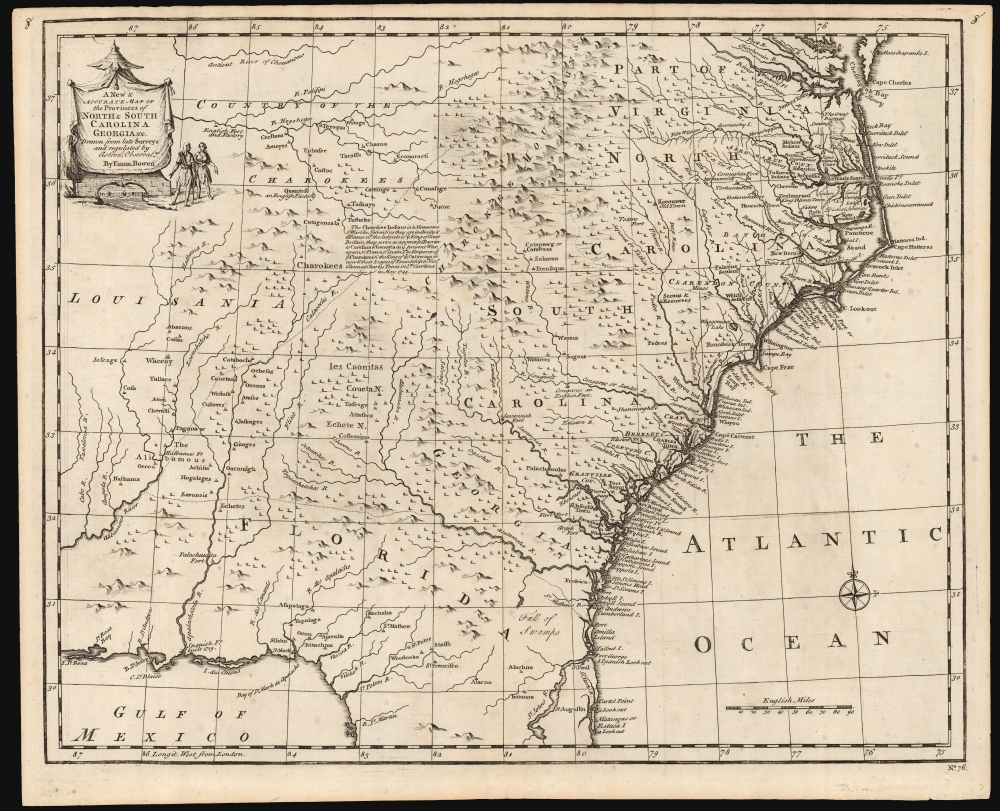
A New and Accurate Map of the Provinces of North and South Carolina etc.
sold
- Digital Map Information
- Suitable for large format printing
- DPI: 600
- File Size: 28.04 MB
- File Type: ZIP / TIFF
- ICC color profile embedded
- Delivered instantly via download link
This is a strong example of Emmanuel Bowen's 1747 map of the Carolinas and Georgia. The map reveals the region against the rising hostilities that would soon culminate in the French and Indian War (1754 - 1763). Among its highlights are the defenses of the Georgia colony - then just 13 years old. It also notes the American Indian treaties and alliances that were the cornerstone of British colonial governance and commerce. (more details)