
The Great Metropolis.
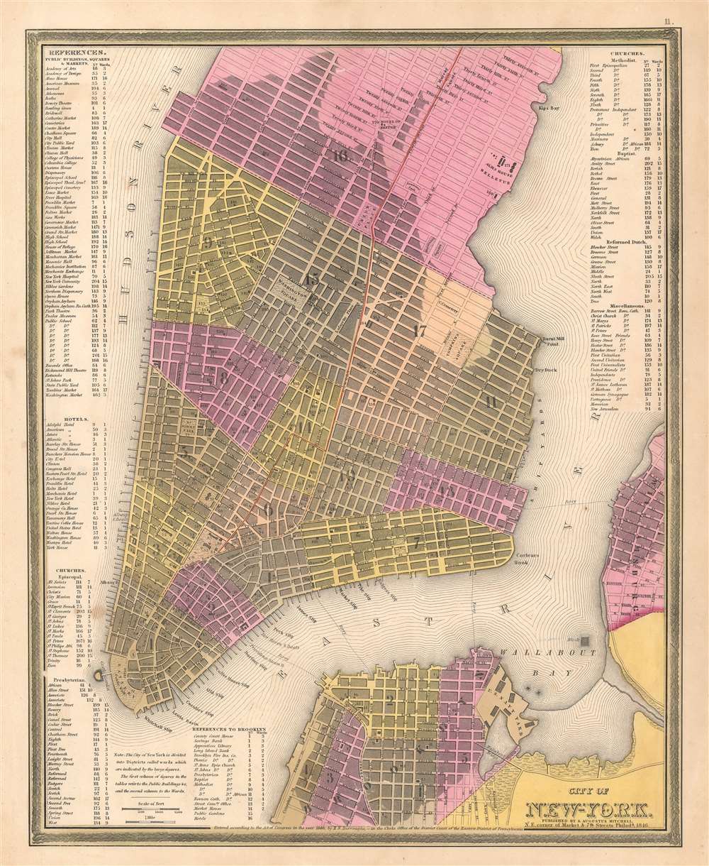
City of New York.
sold
- Digital Map Information
- Suitable for large format printing
- Full resolution TIFF file
- ICC color profile embedded
- Delivered instantly via download link
This is a beautiful example of S. A. Mitchell 1846 map of New York City. The map depicts southern Manhattan from 37th Street (Kips Bay) south to Battery Park and Brooklyn from Williamsburg to Columbia St. Mitchell offers wonderful detail at the street level ... (more details)
Pictorial map of Rocky Mountain National Park.

Rocky Mountain National Park.
sold
- Digital Map Information
- Suitable for large format printing
- Full resolution TIFF file
- ICC color profile embedded
- Delivered instantly via download link
This is a 1948 Rocky Mountain Motor Company pictorial map of Estes Park and Rocky Mountain National Park, Colorado. A truly verdant map, famous lakes, mountain peaks, and other sites throughout are identified. Among these are Longs Peak, Bear Lake, Dream Lake, and the Never Summer Range. Cabins, lodges, hotels, and tourist accommodations are illustrated and labeled. 'World Famous Trail Ridge Road winds its way into the mountains near the Harmony Guest Ranch and reaches the Trail Ridge Museum before crossing the Continental Divide. Many of Rocky Mountain National Park's animal residents are illustrated as well, including elk, deer, mountain sheep, and a bat. Home to the headwaters of the mighty Colorado, a drop literally runs its way down Phantom Valley (it's drawn with legs and a face) on its way to Hoover Dam and the Grand Canyon. A view of beautiful Bear Lake adorns the right border and a stunning view of Grand Lake, the largest natural body of water in Colorado, appears on the opposite side. (more details)
'The most picturesque and charming summer resort in America.'

Lake Champlain and Lake George.
sold
- Digital Map Information
- Suitable for large format printing
- File Size: 155 MB
- File Type: ZIP / TIFF
- ICC color profile embedded
- Delivered instantly via download link
An impressive 1911 bird's-eye view of the Adirondack Mountains, Lake George, Lake Champlain, and environs drawn by H. H. Green and published by Poole Brothers. Sponsored by the Delaware and Hudson Company and the Champlain Transportation Company, it advertises the region's natural beauty and amenities to attract potential tourists. (more details)
Go for a cruise around Biscayne Bay!
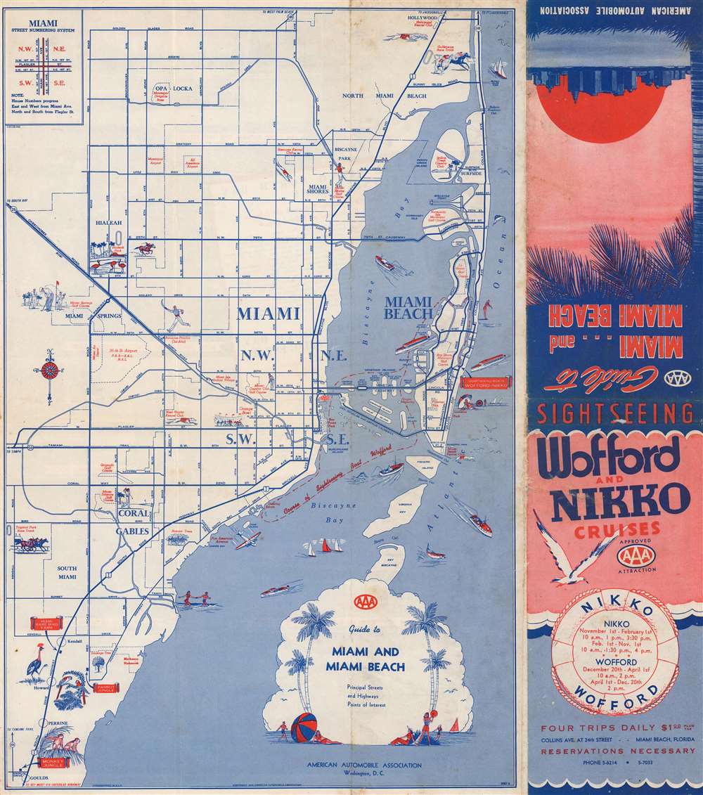
Guide to Miami and Miami Beach.
$250.00
Acquire
- Digital Map Information
- Suitable for large format printing
- Full resolution TIFF file
- ICC color profile embedded
- Delivered instantly via download link
This is a 1945 American Automobile Association city map of Miami and Miami Beach, Florida. Distributed by Wofford and Nikko Cruises, the 'course of Sightseeing Boat Wofford' appears as a dashed line within Biscayne Bay, under the two causeways connecting Miami and Miami Beach, and along Miami's coastline from the Venetian Causeway to the Deering Estate. Pictorial vignettes highlight the Orange Bowl, the West Flagler Kennel Club, Hialeah Park, and the Miami Springs Golf Course. Vignettes also promote the Parrot Jungle, Monkey Jungle, and Miami Rare Bird Farm in South Miami. Red text also identifies numerous city parks, the 36th Street Airport, the Pan American flying boat terminal, and several golf courses. (more details)
Fascinating and influential representation of world history.
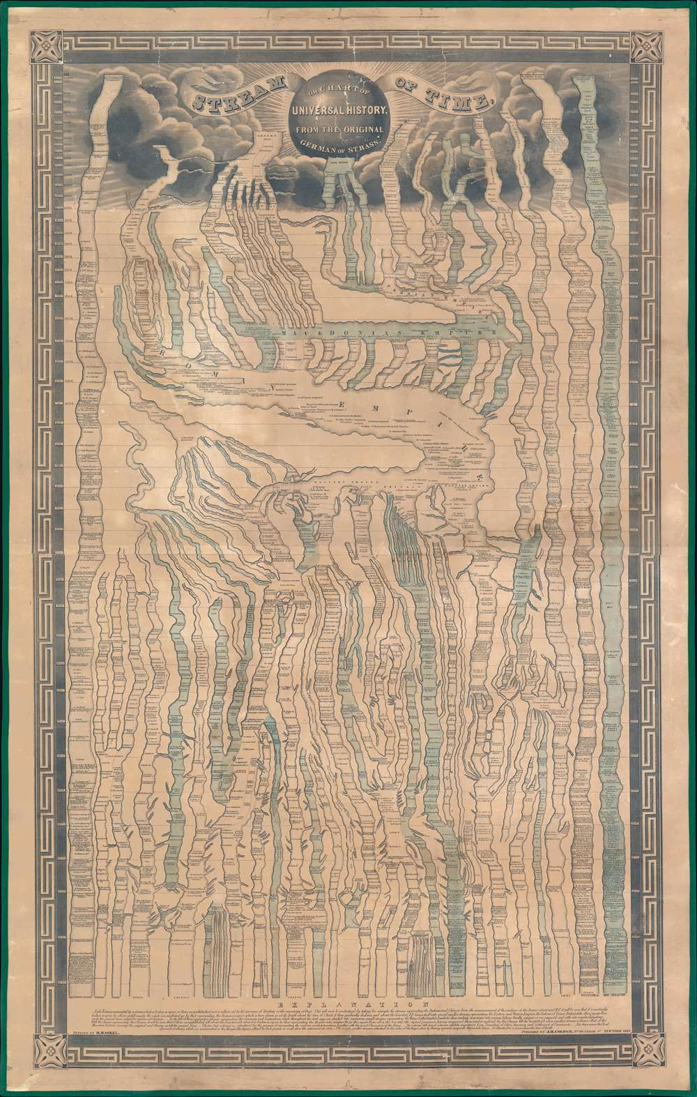
Stream of Time or Chart of universal history, from the original German of Strass.
sold
- Digital Map Information
- Suitable for large format printing
- Full resolution TIFF file
- ICC color profile embedded
- Delivered instantly via download link
A remarkable 1845 chart of world history covering the passage of time from creation (4004 BC) to roughly 1845. (more details)
Natural resources of Guatemala along with its physical and political geography.
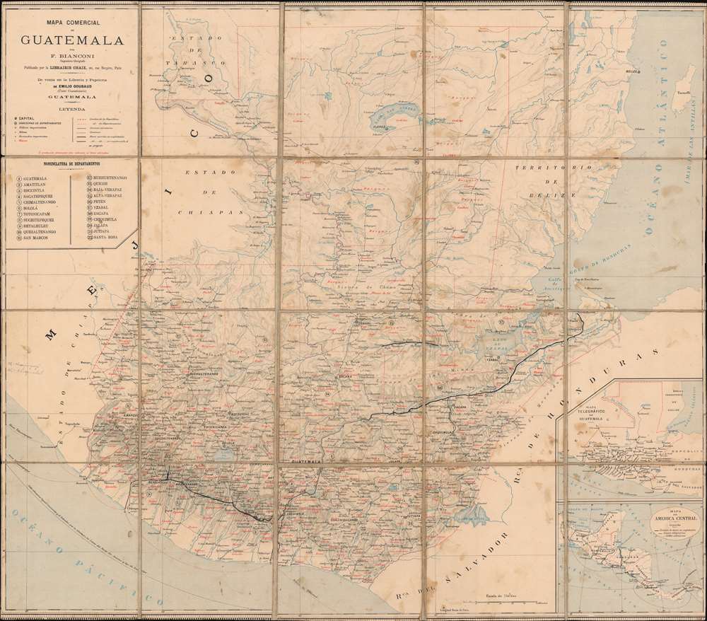
Mapa Comercial de Guatemala.
sold
- Digital Map Information
- Suitable for large format printing
- File Size: 43.77 MB
- File Type: ZIP / TIFF
- ICC color profile embedded
- Delivered instantly via download link
This is a c. 1890 F. Bianconi economic map of Guatemala. As a commercial map, Guatemala's rich natural resources are extolled from Tikal to the Pacific Ocean. Small italic print in both French and Spanish indicates the different products produced, grown, harvested, or raised. These include sarsaparilla, vanilla, mahogany, cedar, pastureland, cotton, wheat, sugarcane, and other grains. 'Forests' are also indicated as important sources of cedar, mahogany, and other tropical woods. (more details)
Mash-up of indigenous and European cartography.
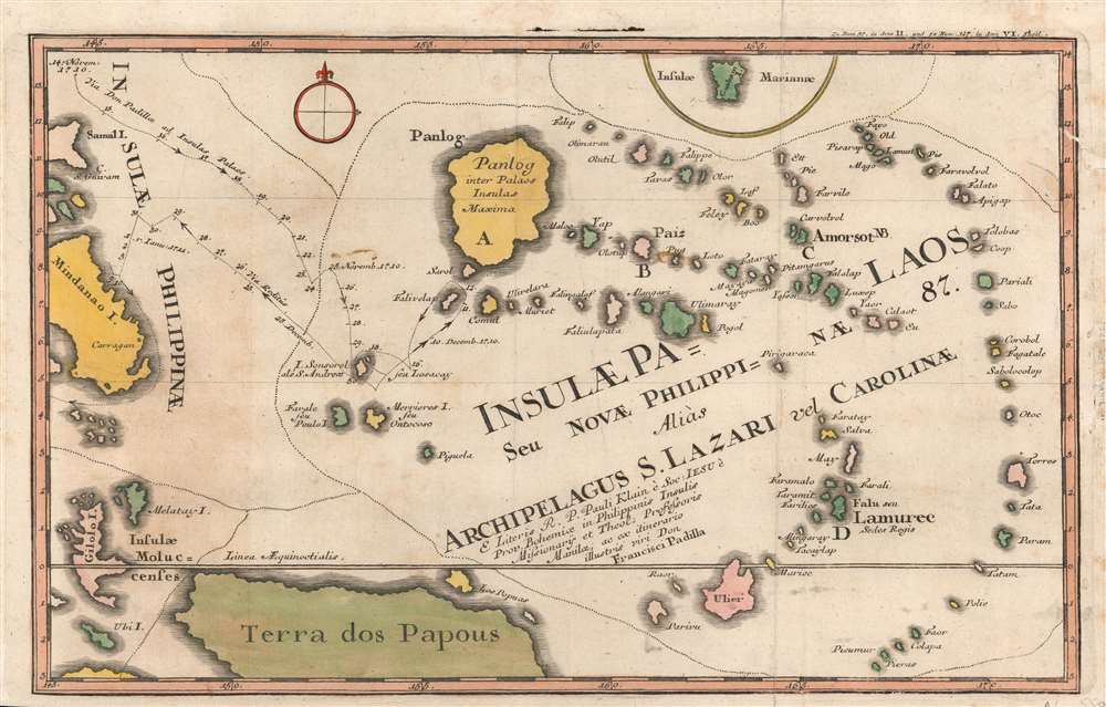
Insulae Palaos seu Novae Philippinae 87, alias Archipelagus S. Lazari vel Carolinae.
sold
- Digital Map Information
- Suitable for large format printing
- DPI: 600
- File Size: 14.58 MB
- File Type: ZIP / TIFF
- ICC color profile embedded
- Delivered instantly via download link
A beautifully hand-colored 1726 Stöcklein map of Palau and surrounding islands in the southwestern Pacific. This map is a fascinating mash-up of Europeand and Indigenous cartography. It is an especially early presentation of these islands, based on a cartographic game of telephone from native Palauans waylaid in the Philippines through the Jesuits and then to the European public via Joseph Stöcklein. (more details)
First edition of an iconic pictorial map.

A Map of Long Island.
sold
- Digital Map Information
- Suitable for large format printing
- File Size: 39.69 MB
- File Type: ZIP / TIFF
- ICC color profile embedded
- Delivered instantly via download link
This is a charming 1933 first edition pictorial map of Long Island by Courtland Smith. This historical map covers from New London in Connecticut and Fishers Island south as far as the Lower New York Bay and Staten Island. Long Island is depicted in its entirety from Brooklyn and Queens east to Montauk. Throughout, the map notes cities, towns, beaches, radio stations, parks, ferry lines, lighthouses and several other important landmarks, scenes, and activities. Several landmarks have been attractively illustrated, including the Montauk Point Light, Fire Island Light, Southampton, Coney Island, etc. Gardiner's Island - 'here Capt. Kidd buried loot' and Oyster Park - 'Burial Place of Theodore Roosevelt' are noted. When Smith died, the mayor of Southampton remarked about this map:
That map has had a significant impact on the development of not only Southampton, but all the other towns on Long Island that it features.(more details)
War over the Caucasus.
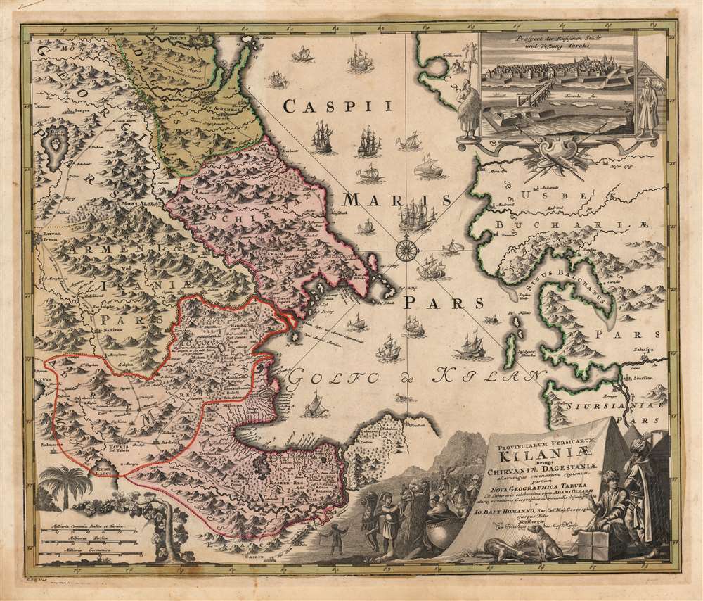
Provinciarum Persicarum Kilaniae nempe Chirvaniae Dagestaniae.
sold
- Digital Map Information
- Suitable for large format printing
- DPI: 600
- File Size: 73.11 MB
- File Type: ZIP / TIFF
- ICC color profile embedded
- Delivered instantly via download link
This map, printed by Johann Baptist Homann and published by his son Johann Christoph Homann, focuses on the Caucuses, now occupied by modern-day Dagestan, Azerbaijan, Armenia, and Iran, on the western coast of the Caspian Sea. The inset view at the upper right depicts Terek, which appears on the map at its northern extent. This was the main outpost of the Terek Cossacks, Russia's vassals on the Empire's Caucasus frontier. (more details)
The drive for a global telegraph circuit.
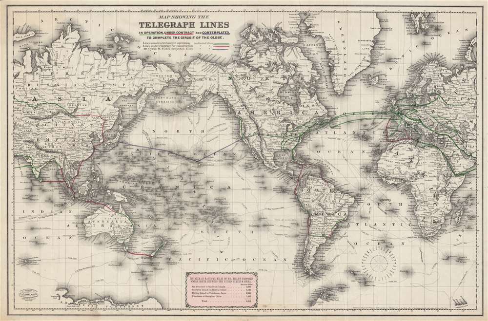
Map showing the telegraph lines in operation, under contract, and contemplated, to complete the circuit of the globe.
sold
- Digital Map Information
- Suitable for large format printing
- File Size: 66.94 MB
- File Type: ZIP / TIFF
- ICC color profile embedded
- Delivered instantly via download link
This is an engaging c. 1871 map of existing and proposed global telegraph lines produced by G.W. and C.B. Colton. This map was produced in the wake of a speech to the U.S. Congress by Cyrus W. Field in May 1870 promoting a Transpacific cable. It highlights the promise of a complete global telegraph circuit, including across the Pacific Ocean, a project not completed until more than thirty years later. (more details)
The North Pole in Texas?

Official Texas Brags Map of North America.
sold
- Digital Map Information
- Suitable for large format printing
- File Size: 33.42 MB
- File Type: ZIP / TIFF
- ICC color profile embedded
- Delivered instantly via download link
This is a 1948 John Randolph and Mark Storm pictorial map of Texas dominating North America. Depicting the entirety of North America, Texas engulfs from the Pacific Ocean north of the Baja Peninsula to most of the Gulf Coast and from almost the Yucatan Peninsula to north of the actual U.S.-Canada border. (more details)
Cutting Edge Asian Geography for an English Audience.
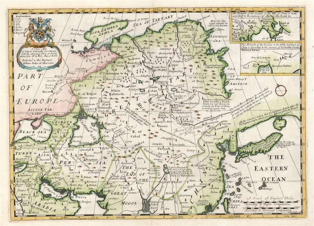
A New Map of Great Tartary, and China, with the adjoyning Parts of Asia.
$550.00
Acquire
- Digital Map Information
- Suitable for large format printing
- DPI: 600
- File Size: 40.85 MB
- File Type: ZIP / TIFF
- ICC color profile embedded
- Delivered instantly via download link
This is Edward Wells' 1700 map of central and northern Asia. The map spans from the near east - Mesopotamia and Persia, and the frontier of Muscovy - to Siberia and Tartary, as well as China, Korea, and Japan. (more details)
A map of New Jersey from the first atlas produced in the American Republic.
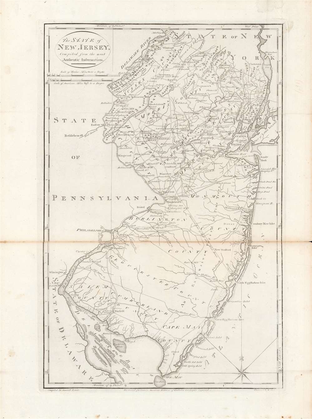
The state of New Jersey, compiled from the most authentic information.
sold
- Digital Map Information
- Suitable for large format printing
- DPI: 600
- File Size: 28 MB
- File Type: ZIP / TIFF
- ICC color profile embedded
- Delivered instantly via download link
Here is Mathew Carey and Samuel Lewis' c. 1796 map of New Jersey, made for Carey's General Atlas, the first atlas produced and published in the American Republic. It portrays the state in the years just after the American Revolution, in which it had played a central role. (more details)
The first outline of the Transpacific telegraph cable.
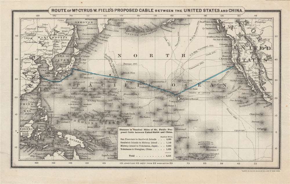
Route of Mr. Cyrus W. Field's Proposed Cable Between the US and China.
sold
- Digital Map Information
- Suitable for large format printing
- File Size: 13.45 MB
- File Type: ZIP / TIFF
- ICC color profile embedded
- Delivered instantly via download link
This is a fascinating c. 1871 G.W. and C.B. Colton map of a proposed telegraph cable across the Pacific Ocean. This map was produced in the wake of a speech to the U.S. Congress by Cyrus W. Field in May 1870 promoting a Transpacific cable. Although an important global infrastructure link, the Transpacific cable was beset by financing and technical difficulties meant that it would be thirty years before the project was realized. (more details)
Chronologies of kings and empires of the world from Julius Caesar to the 1700s.
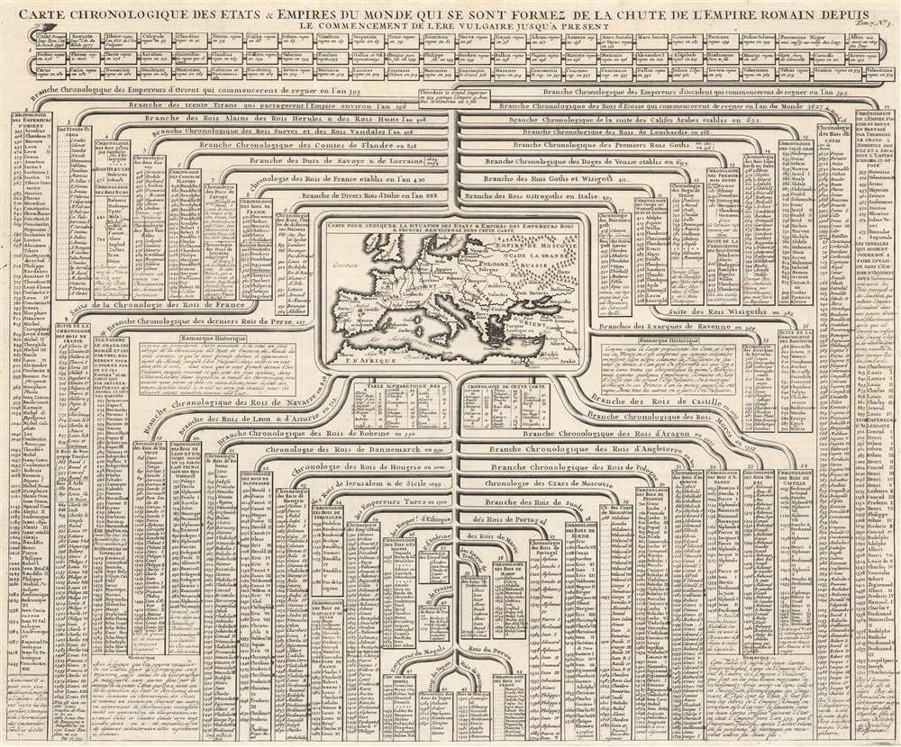
Carte Chronologique des etats et empires du monde qui se sont formez de la chute de l'empire romain depuis le commencement de l'ere vulgaire jusqu'a present.
sold
- Digital Map Information
- Suitable for large format printing
- DPI: 600
- File Size: 71.43 MB
- File Type: ZIP / TIFF
- ICC color profile embedded
- Delivered instantly via download link
This is a 1720 Henri Abraham Chatelain chart of historical empires and nations from dating from Julius Caesar's Rome, up through through Chatelain's present day. The chart chronicles hundreds of years of human history and separates nations and empires into columns. Among the histories recounted are chronologies of the kings of France, Flanders, Persia, Hungary, Denmark, Ethiopia, Jerusalem, and Russia, along with many others. A map of Europe appears at center. In a short description divided between two boxes, Chatelain explains that these chronologies provide a perspective on history following the fall of the western Roman Empire. (more details)
The 'Old Northwest' remembered.
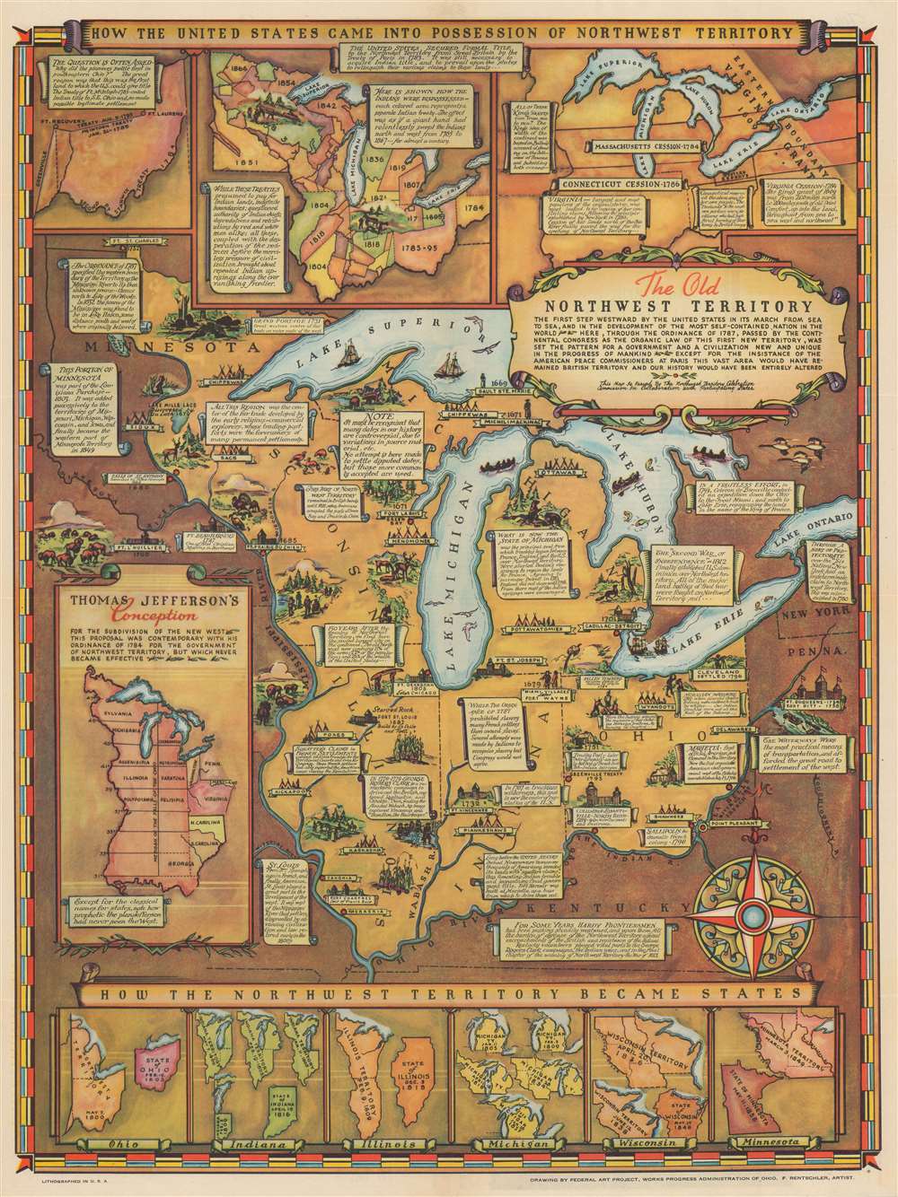
The Old Northwest Territory.
sold
- Digital Map Information
- Suitable for large format printing
- Full resolution TIFF file
- ICC color profile embedded
- Delivered instantly via download link
An uncommon 1937 pictorial map of the old Northwest Territory by Fred Rentschler, accompanied by its original booklet. The map includes all five Great Lakes and the modern-day states of Minnesota, Wisconsin, Illinois, Indiana, Michigan, and Ohio. It includes numerous vignettes referencing historic events, American Indian peoples, and folklore. The main map is surrounded by historical maps illustrating various plans for the Northwest Territory ranging from the 'Thomas Jefferson Conception' to specific illustrations of the individual states in different configurations. The verso features a transcript of the Ordinance of 1787 as well as additional historical text. (more details)
Testing ground for the Air Force.
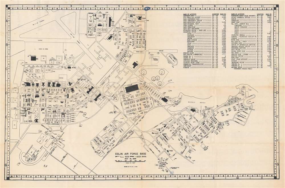
Eglin Air Force Base. / Official Map Eglin Air Force Base, Fla. Air Proving Ground Center (ARDC).
sold
This is a 1955 U.S. Air Force plan or map of Eglin Air Force Base, just east of Pensacola, Florida. Most buildings are numerically identified. Other locations are identified by name, including the tennis courts, bus station, motor pool, baseball diamond, and small arms range. Both runways are labeled, as is the taxiway and warm up apron. An index occupies the upper right noting important to new arrivals. It provides the 'activity', the grid location, and the building number. A more extensive index appears on the verso, although only the building number and grid coordinates are provided. (more details)
One of California's great scenic drives.
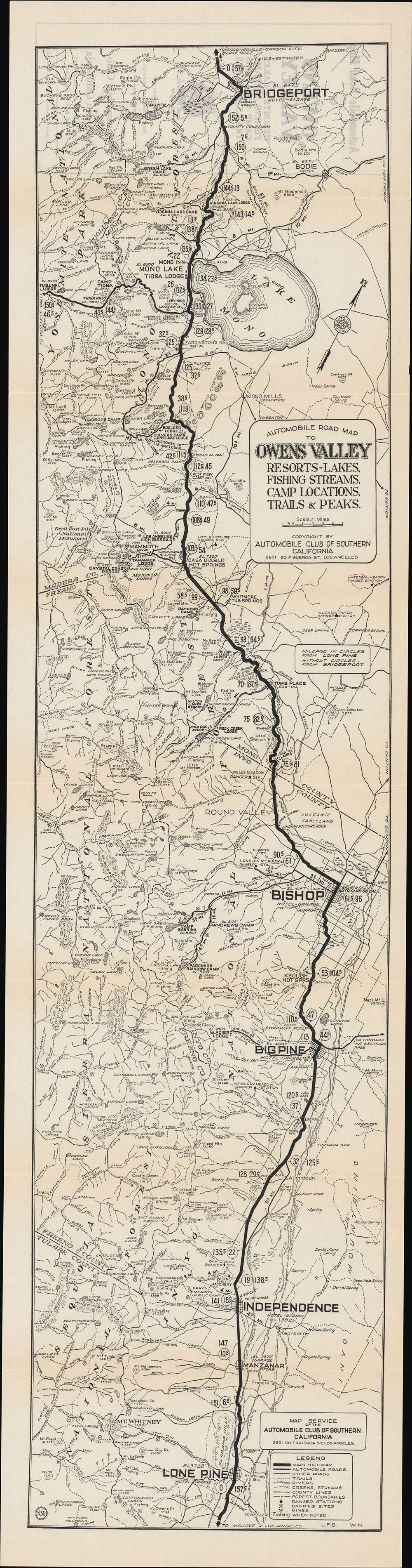
Automobile road map of Owens Valley : resort, lakes, fishing streams, camp locations, trails and peaks.
sold
- Digital Map Information
- Suitable for large format printing
- Full resolution TIFF file
- ICC color profile embedded
- Delivered instantly via download link
This is a rare c. 1930 Automobile Club of Southern California (ACSC) 'strip map' of the Owens Valley and nearby areas between Mono Lake and the Mojave Desert. It illustrates the route to the beautiful scenery of the Sierra Nevada Mountains, which were then becoming an increasingly popular and accessible tourist destination. (more details)
The aftermath of the Opium War.
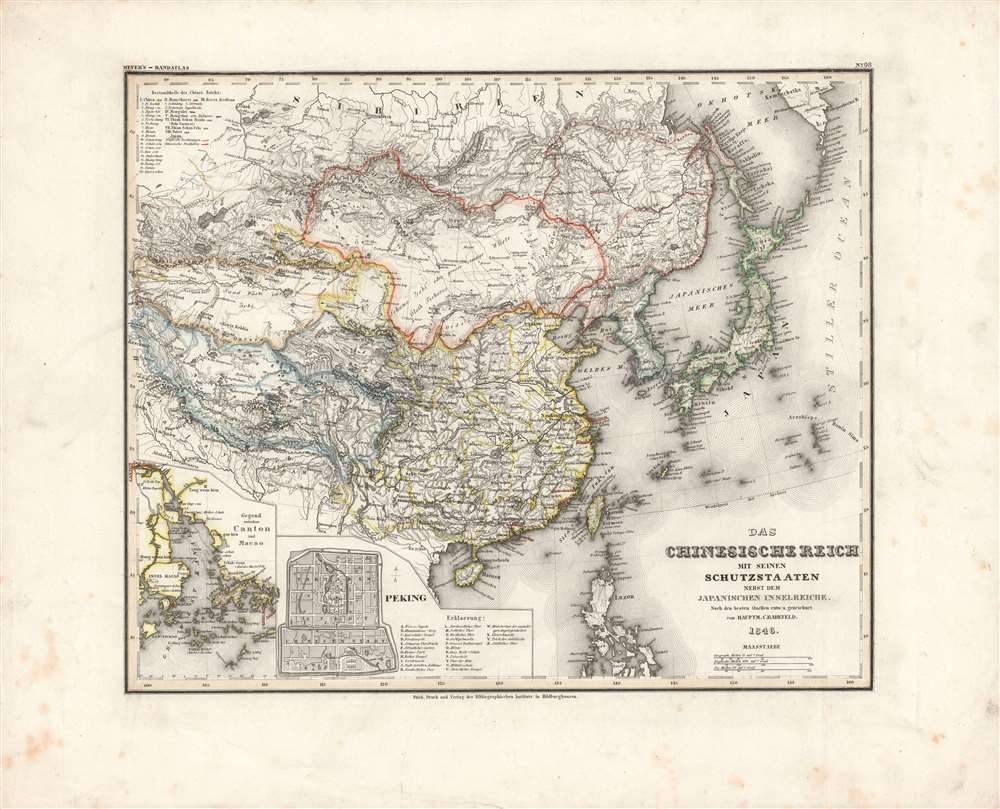
Chinesische Reich mit seinen Schutzstaaten nebst dem Japanischen Inselreiche.
sold
- Digital Map Information
- Suitable for large format printing
- DPI: 600
- File Size: 34.31 MB
- File Type: ZIP / TIFF
- ICC color profile embedded
- Delivered instantly via download link
Here is Carl Radefeld's attractive 1846 map of East Asia, produced for Meyer's Grosser Hand-Atlas. It depicts the region in the wake of the Opium War (1839-1842), when the momentous changes initiated by that conflict had just begun and were not yet fully understood. (more details)
The origins of the Great Game.
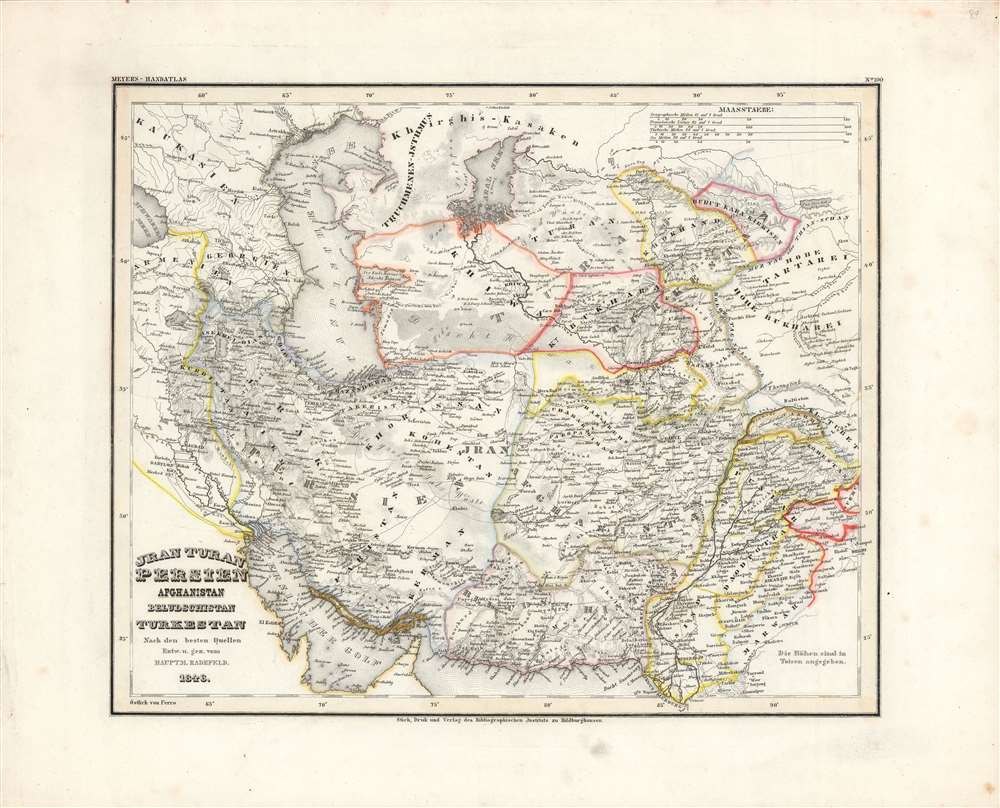
Jran, Turan, Persien, Afghanistan, Beludschistan, Turkestan.
sold
- Digital Map Information
- Suitable for large format printing
- DPI: 600
- File Size: 31.34 MB
- File Type: ZIP / TIFF
- ICC color profile embedded
- Delivered instantly via download link
This is Carl Radefeld's appealingly hand-colored 1846 map of the Middle East and Central Asia, produced for Meyer's Grosser Hand-Atlas. It depicts the region as both British and Russian influence were increasing, setting off the 'Great Game' competition between the two empires. (more details)