
An Evocative Image of the Age of Discovery.

[Untitled Woodcut].
sold
- Digital Map Information
- Suitable for large format printing
- Full resolution TIFF file
- ICC color profile embedded
- Delivered instantly via download link
This is a fascinating and evocative woodcut image of islands, ships and sea monsters, illustrating a text describing islands in general. It appeared in Sebastian Münster's Cosmographia beginning in 1550, and appears here in an early French text edition of the work. (more details)
The Jacksonville, Tampa, and Key West System!

Correct Map of Florida Showing the Jacksonville Tampa and Key West System and Connections.
sold
- Digital Map Information
- Suitable for large format printing
- File Size: 30.23 MB
- File Type: ZIP / TIFF
- ICC color profile embedded
- Delivered instantly via download link
This is an 1889 Matthews Northrup railroad map of Florida. Thick black lines highlight the main railroads throughout Florida, including the Jacksonville, Tampa, and Key West System; the Savannah, Florida, and Western Railway; the Jacksonville, St. Augustine, and Halifax River Railway; the Florida Southern Railway; and the St. Johns and Halifax River Railway. Major stops along all these railways are identified. Dashed lines illustrate associated steamship lines associated, such as the Indian River Steamboat Company operated by the Jacksonville, Tampa, and Key West System. Thinner lines trace unaffiliated railways, such as the Orange Belt Railway and the Florida Central and Peninsular Railroad. Two insets appear along the left depicting the Florida panhandle and the railroad network in the eastern United States, respectively. (more details)
Interurban streetcar railways around Boston.

Railroad Map Showing the Street Rail Road Routes in and leading from Boston with the Terminus of Each Road in Suburban Cities and Towns.
sold
- Digital Map Information
- Suitable for large format printing
- File Size: 23.96 MB
- File Type: ZIP / TIFF
- ICC color profile embedded
- Delivered instantly via download link
This is an 1865 Josiah G. Chase railroad map of Boston, Massachusetts, and vicinity. Illustrating the Boston region's streetcar railway and railroad network, the map provides an illuminating view of transportation around Boston just after the American Civil War. (more details)
Comic view of Boston.

Boston.
sold
This is a 1975 Joe Connolly pictorial map and view of Boston, Massachusetts. Composed in a comic style, Bostonians populate the map and perform concerts, march in parades, and generally enjoy life in their city. Fenway Park is situated along the right border with a baseball apparently to be launching into orbit! Boston Garden, the home of the Bruins and the Celtics, is on the left near the river. Old North Church and Trinity Church both appear and the U.S.S. Constitution is moored in the harbor. (more details)
A Klondike Gold Rush railroad!

Map of the White Pass and Yukon Route and Connections.
sold
- Digital Map Information
- Suitable for large format printing
- Full resolution TIFF file
- ICC color profile embedded
- Delivered instantly via download link
This is a 1930 White Pass and Yukon Route railroad map of Alaska and northwest Canada - the major artery of access to the Klondike Gold Rush cities. (more details)
WWI Infographic.

Daily Mail War Map.
sold
- Digital Map Information
- Suitable for large format printing
- Full resolution TIFF file
- ICC color profile embedded
- Delivered instantly via download link
This is a 1914 George Philip map of Europe at the beginning of World War I. Philip uses colors to illustrate the alliances between the Triple Entente (Great Britain, France, and Russia) and the Triple Alliance (Germany, Austria-Hungary, and Italy). Neutral and independent countries are shaded other colors, although their neutrality did not save them from the onslaught of war in Belgium's case. Major cities are identified across the continent, along with fortresses, airship depots, wireless stations, and railways. Infographics along the right border provide an incredible visual summary of each country's military strength. The infographics create compelling comparisons between the belligerents. The comparison between standing armies, for example, lays bare the shocking difference between the Russian and French armies and the British army. At the same time, the British navy vastly outclasses all others in every category. Aircraft appear as well, an intriguing prospect in 1914 since airships and airplanes had never before been used in combat. (more details)
Detailed map of the White Mountain region in New Hampshire.

Central New Hampshire.
sold
- Digital Map Information
- Suitable for large format printing
- File Size: 29.75 MB
- File Type: ZIP / TIFF
- ICC color profile embedded
- Delivered instantly via download link
This is a 1908 George H. Walker map of the beautiful White Mountains region of central New Hampshire. The map was issued at the height of the Naturalist Movement and the White Mountains Gilded Age - a period when nature lovers flocked to places like the White Mountains, the Adirondacks, and Mount Desert Island to be closer to nature (and thus god). (more details)
Miami to Key West on the Overseas Highway!
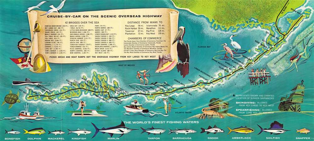
Your treasure map...to 'sea' Florida Keys and Key West for the vacation thrill of your life.
sold
This is a c. 1973 Monroe County Advertising Commission map of the Florida Keys. The map marks stops along the Overseas Highway from Ocean Reef to Key West and identifies all major Keys. Illustrations of a heron, an egret, a pelican, and two terns underscore the birding opportunities of South Florida. Sportfish, including marlin and sailfish, adorn the bottom border and promote 'the world's finest fishing waters'. Vignettes of fishing boats, golfers, water-skiers, snorkelers, and shipwrecks highlight the many activities available to vacationers in the Keys. A scroll occupies most of Florida Bay and names forty-two of the bridges on the Overseas Highway and provides distances. (more details)
The Fleming Grant.
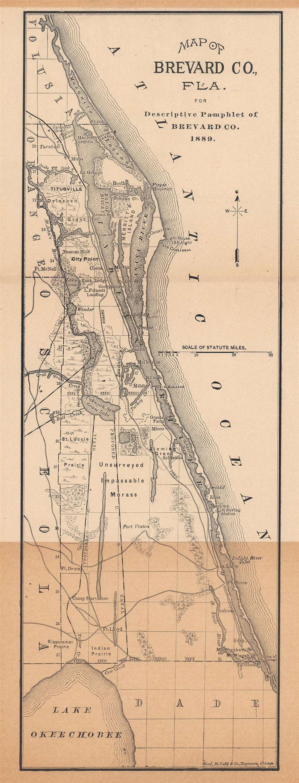
Map of Brevard Co., Fla. for Descriptive Pamphlet of Brevard Co.
sold
- Digital Map Information
- Suitable for large format printing
- File Size: 5.28 MB
- File Type: ZIP / TIFF
- ICC color profile embedded
- Delivered instantly via download link
This is an 1889 Rand McNally and Company map of Brevard County, Florida. Coverage extends from Mosquito Lagoon south along the Florida Atlantic coast to Dade County and Lake Okeechobee (further inland). Titusville, the terminus of the Jacksonville, Tampa, and Key West Railroad, appears in bold print with the railroad heading to the northwest. Cape Canaveral is labeled. Two proposed canal routes from Unknown Saw Grass Lake and Lake Okeechobee are illustrated by black and white dashed lines. Several forts are identified in the southwest corner of Brevard County. An 'unsurveyed impassable morass' occupies part of the central portion of the county next to the Fleming Grant. The Capron Trail appears near the bank of the Indian River and traverses almost the entirety of Brevard County. (more details)
First detailed, printed map of Albania.
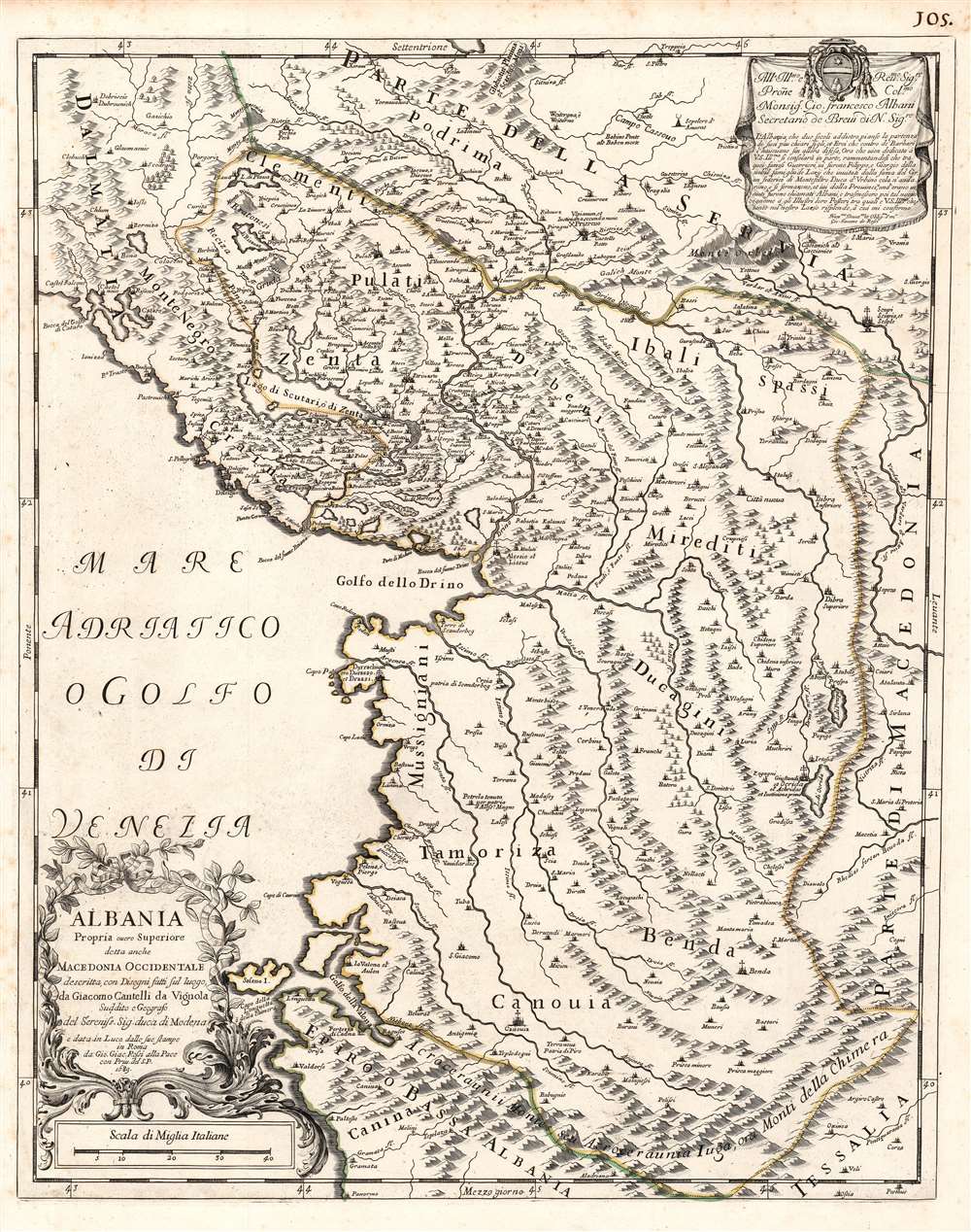
Albania Propria overo Superiore detta anche Macedonia Occidentale descritta, con Disegni fatti sul luogo. . .
sold
- Digital Map Information
- Suitable for large format printing
- DPI: 600
- File Size: 23.16 MB
- File Type: ZIP / TIFF
- ICC color profile embedded
- Delivered instantly via download link
This is a rare 1689 Cantelli da Vignola map of Albania - the first reasonably accurate printed map of Albania. The map incorporates most of modern-day Montenegro and part of Macedonia. This is the only specific map of Albania produced in the 17th century, predated only by the 1572 Camocio map. Lissus on the coast corresponds with modern Lezhë at the mouth of the Drin. The modern capital of Tirana appears here as Terrana. The city of Vlorë appears, using its Italian name Valona (and the Greek Aulon.) To the southwest of Terrana is noted Petrela, a supposed birthplace of Alexander the Great. The mountainous terrain is pictorially depicted, showing in particular the forbidding mountain ranges forming the country's natural borders with Greece, Macedonia, and Kosovo. (more details)
Ephemeral state of Franklin!
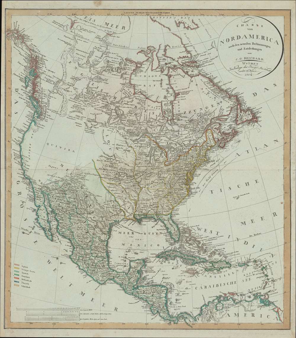
Charte von Nord America nach en neuesten Bestimmungen und Entdeckungen.
sold
- Digital Map Information
- Suitable for large format printing
- DPI: 600
- File Size: 31.76 MB
- File Type: ZIP / TIFF
- ICC color profile embedded
- Delivered instantly via download link
A fascinating 1804 map of North America by C. G. Reichard including the ephemeral 'lost state' of Franklin. The map embraces all of North America from Baffin Bay and Cook's Inlet (Alaska) to Panama and the Spanish Main, including all of the modern day United States, Canada, Mexico, West Indies, and Central America. (more details)
The resources behind Japan's militarization.
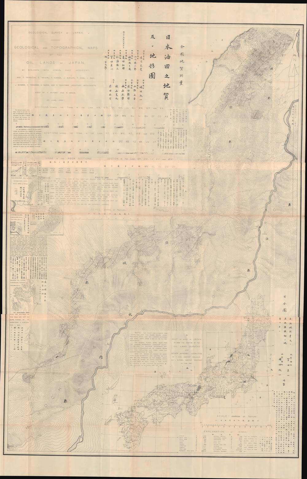
日本油田之地質及ヒ地形圖 / Geological and Topographical Maps of the Oil Lands of Japan.
sold
- Digital Map Information
- Suitable for large format printing
- File Size: 110.36 MB
- File Type: ZIP / TIFF
- ICC color profile embedded
- Delivered instantly via download link
This is an important 1882 bilingual map of Japan highlighting oil regions. It was issued in a unique 19th century Japanese-American collaboration spurred by the Meiji agenda to modernize, expand access to fossil fuels, and drive industrialization. It was prepared by the American geologist Benjamin Smith Lyman and a team of Japanese colleagues. The size of the map, its lack of publication information, and the high-level of technical underscore its purpose as internal government and industrial document. (more details)
Japan in the midst of social, economic, and geographic transformation.
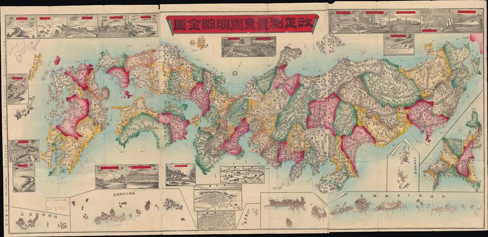
改正測量皇國明細全圖 / [Complete and Detailed Revised Survey Map of the Empire].
sold
- Digital Map Information
- Suitable for large format printing
- Full resolution TIFF file
- ICC color profile embedded
- Delivered instantly via download link
This is a striking 1888 Inoue Katsugorō folding map of the prefectures of Japan with vignette illustrations. It was most likely made to publicize administrative reforms that began that year, which reorganized territories and instituted a new model of local government. (more details)
Curious multi-national educational map.
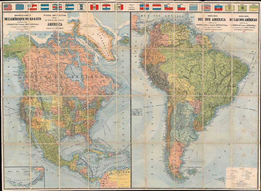
Nouvelle Carte de l'Amérique Nord et Sud. Physical and Political Map of North and South America. Nuova Mapa del Due America. Nueva Mapa de las dos Américas.
sold
- Digital Map Information
- Suitable for large format printing
- Full resolution TIFF file
- ICC color profile embedded
- Delivered instantly via download link
This is an attractive 1890 Jean Dosseray map of North and South America. The map is divided into sections dedicated to North America and South America. Although most of the content is in French, additional titling in English, Italian, and Spanish underscore the author's intended pan-European audience. A row of flags across the top add a vexillological component. Bold lines trace continental railroad networks throughout both maps. In addition, significant attention is given to First Peoples nations, which are labeled throughout. An inset in the lower left focuses on the Aleutian Islands and the Bering Sea. (more details)
New York City just after the Civil War.
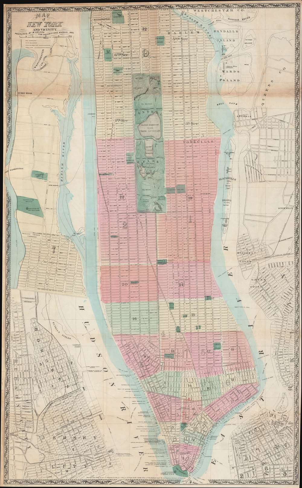
Map of New York and Vicinity.
sold
- Digital Map Information
- Suitable for large format printing
- File Size: 48.1 MB
- File Type: ZIP / TIFF
- ICC color profile embedded
- Delivered instantly via download link
This is a scarce large format 1865 plan or map of New York City by Matthew Dripps. It depicts the island of Manhattan as well as parts of Brooklyn, Queens, Hoboken, and Jersey City. The map illustrates the city in considerable detail with all streets and, in Manhattan, block numbers clearly identified. An inset along the left border details the northern portion of Manhattan. The map labels most of the piers in lower Manhattan and shows numerous individual buildings with identifying numbers. Where Columbia University now stands, this map reveals a 19th century Lunatic Asylum. In Queens, Dripps labels Hunters Point and presents the beginnings of the Long Island Railroad. Astoria is delineated. Central Park is mapped in detail exhibiting the fully glory of Olmsted's plan. (more details)
Roadmap for Russia's conquest of Central Asia.
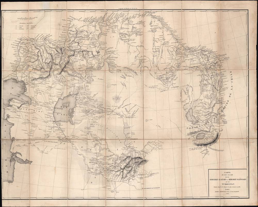
Carte du pays occupé par les Kirghiz - Kazaks ou Kirghiz - Kaissaks et du Turkestan.
sold
- Digital Map Information
- Suitable for large format printing
- DPI: 600
- File Size: 24.54 MB
- File Type: ZIP / TIFF
- ICC color profile embedded
- Delivered instantly via download link
This is the 1840 Claude Arthus-Bertrand translation of a Russian-language map of Central Asia by Aleksei Levshin, a pioneer in the study of Central Asia. The map was produced in the early stage of the 'Great Game', an imperial struggle between Great Britain and the Russian Empire over Central Asia. Given Arthus-Bertrand's connections with the French military and his firm's role as the official editor for the Ministère de la Marine, it is likely that this map was intended for use by the French military for intelligence purposes. (more details)
Indigenous dwellings throughout the Pacific world.
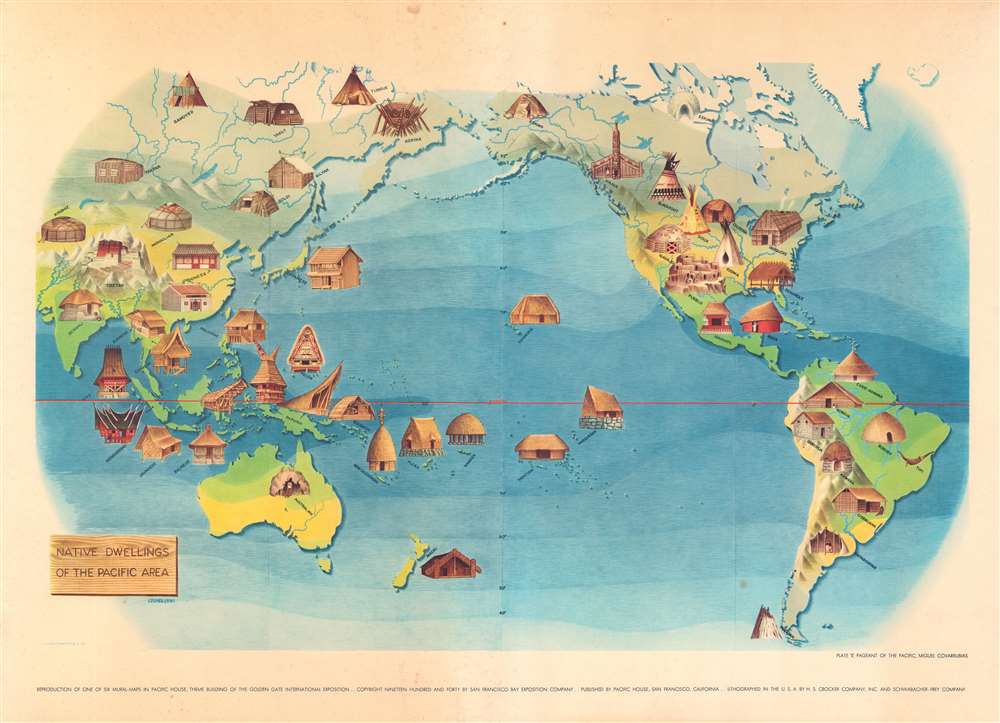
Plate V. Pageant of the Pacific. Native Dwellings of the Pacific Area.
$400.00
Acquire
- Digital Map Information
- Suitable for large format printing
- File Size: 22 MB
- File Type: ZIP / TIFF
- ICC color profile embedded
- Delivered instantly via download link
This is a 1940 Miguel Covarrubias pictorial map of the Pacific. Pictorial vignettes illustrate indigenous dwellings throughout, all of which are labeled according to culture. Plains Indian tepees are labeled as 'Blackfoot', 'Sioux', and 'Kiowa'. An igloo is labeled as 'Eskimo' and an Iroquois longhouse is identified simply as 'longhouse'. This print reproduces one of six murals created by Covarrubias for the Golden Gate International Exposition. The murals were displayed at Pacific House. (more details)
Traditional transportation in the Pacific.

Plate VI. Pageant of the Pacific. Native Means of Transportation in the Pacific Area.
sold
- Digital Map Information
- Suitable for large format printing
- File Size: 21.4 MB
- File Type: ZIP / TIFF
- ICC color profile embedded
- Delivered instantly via download link
This is a 1940 Miguel Covarrubias pictorial map of the Pacific. Pictorial vignettes illustrate indigenous forms of transportation throughout, including elephants in India, camels in Mongolia, llamas in the Andes, horses in the American Great Plains, canoes in the Pacific Northwest, and numerous boats. This print reproduces one of six murals created by Covarrubias for the Pacific House at the Golden Gate International Exposition (1939 - 1940). (more details)
An iconic pictorial map of San Diego.
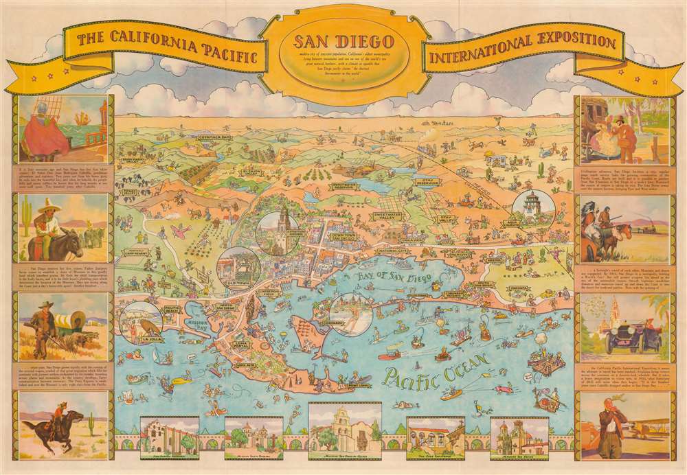
San Diego. The California Pacific International Exposition.
sold
- Digital Map Information
- Suitable for large format printing
- Full resolution TIFF file
- ICC color profile embedded
- Delivered instantly via download link
This is an attractive 1935 Don Bloodgood pictorial map of San Diego, California. Drawn to celebrate the 1935 California Pacific Exposition, the map looks eastward from a fictional high point above the Pacific Ocean and depicts San Diego from La Jolla to Oneonta and inland as far as Cuyamaca Dam. Cartoonish figures populate the map and illustrate the residents going about their daily lives and the many tourists enjoying their vacation. Circular vignettes emphasize areas of interest, including La Jolla, Old Town, the Exposition Grounds (which became Balboa Park), Coronado, and Agua Caliente. A pictorial history of San Diego surrounds the map with views of missions along the bottom border. (more details)
Oxford Presented Pastorally for a French Audience.

A West Prospect of the City of Oxford / Veuë de la Ville d'Oxford du Côté de l'Occident.
sold
- Digital Map Information
- Suitable for large format printing
- DPI: 600
- File Size: 14.68 MB
- File Type: ZIP / TIFF
- ICC color profile embedded
- Delivered instantly via download link
This is a beautiful English Vue d'Optique engraved by John Boydell in 1751. It presents the City of Oxford as seen across the fields to the west of the town. Many of the University town's landmarks are visible: Christ Church is fully visible, along with its famous Tom Tower/ Magdalen College, the Bodleian Library, Radcliffe Camera and Oxford Cathedral can also be seen, rising above the rooftops. In the foreground, farmers bale and gather hay, while in the cleared others enjoy a picnic. Standing apart from the group are two scholars (marked by their gowns and mortarboards) for whom, perhaps, food for thought is food enough. (more details)