
One of the earliest acquirable maps specifically of Vietnam.
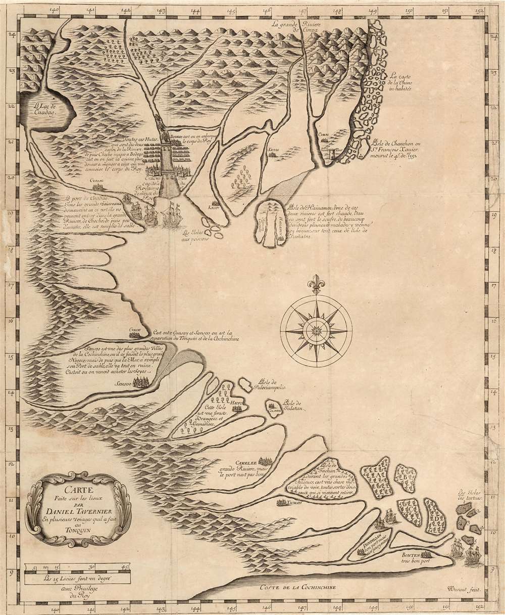
Carte Faite sur la Lieux Par Daniel Tavernier En Plusieurs Voiages quil a fait au Tonquin.
sold
- Digital Map Information
- Suitable for large format printing
- Full resolution TIFF file
- ICC color profile embedded
- Delivered instantly via download link
This is a rare, large, 1679 map of Vietnam and Southern China printed by Jean-Baptiste Tavernier and attributed to that mapmaker's elder brother, the French Huguenot merchant adventurer, Daniel Tavernier. The map covers the coast of Vietnam from southern China to the Mekong Delta. It includes parts of modern-day China: the Island of Hainan and the Chinese coast roughly as far north as modern-day Hong Kong and Macau. The Island of Shangchuan (上川岛) appears as well, just south of Hong Kong, where the Navarrese-Basque Roman Catholic missionary, St. Francis Xavier, died. (more details)
Singapore, on the road to prosperity.

Singapore.
sold
This is a c. 1982 map of Singapore made by the Singapore Tourist Promotion Board. It dates from the height of Singapore's economic transformation and highlights the city-state's developing tourist industry. (more details)
A large possibly one of a kind linen backed map of two districts in Kashmir, India.

Kashmir and Jammu. Anantnag and Baramula Districts.
$1,000.00
Acquire
- Digital Map Information
- Suitable for large format printing
- File Size: 124.76 MB
- File Type: ZIP / TIFF
- ICC color profile embedded
- Delivered instantly via download link
This is a large 1929 Survey of India topographic map of Anantnag and Baramula Districts in Jammu and Kashmir, India. Dissected and mounted on its original linen from what appears to be a least two separately issued sheets, the map depicts the region from Kanzdor to the Lokut Gumbur Nar and from Bajrathar to Shar and Purmandal. Mountain passes are identified, as are 'temporary huts' and other landmarks. Forests are shaded green and are labeled. Roads of varying grades are also marked, along with foot paths and mineral lines. Glaciers are shaded a blueish-white and have blue dashed lines crossing their expanse. Several keys along the bottom border explain the different notations used. (more details)
The Congo Free State and Scramble for Africa.
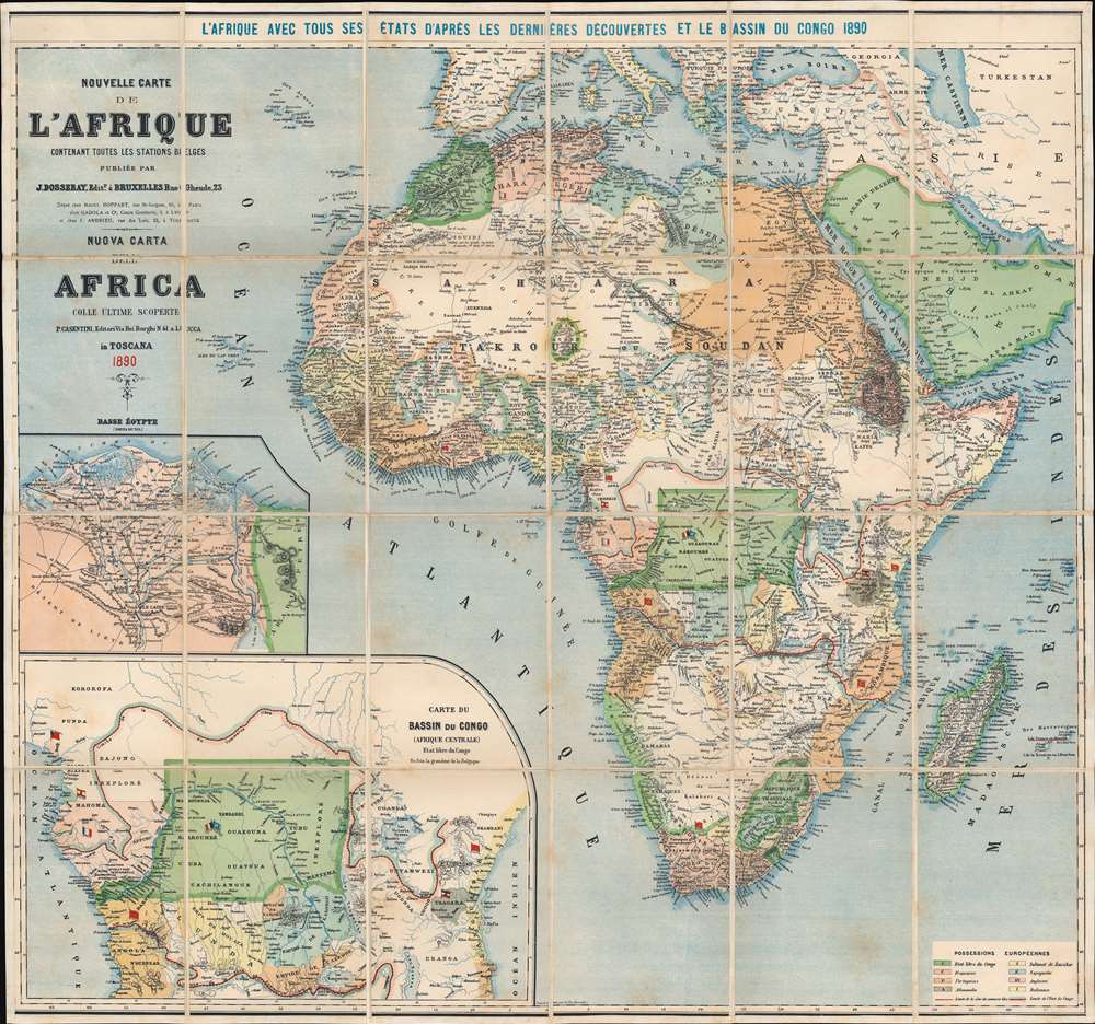
Nouvelle Carte de l'Afrique Contenant Toutes les Stations Belges. Nuova Carta dell'Africa Colle Ultime Scoperte.
sold
- Digital Map Information
- Suitable for large format printing
- Full resolution TIFF file
- ICC color profile embedded
- Delivered instantly via download link
This is an 1890 Jean Dosseray wall map of Africa, published five years after the Berlin Conference that defined the Scramble for Africa. Dosseray uses color to illustrate regions claimed by various European powers, including France, England, Spain, Italy, Germany, and Portugal. Some are also identified by flags, including Algeria (France), Angola (Portugal), and Mozambique (Portugal). The bright green region in central Africa represents the Congo Free State, privately owned by King Leopold II of Belgium. The large inset map in the lower left focuses on the Congo Free State and the free economic zone in Central Africa established by the Berlin Conference. A second inset just above focuses on the Nile Delta. The critical Suez Canal is also illustrated. (more details)
A modern geological triumph!
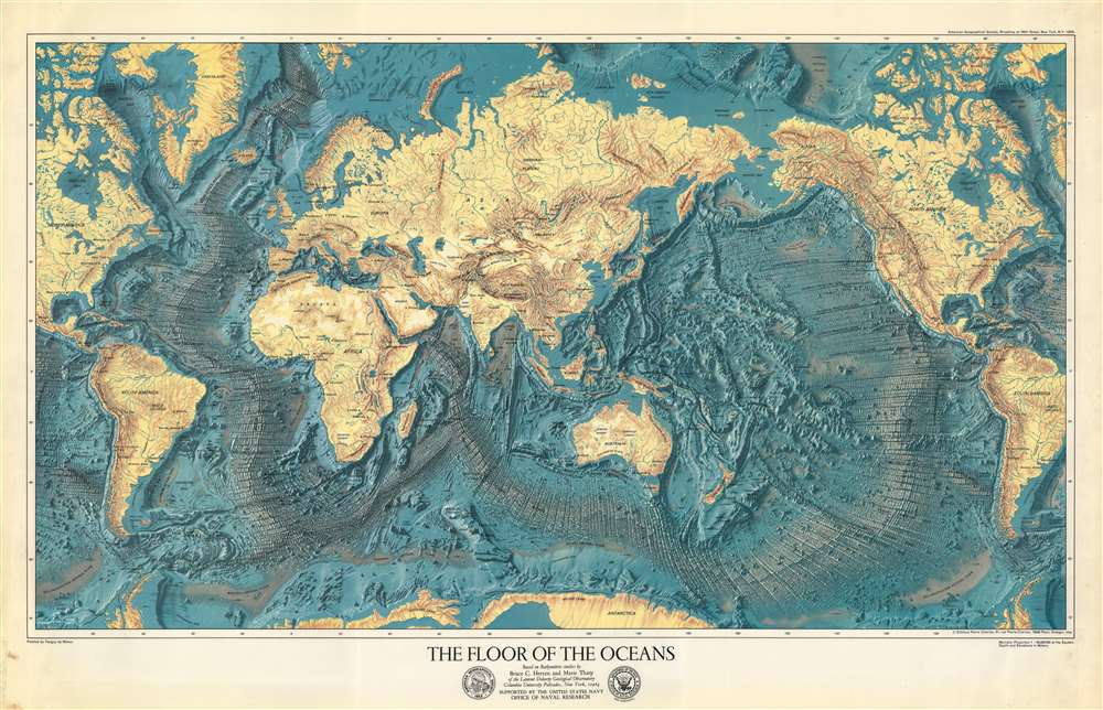
The Floor of the Oceans.
sold
A visually striking and scientifically significant 1977 Marie Tharp and Bruce C. Heezen physiographic map of the world detailing the oceans' floors. The map offers a striking axonometric view of the terrain throughout, with the focus being the seabed. A revolutionary work, it combines genuine scientific work of interpreting and compiling thousands of sonar images, with the exceptional artistry of Tanguy de Rémur. (more details)
The rarest of Jaro Hess's iconic cartoon maps.
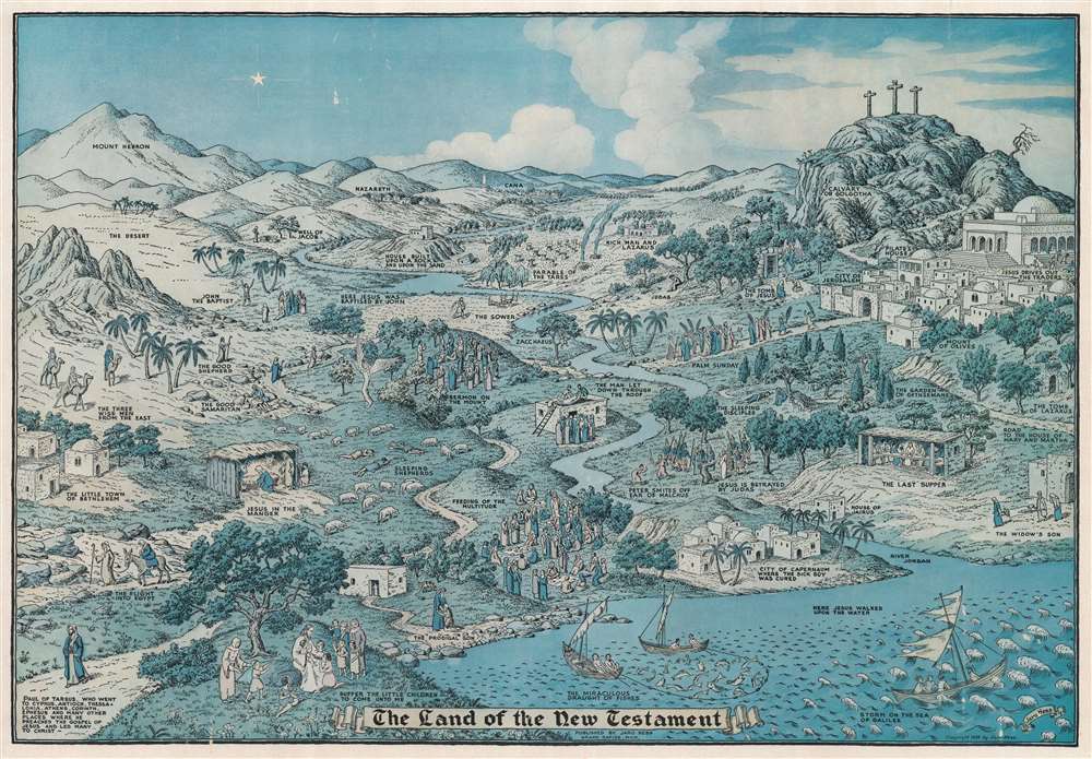
The Land of the New Testament.
sold
- Digital Map Information
- Suitable for large format printing
- File Size: 60.85 MB
- File Type: ZIP / TIFF
- ICC color profile embedded
- Delivered instantly via download link
This is the rare 1939 Jaro Hess pictorial view and map of the land of the New Testament - the second and scarcest of Hess's two known maps. Like his more famous Land of Make Believe, Hess populates the terrain with vignettes from the Gospels are illustrated throughout the piece, including Jesus in the Manger, the Flight into Egypt, the Sermon on the Mount, Palm Sunday, the Last Supper, and Jesus's Betrayal by Judas. The Cavalry of Golgotha and the three crosses draw the eye to the upper right. John the Baptist, the Good Shepherd, the Good Samaritan, and Paul of Tarsus appear. Important Biblical locations, such as Jerusalem, Bethlehem, and Nazareth, are interspersed amongst the illustrated events. (more details)
How poorly Europeans understood South America at the beginning of the 18th century!
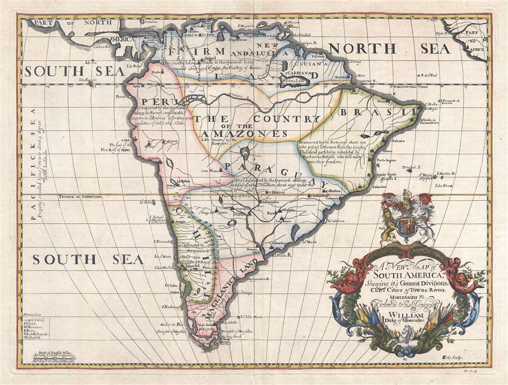
A New Map of South America, Shewing its General Divisions, Chief Cities and Towns; Rivers, Mountains, etc. Dedicated to his Highness William Duke of Gloucester.
sold
- Digital Map Information
- Suitable for large format printing
- DPI: 300
- File Size: 7.04 MB
- File Type: ZIP / TIFF
- ICC color profile embedded
- Delivered instantly via download link
This is a 1700 Edward Wells map of South America. Sparsely illustrated, the scarcity of notations reflects the general lack of knowledge concerning the interior of South America. Annotations in each of the regions provide a date for when Europeans (almost entirely Spaniards, except for the Portuguese in Brazil) conquered different regions and installed their own governments. Two regions, 'The Country of the Amazones' and 'Magelanick Land' are 'little known' to Europeans, meaning that they remained unconquered. Even today, the Amazon Rainforest remains one of the least well-known regions on the planet. The Amazon River cuts its way across the northern portion of the continent. Numerous cities are labeled, including Buenos Aires (Buenos Ayres), Assumption, Cusco, Lima, Quito, and Cartagena. Several cities along the Brazilian coast, such as Pernambuco, San Salvador, Porto Seguro, and Spirito Sancto, are names used in modern Brazil either as city names or as names of region. Two lakes, Lake Parima and the Laguna de Xarayes, are both illustrated here, though only Lake Parima is labeled. Both lakes, which hold equal parts reality and fantasy in their mapping, are central to the European conception of South America and play a critical role in the mapping of the continent. (more details)
Celebrating Japan's progress in the war against China.

最新支那明細大地圖 / [Latest Detailed Map of China].
sold
- Digital Map Information
- Suitable for large format printing
- Full resolution TIFF file
- ICC color profile embedded
- Delivered instantly via download link
This is a scarce 1938 propaganda map of China published in the Japanese magazine King (キング) just after Japanese troops' captured Shanghai and Nanjing in the opening months of the Second Sino-Japanese War (World War II). (more details)
Follow the 331st Combat Team from Normandy to the Elbe River.
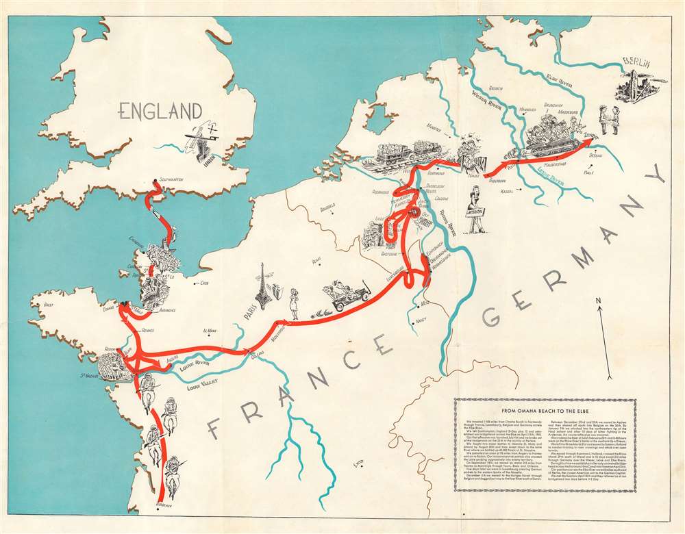
From Omaha Beach to the Elbe.
sold
- Digital Map Information
- Suitable for large format printing
- File Size: 18.37 MB
- File Type: ZIP / TIFF
- ICC color profile embedded
- Delivered instantly via download link
This is a 1945 World War II pictorial route map of western Europe illustrating the path forged by the 331st Combat Team. Following the unit from Southampton, England, to Zerbst, Germany (just across the Elbe River), pictorial vignettes highlight the combat team's experiences. (more details)
Yellowstone National Park during the New Deal.

A Hysterical Map of the Yellowstone Park with Apologies to the Park. Smilage Guaranteed. / The Famous Hysterical Map of Yellowstone Park Including a few minor ? Changes.
sold
- Digital Map Information
- Suitable for large format printing
- Full resolution TIFF file
- ICC color profile embedded
- Delivered instantly via download link
A cheerful 1936 pictorial map of Yellowstone Park, 'hatched and scratched' by the American printer and humorist Jolly Lindgren. The map depicts the whole of Yellowstone Park with a richly humorous array of vignettes and annotations. Major roadways through the park are marked in red with important locations, topography, and more illustrated pictorially. As the title suggests, 'smilage' is guaranteed to the viewer. Some of the amusing annotations include:
- Brimstone Basin (Hell for Certain)
- Gibbons Falls (Are ya Hurt?)
- Grand Canyon (Don't Think it Ain't)
- Wahb Springs (Just a Little Cold in the Head)
First map of China published in the American Republic.
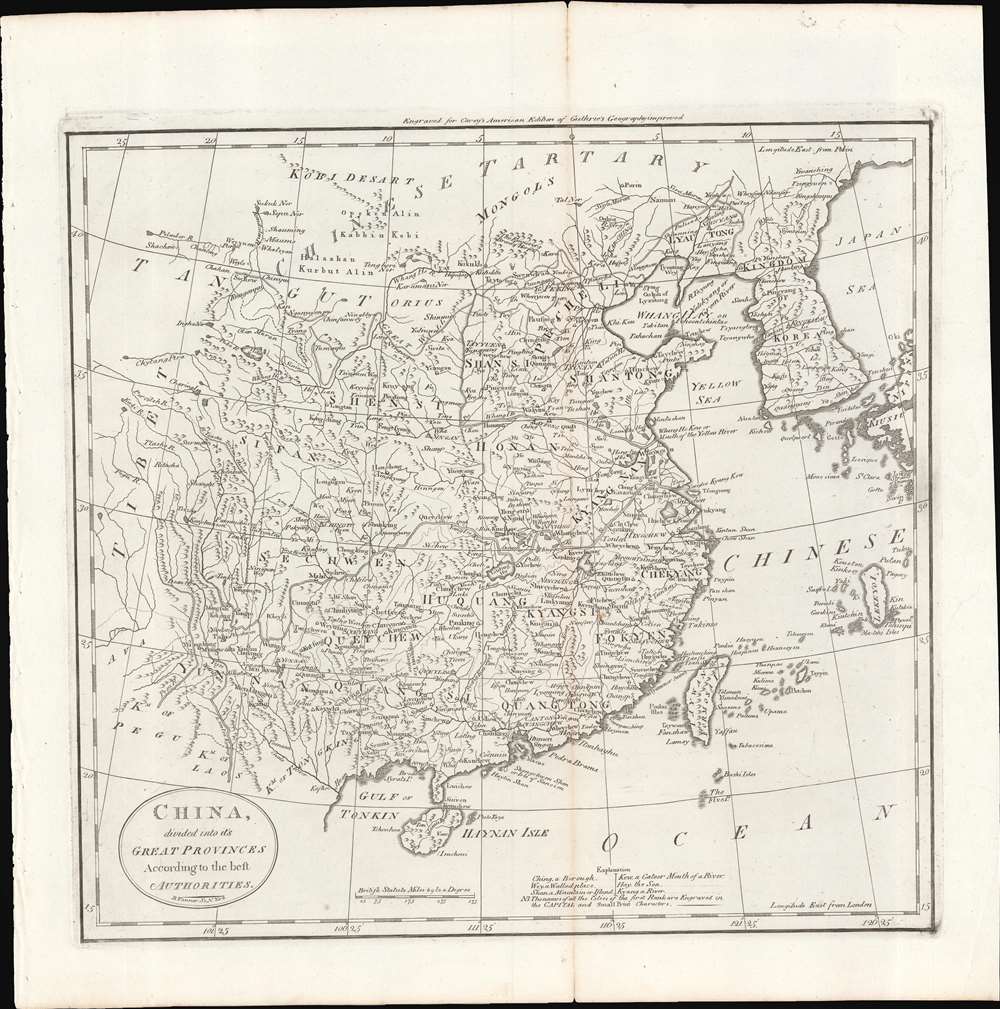
China, divided into its Great Provinces. According to the best Authorities.
sold
- Digital Map Information
- Suitable for large format printing
- Full resolution TIFF file
- ICC color profile embedded
- Delivered instantly via download link
This is a c. 1796 map of China from Carey's General Atlas, the first atlas published in the new American Republic. It depicts 'China proper,' roughly the territory covered by the Ming Dynasty, which had been conquered by the Manchu Qing Dynasty in 1644. (more details)
Postal infrastructure as a reflection of China's modernization.
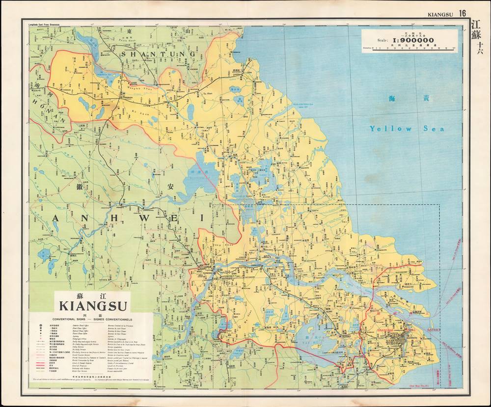
江蘇 / Kiangsu.
sold
- Digital Map Information
- Suitable for large format printing
- Full resolution TIFF file
- ICC color profile embedded
- Delivered instantly via download link
This is a map of Jiangsu (Kiangsu) Province from the 1933 edition of The Postal Atlas of China (中華郵政輿圖), compiled by Charles Jacot-Guillarmod. It highlights the evolving postal infrastructure of the region, reflecting a broader modernization drive by the Nanjing government. (more details)
U.S. 20 from the Atlantic to the Pacific!

U.S. 20 The Highway to the Scenic West. 'The Water Level Route'.
sold
- Digital Map Information
- Suitable for large format printing
- Full resolution TIFF file
- ICC color profile embedded
- Delivered instantly via download link
This is a 1954 Dunning pictorial tourist map of the United States highlighting historic U.S. Route 20. (more details)
Dramatic, Pictorial Long Island with Nautical and Historical Vignettes.
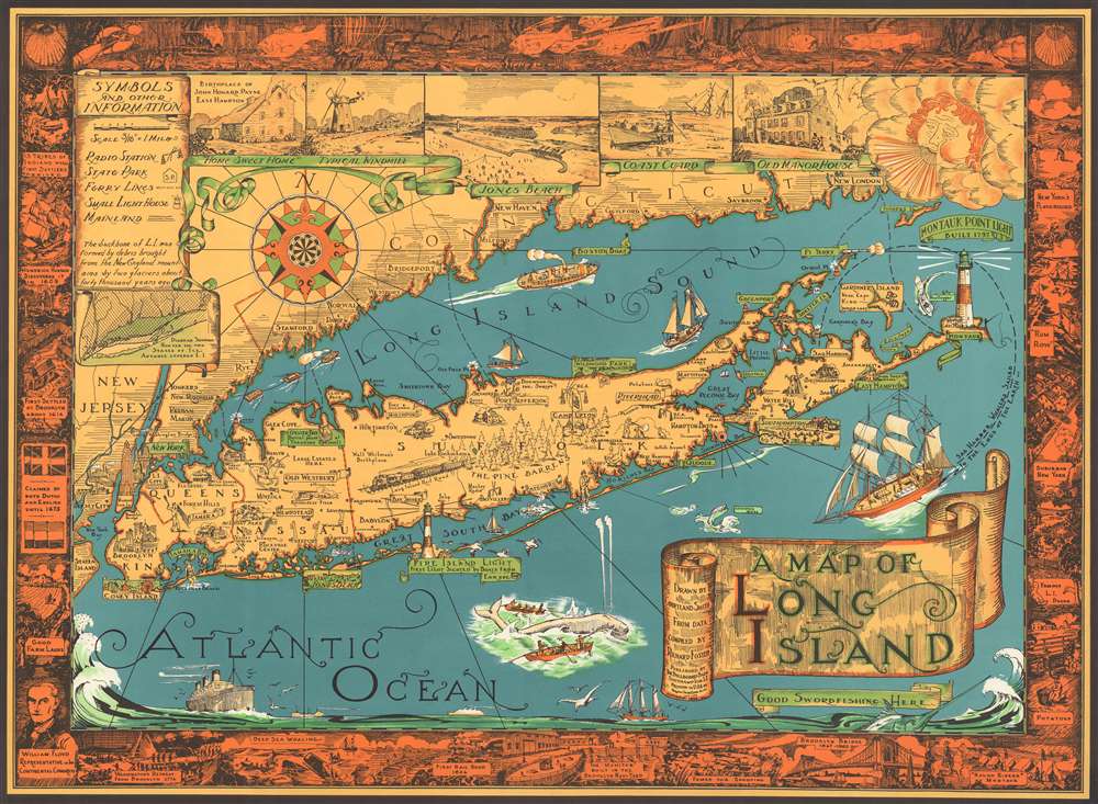
A Map of Long Island.
sold
This is a charming 1961 pictorial map of Long Island by Courtland Smith, depicting from New London in Connecticut and Fishers Island south as far as the Lower New York Bay and Staten Island. Long Island is depicted in its entirety from Brooklyn and Queens east to Montauk. Throughout, the map notes cities, towns, beaches, radio stations, parks, ferry lines, lighthouses and several other important landmarks, scenes, and activities. Several landmarks have been attractively illustrated, including the Montauk Point Light, Fire Island Light, Southampton, Coney Island, etc. Facts about Gardiner's Island - 'here Capt. Kidd buried loot' and Oyster Park 'Burial Place of Theodore Roosevelt' are noted.
The top left quadrant of the map includes the note, 'The backbone of L.I. was formed by debris brought from the New England Mountains by two glaciers about forty thousand years ago' as well as an inset featuring a 'Diagram showing how far the two Stages of Ice Advance covered L.I.' Five beautiful illustrated views along the top border include the Birthplace of John Howard Payne East Hampton, a Typical Windmill, Jones Beach, Coast Guard and Old Manor House. A decorative compass rose and an art deco style wind figure are also featured. In Long Island Sound and the Atlantic Ocean, pictorial illustrations of Boston Boat, ships, striped bass, a swordfish, whale fishing, and the Sag Harbor Whalers that 'sailed to the ends of the Earth' can be seen. The map is surrounded by an elaborate border, with underwater scenes at the top and historic events and places along the remaining three sides, including the '13 Tribes of Indians when First Settlers Arrived,' 'First Settled at Brooklyn in 1614,' 'First Rail Road 1836,' 'Brooklyn Bridge 1867-1883,' etc. (more details)
The top left quadrant of the map includes the note, 'The backbone of L.I. was formed by debris brought from the New England Mountains by two glaciers about forty thousand years ago' as well as an inset featuring a 'Diagram showing how far the two Stages of Ice Advance covered L.I.' Five beautiful illustrated views along the top border include the Birthplace of John Howard Payne East Hampton, a Typical Windmill, Jones Beach, Coast Guard and Old Manor House. A decorative compass rose and an art deco style wind figure are also featured. In Long Island Sound and the Atlantic Ocean, pictorial illustrations of Boston Boat, ships, striped bass, a swordfish, whale fishing, and the Sag Harbor Whalers that 'sailed to the ends of the Earth' can be seen. The map is surrounded by an elaborate border, with underwater scenes at the top and historic events and places along the remaining three sides, including the '13 Tribes of Indians when First Settlers Arrived,' 'First Settled at Brooklyn in 1614,' 'First Rail Road 1836,' 'Brooklyn Bridge 1867-1883,' etc. (more details)
Caribbean paradise!
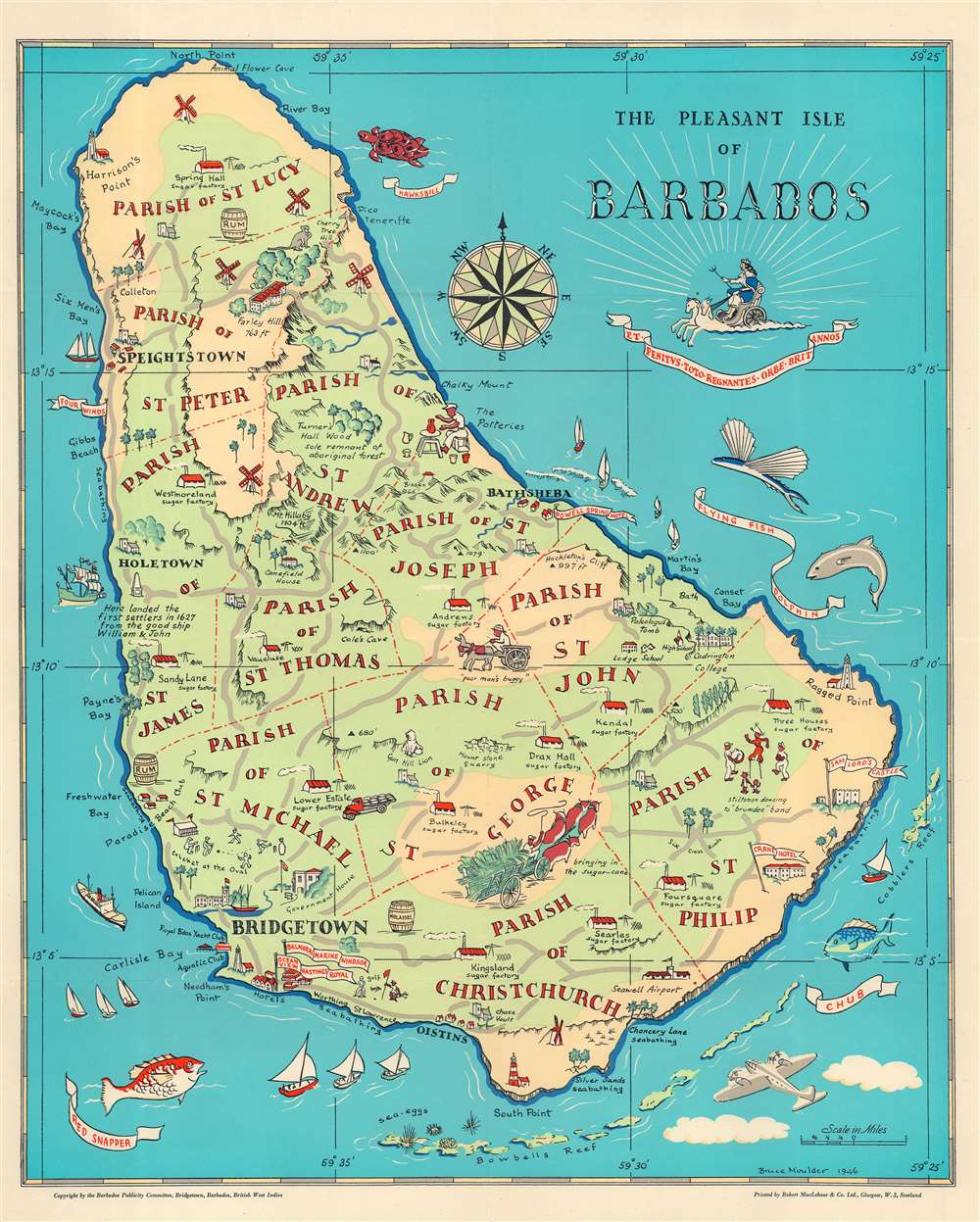
The Pleasant Isle of Barbados.
sold
- Digital Map Information
- Suitable for large format printing
- File Size: 17.23 MB
- File Type: ZIP / TIFF
- ICC color profile embedded
- Delivered instantly via download link
This is a 1946 Bruce Moulder pictorial map of Barbados. Pictorial icons illustrate the island's sugar factories, windmills, and lighthouses. Other illustrations mark hotels, important buildings (such as the Government House in Bridgetown), and the Seawell Airport. A handful of short descriptions provide historical information. Beaches where swimming is possible are noted with the word 'seabathing'. Red dotted and dashed lines separate the island's parishes, each of which is labeled. The Caribbean's diverse sea life encircles the map, with a hawksbill turtle, a flying fish, and a red snapper illustrated. (more details)
Original planning and promotional map for Siboney or Country Club Park, the 'Beverly Hills' of Havana, Cuba!

Plano de Subdivision Country Club Park.
sold
- Digital Map Information
- Suitable for large format printing
- File Size: 32.9 MB
- File Type: ZIP / TIFF
- ICC color profile embedded
- Delivered instantly via download link
The only surviving example of the 1924 Gutierrez promotional real-estate map of the Siboney / Country Club Park neighborhood of Havana, Cuba - generally considered to be the wealthiest neighborhood in the city, home to elites like the Castro family, ministers, and other government 'insiders.' In 1924, this development was known as Country Club Park, home to Havana's most prestigious golf clubs, hotels, and the Yacht Club - all of which are noted here. The large green area, once the country club, is today a military airport, but the remainder of Siboney is today, as it was originally intended, an enclave of wealth. El Lago, today as then, is surrounded by fabulous mansions and lush gardens. (more details)
An important and often overlooked 1744 map of French, English and Spanish claims in North America.
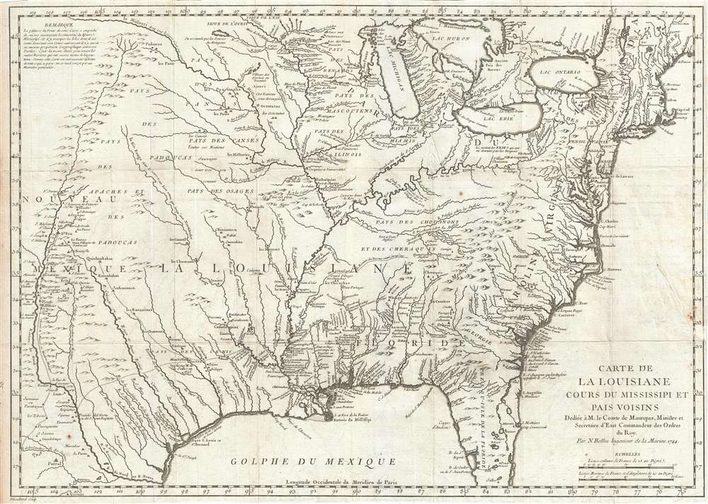
Carte de La Louisiane Cours du Mississipi et Pais Voisins.
$1,500.00
Acquire
- Digital Map Information
- Suitable for large format printing
- DPI: 300
- File Size: 9.76 MB
- File Type: ZIP / TIFF
- ICC color profile embedded
- Delivered instantly via download link
An important and influential 1744 map of the settled portions of North America by the French cartographer Jacques-Nicholas Bellin. Centered on the Mississippi Valley, Bellin's map covers from the Riviere de Nord (Rio Grande) eastward to the Atlantic seaboard and from Lake Huron to the Gulf of Mexico and south Florida. (more details)
Published the year the Republic of Turkey was founded.

Türkiye Cumhuriyeti Haritası. / [Map of the Republic of Turkey].
sold
- Digital Map Information
- Suitable for large format printing
- Full resolution TIFF file
- ICC color profile embedded
- Delivered instantly via download link
This is an enormous 1923 wall map of Turkey in Ottoman Turkish, published the year the modern Republic of Turkey was founded. The cartographer uses different colors to mark Turkey's extreme topography. Shades of brown illustrate elevation changes, while areas of green highlight river valleys and other fertile zones. (more details)
American Civil War: First battle of ironclads!

The First Battle Between 'Iron' Ships of War.
sold
- Digital Map Information
- Suitable for large format printing
- File Size: 17.67 MB
- File Type: ZIP / TIFF
- ICC color profile embedded
- Delivered instantly via download link
This is an 1862 Henry Bill chromolithograph view of the Battle of Hampton Roads (March 8 - 9, 1862), a naval battle during the American Civil War, renowned as the first naval battle between ironclad ships. The USS Monitor, the Union ironclad, occupies the foreground and bears a U.S. flag on her stern. She fires on the CSS Virginia, the Confederate ironclad, at close range. Other ships involved in the battle, including the USS Cumberland, USS Congress, and USS Minnesota appear as well, along with several Confederate ships. (more details)
Disney's 1953 movie Peter Pan.

Peter Pan's Neverland by Walt Disney.
sold
- Digital Map Information
- Suitable for large format printing
- File Size: 38.67 MB
- File Type: ZIP / TIFF
- ICC color profile embedded
- Delivered instantly via download link
This is a charming and surprisingly rare 1953 Walt Disney pictorial map of Neverland from the movie Peter Pan. Disney illustrates several iconic locations, including the Indian Camp, the Mermaid Lagoon, Peter's Secret Hideout, Skull Rock, and Pirate Cove. Events from the movie are referenced as well, such as Captain Hook capturing Tiger Lily, the Indians capturing the Lost Boys, and Peter Pan leading the attack on the Pirates. Disney also includes some classic cartographic elements, such as a compass rose, depth soundings off the coast of Neverland, and a whale and a sea monster swimming in the ocean. Eighteen stills from the movie frame the map and depict events from the movie. (more details)