
Fascinating first print of an important Kyoto plan.

京都指掌圖 : 文化改正 / [Bunka 9 Revised Hand Map of Kyoto].
sold
- Digital Map Information
- Suitable for large format printing
- Full resolution TIFF file
- ICC color profile embedded
- Delivered instantly via download link
This is a fascinating 1812 (Bunka 9) kyōgōzuri (校合摺 first printing) folding map of Kyoto, designed to be portable for visitors to the imperial city. Most often, these would have been religious pilgrims visiting one of the city's many shrines and temples. In addition, travel purely for leisure had become widespread in Japan by the time this map was produced. (more details)
'Best little whorehouses' in Nevada.

The Best Little Whorehouses in Nevada.
sold
This is a 1984 pictorial map of legal brothels in Nevada - red signs mark thirty-six 'best little whorehouses'. Red illustrations of windsocks (used to indicate wind speed and direction at airports) note brothels with private airstrips and black airplane silhouettes mark other airports. Pictorial vignettes provide charm, and include a tortoise, a rattlesnake, cacti, several 'ghost towns', and a bed. The Shamrock, a brothel near Lathrop Wells, merits its own vignette, suggesting that this map may have been produced by that establishment. A short promotional text appears along the bottom and reads, 'While driving thru Nevada stop by and see some of our prime virgin territory and enjoy the ultimate relaxation and scenery at one of our better estates'. (more details)
French and English land grants along Lake Champlain.

Map of French and English Grants on Lake Champlain.
sold
- Digital Map Information
- Suitable for large format printing
- Full resolution TIFF file
- ICC color profile embedded
- Delivered instantly via download link
This is an 1851 Richard H. Pease map of Lake Champlain illustrating French and English land grants. French grants are illustrated in yellow and English grants in black. However, the grant to Dominic Dellius in 1696 is different, as the northern part of the Dellius grant is presented using red lines. Apart from the depiction of the grants, very little detail is included. Depth in Lake Champlain is shown by hachure, and a few rivers are illustrated running into the lake. Both Grand Isle and Long Island are named. (more details)
One of America's best private schools.

Phillips Academy. Founded 1778. Andover, Massachusetts.
sold
This is a 1960 Virginia Powel composite view of Phillips Academy in Andover, Massachusetts. Philipps Academy is an elite co-educational university preparatory school founded in 1778. Nineteen buildings that are part of the Academy are expertly drawn in profile. These include Samuel Phillips Hall, the Borden and Memorial Gymnasium, the Addison Gallery of American Art, Cochran Chapel, and the Oliver Wendell Holmes Library. The Academy's sigil is situated in the upper right corner, and an illustration of an armillary sphere appears in front of the library in the lower right corner. (more details)
The Forge of the Gods.

Sicilia.
sold
- Digital Map Information
- Suitable for large format printing
- Full resolution TIFF file
- ICC color profile embedded
- Delivered instantly via download link
This is Isaac Basire's scarce map of Sicily, Italy, with a vignette of Hephaestus' forge at work under the erupting volcano Mt. Etna. This detailed map of the island includes an inset in the upper left showing Sicily's position with respect to Carthage and Malta. The map is a copy of Christoph Cellarius' Sicilia Antiqua, published in his 1686 Geographia Antiqua. (more details)
Early Texas scene on Fan depicting the Las Salle Expedition w/map.

[LaSalle Expedition Texas Map Fan].
sold
A remarkable c. 1750 Texas cartifact, this is a French hand-held fan, printed and hand colored on both sides, with one side bearing a map of Texas and illustrations celebrating the La Salle Expedition. The fan is a highly decorative and stylized chronology of the René Robert Cavalier, Sieur de La Salle (1643 - 1687) led French attempt to colonize Texas. It is a striking example of the fanciful representation that went into many depictions of European colonial enterprises, regardless of the facts. (more details)
Published during the French Revolution.
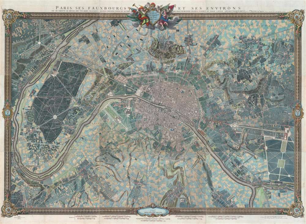
Paris, ses Fauxbourgs, et ses Environs.
sold
- Digital Map Information
- Suitable for large format printing
- DPI: 600
- File Size: 260.28 MB
- File Type: ZIP / TIFF
- ICC color profile embedded
- Delivered instantly via download link
This is a striking 1795 - 1796 Roussel wall-sized city plan or map of Paris, France, and its environs - one of the few large-scale maps of Paris issued during the French Revolution (1789 - 1799). Within Paris, buildings, squares, and parks are illustrated, with the Palais des Tuileries, the Louvre, the Hotel Royal des Invalides, and Notre Dame, among many other famous buildings recognizable. Churches are highlighted in blue, while Paris's many gardens, including the Champs-Elysées, the Champs de Mars, the Jardin des Tuileries, and the Jardin du Luxembourg, appear in green. Some of the most important buildings are illustrated pictorially, including the Abbaye St. Victor, the menagerie in today's Jardin des Plantes, and the factories across the Seine from the Jardin des Plantes. Outside Paris proper, spectacular illustrations of Montmarte and the Butte Chaumont appear. Paris's suburbs are illustrated and labeled as well, many of which are modern-day neighborhoods. (more details)
Most Finely Detailed Dutch Map of the Northeast from the 17th Century.
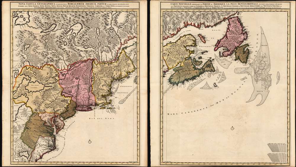
Nova Tabula Geographica Complectens Borealiorem Americae Partem: in qua Exacte Delineatae Sunt Canada sive Nova Francia, Nova Scotia, Nova Anglia, Novum Belgium, Pensylvania, Virginia, Carolina et Terra Nova, cum Omnibus Littorum. Pulvinorumque Profunditatibus. Amstelodami. à Nicolao Visscher. Cum Privilegio Ordinum Generalium Foederati Belgii./ Carte Nouvelle contenant la Partie d'Amerique la Plus Septentrionale, ou Sont Exactement Dècrites les Provinces Suivantes comme le Canada ou Nouvelle France, La Nouvelle Ecosse, la Nouvelle Angleterre, les Nouveaux Païs Bas, la Pensylvanie, la Virginie, la Caroline et l'Ile de Terre Neuve avec les profondeuis le Long des Côtes et sur les Bancs. Par Nicolas Visscher avec Privilege des Etats Géneraux.
sold
- Digital Map Information
- Suitable for large format printing
- DPI: 600
- File Size: 121.39 MB
- File Type: ZIP / TIFF
- ICC color profile embedded
- Delivered instantly via download link
This is Nicolas Visscher II's 1696 two-sheet map of the North American eastern seaboard and the Canadian Maritimes, in a beautiful example of its earliest acquirable state with rich original color. It represents the 17th century's most finely-detailed mapping of the coast from the Carolinas to Labrador. Also, it is the first Dutch map of the region to diverge from the 'Jansson-Visscher' precursor maps. (more details)
Apache Wars on the Mexico-Texas border.
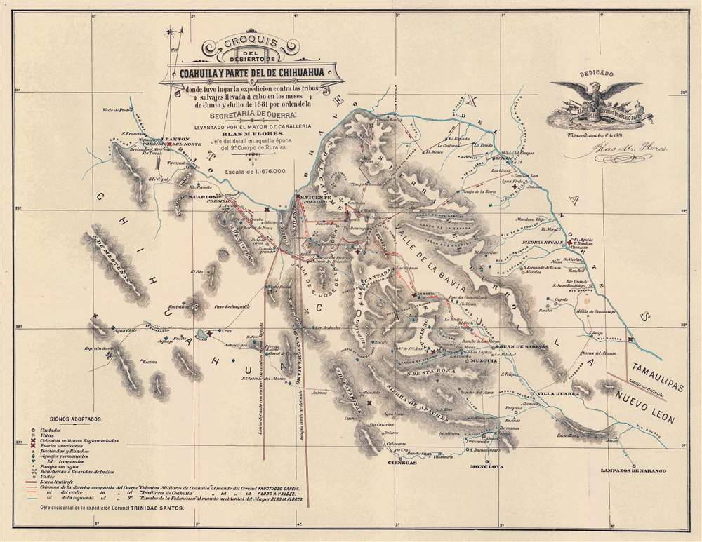
Croquis del Desierto de Coahuila y Parte del de Chihuahua donde tuvo lugar la expedicion contra las tribus salvajes llevada á cabo en los meses de Junio y Julio de 1881 por orden de la Secretaria de Guerra.
sold
- Digital Map Information
- Suitable for large format printing
- File Size: 15.07 MB
- File Type: ZIP / TIFF
- ICC color profile embedded
- Delivered instantly via download link
This is a very rare 1892 Major Blas María Flores map of the Mexico-Texas border illustrating a little-known chapter of the Apache Wars (1849 - 1887). It describes an 1881 Mexican Army campaign against the Lipan Apache led by Major Blas María Flores. This was the last major action of the Mexican Federal Government against the Apache. The map was further intended to detail population centers, routes, and favored Apache haunts to support Flores' argument for the strategic placement of military colonies to protect settlement and investment. Coverage encompasses the northernmost parts of Coahuila and Chihuahua, Mexico, and the adjacent Texas border lands. Purple, red, and blue lines trace routes followed by Mexican army columns. Lipan ranches and other settlements, along with haciendas and rancherias owned by Mexicans are noted. Both Mexican and American forts are illustrated, along with water sources. (more details)
France recognizes the Republic of Texas.
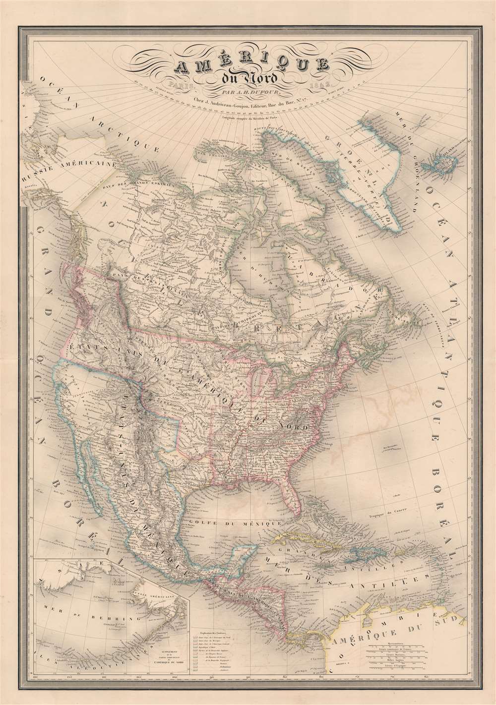
Amérique du Nord par A. H. Dufour...
sold
- Digital Map Information
- Suitable for large format printing
- Full resolution TIFF file
- ICC color profile embedded
- Delivered instantly via download link
A fine example of A.-H. Dufour's 1842 map of North America, including the Republic of Texas. The map covers the entire North American continent and Greenland, embracing Mexico, an independent Texas, Central America, and the Caribbean. An inset in the lower left corner details the Bering Sea and the Aleutian Islands. This map appeared in several editions of the Dufour/ Andriveau-Goujon elephant folio atlas, but this edition is significant for its inclusion of the Republic of Texas - and as such this makes it one of the earliest European maps to do so. The map also recognizes American claims to British Columbia - further underscoring the then hot political tensions between France and England. (more details)
The 'BREM' map of Middle Earth!

Middle Earth.
sold
A beautiful example of one of the rarest and most iconic J. R. R. Tolkien 'Middle Earth' maps - the 1969 poster-map issued to promote Ballentine's first American issue of the Lord of the Rings, featuring the illustrations of Barbara Remington. (more details)
Celebrating American literature.

Being a Literary Map of These United States depicting a Renaissance no less astonishing than that of Periclean Athens or Elizabethan London.
sold
- Digital Map Information
- Suitable for large format printing
- File Size: 31.1 MB
- File Type: ZIP / TIFF
- ICC color profile embedded
- Delivered instantly via download link
This is a 1942 Gladys and Sterling North and Frederic Dornseif pictorial map of the United States celebrating literary achievement. Each state features at least one novelist, poet, or historian, and many highlight a work set there. For example, Nebraska focuses on My Antonia by Willa Cather, while The Yearling by Marjorie Kinnan Rawlings dominates Florida. Authors known for works set outside the United States are referenced in the Pacific or Atlantic Oceans, respectively. Pearl Buck and her novel The Good Earth are included on the China Clipper in the Pacific, while authors who took up residence in Europe, including Gertrude Stein and Ernest Hemingway, are listed on the passenger list of the S.S. Europa. The U.S.S. Foreign Correspondent also occupies space in the Atlantic, with William Shirer and John Gunther among its passengers. (more details)
A golden age for Tunis.
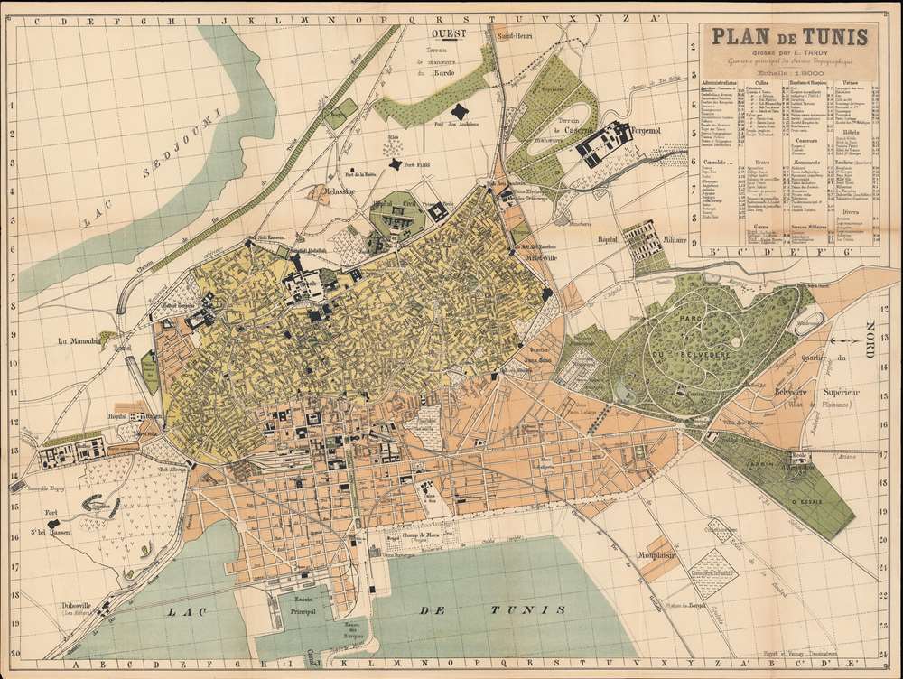
Plan de Tunis.
sold
- Digital Map Information
- Suitable for large format printing
- File Size: 36.66 MB
- File Type: ZIP / TIFF
- ICC color profile embedded
- Delivered instantly via download link
A scarce Tunisian-published map of Tunis, the capital of Tunisia, dating to about 1899 by the French cartographer E. Tardy. Oriented to the west, this map covers all of Tunis as it appeared at the end of the 19th century. Streets, parks, rail lines, important buildings, and neighborhoods are identified. A table in the upper right offers coordinates for consulates, schools, government offices, hotels, hospitals, banks, monuments, train stations, and military establishments. (more details)
On the eve of the Mexican-American War.
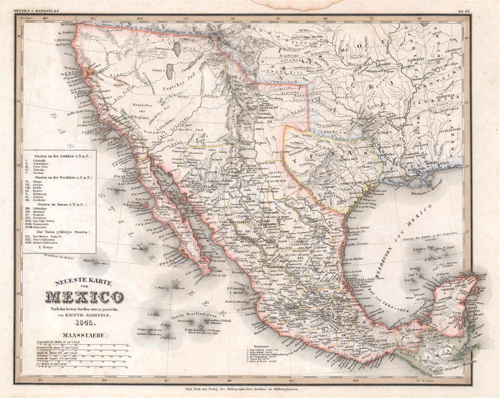
Neueste Karte von Mexico.
sold
- Digital Map Information
- Suitable for large format printing
- Full resolution TIFF file
- ICC color profile embedded
- Delivered instantly via download link
This is an 1845 Carl Radefeld map of Mexico and the Republic of Texas. Published on the eve of the Mexican-American War (1846 - 1848), Mexico stretches from Oregon to Guatemala, the border of the 1819 Adams-Onís Treaty. The Republic of Texas appears in one of its smallest border configurations, suggesting that the German cartographers were sympathetic to Mexico's arguments about Texas's rightful borders and not the more expansive borders advocated by Texans. Rivers are labeled throughout, including the Colorado, Nueces, and Rio Grande. Two mythical rivers, the Buenaventura and Francisco, are also identified, and two great salt lakes illustrated. San Antonio, Santa Fe, Albuquerque, Mexico City, and Veracruz are named, along with numerous other cities and towns. Mexican states are labeled using Roman numerals corresponding with an index along the left border. (more details)
The most beloved fantasy series since Tolkien.

Wheel of Time Robert Jordan.
sold
An uncommon large-scale 1997 promotional map illustrating the 'Westlands', the primary setting of Robert Jordan's Wheel of Time series. It was issued to promote Book 7 of the series, A Crown of Swords based upon the original map art. Jordan fans will recognize the map from the endpapers of the hardcover editions of each volume designed by Elissa Mitchell. Coverage extends from the Spine of the World to the Aryth Ocean, and from the Blight (Shayol Ghul) to the Sea of Storms. The verso features glowing reviews for the Wheel of Time series. (more details)
Rare road map of Florida.
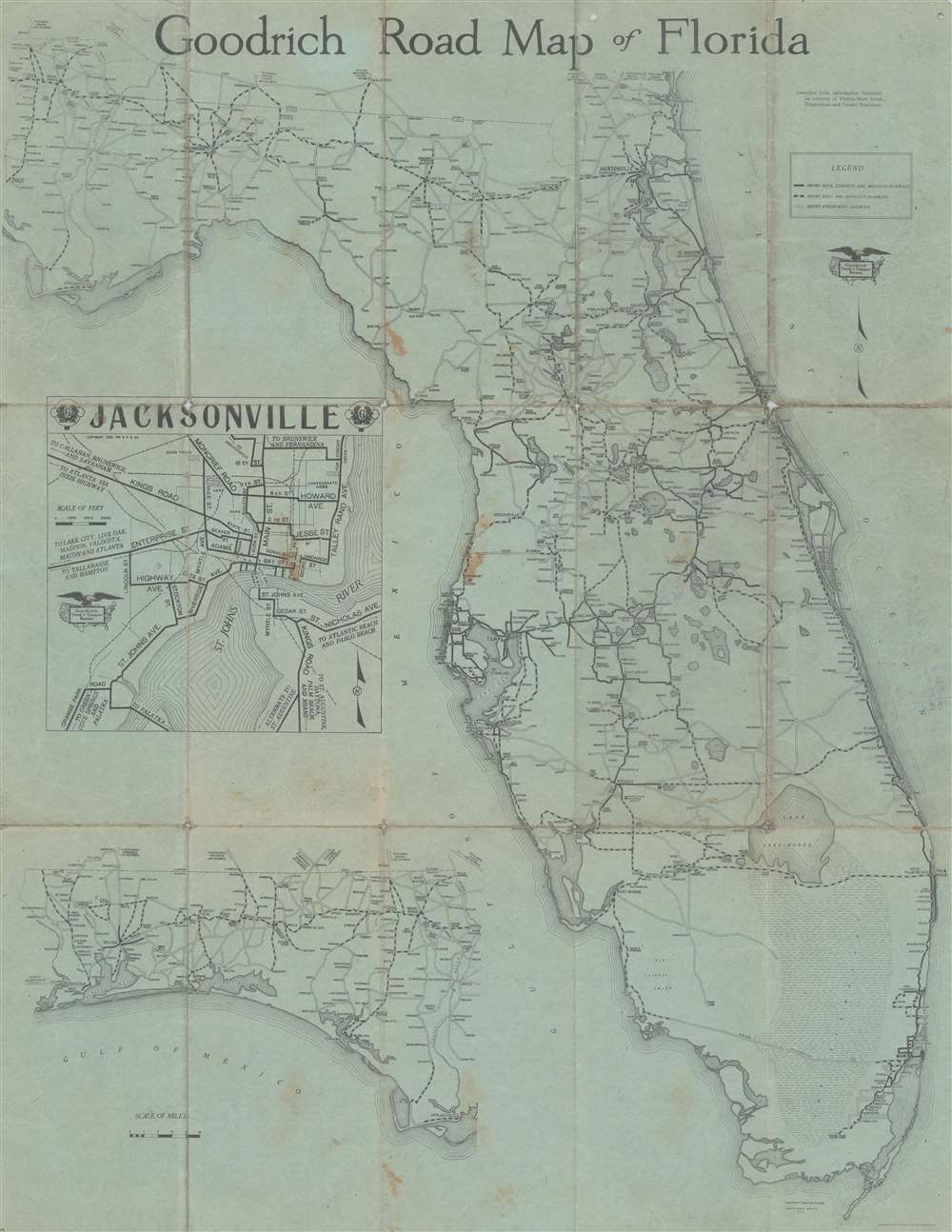
Goodrich Road Map of Florida.
sold
- Digital Map Information
- Suitable for large format printing
- Full resolution TIFF file
- ICC color profile embedded
- Delivered instantly via download link
This is a 1920 B.F. Goodrich and Raymond Beck road map of Florida. An inset in the Gulf of Mexico details Jacksonville and a second inset illustrates the highway network in the Panhandle from Pensacola to Apalachicola. Road type and grade are defined by a representational system keyed to the legend. (more details)
An Antarctic island that is an important bird sanctuary.
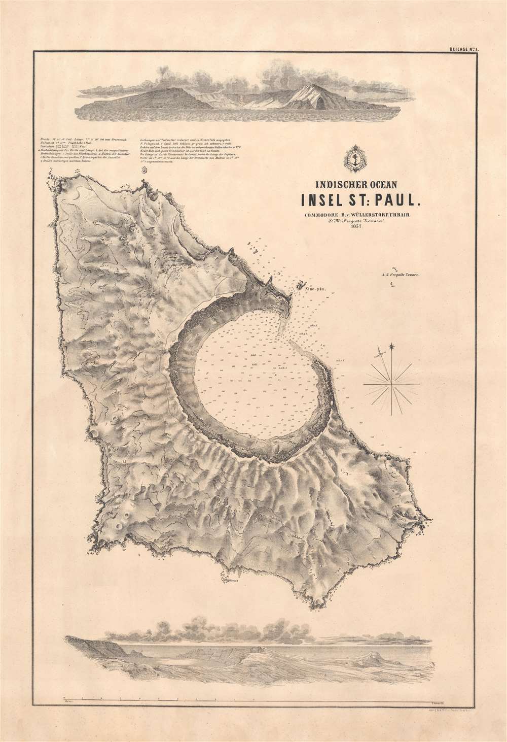
Indischer Ocean Insel St. Paul. / [St. Paul Island, Indian Ocean].
sold
- Digital Map Information
- Suitable for large format printing
- File Size: 29.21 MB
- File Type: ZIP / TIFF
- ICC color profile embedded
- Delivered instantly via download link
This is a rare 1857 Baron Bernhard von Wüllerstorf-Urbair map of St. Paul Island (Île Saint-Paul), a remote island in the extreme southern Indian Ocean, French Southern and Antarctic Lands. Today Île Saint-Paul is an important bird sanctuary. This is one of a series of maps of Indian Ocean islands compiled during the 1857 - 1859 Novara Expedition. The map includes a bird's-eye view of the island at bottom, and another illustration at top showing the island as it would have appeared from the ship. Near the top is a legend, along with latitude, longitude, and a number of other measurements and explanatory notes. (more details)
Rare first edition nautical chart of the Pasquotank River.
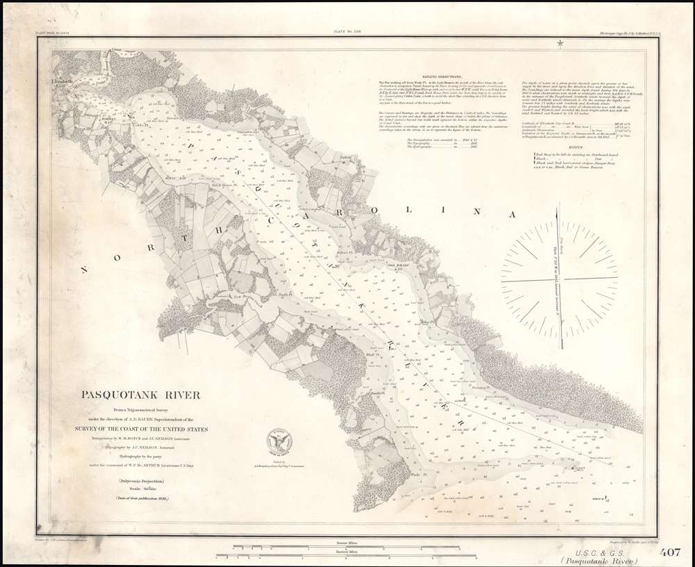
Pasquotank River.
sold
- Digital Map Information
- Suitable for large format printing
- Full resolution TIFF file
- ICC color profile embedded
- Delivered instantly via download link
This is a rare separate issue first edition 1850 U.S. Coast Survey nautical chart or maritime map of the Pasquotank River, North Carolina. The map depicts from Elizabeth City along the course of the river to the river's mouth on the Atlantic coast. (more details)
Island in the Nicobars.

Indischer Ocean Nicobaren. Bucht von Saoui auf Carnicobar. / [Sawai Bay at Car Nicobar].
$200.00
Acquire
- Digital Map Information
- Suitable for large format printing
- File Size: 14.48 MB
- File Type: ZIP / TIFF
- ICC color profile embedded
- Delivered instantly via download link
This is a rare 1858 Baron Bernhard von Wüllerstorf-Urbair map of Sawai Bay and the northern part of the island of Car Nicobar, Nicobar Islands, Indian Ocean. It is one of series of maps of Indian Ocean islands compiled by the 1857 - 1859 Austrian Novara Expedition. This map includes a brief legend noting longitude, latitude, and units of measurement ('Viennese feet'), as well as common elements of maps in this series, such as numbers on the map indicating the hourly speed of the current in stagnant or falling water. (more details)
Island paradise in the Indian Ocean.

Indischer Ocean Nicobaren. St. Georgs Canal. / [St. Georgs Channel].
$200.00
Acquire
- Digital Map Information
- Suitable for large format printing
- File Size: 17.42 MB
- File Type: ZIP / TIFF
- ICC color profile embedded
- Delivered instantly via download link
This is a rare 1858 Baron Bernhard von Wüllerstorf-Urbair map of St. Georgs Channel, Nicobar Islands, Indian Ocean. St. Georgs Channel separates Great Nicobar and Little Nicobar. This is one of a series of maps of Indian Ocean islands compiled during the Austrian 1857 - 1859 Novara. This map includes a brief explanatory note and the common elements of maps in this series, such as numbers on the map indicating the hourly speed of the current in stagnant or falling water. (more details)