
Orlando get's its second wind...

Map of Orlando, Orange County, Florida.
sold
- Digital Map Information
- Suitable for large format printing
- Full resolution TIFF file
- ICC color profile embedded
- Delivered instantly via download link
This is a 1910 South Florida Sentinel city plan or map of Orlando, Florida at the beginning of the Florida Land Boom. Depicting from Concord Lake to Copeland Lake and from just west of Reel Street to Sink Lake, the map provides a detailed look at Orlando at the beginning of the 20th century. Forty-three locations are numerically identified and correspond with an index (labeled 'Explanations') situated in the upper left. Housing additions are illustrated and labeled with the developer's name. In some cases, individual blocks are also labeled. (more details)
Allied losses after the German Spring Offensive and Allied gains during the Hundred Days Offensive.
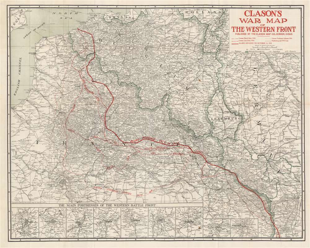
Clason's War Map of the Western Front.
sold
- Digital Map Information
- Suitable for large format printing
- Full resolution TIFF file
- ICC color profile embedded
- Delivered instantly via download link
This is a 1918 Clason Map Company map of northern France illustrating the movements of the front line in World War I through mid October 1918. Unlike World War II, World War I was fought along mostly static lines of trenches in northern France and Belgium from 1914 through 1918. The map depicts the region from the English Channel and Dieppe to Strasburg (Strassburg) in Alsace, then part of Germany, and from Holland and the North Sea to Colmar. Red overprinting is used to illustrate the battle line at five different times during the four-year slaughter. The furthest line depicts the farthest advance of the German army, when they reached within thirty kilometers of the center of Paris before their advance was stopped by the French at the First Battle of the Marne. This is the battle that includes the fabled taxis of Paris ferrying soldiers to the battlefield. Dashed lines also trace the German offensives of March and June 1918, collectively known as the Spring Offensive. The thin solid line marks the battle line of October 7, 1918 which was part of the Hundred Days Offensive, a campaign that began in August 1918 with the Battle of Amiens. Following the Allied success in the Battle of Amiens, the Germans fell back to the Hindenburg Line, a well-fortified defensive line that was established in 1917 and is illustrated and labeled here. The Hundred Days Offensive, in fact a series of battles that pushed back the Central Powers, eventually led to the end of the war. The final, bold battle line marks the progress made by the Hundred Days Offensive through October 14, 1918. (more details)
Boston on fire!
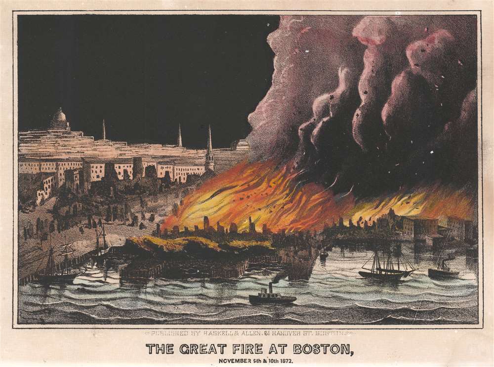
The Great Fire at Boston, November 9th and 10th, 1872.
sold
- Digital Map Information
- Suitable for large format printing
- File Size: 7.46 MB
- File Type: ZIP / TIFF
- ICC color profile embedded
- Delivered instantly via download link
This is a c. 1872 Haskell and Allen view of the Great Boston Fire of 1872. Flames engulf the city's commercial district and smoke billows skyward off the page. Debris can be seen flying through the inferno. The Charles River appears in the foreground, with a handful of ships bobbing on the water. Boston's church spires can be seen along its skyline and the dome of the Massachusetts State House appears near the left border. (more details)
Buy land outside Jacksonville. Only $50! (In 1925).
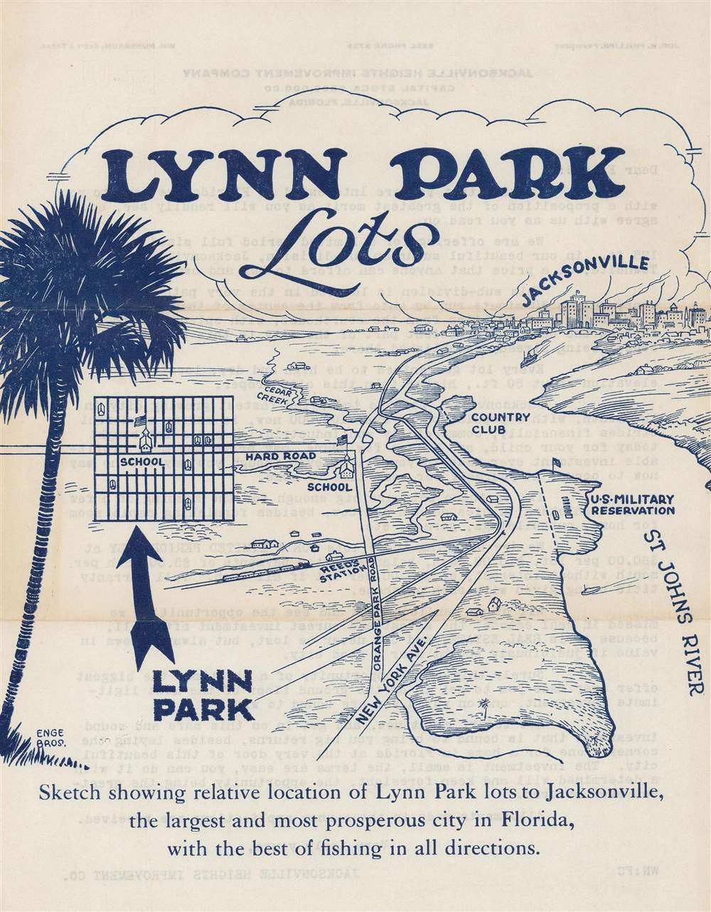
Lynn Park Lots.
sold
- Digital Map Information
- Suitable for large format printing
- Full resolution TIFF file
- ICC color profile embedded
- Delivered instantly via download link
This is a c. 1925 Enge Brothers map of Lynn Park Lots in Jacksonville Heights, Jacksonville, Florida. Lynn Park Lots was a development south of Jacksonville along the St. John's River. The view highlights the area's main streets, its railroad station, and its school. A country club and a U.S. military base (Jacksonville Naval Air Station) are both labeled. An inset map illustrates the lot layout of Lynn Park. (more details)
Early, English Colonial Map of Barbados.
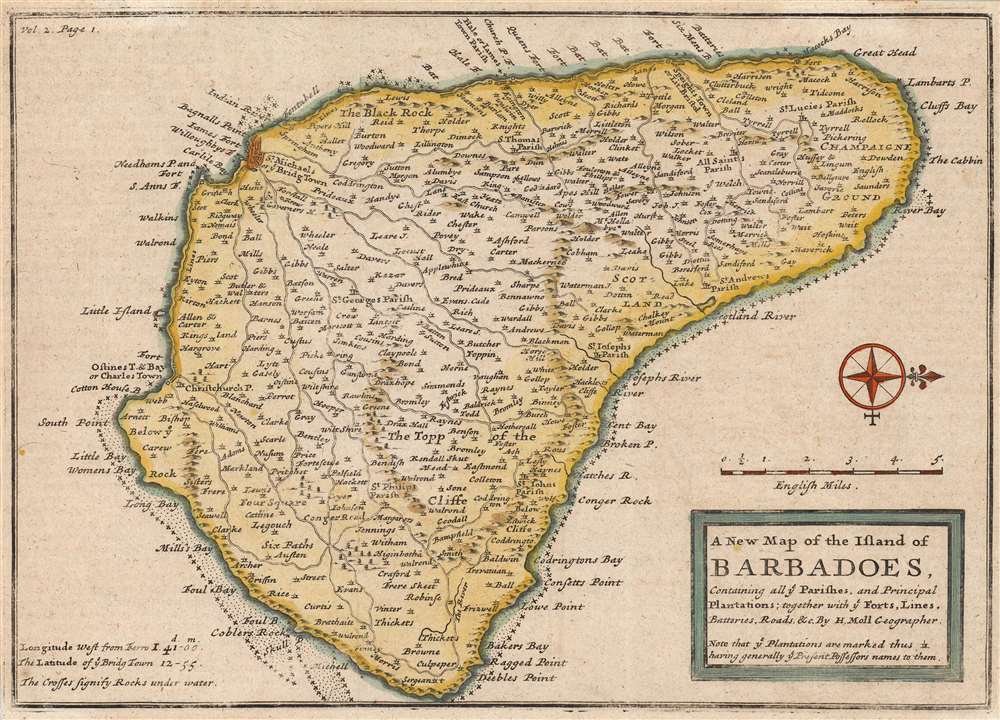
The New Map of the Island of Barbadoes, Containing all ye Parishes, and Principal Plantations; together with ye Forts, Lines, Batteries, Roads etc. By H. Moll Geographer.
sold
- Digital Map Information
- Suitable for large format printing
- Full resolution TIFF file
- ICC color profile embedded
- Delivered instantly via download link
This is a 1708 Herman Moll map of the island of Barbados. The map depicts the entire island oriented to the west, with the elegant compass rose indicating north to the right. The island is divided into its eleven parishes, all as today with the exception of St. Peter, which is here named 'All Saints'. The map names the island's towns, among which the island's capital at Bridge Town is emphasized. Much more in evidence are the island's many individual plantations, labeled with the owner's last name. Parish churches are noted as well. The map also illustrates roads and waterways. Topography is depicted pictorially. A scale is provided in English miles. (more details)
Ontario to Key West - 99 7/10% Paved!

Ontario to Florida Short Route. U.S. 25 - U.S. 1 Association.
sold
- Digital Map Information
- Suitable for large format printing
- Full resolution TIFF file
- ICC color profile embedded
- Delivered instantly via download link
This is a 1930 AAA and 'Ontario to Florida Short Route U.S. 25 - U.S. 1 Association' road map of the central United States. Coverage extends from Cochrane, Ontario, south to Key West, Florida. 'Heavy red lines' indicate U.S. Highways 25 and 1. Cities and towns are identified and distances between major stops are provided. Thinner red lines trace connecting routes from Cleveland, Chicago, Indianapolis, and Louisville. The dashed red line in Canada indicates the forty-four miles of unpaved road between Owen Sound, Ontario, and the US Border. 'Heavy black lines indicate alternative routes', while thinner lines detail the general road network. Information concerning the route, including touristic stopovers, is printed on the verso. (more details)
The most unique and visually engaging early map of the American Northeast.
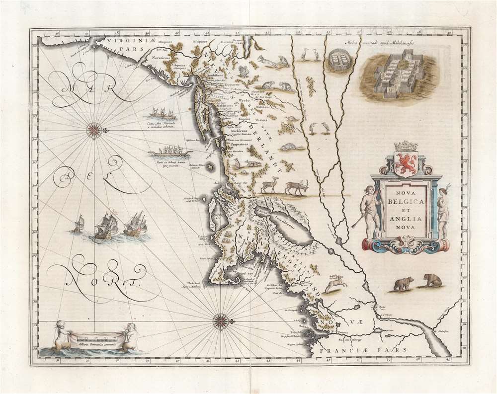
Nova Belgica Et Anglia Nova.
sold
- Digital Map Information
- Suitable for large format printing
- Full resolution TIFF file
- ICC color profile embedded
- Delivered instantly via download link
This is an attractive example of Willem Blaeu’s 1634 map of the American Northeast, the regions settled by the Dutch (New Netherlands) and the English (New England). Oriented to the west, Blaeu's map covers the American coast from Virginia, past New York and Long Island to Cape Cod, New England, and Quebec. The map is the first of the region to accurately depict the fur-bearing and food animals of the region, and it does so in profusion. Between this imagery, and the fleet of trade ships heading towards the coast, the decorative elements of the map vividly emphasize the potential for wealth offered by this region. (more details)
Mora's second map!
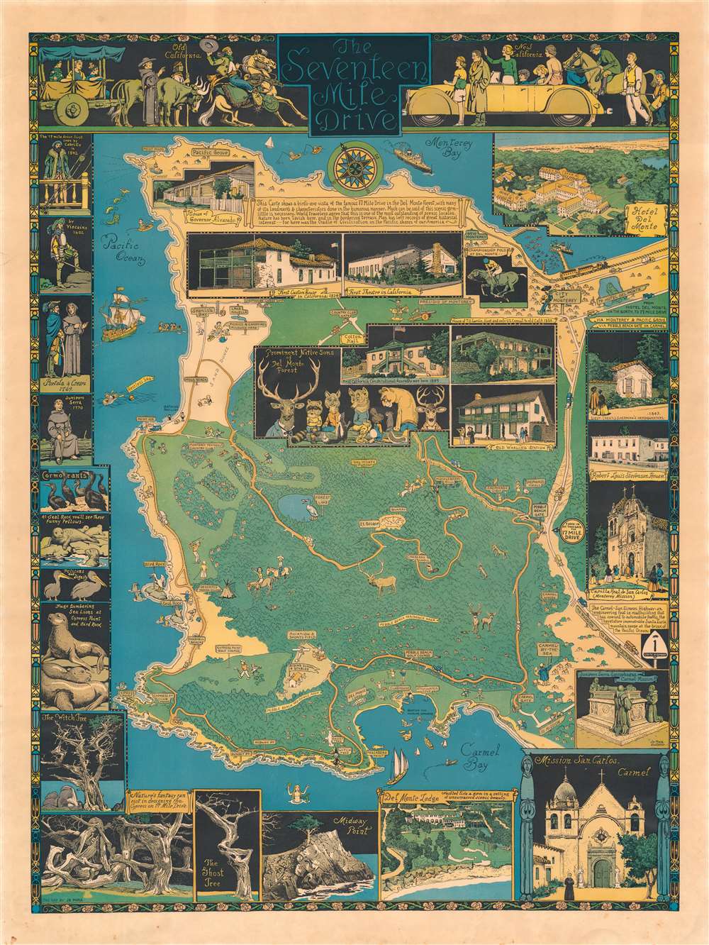
The Seventeen Mile Drive.
sold
- Digital Map Information
- Suitable for large format printing
- File Size: 59.53 MB
- File Type: ZIP / TIFF
- ICC color profile embedded
- Delivered instantly via download link
The rare first edition of Jo Mora's 1927 pictorial map of Monterey Peninsula's Seventeen Mile Drive. This is the second of Mora's iconic pictorial maps, which he called his 'cartes.' The map covers Monterey Peninsula in full, detailing the seventeen-mile drive around the peninsula and the various points of interest along the way. (more details)
Foreign concessions and 'special areas'.
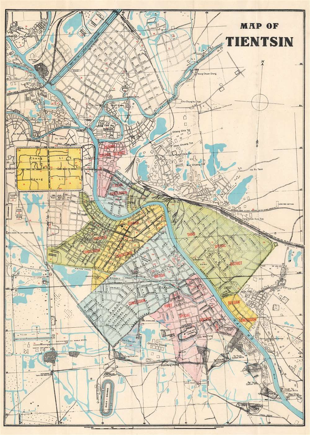
Map of Tientsin.
sold
- Digital Map Information
- Suitable for large format printing
- Full resolution TIFF file
- ICC color profile embedded
- Delivered instantly via download link
This is a 1928 Peiyang Press city plan or map of Tientsin (天津市,Tianjin), China, shortly after the outbreak of the Chinese Civil War (1927 - 1849). Red overprinting identifies the British, French, Italian, Japanese, and Belgian concessions, along with the First, Second, and Third Special Districts. The same red overprinting marks 185 locations corresponding to an index. The Russian Consulate, French Consulate, British Consulate, Italian Consulate, Japanese Consulate, and U.S. Consulate are labeled within the Concessions and Special Areas. Other identified sites include Standard Oil's installation along the Hai Ho River, the Japanese Barracks, several gardens and parks, and Woodrow Wilson Field. (more details)
Focuses on part of the battle fought between the 63rd Ohio and 2nd Texas Infantry Regiments.

Battle of Corinth.
sold
- Digital Map Information
- Suitable for large format printing
- File Size: 48.88 MB
- File Type: ZIP / TIFF
- ICC color profile embedded
- Delivered instantly via download link
This is an 1891 Kurz and Allison chromolithograph view of the Battle of Corinth (also known as the Second Battle of Corinth) during the American Civil War. The Union Army's 63rd Ohio Infantry Regiment appears on the left side repelling an attack on Battery Robinett by the Confederate Army's 2nd Texas Infantry Regiment from the right side. Soldiers manning both battle lines fire on the other from point blank range and the regimental colors for both units are prominently illustrated. (more details)
Clemson, Charleston, and Myrtle Beach.
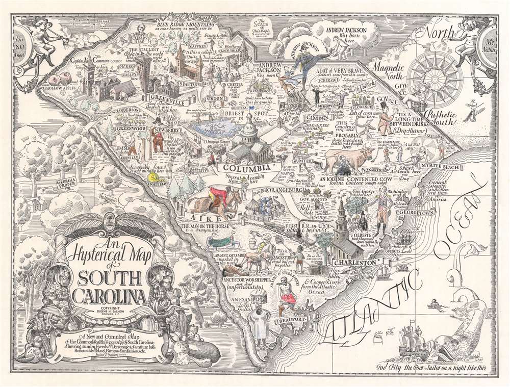
An Hysterical Map of South Carolina.
sold
- Digital Map Information
- Suitable for large format printing
- File Size: 28.66 MB
- File Type: ZIP / TIFF
- ICC color profile embedded
- Delivered instantly via download link
This is a c. 1942 hysterical Irving Geisberg pictorial map of South Carolina. Humorous vignettes highlight cities and towns across the state, with the South Carolina State Capital occupying pride of place near the center. The politicians working at the capital, are humorously (depending) illustrated sleeping on the lawn outside the building. Famous buildings identify certain cities, such Saint Michael's Church in Charleston and Tillman Hall for both Clemson and Clemson University. 'The Great White Way all lit up' symbolizes Anderson, Geisberg's hometown and the first city with electricity in the United States. Myrtle Beach, a popular vacation destination then and now, is marked by a stunning woman lounging in a swimsuit. Cherubs occupy the upper left and right corners (likely a reference to classical cartography), but their cartouches state 'I'm NO Angel' and 'Me Neither', respectively. (more details)
Stunning midcoast Maine.

United States - East Coast. Maine. Monhegan Island to Cape Elizabeth.
sold
- Digital Map Information
- Suitable for large format printing
- File Size: 50.99 MB
- File Type: ZIP / TIFF
- ICC color profile embedded
- Delivered instantly via download link
This is a 1913 U.S. Coast and Geodetic Survey nautical chart or maritime map of mid-coast coast of Maine, depicting from Portland and Cape Elizabeth northeast along the coastline to the Meduncook River and Monhegan Island. Islands, bays, necks, capes, and other coastal features are illustrated in detail. The Kennebec River, Sheepscot River, and Damariscotta River are identified. Yarmouth, Bath, Brunswick, Wiscasset, Newcastle, and Damariscotta are illustrated and labeled, along with the Maine Central Railroad. A wealth of additional practical information for the mariner is scattered throughout. (more details)
The Caribbean Theater of the Revolutionary War.

Map of the Gulf of Mexico, the Islands and Countries Adjacent.
sold
- Digital Map Information
- Suitable for large format printing
- Full resolution TIFF file
- ICC color profile embedded
- Delivered instantly via download link
This is an attractive 1777 map of the West Indies and the adjacent coasts of North, Central and South America, by the British cartographer Thomas Kitchin. The map includes Florida and the Gulf of Mexico in the north and west, the Central American coastline and the northern parts of South America extending to the mouth of the Orinoco River. Florida is unusually long, breaking into an archipelago at its tip, and with the St. John River extending almost its full length. Major towns and ports are marked throughout. New Orleans is shown and named. La Salle's settlement on Matagorda Bay - here named 'B. de St. Bernard' - is shown and dated 1685. A Spanish Presidio is also marked on the bay. (more details)
Libraries for soldiers.

Library War Service of the American Library Association. United War Work Campaign - Week of November 11, 1918.
sold
- Digital Map Information
- Suitable for large format printing
- File Size: 19.5 MB
- File Type: ZIP / TIFF
- ICC color profile embedded
- Delivered instantly via download link
This is a 1918 American Library Association (ALA) map of the United States highlighting 'Special War Libraries' created by the ALA during World War I. Published during the week of the Armistice (November 11, 1918), squares mark military camps that have dedicated library buildings, while circles mark camps that have libraries in other buildings. Statistics along the bottom border detail the camp library buildings in operation at the time of publication, librarians employed by the Service, Library War Service distribution points overseas, and the number of books shipped overseas, among many other facts. (more details)
Go Greyhound and Leave the Driving to Us!
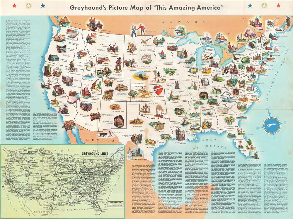
Greyhound's Picture Map of 'This Amazing America'.
sold
- Digital Map Information
- Suitable for large format printing
- Full resolution TIFF file
- ICC color profile embedded
- Delivered instantly via download link
This is a 1946 Greyhound pictorial map of the United States. Pictorial vignettes highlight American culture, landscape, and history. National parks, including Yosemite, Yellowstone, Mesa Verde, and the Great Smoky Mountains, are among the illustrated sites. Historical landmarks include the Statue of Liberty, Independence Hall, and the site of man's first powered flight at Kitty Hawk, North Carolina. Cultural references include Paul Bunyan in Minnesota, Hollywood California, and Frontier Days in Cheyenne, Wyoming. Each vignette is numbered and corresponds with a short reference text situated either to the left side or below the map. An inset in the lower left details Greyhound's extensive nationwide bus network. (more details)
Poultry in Ft. Lauderdale.
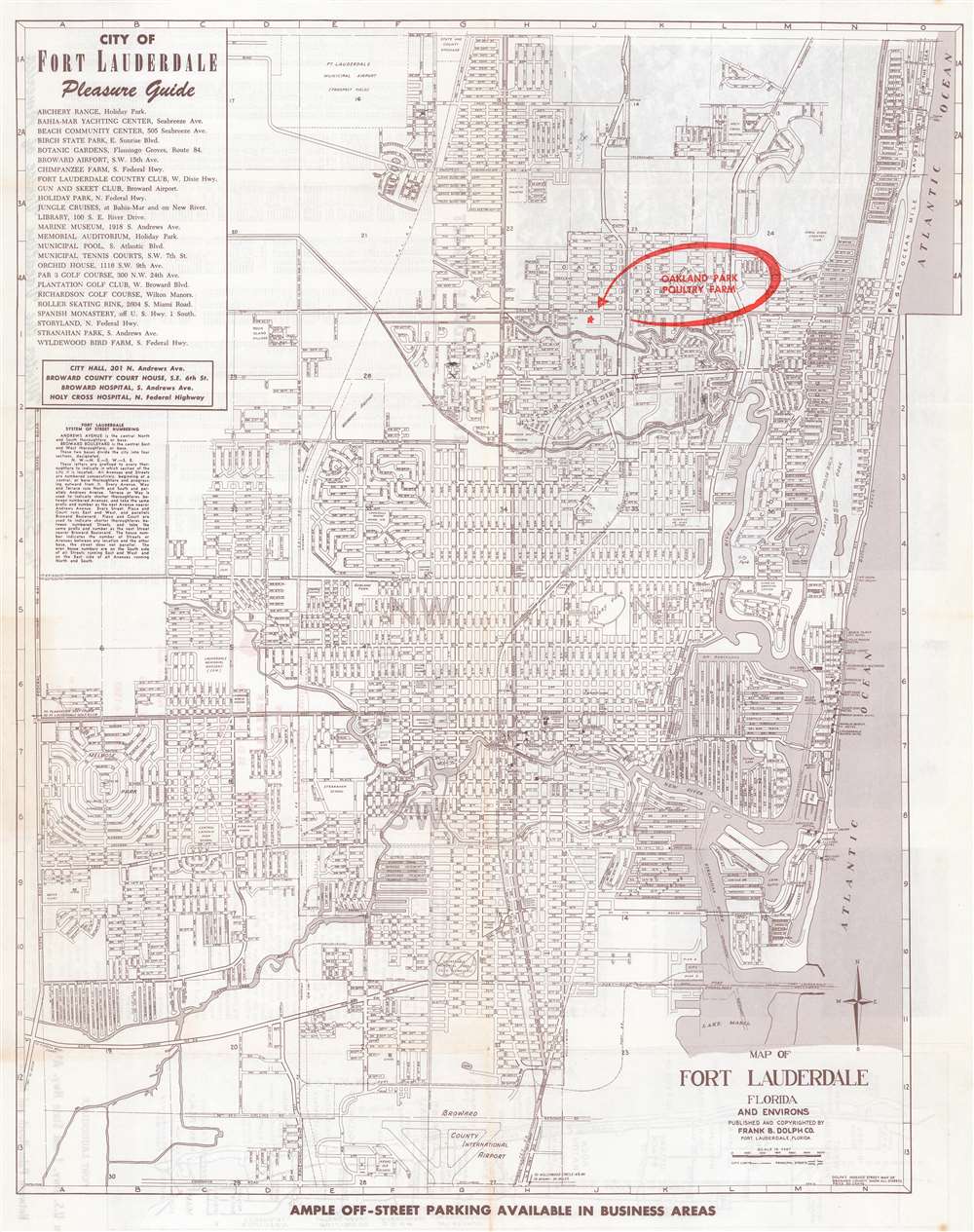
Map of Fort Lauderdale Florida and Environs.
sold
- Digital Map Information
- Suitable for large format printing
- Full resolution TIFF file
- ICC color profile embedded
- Delivered instantly via download link
This is a c. 1947 Dolph Map Company city plan or map of Fort Lauderdale, Florida. The map depicts from Northeast 56th Street south to the Broward County International Airport (now Fort Lauderdale-Hollywood International Airport) and from Federal Highway 441 east to the Atlantic Ocean. Schools, hospitals, parks, shopping centers, and a handful of government buildings are labeled. The Florida East Coast Railroad line cuts through the center of town. The most eye-catching detail is the red overprinting emphasizing the location of the Oakland Park Poultry Farm. (more details)
Historic homes!
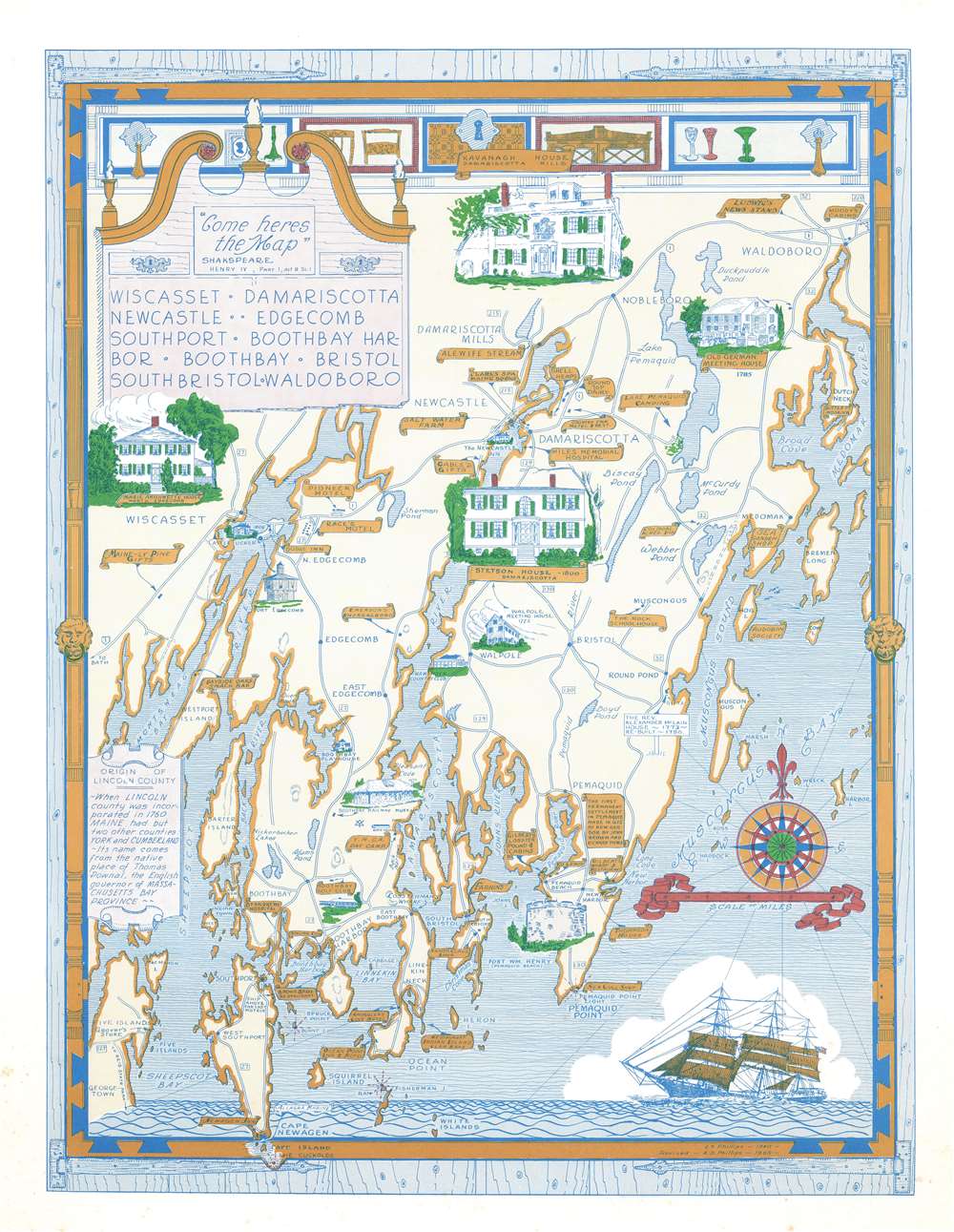
Wiscasset. Damariscotta. Newcastle. Edgecomb. Southport. Boothbay Harbor. Boothbay. Bristol. South Bristol. Waldoboro.
sold
This is a 1966 Augustus Dewey Phillips pictorial map of Lincoln, County, Maine depicting from Montsweag Bay to Muscongus Bay and from Waldoboro to Cape Island. Phillips highlights local history, the county's historic whaling towns, and identifies many local businesses. The towns of Damariscotta, Waldoboro, Wiscasset, Boothbay Harbor, Newcastle, Boothbay, and others appear. Vignettes illustrate important historic structures, including the Marie Antoinette House in North Edgecomb, Castle Tucker, the Stetson House in Damariscotta, the Boothbay Railway Museum, and the Kavanagh House in Damariscotta Mills. The Round Top Dairy, Cable's Gifts, the Rock Schoolhouse, Emerson's Smorgasbord, the Boothbay Golf Club, and the Bayside Oaks Snack Bar represent a sampling of the local establishments. A text along the left provides a short history of Lincoln County's founding. (more details)
Follows the Lewis and Clark Expedition.

The Trail of Lewis and Clark 1804 - 1806.
sold
- Digital Map Information
- Suitable for large format printing
- File Size: 19.56 MB
- File Type: ZIP / TIFF
- ICC color profile embedded
- Delivered instantly via download link
This is a 1945 Irvin Shope pictorial map of the western United States commemorating the Lewis and Clark Expedition. Depicting from the Mississippi River west to the Pacific, a solid red line traces Lewis and Clark's route from Wood River, Illinois, up the Missouri River to Montana, west to the Snake and Columbia Rivers, and on to Astoria, Oregon. Pictorial vignettes highlight their 3-year expedition, including the keel boat the expedition took up the Missouri, portaging canoes around the great falls of the Missouri, and Sacajawea recognizing the Shoshone. Dashed red lines trace deviations on the return voyage. The various yellow lines follow other famous trails of the American West, including the Oregon Trail, the Pony Express, the Santa Fe Trail, and the Mormon Trail. Shope includes other vignettes illustrating aspects of pioneer western life, such as a covered wagon being pulled by a team of oxen, a Pony Express rider, bison, pronghorn antelope, and a stagecoach. (more details)
The Pike's Peak Gold Rush.
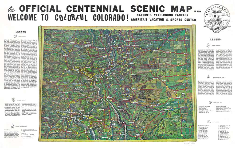
An Official Centennial Scenic Map...Welcome to Colorful Colorado! Nature's Year-Round Fantasy. America's Vacation and Sports Center.
sold
This is a 1959 J.F. Brewer pictorial map of Colorado celebrating the centennial of the Pike's Peak Gold Rush. Spectacularly illustrated, Brewer evokes Colorado's stunning landscape. He blends all the colors found around the state to breathe life into the work. Aspects of Colorado's history, including oil derricks, mines, and frontier forts are juxtaposed with more contemporary creations, like national parks and forests, and even the Royal Gorge Bridge. Extensive numerical indexes are situated on the left and right. Noted scenic landmarks, ski areas, mountain passes, historic sites, and national forests, monuments, and parks. (more details)
Canadian WWI military achievement!

War Map Specially Indicating Scenes Where Canadian Troops Distinguished Themselves.
sold
- Digital Map Information
- Suitable for large format printing
- Full resolution TIFF file
- ICC color profile embedded
- Delivered instantly via download link
This is a c. 1918 Montreal Star map of France and Belgium during World War I, known as the Western Front. Created for domestic consumption in Canada, the map highlights where Canadian troops distinguished themselves in battle. A line of battle sites from Ypres in western Belgium south to Coucy in France are highlighted. The most visually arresting aspect of the map is its border where insignia for forty different Canadian units appear. Illustrations of the highest military honors awarded to Canadian soldiers, including the Victoria Cross and the Distinguished Service Order, occupy the corners. Banners bearing the names of many of the Canadian Corps' most arduous battles separate the unit insignia on the left and right. An elaborate cartouche featuring an armorial crest and maple leaves occupies the center along the bottom border. (more details)