
Clebrating Florida with over one hundred photos.

Views of Florida.
sold
- Digital Map Information
- Suitable for large format printing
- Full resolution TIFF file
- ICC color profile embedded
- Delivered instantly via download link
This is a c. 1890 Chisholm Brothers bird's-eye view or map of Jacksonville, Florida. Printed in the Chisholm Brothers' photobook Views of Florida, the view overlooks Jacksonville from high above the St. John's River. Steamships, sailing ships, and riverboats, ply the waters of the St. John's River in the foreground. A train is illustrated making its way toward the waterfront and several ships are moored at piers, underlining Jacksonville's economic importance. Many city streets are labeled and buildings throughout town are drawn in profile (although none are identified). A small view in the upper left corner depicts the view south from the post office overlooking the St. John's River. (more details)
Sailing from Martha's Vineyard to Hyannis.
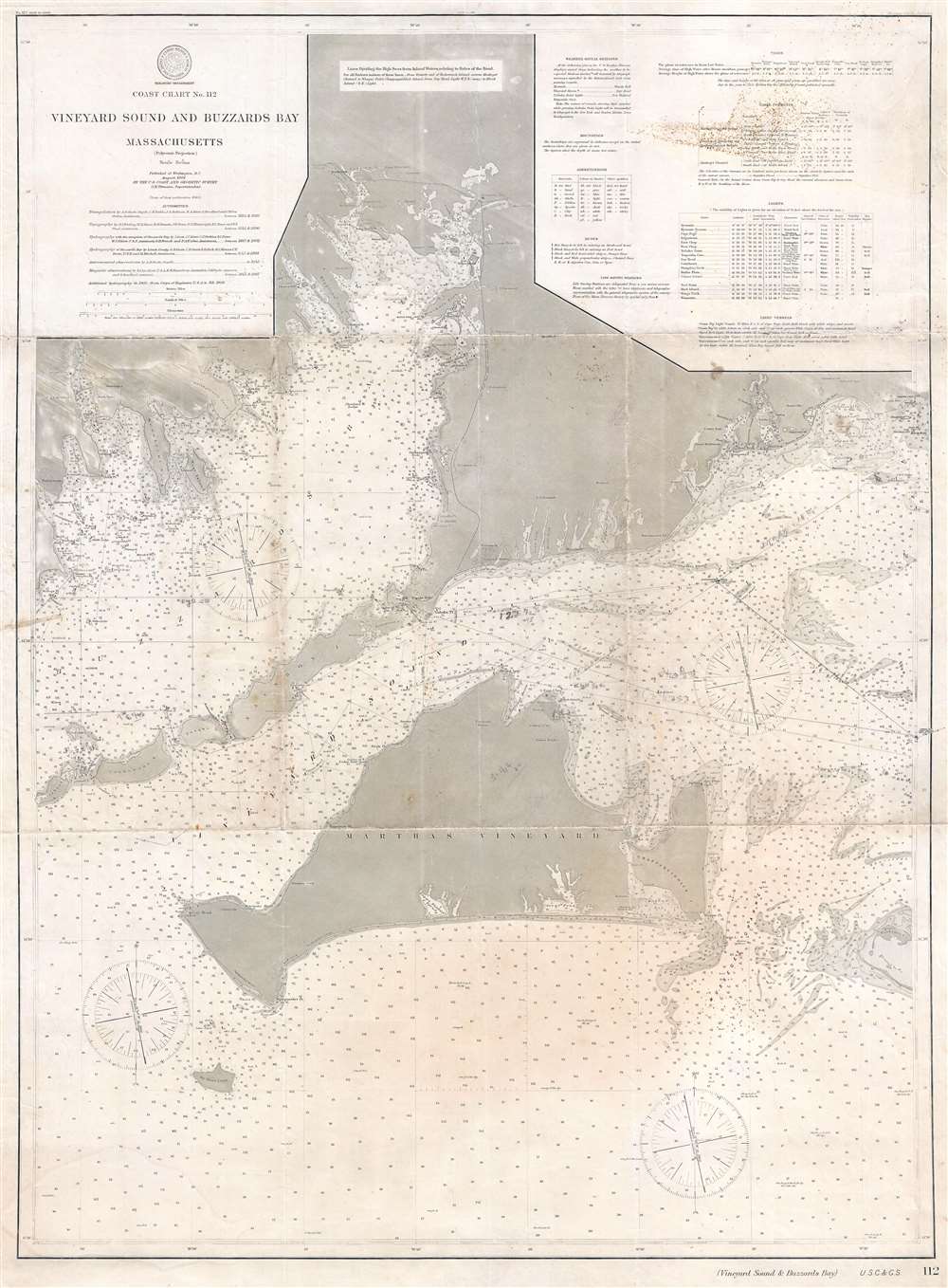
Coast Chart No. 112. Vineyard Sound and Buzzards Bay.
sold
- Digital Map Information
- Suitable for large format printing
- File Size: 28.35 MB
- File Type: ZIP / TIFF
- ICC color profile embedded
- Delivered instantly via download link
This is a 1906 U.S. Coast and Geodetic Survey nautical chart or maritime map of Martha's Vineyard, Buzzards Bay, and Vineyard Sound, Massachusetts. The map depicts from Wareham and Buzzards Bay, Massachusetts to the Atlantic south of Martha's Vineyard and from Cuttyhunk to Hyannis Port. The chart is rich with information essential to the mariner with myriad depth soundings particularly dense along the coastlines. Numerous cities and towns are labeled, including New Bedford, Falmouth, Woods Hole, and several towns on Martha's Vineyard. This chart appears to have been sailed, as it bears manuscript notations, including a course from Martha's Vineyard to Hyannis Port. (more details)
Weekends on the Cape and how to get there.

Bird's Eye View of Boston Harbor and South Shore to Provincetown Showing Steamship Routes.
sold
- Digital Map Information
- Suitable for large format printing
- Full resolution TIFF file
- ICC color profile embedded
- Delivered instantly via download link
This is a remarkable c. 1917 chromolithograph map and view of Boston Harbor from Boston to Provincetown published by Union News. Including all of Cape Cod Bay, Quincy Bay, and Dorchester Bay, the cities of Boston, Dorchester, Plymouth, and Provincetown are named, among others. Islands in Boston Harbor are illustrated as well, including Moon Island, Spectacle Island, Long Island, Governor's Island. Ferry and steamboat routes are illustrated and labeled, with lines to Plymouth, Provincetown, and New York. Smoke rises from Boston's many manufactories. Today, such are construed as pollution and urban defilement, but when this view was printed busy smokestacks were indicative of commercial prosperity and industrial optimism. (more details)
'Rusticators' become 'Tourists'.

A Map of Mount Desert Island and Acadia National Park Maine.
sold
- Digital Map Information
- Suitable for large format printing
- Full resolution TIFF file
- ICC color profile embedded
- Delivered instantly via download link
This is a 1938 National Survey Company tourist map of Mount Desert Island, Maine, likely created 'rusticators' visiting Acadia National Park. Pink areas highlight the park's boundaries. Highways, secondary roads, and Mount Desert Island's celebrated carriage roads are illustrated. Charming pictorial elements occupy the three corners, including a personification of wind blowing a sailboat along the island's northern coast. (more details)
Christian faith as a railroad.

A Rail Road Man's Prayer.
sold
- Digital Map Information
- Suitable for large format printing
- File Size: 7.65 MB
- File Type: ZIP / TIFF
- ICC color profile embedded
- Delivered instantly via download link
This is a c. 1905 C. Erb broadside 'A Rail Road Man's Prayer'. Featuring a stunning illustration of a steam locomotive, the prayer occupies the majority of the broadside. (more details)
The 'Old Northwest' remembered.

The Old Northwest Territory.
sold
- Digital Map Information
- Suitable for large format printing
- Full resolution TIFF file
- ICC color profile embedded
- Delivered instantly via download link
An uncommon 1937 pictorial map of the old Northwest Territory by Fred Rentschler. The map includes all five Great Lakes and the modern-day states of Minnesota, Wisconsin, Illinois, Indiana, Michigan, and Ohio. It includes numerous vignettes referencing historic events, American Indian peoples, and folklore. The main map is surrounded by historical maps illustrating various plans for the Northwest Territory ranging from the 'Thomas Jefferson Conception' to specific illustrations of the individual states in different configurations. The verso features a transcript of the Ordinance of 1787 as well as additional historical text. (more details)
One of the most beautiful, important, and enduring maps of Manhattan ever published.
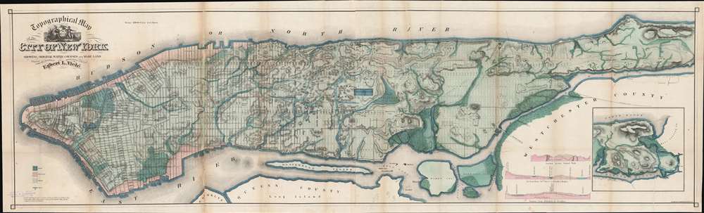
Topographical Map of the City of New York Showing Original Water Courses and Made Land.
sold
- Digital Map Information
- Suitable for large format printing
- File Size: 71.25 MB
- File Type: ZIP / TIFF
- ICC color profile embedded
- Delivered instantly via download link
This is a very beautiful and fine example of Egbert L. Viele's 1865 topography and waterways map of Manhattan, one of the scarcest, most important, and most enduring maps of New York City ever published. Covering the entirety of Manhattan Island, Viele's map details the canals, swamps, rivers, ditches, ponds, meadows, and drainage basins of Manhattan as they existed prior to the city's urban development. A version of the Viele map remains in use today by architects and contractors who need to be certain they are not building over underground rivers and swamps that may destabilize a new construction's foundation. (more details)
The American Revolutionary War - in SE Asia!

Carte du Theatre De La Guerre Dans L'inde ou se Trouvent Une Partie de La Chine, Les Iles De Sumatra, Java, Borneo, Moluques et Philippines. Dressee d'apres les Meilleures Cartes tant Francaises qu'Anglaises.
sold
- Digital Map Information
- Suitable for large format printing
- Full resolution TIFF file
- ICC color profile embedded
- Delivered instantly via download link
A rare and important 1781 separately issued map of the East Indies by Andre Basset. This map was issued to illustrate a series of conflicts in India and East Indies associated with the American Revolutionary War (1775 - 1783), including the Anglo-French War (1778 - 1783), Fourth Anglo-Dutch War (1780 - 1784), and the Second Anglo-Mysore War (1780 - 1784). The theater of war described is a vast expanse of East Asian territory centered on the Malay Peninsula, but extending from the Maldives to the Philippines and from China to Java, including all of the East Indies, the Indian Subcontinent, the Philippines, and Southeast Asia. (more details)
Imaginary (but important!) Islands of Lake Superior.

Carte des Lacs du Canada Dresse sur les Manuscrits du Depost des Carts, Plans et Journaux de la Marine et sur le Journal de RP. De Charlevoix.
sold
- Digital Map Information
- Suitable for large format printing
- Full resolution TIFF file
- ICC color profile embedded
- Delivered instantly via download link
This is the 1744 Bellin / Charlevoix map of the Great Lakes, the most accurate map of the Great Lakes to date and the best produced since the De l'Isle map of 1718. It is also the earliest obtainable map, preceded only by a 1742 proof noted by Kershaw, to depict the four fictive islands in Lake Superior (Philippeux, Pontchartrain, Maurepas, and St. Anne) - islands that nonetheless significantly influenced the structuring of post-Revolutionary War borders between British Canada and the fledgling United States. It is also notable for being among the earliest maps to identify Detroit and the Port of Chicago. Bellin's map covers all five Great Lakes and their adjacent drainage systems in considerable detail, noting known fortifications, American Indian villages, missions, and some speculative topography (particularly in Michigan). (more details)
No amount of time spent on this map would be wasted; its detail is fascinating. - Wheat
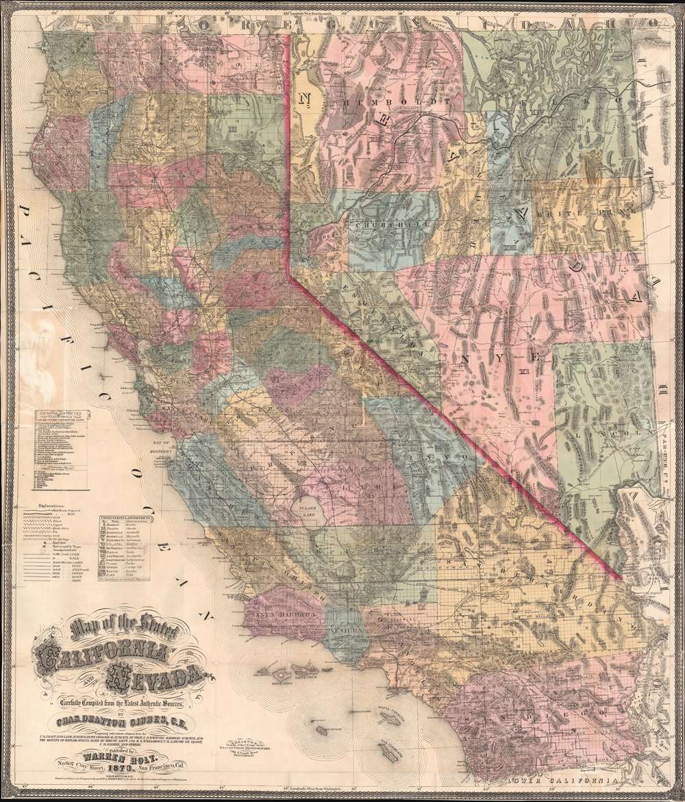
Map of the States of California and Nevada. Carefully Compiled from the Latest Authentic Sources. By Chas. Drayton Gibbes, C.E.
sold
- Digital Map Information
- Suitable for large format printing
- File Size: 95.74 MB
- File Type: ZIP / TIFF
- ICC color profile embedded
- Delivered instantly via download link
A beautiful and rare variant on the first edition second state of Warren Holt and Charles Drayton Gibbes' 1873 map of California and Nevada. This map considered to be one of the finest large-scale maps of California to appear in the second half of the 19th century. Depicting all of California and Nevada, the map offers exceptional detail throughout. To the left, a key identifies 14 Federal Land Districts, 20 California Judicial Districts, and 9 Nevada Counties. The key, which was inherited from the first edition first state, is somewhat out of sync with the updated second state, which adds Eureka County, Nevada. Additional coding identifies 10, 20, and 30 mile railroad grants to the Central Pacific, Western Pacific, C. and O., Southern Pacific, P. and S., S. and C., and A. and P. Railroads. (more details)
Race to the North Pole.

五六年の小學生新年號附録 / 5-6th Grade Elementary School New Years Appendix.
sold
- Digital Map Information
- Suitable for large format printing
- Full resolution TIFF file
- ICC color profile embedded
- Delivered instantly via download link
This is a rare 1925 (Taisho 14) / 1926 (Taisho 15) sugoroku game board and map of the Arctic / North Pole, commemorating the struggle to reach it in 1925. The board is oriented such that one player could sit on either side. As we have it oriented, the figure on the right is the Arctic explorer and polymath Fridtjof Nansen (1861 - 1930), who made a failed dash for the North Pole in 1895. The figure on the left is Robert Edwin Peary (1856 - 1920), who after several attempts, successfully reached the North Pole on April 6, 1909. (more details)
Japanese anti-Soviet anti-Communist Propaganda Pictorial!
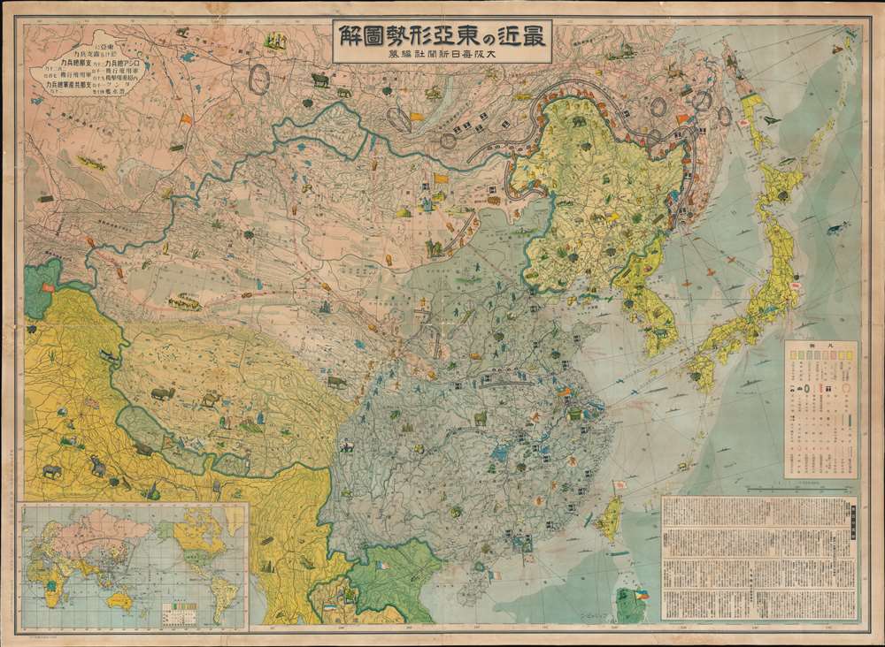
最近の東 亞形勢圖解 / Illustrated Explanation of Recent East Asia Situations. / Saikin no Tōa keisei zukai.
sold
- Digital Map Information
- Suitable for large format printing
- File Size: 133.07 MB
- File Type: ZIP / TIFF
- ICC color profile embedded
- Delivered instantly via download link
A remarkable and rare 1937 large format Japanese anti-Soviet propaganda pictorial map of East Asia. Centered on China, this stunning map covers from Central Asia and India to Japan and from Siberia to Vietnam. The map employs text, color coding, and cartoon ... (more details)
Rare edition of Colton's beautiful railroad map.
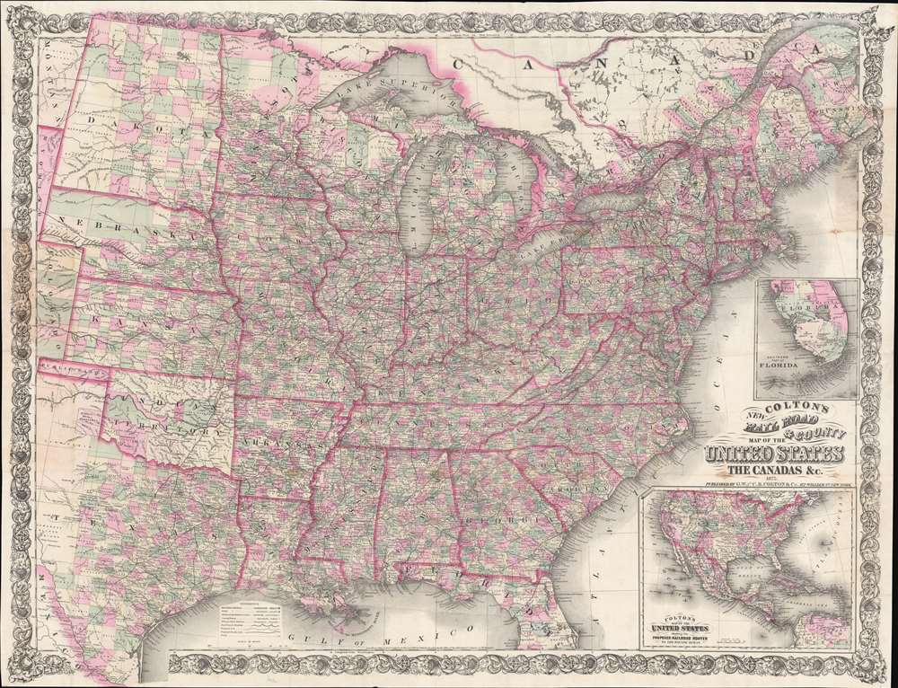
Colton's New Railroad and County Map of the United States the Canadas etc.
sold
- Digital Map Information
- Suitable for large format printing
- Full resolution TIFF file
- ICC color profile embedded
- Delivered instantly via download link
An uncommon pocket map of the United States issued in 1875 by J. H Colton. This large map depicts most of the inhabited parts of the United States at the time, from Texas, Kansas, Nebraska, and Dakota eastward to the Atlantic. Colton offers a wealth of cartographic detail including counties defined by color coding and elevation rendered by hachure. The map includes railroad lines, towns, cities, and notations regarding various American Indian nations. Colton's choice to terminate the map on the eastern slopes of the Rocky Mountains (106th meridian) is suggestive of the fact that this is, in essence, a railroad map and the transcontinental railroad had yet to be completed when this map was first issued in 1860. An inset map in the lower right quadrant details the entire United States and offers more information regarding proposed railway lines extending to the Pacific. A further inset above the title details south Florida, identifying the then-young city of Miami, though no railroad had yet extended into the region. The whole is surrounded by a wide decorative vine motif border. (more details)
A rare map of Angkor, the capital of the Khmer Empire.

Carte du Groupe et du Parc d'Angkor.
sold
- Digital Map Information
- Suitable for large format printing
- File Size: 14.91 MB
- File Type: ZIP / TIFF
- ICC color profile embedded
- Delivered instantly via download link
This is a 1930 Henri Parmentier map of Angkor, Siem Reap Cambodia. Angkor, home to the world-famous temples of Angkor Wat and Angkor Thom, among others, was the capital of the Khmer Empire, which flourished between the 9th and 15th centuries. Both Angkor Wat and Angkor Thom are illustrated and labeled. Angkor Wat, while the smaller of the two sites, is said to be the world's largest single religious monument and is Cambodia's most popular tourist attraction. Both temples, along with the surrounding area, are collectively a UNESCO World Heritage Site. Using satellite photography and other modern techniques, an international team of researchers determined that Angkor at its height was the largest pre-industrial city in the world - an interconnected community that covered at least 390 square miles, with Angkor Wat at its center. Today, over two million people visit the site annually. (more details)
Oxford to Bristol by Foot or Horse.
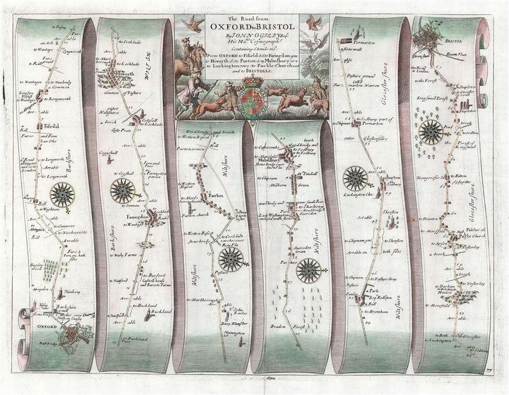
The Road from Oxford to Bristol by John Ogilby Esqr.
sold
- Digital Map Information
- Suitable for large format printing
- Full resolution TIFF file
- ICC color profile embedded
- Delivered instantly via download link
This is John Ogilby's road map detailing the road between the cities of Oxford and Bristol. It is a strip-map, following the road from Oxford south and west in six lengths, presented as if on a single, unspooled sheet of paper. Smaller towns, bridges, forests, churches, and county borders are all noted along the way. Pastures, and even some coal mines are marked as well. Strip maps served to inform travelers of the distances, landmarks, obstacles and resting points along a given road between two destinations. Changes in direction along the way are indicated by the placement of attractive compass-roses. The wise traveler, of course, would never leave the high road; consequently, no further routes would require consideration.
The map's attractive cartouche is embellished with what appears to be a remarkably unsuccessful hunting scene: the mounted hunter, his footmen, and his dogs unable to snare any of the fowl taking wing.
Britannia was based on firsthand survey by Ogilby and his team, who published their results at a uniform scale of one inch to one mile. Of more general importance, Ogilby standardized the English mile throughout his book at 1,760 yards (prior to this, no such uniformity existed in England.) Ogilby's work was the first to utilize strip maps of this kind, but the 18th century would see similar works published by Bowen, Gardner and Senex. (more details)
The map's attractive cartouche is embellished with what appears to be a remarkably unsuccessful hunting scene: the mounted hunter, his footmen, and his dogs unable to snare any of the fowl taking wing.
Britannia was based on firsthand survey by Ogilby and his team, who published their results at a uniform scale of one inch to one mile. Of more general importance, Ogilby standardized the English mile throughout his book at 1,760 yards (prior to this, no such uniformity existed in England.) Ogilby's work was the first to utilize strip maps of this kind, but the 18th century would see similar works published by Bowen, Gardner and Senex. (more details)
Henry Hudson's Final Voyage.
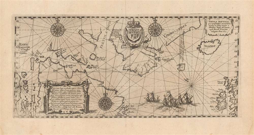
Tabula nautica, qua repraesentātur orae maritimae meatus, ac freta, noviter a H. Hudsono Anglo ad Caurum supra Novam Franciam indagata anno 1612.
sold
- Digital Map Information
- Suitable for large format printing
- Full resolution TIFF file
- ICC color profile embedded
- Delivered instantly via download link
This is Johann Theodore De Bry's 1613 edition of Hessel Gerritz' chart of the North Atlantic and the Canadian Maritimes, based on the reports of Henry Hudson's fourth, final voyage. Predated only by Gerritsz' much rarer 1612 issue, this is the first map of Hudson Bay and the surrounding region, and remained the best chart of the northern regions of Canada for decades. The chart reaches from the British Isles to the western shore of James Bay, extending from 50° - 70° N. (more details)
One of the first charts of California as an island!
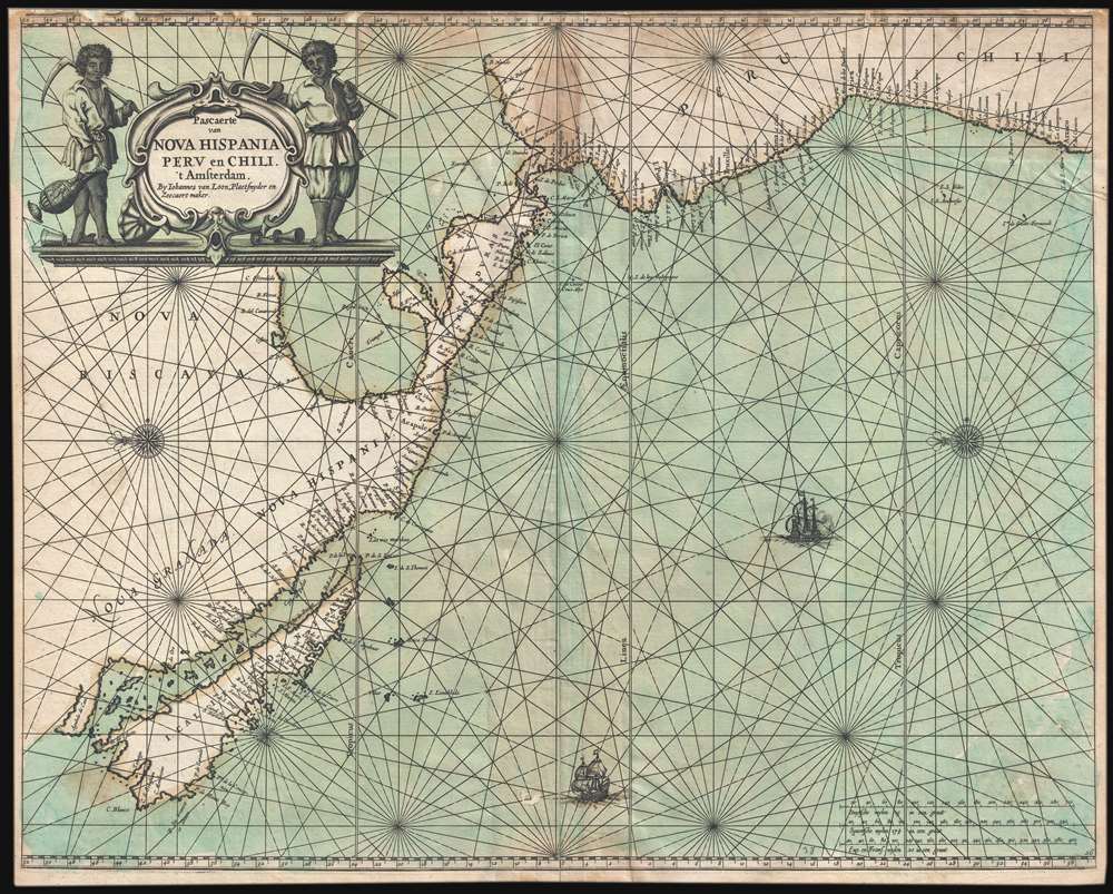
Pascaerte van Nova Hispania Perv en Chili.
sold
- Digital Map Information
- Suitable for large format printing
- DPI: 300
- File Size: 13.62 MB
- File Type: ZIP / TIFF
- ICC color profile embedded
- Delivered instantly via download link
An example of Joannes van Loon's important 1661 map of the western coast of America including California as an Island. This is one of the earliest and rarest nautical charts to embrace the Insular California convention. The map is oriented to the east, as navigators sailing for the important Mexican silver port of Acapulco from Far East would have experienced the approach. The title cartouche, in the upper let, features two simply dressed farmers with cycles, presumably a stylized attempt at indigenous Americans. (more details)
Early days Florida as part of the U.S.
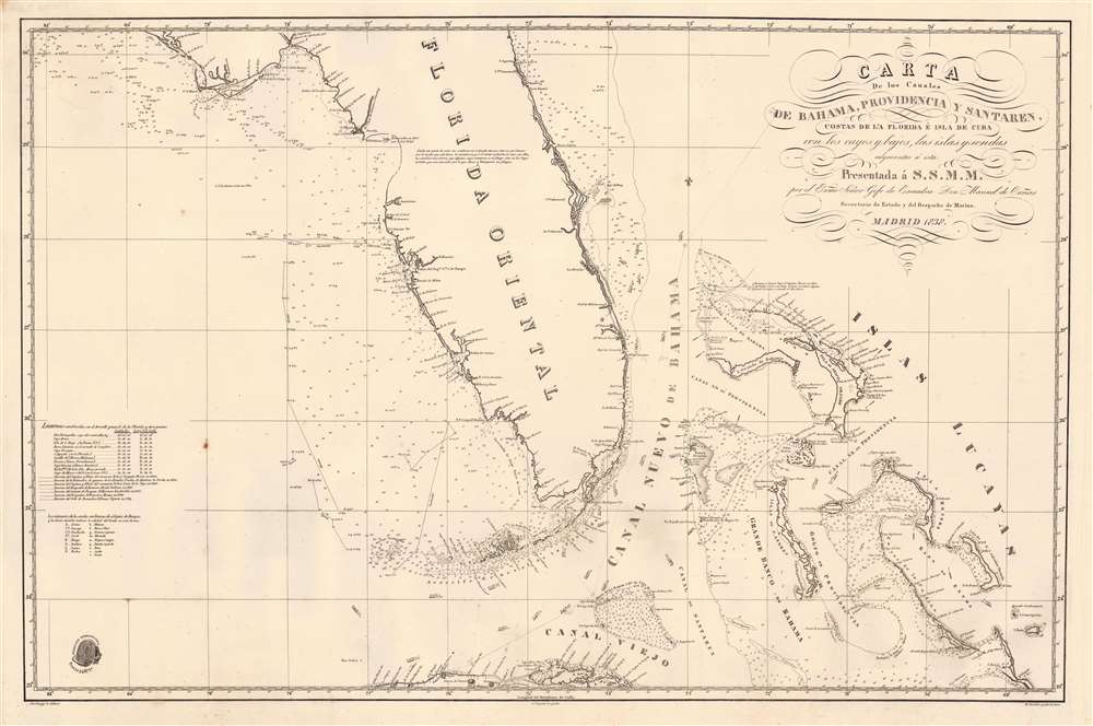
Carta de los Canales de Bahama, Providencia y Santaren, Costas de la Florida e Isla de Cuba con los cayos y bajos, las islas y sondas adyacentes a esta...
sold
- Digital Map Information
- Suitable for large format printing
- Full resolution TIFF file
- ICC color profile embedded
- Delivered instantly via download link
A strikingly engraved 1838 Spanish nautical chart of Florida and the Bahamas (Lucayas) published in Madrid by the Spanish Dirección Hidrografía. Coverage extends roughly from St. Augustine to Cuba, and from the Bay of St. Andres (Saint Andrew Bay) to Rum Cay and I. Conception. There is very little inland detail, but the Florida Keys, Tampa Bay, and Biscayne Bay are well mapped - with notes identifying water sources. The routes of several voyages influential in preparing the map are noted, for the most part, undertaken between 1794 and 1820. The Cape Florida lighthouse near Miami, constructed in 1825, is also noted. The general shape of Florida is consistent with maps of the period, including an exaggerated hook south of Cape Romano, and an unexplored region in the vicinity of the Crystal River south of the Cedar Keys. Pencil marks track the map's use on a single voyage, from Cadiz (Spain) to Havana. (more details)
Best Acquirable View of London Prior to the Great Fire.
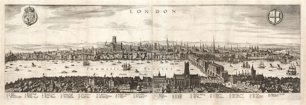
London.
sold
- Digital Map Information
- Suitable for large format printing
- Full resolution TIFF file
- ICC color profile embedded
- Delivered instantly via download link
This is a Matthäus Merian view of London, engraved in 1638 for inclusion in his Archontologia cosmica. It was based on an earlier, 1616 panorama of the city by Claes Visscher (1587 - 1652.) The four-sheet, nearly seven-foot-long Visscher is an all but unobtainable rarity, with only a handful of known copies in institutional and private hands. (An example sold at Christies in 2018 for nearly $150,000.) The Merian expertly reduces the image, preserving much of its detail and elegance. The detail and recognizability of the image are particularly remarkable, given that neither Merian nor Visscher ever had visited London; Visscher's view was based on traditional printed maps (possibly including John Norden's Civitas Londini, which survives in a single copy in the Royal Library in Stockholm) and the reports of visitors at the turn of the century. Visscher's publisher, Jodocus Hondius, lived in London from 1587 to 1593, and he may have been consulted. Thus, despite being engraved during the reign of Charles I, the view is a depiction of Elizabethan London c. 1600; it remains one of the very few acquirable views of the city as it stood prior to the 1666 Great Fire of London. (more details)
The Royal Indian Navy Mutiny.
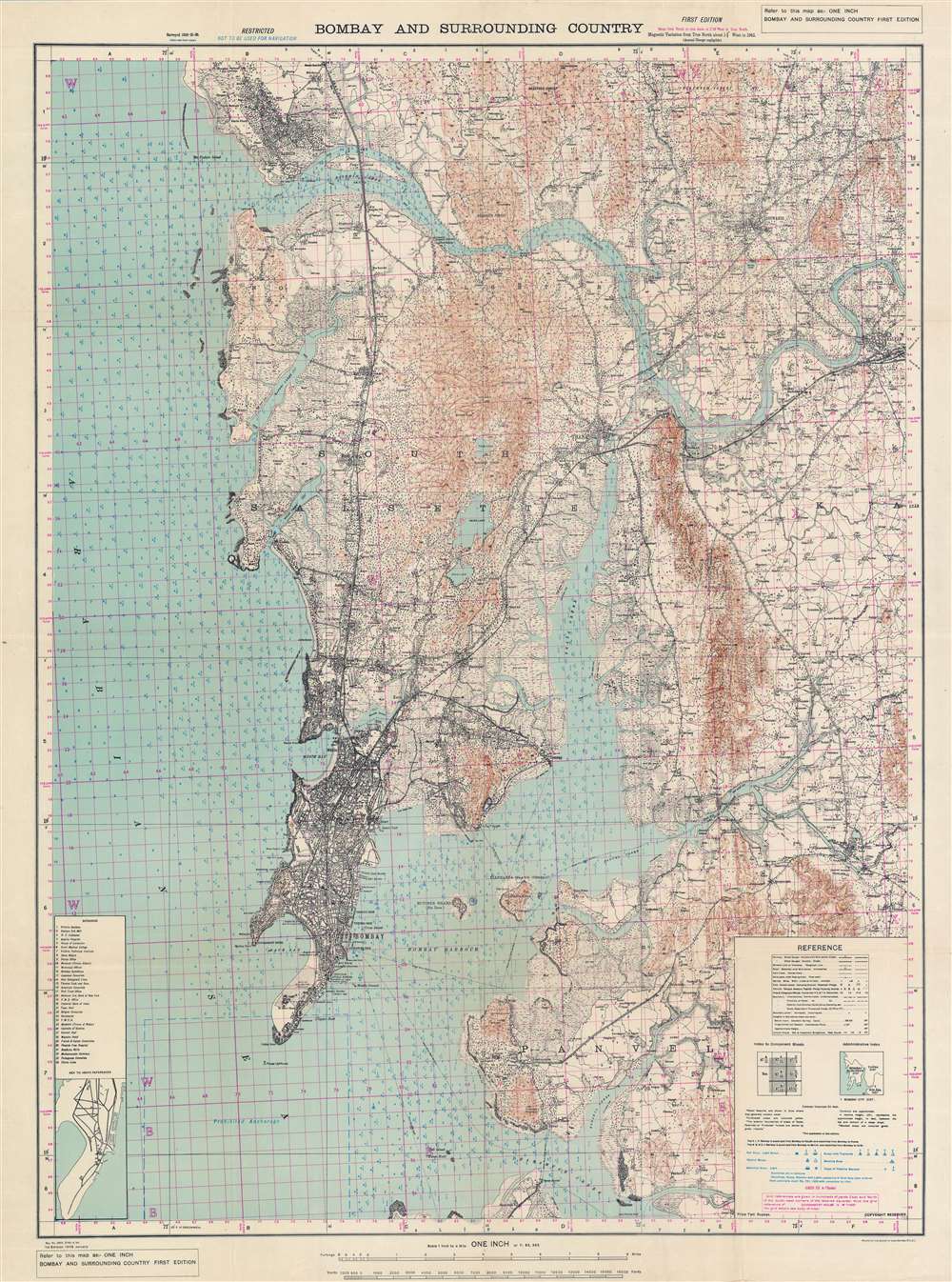
Bombay and Surrounding Country.
sold
- Digital Map Information
- Suitable for large format printing
- File Size: 85.55 MB
- File Type: ZIP / TIFF
- ICC color profile embedded
- Delivered instantly via download link
This is a rare 1946 first edition map of Bombay / Mumbai issued by the Survey of India just days before the Royal Indian Navy Mutiny (February 18 - 15, 1946). The map features manuscript annotations near Butcher Island (Dia Deva) in Bombay Harbor - a major focus of the mutiny as the Bombay Presidency’s entire ammunition hold, including telephone and wireless equipment, was stored there. The map is large and meticulously detailed, noting individual buildings, streets, railroads, topography, depth soundings, and more - without a doubt, the finest map of Bombay then obtainable. (more details)