
Best 18th century map of the Turks Islands.
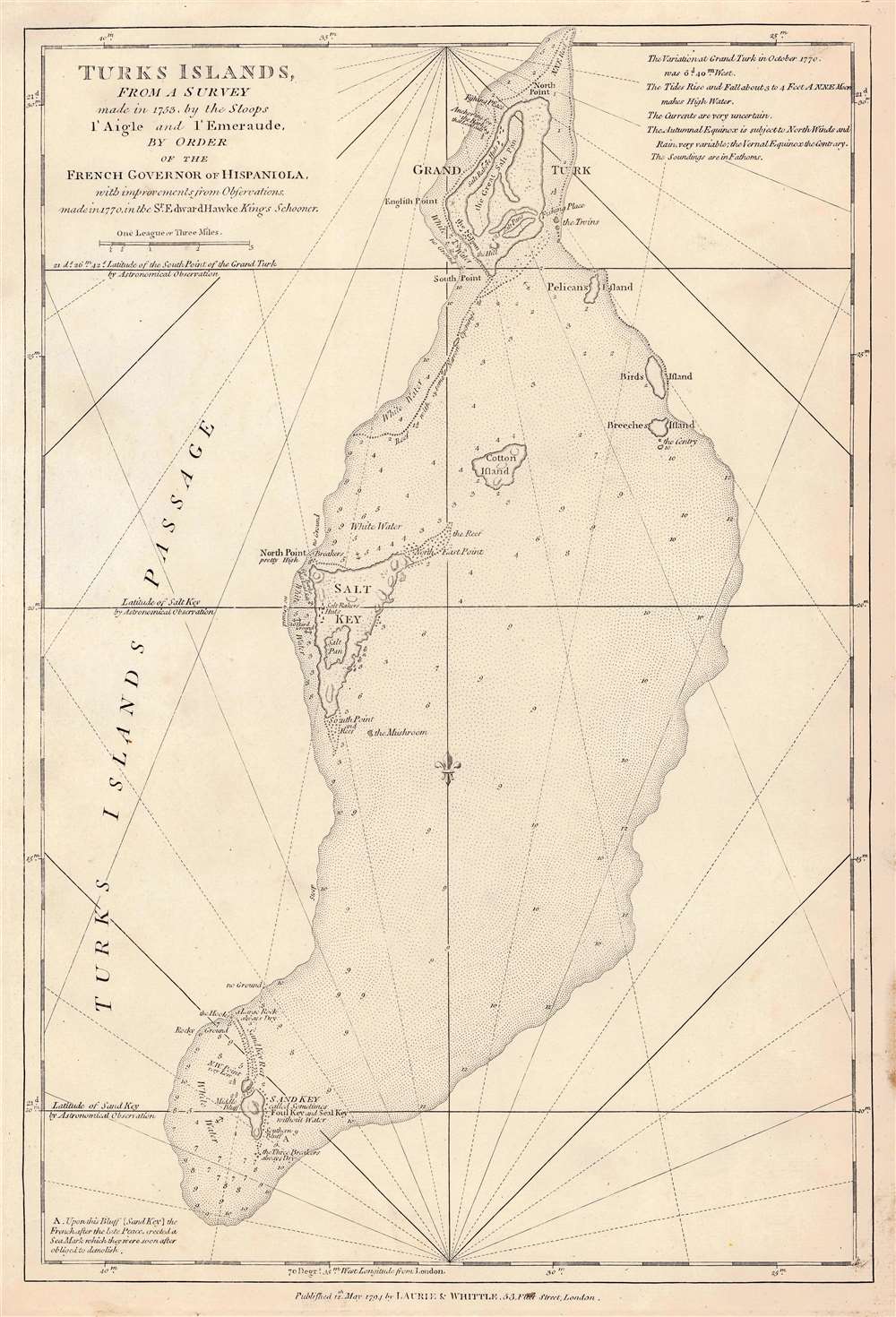
Turks Islands, from a survey made in 1753, by the Sloops l'Aigle and l'Emeraude by order of the French Governor of Hispaniola.
sold
- Digital Map Information
- Suitable for large format printing
- Full resolution TIFF file
- ICC color profile embedded
- Delivered instantly via download link
This is the 1794 Laurie and Whittle edition of Thomas Jeffrys' map of the Turks Islands, among the earliest maps to focus on the islands. The map shows not only Grand Turk, Salt Key, and Sand Key but also the shallows linking these islands, as well as several smaller. As such, the map - with copious depth soundings, anchorages, and notations - is able to emphasize the many localized navigational hazards. As small as they are, the Turks were an important resource: its tiny population produced salt from sea brine. (Indeed, the only settlements noted on the map are 'Salt rakers' huts.' During the American Revolution the Continental Army depended on Turks and Caicos salt for food preservation, and American fishing vessels used Turks salt to preserve their catches. Jefferys credited the a 1753 survey attributed to the French schooners l'Aigle and l'Emeraude, further amended in 1770 by the British sloop Sir Edward Hawke (the sloop, not Sir Edward himself, who was by this time First Lord of the Admiralty and above such chores.) (more details)
Striking blue railroad map.
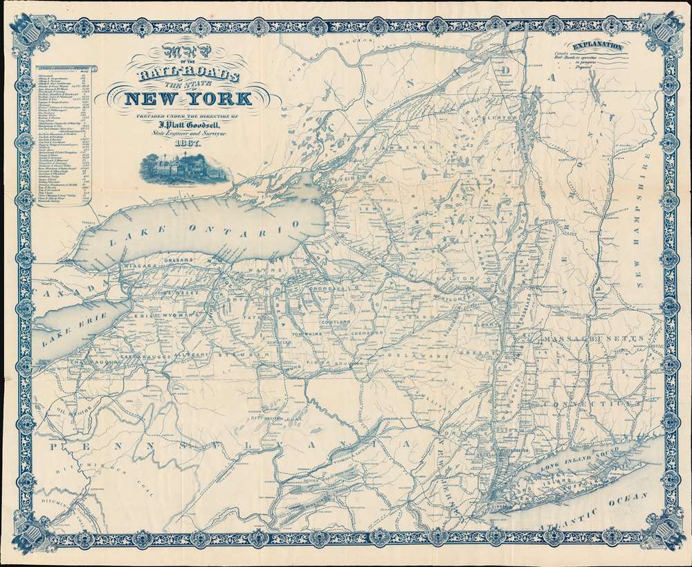
Map of the Rail-Roads of the State of New York.
sold
- Digital Map Information
- Suitable for large format printing
- File Size: 50.9 MB
- File Type: ZIP / TIFF
- ICC color profile embedded
- Delivered instantly via download link
A striking, cyan-toned railroad map of New York State issued in 1867 by Jonas Platt Goodsell. The map offers expansive coverage of New York, as well as some of the adjacent states, including all of Vermont, western Massachusetts and Connecticut, and northern Pennsylvania. This map was issued in Godsell's final year as State Engineer and Surveyor, and indeed the final year of his life. (more details)
A moment in the history of an island paradise.
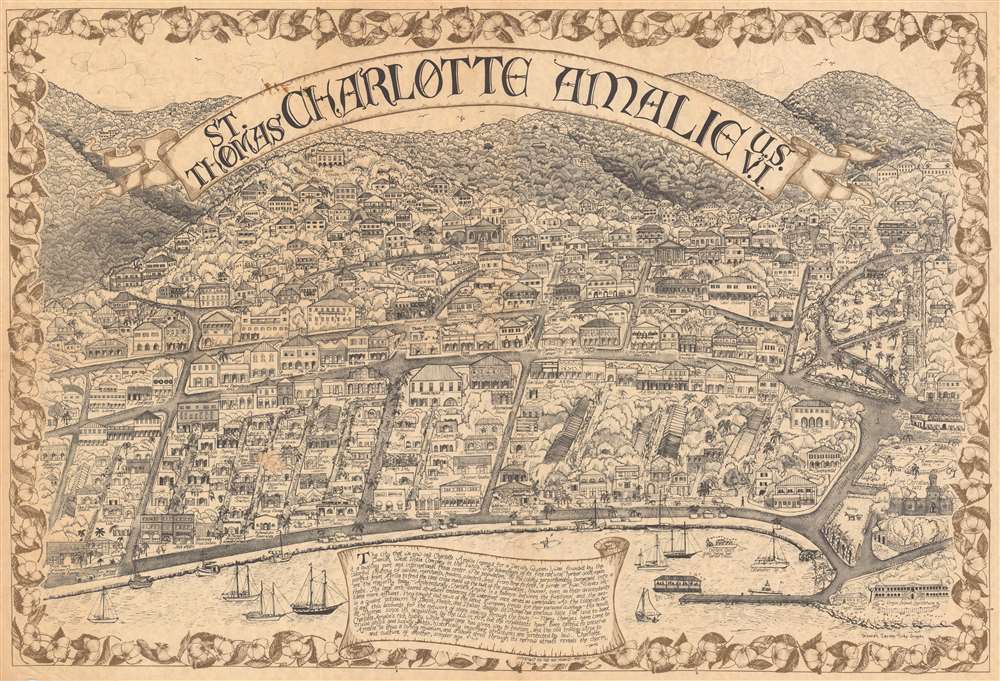
Charlotte Amalie St. Thomas U.S.V.I.
sold
This is a rare c. 1970 Deborah Jacobs and Judy Grogan pictorial map of Charlotte Amalie on the island of St. Thomas, U.S. Virgin Islands. Focusing on part of Charlotte Amalie, the map includes depictions of several famous sites, including Fort Christian, the Virgin Islands Legislature, the Emancipation Garden (labeled on the map as Emancipation Park), and the 99 steps. Hotel 1829, situated just to the left of the 99 steps, remains in operation today. Among local mainstays from years past are Sparky's Waterfront Saloon, the Joe Vogel Diving Company, The Cuckoo's Nest, and the Crazy Cow. (more details)
Charming and detailed.

South Carolina.
sold
- Digital Map Information
- Suitable for large format printing
- Full resolution TIFF file
- ICC color profile embedded
- Delivered instantly via download link
This is a beautiful example of Anthony Finley's important 1827 map of South Carolina. A rarity of the time period, this map depicts the state individually rather than bundled with North Carolina. Rivers, roads, canals, and some topographical features are illustrated, including the Savanna River and the Blue Ridge Mountains. Cities and towns are identified, such as Charleston, George Town, Newberry, and Greenville. Counties are shaded different colors to allow for easy differentiation. Augusta and Savannah, Georgia, both just across the Savannah River in Georgia, are also labeled. (more details)
Oahu on liberty.

On Liberty on the Island of Oahu.
sold
- Digital Map Information
- Suitable for large format printing
- File Size: 17.43 MB
- File Type: ZIP / TIFF
- ICC color profile embedded
- Delivered instantly via download link
This is a 1953 Tommy Robuck pictorial map of Oahu, Hawaii, issued for U.S. Navy personnel. The Special Services office published this map to help off-duty sailors enjoy the island, while at the same time encouraging dignified comportment. 'Authorized beaches for military personnel' are highlighted in yellow. These include Waikiki Beach, Waialae Beach at Diamond Head, Waimanalo Beach Park, Manners Beach, Waianae Army Beach, and numerous others. Pearl Harbor is prominently illustrated. Pictorial vignettes illustrate other sites around the island, including the Mormon temple, the Lualualei Naval Radio Station, Schofield Army Base, Wheeler Air Force Base, and Hickam Field. Solid black lines mark main roads, while dashed lines mark 'not recommended' dirt roads. Oahu's most plentiful resources, palm trees, pineapples, and sugar cane, appear throughout. (more details)
Visually spectacular map of the Solar System.

Rand McNally Map of Outer Space.
sold
This is a 1958 Rand McNally map of the Solar System. The map focuses on the Solar system and illustrates all eight planets (at that point there were nine). Moons orbit Earth, Mars, Jupiter, Saturn, Uranus, and Neptune, each of which is situated in its own orbit around the Sun. The distance in miles between the orbits is provided, as is the distance traveled in each orbit, the length of time spent in one orbit (given in Earth years), and the amount of time it takes for each planet to complete one revolution. The asteroids Ceres and Eros are illustrated in the Asteroid Belt between Mars and Jupiter, and a note states that between 1,500 and 50,000 asteroids are known to exist within the belt. Other celestial formations are noted as well, including Antares, Magellanic clouds, the Crab Nebula, and the Andromeda Galaxy. Text boxes and inset views create a frame around the center map, and provide information concerning interplanetary and intergalactic distances, the relative size of the planes in the Solar System, an artist's rendering of Eros and Ceres, a chart of interplanetary weights, and artist renderings of a volcanic eruption on Mercury, canals on Mars, the Rings of Saturn, methane storms on Venus, the Jupiter's Great Red Spot, and Earth as seen from the Moon. (more details)
One of the largest commercial maps we have seen.

Gran Carta d'Italia.
sold
- Digital Map Information
- Suitable for large format printing
- Full resolution TIFF file
- ICC color profile embedded
- Delivered instantly via download link
A truly 'ginormous' production, this is Giuseppe Civelli's great map of Italy, here in its 1853 edition. The map measures nearly 100 inches high and 80 inches wide, making it one of the largest maps we have seen. This map was issued in the early days of the Italian Risorgimento (1848 - 1871) and can be seen as a unique symbol aspiring to a newly ascendant sense of shared Italian national identity. The map embraces the whole of the Italian peninsula and Sicily, as well as Corsica, Sardinia, Dalmatia, Malta, North Africa, and the northern Italian states. Along the top of the map, there appears a detailed comparative elevation chart. Throughout the detail is staggering, making this great work the finest map of Italy to appear in the 19th century. (more details)
By Cleveland's hometown cartographer.
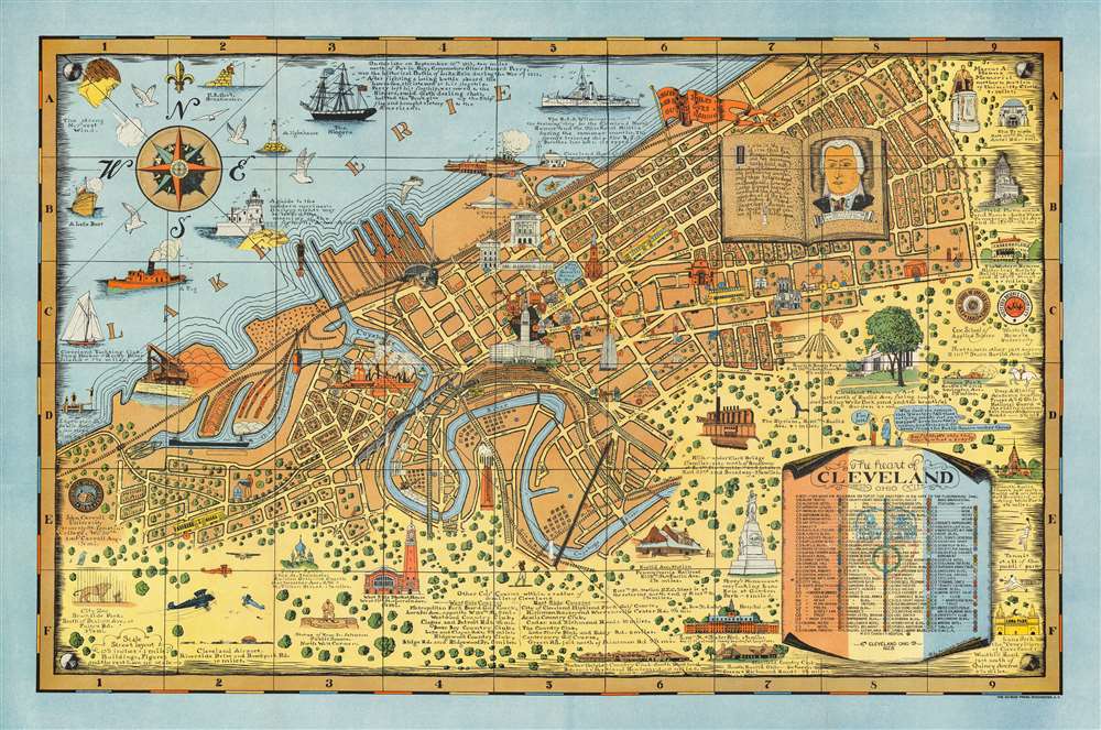
The Heart of Cleveland Ohio Forest City.
$950.00
Acquire
- Digital Map Information
- Suitable for large format printing
- File Size: 114.09 MB
- File Type: ZIP / TIFF
- ICC color profile embedded
- Delivered instantly via download link
This is a striking example of Arthur Suchy's 1928 pictorial map of Cleveland, Ohio - Suchy's hometown - accompanied by its original mailer envelope. The map covers from Cleveland's waterfront on Lake Erie south to the Cuyahoga River, beyond which, space is dedicated to historical vignettes and illustrations of local landmarks. Much emphasis is given to Cleveland's 'Forest City' qualities, with tree-filled residential blocks and parks noted. At the same time, skyscrapers and smoking factories underscore Cleveland's industrial might. Among the vignettes is an illustration of Moses Cleveland, the city's founder. (more details)
A modern geological triumph!
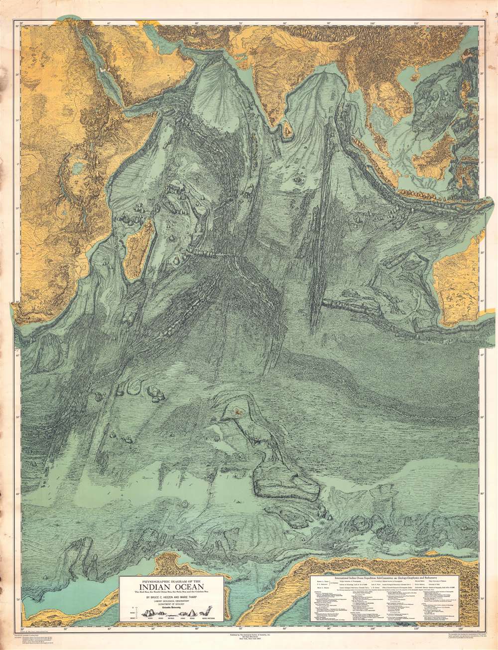
Physiographic Diagram of the Indian Ocean. The Red Sea, the South China Sea, the Sulu Sea and the Celebes Sea.
sold
An enormous and visually striking 1974 Bruce C. Heezen and Marie Tharp physiographic map of the Indian Ocean. Coverage extends from the Suez, the Himalayas, and Taiwan south to the Antarctic shelf, and from the Cape of Good Hope to the Philippines. The map offers a striking axonometric view of the terrain throughout, with the focus being the subterranean depths of the Indian Ocean. (more details)
Jacksonville to Miami on the Florida East Coast Railway!
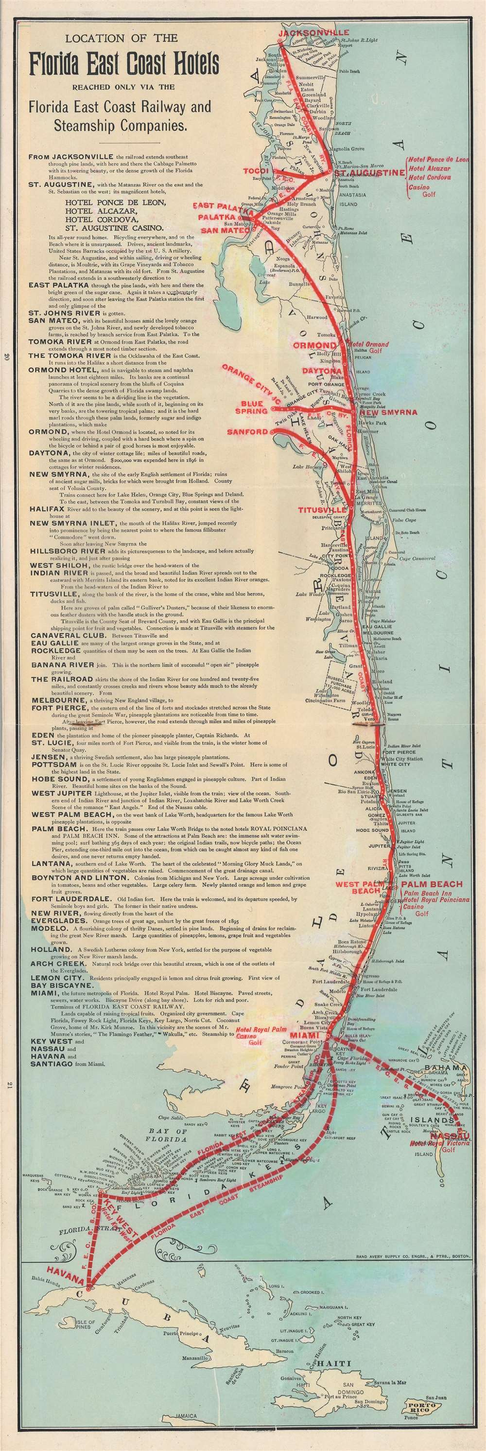
Location of the Florida East Coast Hotels Reached Only Via the Florida East Coast Railway and Steamship Companies.
sold
- Digital Map Information
- Suitable for large format printing
- File Size: 8.05 MB
- File Type: ZIP / TIFF
- ICC color profile embedded
- Delivered instantly via download link
This is a 1900 Rand Avery map of Florida's East Coast, its railway network, and its resort hotels. Depicting from Jacksonville south to Puerto Rico and Jamaica, red overprinting highlights the Florida East Coast Railway and the connected Florida East Coast Steamship Company. Major stops along the railway, including Jacksonville, St. Augustine, New Smyrna, Palm Beach, and Miami, are labeled in red. Ports of Call for the steamship company are identified in the same manner, including Key West, Nassau, and Havana. Smaller stops along the railway are identified in black, along with coastal inlets, bays, lakes, and other sites. A narrative recounting high points in cities from Jacksonville to Miami occupies the left half of the map. (more details)
New England's Summer stock theaters.

Stage's Own Map of the Summer Theatres Whereon are Located Most of Summer Broadway's Hundred Odd Show Shops.
sold
- Digital Map Information
- Suitable for large format printing
- File Size: 14.41 MB
- File Type: ZIP / TIFF
- ICC color profile embedded
- Delivered instantly via download link
This is a comical 1935 Willard Mullin pictorial map of New England highlighting the summer theater scene. Covering the American northeast from Augusta, Maine, south to Bay Head, New Jersey. 'Wooden' signs mark cities and towns, but the map's focus is on the regional theaters. (more details)
The greatest map of Burma - ever.
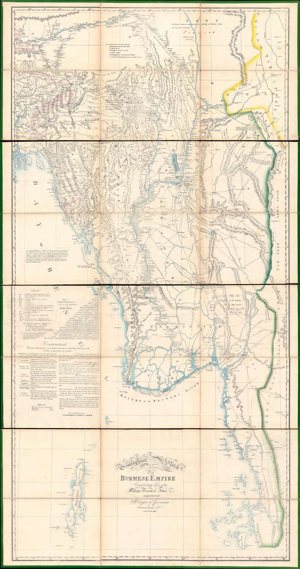
A Geographical Sketch of the Burmese Empire.
sold
- Digital Map Information
- Suitable for large format printing
- Full resolution TIFF file
- ICC color profile embedded
- Delivered instantly via download link
An extraordinary 1825 large-scale map of the Empire of Burma, modern-day Myanmar, issued by the Surveyor-General (QMG) and the private Asiatic Lithographic Press in Calcutta/Kolkata at the height of the First Anglo-Burmese War (1824 - 1826). Issued in four dissected and linen-backed sheets (18.75 x 39.25 in), the map is impressive, measuring nearly 76 inches high and 40 inches wide. Coverage extends from the Brahmaputra River in northern Assam to Domel Island (Letsok-aw Island) and the Mergui Archipelago. Despite its impressive size and apparent density, a close examination actually reveals how little Europeans then knew of the Burmese interior. (more details)
First map to show Vancouver Island and Puget Sound.
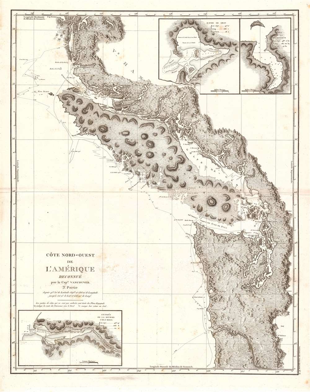
Cote Nord-Ouest de L'Amerique Reconnue par le Cape. Vanouver. 3e. Partie.
sold
- Digital Map Information
- Suitable for large format printing
- Full resolution TIFF file
- ICC color profile embedded
- Delivered instantly via download link
This is the 1799 French edition of George Vancouver's 1799 nautical map of the region around Vancouver Island, the Strait of Juan de Fuca, the mouth of the Columbia River, and Queen Charlotte Sound, extending from Cape Lookout (in modern-day Oregon) to Cape Swaine (Alaska). It is considered to be the great navigator George Vancouver's most important and influential map, among those he produced in his foundational reconnaissance of the northwest coast of America (1791 - 1795). (more details)
Asia's 1st major Railroad.
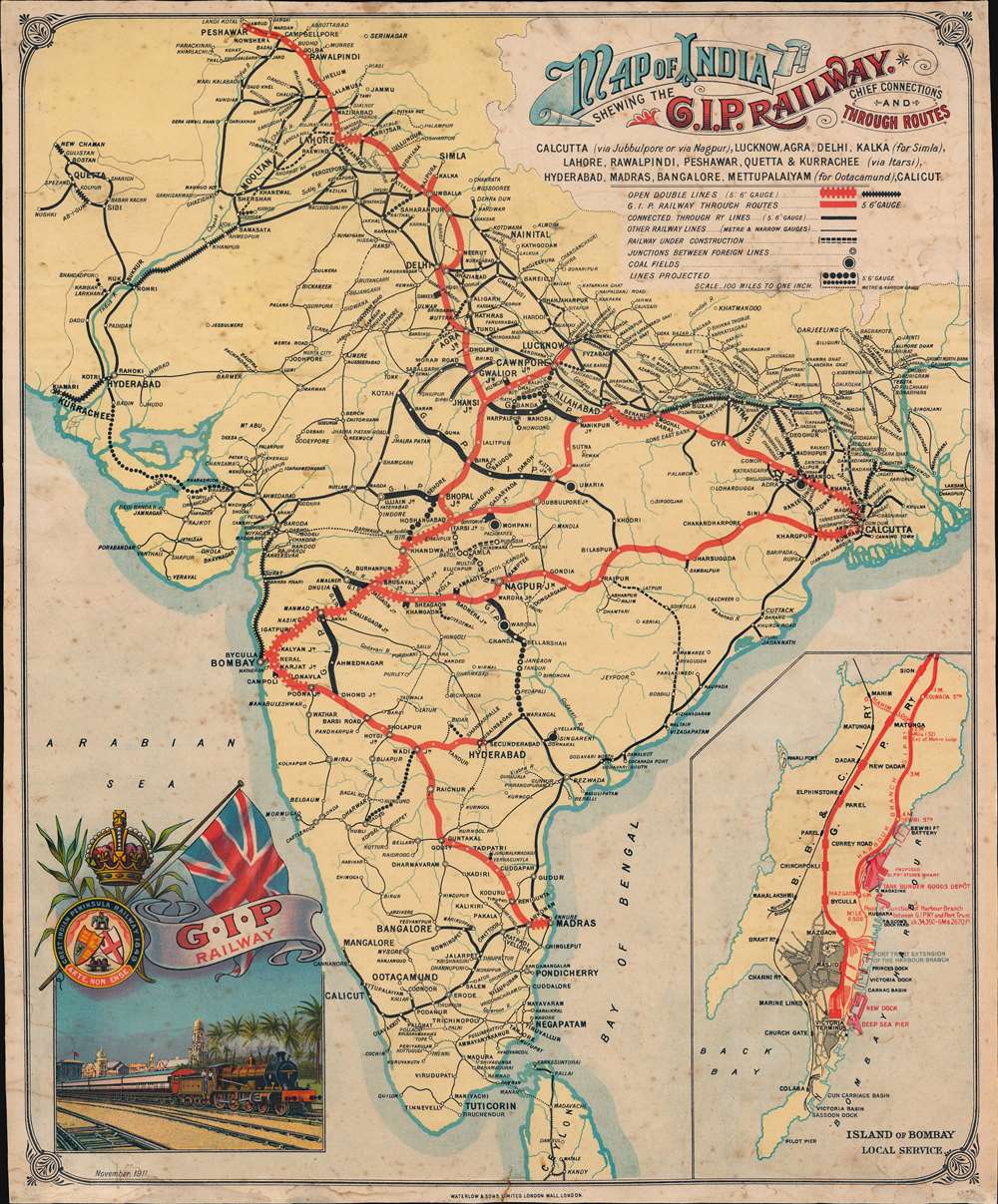
Map of India Shewing the G.I.P. Railway. Chief Connections and Through Routes.
sold
- Digital Map Information
- Suitable for large format printing
- File Size: 23.17 MB
- File Type: ZIP / TIFF
- ICC color profile embedded
- Delivered instantly via download link
A striking and rare discovery - this is a 1911 Waterlow and Company chromolithograph promotional broadside issued to promote the Great Indian Peninsular Railway (GIPR), Asia's first and greatest railroad. Boldly promoting the GIPR's expansive sub-continent wide rail network, this map was designed for display in railroad stations throughout India. The map covers the entire subcontinent, with GIPR trunk lines highlighted in red and subsidiary lines via a keyed network of symbols. In the lower right, a large inset of Bombay promotes GIPR services within the network's nucleus. In the lower-left, a finely executed vignette illustrates a GIPR train leaving Bombay's Victoria Terminus (Chhatrapati Shivaji Maharaj Terminus), with theIconic Mumbai Municipal Corporation Building (MMCB) recognizable in the background. (more details)
Largest California wine region.
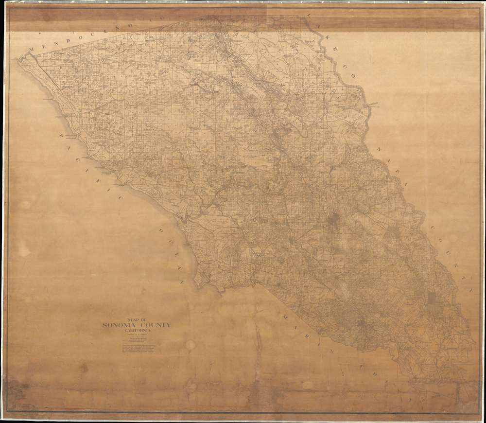
Map of Sonoma County, California.
sold
- Digital Map Information
- Suitable for large format printing
- File Size: 126.65 MB
- File Type: ZIP / TIFF
- ICC color profile embedded
- Delivered instantly via download link
A monumental and detailed 1908 Malcolm Phillip Youker map of Sonoma County, California, the heart of California's famed wine country. Depicting the entirety of Sonoma County, individual ranches, farms, and homesteads are delineated throughout. Each is identified by the owner's last name and acreage owned. Other land tracts, such as those owned by the Empire Redwood Company or the Bender Mill and Lumber Company, are labeled as such. The towns of Sonoma, Petaluma, Sebastopol, and Santa Rosa are identified. (more details)
The first European expedition into the Tian Shan Mountains.
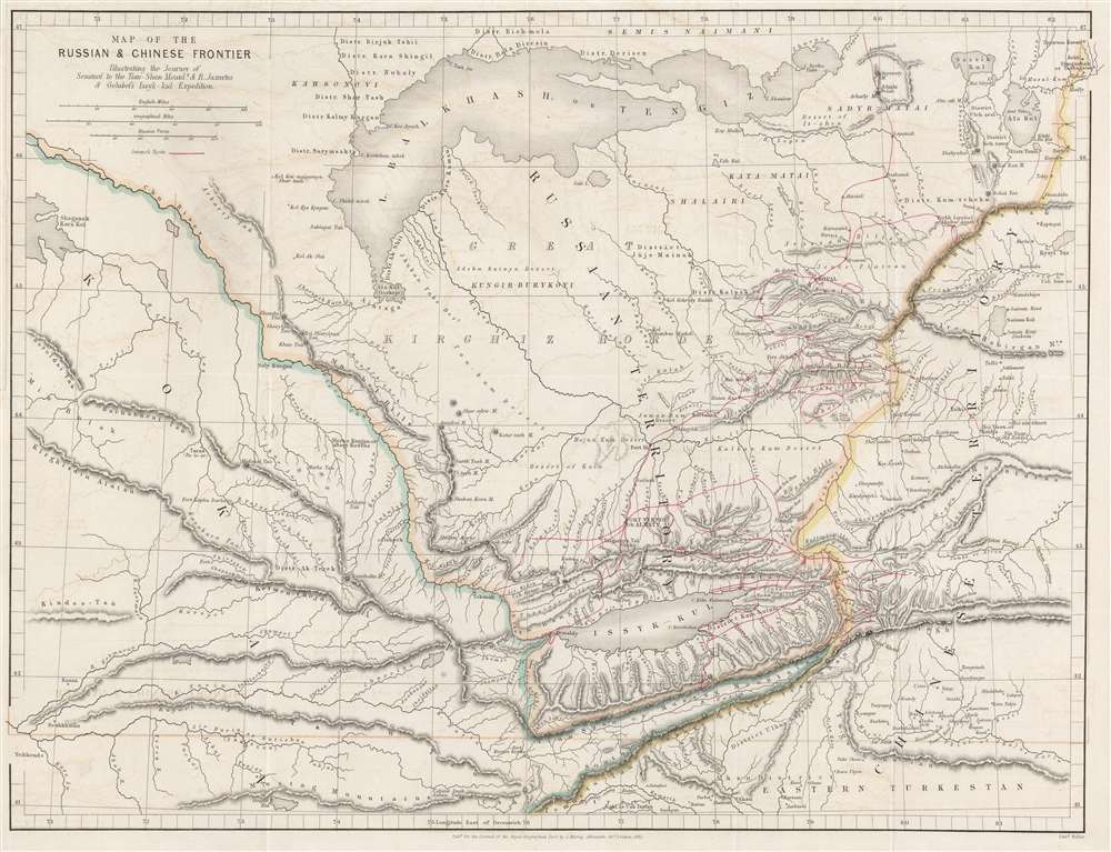
Map of Russian and Chinese Frontier Illustrating the Journey of Semenof to the Tian-Shan Mounts. and R. Jaxartes and Golubof's Issyk-kul Expedition.
$575.00
Acquire
- Digital Map Information
- Suitable for large format printing
- File Size: 12.88 MB
- File Type: ZIP / TIFF
- ICC color profile embedded
- Delivered instantly via download link
This is an 1861 John Murray map of Central Asia tracing Pyotr Semyonov's (1827 - 1914) first European ascent into the Tian Shan Mountains. The map depicts the region from Lake Balkash south to the Tian Shan Mountains, encompassing modern-day Kyrgyzstan, Kazakhstan, and western China - at the time considered one of the most remote and inaccessible parts of the world. (more details)
Anticipating the Columbian Exposition.
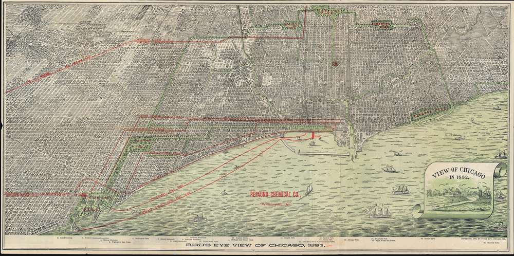
Bird's Eye View of Chicago, 1893.
sold
- Digital Map Information
- Suitable for large format printing
- Full resolution TIFF file
- ICC color profile embedded
- Delivered instantly via download link
An uncommon 1892 promotional view of Chicago issued by Peter Roy in anticipation of the 1893 Chicago World's Fair or Columbian Exposition. This view is a promotional piece for the fair and is printed on both front (recto) and back (verso). The recto features an expansive view of Chicago before the major renovations intended to accommodate the explosion were complete. The verso features a map of the planed fair and an artist's conception of the completed fairgrounds. (more details)
One of the most lopsided battles of the Civil War.

Fredericksburg.
sold
- Digital Map Information
- Suitable for large format printing
- File Size: 59.15 MB
- File Type: ZIP / TIFF
- ICC color profile embedded
- Delivered instantly via download link
This is an 1867 John Weyss and Nathaniel Michler map of the battlefield of Fredericksburg, Virginia. The map depicts the region from the Banks farmstead to the Fitzhugh farmstead and from the Jewett farmstead to the Massaponax River. Highly detailed, numerous homesteads, mills, farms, and churches are noted in the vicinity. Fredericksburg itself is situated along the Rappahannock River and the town's street grid is apparent. The Richmond, Fredericksburg, and Potomac Railroad traverses the map from north to south and crosses the Rappahannock at Fredericksburg. A canal to the northwest of Fredericksburg allows for an easier transit of the Rappahannock around Beck's Island. The Old Richmond Stage Road, Orange Court House Turnpike, and Telegraph Road are illustrated as well. Although the battle is not explicitly traced, Confederate positions are illustrated in red, while a handful of Union forces are noted in blue. (more details)
America's sunshine playground.

Scenic and Picturesque Florida.
sold
- Digital Map Information
- Suitable for large format printing
- Full resolution TIFF file
- ICC color profile embedded
- Delivered instantly via download link
This is a 1947 George D. Way pictorial tourist map of Florida. Vignettes highlight attractions from Pensacola to Key West. These include national parks, forests, beaches, museums, wildlife sanctuaries, gardens, and zoos. Florida is portrayed as America's outdoor playground with activities including tennis, golf, waterskiing, fishing, and boating taking center stage. Florida's tropical weather is also hinted at by emphasizing the Ringling Brothers' Circus winter quarters, Major League Baseball's spring training fields, and the map's overall aesthetic. Photographs adorn the border and promote sites throughout the state, including the Oriental Gardens, Silver Springs, Fort San Marcos, and the Bok Tower. (more details)
Three days after the Six-Day War.

A Complete Map of Jerusalem. / מפת ירושלים השלמה
sold
This is a 1967 Maariv pictorial city plan or map of Jerusalem, Israel, published on June 13, 1967, only three days after the end of the Six-Day War. Buildings throughout the city are illustrated in profile. The Old City's walls are immediately eye-catching, and the Dome of the Rock and the Temple Mount recognizable. Other identified locations include the Monastery of the Cross, the Knesset, Hadassah Hospital, and the Jerusalem Biblical Zoo (officially known as the Tisch Family Zoological Gardens), marked by a giraffe. (more details)