
A bird's-eye view of the White Mountains advertising rail service in the region.

Bird's Eye Map of the White Mountains Reached by Boston and Maine Railroad.
sold
- Digital Map Information
- Suitable for large format printing
- File Size: 11.53 MB
- File Type: ZIP / TIFF
- ICC color profile embedded
- Delivered instantly via download link
This is an 1896 Boston and Maine Railroad bird's eye view map of the White Mountains promoting their service in the area to tourists. The view depicts the region from St. Johnsbury and East Haverhill to Shelburne, Chatham, and Conway Center and from Lancaster and Jefferson Mills to Plymouth and Squam Lake. Beautifully engraved, every mountain in the region is labeled and its elevation is given. Railroad routes in the region, including those of the Boston and Maine Railroad and the Maine Central Railroad, are illustrated by thick black lines. (more details)
Promotes real estate development around Elmont, New York, where the Belmont Stakes takes place annually.

Chandler View of Queens Park Gardens Nassau County N.Y.
sold
- Digital Map Information
- Suitable for large format printing
- File Size: 36.64 MB
- File Type: ZIP / TIFF
- ICC color profile embedded
- Delivered instantly via download link
This is a c. 1927 Harry A. Chandler view of Queens Park Gardens, what was then a newly created subdivision of the bedroom community of Elmont, New York, the home of the Belmont States. Oriented towards the west and New York City, Chandler's view emphasizes the openness of Queens Park Gardens while also promoting its proximity to New York City and the ease with which commuters could get there. Chandler was likely commissioned by the Stewart Development Corporation to create a pamphlet that would entice visitors and potential buyers from the city. The streets and lots of Queens Park Gardens are illustrated in detail and the public school, shopping center, and fire department are labeled. The New York City line is marked in red, and Jamaica, Flushing, Queens Boulevard, Manhattan, the Queensboro Bridge, Penn Station, and even the Hudson River are labeled in the distance. Some persuasive commentary is situated along the bottom border, while more promotional text is printed on the verso. (more details)
A Colorful Depiction of the United States just prior to the 1939 World's Fair
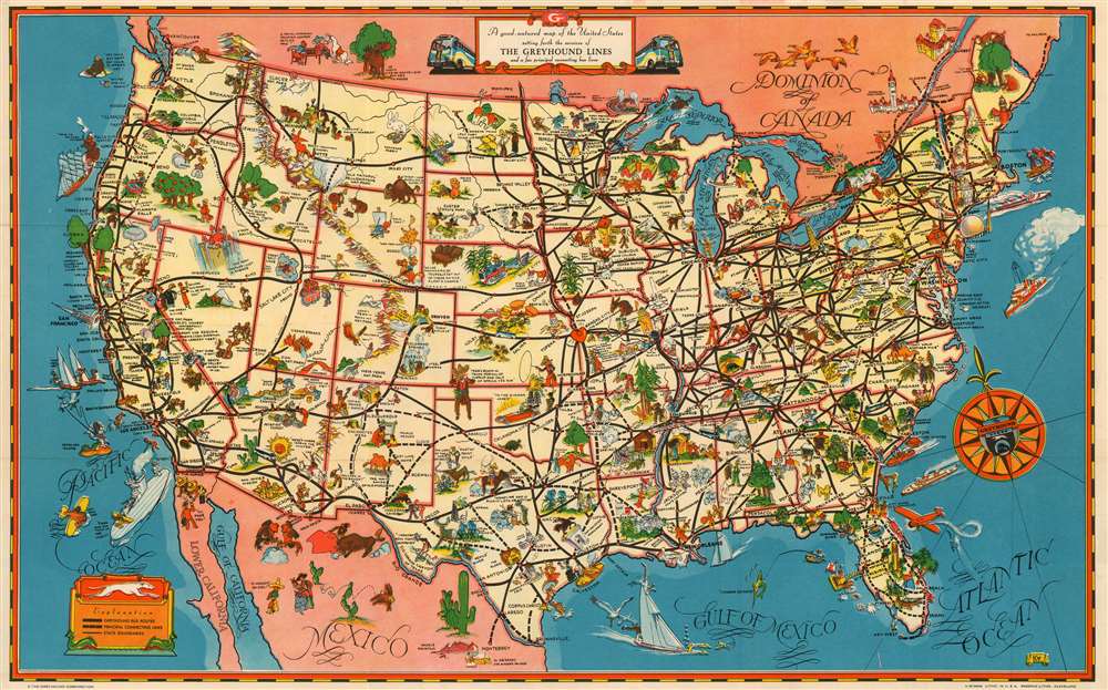
A Good - Natured Map of the United States Setting Forth the Services of The Greyhound Lines and a Few Principal Connecting Bus Lines
sold
- Digital Map Information
- Suitable for large format printing
- File Size: 28.89 MB
- File Type: ZIP / TIFF
- ICC color profile embedded
- Delivered instantly via download link
This is a charming 1939 pictorial map of the United States, produced as a pamphlet by the Greyhound Company to promote their line as a comfortable and affordable means of tourist travel - with a special focus on the upcoming New York World's Fair. (more details)
Pictorial fun in Pre-War London!

Geographia Pictorial Map of London.
sold
- Digital Map Information
- Suitable for large format printing
- File Size: 54.4 MB
- File Type: ZIP / TIFF
- ICC color profile embedded
- Delivered instantly via download link
This is a wonderful plan or pocket map of London published in August of 1932 by Geographia Ltd. It covers downtown London from the Hammersmith Bridge and Wormwood scrubs eastward past Hyde Park and Buckingham Place to Whitechapel Road and the London Docks. Unlike most English city plans of the period, this map replicates the pictorial style which popular in Paris during the early part of the 20th century.
The map features many of the buildings of London drawn in three dimensions. Gardens and parks are beautifully rendered in green with illustrations of ships sailing in the Thames River. Bridges, museums, cathedrals etc. are also identified. Insets in the lower right and lower left depict Theaterland and Cinemas, respectively. Both insets detail individual establishments as they existed at the time including the Regal, Marblearch Pavilion, The Palladium, the Hippodrome Theater and the Coliseum Theater, among many others. Notes stations on the London Underground. An index in the top left quadrant notes several places of interest. (more details)
The map features many of the buildings of London drawn in three dimensions. Gardens and parks are beautifully rendered in green with illustrations of ships sailing in the Thames River. Bridges, museums, cathedrals etc. are also identified. Insets in the lower right and lower left depict Theaterland and Cinemas, respectively. Both insets detail individual establishments as they existed at the time including the Regal, Marblearch Pavilion, The Palladium, the Hippodrome Theater and the Coliseum Theater, among many others. Notes stations on the London Underground. An index in the top left quadrant notes several places of interest. (more details)
Features a curious configuration of Texas presaging the 1850 Compromise following the proposals of Senator Henry Clay.
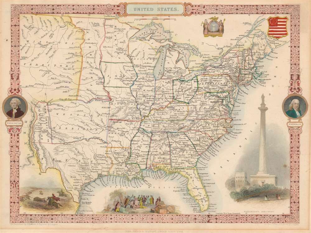
United States.
sold
- Digital Map Information
- Suitable for large format printing
- DPI: 600
- File Size: 7.88 MB
- File Type: ZIP / TIFF
- ICC color profile embedded
- Delivered instantly via download link
This exceptional 1851 John Tallis map of the United States features an incredible configuration of the geography of the western U.S. The map depicts the region from an unusually large Missouri Territory and New Mexico to the Atlantic and from the Canadian border to Mexico. The states in the eastern portion of the country are all illustrated as would be expected. All are labeled, and myriad cities and towns are identified. A handful of railroads are also included, although none are labeled. George Washington and Benjamin Franklin medallions decorate the right and left borders. Several decorative vignettes drawn by J. Marchant and engraved by J. Rogers adorn the work and depict a Native American Buffalo Hunt, William Penn's Treaty with the Indians, and the Washington Monument. (more details)
Comparing two groundbreaking maps of the Amazon on one sheet
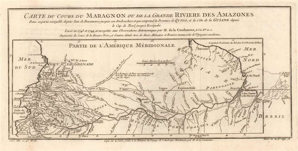
Carte du Cours du Maragnon ou de la Grande Riviere des Amazones Dans sa partie navigable depuis Jaen de Bracamoros jusqu'a son Embouchure et qui comprend la Province de Quito, et la Côte de la Guïane depuis le Cap de Nord jusqu'à Esséquebè.
sold
- Digital Map Information
- Suitable for large format printing
- DPI: 600
- File Size: 6.01 MB
- File Type: ZIP / TIFF
- ICC color profile embedded
- Delivered instantly via download link
This is a fascinating 1780 map of the Amazon river basin, spanning the breadth of the South American continent, embracing Peru, Ecuador, Colombia, Venezuela, Brazil, Guyana, Suriname, and French Guiana. It displays the mapping of the great river produced in 1743 by the French Geodesic Mission under Charles Marie de La Condamine, which still represented the state of the art. This exhaustive mapping of the Amazon and its tributaries is shown overlaying another map of the Amazon, this one executed in 1707 by the Jesuit Father Samuel Fritz. His mapping of the Amazon had been the first accurate one to be produced, and so to have it compare so poorly to Condamine's was to present a flourish on behalf of modern, French scientific geography. (more details)
Details the red-light district of New Orleans, popular with travelers, musicians, and many others from 1897 until 1917.
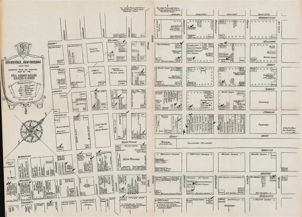
Storyville, New Orleans 1900 - 1915.
sold
- Digital Map Information
- Suitable for large format printing
- File Size: 15.35 MB
- File Type: ZIP / TIFF
- ICC color profile embedded
- Delivered instantly via download link
This is a 1944 Paul Eduard Miller and Richard M. Jones map of Storyville, New Orleans, the city's red-light district. Established in 1897 by municipal ordinance, Storyville consisted of thirty-eight blocks and was bounded by North Robertson, Iberville, Basin, and St. Louis Streets. Miller and Jones (who had lived and worked in Storyville) detail the district and identify brothels as well as grocery stores, hospitals, shops, saloons, and honky tonks. Streets are labeled, as is the railroad station across Basin Street from some of the highest-end establishments, including Mahogany Hall. (more details)
One of the Most Informative American Maps of its Period.
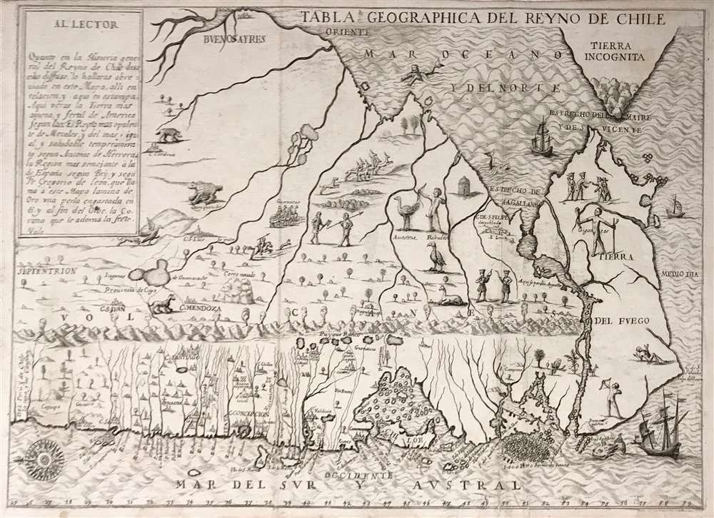
Tabla Geographica del Reyno de Chile.
sold
- Digital Map Information
- Suitable for large format printing
- Full resolution TIFF file
- ICC color profile embedded
- Delivered instantly via download link
This is an extremely rare Spanish edition of Alonso de Ovalle's map of Chile - arguably the most important early map of Chile, as it is the first printed map of the region produced by someone who actually lived there. it was published to illustrate Ovalle's Historia relacion del Reyno de Chile, the first history of that country. This Spanish edition of the map is significantly rarer than the Italian edition of the same year - we see no separate examples of the map in institutional collections. (more details)
Stunning highly detailed bird's-eye view of Portsmouth, New Hampshire.

Bird's Eye View of Portsmouth Rockingham Co. New Hampshire, 1877.
sold
- Digital Map Information
- Suitable for large format printing
- File Size: 46.36 MB
- File Type: ZIP / TIFF
- ICC color profile embedded
- Delivered instantly via download link
A rare and highly-detailed Albert Ruger and Joseph Stoner bird's-eye view map of Portsmouth, New Hampshire. The view looks south on Portsmouth from an imaginary high point above Badger's Island. The map centers on the juncture of the Piscatuaqua River and the North Mill Pond. The South Mill Pond (Sagamore Creek) is visible in the distance, as is the Atlantic. Streets are named and individual buildings rendered. Of note are some 36 alphanumerically associated locations, among them civic offices, churches, academies, breweries, churches, lumber yards, and more. The W. F. Fernald Shipyard where is large sailboat is under constructions. Other notable commercial buildings depicted include the Frank Jones Brewery, the Eldridge Brewing Company, and the Kearsarge Mills. Ships, both sail and steam, ply the busy harbor which is connected by the Eastern and Concord Rail Road to locations inland. (more details)
A Civil War blockade-runners map of the Savannah River.
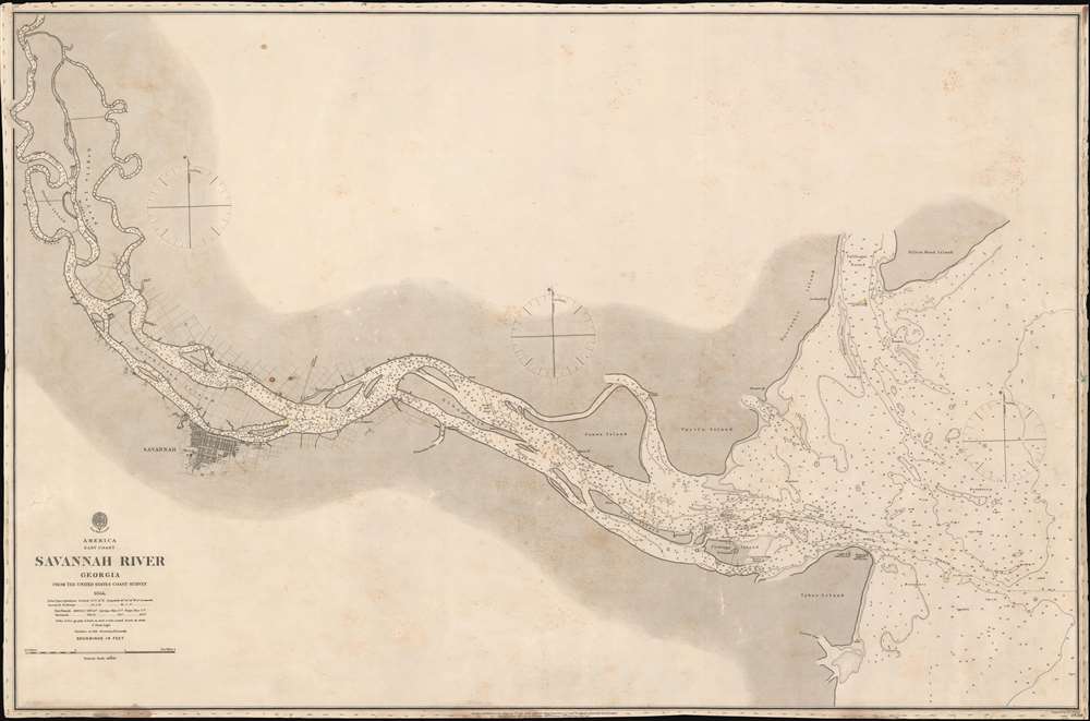
Savannah River Georgia From the United States Coast Survey 1855.
sold
- Digital Map Information
- Suitable for large format printing
- File Size: 46.2 MB
- File Type: ZIP / TIFF
- ICC color profile embedded
- Delivered instantly via download link
This is an extremely scarce 1861 British Admiralty Chart of the Savannah River and city of Savannah, Georgia, issued at the outset of the American Civil War (1961 - 1865). Although formally neutral in the conflict, British private interests financed blockade runners that sent munitions and luxuries to Confederate ports in return for cotton and tobacco. This map of the Savannah River was doubtless produced for this purpose.
The map is derived from U.S. Coast Survey work in the Savannah region completed in 1855, and although the Admiralty chart is superior in construction and presentation, is substantively similar. Coverage extends from the mouth of the Savanna River, Hilton Head, and Tybee Island, westward towards savanna, as far north as Argyle Island. The triangulation for this map was completed by E.O. Cord, C. O. Boutelle, C. P. Bolles and D. T. Van Buren. The topography is the work of H. I. Whiting. The Hydrography was accomplished by a party under the command of J. N. Maffitt. (more details)
The map is derived from U.S. Coast Survey work in the Savannah region completed in 1855, and although the Admiralty chart is superior in construction and presentation, is substantively similar. Coverage extends from the mouth of the Savanna River, Hilton Head, and Tybee Island, westward towards savanna, as far north as Argyle Island. The triangulation for this map was completed by E.O. Cord, C. O. Boutelle, C. P. Bolles and D. T. Van Buren. The topography is the work of H. I. Whiting. The Hydrography was accomplished by a party under the command of J. N. Maffitt. (more details)
The
Theatre of the First Anglo-Afghan War: The Beginning of The Great Game and
the scene of the Disaster in Afghanistan
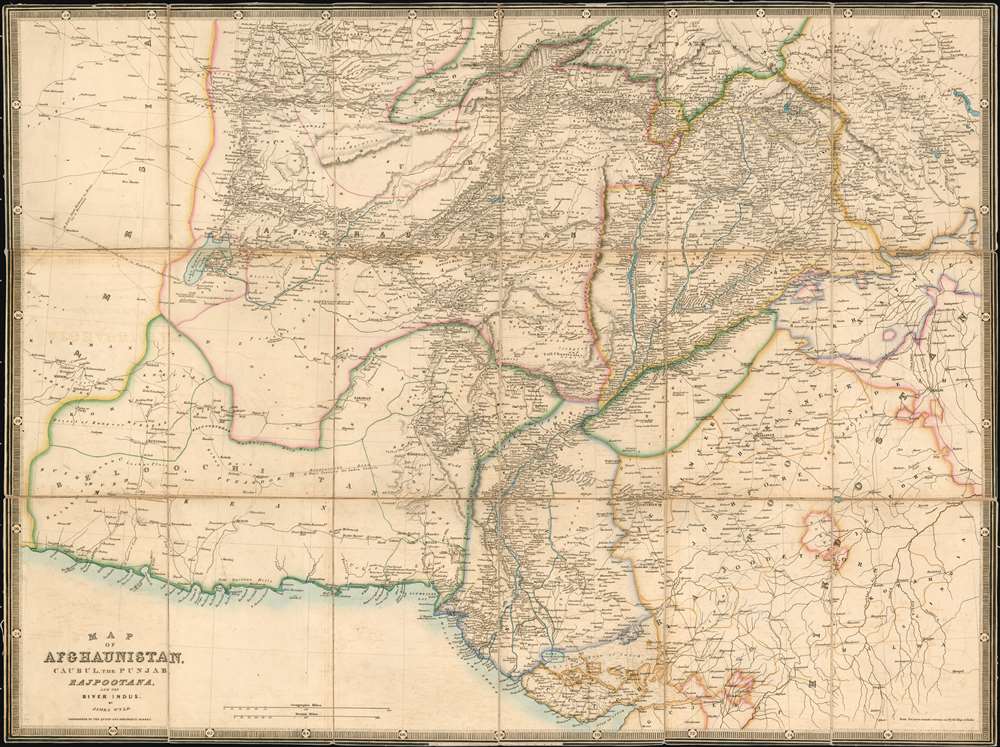
Map of
Afghaunistan, Caubul, the Punjab, Rajpootana, and the River Indus
sold
- Digital Map Information
- Suitable for large format printing
- DPI: 600
- File Size: 42.38 MB
- File Type: ZIP / TIFF
- ICC color profile embedded
- Delivered instantly via download link
This is an 1842 Wyld map of Afghanistan and its surrounds, showing the theatre of the First Anglo-Afghan War: the first major conflict of ‘The Great Game’ for British control of India. It was printed just three months after the disastrous Retreat from Kabul. Though the debacle is not specifically referred to on the map, the passes between Kabul and Peshawar are shown with sufficient detail (surpassing other contemporaneous maps of the area ) that it seems clear that the map reflects the best British understanding of Afghanistan’s geography at the time of the conflict. These include Gandamak - the pass approaching Jalalabad in which the massacre of Elphinstone's army took place between January 6 and January 13, 1842. (more details)
Berkeley, meet Art Deco!

A Map of Berkeley, Oakland and Alameda.
sold
- Digital Map Information
- Suitable for large format printing
- File Size: 110.52 MB
- File Type: ZIP / TIFF
- ICC color profile embedded
- Delivered instantly via download link
This is an outstanding c. 1930 large-format art deco chromolithograph pictorial map of Berkeley, Oakland, and Alamada County, California. The map was issued by the Berkeley artists Michael A. Baltekal-Goodman and Eugene (Eugen) Neuhaus, both then at U.C. Berkeley. Coverage extends from the San Francisco Bay to the Berkeley Hills. The artists have employed a bold color scheme that contracts the blue of San Francisco Bay with the orange and white Berkeley-Oakland street grid. Pictorial elements include vignette illustrations of significant buildings and other attractions. In the hills to the northeast, the focus is more on cultural references, natural beautify, and wildlife. The map features a decorative border with numerous vignettes illustrating historical events, ranging from an 1874 temperance protest to dueling. (more details)
Thematic map illustrating the events of the WWII Philippines Campaign of 1945.
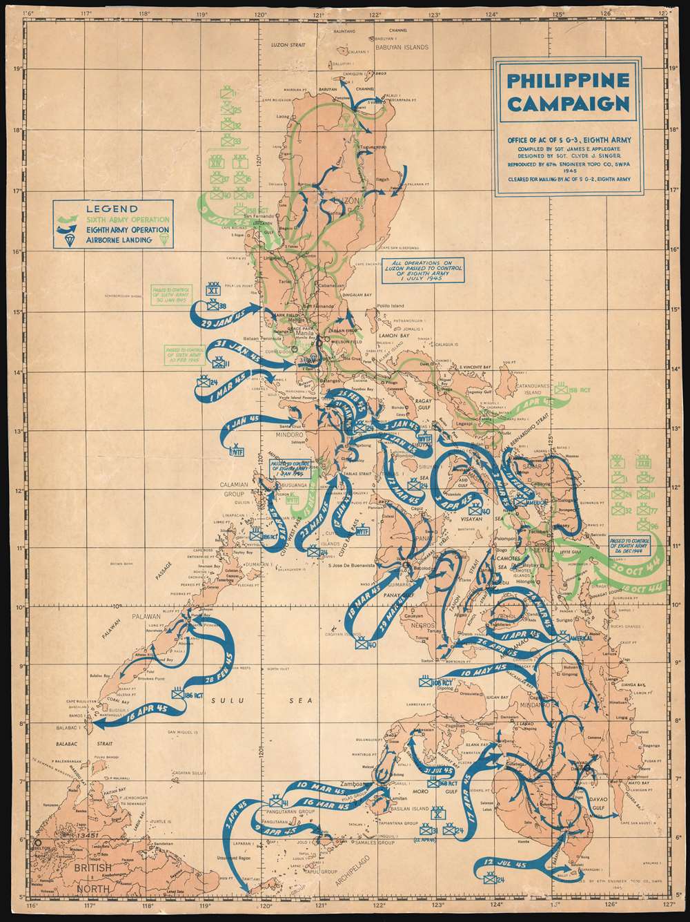
Philippine Campaign.
sold
- Digital Map Information
- Suitable for large format printing
- File Size: 16.31 MB
- File Type: ZIP / TIFF
- ICC color profile embedded
- Delivered instantly via download link
This is an unusual 1945 James E. Applegate and Clyde J. Singer thematic map of the Philippine Islands illustrating the events of the Philippine Campaign (1944 – 1945) during World War II. The map depicts the entirety of the Philippine archipelago with sinuous arrows indicating military activity. Blue arrows indicate operations undertaken by the Eighth Army, while green arrows highlights the operations of the Sixth Army, and little parachute drawings in either color represent airborne landing sites. (more details)
A Beautiful Map of the Contentious Borderland between Western Europe and the Turkish Empire
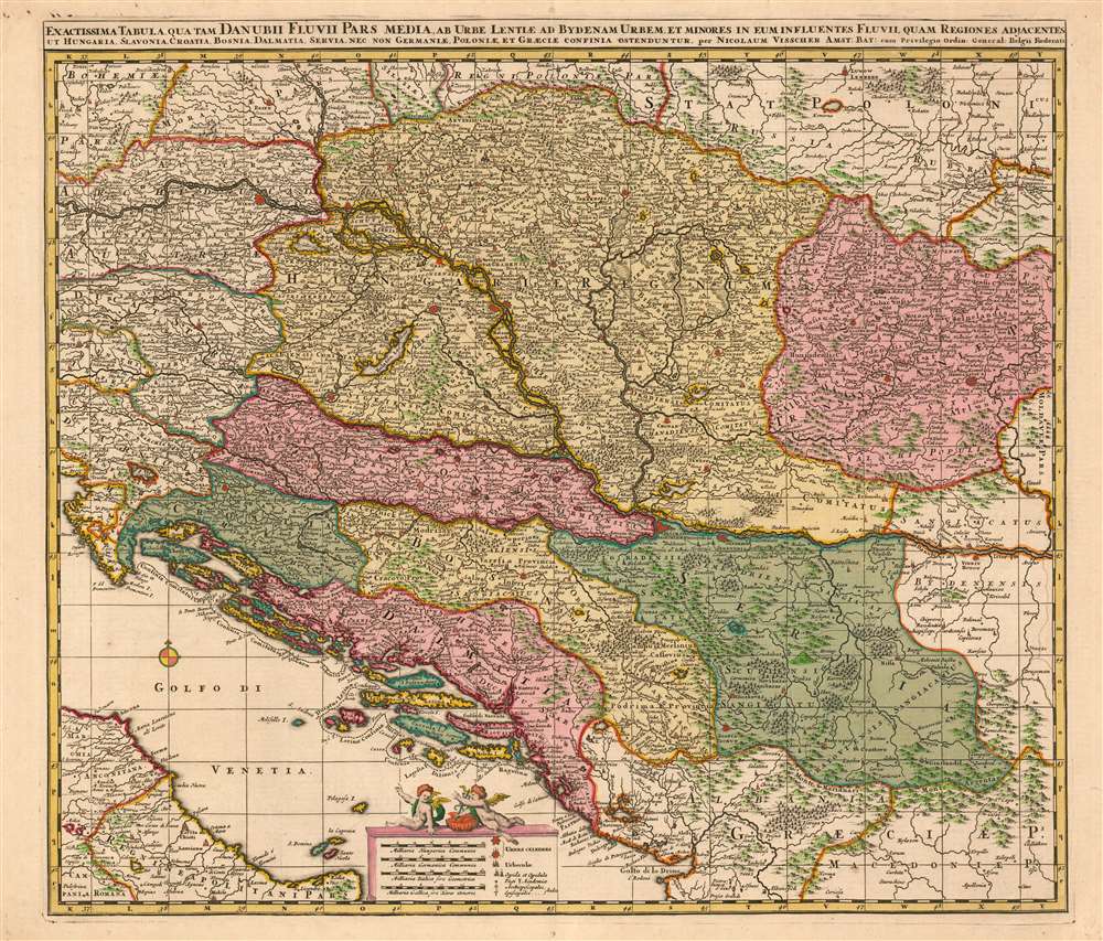
Exactissima Tabula qua tam Danubii Fluvii Pars Media, ab urbe Lentiae ad Bydenam Urbem et Minores in eum Influentes Fluvii, quam Regiones Adiacentes ut Hungaria, Slavonia, Croatia, Bosnia, Servia, nec non Germaniae, Poloniae, et Graeciae Confinia Ostenduntur. per Nicolaum Visscher.
sold
- Digital Map Information
- Suitable for large format printing
- DPI: 600
- File Size: 43.89 MB
- File Type: ZIP / TIFF
- ICC color profile embedded
- Delivered instantly via download link
This is a beautiful, contemporary-color example of Nicolas Visscher's c. 1677 map of the middle part of the Danube River. The map encompasses much of what would be considered the seat of war between Christian European powers and the Turkish Empire. Austria, Transylvania, Sclavonia, Croatia, Bosnia, Serbia and Dalmatia. Portions of Austria, Greece and Italy appear as well. Vienna, Buda and Pest, and Belgrade are among the major cities appearing here. (more details)
A utopic Florida resort community.

Rio Vista on the Halifax Florida.
sold
- Digital Map Information
- Suitable for large format printing
- File Size: 25.83 MB
- File Type: ZIP / TIFF
- ICC color profile embedded
- Delivered instantly via download link
This is the original published c. 1926 promotional plan for Walter Collins Hardesty's ambitious development Rio-Vista-on-the-Halifax. Rio-Vista was a planned resort community located on the east coast of Florida between Daytona and Oromond, Party of what is today Holly Hill. Although it never materialized, this plan encapsulates the grandeur and lavish excess of Pre-1929 Florida. (more details)
Engraved at the Height of the Golden Age of Dutch Cartography
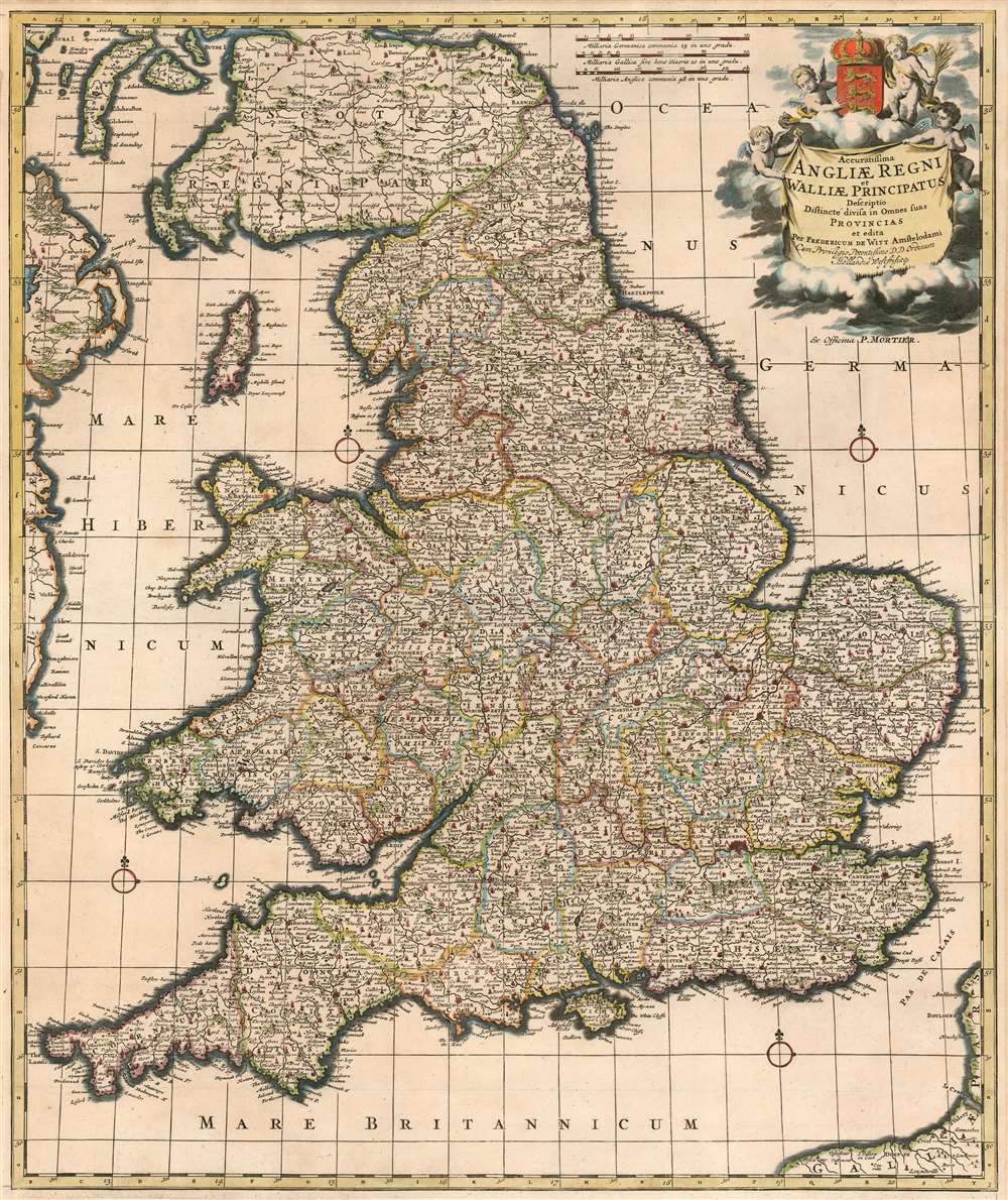
Accuratissima Angliae Regnum et Walliae Principatus Descriptio Distincté Divisa in Omnes Suas Provincias.
sold
- Digital Map Information
- Suitable for large format printing
- DPI: 600
- File Size: 37.19 MB
- File Type: ZIP / TIFF
- ICC color profile embedded
- Delivered instantly via download link
This is Frederic De Wit's superbly engraved 1662 map of England and Wales, in one of its most complete states. De Wit's last, fifth state of the map (coinciding with his being granted his privilege, in 1689) exhibits the totality of its maker's aesthetic changes. De Wit completely re-engraved the cartouche and the scales at that time, with its four splendid putti and the crowned Royal Arms of England. The maps produced in Amsterdam in the latter part of the 17th century enjoyed both technological advances both in printing technology (resulting in larger presses, hence larger plates and larger maps) and in the art of engraving (resulting in finer and more dense geographical detail and toponymy.) Hence both as geographical documents and works of art, they represent great steps forward. (more details)
A rare map of Southeast Asia that includes the famous route mandarine.
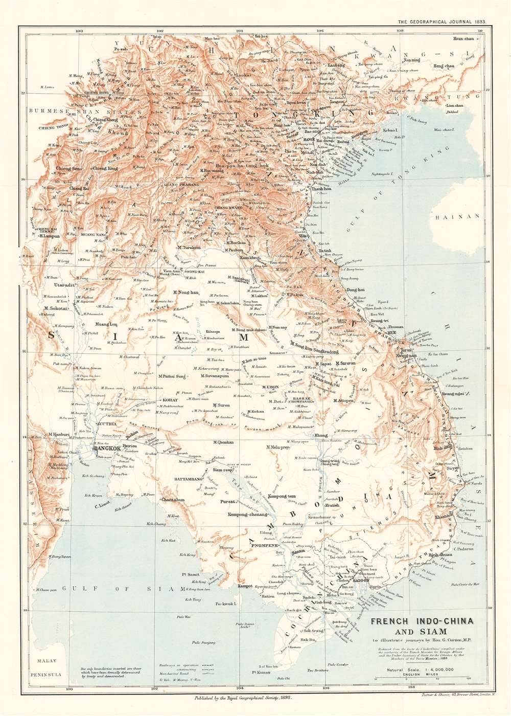
French Indo-China and Siam to illustrate journeys by Hon. G. Curzon, M.P.
sold
- Digital Map Information
- Suitable for large format printing
- File Size: 13.9 MB
- File Type: ZIP / TIFF
- ICC color profile embedded
- Delivered instantly via download link
This is an 1893 William Shawe map of Southeast Asia, encompassing modern-day Vietnam, Cambodia, Laos, and Thailand (Siam). A note in the Geographical Journal states that, while the international boundaries were not included because they had not yet been settled, ‘the topography differs considerably from that shown in maps previously published,’ and continues, ‘The present map also contains a large amount of detail in districts previous left nearly blank’. These details include labeling numerous cities, towns, and villages, and tracing the courses of rivers both large and small. Railroads, both those in operation and those under construction, are also illustrated. The ruins at Angkor are identified as well. (more details)
A rare pictorial map of Savannah commissioned to commemorate the 250th anniversary of the founding of the Colony of Georgia.

Savannah. Georgia's Colonial City.
sold
This is a 1983 Marilou Esguerra pictorial map of Savannah, Georgia, created to commemorate the 250th anniversary of the founding of the colony of Georgia. Buildings throughout Savannah are artistically rendered, lending charm and elegance to this work. Savannah’s historic homes and house museums are interspersed among renderings of the city’s businesses and cultural institutions. Portraits of important historic figures also populate the city’s streets, including Juliette Gordon Low, the founder of the Girl Scouts of the U.S.A., Nathaniel Greene, and King George III. George Whitefield and James Habersham, the founders of Bethesda Orphanage, the oldest in the United States, are also illustrated. Tybee Island, Lighthouse Point, and forts Jackson and Pulaski occupy the lower left corner and several ships ply the Savannah River. (more details)
A rare railroad map highlighting the railways that were part of the network owned by the Great Northern Railroad.

Map Showing Chicago, Burlington and Quincy Railroad, Great Northern Railway System, Northern Pacific Railway System, Spokane, Portland, and Seattle Railway, Colorado and Southern Railway Lines, Trinity and Brazos Valley Railway.
sold
- Digital Map Information
- Suitable for large format printing
- File Size: 46.72 MB
- File Type: ZIP / TIFF
- ICC color profile embedded
- Delivered instantly via download link
This is a 1927 McGill-Warner Company railroad map of the western United States. The map depicts the region from the Pacific Ocean to Chicago, Illinois and Mobile, Alabama and from southern Canada to Houston and San Antonio. The railroad network is extensively detailed and numerous different lines illustrated and labeled. Six lines are highlighted in color, making them stand out from the rest. These are the Chicago, Burlington and Quincy Railroad; the Great Northern Railway System; the Northern Pacific Railway System; the Spokane, Portland, and Seattle Railway; the Colorado and Southern Railway Lines; and the Trinity and Brazos Valley Railway. All six of these railways were owned and operated by the Great Northern Railway in 1927. Every stop along these six lines is identified, allowing for a thorough understanding of how these railroads interconnected. Yellowstone National Park, Glacier National Park, and Rocky Mountain National Park are also identified. (more details)
French Edition of the First Mapping of the Society Islands
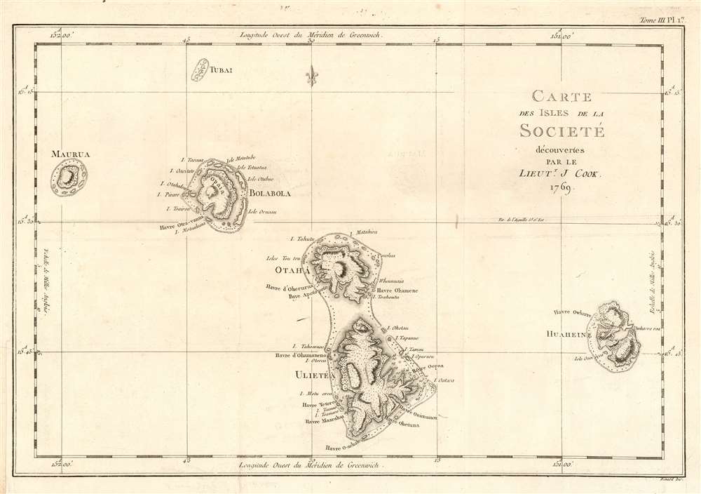
Carte des Isles de la Societé découvertes par le Lieutt. J. Cook 1769.
sold
- Digital Map Information
- Suitable for large format printing
- DPI: 600
- File Size: 10.65 MB
- File Type: ZIP / TIFF
- ICC color profile embedded
- Delivered instantly via download link
This is a 1774 map of the Society Islands - the French edition of the first map revealing the exploration of these islands by then-Lieutenant James Cook during his first Pacific voyage. Now part of French Polynesia, the map shows the islands of Maupiti (Maurua on the map), Tupai (Tubai), Bora Bora (Bolabola),Tahaa (Otaha), Raiatea (Ulieta) and Huaheine. Cook's visit was the Islands' first contact with Europeans; Cook discussed in his journal the naming of the 'Society Islands:
'So call'd by the Natives and it was not thought advisable to give them any other names but these three together with Huaheine, Tubai, and Maurua as they lay contiguous to one another I have named Society Isles .'Topography of each of the islands is shown pictorially, including reefs, mountains, and valleys. Depth soundings and anchorages are shown for Huaheine, Raiatea and Otaha. Engraved by Bernard for the 1774 French edition of John Hawkesworth's Account of the Voyages…, in which this was contained as Plate 1 in Volume III. (more details)