
The final frontier!
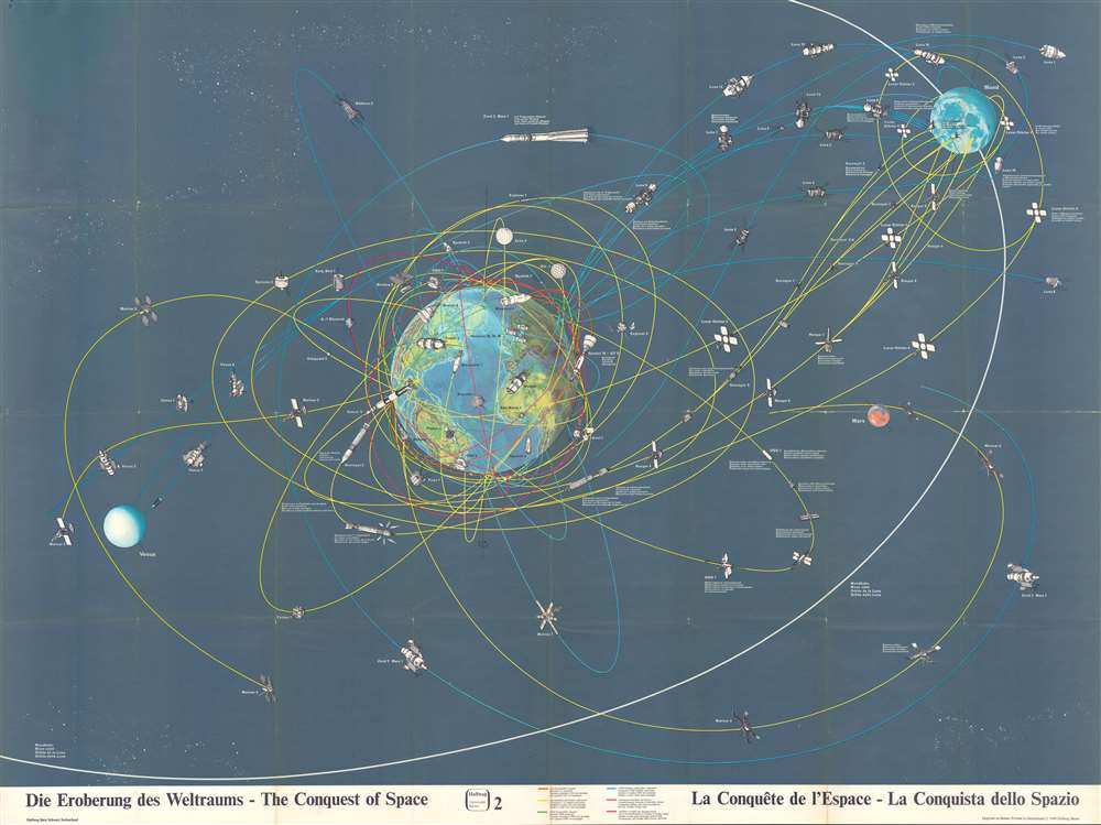
Die Eroberung des Weltraums - The Conquest of Space - La Conquête de l'Espace - La Conquista dello Spazio.
sold
- Digital Map Information
- Suitable for large format printing
- File Size: 83.65 MB
- File Type: ZIP / TIFF
- ICC color profile embedded
- Delivered instantly via download link
This is a 1968 Hallwag pictorial map of space exploration. With Earth just to the left of center, the map depicts the presumed trajectories of both manned and unmanned spacecraft in orbit around the Earth, the Moon, and flying by Mars. (more details)
Scarce British Military Map of Lebanon and Syria, with the Bookplate of a Virtually Unknown Map Dealer.

Syria, Homs - Beirut Sheet.
sold
- Digital Map Information
- Suitable for large format printing
- File Size: 34.3 MB
- File Type: ZIP / TIFF
- ICC color profile embedded
- Delivered instantly via download link
This is a 1910 British War Office Map of central and northern Lebanon, and the surrounding parts of Syria. The area mapped extends from Sidon and Damascus in the south to Hosain Al Bahir in the north (Ras al Hassan on the map). The map spans from the Mediterranean Sea eastwards to Homs, Al Nabk, (Nebk) and Jayrud (Jerud). The map is meticulously detailed, showing the country's mountainous terrain with superb hachure, and with the heights of the higher peaks noted in feet. The map distinguishes between 'metalled' roads (levelled, and made of small pieces of stone,) roads passable by automobile, and mule track. Telegraph lines, telegraph offices, railways, and bridges are shown. Coastal areas include soundings, anchorages and lighthouses. Interior details include convents, mosques, ruins and ancient mounds, towers, and garden areas. Rivers, springs and wells, wetlands and even underground water channels are marked as well. The map's reference key is included on the verso, along with the scales. (more details)
Abundantly Data-Rich Midcentury Map of New York City

The City of New York.
sold
- Digital Map Information
- Suitable for large format printing
- File Size: 45.02 MB
- File Type: ZIP / TIFF
- ICC color profile embedded
- Delivered instantly via download link
This 1939 Richard Edes Harrison map of New York City - published in conjunction with the New York World’s Fair – represents a triumph of the visual display of quantitative information. Its aesthetic impact is all the more impressive in its clear expression of municipal and demographic data, making this a map of the people of New York City, as much as of the physical city itself. All five boroughs are represented in the primary map. On it, Harrison’s masterful use of vivid color to distinguish between residential, commercial, industrial, and federal use of land is clear yet supple, able to make distinction (for example) of low-income housing projects using the same palette. Parks and cemeteries both appear as green spaces, with white spots - evoking headstones - indicating the difference between the two. The two major airports (Floyd Bennett Field and North Beach Airport) are given their own color as well. The city’s industrial areas, shown in black, dominate the East River and Hudson coastlines, a reminder of the centrality of trade to the city’s development and history. (more details)
Iconic humorous map satirizing the stereotypical insular Bostonian.

This Map Presents A Bostonian's Idea of the United States of America.
sold
- Digital Map Information
- Suitable for large format printing
- File Size: 13.44 MB
- File Type: ZIP / TIFF
- ICC color profile embedded
- Delivered instantly via download link
This is a 1936 Daniel Wallingford map of the United States as viewed by the stereotypical Bostonian. Poking fun at the caricaturized idea of a Bostonian, the map depicts the country varying detail, with a high degree of accuracy and numerous cities and towns labeled in the Northeast and decreasing accuracy and density of cities and towns further to the west. Cape Cod in particular is disproportionately enormous. The 'western prairies' the cities are listed, but not placed anywhere, rather are simply said to be 'located in this territory'. The Mississippi River barely extends north beyond Saint Louis, while Denver and Omaha are both decidedly West Coast cities. As a point of caution, the publishers have included a warning, 'As this map contains some inaccuracies, its use in connection with problems in navigation, astronomy, meteorology, etc. is not recommended.' An inset map of Boston and its environs is located in the lower right corner, with 'important cities and towns not shown on general map for lack of space are included in this inset.' It is also of note that Bali is no longer located in Indonesia, but just off the coast of Central America, per this map. (more details)
Some of the earliest surviving original illustrations associated with the King Features Mickey Mouse comic series.

[Biedermann / King Features / Disney Original Calendar Art]
sold
- Digital Map Information
- Suitable for large format printing
- File Size: 303.48 MB
- File Type: ZIP / TIFF
- ICC color profile embedded
- Delivered instantly via download link
A one-of-a-kind set of four 30 x 40 inch original 1930 Disney / King Features manuscript pen and ink drawings of impressive size, by the master cartoonist Louis Biedermann. They are among he earliest surviving original artworks related to the Micky Mouse Comic Strip (1930 - 1995). The drawings feature Mikey Mouse (just 2 years after he was created), Felix the Cat, Bonzo the Dog, Jiggs and Maggie, Dub Dora and others. (more details)
Rare early nautical chart of the Virgin Islands.

Carta Esferica de la Islas Caribes de Sotavento.
sold
- Digital Map Information
- Suitable for large format printing
- DPI: 600
- File Size: 49.61 MB
- File Type: ZIP / TIFF
- ICC color profile embedded
- Delivered instantly via download link
A rare 1804 Direccion Hidrografica nautical chart or maritime map of the Virgin Islands. Centered on Virgin Gorda Island, the map covers from eastern Puerto Rico to St. Christopher and St. Barts. When it was printed, this was the finest map of the Virgin Islands yet produced, the result of a meticulous 1792 survey by Spanish officers Joaquin Francisco Fidalgo and Cosme Damián de Churruca y Elorza. (more details)
Illustrates the support of European Missionaries for the Repubic of Texas before any offical recognition.
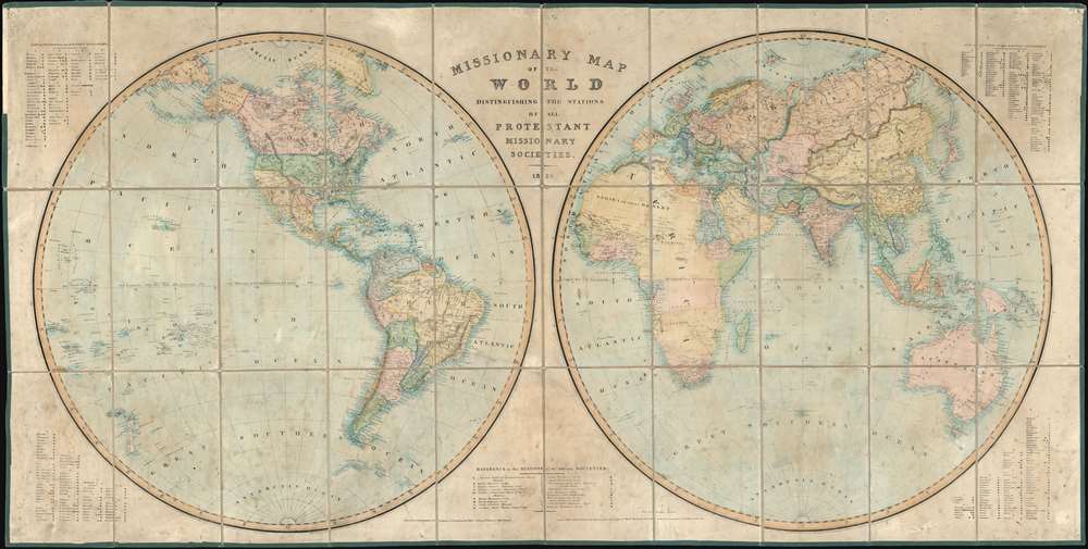
Missionary Map of the World Distinguishing the Stations of all Protestant Missionary Societies.
sold
- Digital Map Information
- Suitable for large format printing
- DPI: 600
- File Size: 84.72 MB
- File Type: ZIP / TIFF
- ICC color profile embedded
- Delivered instantly via download link
This is a rare and enormous 1838 missionary map of the world by John B. Netherchit and the Church Missionary Society. The map, published at the down of the Victorian Era, covers the world in a dual hemisphere projection and is noteworthy for its in-depth presentation of the global protestant missionary situation, and its early and significant support for the nascent Republic of Texas, declared just 2 years prior. Keyed at the corners and at bottom center, there is elaborate coding system identifying 19 different missionary societies and their stations throughout the globe, providing an outstanding overview of Protestant Missionary activity in the early-middle 19th century. Many remote towns and indigenous villages that do not commonly appear on other maps are noted here - suggesting deep knowledge of geography drawn from unique missionary sources. (more details)
Rare French Government Map Displaying the World's Muslim Populations
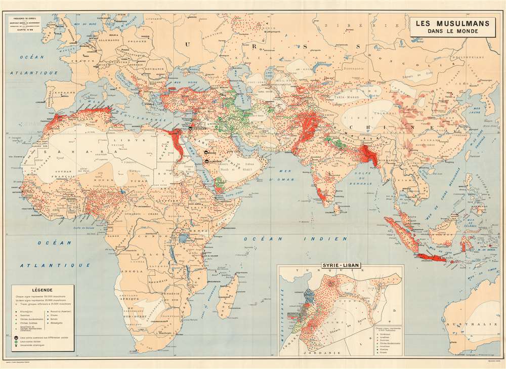
Les Musulmans Dans Le Monde
sold
- Digital Map Information
- Suitable for large format printing
- File Size: 55.23 MB
- File Type: ZIP / TIFF
- ICC color profile embedded
- Delivered instantly via download link
This rare 1952 world map produced by Georges Lafosse shows the distribution of Islam throughout the Eastern Hemisphere. (Despite the title, the map does not include the Americas). Using colored dots, (each indicating a population of approximately 50,000) the map is able to differentiate between major sects: Sunni, Shiite, Kharijite, Alawites, Druze, Bahai'i and Ahmadiyya Muslims are all shown - of course, we realize that the Druze and Baha'I are not Muslims, but in this case we follow the conventions of the map. Holy sites for the Sunni and Shia are marked as are Muslim universities. An inset map focuses on the religious populations of Syria and Lebanon.
The map was produced by the Institut Géographique National for the French Direction de la documentation, the directorate tasked with the mission of informing government officials on issues related to economics, geopolitics, finance, culture, and foreign affairs. Many - such as this present map - focused specifically on issues pertinent to France's colonial interests. That these maps were not intended for public consumption is suggested by the notation 'Reproduction interdite' (reproduction forbidden) in the lower right. (more details)
The map was produced by the Institut Géographique National for the French Direction de la documentation, the directorate tasked with the mission of informing government officials on issues related to economics, geopolitics, finance, culture, and foreign affairs. Many - such as this present map - focused specifically on issues pertinent to France's colonial interests. That these maps were not intended for public consumption is suggested by the notation 'Reproduction interdite' (reproduction forbidden) in the lower right. (more details)
Marks the final resting places of both the USS Arizona and the USS Utah, two American battleships sunk during the Japanese attack on December 7, 1941.
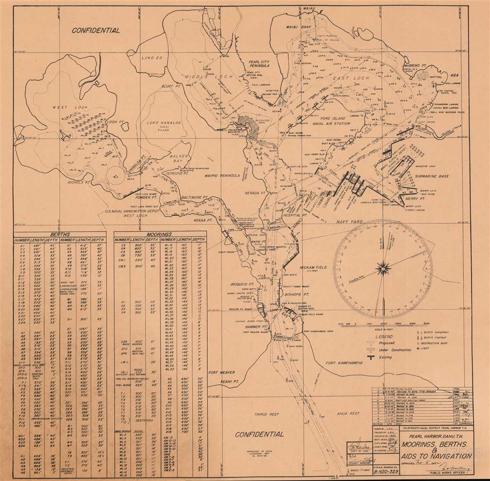
Pearl Harbor, Oahu, T.H. Moorings, Berths, and Aids to Navigation.
sold
- Digital Map Information
- Suitable for large format printing
- File Size: 14.45 MB
- File Type: ZIP / TIFF
- ICC color profile embedded
- Delivered instantly via download link
An incredibly important historical artifact, this is a United States Navy map of Pearl Harbor, Hawaii referencing the December 7, 1941 Japanese Attack on Pearl Harbor. Marked 'confidential' at both top and bottom, the map depicts the harbor from Waiau to Tripod Reef and Ahua Reef and from West Loch to the Submarine Base and Aiea. Highly detailed, moorings and berths are labeled throughout via a table situated in the lower left providing the number, length, and depth of each. Ford Island Naval Air Station, Hickam Field, and the submarine base, as well as drydocks, seaplane landing and take-off ranges, and the Naval Supply Depot are also identified. Lighted and unlighted buoys are also marked, providing a navigator some help in maneuvering through the tight confines of the harbor. (more details)
The first and finest scientific map of the Fiji Islands.

Chart of the Viti Group or Feejee Islands by the U.S. Ex. Ex.
sold
- Digital Map Information
- Suitable for large format printing
- DPI: 600
- File Size: 30 MB
- File Type: ZIP / TIFF
- ICC color profile embedded
- Delivered instantly via download link
A beautiful example of Wilkes' 1840 map of the Fiji Islands. Considered to be the first accurate scientifically produced map of the Fiji Islands, this map includes three main islands, Vanua Levu, Viti Levu, and Taveuni as well as the Yasawa Group and countless lesser islands. Topography is rendered by hachure and shoals, reefs, and other undersea dangers are indicated with shading. (more details)
Created to commemorate Harvard's tercentenary.
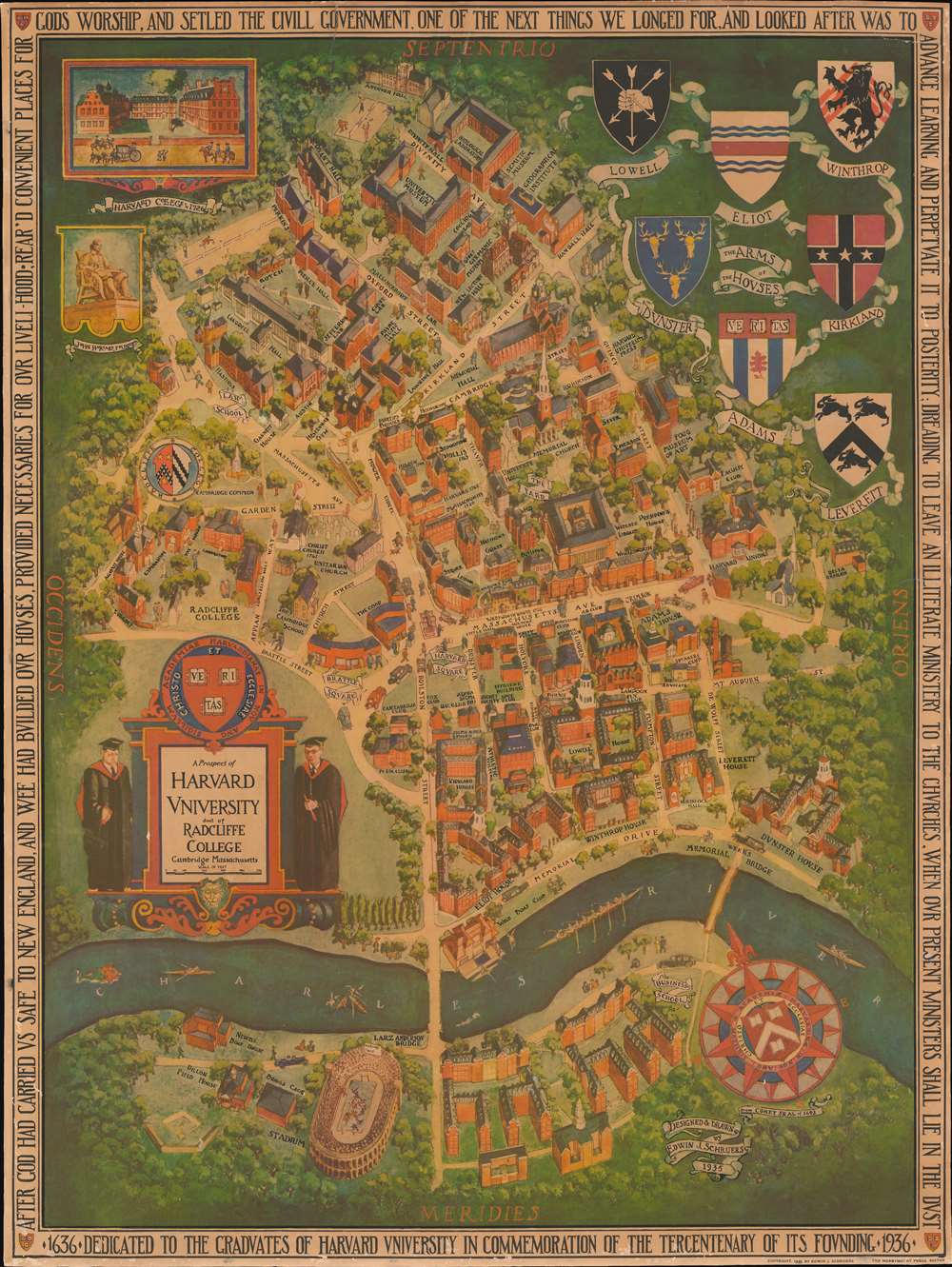
A Prospect of Harvard University and of Radcliffe College.
sold
- Digital Map Information
- Suitable for large format printing
- File Size: 55.44 MB
- File Type: ZIP / TIFF
- ICC color profile embedded
- Delivered instantly via download link
This is a 1935 Edwin J. Schruers pictorial map of Harvard University and Radcliffe College created to commemorate the Harvard's tercentenary. The map depicts the region from Radcliffe College to Dunster House and from Andover Hall across the Charles River to the Business School and the stadium. Wonderfully illustrated in a bird's eye view style, buildings throughout campus are labeled, including Lowell House, Widener Library, the Fogg Museum of Art, Memorial Church, the University Museum, the law school, and Langdell Hall. Streets around campus are also labeled. The Coats of Arms of the Houses are situated in the upper right corner, and a version of Harvard's crest decorates the compass rose. A view of Harvard College in 1726 is included in the upper left corner, along with a depiction of a statue of John Harvard, who founded the university. The seal of Radcliffe College is also present. (more details)
A manuscript cartoon celebrating a triumph of early aviation. This is a one-of-a-kind piece of aviation history.

[1910 Harvard-Boston Aero Meet Cartoon.]
sold
- Digital Map Information
- Suitable for large format printing
- File Size: 11.12 MB
- File Type: ZIP / TIFF
- ICC color profile embedded
- Delivered instantly via download link
This is a 1910 cartoon celebrating the Harvard Boston Aero Meet. The Harvard Boston Aero Meet, jointly organized by the Aero Club of New England and the Harvard Aeronautical Society, was scheduled to take place between September 3rd and 13th, 1910, but proved so popular that it was extended two extra days. Twenty-two aviators from around the world descended on Squantum Field in Massachusetts to compete in various competitions, including contests testing which pilot could stay aloft the longest, bomb dropping accuracy, take off distance, and landing precision. (more details)
Natural resources of Guatemala along with its physical and political geography.

Commercial Map of Guatemala.
sold
- Digital Map Information
- Suitable for large format printing
- File Size: 25.5 MB
- File Type: ZIP / TIFF
- ICC color profile embedded
- Delivered instantly via download link
This is an 1891 F. Bianconi economic map of Guatemala. The map depicts the region from the Pacific Ocean and Mexico to Honduras, El Salvador, and the Caribbean Sea and from Mexico and the Caribbean Sea to El Salvador and the Pacific Ocean. As a commercial map, Guatemala's rich natural resources are extolled from Tikal to the Pacific Ocean. Small print in italics appear throughout the map in both French and Spanish indicate the different products produced, grown, harvested, or raised in a certain region, and these include sarsaparilla, vanilla, mahogany, cedar, pastureland, cotton, wheat, sugarcane, and other grains. 'Forests' is also indicated regularly, creating the presumption that these forests were used to export wood, but not a specific kind of wood, like cedar and mahogany, which are specifically named. (more details)
Rare Map of Florida Showing Civil War Railways and the Seat of the Second Seminole War

Florida
sold
- Digital Map Information
- Suitable for large format printing
- File Size: 11.45 MB
- File Type: ZIP / TIFF
- ICC color profile embedded
- Delivered instantly via download link
This is a rare 1864 map of Florida by Schönberg and Company, a printer and map publisher based in New York City and active in the 1850s and 1860s. The map shows all of eastern Florida, and in an inset map shows the western portion of the state. The map shows 37 counties, differentiated by color. Topography is shown pictorially. (more details)
Highlights transcontinental roads leading to Yellowstone National Park.
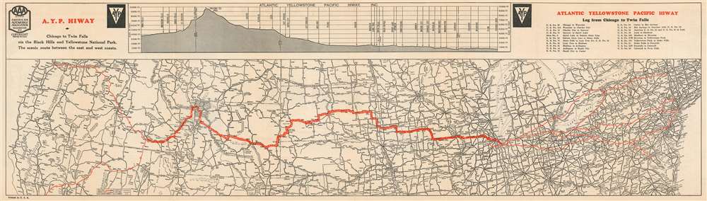
Atlantic Yellowstone Pacific Hiway
sold
- Digital Map Information
- Suitable for large format printing
- File Size: 16.02 MB
- File Type: ZIP / TIFF
- ICC color profile embedded
- Delivered instantly via download link
This is a c. 1927 American Automobile Association map of the Atlantic Yellowstone Pacific Highway. The map depicts the United States from the Pacific Ocean to the Atlantic Ocean and from Montana and Duluth, Minnesota to Norfolk, Virginia and Carson City, Nevada. The Atlantic Yellowstone Pacific Highway is highlighted in red, with the route from Chicago, Illinois to Twin Falls, Idaho marked in bold. Myriad cities and towns throughout the U.S. are labeled, with state capitals marked by star inscribed in a circle. Other highways across the country are illustrated as well, with different markings used to denote differing road grades. National parks, mountain ranges, lakes, and rivers are noted as well. A chart tracing the elevation of the highway from Chicago to Twin Falls is situated along the top border and highlights the increase in elevation, with the highest point along the route at th4e summit of the Togwotee Pass. (more details)
Mitchell's depiction of the southern portions of modern Greece.

Greece.
sold
- Digital Map Information
- Suitable for large format printing
- DPI: 600
- File Size: 15.34 MB
- File Type: ZIP / TIFF
- ICC color profile embedded
- Delivered instantly via download link
This is an 1849 Samuel Augustus Mitchell map of Greece. The map depicts the region from Ioannina and Triekhala south to include the Euboea (Negropont) and the Peloponnese (Morea). The southern portion of modern Greece is illustrated in detail, including the Peloponnese (Morea), the Negroponte, and Karalla, as well as the Ionian Republic and the Greek Isles inclusive of Crete (Candia) via an inset in the lower left. Political and topographical features are noted and color coded with elevation rendered by hachure. At the time, this part of Greece was the center of the Greek Independence movement having attained independence from the Ottoman Empire in 1821. (more details)
First map to show U.S. claims to British Columbia.
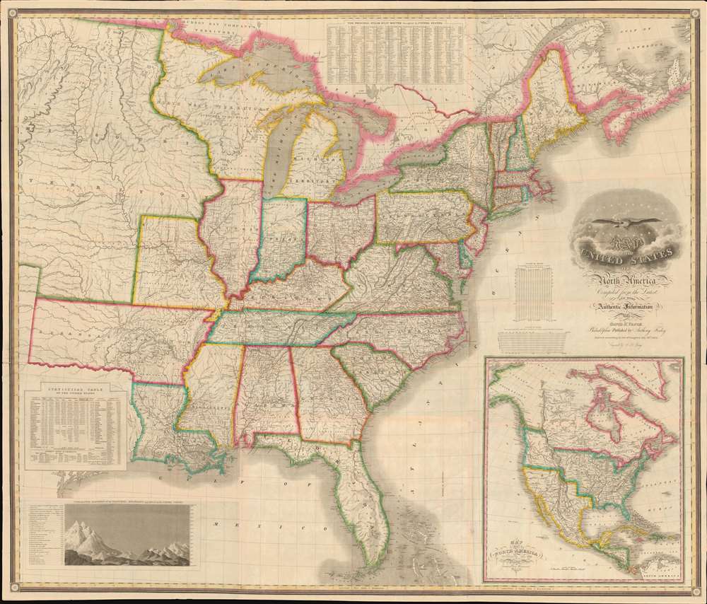
Map of the United States of North America Compiled from the Latest and most Authentic Information by David H. Vance.
sold
- Digital Map Information
- Suitable for large format printing
- DPI: 600
- File Size: 277.94 MB
- File Type: ZIP / TIFF
- ICC color profile embedded
- Delivered instantly via download link
This is the first edition of David Vance and Anthony Finley's outstanding wall map of the United States, published in 1825, here in a remarkable fresh state. This map is significant with regard to its early date, contemporaneous with Amos Lay's map, but more ambitions and predating the 1829 Tanner map by 4 years, as well as its detailed coverage of historic developments. Converge encompasses the Untitled States as it appeared at the time, extending from roughly the Texas Border (100° West of Greenwich / 27° West of Washington) to the Pacific and from the Saint Lawrence River to the Florida Keys. A large inset map appears in the lower right quadrant, illustrating the whole of North America. This is the first map to illustrate American claims to British Columbia that would later spark the 54°40' Debate. (more details)
Ceremonial and Administrative Embodiment of the Qing.
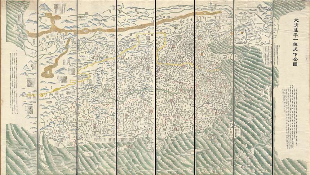
DaQing Wannian Yitong Tianxia Quantu / 大清万年一统天下全图 / All-Under-Heaven Complete Map of the Everlasting Unified Qing Empire
sold
- Digital Map Information
- Suitable for large format printing
- Full resolution TIFF file
- ICC color profile embedded
- Delivered instantly via download link
A seminal 1821 (Daoguang 1) Qing Dynasty Chinese map of utmost importance and rarity, this is Huang Qianren's (黃千人, 1694–1771) grand and spacious map of the Great Qing Empire of China. Although ostensibly a map of China, the coverage of this map in fact extends to all lands touched by the influence Qing Empire, including England, Holland, Southeast Asia, and Africa. As such it can be considered a political manifesto lionizing the unity and majesty of Qing China as well as a functional administrative document. This edition of the map, 1821, was issued to memorialize the reign of the Jiaqing Emperor and celebrate the coming Daoguang reign. (more details)
The most extraordinary view of Saigon or Ho Chi Minh City during the French period.

[Saigon]
sold
- Digital Map Information
- Suitable for large format printing
- File Size: 117.95 MB
- File Type: ZIP / TIFF
- ICC color profile embedded
- Delivered instantly via download link
The only known example of what can only be the largest and most spectacular panoramic bird's-eye view of Saigon (Ho Chi Minh City, Vietnam) ever produced. Drafted by Gaston Pusch and published in Saigon by Claude et Cie., this c. 1898 view was printed using a sophisticated multi-color chromolithograph process - a testament to the intellectual and industrial prosperity of Saigon at the height of French imperial rule. The perspective Bird's-eye view looks on Saigon from a high point to the east of the city just across the bustling Saigon River. The view celebrates the massive and all-encompassing rebuilding of Saigon on a grand scale in the late 19th century, reveling lively city full of imposing colonial buildings, sprawling formal gardens, and grand tree-lined boulevards. (more details)
Map exhiiting French interest in a California colony and the Republic of Texas.
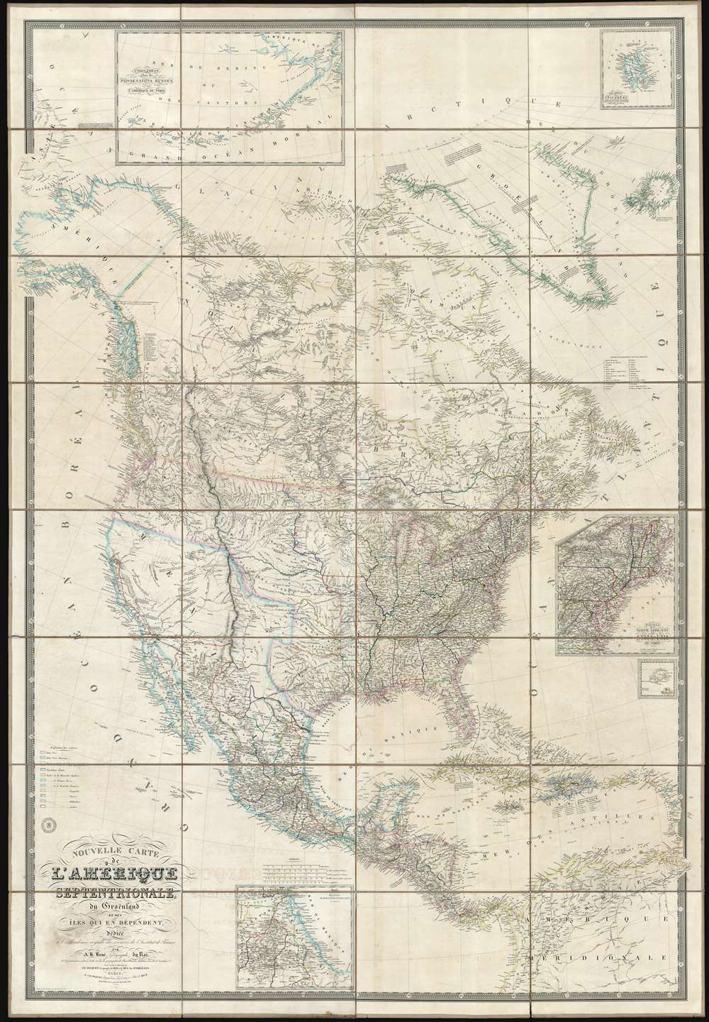
Nouvelle Carte de l'Amérique Septentrionale, du Groenland et des îles qui en dépendent.
sold
- Digital Map Information
- Suitable for large format printing
- DPI: 600
- File Size: 1001.97 MB
- File Type: ZIP / TIFF
- ICC color profile embedded
- Delivered instantly via download link
This is a spectacular and enormous 1843 French wall map of North America, including the Republic of Texas, dissected and on linen, issued by Adrien-Hubert Brué and Charles Picquet. The map represents an ephemeral historical period when France, coming out of the First French Intervention in Mexico, was seriously considering a colonizing play for California. With increased hegemony over Mexico, a mutually beneficial alliance with the Republic of Texas, and a potential colony in California, France was well positioned to push for dominance over all of western North America - inspiring considerable French enthusiasm and great interest in North America among the French populace. This map is perhaps the signal largest and most impressive cartographic statement of King Louis Phliippe ambitions of a new French empire in North America. While it may simply be chance, it is striking the light blue used to represent French properties is also used for Mexico, California, and Russian Alaska. (more details)