
Dramatically Engraved Map of Judaea and the Dead Sea

(Holy Land, Trubes of Simeon, Judah, Dan, Benjamin, Reuben, and Ephraim)
sold
- Digital Map Information
- Suitable for large format printing
- DPI: 600
- File Size: 19.37 MB
- File Type: ZIP / TIFF
- ICC color profile embedded
- Delivered instantly via download link
This 1650 Thomas Fuller map of Judaea shows the lands of six of the Thirteen Tribes of Israel, in the portion of the Holy Land running from Samaria to the southern extent of the Dead Sea. Jerusalem and Bethlehem are shown. Within a large, dramatically-engraved Dead ... (more details)
Includes portraits of such luminaries as Voltaire, Mozart, Dante, and Tolstoy.
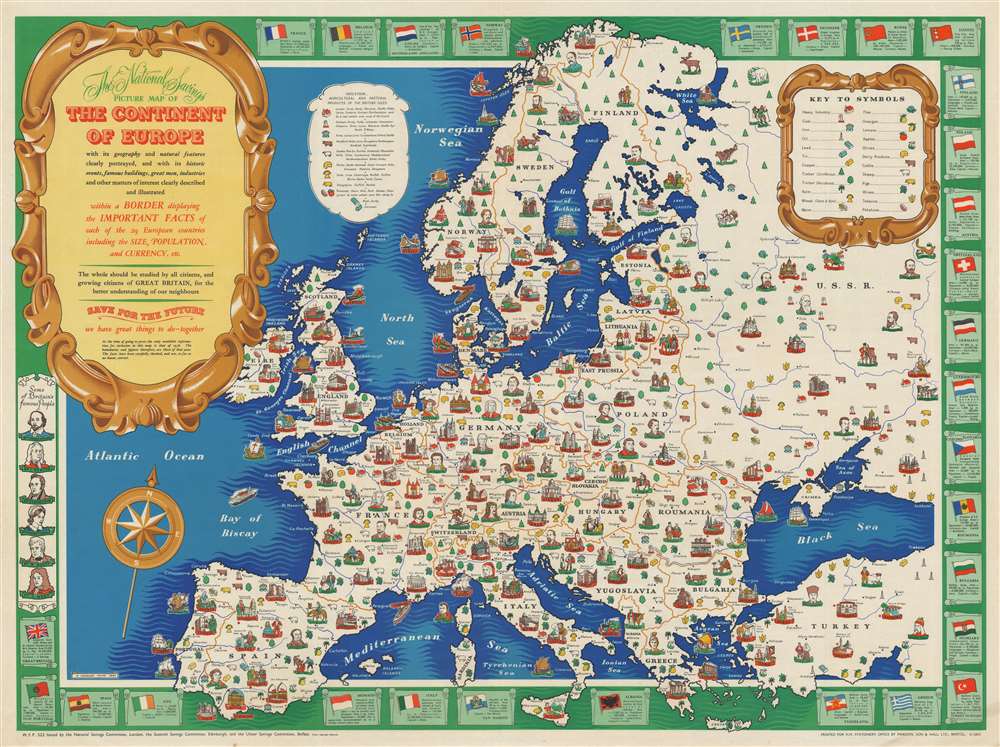
The National Savings Picture Map of the Continent of Europe with its geography and natural features clearly portrayed,and with its historic events, famous buildings, great men, industries and other matters of interest clearly described and illustrated within a Border displayong the Important Facts of each of the 29 European countries including the Size, Population, and Currency, etc.
sold
- Digital Map Information
- Suitable for large format printing
- File Size: 67.31 MB
- File Type: ZIP / TIFF
- ICC color profile embedded
- Delivered instantly via download link
This is a 1945 H. Charles Paine and National Savings pictorial map of Europe. The map depicts the continent from the Atlantic Ocean to Turkey and the Soviet Union and from Norway to Gibraltar, Sicily, and Crete. Created 'for the better understanding of our neighbors', cities throughout the continent are identified by a profile view of one of each city's most well-known landmarks and labeled by black block lettering 'stitched' on a red banner. Some of these, from a modern standpoint, are surprising, particularly Paris, which is embodied by the Arc de Triomphe, and London, which is marked by the Tower of London. Many cities are highlighted by their cathedral, including Amiens, Nantes, Milan, Cologne, Brussels, Prague, and St. Petersburg. Istanbul is marked by a view of the Hagia Sophia. Smaller cities are also labeled but are in a much less obvious font. The Continent's people and luminaries are illustrated as well, with portraits of such noted figures as Voltaire, Goya, Rembrandt, Beethoven, Chopin, Copernicus, Lenin, Tolstoy, and Genghis Khan. Sketches of Czechs, Croatians, Bretons, Basques, Albanians, and Turks are also included. The whole is bordered by illustrations of each nation's flag and information concerning their area, population, and currency. Portraits of a few famous British citizens are also included in the border, including Newton, Shakespeare, and Florence Nightingale. (more details)
Western China, Mongolia and Central Asia North of the Himalayas
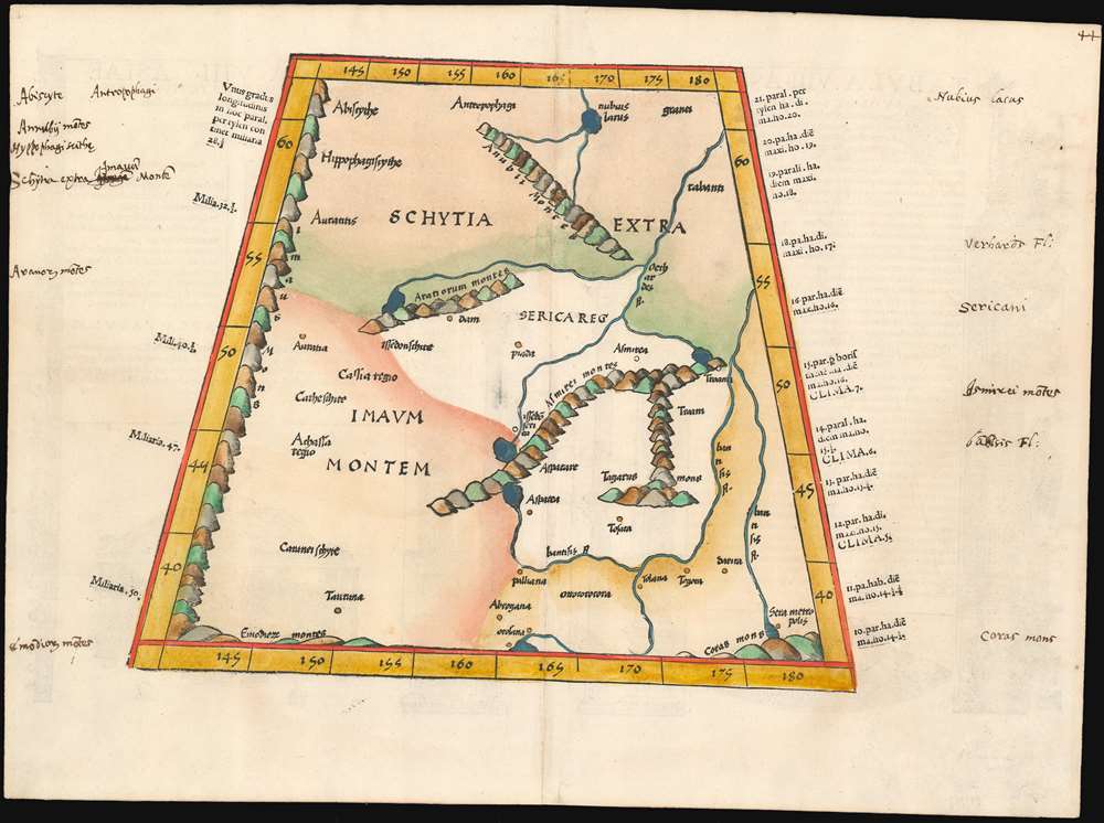
(Tabula VIII Asiae)
sold
- Digital Map Information
- Suitable for large format printing
- DPI: 600
- File Size: 17.68 MB
- File Type: ZIP / TIFF
- ICC color profile embedded
- Delivered instantly via download link
This map depicts the area now known as China and Mongolia. Specifically, it shows the lands known to Strabo and Ptolemy as Scythia Extra Imaum and Serica. Scythia Extra Imaum refers to the territory of the nomadic Scythians to the east of the Tian Shan mountain range, while Serica was a mysterious land thought to be the source of silk: indeed, the place name literally means “the land where silk comes from.” The map includes specific descriptors for some of the people to be found in the region: in the northwestern extreme of the map, Hippophagi (horse-eaters) and Anthropophagi (cannibals) can be found. Since this map covers one of the norther nmost regions addressed in Ptolemy's work, it includes notation in its margins indicating the increase in the length of the days as one travels north, a phenomenon not easily observed during Ptolemy's time but one with which northern European travelers of the 16th century would have been growing familiar. (more details)
Includes vignettes of Scottish Highland Games and the burning of a Viking Long Ship in the Shetland Islands.

National Savings Map of the British Isles Showing Festivals and Customs and the Arms or Seals of the Counties.
sold
- Digital Map Information
- Suitable for large format printing
- File Size: 72.33 MB
- File Type: ZIP / TIFF
- ICC color profile embedded
- Delivered instantly via download link
This is a 1953 National Savings pictorial map of the British Isles celebrating their festivals and customs. The map depicts the region from Northern Ireland to the North Sea and from Scotland to the English Channel. Pictorial vignettes populate the islands and highlight some of the festivals and customs celebrated in Scotland, England, Wales, and Northern Ireland. Each vignette is accompanied by its name and location, usually down to the city and county. In certain cases, only the city is given for the location of the festival, such as Edinburgh, Aberdeen, and London. An incredible variety of celebrations are presented, including the Up-Helly-A in the Shetland Islands, which comes from Viking tradition, several different depictions of Highland Games in Scotland, and the Olney Pancake Race in Buckinghamshire. The coats of arms and seals of the counties of England, Scotland, Wales, and Ireland are included all along the border, in the title cartouche, and in a cartouche situated along the left border. (more details)
A soldier's map of Florence - allowed an ambitious GI to make the best of some rest and relaxation time in this historic city.

A Soldier's Guide to Florence.
sold
- Digital Map Information
- Suitable for large format printing
- File Size: 29.42 MB
- File Type: ZIP / TIFF
- ICC color profile embedded
- Delivered instantly via download link
Created as a resource for soldiers on leave from the front, this is a c. 1945 Information and Education Section of MTOUSA (Mediterranean Theater of Operations United States Army) city map or plan of Florence, Italy. The map depicts the center of Florence from the Giardino Torrigiani to the Ponte di Ferro and the Piazza Beccaria and from the Cloister of the Scalzo to the Piazzale di Porta Romana and the Giardino delle Scuderie Reali. Streets throughout the city center are illustrated with the major streets and plazas identified by name. The main train station is depicted as well. The map is surrounded by the names and descriptions of forty-three cultural sites scattered around the city center, with red lines directing the soldier's attention to each site's relative location. Some of the sites are illustrated in profile, including the Cathedral, the Palazzo Vecchio, the Church of Santa Croce, the Ponte Vecchio, and the Palazzo Strozzi. The House of Galileo, the Uffizi Gallery, the House of Dante, and several churches and cloisters are among the other locations identified but not illustrated. An index of possibly unfamiliar terms is situated in the upper right corner and defines such words as 'cloister', 'fresco', 'loggia', and 'nave'. Part of the text on the verso imparts advice to visiting soldiers about the best way to see the city, some of which is good advice for the modern visitor as well.
If you chose this individual way of seeing Florence, don't try to look at every picture or statue in an gallery or church; there are too many. Glance around quickly for the picture or statue that interests you, and enjoy that one. Don't be afraid to use this map; carry it around and read the text on the spot. And finally don't hesitate to visit the Florentine churches, regardless of your religion; these welcome visitors at any time.(more details)
Highlights historic houses and sailing ships.
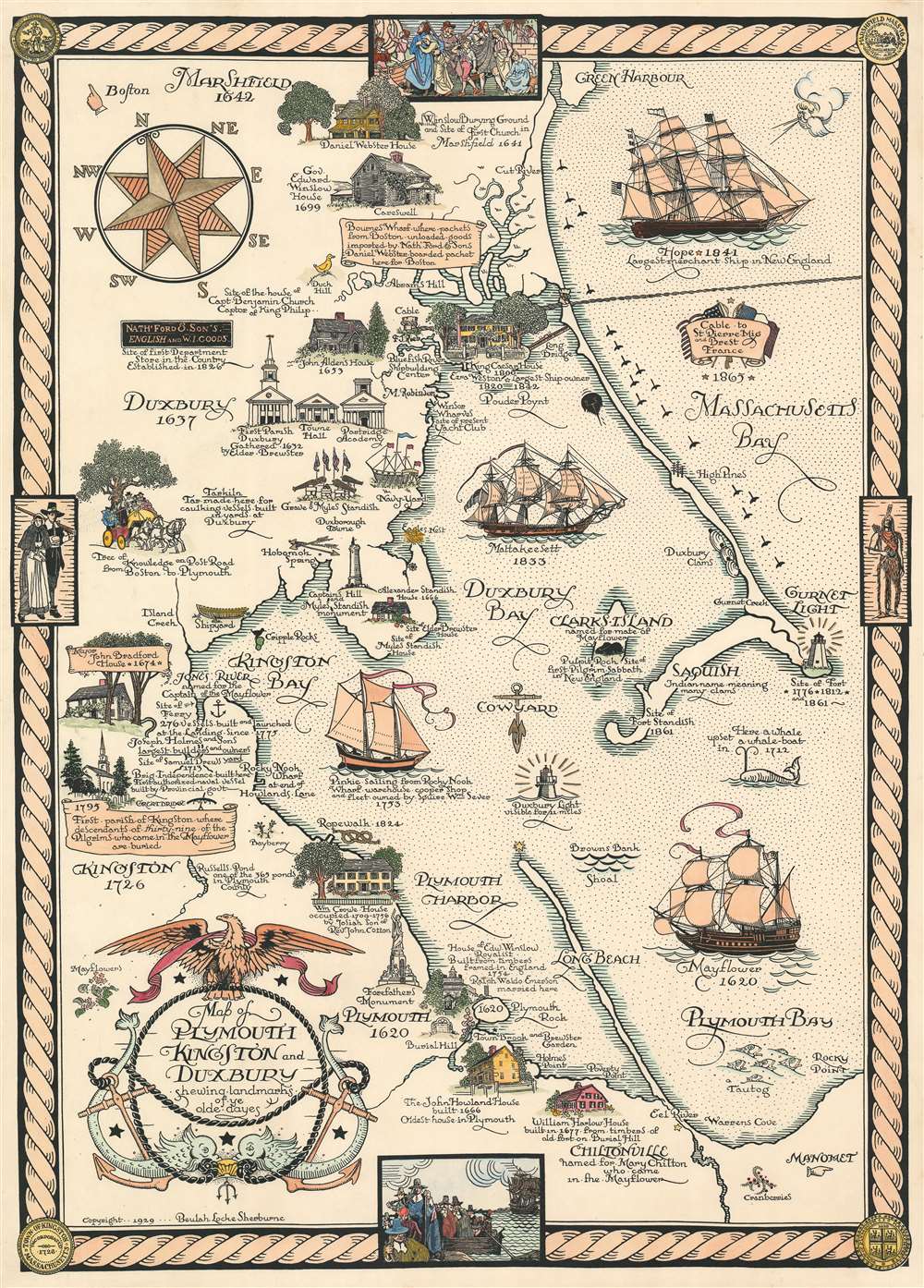
Map of Plymouth, Kingston, and Duxbury shewing landmarks of ye olde dayes.
sold
- Digital Map Information
- Suitable for large format printing
- File Size: 49.59 MB
- File Type: ZIP / TIFF
- ICC color profile embedded
- Delivered instantly via download link
Rare and brimming with charm, this is a 1929 Beulah Locke Sherburne pictorial map of Plymouth, Kingston, and Duxbury, Massachusetts. The map depicts the region from the Mayor John Bradford House to Massachusetts Bay and from Green Harbor to Chintonville and Warren Cove. Wonderfully illustrated, historic sites from Marshfield south along the bay to Chiltonville are presented in profile, with the John Howland House, William Harlow House, William Creowe House, and King Caesar House among said sites. The first parish in Duxbury is shown next to the town hall and the Partridge Academy. Plymouth Rock in Plymouth is identified as is the Forefathers Monument. Historic sailing ships, the Mattakeesett, Pinkie, and Mayflower, ply the waters of Duxbury Bay, Kingston Bay, and Plymouth Bay, while the Hope, the largest merchant ship in New England as of 1841, has set sail in Massachusetts Bay. A whale is also included in Plymouth Bay, with a caption noting that a whale upset a whaleboat in the general vicinity of the vignette in 1712. The whole is surrounded by a rope border that features illustrations of colonial life and the seals of Duxbury, Kingston, and Plymouth. (more details)
Published by the Missouri State Highway Commission for tourists traveling through the state to the 1933 Chicago World's Fair.
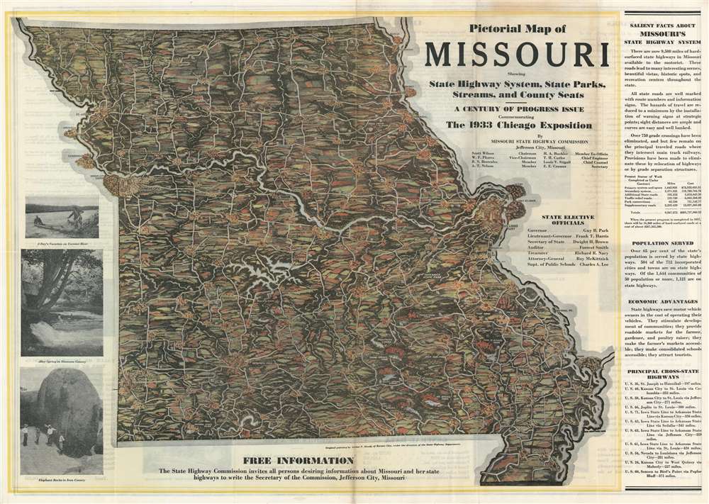
Pictorial Map of Missouri Showing State Highway System, State Parks, Streams, and County Seats. - A Century of Progress Issue Commemorating the 1933 Chicago Exposition.
sold
- Digital Map Information
- Suitable for large format printing
- File Size: 59.42 MB
- File Type: ZIP / TIFF
- ICC color profile embedded
- Delivered instantly via download link
This is a 1933 Arthur P. Moody and Missouri State Highway Commission pictorial map of Missouri. The map depicts the entire state but leaves the neighboring states unillustrated and unidentified. The Missouri River creates the northern third of the state's western border and also remains unlabeled, while the Mississippi River serves as the state's entire eastern border and likewise is not identified. State highways snake their way across the state, all of which are labeled by highway signs either in the shape of the state of Missouri or the U.S. Highway shield. Cities and towns are illustrated and labeled, with the largest cities, such as St. Joseph, Kansas City, Jefferson City, and St. Louis highlighted by profile illustrations of some of the city's more recognizable buildings. State parks are labeled throughout the state, almost all of which are located in the southern third. Facts about Missouri are included along the right side, promoting the many benefits of the Missouri state highway system. Printed photographs documents a day on Current River, Alley Spring in Shannon County, and the Elephant Rocks in Iron County are situated along the left border. (more details)
The height of the China Trade on one chart! Belcher's Hong Kong! Collinson's survey!
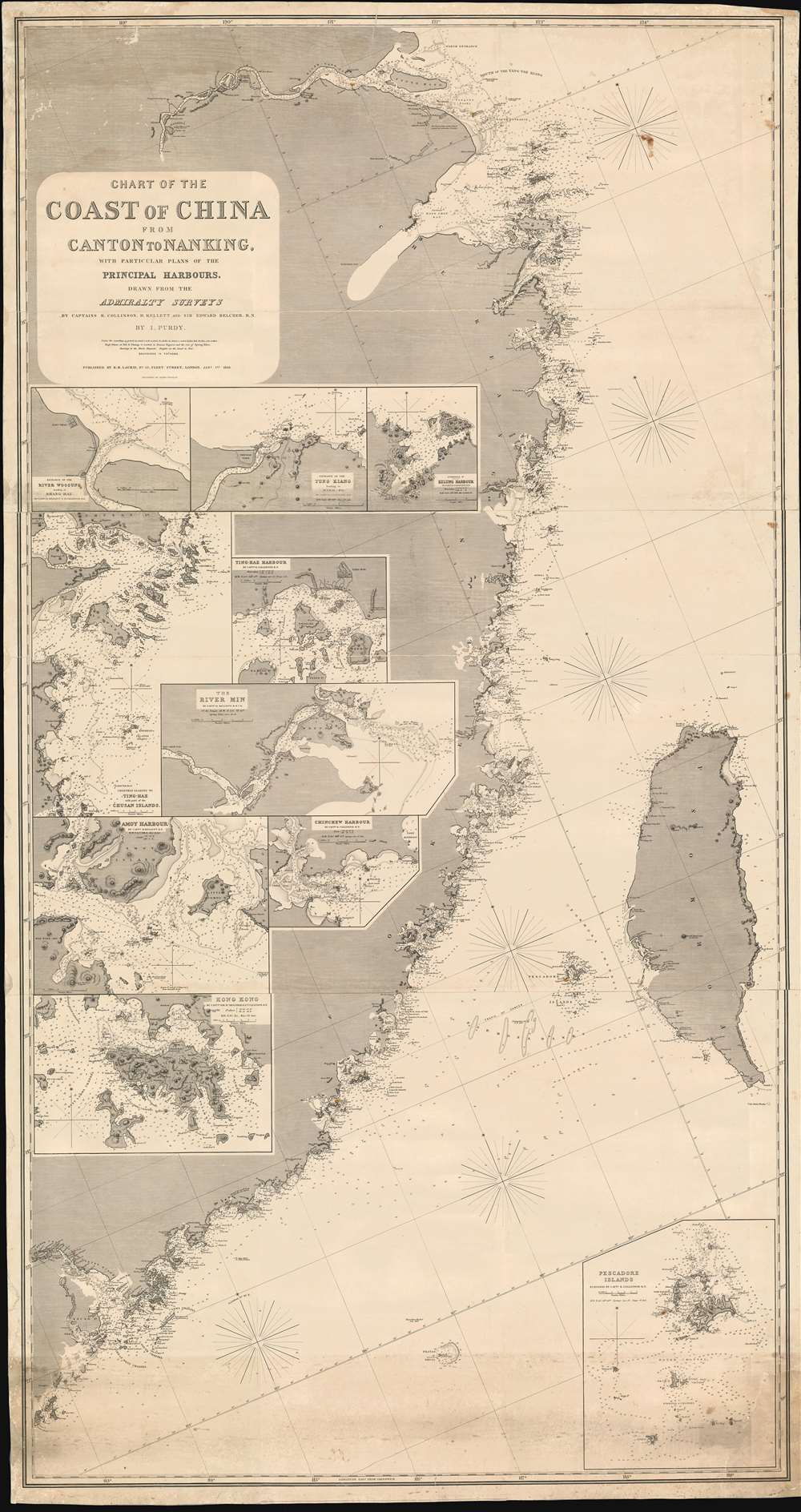
Chart of the Coast of China from Canton to Nanking, with particular plans of the principal Harbors, Drawn from the Admiralty Surveys by Captains R. Collinson, H. Kellett and Sir Edwad Belcher, R. N.
sold
- Digital Map Information
- Suitable for large format printing
- Full resolution TIFF file
- ICC color profile embedded
- Delivered instantly via download link
An exceptionally rare and important 1865 nautical chart or maritime map of the coast of China compiled by John Purdy from the surveys of Sir Edward Belcher (Hong Kong), Richard Collinson (China Coast), and Henry Kellett (China Coast) - probably the best general map of the China coast then obtainable. The map's coverage extends from mouth of the Yangtse River (Nanjing and Shanghai) south as far as Hong Kong and Macao, and east to include Taiwan (Formosa). The chart includes nine insets, among them a large representation Collinson's update of Belcher's First Opium War Hong Kong survey of 1841. This map, made after the second opium war, represents the high point of the China Trade when cities like Shanghai and Hong Kong were transforming into global centers of trade and commerce, largely at the expense of an increasing angry and frustrated Chinese populace (more details)
An enormous geological map of the former Soviet Union that was internationally renowned when it was first issued.
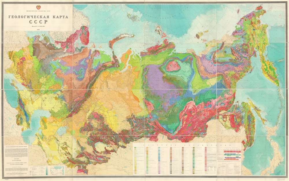
Geological Map of the U.S.S.R. / ГЕОЛОГИЧЕСКАЯ КАРТА CCCP.
sold
- Digital Map Information
- Suitable for large format printing
- Full resolution TIFF file
- ICC color profile embedded
- Delivered instantly via download link
This is a 1968 Dimitri Vasilievich Nalivkin geological map of the Union of Soviet Socialist Republics (U.S.S.R). The map depicts the region from Poland to the Pacific Ocean and from the Arctic Ocean to Iran, China, and Japan. Strikingly beautiful and meticulously ... (more details)
One of the earliest cartographic depictions of Wine Making in California!

Geographical Map of the State of California Compiled from Actual Surveys.
sold
- Digital Map Information
- Suitable for large format printing
- File Size: 82.39 MB
- File Type: ZIP / TIFF
- ICC color profile embedded
- Delivered instantly via download link
A stunning separately issued 1893 decorative map of California issued to promote the Crocker family business interests in the development and settlement of California. It is also among the earliest, if not the earliest, cartographic representation of wine making in California. While the mapmaker, Henry Smith Crocker was on the surface a printer, his business interests were inextricably linked to those of this brother, Central Pacific railroad magnate Charles Crocker (1822 - 1888). H. S. Crocker used his publishing and printing empire to propagandize the Central Pacific as well as the general virtues of California as a place to resettle - this map being one such example, probably issued as a booster publication for the California exhibit at the Chicago Columbian Exposition of 1893. (more details)
A stunningly colored tectonic map of Africa.
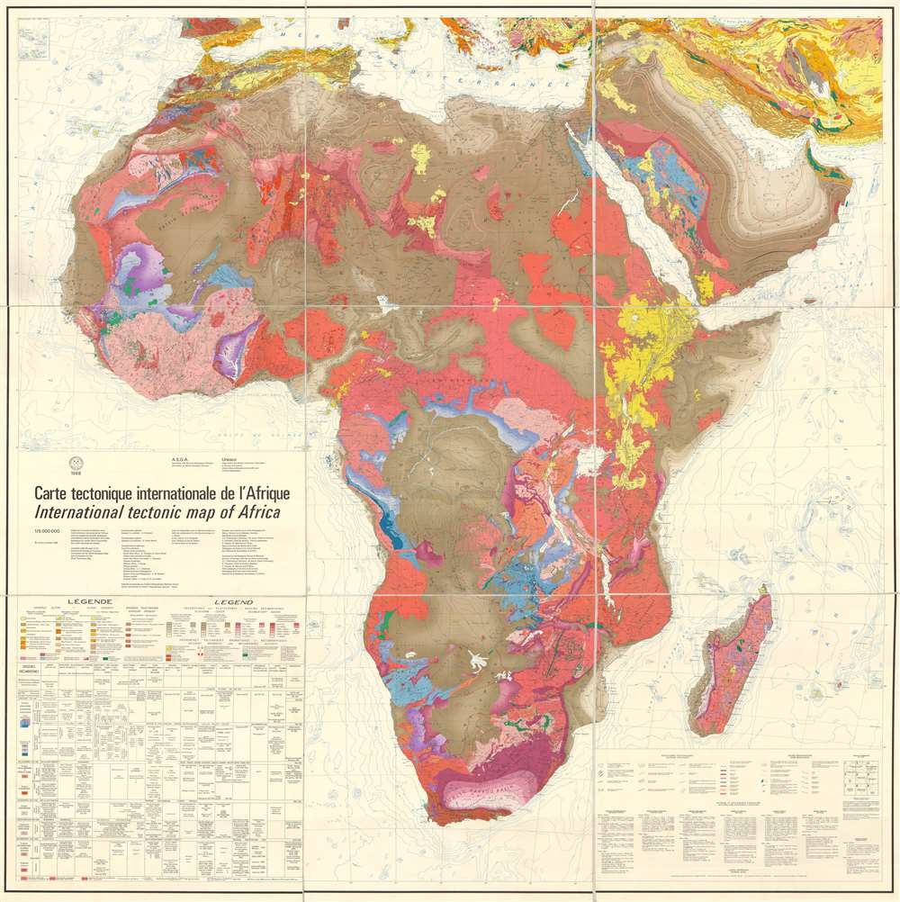
Carte tectonique internationale de l'Afrique. / International tectonic map of Africa.
sold
- Digital Map Information
- Suitable for large format printing
- File Size: 1048.02 MB
- File Type: ZIP / TIFF
- ICC color profile embedded
- Delivered instantly via download link
This is a 1968 Association des Services Géologiques Africains (Association of African Geological Surveys) and UNESCO tectonic map of Africa. The map depicts the continent from the Atlantic Ocean to the Gulf of Oman, the Arabian Sea, and the Indian Ocean and from ... (more details)
Scarce 1929 Map of Prehistoric Canals of Phoenix, Tempe and Scottsdale, AZ
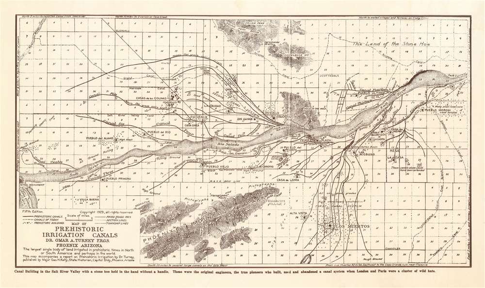
Map of Prehistoric Irrigation Canals. Dr. Omar A. Turney F.R.G.S. Phoenix, AZ
sold
- Digital Map Information
- Suitable for large format printing
- File Size: 9.24 MB
- File Type: ZIP / TIFF
- ICC color profile embedded
- Delivered instantly via download link
This 1929 Omar Turney map of regional Phoenix, Arizona shows the results of exhaustive surveys cataloguing Hohokam canal systems in the Salt River Valley. Constructed with hand tools over the span of several hundred years as far back as 600 C.E., this canal system is the largest pre-industrial irrigation system in the Western Hemisphere. Major canals in the system extended as far as twelve miles in length. They were remarkably sophisticated, tapered to maintain a constant velocity of water along their length, and varied in construction to suit changes in terrain. They remained useful for a millennium: Spanish explorers found modern Pima using some of these canals as recently as the 18th century. Turney’s astonishment and respect for the accomplishments of these ancients is evident in the text of the map:
These were the original engineers, the true pioneers who built, used and abandoned a canal system when London and Paris were a cluster of wild huts.Truly remarkable. (more details)
First Map of Iceland to Improve on Olaus Magnus
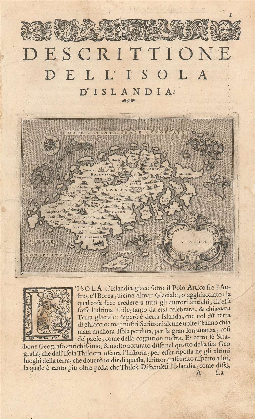
Islanda.
sold
- Digital Map Information
- Suitable for large format printing
- Full resolution TIFF file
- ICC color profile embedded
- Delivered instantly via download link
Tommaso Porcacchi's 1572 map of Iceland, in a beautiful early issue with a bold, sharp strike. It is the first separate map of Iceland to improve upon the cartography handed down from the venerable 1539 Olaus Magnus Carta Marina, whose Iceland data was reproduced by several mapmakers of the La Freri school without improvement. This map - elegantly engraved by Girolamo Porro for Porcacchi's isolario - starts with the Iceland of Magnus' Carta Marina but corrects the locations of many features. For example, the see of Hólar (Holensis) has been moved to its right place in the north, and Skálholt (Scalholdin) is correctly located in the south. Both of these locations were important in recent Icelandic history: Hólar had been the see of Jón Arason, the last Catholic bishop of Iceland. During the Reformation, it was to Skálholt that Arason and his two sons were taken and beheaded. Not all of Porcacchi's additions were well-advised; a few items have been taken from the wildly inventive Zeno map, including the seven islands appearing off the east coast. (more details)
1734 Map of the Holy Land.with Beautifully Engraved Bible Scenes
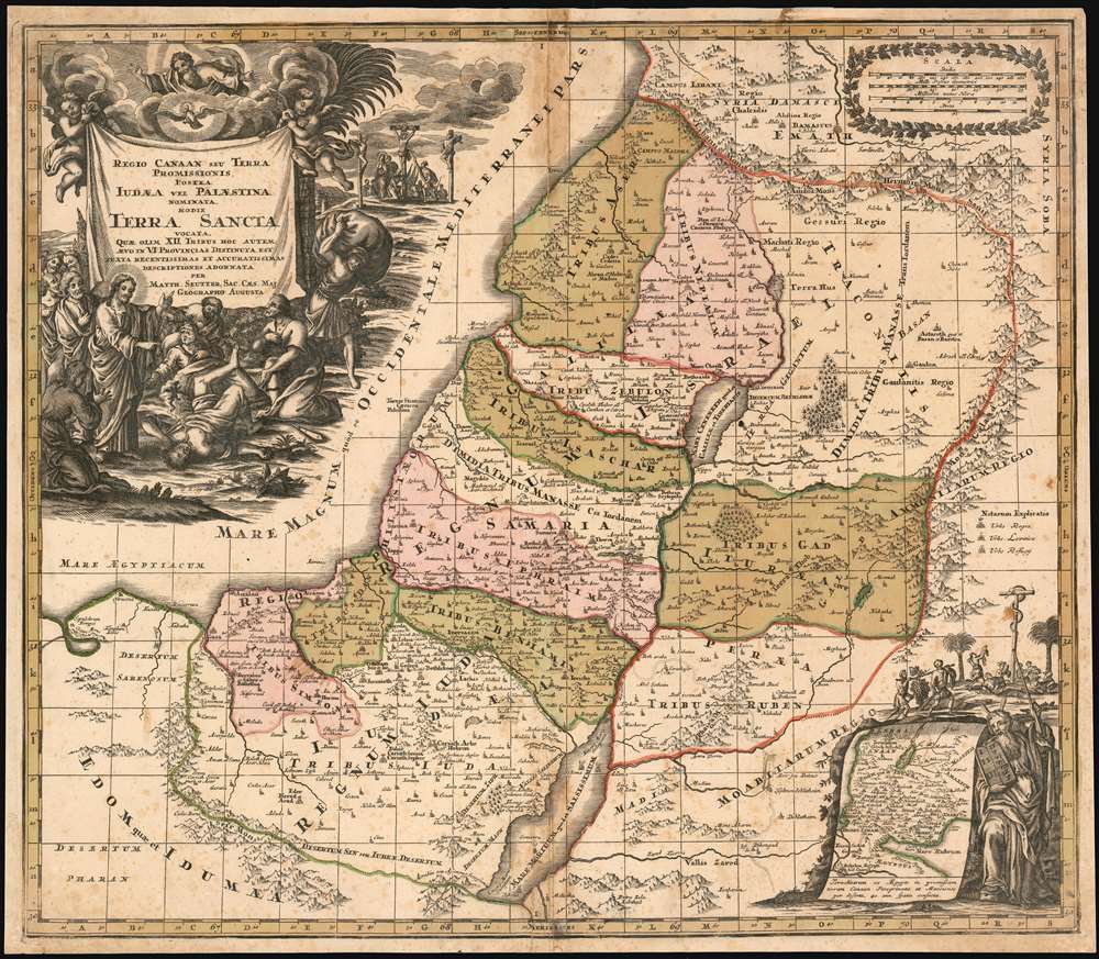
Regio Canaan Seu Terra Promissionis, Postea Iudaea Vel Palestina Nominata, Hodie Terra Sancta Vocata : Quae Olim XII Hoc Autem Aevo In VI Provincias Distincta Est Iuxta Recentissimas et Accuraissimas Descriptiones Adornata Per Matth. Seutter, Sac. Caes. Maj. Geographo Augusta.
sold
- Digital Map Information
- Suitable for large format printing
- DPI: 600
- File Size: 36.81 MB
- File Type: ZIP / TIFF
- ICC color profile embedded
- Delivered instantly via download link
This 1734 Seutter map of the Holy Land reproduces the authoritative cartography of Nicolas Sanson with the bold, richly decorative cartouches of Seutter’s master engraver, Gottfried Rogg. The primary map shows Judaea, divided into the territories of the 12 Tribes. The tribal regions are distinguished from one another in rich, period wash and outline color. Mountains and forests are shown pictorially. The map uses a key to distinguish Royal Cities, Cities of Refuge, and Levite Cities from each other. It includes, also, cities the Bible records were destroyed: Sodom, Gomorrah, and Seboim. All of these can be found within the bounds of the Dead Sea. The superbly engraved cartouche shows a New Testament scene of Christ drawing a demon - appearing in the form of a wriggling, winged creature in a puff of smoke - out of the mouth of a possessed man, while a crowd of onlookers gasp in amazement. An inset map in the lower right shows the track of the Israelites out of Egypt and into Canaan: Moses appears to the right of the inset, and above is a depiction of Numbers 21:4-9 in which the Israelites gather close to a brazen serpent, set up by Moses to protect them from the flying fiery serpents assailing them. The presence of this allegory here is not accidental: it is placed in support of the crucifixion scene appearing in the background of the main cartouche (in John 3:14-16 an explicit comparison was drawn between the raising of the Brazen Serpent and the Crucifixion.) (more details)
A wonderful pictorial map of Washington State created by a celebrated woman artist.
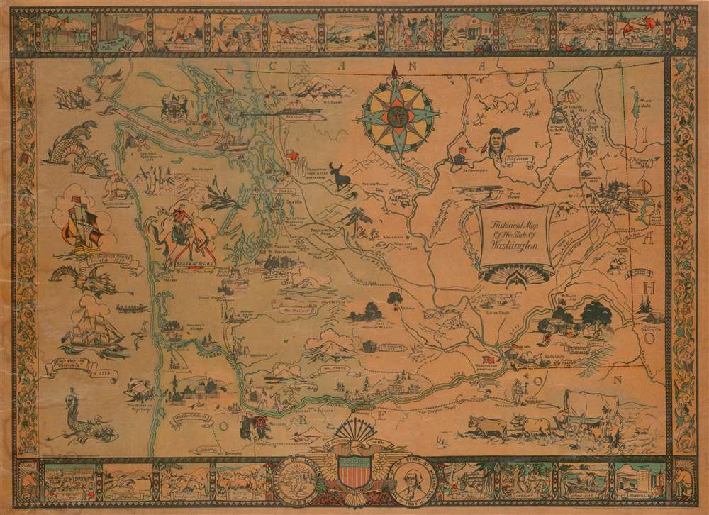
Historical Map of the State of Washington.
sold
- Digital Map Information
- Suitable for large format printing
- File Size: 42.62 MB
- File Type: ZIP / TIFF
- ICC color profile embedded
- Delivered instantly via download link
This is a 1931 Bertha Ballou pictorial map of Washington State tracing historical events around the state. The map depicts the region from the Pacific Ocean to Idaho and from Canada to Oregon and includes views of several of Washington's well-known mountain peaks, including Mt. Saint Helens and Mt. Rainier. Beginning with the arrival of Sir Francis Drake in 1579, Ballou identifies key events in the history of the region, such as the 1855 gold rush, the arrival of Vancouver, and battles all across the state. One such event, the 1847 Whitman massacre, is illustrated by a vignette in the lower right quadrant. The Whitman massacre, as it has become known, was the murder of missionaries Marcus Whitman, his wife Narcissa, and eleven others by Cayuse Indians, and is one of the most notorious episodes in the history of the American settlement of the Pacific Northwest. The incident sparked the Cayuse War, which raged until 1855.
Historical forts are illustrated in profile, including Fort Nisqually which was a Hudson's Bay Company post, Fort Astoria (in Oregon), and Fort Walla Walla, all of which are labeled and the date they were established given. Seattle, Tacoma, Spokane, and Olympia are labeled, with Olympia marked by a vignette of the State Capital. The rail lines of the Northern Pacific Railroad; Chicago, Milwaukee, St. Paul, and Pacific Railroad; the Oregon Railroad and Navigation Company; and the Spokane, Portland, and Seattle Railway are illustrated and identified. Other vignettes include an illustration of a covered wagon being pulled by a team of oxen, a cowboy riding a bronco, and the Grand Coulee. The whole is surrounded by a pictorial border consisting of views of historical events along with common sights around Washington. (more details)
Historical forts are illustrated in profile, including Fort Nisqually which was a Hudson's Bay Company post, Fort Astoria (in Oregon), and Fort Walla Walla, all of which are labeled and the date they were established given. Seattle, Tacoma, Spokane, and Olympia are labeled, with Olympia marked by a vignette of the State Capital. The rail lines of the Northern Pacific Railroad; Chicago, Milwaukee, St. Paul, and Pacific Railroad; the Oregon Railroad and Navigation Company; and the Spokane, Portland, and Seattle Railway are illustrated and identified. Other vignettes include an illustration of a covered wagon being pulled by a team of oxen, a cowboy riding a bronco, and the Grand Coulee. The whole is surrounded by a pictorial border consisting of views of historical events along with common sights around Washington. (more details)
Makes an effort at preparing the American people for a long, bloody war in the Pacific against Japan.
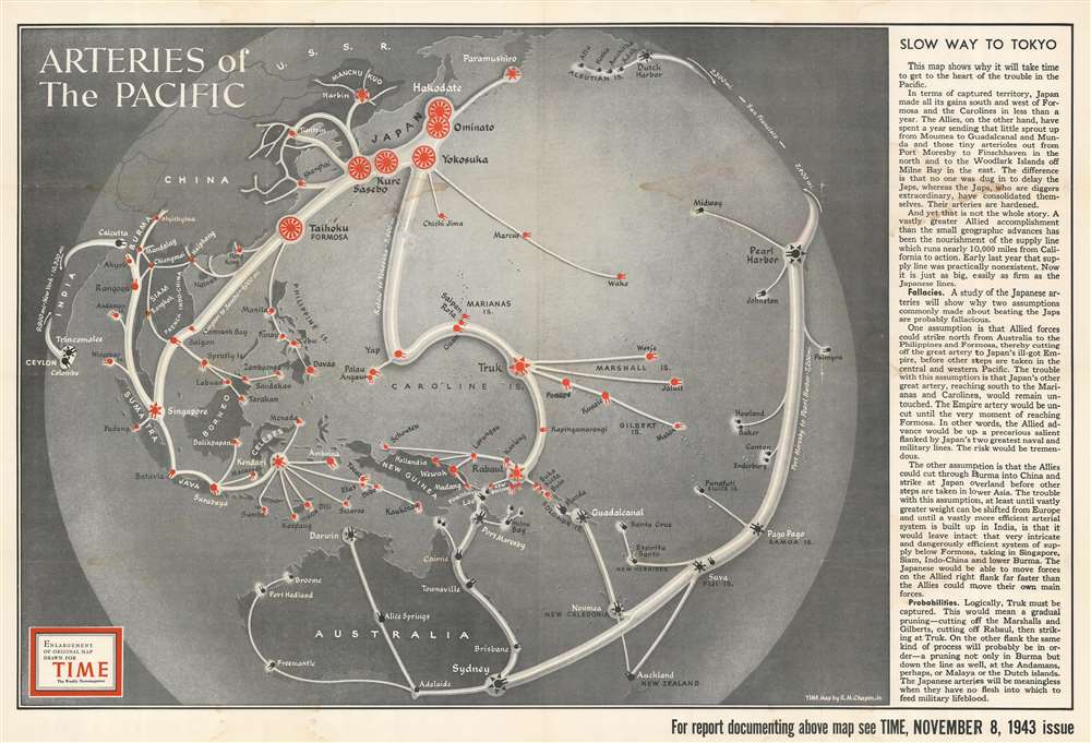
Arteries of the Pacific.
$400.00
Acquire
- Digital Map Information
- Suitable for large format printing
- File Size: 137.12 MB
- File Type: ZIP / TIFF
- ICC color profile embedded
- Delivered instantly via download link
This is an enlarged, separate issue version of a 1943 Robert M. Chapin, Jr. pictorial map of the Pacific Ocean fortifications and supply routes at the height of the Pacific War during World War II. Wonderfully compiled, the map depicts the region from India to Hawaii and from Kamchatka and the Aleutian Islands to Australia and New Zealand. Concise and clear iconography is used to delineate both American and Japanese fortifications and supply lines, allowing viewers to easily comprehend the strategic reality of the Pacific War. Icons in the shape of shore guns mark the fortified locations of both Japan and the United States, with white 'arteries' connecting them all. Moreover, a very frank text along the right border explains in no uncertain terms why the Pacific campaign has been so much more difficult for the Americans than it was for the Japanese in late 1941 and the first half of 1942. One of the many important factors in the relating to the American advance pointed out the reality of a 10,000-mile supply line between where combat was taking place and the California coast. The establishment and protection of this 'artery' was essential. Another such factor was that the Japanese had the advantage of attacking unfortified positions, while the Americans, in order to roll back Japan's conquests, had to land troops on beachheads on heavily fortified islands. (more details)
A detailed map of Sindh Province in Pakistan, a province which borders India.

Sind.
sold
This is a 1981 Anis Ali Syed and Survey of Pakistan map of Sindh Province in southeastern Pakistan, one of the four provinces of Pakistan. The map depicts the region from Balochistan to India and from Alipur in Punjab Province to the Gulf of Kutch. Highly detailed, cities, towns, and villages are labeled throughout the province, including Karachi, Hyderabad, and Sukkur. Roads (illustrated in red) and railroads (marked in black) snake their way across the province, with differences between road grades and railroad gauges made evident by differences in notation, all of which are explained in the lower left corner. Telegraph lines, canals, swamps, and marshes are also indicated. The Mouth of the Indus River is illustrated in detail, as are ruins throughout the region. The border between Pakistan and India is marked by two solid green and orange lines next to each other. The sea route between Karachi and Bombay (Mumbai) is labeled, as is the route from Aden to Karachi. (more details)
Highlights the heroes, villains, and martyrs of Frontier Colorado.

Historic Colorado. A Map Locating Only a Few of the Many Adventures on the Frontier that Became Colorado.
sold
- Digital Map Information
- Suitable for large format printing
- File Size: 20.8 MB
- File Type: ZIP / TIFF
- ICC color profile embedded
- Delivered instantly via download link
This is a 1942 Victor Drake pictorial map of Colorado tracing its frontier history. The map depicts the state from the Utah border to the Kansas and Nebraska borders and from the Wyoming border to the New Mexico border, although none of the neighboring states are identified. (more details)
Depicts the Penobscot River from Belfast to Bangor.
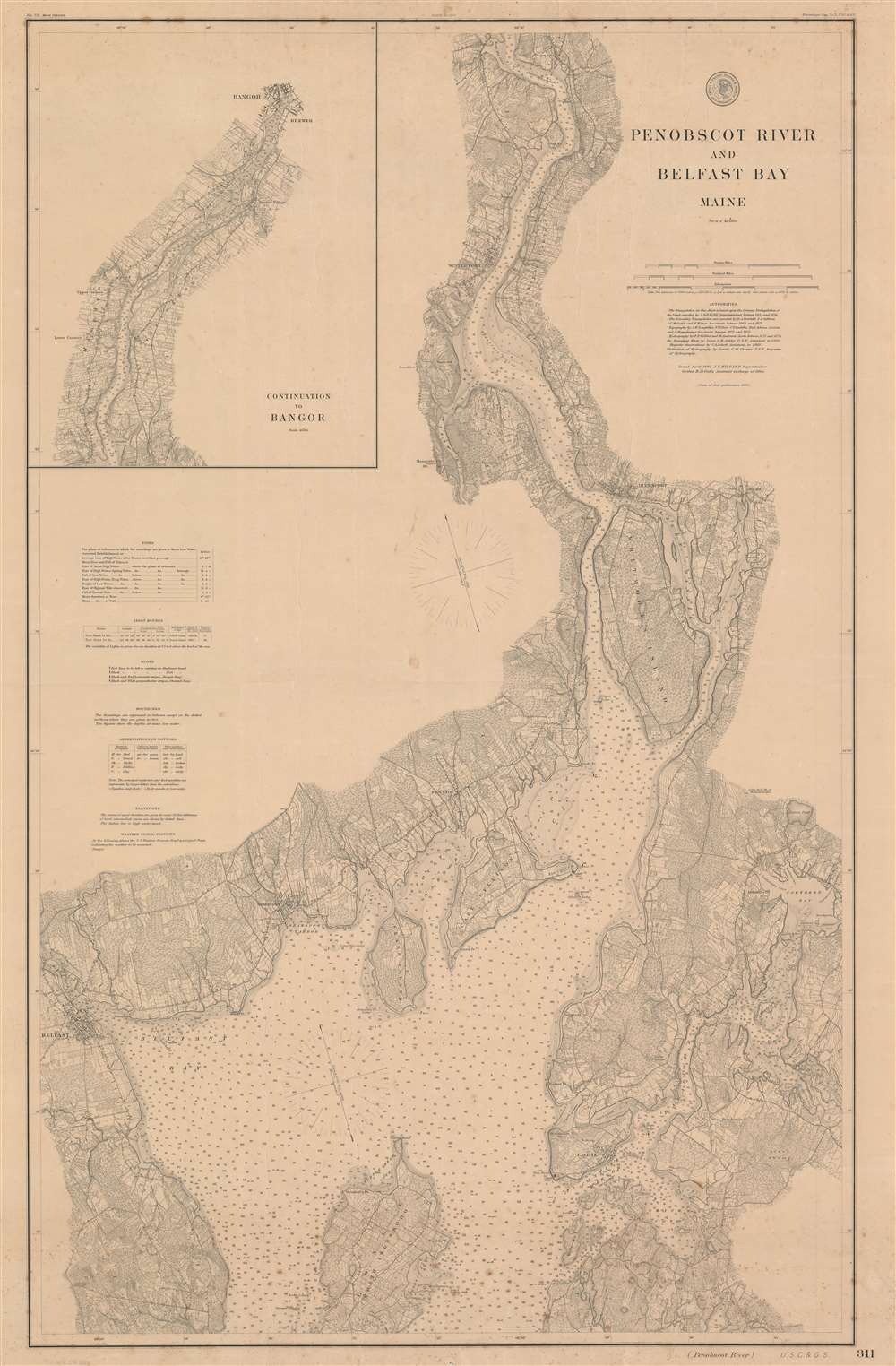
Penobscot River and Belfast Bay Maine.
sold
- Digital Map Information
- Suitable for large format printing
- File Size: 66.29 MB
- File Type: ZIP / TIFF
- ICC color profile embedded
- Delivered instantly via download link
This is an 1892 U.S. Coast and Geodetic Survey nautical chart or maritime map of the Penobscot River and Belfast Bay in Maine. The map depicts the region from Belfast to Northern Bay and Pierce's Pond and from Bald Hill Cove to Sabbath Day Harbor, with an inset situated in the upper left corner illustrating the river from just below Smith's Cove to Bangor. Highly detailed, myriad depth soundings are indicated throughout, including up the Belfast River and the Bagaduce River. Cities and towns throughout the region are labeled, including Bangor, Brewer, Hampden, Winterport, Bucksport, Orland, Stockton, Castine, Searsport, and Belfast. Roads snake their way across the landscape and topography is noted by topographical lines. Points, capes, coves, and bays are labeled all along the coast and the riverbank, allowing for their identification while navigating the river and bay. (more details)
Highlights Germany's desire to regain its African colonies - and depicts the Anschluss, Germany's annexation of Austria.
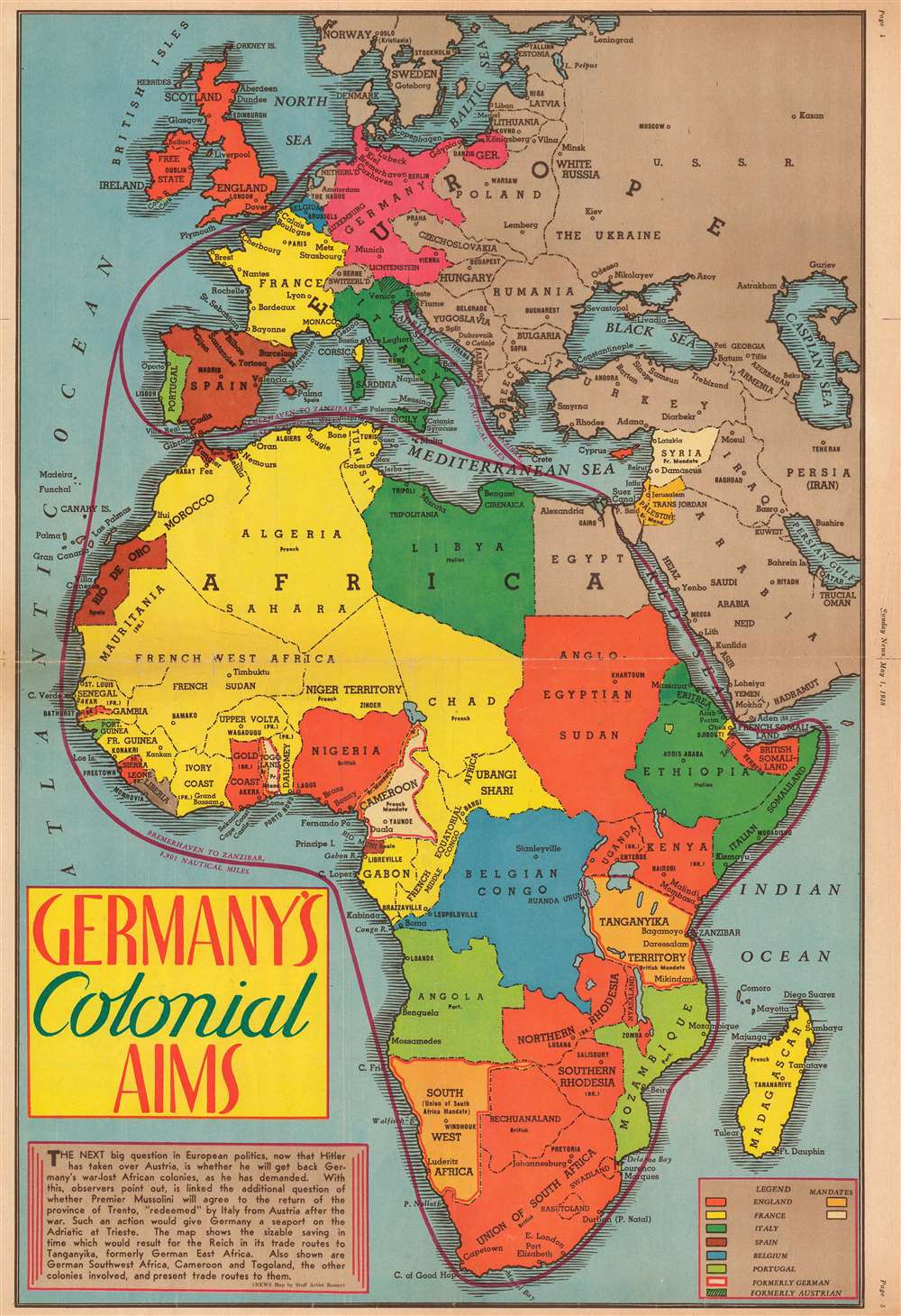
Germany's Colonial Aims.
sold
- Digital Map Information
- Suitable for large format printing
- File Size: 27.91 MB
- File Type: ZIP / TIFF
- ICC color profile embedded
- Delivered instantly via download link
This is a 1938 Jack Romer map of Africa highlighting various world power's colonial possessions throughout the continent only a year before the outbreak of World War II. The map depicts the region from the Atlantic Ocean to the Soviet Union and the Indian Ocean and from Norway to the Cape of Good Hope. Romer uses different colors to differentiate between the colonial holdings of seven different world powers: England, France, Italy, Spain, Belgium, Portugal, and Germany, although Germany lost its African colonies as a result of the Treaty of Versailles which ended World War I. (more details)