
First mapping of pan-European wine production.

Weinkarte von Europa.
$2,000.00
Acquire
- Digital Map Information
- Suitable for large format printing
- Full resolution TIFF file
- ICC color profile embedded
- Delivered instantly via download link
This is Wilhelm Hamm's 1871 infographic map of Europe illustrating wine production, considered a cartographic masterpiece in the illustration of viticulture. According to Petermann, writing when this map was published, 'to our knowledge, the cultivation of viticulture throughout Europe has never been attempted to be presented in such completeness and with such detail.' (our translation, 'Prospectus') (more details)
First Edition 'BREM' map of Middle Earth!

Middle Earth.
sold
An example of one of the most iconic J. R. R. Tolkien 'Middle Earth' maps - the 1965 first edition poster-map issued to promote Ballentine's first American issue of the Lord of the Rings, featuring the illustrations of Barbara Remington. (more details)
Education for Civic Virtue in the Reconstruction Era.

God Bless Our School.
sold
- Digital Map Information
- Suitable for large format printing
- File Size: 9.8 MB
- File Type: ZIP / TIFF
- ICC color profile embedded
- Delivered instantly via download link
This is a scarce 1874 Currier and Ives lithograph extolling the value of education and its importance for inculcating patriotism and civic virtue. (more details)
Texan Take on Steinberg's 'View of the World from 9th Avenue'.

Austin.
sold
This is Joe Waldon's autographed 1983 pictorial view of Austin, Texas, in the Steinberg style. Emphasizing local landmarks and culture, the view is a Texan spoof of Saul Steinberg's iconic 1976 drawing, 'The World from 9th Avenue.' (more details)
Native American History with unique Teacher's Kit Supplement.

Indians of the U.S.A.
sold
- Digital Map Information
- Suitable for large format printing
- Full resolution TIFF file
- ICC color profile embedded
- Delivered instantly via download link
This is a 1944 Louise E. Jefferson pictorial map of the United States illustrating the historic home regions of Native American tribes. In addition to the map, the teacher's kit that accompanied it is also present, including additional maps, student exercises, and sheets of supplementary information. (more details)
Second Issue of Foundational Map of the American West.
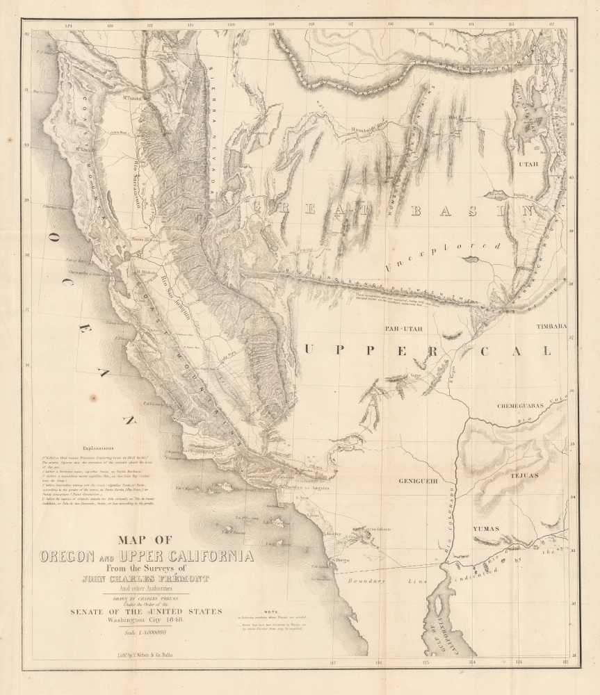
Map of Oregon and Upper California From the Surveys of John Charles Frémont And other Authorities.
sold
- Digital Map Information
- Suitable for large format printing
- File Size: 17.01 MB
- File Type: ZIP / TIFF
- ICC color profile embedded
- Delivered instantly via download link
This is the c. 1850 second issue of John C. Frémont and Charles Preuss' seminal 1848 map of the American West, often considered the first accurate mapping of the vast region between the Rocky Mountains and the Pacific Ocean. Although smaller than the 1848 map on which it is based (UpperCaliforniaOregon-fremont-1848), being later, this issue was also able to include some information not on the original. (more details)
Striking Old Color.

Vermont. From Actual Survey.
sold
- Digital Map Information
- Suitable for large format printing
- File Size: 9.31 MB
- File Type: ZIP / TIFF
- ICC color profile embedded
- Delivered instantly via download link
This is the second state of the first atlas map of Vermont published in the United States, here in striking original color. This 1814 work was drawn and engraved by Amos Doolittle for Matthew Carey's Carey's General Atlas. (more details)
New York City of the Roaring Twenties.

View of New York and Vicinity Showing Good Automobile Roads.
sold
- Digital Map Information
- Suitable for large format printing
- File Size: 44.33 MB
- File Type: ZIP / TIFF
- ICC color profile embedded
- Delivered instantly via download link
This is an engaging 1928 birds-eye view map of New York City and vicinity by George J. Nostrand. Brightly colored and evocative, the view presents New York City and its surrounds at the height of 'the Roaring Twenties.' As the title suggests, it was meant to highlight the most auto-friendly of New York City’s roads during an era in which the automobile was still a relative novelty and the outer boroughs not yet fully developed. Ferry routes are prominently shown, and the East River is spanned by the Brooklyn, Manhattan, Williamsburg and Queensboro Bridges. All five New York City Boroughs are represented, and the map encompasses Westchester County, Bergen County and Nassau County in Long Island. In addition to major roads, the map details specific neighborhoods, the character of their development and topography beautifully rendered. Individual landmarks, buildings and bridges are illustrated throughout, including the Statue of Liberty, Ellis Island, Grand Central, Madison Square Garden, Museum of Natural History, and Metropolitan Museum of Art. The harbor is full of ships while an airplane - in fact, Charles Lindbergh's Spirit of St. Louis - soars over Paterson. (more details)
A French Prince in the American Civil War.

Pamlico Sound (Caroline du Nord).
sold
- Digital Map Information
- Suitable for large format printing
- File Size: 9.6 MB
- File Type: ZIP / TIFF
- ICC color profile embedded
- Delivered instantly via download link
This is a striking 1890 Dumas Vorzet map of the Pamlico Sound and Albemarle Sound, eastern North Carolina, issued to illustrate the scarce atlas volume of the French edition of the Prince Philippe d'Orléans' Histoire de la Guerre Civile en Amérique. (more details)
A Great Rarity of Great Beauty.

Palestinae sive Terre Sancte Descriptio.
sold
- Digital Map Information
- Suitable for large format printing
- File Size: 16.14 MB
- File Type: ZIP / TIFF
- ICC color profile embedded
- Delivered instantly via download link
This is an extremely rare, separately-issued 1565 map of the Holy Land, engraved and published by Giovanni Camocio. It is among a handful of maps based on the unobtainable 1538 map of Wolfgang Wissenburg, all rare, and one of the earliest printed maps to illustrate the path of the Exodus and to present in detail the geography of the Bible. The engraving captures the vivid imagery of its model, pictorially presenting the deserts and mountains of the Holy Land whilst marking out the stations of the Exodus (the itinerary given in Numbers 33.) Beyond its fascinating content and great rarity, this copperplate engraving presents itself in beautiful condition, with a bold, sharp strike and paper of a warm luminosity. (more details)
Van Santen's matchless coloring heightened with lavish gold gilt.

Haemisphaerium Stellatum Boreale cum Subiecto Haemisphaerio Terrestri.
$15,000.00
Acquire
- Digital Map Information
- Suitable for large format printing
- Full resolution TIFF file
- ICC color profile embedded
- Delivered instantly via download link
An exemplar regium of Andreas Cellarius's 1661 celestial map of the northern constellations with astounding Dirk Jansz Van Santen color. This chart stands out as an exemplary piece from a chart series long known for lavish presentation due both to fine engraving and the extraordinary colorwork of Van Santen. (more details)
Brahe's Model with Van Santen's matchless coloring heightened with lavish gold.

Planisphaerium Braheum Sive Structura Mundi Totius Ex Hypothesi Tychonis Braehi In Plano Delineata.
$15,000.00
Acquire
- Digital Map Information
- Suitable for large format printing
- Full resolution TIFF file
- ICC color profile embedded
- Delivered instantly via download link
An exemplar regium of Andreas Cellarius' 1661 celestial chart depicting the Solar system after the fascinating model of Tycho Brahe, embellished with astounding Dirk Jansz Van Santen color and gilt illumination. (more details)
'Away! to the wilds of the far, far, west,
Which the foot of man hath never prest...'
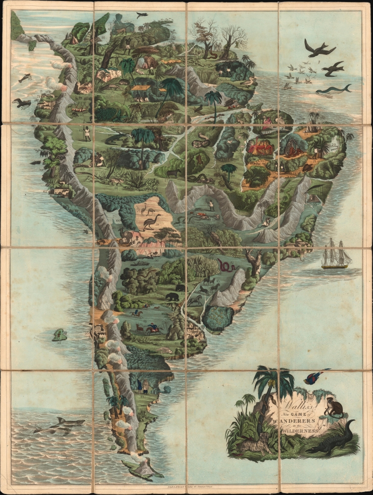
Wallis's New Game of Wanderers in the Wilderness.
sold
- Digital Map Information
- Suitable for large format printing
- File Size: 32.25 MB
- File Type: ZIP / TIFF
- ICC color profile embedded
- Delivered instantly via download link
This is Edward Wallis' striking 1844 gameboard and map of South America. The game encourages players to explore the flora and fauna of the continent, which the British public would have imagined as wild and untamed. (more details)
Best 18th-century map of Italy.
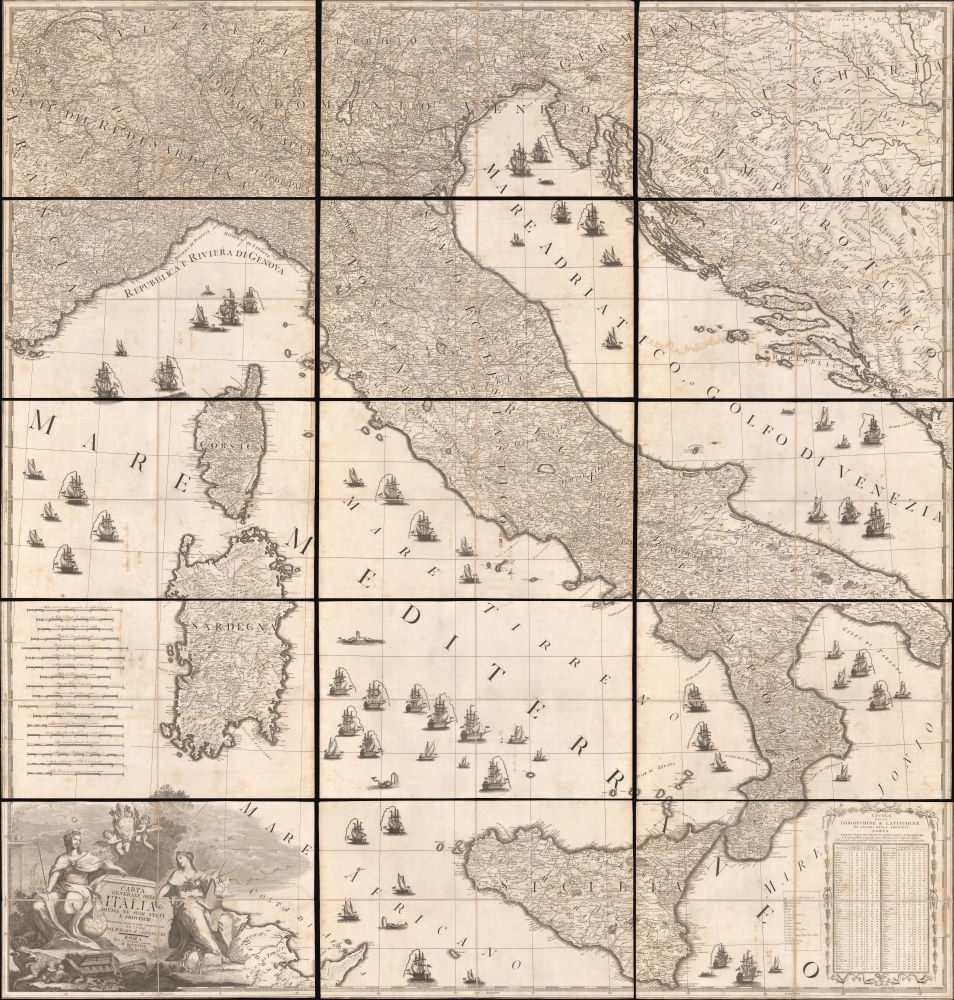
Carta Generale dell'Italia Divisa Ne' Suoi Stati e Provincie.
sold
- Digital Map Information
- Suitable for large format printing
- DPI: 600
- File Size: 791.29 MB
- File Type: ZIP / TIFF
- ICC color profile embedded
- Delivered instantly via download link
This is Giovanni Maria Cassini's monumental 1793 wall map of Italy. Considered the best map of Italy of the 18th century, this massive map is in 15 dissected sheets, each of which is sectionalized and laid on linen. Although Italy was an often-feuding network of loosely aligned kingdoms at this time, this map seems to suggest broad solidarity and emphasizes traditional hierarchical structures - likely a response to the ideals of the French Revolution (1789 - 1799) then destabilizing Europe. (more details)
First Admiralty Chart of Bermuda and the foundation of British Naval power in the archipelago.
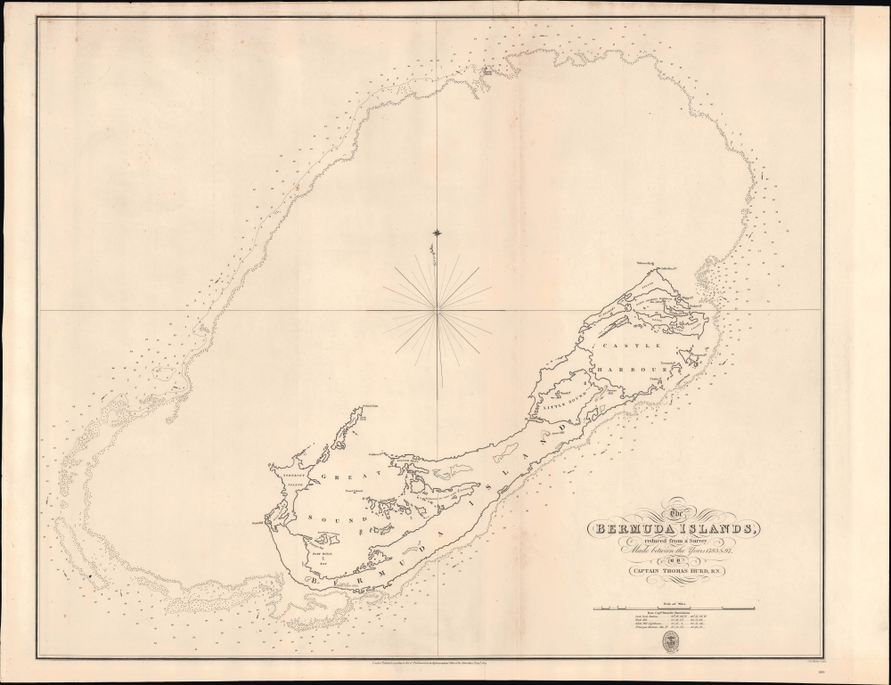
The Bermuda Islands reduced from a survey Made between the years 1783 and 97.
sold
- Digital Map Information
- Suitable for large format printing
- File Size: 25.19 MB
- File Type: ZIP / TIFF
- ICC color profile embedded
- Delivered instantly via download link
This is 1827 Thomas Hurd nautical map of Bermuda, the first chart of the archipelago produced by the British Admiralty. Headed by Royal Navy officer Thomas Hurd (later head of the Hydrographic Office), as well as a team of hydrographers, including local African-descended pilots, the survey took 9 years to complete and resulted in Bermuda's 19th-century development into Britain's premier naval base in the North Atlantic. (more details)
Japanese anti-Russia propaganda 'Octopus Map' of Asia.

A Humorous Diplomatic Atlas of Europe and Asia. / 滑稽欧亜外交地図 / Kokkei Ō-A Gaikō Chizu.
sold
- Digital Map Information
- Suitable for large format printing
- Full resolution TIFF file
- ICC color profile embedded
- Delivered instantly via download link
An example of the rare 1904 Kisaburō Ohara / Shingo Nakamura satirical 'Octopus Map' of Europe. The map celebrates the Japanese dominance in the ongoing Russo-Japanese war and was intended as a propagandistic message to both the Japanese and European readers. It is the second of 5 significant serio-comic maps issued in Japan during that war - the only such maps at that time issued outside of Europe. (more details)
Tulsa Oil Boom, Black Wall Street, Early Statehood.
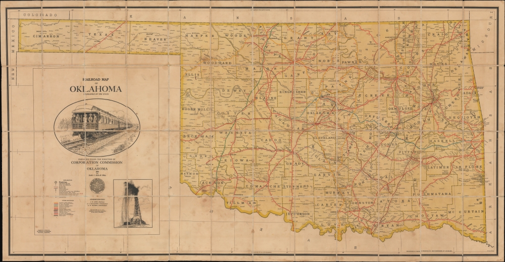
Railroad Map of Oklahoma.
sold
- Digital Map Information
- Suitable for large format printing
- File Size: 89.78 MB
- File Type: ZIP / TIFF
- ICC color profile embedded
- Delivered instantly via download link
This is a 1909 Woodward and Tiernan large-format folding railroad map of the State of Oklahoma at the peak of the Tulsa Oil Boom and just two years after Oklahoma became the 46th state. This was the era of Tulsa's 'Black Wall Street,' an unprecedented explosion of oil-driven African-American wealth centered around Tulsa. The map provides granular detail of the state's rail and oil infrastructure during this heady period. (more details)
First Complete Chart of the Strait of Magellan Based on Exploration.
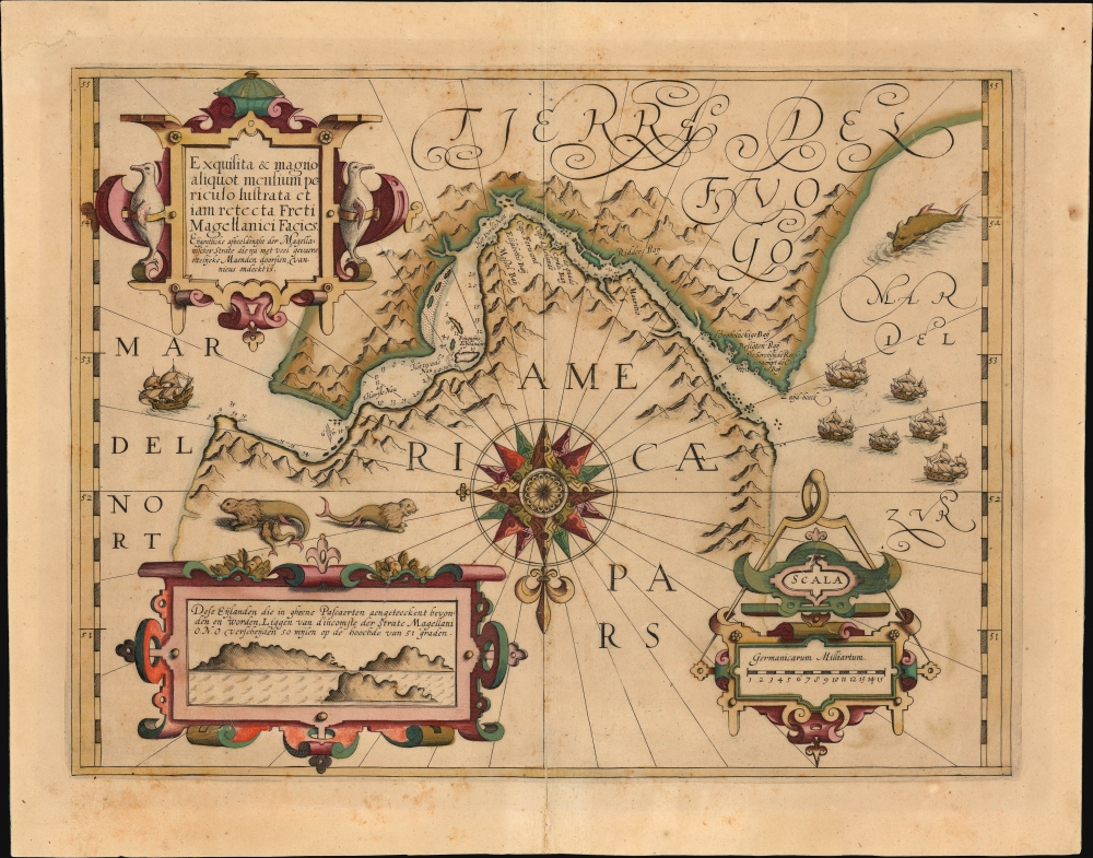
Exquisita et magno aliquot mensium periculo lustrata et jam retecta Freti Magellanici Facies.
sold
- Digital Map Information
- Suitable for large format printing
- Full resolution TIFF file
- ICC color profile embedded
- Delivered instantly via download link
This is a beautiful, original-color example of Jodocus Hondius' 1606/1613 map of the Strait of Magellan. It is one of the earliest charts specifically of the Strait, which was the only known westward communication between the Atlantic and the Pacific oceans at the time of its printing. (Le Maire and Schouten did not discover the Cape Horn route until 1619.) With its abundant depictions of animals, ships, and the mountainous terrain - not to mention a superb compass rose - this is among Jodocus Hondius' most visually engaging maps. (more details)
Early Days of Avalon and Catalina.
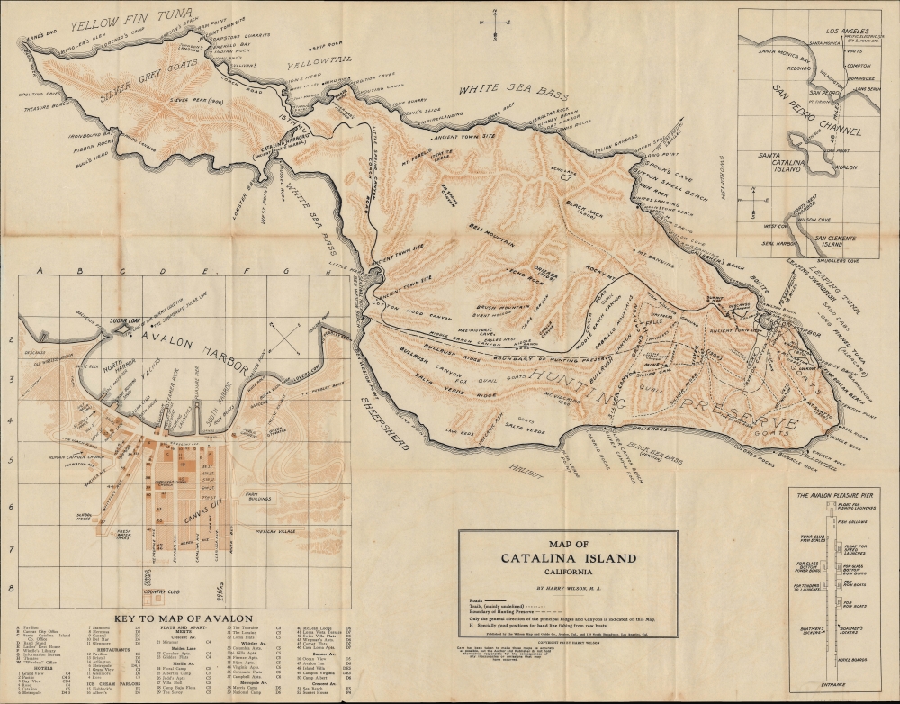
Map of Catalina Island California / Wilson's Map of Avalon and Catalina Island.
sold
- Digital Map Information
- Suitable for large format printing
- File Size: 27.57 MB
- File Type: ZIP / TIFF
- ICC color profile embedded
- Delivered instantly via download link
This is Harry Wilson's rare 1913 map of Avalon and Santa Catalina Island, near Los Angeles, California, published when the island was still in its early days as a weekend destination for Los Angelinos. It also captures the island and Avalon, in particular, on the eve of a devastating 1915 fire that destroyed much of the town. (more details)
Early Automobile Road Map of California.

For Index to Hotels, Garages, Trips.... [Bird's Eye View of Central California]
sold
- Digital Map Information
- Suitable for large format printing
- Full resolution TIFF file
- ICC color profile embedded
- Delivered instantly via download link
This is a chromolithograph pictorial bird's eye view of the San Francisco Bay Area prepared in 1913 by the Topographical Automobile Road Map Company and printed by H.C. Madison for the insurance company Aetna. Marking the dawn of the automobile revolution, this view underscores how automobiles, while still expensive, not-entirely-reliable, and limited by both their own engines and the existing road network, could make previously long and tortuous journeys quick and accessible. (more details)