
Humorous map of the United States 'bragging' about the importance of Arizona.
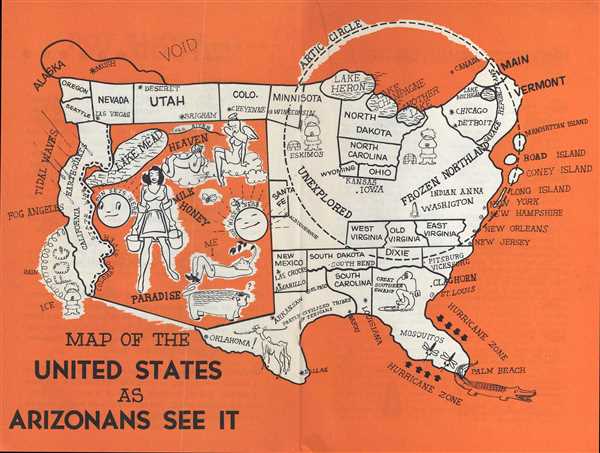
Map of the United States as Arizonans See It.
sold
- Digital Map Information
- Suitable for large format printing
- File Size: 1.4 MB
- File Type: ZIP / TIFF
- ICC color profile embedded
- Delivered instantly via download link
This is a 1947 Oren Arnold and Leigh St. John humorous pictorial map of the United States. The map depicts the continental United States (relatively speaking) from the Pacific Ocean to the Atlantic Ocean and from Canada to Mexico from an Arizonan's perspective. ... (more details)
One of the first atlases of the Philippines - created under the direction of a Jesuit priest.
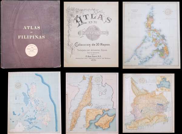
Atlas de Filipinas Colección de 30 Mapas. / Special Publication No. 3 Atlas of the Philippine Islands.
sold
This is a 1900 José María Algué atlas of the Philippines. The atlas consists of twenty-four maps of the Philippines and one map of the Pacific. Each map depicts a different aspect of the archipelago. Some of the maps in the atlas include an ethnographic and ... (more details)
An interesting 1876 reprint of a 1782 map of Manhattan.

City of New York. Surveyed by J. Hills, 1782. Re-Published by J. Disturnell. 1876.
sold
- Digital Map Information
- Suitable for large format printing
- Full resolution TIFF file
- ICC color profile embedded
- Delivered instantly via download link
This is an 1876 John Disturnell republication of a 1782 J. Hills city map or plan of New York City. The map depicts the lower half of Manhattan and a small part of Long Island, including Brooklyn. Most of Manhattan is undeveloped. Streets are labeled from the ... (more details)
Depicts the extensive rail network in Massachusetts, including the Old Colony Railroad to Cape Cod.
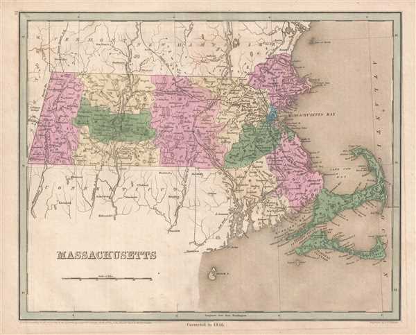
Massachusetts.
sold
- Digital Map Information
- Suitable for large format printing
- DPI: 300
- File Size: 4.7 MB
- File Type: ZIP / TIFF
- ICC color profile embedded
- Delivered instantly via download link
This is an 1846 Thomas G. Bradford map of Massachusetts. The map depicts the region from New York to the Atlantic Ocean and from Vermont and New Hampshire to Block Island. As is prevalent among many maps from Bradford's A Universal Illustrated Atlas , the ... (more details)
Illustrates the route of numerous railroads - and proposed railroads - in New Hampshire, including the never-built Wilton Railroad.

New Hampshire.
sold
- Digital Map Information
- Suitable for large format printing
- DPI: 300
- File Size: 3.9 MB
- File Type: ZIP / TIFF
- ICC color profile embedded
- Delivered instantly via download link
This is an 1846 Thomas G. Bradford map of New Hampshire. The map depicts the region from Vermont to Maine and from Quebec to Massachusetts. As is prevalent among many maps from Bradford's A Universal Illustrated Atlas , the recently constructed rail ... (more details)
Details the Presidential election of 1888 - one of the five Presidential elections in which the candidate elected President did not win the popular vote.
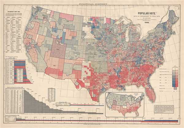
Popular Vote. Ratio of Predominant to Total Vote, by Counties.
sold
- Digital Map Information
- Suitable for large format printing
- File Size: 12.59 MB
- File Type: ZIP / TIFF
- ICC color profile embedded
- Delivered instantly via download link
This is a Fletcher W. Hewes and Charles Scribner's Sons political map of the United States. The map depicts the continental United States from the Pacific Ocean to the Atlantic Ocean and from the Canadian border to the border with Mexico. ... (more details)
Created by one of the premier geographers and surveyors in British India.

Orographical Map of Afghanistan and Baluchistan.
sold
- Digital Map Information
- Suitable for large format printing
- File Size: 3.7 MB
- File Type: ZIP / TIFF
- ICC color profile embedded
- Delivered instantly via download link
This is a 1900 Sir Thomas Holdich map of Afghanistan and Pakistan. The map depicts the region from Iran (Persia) to India and from the Caspian Sea, Turkmenistan and Tajikistan (Russian Turkistan) to the Arabian Sea. Orographic maps are ... (more details)
Created to promote worldwide interest in space exploration and a manned mission to Mars.

An Explorer's Guide to Mars.
sold
This is a 1986 Planetary Society persuasive pictorial map of Mars. With a mission to both educate and persuade, this piece informs the viewer about the current state of Martian exploration by Earthlings (as of 1986, of course) in an ... (more details)
An essential map for Transmississippi and American Southwest collectors.

Spanish North America.
sold
- Digital Map Information
- Suitable for large format printing
- DPI: 300
- File Size: 16.57 MB
- File Type: ZIP / TIFF
- ICC color profile embedded
- Delivered instantly via download link
This beautiful 1814 map, along with Pinkerton's similar map, is most likely the most important large format English atlas map of the American Southwest to be produced in the 19th century. The map depicts Mexico from the Yucatan ... (more details)
One of the first maps to show Jedediah Smith's cartography. Also illustrates the Republic of Texas!
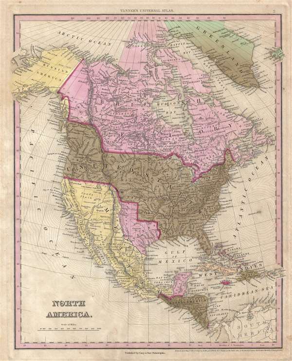
North America.
sold
- Digital Map Information
- Suitable for large format printing
- DPI: 300
- File Size: 7.29 MB
- File Type: ZIP / TIFF
- ICC color profile embedded
- Delivered instantly via download link
This is Tanner's rare 1845 map of North America showing the Republic of Texas at its fullest. The map cover all of North America, from the Arctic Circle, Greenland, and Alaska, to Mexico, Central America, the Caribbean, and ... (more details)
Illustrates the former Washington City Canal - now under Constitution Avenue.
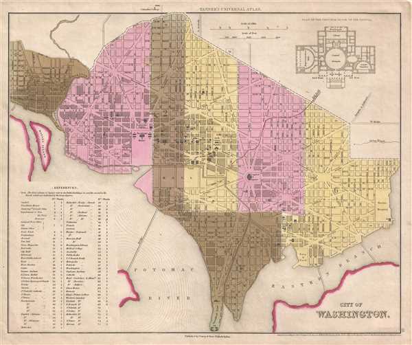
City of Washington.
sold
- Digital Map Information
- Suitable for large format printing
- DPI: 300
- File Size: 4.71 MB
- File Type: ZIP / TIFF
- ICC color profile embedded
- Delivered instantly via download link
This is an 1845 Henry Schenck Tanner map of Washington, D.C. published by Edward L. Carey and Abraham Hart. The map depicts the city from Georgetown and the Potomac River to the Marine Hospital and the Anacostia River and ... (more details)
Illustrates the Old CIty and the Temple Mount in detail.

Jerusalem Old and New.
sold
- Digital Map Information
- Suitable for large format printing
- File Size: 13.48 MB
- File Type: ZIP / TIFF
- ICC color profile embedded
- Delivered instantly via download link
This is a 1942 Steimatzky pictorial map of Jerusalem. The map depicts the city from Karem es Sila to El Tur and the Mount of Olives and from the Hadassa Medical Center, the Hebrew University and Mt. Scopus to Meqor Hayim. ... (more details)
Rare final Carey and Hart edition of Tanner's Florida.

Florida.
sold
- Digital Map Information
- Suitable for large format printing
- Full resolution TIFF file
- ICC color profile embedded
- Delivered instantly via download link
A fine example of the last state of the Carey and Hart edition of Tanner's 1845 map of Florida. Florida here is illustrated shortly after the Second Seminole War (1835–1842) in the year it became the 27th U.S. State. ... (more details)
Illustrates the newly-founded Isle Royale National Park - known as a 'camper's paradise'.

Isle Royale (The Majestic Island of Lake Superior). United States National Park.
sold
- Digital Map Information
- Suitable for large format printing
- File Size: 13.19 MB
- File Type: ZIP / TIFF
- ICC color profile embedded
- Delivered instantly via download link
This is a 1939 Elmer O. C. Krause pictorial map of Isle Royale, part of Isle Royale National Park. Depicting the whole of Isle Royale, an island in Lake Superior, the map depicts the region from Pie Island and Flatland ... (more details)
llustrates Nebraska from Iowa to Fremont's Peak.

Johnson's Nebraska, Dakota, Colorado, and Kansas.
sold
- Digital Map Information
- Suitable for large format printing
- File Size: 5.51 MB
- File Type: ZIP / TIFF
- ICC color profile embedded
- Delivered instantly via download link
From the 1862 Johnson and Ward edition of the Atlas , this is one of the rarest and most desirable states of the Johnson's Dakota, Nebraska and Kansas map. In this example, Nebraska is drawn with a long panhandle, ... (more details)
An entertaining map depicting a fictional town that was part of the Amos 'n' Andy radio show.

Eagle's Eye View of Weber City.
sold
- Digital Map Information
- Suitable for large format printing
- File Size: 10.41 MB
- File Type: ZIP / TIFF
- ICC color profile embedded
- Delivered instantly via download link
This is a 1935 Amos 'n' Andy map of Weber City. A high-class housing development created for the Amos 'n' Andy radio show, the map depicts Weber City from Amos Jones Alley to Van Porter Road and from the 'love nest ... (more details)
Rare map of Fuzhou illustrating postal districts.

Postal map of Foochow. / 福建省會郵圖
sold
- Digital Map Information
- Suitable for large format printing
- File Size: 16.48 MB
- File Type: ZIP / TIFF
- ICC color profile embedded
- Delivered instantly via download link
This is a scarce c. 1915 Chinese issue postal map of Fuzhou (Foochow), China. The map was issued by the Foochow Printing Bureau of the Treasury Department. While the map does include a fair amount of English, ... (more details)
One of the earliest obtainable English language maps to name the United States.
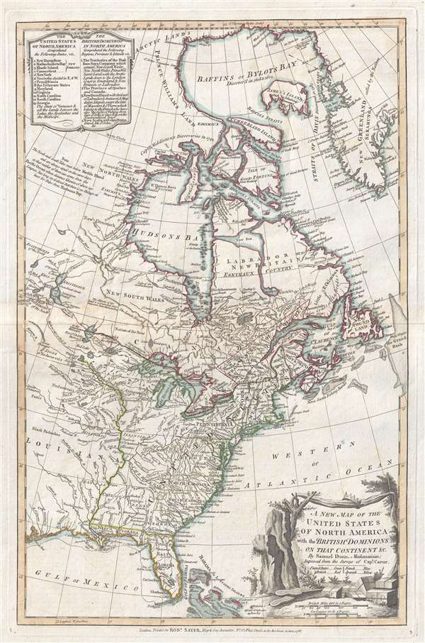
A New Map of the United States of North America with the British Dominions on that Continent…
sold
- Digital Map Information
- Suitable for large format printing
- DPI: 300
- File Size: 6.7 MB
- File Type: ZIP / TIFF
- ICC color profile embedded
- Delivered instantly via download link
This rare 1786 map of the United States by Samuel Dun and Robert Sayer is one of the earliest obtainable English maps to embrace the term 'United Sates.' The map was prepared by Samuel Dunn, a British ... (more details)
An incredible large scale naval chart of Gibraltar and the Bay of Gibraltar.
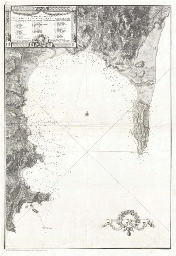
Plano Geométrico de la Bahia de Algeciras y Gibraltar.
sold
- Digital Map Information
- Suitable for large format printing
- DPI: 300
- File Size: 16.01 MB
- File Type: ZIP / TIFF
- ICC color profile embedded
- Delivered instantly via download link
An extremely rare large scale 1786 Spanish nautical chart detailing the Bay of Gibraltar and Gibraltar by the famed hydrographer Vincente Tofiño de San Miguel. The map depicts the Bay of Gibraltar ... (more details)
Attractive pictorial map advertising coach tours through South Florida.

Complete South Florida Tour on Great Florida Scenic Loop. Southern Tours, Inc.
sold
- Digital Map Information
- Suitable for large format printing
- File Size: 2.53 MB
- File Type: ZIP / TIFF
- ICC color profile embedded
- Delivered instantly via download link
This is a charming c. 1950 Southern Tours, Inc. pictorial map of southern Florida. The map depicts the region from Georgia to the Everglades and from the Atlantic Ocean to the Gulf of Mexico. Created ... (more details)