
Important Japanese Map of Singapore issued just after the WWII Battle of Singapore, considered by Churchill the 'worse disaster' in British Military History.
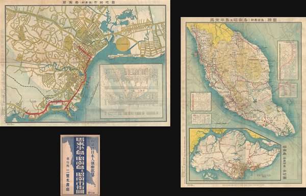
新嘉坡市街地圖 / Map of Singapore City. / Shingapōru shigai chizu. / 馬來半島旅行案内地圖 / Malay Peninsula Travel Map. / Marē Hontō ryokō annai chizu.
sold
- Digital Map Information
- Suitable for large format printing
- File Size: 40.55 MB
- File Type: ZIP / TIFF
- ICC color profile embedded
- Delivered instantly via download link
A very rare 1942 WWII (World War II) map of Singapore City and the Malay Peninsula (Malaysia) issued by the Singapore Japanese Club. Although the first edition of this map was issued in 1938, the present example dates to 1942, and was issued just after the Battle ... (more details)
Spectacularly detailed British Army map of Singapore and Malaysia.

Singapore and Johore Bahru.
sold
- Digital Map Information
- Suitable for large format printing
- File Size: 19.95 MB
- File Type: ZIP / TIFF
- ICC color profile embedded
- Delivered instantly via download link
This is a 1955 British War Office map of Singapore and Johor Bahru (Johore Bahru), # 4690. This map centers on the island of Singapore and depicts Johor Bahru and the surrounding areas of the extreme southern tip of the Malaysian peninsula. The border between ... (more details)
Hard to find early map of Kuala Lumpur!
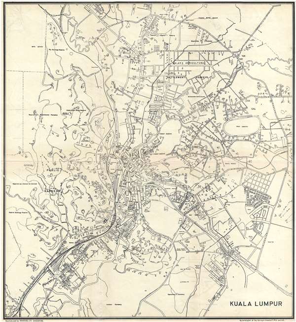
Kuala Lumpur.
sold
- Digital Map Information
- Suitable for large format printing
- File Size: 6.36 MB
- File Type: ZIP / TIFF
- ICC color profile embedded
- Delivered instantly via download link
A very uncommon 1933 map of Kuala Lumpur, the capital of Malaysia, issued by Printers Ltd. of Singapore. This map is centered on the Kuala Lumpur City Center and the modern day Central Market. It extends from the modern day Perdana Botanical Garden (Public ... (more details)
The first English publication of Muller's seminal map of the Arctic.
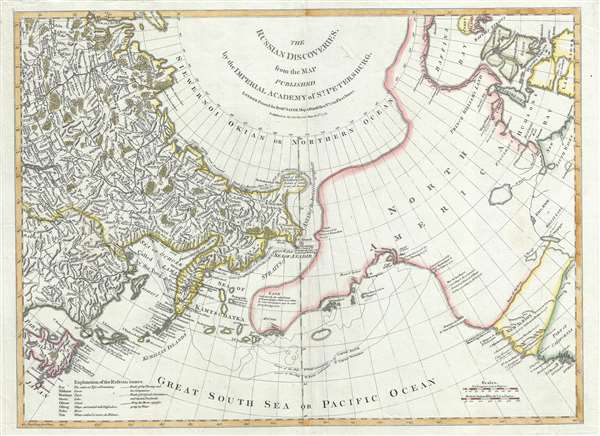
The Russian Discoveries, from the Map Published by the Imperial Academy of St. Petersburg.
sold
- Digital Map Information
- Suitable for large format printing
- DPI: 300
- File Size: 12.04 MB
- File Type: ZIP / TIFF
- ICC color profile embedded
- Delivered instantly via download link
A beautiful example of Robert Sayer's 1775 map of the Pacific Northwest, Alaska, the Bering Strait and Siberia, this is considered to be the first English edition of Fredrich Muller's seminal map. Issued after the seminal explorations of Vitus Bering ... (more details)
Uncommon map of Seranban, Malasia.

Seremban.
sold
- Digital Map Information
- Suitable for large format printing
- File Size: 5.03 MB
- File Type: ZIP / TIFF
- ICC color profile embedded
- Delivered instantly via download link
A very uncommon 1933 map of Seremban, Malaysia, issued by Printers Ltd. of Singapore. This map is centered on the government office and Cenotaph at Jabatan Pendidikan Negeri Sembilan and extends from Jalan Lobak to Jalan Ampangan. This map is based ... (more details)
One of the earliest views of Hamilton College.

Hamilton College.
sold
- Digital Map Information
- Suitable for large format printing
- File Size: 3.37 MB
- File Type: ZIP / TIFF
- ICC color profile embedded
- Delivered instantly via download link
This is an iconic c. 1908 view of the Hamilton College, Clinton, New York, by Richard Rummell. The view focused on the north side, or 'Stryker' part of Hamilton College's campus. It centers on the 1827 federal style Hamilton College Chapel. To the ... (more details)
Americana! New England school boy map of the world in manuscript.

The World. George Freeman Midsummer Age 13.
sold
- Digital Map Information
- Suitable for large format printing
- DPI: 300
- File Size: 7.25 MB
- File Type: ZIP / TIFF
- ICC color profile embedded
- Delivered instantly via download link
A very attractive manuscript schoolboy / schoolgirl map of the world executed by George Freeman, age 13, in or about 1830. The map covers the world on a Mercator Projection. Maps of this kind were made by school children, primarily in New England ... (more details)
The eariest known map of St. Paul, Minnesota.
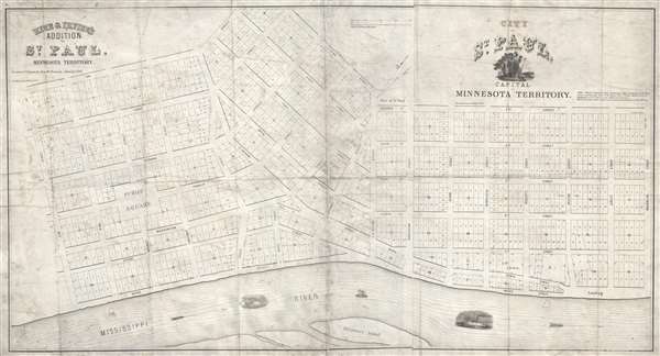
City of Saint Paul, Capital of Minnesota Territory. / Rice and Irvine's addition to St. Paul, Minnesota Territory.
sold
- Digital Map Information
- Suitable for large format printing
- Full resolution TIFF file
- ICC color profile embedded
- Delivered instantly via download link
A rarity of extreme historical importance, this 1849 map by Benjamin Brunson is the earliest printed map of Saint Paul, Minnesota, and the original plat of the city. Centered on Seven Corners and Rice Park, this map covers the original 280 acres ... (more details)
Incudes the New England Globe Flag - one of the earliest illustrations of a purely American flag.
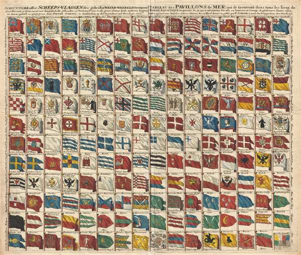
Schouw-park aller Scheeps-Vlaggen des geheelen Water-Waerelds . . . / Tableau des Pavillons de Mer, qui se trouvent dans tous les lieux du Monde Aquatique Augmente de 50 aui n ont jamais ete mis en lumiere . . . 1711.
sold
- Digital Map Information
- Suitable for large format printing
- DPI: 300
- File Size: 17.19 MB
- File Type: ZIP / TIFF
- ICC color profile embedded
- Delivered instantly via download link
A rare and exceptional 1711 flag chart by Petrus Schenk illustrating the ephemeral Globe Flag of New England, as well as the flags of various trading companies, including the Dutch East India Company (VOC, Verenigde Oostindische Compagnie ) and ... (more details)
A map and view of Florence centered on Brunelleschi's Dome!
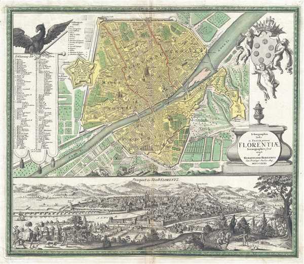
Ichnographia Urbis in Tuscia primariæ Florentiae. Scenographice.
sold
- Digital Map Information
- Suitable for large format printing
- DPI: 300
- File Size: 20.44 MB
- File Type: ZIP / TIFF
- ICC color profile embedded
- Delivered instantly via download link
This is a 1731 Homann Heirs city map or plan of Florence, Italy. The map depicts the city of Florence from the Giovanni Citadel ( Cittadella di Giovanni ) to the Miniato Fortress ( Fortezza Miniato ) and from the city walls and the Porta Pinti ... (more details)
Depicts 'Gamaland', Lake Apalachy, and Lake Xarayes!

Totius Americae Septentrionalis et Meridionalis. Novissima Repraesentatio.
sold
- Digital Map Information
- Suitable for large format printing
- DPI: 300
- File Size: 11.47 MB
- File Type: ZIP / TIFF
- ICC color profile embedded
- Delivered instantly via download link
This is a 1720 Johann Baptiste Homann map of North and South America. The map depicts from the Pacific Coast of North and South America to Spain, France, and the Atlantic coast of Africa and from northern Canada and Greenland to Tierra del ... (more details)
Very rare nautical chart of Cape Breton Island - notes lighthouses and lightboats!
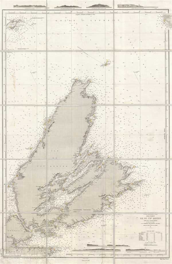
Océan Atlantique Nord. Golfe St. Laurent. Ile du Cap Breton.
sold
- Digital Map Information
- Suitable for large format printing
- File Size: 27.59 MB
- File Type: ZIP / TIFF
- ICC color profile embedded
- Delivered instantly via download link
This is a 1905 Dépôt des Cartes et Plans de la Marine nautical chart or maritime map of Cape Breton Island, Canada. It is extremelyt difficult to find any specific maps of Cape Breton Island, this being only the second we have seen in ... (more details)
Includes an inset map commemorating the D-Day invasion of Fortress Europe - June 6, 1944!
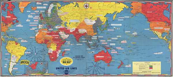
Dated Events War Map. Invasion Map of Fortress Europe. Commemorating D-Day June 6, 1944.
sold
- Digital Map Information
- Suitable for large format printing
- File Size: 14.59 MB
- File Type: ZIP / TIFF
- ICC color profile embedded
- Delivered instantly via download link
This is a 1944 Stanley Francis Turner world map detailing the events of World War II until mid-1944 specifically commemorating the Normandy landings on June 6, 1944. The map depicts the world from the Atlantic coast of North America and ... (more details)
Illustrates in detail the Waycross Short Line which cut travel time from Savannah to Jacksonville in half!

Map of the Savannah, Florida, and Western Railway and Connections. The Waycross Short Line to and from Florida and South Georgia the only line to All Winter Resorts.
sold
- Digital Map Information
- Suitable for large format printing
- File Size: 11.4 MB
- File Type: ZIP / TIFF
- ICC color profile embedded
- Delivered instantly via download link
This is very rare 1883 Rand McNally railroad map of the United States. The map depicts the continental United States from the Pacific Ocean to the Atlantic Ocean and from Washington, Idaho, Montana and Ontario and Quebec, Canada to ... (more details)
Fantastic separate issue example of this awesome chart!
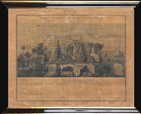
Tableau Pittoresque des Merveilles de la Nature.
$950.00
Acquire
- Digital Map Information
- Suitable for large format printing
- DPI: 300
- File Size: 4.52 MB
- File Type: ZIP / TIFF
- ICC color profile embedded
- Delivered instantly via download link
This is a separate issue c.1840 Aristide Michel Perrot comparative chart illustrating the wonders of the nature. The chart depicts 58 different numerically identified natural wonders occurring throughout the world. A table, ... (more details)
Incredible separate issue example of this beautiful chart!
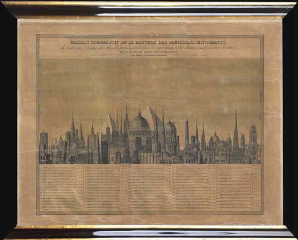
Tableau Comparatif de la Hauteur des Principaux Monuments de toutes les Parties du Monde, présentant leur Configuration, les details éxacts de leur élévation, et la Date de leur Construction.
$950.00
Acquire
- Digital Map Information
- Suitable for large format printing
- DPI: 300
- File Size: 5.24 MB
- File Type: ZIP / TIFF
- ICC color profile embedded
- Delivered instantly via download link
This is a separate issue c.1840 Aristide Michel Perrot comparative chart of the heights of the monuments of the world. The chart depicts 71 different numerically identified monuments located throughout the world, although ... (more details)
Stunning of upper Manahattan drawn to illustrate the Battle of Harlem Heights.
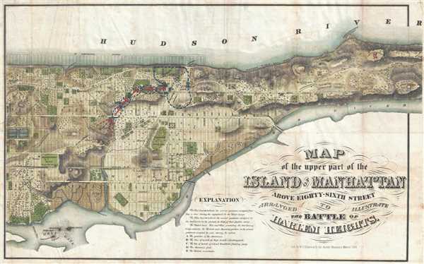
Map of the Upper Part of the Island of Manhattan above Eighty-Sixth Street Arranged to Illustrate the Battle of Harlem Heights.
sold
- Digital Map Information
- Suitable for large format printing
- File Size: 12.49 MB
- File Type: ZIP / TIFF
- ICC color profile embedded
- Delivered instantly via download link
A stunning and rare 1868 map of the northern part of the island of Manhattan, New York city by W. C. Rogers. The map depicts the upper part of Manhattan, above 86th street (including Morningside Heights, Manhattan ... (more details)
Manuscript color illustrates the various rail lines running in and around Washington, D.C.
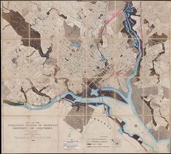
Map of the Permanent System of Highways District of Columbia.
sold
- Digital Map Information
- Suitable for large format printing
- File Size: 64.6 MB
- File Type: ZIP / TIFF
- ICC color profile embedded
- Delivered instantly via download link
This is a 1939 Surveyor of Washington, D.C. city map or plan of Washington, D.C. The map depicts the city from Dalecarlia Reservoir and the extreme northwestern portion of Rock Creek Park to Fort Dupont Park, Camp ... (more details)
Detailed map of southern Luzon during the Philippine-American War.

Southern Luzon. Showing Portion of Theatre of Operations. 8th Army Corps, Major General Elwell S. Otis, Commanding.
sold
- Digital Map Information
- Suitable for large format printing
- File Size: 11.78 MB
- File Type: ZIP / TIFF
- ICC color profile embedded
- Delivered instantly via download link
This is an extremely rare map of Southern Luzon, the Philippines, issued at the height of the Philippine-American War (1899 – 1902) by the Military Governor in the Philippines, Major General Elwell Stephen Otis ... (more details)
Entertaining pictorial map of the Hawaiian Islands!

Territory of Hawaii. / Samoa.
sold
- Digital Map Information
- Suitable for large format printing
- File Size: 2.71 MB
- File Type: ZIP / TIFF
- ICC color profile embedded
- Delivered instantly via download link
This is a 1935 Ruth Taylor White pictorial map or 'cartograph' of the Hawaiian Islands and Samoa. The map depicts the Hawaiian Islands of Hawaii, Maui, Molokai, Kahoolawe, Lanai, Oahu, Kauai, and part of Niihau. ... (more details)