
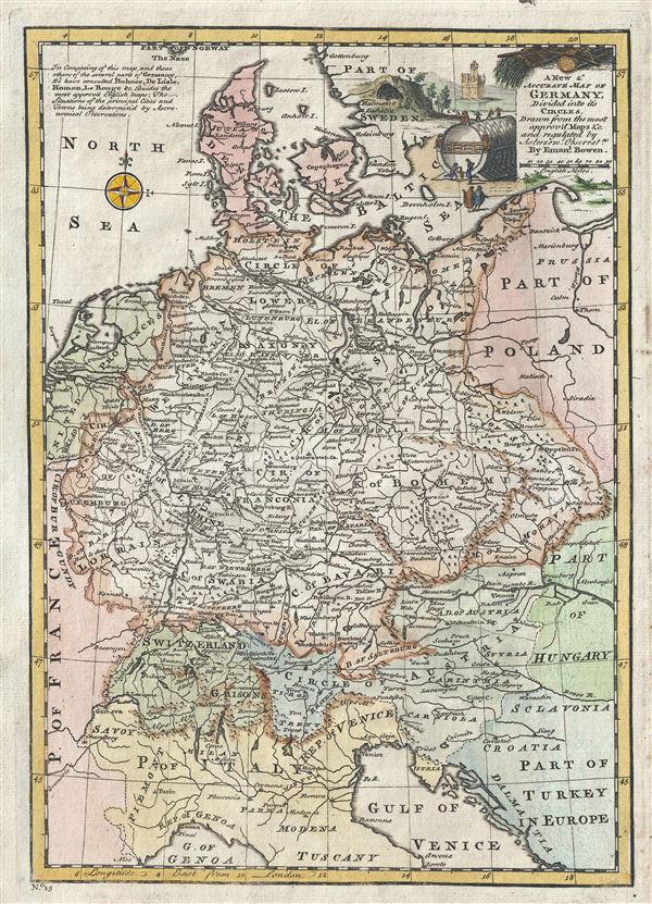
A New and Accurate Map of Germany Divided into its Circles.
sold
- Digital Map Information
- Suitable for large format printing
- DPI: 300
- File Size: 4.61 MB
- File Type: ZIP / TIFF
- ICC color profile embedded
- Delivered instantly via download link
This is a beautiful 1747 map of Germany by the British cartographer Emanuel Bowen. It covers Germany during the mid-18th century, which included all of modern day Germany, Austria, Switzerland, Czech Republic, the Netherlands, Denmark and parts of Eastern Europe. ... (more details)
1796 Collot Map of the Country of the Illinois (Mississippi River near Missouri, St. Louis, Illinois
The first published map of the St. Louis area.
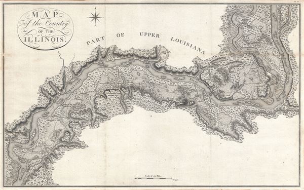
Map of the Country of the Illinois.
sold
- Digital Map Information
- Suitable for large format printing
- DPI: 300
- File Size: 13.95 MB
- File Type: ZIP / TIFF
- ICC color profile embedded
- Delivered instantly via download link
A map of 'superlative' rarity, this is Victor Collot's 1796 map of the Mississippi River in the vicinity of St. Louis, Missouri, or what at the time was known as the 'Country of the Illinois.' Focusing on the Mississippi River valley, this map covers from the ... (more details)
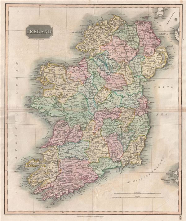
Ireland.
sold
- Digital Map Information
- Suitable for large format printing
- DPI: 300
- File Size: 3.7 MB
- File Type: ZIP / TIFF
- ICC color profile embedded
- Delivered instantly via download link
This is an attractive example of John Thomson's 1816 map of Ireland. The whole is beautifully engraved in the minimalist English style pioneered in the London and Edinburgh during early part of the 19th century. It depicts the entire Emerald Isle, divided ... (more details)
Scarce minature map of London.
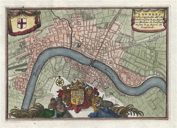
Londres Ville Capitalle de l'Angleterre.
sold
- Digital Map Information
- Suitable for large format printing
- DPI: 300
- File Size: 1.53 MB
- File Type: ZIP / TIFF
- ICC color profile embedded
- Delivered instantly via download link
An extremely attractive and finely engraved 1706 Daniel de La Feuille miniature map of London, England. Centered on the Thames River, La Feuille's map covers London from Shoreditch to Shadwell and from Lambeth to St. James Park. Saint Paul's Cathedral ... (more details)
Uncommon map naming the Sea of Korea.

Carte de la Province de Quan-tong ou Lyau-tong et du Royaume de Kau-Li ou Coree.
sold
- Digital Map Information
- Suitable for large format printing
- Full resolution TIFF file
- ICC color profile embedded
- Delivered instantly via download link
An uncommon c. 1748 map of Korea by Jacques Nicholas Bellin. Centered on the west coast of Korea (Corea), this map covers all of peninsular Korea as well as adjacent parts of Manchuria and China. Korea, as presented here takes on a trapezoidal form with ... (more details)
Unusual map of the west coast of South America and the Galapagos Islands.
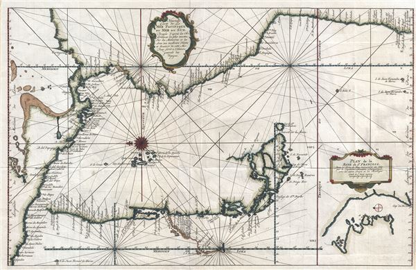
Nouvelle Carte de la Mer Pacifique, ou Mer du Sud.
sold
- Digital Map Information
- Suitable for large format printing
- Full resolution TIFF file
- ICC color profile embedded
- Delivered instantly via download link
An uncommon and unusual c. 1750 Jacques Nicholas Bellin map of the western coast of South America and Central America. Oriented to the east, this map illustrates the coast line from Acapulco, Mexico to Valparaiso, Chile. The map is continued via inset ... (more details)
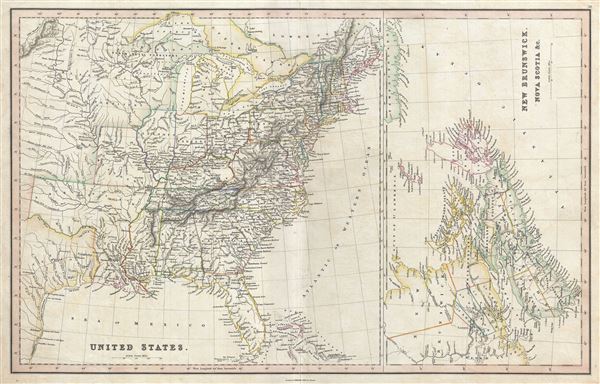
United States. New Brunswick, Nova Scotia etc.
sold
- Digital Map Information
- Suitable for large format printing
- DPI: 300
- File Size: 11.17 MB
- File Type: ZIP / TIFF
- ICC color profile embedded
- Delivered instantly via download link
A fine 1830 map of the United States and Canada by Charles Smith and Sons. Essentially two maps on the same sheet, the map on the left depicts United States as it existed in 1830, including the Missouri Territory, Arkansas Territory (spelled ... (more details)
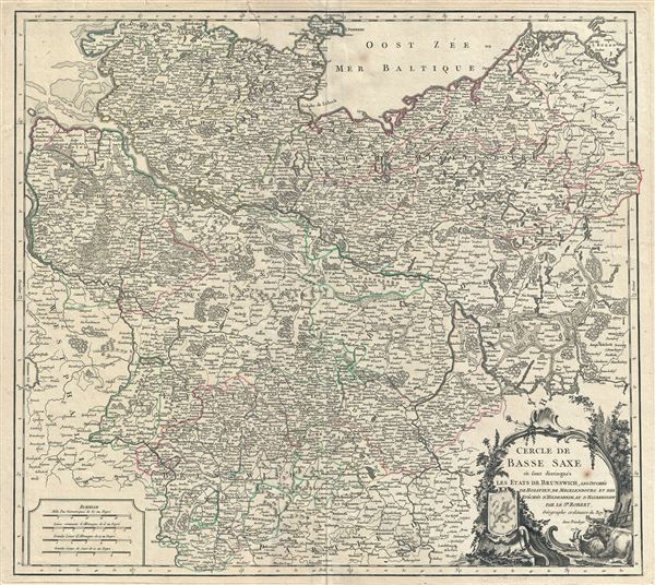
Cercle de Basse Saxe ou sont distingues les Etats de Brunswich, les Duches de Holstien, de Mecklenbourg et des Eveches d'Hildesheim, et d'Halberstadt.
sold
- Digital Map Information
- Suitable for large format printing
- Full resolution TIFF file
- ICC color profile embedded
- Delivered instantly via download link
This is a fine 1751 map of Lower Saxony, in what is now Central Germany by Robert de Vaugondy. As shown here, Lower Saxony was bordered by Denmark and the Baltic Sea to the north, Westphalia to the west, Pomerania to the Northeast, and the ... (more details)
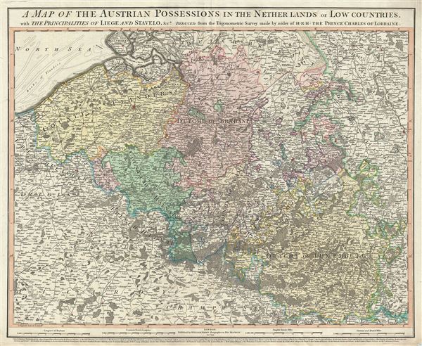
A map of the Austrian possessions in the Netherlands or Low Countries, with the principalities of Liege and Stavelo, etc.
sold
- Digital Map Information
- Suitable for large format printing
- File Size: 23.73 MB
- File Type: ZIP / TIFF
- ICC color profile embedded
- Delivered instantly via download link
This is an attractive 1789 map of Belgium and Luxemburg by William Faden. The map covers present day Belgium and Luxemburg along with adjacent parts of France and Germany. The map extends from Breda, south as far as Montmedy and from ... (more details)
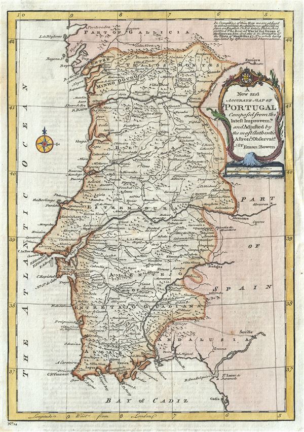
A New and Accurate Map of Portugal.
sold
- Digital Map Information
- Suitable for large format printing
- DPI: 300
- File Size: 3.68 MB
- File Type: ZIP / TIFF
- ICC color profile embedded
- Delivered instantly via download link
This is a beautiful 1747 map of Portugal by the British cartographer Emanuel Bowen. Centered on the Tajo River, it covers all of Portugal, noting several towns, cities, rivers, lakes, roads and a host of additional topographical ... (more details)

Etats de Pologne et de Lithuanie Divises par Palaunats et Provinces Ecclesiastiques Avec le Roiaume de Prusse et le Duche de Curlande.
sold
- Digital Map Information
- Suitable for large format printing
- DPI: 300
- File Size: 12.95 MB
- File Type: ZIP / TIFF
- ICC color profile embedded
- Delivered instantly via download link
This is a fine 1790 map of Poland and Lithuania by Brion de la Tour and Louis Charles Desnos. It covers modern day Poland, Lithuania, Latvia, Belarus, Ukraine, etc. The map depicts the Polish boundaries set following the First ... (more details)
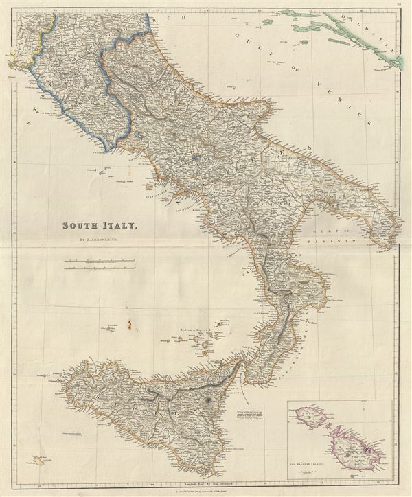
South Italy.
sold
- Digital Map Information
- Suitable for large format printing
- DPI: 300
- File Size: 12.92 MB
- File Type: ZIP / TIFF
- ICC color profile embedded
- Delivered instantly via download link
This is a scarce example of J. Arrowsmith's 1842 map of southern Italy. It covers the Kingdom if Naples (a common reference for the 'Kingdom of the Two Sicilies'), which extended from the Papal States south to include all of ... (more details)

North America.
sold
- Digital Map Information
- Suitable for large format printing
- File Size: 8.15 MB
- File Type: ZIP / TIFF
- ICC color profile embedded
- Delivered instantly via download link
An excellent 1856 first edition example of Colton's desirable map of North America. The map covers the continent from South America to the Arctic, inclusive of the United States, Canada, Mexico, Central America and the West ... (more details)
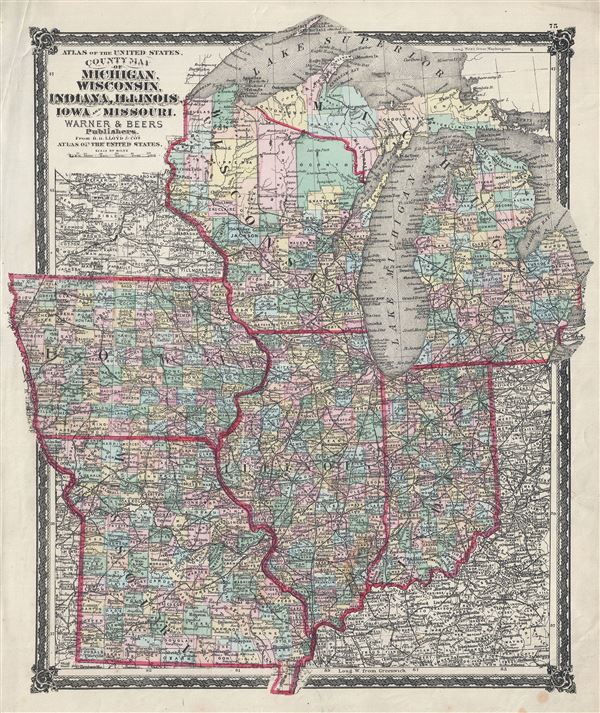
County Map of Michigan, Wisconsin, Indiana, Illinois, Iowa and Missouri.
sold
- Digital Map Information
- Suitable for large format printing
- File Size: 10.62 MB
- File Type: ZIP / TIFF
- ICC color profile embedded
- Delivered instantly via download link
A fine 1876 map of the American Midwest by Warner and Beers. It covers the states of Michigan, Wisconsin, Indiana, Illinois, Iowa and Missouri and includes Lake Michigan and part of Lake Superior. The map is highly ... (more details)

North America Sheet IV Lake Superior.
sold
- Digital Map Information
- Suitable for large format printing
- DPI: 300
- File Size: 5.43 MB
- File Type: ZIP / TIFF
- ICC color profile embedded
- Delivered instantly via download link
A beautiful 1832 S.D.U.K. map of Lake Superior, the largest of the five Great Lakes. Centered on Lake Superior, the map coves the modern day regions of southern Ontario, northern Michigan and northeastern Minnesota. ... (more details)
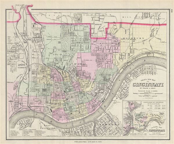
Gray's New Map of Cincinnati.
sold
- Digital Map Information
- Suitable for large format printing
- File Size: 6.72 MB
- File Type: ZIP / TIFF
- ICC color profile embedded
- Delivered instantly via download link
A fine 1877 map of Cincinnati, Ohio by O. W. Gray and Sons. It covers the city from Fairmount to Columbia south across the Ohio River to Covington in Kentucky. The map is extremely detailed, showing individual ... (more details)
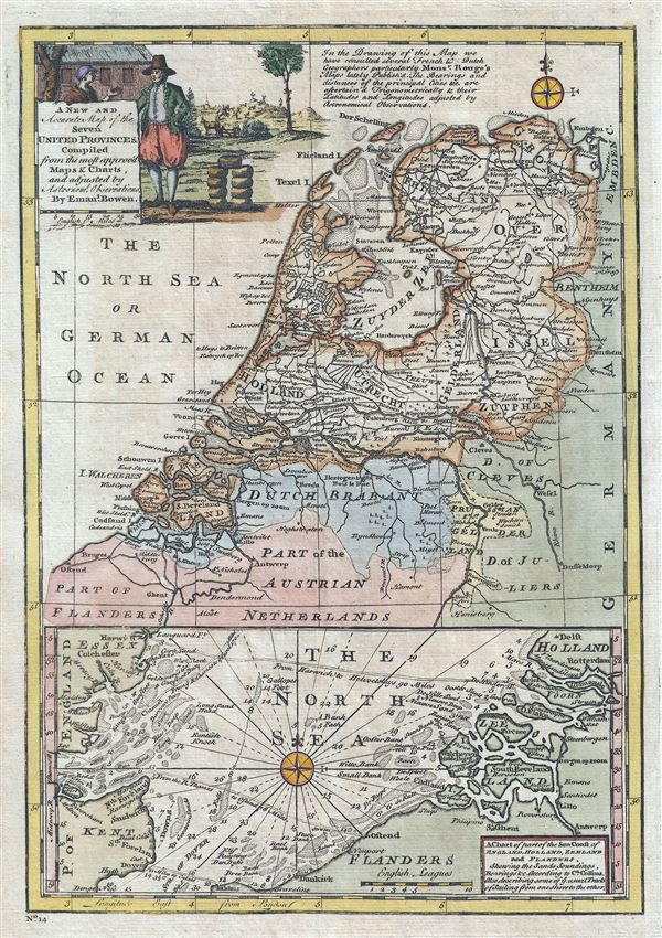
A New and Accurate Map of the Seven United Province. A Chart of part of the Sea Coast of England, Holland, Zeeland and Flanders, shewing the Sandy Soundings, Bearings etc.
sold
- Digital Map Information
- Suitable for large format printing
- DPI: 300
- File Size: 4.36 MB
- File Type: ZIP / TIFF
- ICC color profile embedded
- Delivered instantly via download link
This is a beautiful 1747 map of Holland or the Netherlands by the British cartographer Emanuel Bowen. Essentially two maps on a single sheet, the top map depicts all of modern day Netherlands along with the ... (more details)
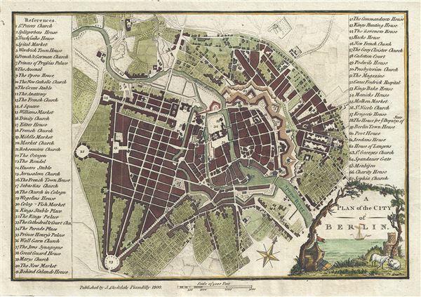
A Plan of the City of Berlin.
sold
- Digital Map Information
- Suitable for large format printing
- DPI: 300
- File Size: 2.94 MB
- File Type: ZIP / TIFF
- ICC color profile embedded
- Delivered instantly via download link
This is an appealing 1800 map or city plan of Berlin, Germany, issued by John Stockdale. It beautifully depicts the capital city of the Kingdom of Prussia at the end of the 18th century. The map is ... (more details)
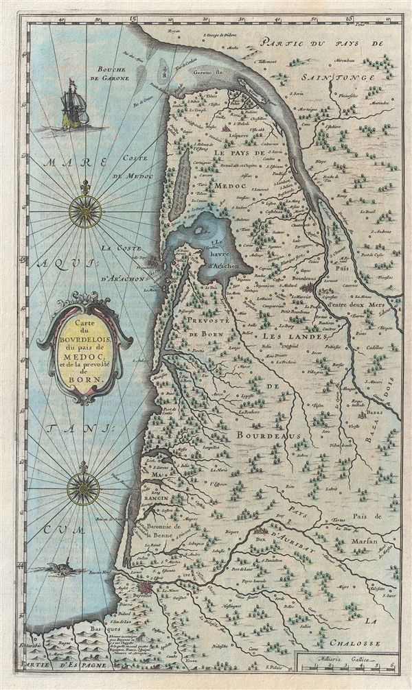
Carte du Bourdelois du pais de Medoc et de la prevoste de Born.
sold
- Digital Map Information
- Suitable for large format printing
- DPI: 300
- File Size: 6.5 MB
- File Type: ZIP / TIFF
- ICC color profile embedded
- Delivered instantly via download link
An attractive c. 1667 Blaeu map of Bordeax and the Pays de Medoc, France. Covers the modern day Department of Gironde from the Garonne River to Spain and from the Atlantic to Mont-de-Marsan. This ... (more details)
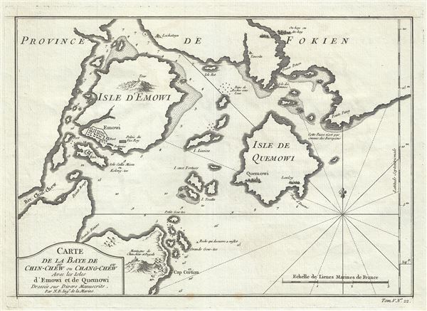
Carte de la Baye de ou Chin-Chew ou Chang-Chew Avec les Isles D'Emowi et de Quemowi.
sold
- Digital Map Information
- Suitable for large format printing
- DPI: 300
- File Size: 3.14 MB
- File Type: ZIP / TIFF
- ICC color profile embedded
- Delivered instantly via download link
A scarce c. 1764 Nicholas Bellin nautical chart or maritime map of the Bay of Changchow (Zhangzhou), Fujian, China. The map focuses on the city of Amoy (here spelled Emowi), or modern day Xiamen. ... (more details)