
The Space Race.
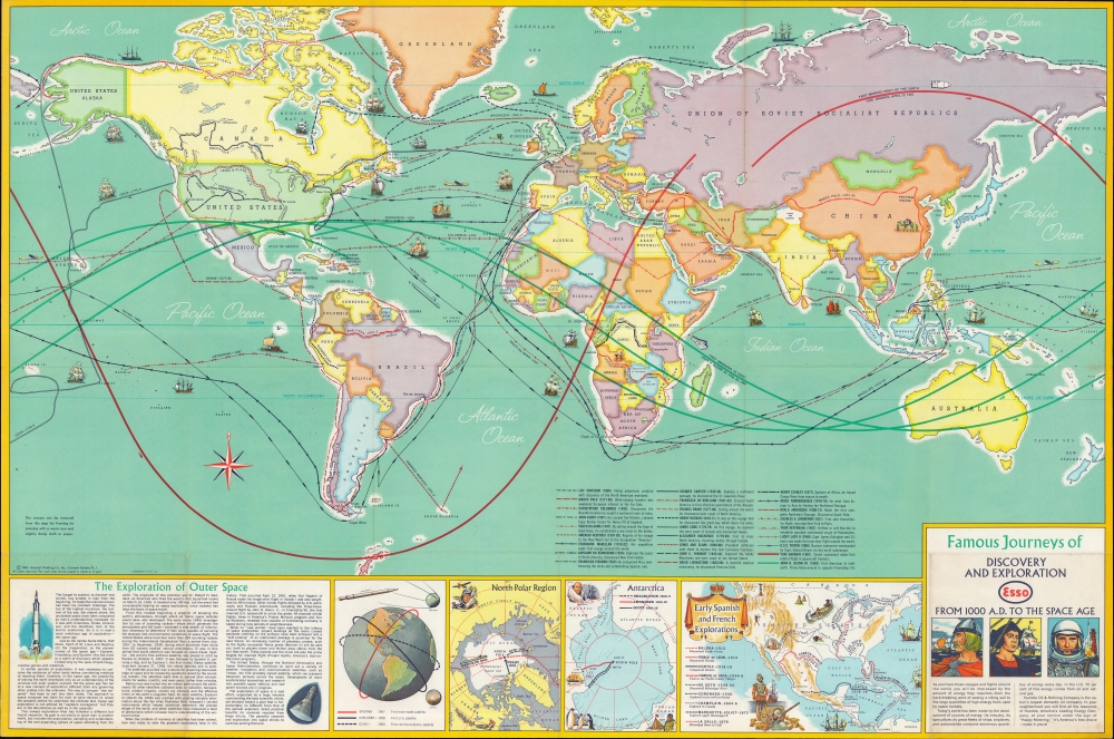
Famous Journeys of Discovery and Exploration from 1000 A.D. to the Space Age.
sold
An inspirational 1963 map by General Drafting depicting voyages of discovery and exploration. It was made in the midst of the space race between the United States and Soviet Union, and more specifically, was prompted by the orbital space flights of Yuri Gagarin and John Glenn. (more details)
First Atlas Map of Japan.
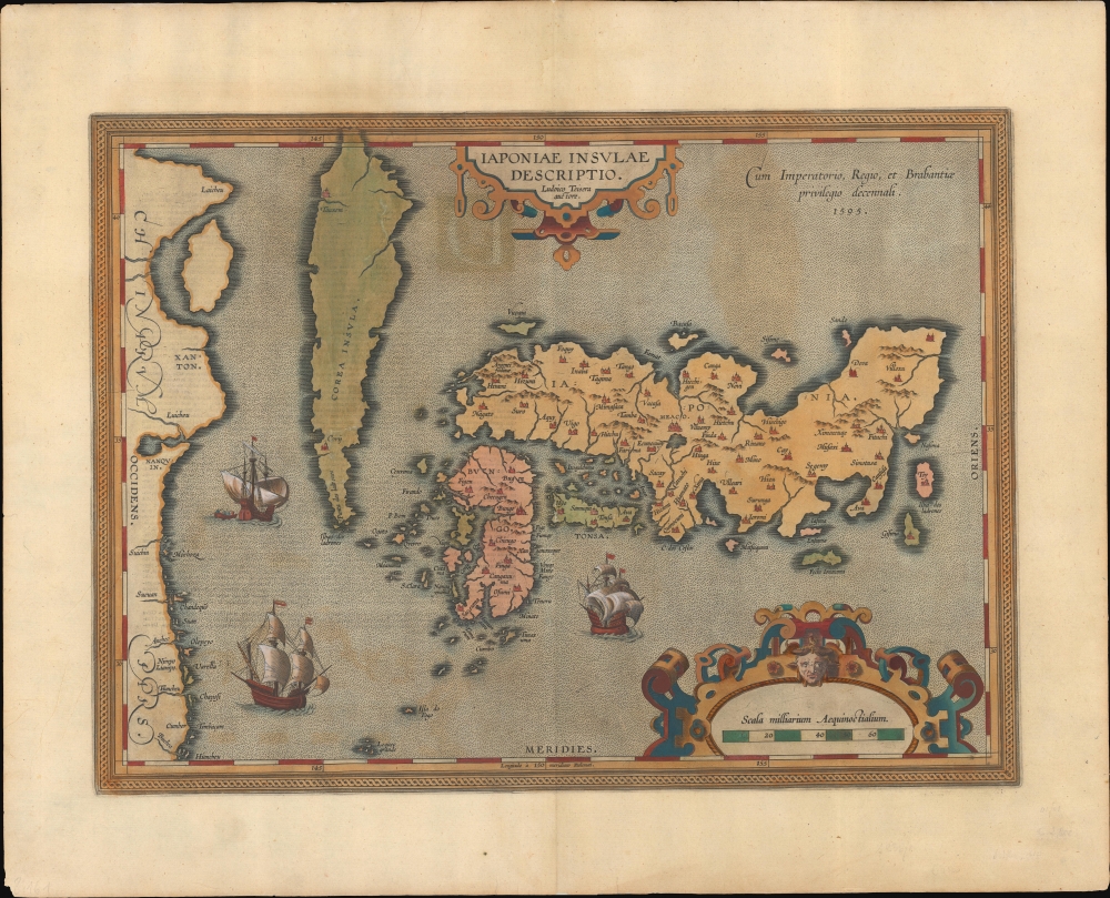
Japoniae Insula Descriptio.
sold
- Digital Map Information
- Suitable for large format printing
- Full resolution TIFF file
- ICC color profile embedded
- Delivered instantly via download link
This is the 1606 second state of Ortelius' map of Japan and Korea, considered the earliest detailed printed map of Japan and Korea. This map is of fundamental importance: according to map historian Lutz Walter, 'A new epoch in Western cartography of Japan begins with the inclusion of this in the Theatrum … Honshu, Kyushu, and Shikoku are depicted with approximately correct proportions for the first time.' (Walter, L. Japan: A Cartographic Vision.) (more details)
Earliest acquirable map explaining the Battle of Gettysburg.

Field of Gettysburg. July 1st, 2nd, and 3rd.
sold
- Digital Map Information
- Suitable for large format printing
- File Size: 16.88 MB
- File Type: ZIP / TIFF
- ICC color profile embedded
- Delivered instantly via download link
An impressive feat of battle cartography, this is Theodore Ditterline's landmark map of the American Civil War Battle of Gettysburg. The battle took place from July 1 - July 3, 1863, and represents the 'high water mark' of the Confederacy. Ditterline manages to encapsulate all three days of fighting onto one sheet in a coherent manner. A Gettysburg resident, he published this work along with a 24-page pamphlet only months after the battle. (more details)
Comprehensive proposal for justice for Native peoples.

Lilawaste Lake Country refuge-to-be.
sold
- Digital Map Information
- Suitable for large format printing
- File Size: 33.22 MB
- File Type: ZIP / TIFF
- ICC color profile embedded
- Delivered instantly via download link
An engrossing and poignant map that merits hours of close study, this is a highly detailed and acerbic proposal for a 'Lilawaste Lake Country Refuge' drawn by the pseudonymous Iktomi. It appeared in the 1937 book America Needs Indians!, by the same author, a creative and combative work that sharply criticizes White society's destruction of indigenous cultures and proposes measures for maintaining and even reviving the latter. (more details)
Pushing Manhattan's urbanization northward.
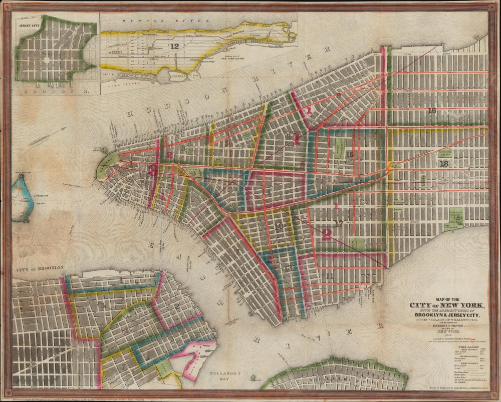
Map of the City of New York, with the Adjacent Cities of Brooklyn and Jersey City, and the Village of Williamsburg.
$1,200.00
Acquire
- Digital Map Information
- Suitable for large format printing
- Full resolution TIFF file
- ICC color profile embedded
- Delivered instantly via download link
This is a striking 1848 Ensigns and Thayer pocket map of New York City. It illustrates the city just as massive redistricting, leveling, and gridding were beginning to push urbanization into central and upper Manhattan. (more details)
War Propaganda for kids.

支那見學大地圖 / Large Study Map of China.
sold
- Digital Map Information
- Suitable for large format printing
- File Size: 82.41 MB
- File Type: ZIP / TIFF
- ICC color profile embedded
- Delivered instantly via download link
This is a rare 1938 (Showa 13) World War II or Second Sino-Japanese War manga-style propaganda map of China by a team of artists, printers, and editors led by Satō Yūtarō (佐藤裕太郎). Published for the magazine Youth Club (or Shōnen Club, 小年俱樂部), this map was meant to educate Japanese children about China and justify Japan's war there. (more details)
Earliest Atlas Map of Vermont Published in the United States - here in striking old color.
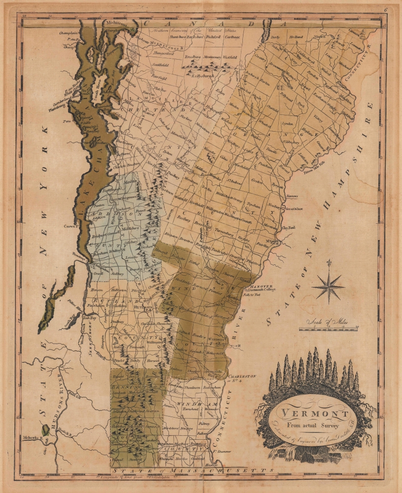
Vermont From Actual Survey.
sold
- Digital Map Information
- Suitable for large format printing
- File Size: 11.17 MB
- File Type: ZIP / TIFF
- ICC color profile embedded
- Delivered instantly via download link
This is the first map of Vermont published in the United States, here in striking original color. This 1795 work was drawn and engraved by Amos Doolittle for Matthew Carey's Carey's American Edition of Guthrie's Geography Improved, the first atlas published in the United States. (more details)
Iconic Depression Era New York City view.

Supervue of New York.
sold
- Digital Map Information
- Suitable for large format printing
- Full resolution TIFF file
- ICC color profile embedded
- Delivered instantly via download link
This is a spectacular 1934 edition of the 1932 first edition of the Edward V. Spofford / Samuel Freedman bird's-eye 'Supervue' map of New York City. Despite being issued at the height of the Great Depression, this view highlights New York City's resilience, prosperity, and multicultural dynamism. (more details)
'Tell the world about our paradise'.
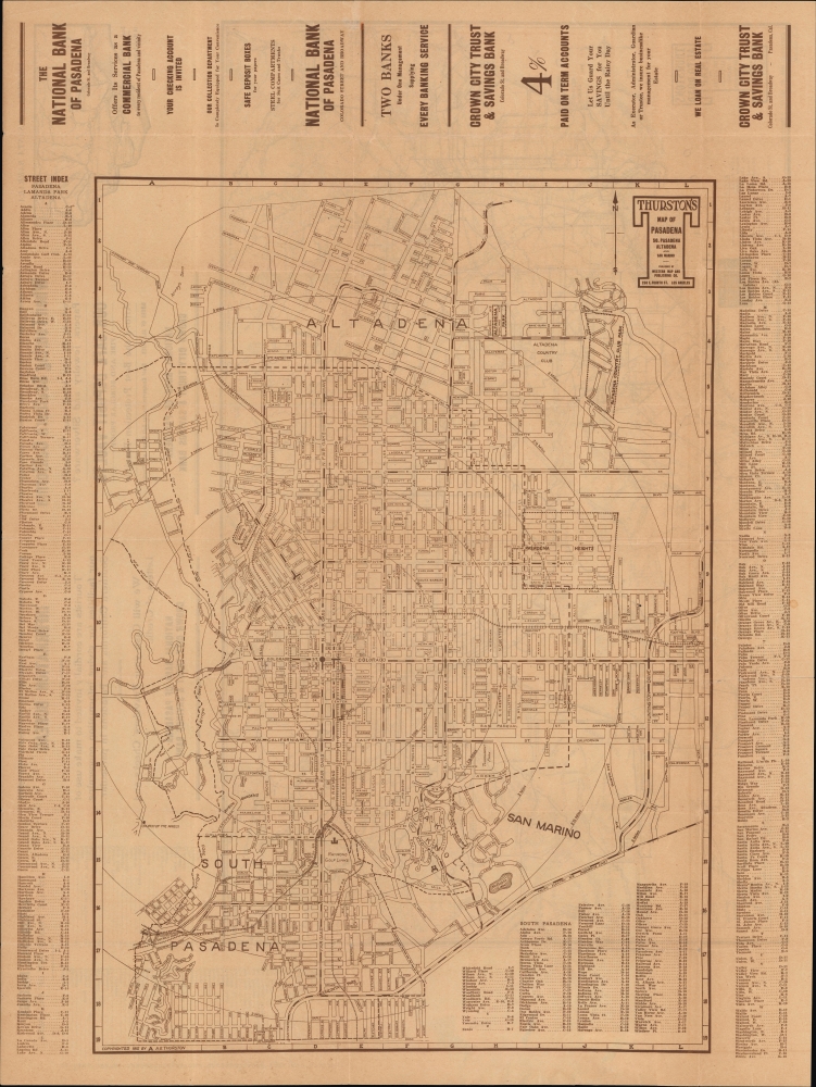
Thurston's Map of Pasadena So. Pasadena Altadena and San Marino.
sold
- Digital Map Information
- Suitable for large format printing
- Full resolution TIFF file
- ICC color profile embedded
- Delivered instantly via download link
An unrecorded 1915 map of Pasadena and surrounding towns produced by Albert G. Thurston and the Western Map and Publishing Co. It displays Pasadena undergoing a period of rapid growth wherein the city developed its distinctive identity. (more details)
Outline of a Beaux Arts Utopia.
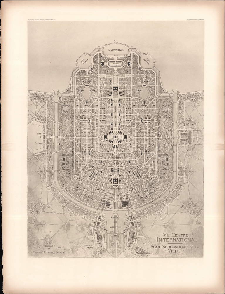
Un Centre International Plan Schematique de la Ville.
sold
- Digital Map Information
- Suitable for large format printing
- File Size: 21.33 MB
- File Type: ZIP / TIFF
- ICC color profile embedded
- Delivered instantly via download link
A curious work of ambitious, utopian, and grandiose urban planning, this 1913 scheme for an 'international center' by Ernest Hébrard appeared in the book Creation of a World Centre of Communication by Hébrard and Hendrick Christian Andersen. (more details)
Revolutionary mapping Sub-Oceanic Topography.
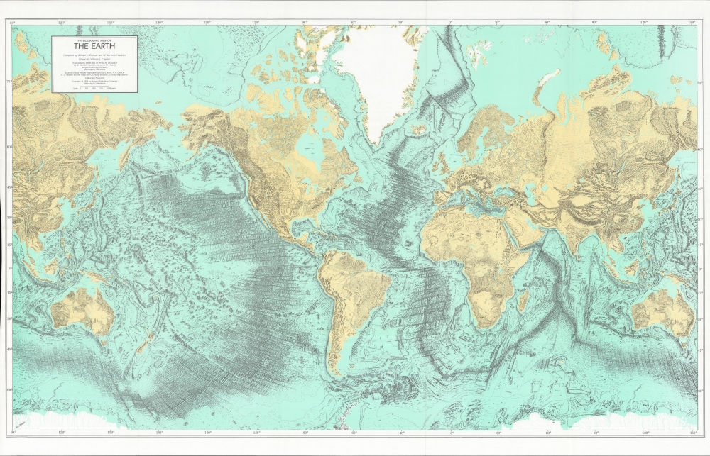
Physiographic Map of the Earth.
sold
An impressive, large-format 1975 physiographic map of the Earth drawn by William Chesser. Although crude by comparison, Chesser's map is based on the revolutionary mapping of sub-oceanic topography by Marie Tharp and Bruce C. Heezen (credited in title), but predated the 1977 official cartographic release of their work. (more details)
The rise of public transit in New England.

Connecticut Valley Electric Transit Route Hartford, Conn. to Greenfield, Mass. including Mt. Tom.
sold
- Digital Map Information
- Suitable for large format printing
- Full resolution TIFF file
- ICC color profile embedded
- Delivered instantly via download link
A scarce 1905 Ernest A. Sherman pictorial view of the Connecticut River Valley between Hartford, Connecticut and Greenfield, Massachusetts. It highlights the rise of public transit in New England through interurban electric train and trolley lines. (more details)
Fort Lauderdale and Broward County during the Florida Land Boom.

Coast Line of Broward County Florida and 26 Miles of the Dixie Highway.
sold
- Digital Map Information
- Suitable for large format printing
- Full resolution TIFF file
- ICC color profile embedded
- Delivered instantly via download link
This is a 1924 Fort Lauderdale Chamber of Commerce map of the coast of Broward County, Florida. Produced at the height of the Florida Land Boom, the map highlights the region's communities, along with the Dixie Highway and the Florida East Coast Railway, emphasizing the ease of access for people interested in relocating to the area. (more details)
Pardies' star atlas is stylistically one of the most attractive ever published.
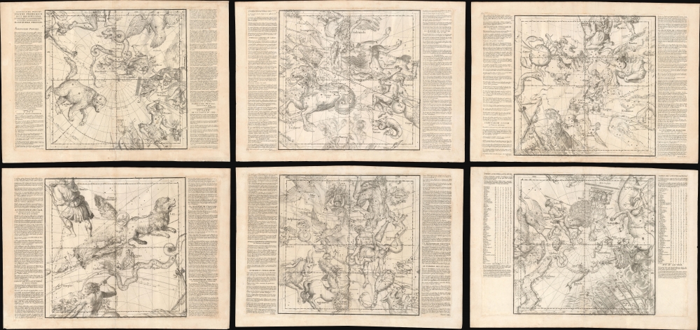
Globi coelestis in tabulas planas redacti descriptio auctore R.P. Ignatio Gastone Pardies Societatis Jesu mathematico opus postumum.
sold
- Digital Map Information
- Suitable for large format printing
- Full resolution TIFF file
- ICC color profile embedded
- Delivered instantly via download link
This is a stunning example of Ignace-Gaston Pardies' innovative 1693 celestial maps on 6-part gnomonic projection - here in fine, uncolored loose sheets with an exceptionally strong, crisp impression. Pardies' charts were both revolutionary and influential, emerging as eager scholars and private researchers, aided by ever more sophisticated telescopes, advanced knowledge of astronomy by leaps and bounds. (more details)
First separate map of the Pacific - in an exceptional old color example.
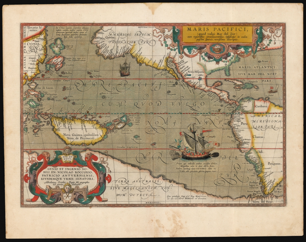
Maris Pacifici (quod vulgo Mar del Zur).
$17,500.00
Acquire
- Digital Map Information
- Suitable for large format printing
- Full resolution TIFF file
- ICC color profile embedded
- Delivered instantly via download link
This is Abraham Ortelius' 1589 map of the Pacific; here is the best example to appear on the market in recent years, with a strong strike and fine original color. Abraham Ortelius' map is as important as it is beautiful - Burden hailed it as 'one of the most important maps that appeared in the Ortelius atlases' and 'one of Ortelius' most desirable maps'. The map is not only the first to focus on the Pacific Ocean, but it is also the first acquirable map to separately identify North and South America. (more details)
First map to use the term 'Thailand'. First official map of Thailand.

ไทย. [Thai.]
sold
- Digital Map Information
- Suitable for large format printing
- File Size: 245.6 MB
- File Type: ZIP / TIFF
- ICC color profile embedded
- Delivered instantly via download link
This exceptional 1939 Thai-language Royal Thai Survey Department map of Southeast Asia is the first national map of Thailand and the first to use the name 'Thailand' to describe the former Siamese Kingdom. It was published against a backdrop of growing Thai nationalism and Prime Minister Phibun's agenda of pan-Thaism, which sought to establish a 'Greater Thai Kingdom' encompassing the whole of Southeast Asia. (more details)
A nation of immigrants that must stand together.
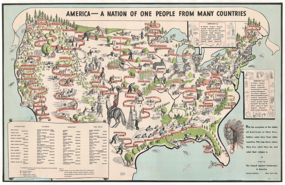
America - A Nation of One People From Many Countries.
sold
- Digital Map Information
- Suitable for large format printing
- File Size: 86.94 MB
- File Type: ZIP / TIFF
- ICC color profile embedded
- Delivered instantly via download link
One of the greatest and most poignant pictorial maps of all time, this 1940 Emma Bourne pictorial map of the United States is a call for unity and mutual acceptance in an era defined by racism, xenophobia, nativism, nationalism, and isolationism. When the Council Against Intolerance in America released this map, World War II (1939 - 1945) was already raging in Europe and Asia, fueled by extremist ideologies. Within a year, the United States, too, would find itself embroiled in the global conflict. (more details)
Playful hand drawn celebration of Manhattans's diverse entertainments.

Manhattan by the Mattimores.
sold
- Digital Map Information
- Suitable for large format printing
- File Size: 61.98 MB
- File Type: ZIP / TIFF
- ICC color profile embedded
- Delivered instantly via download link
A remarkable c. 1940s manuscript pictorial map of Manhattan, New York City, drawn by or for the Mattimore family. It is unclear who the Mattimores were, but we believe the happy family of three is illustrated at the center, in front of Rockefeller Center's Atlas statue. (more details)
Foreign investment in American Railroad Securities.
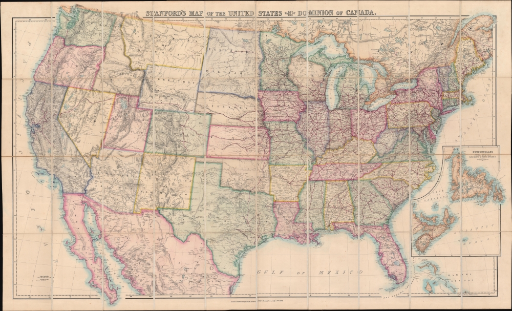
Stanford's Map of the United States and part of the Dominion of Canada.
sold
- Digital Map Information
- Suitable for large format printing
- File Size: 107.33 MB
- File Type: ZIP / TIFF
- ICC color profile embedded
- Delivered instantly via download link
A striking 1874 large-scale map of the United States by the pre-eminent British publisher of his generation, Edward Stanford. This is a general geographical and political map, but it's focus is clearly the growing American railroad network - a subject of keen interest to the British public who was deeply invested in American Railroad securities. This justifies much of the size, detail, and production mastery dedicated to this lavish map, as all would have been essential in planning investments in the far-off American continent. (more details)
Early Spanish Grants in Volusia County, Florida.

Plan of the subdivision of Harwood Volusia Co. Fla. 1888. Being a Subdivision of the J. and E. Ormond Grant the Robt. McHardy and Mary Kunner Grants.
sold
- Digital Map Information
- Suitable for large format printing
- File Size: 31.99 MB
- File Type: ZIP / TIFF
- ICC color profile embedded
- Delivered instantly via download link
This is an 1888 P. D. Rogers first Florida Land Boom map of the subdivision of Harwood, Volusia County, Florida. The map illustrates Spanish land grants to James Ormond (Today, this part of Florida is part of the town of Ormond Beach, named after the Ormond family, which operated a plantation in this area in the early 1800s. (more details)