
France (sold)
The Finest Engraved Plan of Paris in its Sole Original Edition.
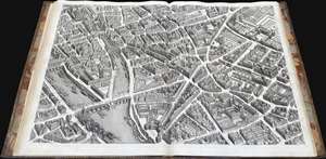
Plan de Paris Commence l’Annee 1734.... Leve et Desine par Louis Bretez Grave par Claude Lucas / Et Ecrit par Aubin.
sold
This is Louis Bretez and Michel-Etienne Turgot's monumental 1739 map of Paris, in a beautiful, bound example. Turgot's map of Paris - possibly the most ambitious urban mapping ever undertaken - shows the whole of 18th century Paris, offering an unparalleled view of the city prior to the 19th century redesign by Baron Georges Eugène Haussmann: every structure within the city at the time is here depicted. Turgot, who held the mayor-like office of Prevôt des Marchands de Paris , commissioned Louis Bretez and Claude Lucas to produce this map. Oriented to the east on an axonometric projection, this map is best understood as an aerial view in which every building, window, tree, shadow, and park are shown from an equidistant aerial perspective. In order to produce the thousands of sketches and surveys required to complete this map, Bretez was issued a permit to enter every building in Paris. It took the team nearly five years of exhaustive sketching and surveying to assemble this masterpiece. (more details)
John Jeffries' own copy of his historic narrative recording the first international aerial voyage across the English Channel.
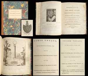
A Narrative of the Two Aerial Voyages of Doctor Jeffries with Mons. Blanchard; with Meteorological Observations and remarks. / First Voyage, on the Thirtieth of November, 1784, from the Rhedarium, near Grosvenor Square, London, into the Paris of Stone, in the Country of Kent; in performing which, we were suspended, and floating in the Atmosphere, on Hour and twenty-one Minutes. / Second Voyage, on the Seventh of January, 1785, from the Cliffs of Dover, Near the Royal Castle, across the British Channel, into the Forest of Guines, in the Province of Artois, in France: In completing which, we were suspended, and floating in the Atmosphere, Two Hours over the Sea; and forty-seven minutes of the Land of France.
sold
- Digital Map Information
- Suitable for large format printing
- Full resolution TIFF file
- ICC color profile embedded
- Delivered instantly via download link
One of the most important books ever published with regard to the history of aviation, this is the American physician John Jeffries' (February 5, 1744 - September 16, 1819) personal copy of his narratives of two balloon voyages personally undertaken in the company ... (more details)
Lost treasure of Parisian Cartography.
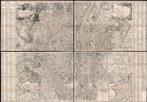
Plan de la Ville de Paris et de ses Faubourgs dédié au Roi.
sold
- Digital Map Information
- Suitable for large format printing
- Full resolution TIFF file
- ICC color profile embedded
- Delivered instantly via download link
The only known example, in this edition, of Bernard-Antoine Jaillot's 1748/1767 large-scale map of Paris. The map is centered on the Île de la Cité and is oriented to the southeast, with the Seine running vertically through the center of the map - a convention established in 1713 by the author's father Bernard-Jean-Hyacinthe Jaillot and followed in 1736-8 by Louis Bretez, and again, here. Coverage extends from the Faubourg Saint-Antoine to the Île des Cygnes that (attached to the Champ de Mars in the late 18th century), and from the Faubourg de Glories to the modern-day 14th arrondissement. Elaborate allegorical cartouches by Pierre-Alexandre Aveline appear in the upper left and right and feature titling and a legend, respectively. In the lower-left and right, inset maps detail the environs of Paris and France in general. The main map is flanked on either side by an exhaustive index of streets and important civic, military, government, mercantile, and ecclesiastical centers. (more details)
Published during the French Revolution.
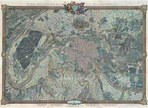
Paris, ses Fauxbourgs, et ses Environs.
sold
- Digital Map Information
- Suitable for large format printing
- DPI: 600
- File Size: 260.28 MB
- File Type: ZIP / TIFF
- ICC color profile embedded
- Delivered instantly via download link
This is a striking 1795 - 1796 Roussel wall-sized city plan or map of Paris, France, and its environs - one of the few large-scale maps of Paris issued during the French Revolution (1789 - 1799). Within Paris, buildings, squares, and parks are illustrated, with the Palais des Tuileries, the Louvre, the Hotel Royal des Invalides, and Notre Dame, among many other famous buildings recognizable. Churches are highlighted in blue, while Paris's many gardens, including the Champs-Elysées, the Champs de Mars, the Jardin des Tuileries, and the Jardin du Luxembourg, appear in green. Some of the most important buildings are illustrated pictorially, including the Abbaye St. Victor, the menagerie in today's Jardin des Plantes, and the factories across the Seine from the Jardin des Plantes. Outside Paris proper, spectacular illustrations of Montmarte and the Butte Chaumont appear. Paris's suburbs are illustrated and labeled as well, many of which are modern-day neighborhoods. (more details)
Only Known Surviving Examples of WWI 'balloonatic' Views.
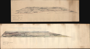
Panoramic View. La Bassee (Canal) to Loos. No 30. Balloon Section. 21:2:1917. / Panoramic View from Q 24a0.0: Lens to Vimy.
sold
- Digital Map Information
- Suitable for large format printing
- Full resolution TIFF file
- ICC color profile embedded
- Delivered instantly via download link
An extraordinary survival, this is a pair of manuscript panoramic views of part of the Western Front in northeastern France during World War I (1914 - 1918). These views were drawn by members of the Royal Naval Air Service and the Royal Flying Corps who rode in baskets beneath hydrogen-filled balloons thousands of feet above the front lines to observe enemy movements and direct artillery fire. Known as kite balloons, these were legitimate military targets, earning the 'balloonatics' had a very high mortality rate. (more details)
Unique constructed manuscript plan to renovate Paris by the architect of the Odéon.
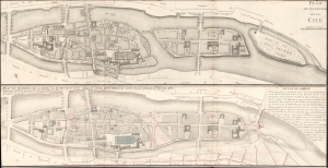
Plan du Quartier de la Cité. / Plan due Quartier de la Cité, de sa Reunion avec L'Isle St. Louis, d'une Garre et d'une Place Consacre a, Louis XVI.
sold
- Digital Map Information
- Suitable for large format printing
- File Size: 14.15 MB
- File Type: ZIP / TIFF
- ICC color profile embedded
- Delivered instantly via download link
A most unique and intriguing 1789 map of the Cité quarter, Paris, with copious manuscript, illustrating the bold plan of French 'Architecte du Roi' and designer of the Odéon, Charles de Wailly, to unite Paris's Île de la Cité with neighboring Île Saint-Louis. The plan, though greeted at the 1789 Paris Salon with much enthusiasm, floundered due to unfortunate timing: it was proposed at the outbreak of the French Revolution (1789 - 1799). It is an epic 'could-have-been' by one of Paris's most famous and influential architects. (more details)
Remarkable original 1720 view of Lyon, the gastronomic capital of France.
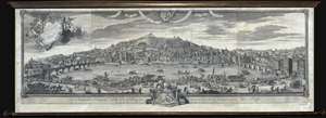
Vue d'une partie de la ville de Lion dessignee dans le maison de Mrs. les Chanoines regulliers de St. Antoine.
sold
- Digital Map Information
- Suitable for large format printing
- File Size: 0.37 MB
- File Type: ZIP / TIFF
- ICC color profile embedded
- Delivered instantly via download link
An extremely rare monumentally proportioned 1720 view of Lyon, foodie capital of France, by François Cleric and François Poilly. The view presents Lyon as seen looking west at the quays from the eastern bank (north is to the right) of the Saone River. Both ... (more details)
Piedmontese Easter - a Massacre of Waldensians in the Europe Wars of Religion.
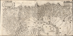
Topografica descrittione d'Alcune singolari Città in pian, e Valliprincipali nelle Alpi, per le quali come Porte del Italia dal Piemonte sipassa in Provenza, Delinato, Savioa, e Vallei, nelle quali resiedono la Missioni de PP. Capuccini.
sold
- Digital Map Information
- Suitable for large format printing
- File Size: 28.98 MB
- File Type: ZIP / TIFF
- ICC color profile embedded
- Delivered instantly via download link
This exceptional piece is the 1659 Paulus a Lotharinga map of the Italian Alps issued to illustrate ongoing efforts to suppress the Waldensians (Valdesi) sect in the wake of the 1655 'Piedmontese Easter' or the 'Massacre of the Waldensians' - one of the darkest episodes in the European Wars of Religion. It is known in academic circles as the Carta dei Cappuccini or 'Capuchin Map'. (more details)
The Bordeaux 'Cru' system.
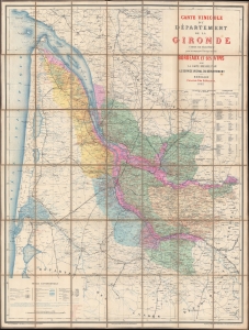
Carte Vinicole du Département de la Gironde.
sold
- Digital Map Information
- Suitable for large format printing
- Full resolution TIFF file
- ICC color profile embedded
- Delivered instantly via download link
This is an 1893 Féret et Fils viticultural map of the Gironde, France, highlighting Bordeaux wine varietals and the Cru system. The Gironde is the heart of Bordeaux wine country with over 110,000 hectares of vineyards producing some of the world's most prestigious wines. (more details)
Extraordinary original wall map of Lyon, France - gastronomic capital of the world!
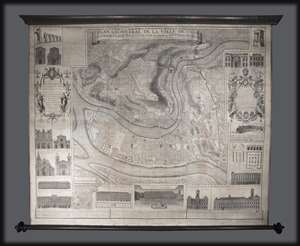
Plan Géometral de la Ville de Lyon.
sold
- Digital Map Information
- Suitable for large format printing
- Full resolution TIFF file
- ICC color profile embedded
- Delivered instantly via download link
A large wall map of Lyon, France by R. P Grégorie and Claude Seraucourt. Oriented to the east, this map centers on the convergence of the Rhone and Saone Rivers and the presqu'Ile , or peninsula, thus formed. It covers modern day Lyon's 1st and 2nd ... (more details)
Extraordinary manuscript illustration of 17th century Battle of Camaret.
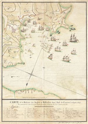
Carte de la Defcente des Anglais et Hollandais dans l'Anse de Camaret, le 18 Juin 1694.
sold
- Digital Map Information
- Suitable for large format printing
- DPI: 300
- File Size: 18.01 MB
- File Type: ZIP / TIFF
- ICC color profile embedded
- Delivered instantly via download link
An extraordinary 1790 manuscript (hand drawn) illustration of the 1694 Battle of Camaret. Truly a masterwork of cartographic manuscript illustration, this map covers parts of Camaret Bay and Vaubon's fortifications at Camaret-sur-Mer, Brittany, ... (more details)
Documenting and propagandizing a scorched-earth campaign in the Nine Years' War.
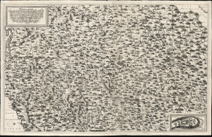
New Inventirte Land Carte Eines theil des Königreichs Franckreichs und darinn gelegenen Vornemsten Stätt und Vestungen: Samt deßen Conquesten Lothring, Franche Conte, Elsas, Pfaltz am Rhein, Mosel-Strohm und in NiderLand: Wie auch des angrentzende Saphoyen, Piemont, Schweitz, Schwartzwald, Würtenberg, Pfaltz am Rhein, und Wetterau, und angelegnen Ländern.
sold
- Digital Map Information
- Suitable for large format printing
- File Size: 39.6 MB
- File Type: ZIP / TIFF
- ICC color profile embedded
- Delivered instantly via download link
This is a 1691 proof state of Johann Hoffman's large, beautiful, and rare separately-issued map of France's frontiers during the Nine Years' War (1688 - 1697), produced as part of an anti-French propaganda scheme at the height of Louis XIV's scorched earth campaign. As described in the map's title, the map portrays part of France, 'Including its Conquests of Lorraine, Franche-Comté, Alsace, the Palatinate on the Rhine, the Moselle-Strohm, and the Netherlands...' The map details the heavily-fortified French border extending from the port of Dunkirk to the German frontier along the Rhine River, then to the frontiers of Switzerland, Piedmont, and Savoy: a defensive front stretching from the English Channel to the Mediterranean. (more details)
Planning the Thiers Wall - Original Manuscript!
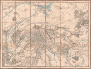
Carte Militaire des Environs de Paris relative aux traveaux de défense éxécutés ou projetés en 1815.
sold
- Digital Map Information
- Suitable for large format printing
- Full resolution TIFF file
- ICC color profile embedded
- Delivered instantly via download link
This is a unique c. 1815 Charles-Étienne Collin map of Paris, France, with unique c. 1841 manuscript updates by General Louis Doguereau illustrating the planned fortification of Paris or, as it became known, the Thiers Wall (Enceinte de Thiers), one of the greatest follies of military engineering ever conceived. As head of the École d'Application de l'Artillerie et du Génie, Doguereau was part of the 8-man Commission des Fortifications organized to design the wall in 1840-41. (more details)
Considered one of the best bird's-eye views of Paris.
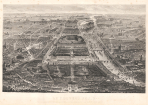
Le Nouveau Paris Panorama de Tous Ses Monuments, Jardins, Promenades; Pris sous un Aspect Nouveau.
sold
- Digital Map Information
- Suitable for large format printing
- File Size: 57.13 MB
- File Type: ZIP / TIFF
- ICC color profile embedded
- Delivered instantly via download link
This is the extremely rare 1865 Guesnu / Chardon bird's-eye view of Paris, France. This is the 'new' Paris, transformed by the Haussmann renovations - celebrated by many, cursed by others. This view stunningly captures the changes by exaggerating the perspective of the new avenues and grand new buildings. (more details)
Considered one of the best Bird's-eye views of Paris.
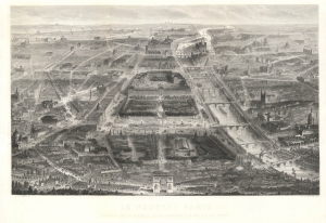
Le Nouveau Paris Panorama de Tous Ses Monuments, Jardins, Promenades; Pris sous un Aspect Nouveau.
sold
- Digital Map Information
- Suitable for large format printing
- File Size: 126.58 MB
- File Type: ZIP / TIFF
- ICC color profile embedded
- Delivered instantly via download link
This is the extremely rare 1865 Guesnu / Chardon bird's-eye view of Paris, France. This is the 'new' Paris, transformed by the Haussmann renovations - celebrated by many, cursed by others. This view stunningly captures the changes by exaggerating the perspective of the new avenues and grand new buildings. (more details)
On the cusp of Imperial glory.
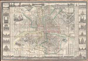
Nouveau Plan Routier de la Ville et Faubourgs de Paris Avec ses Principaux Edifices et Nouvelles Barrieres.
sold
- Digital Map Information
- Suitable for large format printing
- Full resolution TIFF file
- ICC color profile embedded
- Delivered instantly via download link
This is a striking 1804 Pichon and Esnault city plan or map of Paris, France, published during the last (13th) year of the French First Republic. This map marks a critical moment in Parisian history, when under Napoleon Bonaparte (1769 - 1821), the city transformed from a national into an imperial capital. Napoleon crowned himself Emperor of France on December 2, 1804, and immediately embarked upon a series of ambitious civic and urban developments intended to transform Paris into an imperial capital on the model of ancient Rome. (more details)
Magnificent, iconic, and highly detailed twenty page wall map of Paris, France.
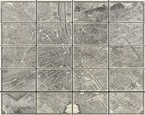
This is the c. 1900 Taride edition of Louis Bretez and Michel-Etienne Turgot's monumental 1739 map of Paris. Turgot's map of Paris is possibly the most ambitious urban mapping ever undertaken. This map shows the whole of 18th century Paris and offers a wonderful perspective on the city before Baron Georges Eugène Haussmann's 19th-century redesign. Turgot, who held the mayor-like office of Prevôt des Marchands de Paris , commissioned Louis Bretez and Claude Lucas to produce this map in 1734. Oriented to the east on an axonometric projection, this map is best understood as an aerial view where in every building, window, tree, shadow, and park are shown. It took the team nearly five years of exhaustive sketching and surveying to assemble this masterpiece. In order to produce the thousands of sketches and surveys required to complete this map, Bretez was issued a permit to enter every building in Paris. (more details)
Important and monumental 20 panel map of Paris.
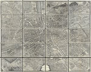
Plan de Paris.
sold
- Digital Map Information
- Suitable for large format printing
- File Size: 32.16 MB
- File Type: ZIP / TIFF
- ICC color profile embedded
- Delivered instantly via download link
This is the c. 1900 Taride edition of Louis Bretez and Michel-Etienne Turgot's monumental 1739 map of Paris. Turgot's map of Paris is possibly the most ambitious urban mapping ever undertaken. This map shows the whole of 18th century Paris and offers a wonderful perspective on the city before Baron Georges Eugène Haussmann's 19th-century redesign. Turgot, who held the mayor-like office of Prevôt des Marchands de Paris , commissioned Louis Bretez and Claude Lucas to produce this map in 1734. Oriented to the east on an axonometric projection, this map is best understood as an aerial view where in every building, window, tree, shadow, and park are shown. It took the team nearly five years of exhaustive sketching and surveying to assemble this masterpiece. In order to produce the thousands of sketches and surveys required to complete this map, Bretez was issued a permit to enter every building in Paris. (more details)
'Secret' contingency map in case Germany did not comply with the Armistice.
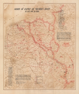
Order of Battle on Western Front 11 A.M., Nov. 11, 1918.
sold
- Digital Map Information
- Suitable for large format printing
- File Size: 81.23 MB
- File Type: ZIP / TIFF
- ICC color profile embedded
- Delivered instantly via download link
This is a c. 1918 General Headquarters 'Secret' map of France, Belgium, Luxembourg, and parts of the Netherlands and Germany, depicting the Western Front on the when fighting stopped, ending World War I (November 11, 1918). The map records the 'eleventh hour of the eleventh day of the eleventh month' of 1918, when the armistice signed between the Allies and Germany at Compiègne, France, called for the cessation of hostilities on the Western Front. It was created in the Map Room of the Operations Section (G-3) of the General Headquarters staff on the contingency that German forces did not comply with the terms of the armistice and the war resumed. According to the Library of Congress, an example of this map was used at the Paris Peace Conference of 1919. (more details)
Dominant 16th century mapping of Paris.
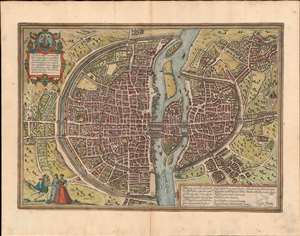
Lutetia vulgari Nomine Paris, Urbs Galliae Maxima, Sequana Navigabili Flumine Irrigatur...
sold
- Digital Map Information
- Suitable for large format printing
- Full resolution TIFF file
- ICC color profile embedded
- Delivered instantly via download link
A handsome example of the Braun and Hogenberg's 1572 map and view of Paris, France. With the Seine flowing at center around the Île de la Cité, this view looks on Paris from the northwest, with the top oriented to the southeast. The city is presented from an equidistant bird's-eye perspective wherein all structures are rendered in view form, but from a uniform height and angle relative to all individual points. Fertile fields surround the city, and the river bustles with boats, suggesting richness and prosperity. In the bottom left corner, a man greets two women, all wearing clothing corresponding to the Spanish-influenced fashion norms of 1560 - 1570. The Bastille, a prison infamous even prior to the French Revolution, appears here at top center, surrounded by a moat. The 1550 bastion, appearing to the left of the main structure of the Bastille is also evident. The map's title 'Lutetia,' is the Latin name for Paris which, by the 16th century, had largely been phased out but still appeared in academic references. (more details)
Dominant 16th century mapping of Paris.
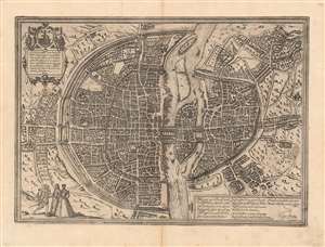
Lutetia vulgari Nomine Paris, Urbs Galliae Maxima, Sequana Navigabili Flumine Irrigatur...
sold
- Digital Map Information
- Suitable for large format printing
- Full resolution TIFF file
- ICC color profile embedded
- Delivered instantly via download link
A handsome example of the Braun and Hogenberg's 1572 map and view of Paris, France. With the Seine flowing at center around the Île de la Cité, this view looks on Paris from the northwest, with the top oriented to the southeast. The city is presented from an equidistant bird's-eye perspective wherein all structures are rendered in view form, but from a uniform height and angle relative to all individual points. Fertile fields surround the city, and the river bustles with boats, suggesting richness and prosperity. In the bottom left corner, a man greets two women, all wearing clothing corresponding to the Spanish-influenced fashion norms of 1560 - 1570. The Bastille, a prison infamous even prior to the French Revolution, appears here at top center, surrounded by a moat. The 1550 bastion, appearing to the left of the main structure of the Bastille is also evident. The map's title 'Lutetia,' is the Latin name for Paris which, by the 16th century, had largely been phased out but still appeared in academic references. (more details)
The dominant 16th Century mapping of Paris.
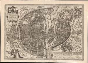
Lutetia vulgari Nomine Paris, Urbs Galliae Maxima, Sequana Navigabili Flumine Irrigatur...
sold
- Digital Map Information
- Suitable for large format printing
- Full resolution TIFF file
- ICC color profile embedded
- Delivered instantly via download link
A handsome example of the Braun and Hogenberg's 1572 map and view of Paris, France. With the Seine flowing at center around the Île de la Cité, this view looks on Paris from the northwest, with the top of the map oriented to the southeast. The city is presented on from equidistant bird's-eye perspective wherein all structures are rendered in view form but from a uniform height and angle relative to all individual points. Fertile fields surround the city, and the rivers bustles with boats, suggesting richness and prosperity. In the bottom left corner, a man greets two women, all wearing clothing corresponding to the Spanish influenced fashion norms of 1560 - 1570. The Bastille, an infamous prison prior to the French Revolution, appears here at top center, surrounded by a moat. The 1550 bastion, appearing to the left of the main structure of the Bastille is also evident. The map's title 'Lutetia' refers to the roman name for Paris which, by the 16th century, had largely been phased out but still appeared in academic references. (more details)
Iconic and early view of Paris.
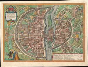
Lutetia vulgari Nomine Paris, Urbs Galliae Maxima, Sequana Navigabili Flumine Irrigatur ...
sold
- Digital Map Information
- Suitable for large format printing
- Full resolution TIFF file
- ICC color profile embedded
- Delivered instantly via download link
A fine full-color example of the Braun and Hogenberg's 1572 map and view of Paris, France. With the Seine flowing at center around the Île de la Cité, this view looks on Paris from the northwest, with the top of the map oriented to the southeast. The city is presented on from equidistant bird's-eye perspective wherein all structures are rendered in view form but from a uniform height and angle relative to all individual points. Fertile fields surround the city, and the rivers bustles with boats, suggesting richness and prosperity. In the bottom left corner, a man greets two women, all are wearing clothing corresponding to the Spanish influenced fashion norms of 1560 - 1570. The Bastille, an infamous as a prison prior to the French Revolution, appears here at top center, surrounded by a mat. The 1550 bastion, appearing to the left of the main structure of the Bastille is also evident. The map's title 'Lutetia' refers to the roman name for Paris which, by the 16th century, had largely been phased out. (more details)
Establishment of the Cru System.
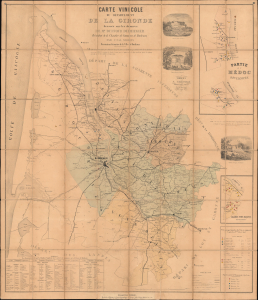
Carte Vinicole du Département de la Gironde dressée sur les données de Mr. Duffour Dubergier President de la Chambre de Commerce de Bordeaux par Unal Serres Dessinateur Géomètre de la Ville Bordeaux.
sold
- Digital Map Information
- Suitable for large format printing
- File Size: 66.01 MB
- File Type: ZIP / TIFF
- ICC color profile embedded
- Delivered instantly via download link
This is an important 1859 Unal Serres and Dubergier thematic map of Bordeaux's (Gironde) official wine, following the Cru System established by the Bordeaux Wine Official Classification of 1855. The map thus illustrates a pivotal moment in the development of global wine ranking models that retains enduring relevance. This is the first map to focus on wine classification. (more details)
First plate of the elder Merian's self-referential panorama of Paris.
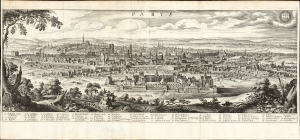
Parys.
sold
- Digital Map Information
- Suitable for large format printing
- File Size: 30.67 MB
- File Type: ZIP / TIFF
- ICC color profile embedded
- Delivered instantly via download link
This is a superb example of Matthaus Merian's view of Paris, France - arguably the most desirable of Merian's panoramas in that it is also a self-portrait. (more details)
The first Printed Chart of the English Channel.
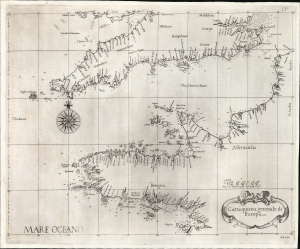
Carta quinta Generale di Europa.
sold
- Digital Map Information
- Suitable for large format printing
- File Size: 13.85 MB
- File Type: ZIP / TIFF
- ICC color profile embedded
- Delivered instantly via download link
This is a beautiful example of Robert Dudley's 1646 chart of the English Channel. It is the first printed chart specifically of this body of water and its coasts. (more details)
Monumental twelve panel map of Paris.
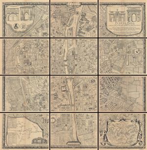
Plan De Paris, Leve Par Les Ordres Du Roy Et Par Les Soins De Messieurs Les Prevost Des Marchands Et Eschevins.
sold
This majestic twelve panel map or plan of Paris is the c. 1900 Taride reissue of an important map originally prepared by Pierre Bullet, Francois Blonde, A. Bonnardt, and Bernard J. H. Jaillot. Like many early maps of Paris, the present example ... (more details)
Important and monumental 20 panel map of Paris, France.
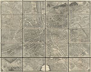
Plan de Paris.
sold
- Digital Map Information
- Suitable for large format printing
- File Size: 17.85 MB
- File Type: ZIP / TIFF
- ICC color profile embedded
- Delivered instantly via download link
This is the c. 1900 Taride edition of Louis Bretez and Michel-Etienne Turgot's monumental 1739 map of Paris. Turgot's map of Paris is possibly the most ambitious urban mapping ever undertaken. Shows the whole of 18th century Paris and offers ... (more details)
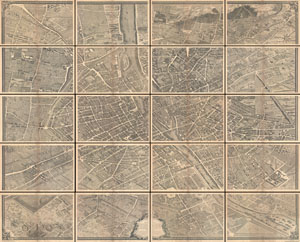
Plan de Paris.
sold
- Digital Map Information
- Suitable for large format printing
- File Size: 39.19 MB
- File Type: ZIP / TIFF
- ICC color profile embedded
- Delivered instantly via download link
This is the c. 1900 Taride edition of Louis Bretez and Michel-Etienne Turgot's monumental 1739 map of Paris. Turgot's map of Paris is possibly the most ambitious urban mapping ever undertaken. Shows the whole of 18th century Paris and offers ... (more details)
Important and monumental 20 panel map of Paris.
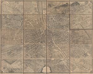
Plan de Paris.
sold
- Digital Map Information
- Suitable for large format printing
- File Size: 30.4 MB
- File Type: ZIP / TIFF
- ICC color profile embedded
- Delivered instantly via download link
This is the c. 1900 Taride edition of Louis Bretez and Michel-Etienne Turgot's monumental 1739 map of Paris. Turgot's map of Paris is possibly the most ambitious urban mapping ever undertaken. This map shows the whole of 18th century Paris and offers a wonderful perspective on the city before Baron Georges Eugène Haussmann's 19th-century redesign. Turgot, who held the mayor-like office of Prevôt des Marchands de Paris , commissioned Louis Bretez and Claude Lucas to produce this map in 1734. Oriented to the east on an axonometric projection, this map is best understood as an aerial view where in every building, window, tree, shadow, and park are shown. It took the team nearly five years of exhaustive sketching and surveying to assemble this masterpiece. In order to produce the thousands of sketches and surveys required to complete this map, Bretez was issued a permit to enter every building in Paris. (more details)
Two weeks before the Siege of Paris.
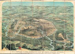
No. 8. Stannard and Son's, Perspective View of Paris and its Environs, Shewing All the Fortifications and Redoubts, Together with the Lines of Defense Recently Thrown Up, and the Roads, Rivers, and Railways Communication with the Interior.
sold
- Digital Map Information
- Suitable for large format printing
- File Size: 61.17 MB
- File Type: ZIP / TIFF
- ICC color profile embedded
- Delivered instantly via download link
Published eighteen days before the beginning of the Siege of Paris on September 17, 1870, this 1870 Alfred Concanen view of Paris and its environs details the newly constructed defensive works around the French capital. Paris itself occupies the center of the view, and the Louvre and Notre Dame are easily identifiable, along with the Arc de Triomphe, the Panthéon, and the Invalides. The city's walls encircle the entire city, spanning 20.5 miles. A series of sixteen disconnected forts, constructed to protect the city gates, surround the city. Redoubts and other fortifications were built as well to supplement the forts. (more details)
Paris after the Haussmann Renovations at the height of the Second Empire.
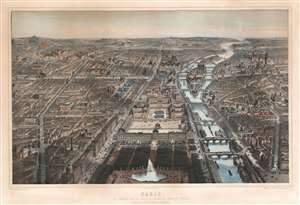
Paris Vue Générale Prise au Dessus de L'Entrée du Jardin ds Tuileries Le Nouveau Louvre, La Rue de Rivoli et Les boulevards.
sold
- Digital Map Information
- Suitable for large format printing
- File Size: 120.04 MB
- File Type: ZIP / TIFF
- ICC color profile embedded
- Delivered instantly via download link
An utterly captivating 1867 large-format lithograph view of Paris by Michel-Charles Fichot and Rose-Joseph Lemercier. The view looks southwest on Paris from hypothetical position above the Bassin Octagonal in the Jardin des Tuileries. The Louvre appears front and center, with the Rue de Rivoli on its left and the Seine on tis right. Notre Dame and the Ile de Cité, the Hôtel de Ville, Tour St. Jacques, and other monuments are apparent. (more details)