
Illinois (sold)
Gangland Style! The greatest pictorial map of all time! Addressing socially, politically, and legally volitile issues!
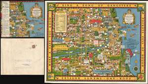
A Map of Chicago's Gangland from Authentic Sources. Designed to Inculcate the Most Important Principles of Piety and Virtue in Young Persons and Graphically Portray the Evils and Sin and Large Cities.
sold
- Digital Map Information
- Suitable for large format printing
- File Size: 52.39 MB
- File Type: ZIP / TIFF
- ICC color profile embedded
- Delivered instantly via download link
Perhaps the greatest pictorial map of all time, this is the legendary 1931 Bruce-Roberts cartoon map of Gangland Chicago, accompanied by its original mailer. Although not drawn to scale, the map covers downtown Chicago from Lincoln Park to Jackson Park and west as far as Cicero and Stickney. When this map was issued, Chicago's Prohibition Era gang wars were winding down. Al Capone, Chicago's criminal king-pin, was convicted of tax evasion and sentenced to 11 years in federal prison in October of this same year. Nonetheless, as this went to press, probably in August or September of 1931, all of Chicago was reeling from years of violent gang warfare. Unlike any previous pictorial map, the revolutionary unknown artist that drew this map is embracing politically, socially, and legally complex issues at the moment of their highest volatility. It comes thus as no surprise that the artist chose to remain anonymous. Despite its violent if cartoonish content, the map was issued with the noble intent, 'to inculcate the most important principles of Piety and virtue in young persons and graphically portray the evils and sin of large cities.' (more details)
1796 Collot Map of the Country of the Illinois (Mississippi River near Missouri, St. Louis, Illinois
The first published map of the St. Louis area.
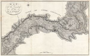
Map of the Country of the Illinois.
sold
- Digital Map Information
- Suitable for large format printing
- DPI: 300
- File Size: 13.95 MB
- File Type: ZIP / TIFF
- ICC color profile embedded
- Delivered instantly via download link
A map of 'superlative' rarity, this is Victor Collot's 1796 map of the Mississippi River in the vicinity of St. Louis, Missouri, or what at the time was known as the 'Country of the Illinois.' Focusing on the Mississippi River valley, this map covers from the ... (more details)
The first English map of the Mississippi River.
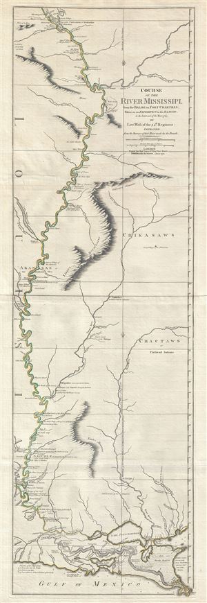
Course of the River Mississipi, from the Balise to Fort Chartres; Taken on an Expedition to the Illinois, in the latter end of the Year 1765.
sold
- Digital Map Information
- Suitable for large format printing
- DPI: 300
- File Size: 15.95 MB
- File Type: ZIP / TIFF
- ICC color profile embedded
- Delivered instantly via download link
A scarce, important, and dramatic map of the Mississippi River Valley from the Gulf of Mexico to Fort Chartres (Illinois). Set on the meridian of New Orleans, this map covers the Mississippi Valley from the Delta of the Mississippi where it joins the Gulf of ... (more details)
The earliest obtainable specific map of the Great Lakes.
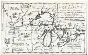
La Louisiana, Parte Settentrionalle, Scoperta sotto la Protettione di Luigi XIV, Re di Francia et Descritta, e Dedicata Dal P. Cosmografo Coronelli, All'Illustriss, et Eccellentiss, S. Zaccaria Bernardi su dell Ecc. S. Francesco.
sold
- Digital Map Information
- Suitable for large format printing
- DPI: 300
- File Size: 6.07 MB
- File Type: ZIP / TIFF
- ICC color profile embedded
- Delivered instantly via download link
This rare 1694 production by Venetian cartographer Vincenzo Coronelli is the earliest and most important obtainable map of the Great Lakes and the headwaters of the Mississippi. Coronelli's map centers on Lake Superior, but covers all five Great Lakes and ... (more details)
The earliest obtainable specific map of the Great Lakes.
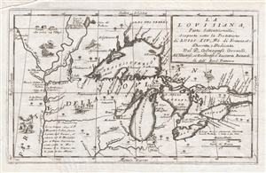
La Louisiana, Parte Settentrionalle, Scoperta sotto la Protettione di Luigi XIV, Re di Francia et Descritta, e Dedicata Dal P. Cosmografo Coronelli, All'Illustriss, et Eccellentiss, S. Zaccaria Bernardi su dell Ecc. S. Francesco.
sold
- Digital Map Information
- Suitable for large format printing
- DPI: 300
- File Size: 5.43 MB
- File Type: ZIP / TIFF
- ICC color profile embedded
- Delivered instantly via download link
This rare 1694 production by Venetian cartographer Vincenzo Coronelli is the earliest and most important obtainable map of the Great Lakes and the headwaters of the Mississippi. Coronelli's map centers on Lake Superior, but covers all five Great Lakes and ... (more details)
Best early map of the Great Lakes.
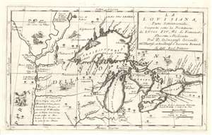
La Louisiana, Parte Settentrionalle, Scoperta sotto la Protettione di Luigi XIV, Re di Francia et Descritta, e Dedicata Dal P. Cosmografo Coronelli, All'Illustriss, et Eccellentiss, S. Zaccaria Bernardi su dell Ecc. S. Francesco.
sold
- Digital Map Information
- Suitable for large format printing
- Full resolution TIFF file
- ICC color profile embedded
- Delivered instantly via download link
This rare 1694 production by Venetian cartographer Vincenzo Coronelli is the earliest and most important obtainable map of the Great Lakes and the headwaters of the Mississippi. Coronelli's map centers on Lake Superior, but covers all five Great Lakes and extends westward as far as the Upper Mississippi River Valley. Cartographically this map is essentially an elaboration upon the 1688 Nolin/Coronelli map, Partie Occidentale du Canada ou de la Nouvelle France. Coronelli was particularly fascinated with the Great Lakes region and this map includes numerous updates and elaborations. (more details)
Rare first edition of Lahontan's highly influential map of the supposedly apocryphal Riviere Longue (Missouri River?)
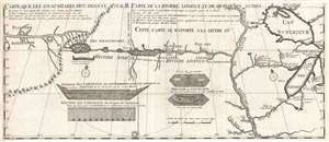
Carte que les Gnacsitares ont Dessine sur / Carte de la Riviere Longue et de quelques Autres qui se Dechargent dans le Grand Fleuve Missisipi.
sold
- Digital Map Information
- Suitable for large format printing
- DPI: 300
- File Size: 7.06 MB
- File Type: ZIP / TIFF
- ICC color profile embedded
- Delivered instantly via download link
A foundational map of extreme importance and influence, this is the rare 1703 first edition of Baron Louis-Armand de Lom d'Arce de Lahontan's, seminal map of the westernmost Great Lakes, the Mississippi River, and an enigmatic tributary river, the Riviere ... (more details)
Rare first edition of Lahontan's highly influential map of the supposedly apocryphal Riviere Longue (Missouri River?)
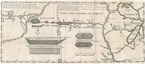
Carte que les Gnacsitares ont Dessine sur / Carte de la Riviere Longue et de quelques Autres qui se Dechargent dans le Grand Fleuve Missisipi.
sold
- Digital Map Information
- Suitable for large format printing
- DPI: 300
- File Size: 8.32 MB
- File Type: ZIP / TIFF
- ICC color profile embedded
- Delivered instantly via download link
A foundational map of extreme importance and influence, this is the rare 1703 first edition of Baron Louis-Armand de Lom d'Arce de Lahontan's, seminal map of the westernmost Great Lakes, the Mississippi River, and an enigmatic tributary river, the Riviere ... (more details)
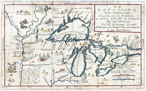
La Louisiana, Parte Settentrionalle, Scoperta sotto la Protettione di Luigi XIV, Re di Francia et Descritta, e Dedicata Dal P. Cosmografo Coronelli, All'Illustriss, et Eccellentiss, S. Zaccaria Bernardi su dell Ecc. S. Francesco.
sold
- Digital Map Information
- Suitable for large format printing
- DPI: 300
- File Size: 6.87 MB
- File Type: ZIP / TIFF
- ICC color profile embedded
- Delivered instantly via download link
This exceedingly rare 1694 map by Vincenzo Coronelli is the most important depiction of the Great Lakes and the headwaters of the Mississippi River to appear in the late 17th century. Covers all five Great Lakes and extends westward as far as the ... (more details)
The ephemeral 'Fast Mail', America's first true 'Express Mail Service'.
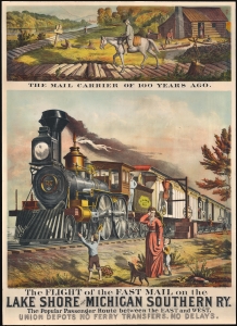
The Flight of the Fast Mail on the Lake Shore and Michigan Southern Ry. The Popular Passenger Route between East and West. Union Depots No Ferry Transfers. No Delays.
sold
- Digital Map Information
- Suitable for large format printing
- File Size: 36.99 MB
- File Type: ZIP / TIFF
- ICC color profile embedded
- Delivered instantly via download link
A spectacular 1875 5-color chromolithograph advertising broadside promoting the 'Fast Mail' route of the Lake Shore and Michigan Southern Railway - this was the first major use of railroads to institute a national 'Express Mail' service. The view contrasts the horse-based mail carrier of 1775 (or literally 1 year prior) to the steam-railroad 'Fast Mail' service. Fast Mail was an ephemeral U.S. postal initiative that utilized the New York Central and Lake Shore and Michigan Southern Railway lines to run an exclusive mail service line capable of moving tons of mail between New York and Chicago - halfway across the country - in just 24 hours. At the time, a ground-breaking achievement. Here, the 'Fast-Mail,' propelled by an impressively rendered steam locomotive, passes through town, hardly slowing as outbound mail is grabbed from a 'mail post' while inbound mail is tossed off the train to a waiting postal worker. (more details)
A real estate map of Wheaton, Illinois featuring a profile illustration of Wheaton College.
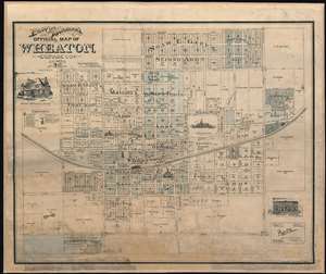
Prout and Burnham's Official Map of Wheaton, Dupage County Illinois.
sold
- Digital Map Information
- Suitable for large format printing
- File Size: 46.91 MB
- File Type: ZIP / TIFF
- ICC color profile embedded
- Delivered instantly via download link
Created as a promotional piece to entice city dwellers to move to Wheaton, this rare 1892 Charles A. Prout and Graham Burnham city plan or map of Wheaton, Illinois, is divided into lots, with numerous different 'additions' identified. Depicting the city from Carleton Avenue (modern-day N. Carlton Street) to President Street and from Prairie Avenue to the Chicago and Batavia Road (modern-day Roosevelt Road), streets throughout town are illustrated and labeled. Profile sketches of Wheaton College, the Court House, the schoolhouse, and both train depots are included, as are small pictorial icons marking the sites of the city's churches. The Chicago and Northwestern Railway arcs across town, splitting the town in half. Profile illustrations of Adam's Memorial Library and Central Block are situated around the map. (more details)
One of the most influential maps of the Great Lakes to appear in the 18th century.
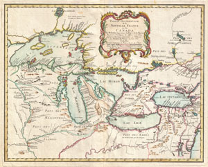
Partie Occidentale de la Nouvelle France ou du Canada.
sold
- Digital Map Information
- Suitable for large format printing
- DPI: 300
- File Size: 13.4 MB
- File Type: ZIP / TIFF
- ICC color profile embedded
- Delivered instantly via download link
A rare and extremely influential 1755 map of the Great Lakes drawn by Jacques Nicholas Bellin. This map, which appeared in the 1755 issue of the Homann Heirs Atlas Major , covers all five of the Great Lakes as well as the adjacent Indian lands ... (more details)
The earliest obtainable example of the first map to introduce four fictional islands in Lake Superior. Islands later used to draw the post-Revolutionary War US-Canada border.
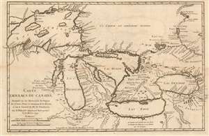
Carte des Lacs du Canada Dresse sur les Manuscrits du Depost des Carts, Plans et Journaux de la Marine et sur le Journal de RP. De Charlevoix.
sold
- Digital Map Information
- Suitable for large format printing
- Full resolution TIFF file
- ICC color profile embedded
- Delivered instantly via download link
This is the 1744 Bellin/ Charlevoix map of the Great Lakes, the most accurate map of the Great Lakes to date and the best to be produced since the De l'Isle map of 1718. It is also the earliest obtainable map, preceded only by a 1742 proof noted by Kershaw, to depict the four fictive islands in Lake Superior (Philippeux, Pontchartrain, Maurepas, and St. Anne) - islands that nonetheless significantly influenced the structuring of post-Revolutionary War borders between British Canada and the fledgling United States. It is also notable for being among the earliest maps to identify Detroit and the Port of Chicago. Bellin's map covers all five Great Lakes and their adjacent drainage systems in considerable detail, noting known fortifications, American Indian villages, missions, and some speculative topography (particularly in Michigan). (more details)
The earliest obtainable example of the first map to introduce four fictional islands in Lake Superior. Islands later used to draw the post-Revolutionary War US-Canada border.
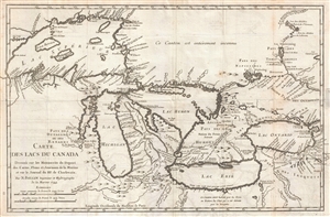
Carte des Lacs du Canada Dresse sur les Manuscrits du Depost des Carts, Plans et Journaux de la Marine et sur le Journal de RP. De Charlevoix.
sold
- Digital Map Information
- Suitable for large format printing
- DPI: 300
- File Size: 5.74 MB
- File Type: ZIP / TIFF
- ICC color profile embedded
- Delivered instantly via download link
An iconic and historically influential 1744 map of the Great Lakes by Jacques-Nicholas Bellin. Possibly Bellin's most important production, this is the earliest obtainable map, preceded only by a 1742 proof noted by Kershaw, to depict the four ... (more details)
The earliest obtainable example of the first map to introduce four fictional islands in Lake Superior. Islands later used to draw post-Revolutionary War US-Canada border.
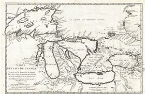
Carte des Lacs du Canada Dresse sur les Manuscrits du Depost des Carts, Plans et Journaux de la Marine et sur le Journal de RP. De Charlevoix.
sold
- Digital Map Information
- Suitable for large format printing
- Full resolution TIFF file
- ICC color profile embedded
- Delivered instantly via download link
An iconic and historically influential 1744 map of the Great Lakes by Jacques-Nicholas Bellin. Possibly Bellin's most important production, this is the earliest obtainable map, preceded only by a 1742 proof noted by Kershaw, to depict the four ... (more details)
The earliest obtainable example of the first map to introduce four fictional islands in Lake Superior. Islands later used to draw the post-Revolutionary War US-Canada border.
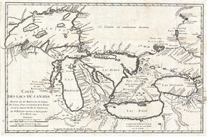
Carte des Lacs du Canada Dresse sur les Manuscrits du Depost des Carts, Plans et Journaux de la Marine et sur le Journal de RP. De Charlevoix.
sold
- Digital Map Information
- Suitable for large format printing
- DPI: 300
- File Size: 6.99 MB
- File Type: ZIP / TIFF
- ICC color profile embedded
- Delivered instantly via download link
An iconic and historically influential 1744 map of the Great Lakes by Jacques-Nicholas Bellin. Possibly Bellin's most important production, this is the earliest obtainable map, preceded only by a 1742 proof noted by Kershaw, to depict the four ... (more details)
Utopian Vision of Chicago's World's Columbian Exhibition.
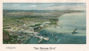
'The Dream City,' The World’s Columbian Exhibition.
sold
- Digital Map Information
- Suitable for large format printing
- File Size: 32.06 MB
- File Type: ZIP / TIFF
- ICC color profile embedded
- Delivered instantly via download link
This is a beautiful and scarce chromolithograph bird’s-eye view of Chicago, Illinois, published as a promotion and souvenir for the World’s Columbian Exposition of 1893. It depicts Chicago's shore of Lake Michigan, foregrounding the buildings of the Columbian Exposition. The city sprawls in the background, with smoke pouring from dozens of chimneys: in the 19th century, a sign of progress and prosperity. The lake is filled with sailboats and steamships, some picking up and discharging passengers at the Exhibition's pier. (more details)
The world's first cane map - a rare novelty from the 1893 Columbian Exposition showing Buffalo Bill's Wild West Show.
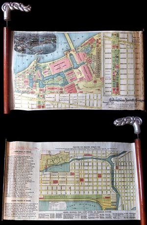
An extremely rare and unusual cane and map prepared in 1893 for the Chicago World's Fair or, as it is better known, the 1893 Columbian Exposition. This is the earliest known example of a cane map. The genre was invented by the Columbian ... (more details)
View of Chicago in the year of its founding!
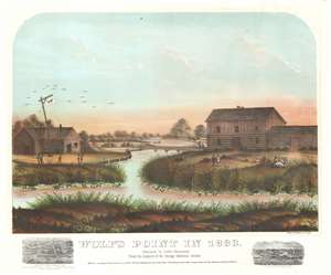
Wolf's Point in 1833.
sold
- Digital Map Information
- Suitable for large format printing
- File Size: 29.24 MB
- File Type: ZIP / TIFF
- ICC color profile embedded
- Delivered instantly via download link
This is a rare 1867 view of Wolf's Point, Chicago, as it appeared near sunset on a summer day in 1833, the year of Chicago's founding. Located at the confluence of the North, South and Main Branches of the Chicago River, Wolf's Point is the earliest site of major development in Chicago, where the city's first shops, taverns, hotels, and theaters were located. Here, Wolf Point Tavern appears on the left, at the time under the management of William Walters (1833 – 1836), with its famous 'wolf' flag. On the opposite bank of here river, a two-story building and adjoining log cabin, possibly represent Miller’s Tavern and store. In the background a simple plank bridge crosses the Chicago River. The foreground reveals a grassy riverside, on which men and women fish, picnic, and generally frolic. Although issued just 34 years after the founding of Chicago, this view already paints the city's early days in the warm tones of nostalgia. (more details)
Imaginary (but important!) Islands of Lake Superior.
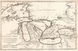
Carte des Lacs du Canada Dresse sur les Manuscrits du Depost des Carts, Plans et Journaux de la Marine et sur le Journal de RP. De Charlevoix.
sold
- Digital Map Information
- Suitable for large format printing
- File Size: 8.57 MB
- File Type: ZIP / TIFF
- ICC color profile embedded
- Delivered instantly via download link
This is the 1744 Bellin / Charlevoix map of the Great Lakes, the most accurate map of the Great Lakes to date and the best produced since the De l'Isle map of 1718. It is also the earliest obtainable map, preceded only by a 1742 proof noted by Kershaw, to depict the four fictive islands in Lake Superior (Philippeux, Pontchartrain, Maurepas, and St. Anne) - islands that nonetheless significantly influenced the structuring of post-Revolutionary War borders between British Canada and the fledgling United States. It is also notable for being among the earliest maps to identify Detroit and the Port of Chicago. Bellin's map covers all five Great Lakes and their adjacent drainage systems in considerable detail, noting known fortifications, American Indian villages, missions, and some speculative topography (particularly in Michigan). (more details)
Important French and Indian War issue of Bellin's influential Map of the Great Lakes. Probably the most decorative of the series.
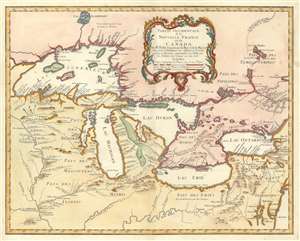
Partie Occidentale de la Nouvelle France ou du Canada.
sold
- Digital Map Information
- Suitable for large format printing
- DPI: 600
- File Size: 22.1 MB
- File Type: ZIP / TIFF
- ICC color profile embedded
- Delivered instantly via download link
A rare and extremely influential 1755 map of the Great Lakes drawn by Jacques Nicholas Bellin. This map, which appeared in the 1755 issue of the Homann Heirs Atlas Major , depicts all five of the Great Lakes as well as the adjacent Indian ... (more details)
Important French and Indian War issue of Bellin's influential Map of the Great Lakes. Probably the most decorative of the series.
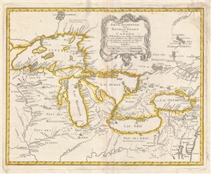
Partie Occidentale de la Nouvelle France ou du Canada.
sold
- Digital Map Information
- Suitable for large format printing
- DPI: 300
- File Size: 11.3 MB
- File Type: ZIP / TIFF
- ICC color profile embedded
- Delivered instantly via download link
A rare and extremely influential 1755 map of the Great Lakes drawn by Jacques Nicholas Bellin. This map, which appeared in the 1755 issue of the Homann Heirs Atlas Major , depicts all five of the Great Lakes as well as the adjacent Indian ... (more details)
Iconic view of Chicago made for the 1893 Columbian Exposition.
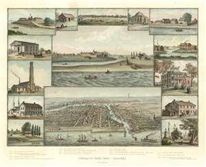
Chicago in Early Days. 1779 - 1857.
sold
- Digital Map Information
- Suitable for large format printing
- Full resolution TIFF file
- ICC color profile embedded
- Delivered instantly via download link
An exceptionally beautiful 1893 Kurz and Allison view of Chicago, Illinois, issued in 1893 to capitalize on the Columbian Exposition or Chicago World's Fair. The image consists of several iconic views of Chicago centered on two contrasting views, Chicago in 1830, three years prior to its founding, appearing at center; and Chicago as a bustling port city, bottom center. The dichotomy presented here underscores the central points of the view - growth, industry, recovery, and prosperity. Surrounding the main view are smaller vignettes illustrating Old Fort Dearborn, the First Settler, Wolf Point, the First Court House, First Rush Medical College, and the Water Works, to name a few. (more details)
Definitive Great Lakes Map of the 18th Century.
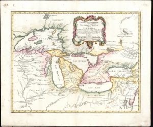
Partie Occidentale de la Nouvelle France ou du Canada.
sold
- Digital Map Information
- Suitable for large format printing
- File Size: 24.47 MB
- File Type: ZIP / TIFF
- ICC color profile embedded
- Delivered instantly via download link
An influential map of the Great Lakes, drawn in 1755 by Jacques Nicholas Bellin and reengraved by Homann Heirs for the 1755 Atlas Homannianus Mathematic-Historice Delineatus. It depicts the five Great Lakes, as well as the adjacent Indian lands and the English colonies of Pennsylvania, New Jersey, and New York. Due to the reach of the Homann Heirs firm, this is one of the most iconic early maps of the Great Lakes. (more details)
Shows American Indian Lands and the Military Bounty Lands in western Illinois.
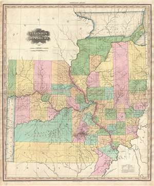
Illinois and Missouri by H. S. Tanner.
sold
- Digital Map Information
- Suitable for large format printing
- DPI: 300
- File Size: 17.22 MB
- File Type: ZIP / TIFF
- ICC color profile embedded
- Delivered instantly via download link
A rare and important map of Illinois and Missouri by H. S. Tanner. This elephant folio map covers all of Illinois and Missouri as well as, in less detail, adjacent parts of Arkansas, Kentucky, and Minnesota. The map shows rivers, ... (more details)
Scarce pocket map of Chicago.
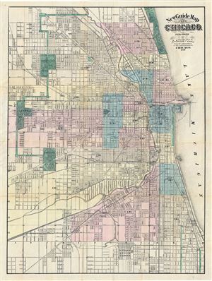
New Guide Map of Chicago. Abraham Lincoln Presidential Library, GZ896 C53 (1875) A834.
sold
- Digital Map Information
- Suitable for large format printing
- File Size: 21.78 MB
- File Type: ZIP / TIFF
- ICC color profile embedded
- Delivered instantly via download link
An extremely rare 1876 pocket map of Chicago, Illinois by the Anders M. Askevold. This Chicago published map covers from Central Park in the west to Lack Michigan in the east, and from Lincoln Park in the north to Union Stock ... (more details)
Art Deco Prohibition view of Chicago as a mirror of the Untied States!
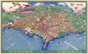
Chicago U.S.A. An Illustrated Map of Chicago Youthful City of the Big Shoulders.
sold
- Digital Map Information
- Suitable for large format printing
- File Size: 45.39 MB
- File Type: ZIP / TIFF
- ICC color profile embedded
- Delivered instantly via download link
An extraordinary 1931 large-format pictorial art-deco view and map of Chicago by Charles Turzak and Henry T. Chapman. Chromolithographed in 'five gay colors', the view humorously embraces Chicago as seen from a highpoint over Lake Michigan, to the northeast. It is centered on the Loop business district, and embraces urban Chicago from the Calmut to Highland Park, and inland as far as Wheaton. Turzak and Chapman's Chicago bustles with life, from 1930s airplanes filling the sky, and fast boats on Lake Michigan, to fast cars, sunbathing beauties, and an enormous blimp. Everything is embraced with wit and charm, from gang wars to Wrigley Tower ('Built of 5¢ Chewing Gum'), to bootlegging. The map, moreover, argues in its form for Chicago as a microcosm of the United States, a message reinforced by the upcoming 1933 Century of Progress World's Fair. The whole is surrounded by an art deco border that defines Chicago, 'youthful city of the big shoulders, restless, ingenious, willful, violent, proud to be alive!' (more details)
Rare map illustrating coal mining in northeastern Illinois.
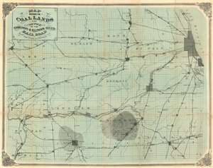
Map showing the Coal Lands and Route of the Chicago and Illinois River Railroad from Chicago to Streator, Ill.
sold
- Digital Map Information
- Suitable for large format printing
- File Size: 44.93 MB
- File Type: ZIP / TIFF
- ICC color profile embedded
- Delivered instantly via download link
A most unusual and mysterious map, this c. 1870 map illustrates railroads and coal fields the northeastern part of Illinois. Coverage extends from Chicago and Lake Michigan westward to the towns of Henry and Lacon, and south as far as Ancona, Reading, and St. Anne. Multiple rail lines are illustrated in detail and coal fields in the vicinity of Grundy and Streator are highlighted with shading. (more details)
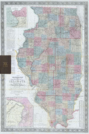
Colton's New Sectional Map of the State of Illinois. Complied from the United States Surveys. Also exhibiting the Internal Improvements, distances between Towns, Villages, & Post Offices: the outlines of Prairies, woodlands, Marshes & the lands donated to the State by the Genl. Govt for the purpose of Internal Improvement.
sold
- Digital Map Information
- Suitable for large format printing
- DPI: 300
- File Size: 28.42 MB
- File Type: ZIP / TIFF
- ICC color profile embedded
- Delivered instantly via download link
This is an extremely scarce 1852 pocket issue map of the state of Illinois by published by J. H. Colton and prepared by J. M Peck, John Messinger, and A. J. Mathewson. Depicts the whole of Illinois with inset maps of 'the ... (more details)
This primary map of Canada emphasized the importance of the river trading routes.' -Kershaw
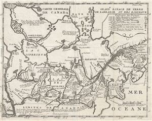
Carte Generale de Canada.
sold
- Digital Map Information
- Suitable for large format printing
- Full resolution TIFF file
- ICC color profile embedded
- Delivered instantly via download link
A fine example of Lahontan's scarce and important 1715 map of the Great Lakes, Canada, and the Upper Mississippi. Lahontan's map covers from the Mississippi River eastward to the mouth of the St. Lawrence and the ... (more details)
An ephemeral railroad.
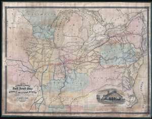
A Section of J. Sage and Sons New and Reliable Rail Road Map comprising all the Rail Roads in operation in the Middle and Western States with their stations and distances.
sold
- Digital Map Information
- Suitable for large format printing
- File Size: 30.49 MB
- File Type: ZIP / TIFF
- ICC color profile embedded
- Delivered instantly via download link
A rare 1858 wall format railroad map issued by J. Sage and Sons. The map's coverage extends from the Mid-Atlantic seaboard west to Missouri and Iowa, inclusive of all of the Great Lakes. It extends south as far as Tennessee and the Outer Banks. A high level of detail is present with regard to rail lines, including many stopping points throughout. Otherwise, the cartographers took a minimalist approach and areas underserved by the railroad networks are generally left blank. Red overprinting emphasizes the Bellefontaine, Terre Haute, and St. Louis Railroad, an extensive network with coverage from New York City to St. Louis. An inset featuring an engraving of the Indianapolis Central Terminal occupies the lower right. (more details)
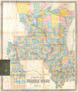
Chapman’s Township Map of the Northwest Compiled from the United States Surveys and other authentic Sources.
sold
- Digital Map Information
- Suitable for large format printing
- File Size: 24.58 MB
- File Type: ZIP / TIFF
- ICC color profile embedded
- Delivered instantly via download link
Offered is an exceedingly rare pocket issue map of the states of Illinois, Iowa, and Wisconsin, with parts of Michigan, Minnesota, Nebraska and Kansas. Printed in 1857 by Silas Chapman and his successors, Dyer & ... (more details)