
Illinois
'The Father of Waters again goes unvexed to the sea.'
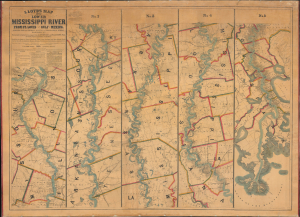
Lloyd’s Map of the Lower Mississippi River From St. Louis to the Gulf of Mexico. Compiled from Government Surveys in the Topographical Bureau...
$17,000.00
Acquire
- Digital Map Information
- Suitable for large format printing
- File Size: 104.66 MB
- File Type: ZIP / TIFF
- ICC color profile embedded
- Delivered instantly via download link
This is James T. Lloyd's engrossing 1863 large-format map of the Mississippi River, produced during the U.S. Civil War (1861 - 1865). It provides a comprehensive overview of the economically vital and strategically critical waterway, then a hotly contested theater of war vital to both the Union and the Confederacy. (more details)
'A system of subways for street cars, at least in the congested districts, is an essential if Chicago is to have good, comfortable, and rapid transportation.' M. J. Foreman
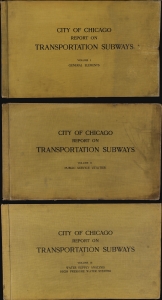
This is an unprecedented and comprehensive 1909 Milton J. Foreman 3-volume feasibility study on the construction of several new subway lines in Chicago. This exhaustive and overwhelming report, enclosed in three massive volumes, contains dozens of maps, charts, and diagrams detailing every factor to be considered in estimating the feasibility, cost, and benefit of both new subway lines and a high-pressure fire deterrent water system for Chicago. (more details)
'The World has never before so lighted up as by the billows of fire that enwrapt doomed Chicago on the dread night of October 9th.'
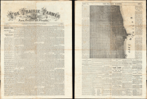
The Prairie Farmer / First Map Issued Showing the District Burned by the Great Chicago Fire Oct. 8 9 and 10, 1871.
$6,500.00
Acquire
- Digital Map Information
- Suitable for large format printing
- Full resolution TIFF file
- ICC color profile embedded
- Delivered instantly via download link
This is the October 14, 1871 (vol 41) issue of the Prairie Farmer containing the first published map of the Great Chicago Fire. This elusive issue was published just days after the fire, wherein the Prairie Farmer building was burnt to the ground. (more details)
One of the earliest maps to promote the 1893 Chicago World's Fair.
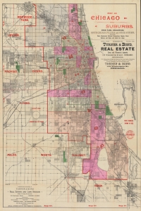
Map of Chicago and Suburbs, Hyde Park, Englewood, South Chicago, Pullman and Other Suburbs, showing Parks, Boulevards, Railroad Connections, Depots, Street Stations and Horse and Cable Car Lines.
$2,000.00
Acquire
- Digital Map Information
- Suitable for large format printing
- Full resolution TIFF file
- ICC color profile embedded
- Delivered instantly via download link
A striking and rare find, this is an 1891 city plan or map of Chicago distributed by the real estate firm Turner and Bond. It is one of the earliest maps, if not the earliest, to promote the 1893 Columbian Exposition (Chicago World's Fair). (more details)
Settling the Upper Midwest.
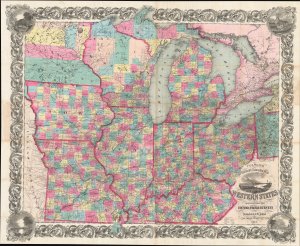
Colton's Railroad and Township Map Western States compiled from the United States Surveys. / Map of the Western States.
$1,500.00
Acquire
- Digital Map Information
- Suitable for large format printing
- File Size: 121.82 MB
- File Type: ZIP / TIFF
- ICC color profile embedded
- Delivered instantly via download link
This is a lovely, decorative, large-format 1854 pocket map of the American Midwest by Joseph H. Colton. It captures the region in the years before the U.S. Civil War and is notable for including Minnesota as a territory as well as demonstrating the rapid expansion of railroads throughout the Midwest. (more details)
Benchmark Map of the Northwest Territory.
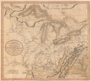
A New Map of Part of the United States of North America, exhibiting The Western Territory, Kentucky, Pennsylvania, Maryland, Virginia and C. Also, the Lakes Superior, Michigan, Huron, Ontario and Erie; with Upper and Lower Canada and C. From the Latest Authorities.
$1,200.00
Acquire
- Digital Map Information
- Suitable for large format printing
- File Size: 22.49 MB
- File Type: ZIP / TIFF
- ICC color profile embedded
- Delivered instantly via download link
Prepared by John Cary in 1805, this is one of the most interesting and attractive maps of the American Frontier and the Great Lakes to emerge in the first years of the 19th century. It provides a detailed snapshot of the western United States in the early years of the republic. (more details)
Detailing the transportation network of the Upper Midwest.
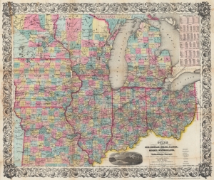
Guide Through Ohio, Michigan, Indiana, Illinois, Missouri, Wisconsin, and Iowa. Showing the Township lines of the United States Surveys, Locations of Cities, Towns, Villages, Post Hamlets, Canals, Rail and Stage Roads.
$1,200.00
Acquire
- Digital Map Information
- Suitable for large format printing
- File Size: 46.6 MB
- File Type: ZIP / TIFF
- ICC color profile embedded
- Delivered instantly via download link
This is an 1855 John Calvin Smith and John H. Colton map of Ohio, Michigan, Indiana, Illinois, Missouri, Wisconsin, and Iowa, along with part of Minnesota. The map captures a pivotal moment as mass emigration, developing industries, and displaced indigenous people transformed regional social, economic, and political spheres. (more details)
Louisiana on the cusp of the Louisiana Purchase.
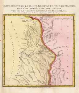
Carte Reduite de la Haute-Louisiane et Pays Circonvoisins, pour etre adaptee a l'ouvrage intitule Vue de la Colonie Espagnole du Mississipi, et c.
$1,000.00
Acquire
- Digital Map Information
- Suitable for large format printing
- DPI: 600
- File Size: 3.93 MB
- File Type: ZIP / TIFF
- ICC color profile embedded
- Delivered instantly via download link
This is Alexandre's Blondeau's exceptional 1803 map of Spanish-administered upper Louisiana, issued for Pierre-Louis Berquin Duvallon's travel narrative, Vue de la Colonie Espagnole due Mississipi. It is one of the best maps to capture the Upper Mississippi Valley on the cusp of the Louisiana Purchase. The map moreover underscores the significance of the Mississippi River as a trade artery between the Great Lakes, and hence the Atlantic, and the Gulf of Mexico. (more details)
One of the Grandest Structures of Pre-Fire Chicago.
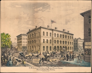
N.W. Corner of Dearborn and Monroe Streets, Chicago, Showing the Post Office Building in the Year 1865.
$950.00
Acquire
- Digital Map Information
- Suitable for large format printing
- File Size: 21.43 MB
- File Type: ZIP / TIFF
- ICC color profile embedded
- Delivered instantly via download link
A 1927 Raoul Varin aquatint view of the Post Office and Customs House, formerly on the northwest corner of Dearborn and Monroe Streets in Downtown Chicago. It depicts the building and its surroundings in 1865, before being destroyed in the 1871 Great Chicago Fire. (more details)
Stunning railroad broadside promoting emigration to Texas.
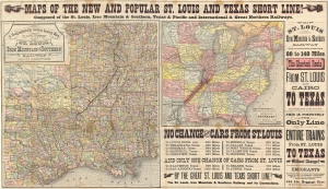
Maps of the New and Popular St. Louis and Texas Short Line!
$900.00
Acquire
- Digital Map Information
- Suitable for large format printing
- File Size: 54.88 MB
- File Type: ZIP / TIFF
- ICC color profile embedded
- Delivered instantly via download link
A striking 1878 promotional map broadsheet issued to promote travel on the St. Louis and Texas Short Line. (more details)
A beautiful view of a church that burned during the 1871 Great Chicago Fire.
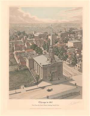
Chicago in 1857. View from the Court House looking South West.
$900.00
Acquire
- Digital Map Information
- Suitable for large format printing
- File Size: 14.45 MB
- File Type: ZIP / TIFF
- ICC color profile embedded
- Delivered instantly via download link
This is a 1930 Raoul Varin aquatint view of the First Baptist Church at the corner of Washington and South LaSalle Streets in Chicago, Illinois, as it appeared in 1857. The view looks southwest over Chicago from the top of the courthouse. The First Baptist Church dominates the foreground, while individual buildings and trees line South LaSalle Street. Ship masts are visible along the Chicago River. Both the courthouse and the First Baptist Church burned during the Great Chicago Fire of October 8-10, 1871. (more details)
Visit the American West via Union Pacific!
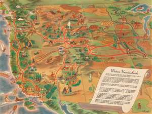
Western Vacationlands.
$750.00
Acquire
- Digital Map Information
- Suitable for large format printing
- Full resolution TIFF file
- ICC color profile embedded
- Delivered instantly via download link
This is a charming 1946 William Willmarth pictorial tourist map of the western United States promoting Union Pacific's western routes. Coverage embraces the western United States from the Mississippi River to Washington, Oregon, and California. Vignettes highlight cities, towns, landmarks, and natural sites throughout the American West. National parks benefit from this treatment, including Yellowstone, the Grand Canyon, Bryce Canyon, Rocky Mountain National Park, Sequoia, and Yosemite. Red lines trace Union Pacific's network, and major cities, including Omaha, Salt Lake City, Kansas City, San Francisco, and Los Angeles, are marked by cityscapes or other buildings. (more details)
Go West!
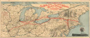
The Popular Through Car Line Between the East and West. New York, Boston, Chicago, and St. Louis. The Niagara Falls Route.
$750.00
Acquire
- Digital Map Information
- Suitable for large format printing
- Full resolution TIFF file
- ICC color profile embedded
- Delivered instantly via download link
A 1898 Wynkoop Hallenbeck railroad map of the northeastern United States promoting the West Shore Railroad and its connections between Boston, New York, Chicago, and St. Louis. (more details)
A rare cartoon map of the U.S. Naval Training Center Great Lakes - today the U.S. Navy's largest training center.
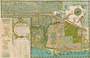
A Cartoon Map of the U.S. Naval Training Center Great Lakes, Illinois, Being as True and Faithful a Graphical Representation as the Cartographer's Art Will Allow, Taking Into Carful Account Prominent Natural Features and Including Certain Man-Made Structures as Bridges, Roads, and Divers Buildings.
$750.00
Acquire
- Digital Map Information
- Suitable for large format printing
- Full resolution TIFF file
- ICC color profile embedded
- Delivered instantly via download link
This is a 1949 Robert William Gadbois and Theodore J. Ritter cartoon pictorial map of the U.S. Naval Training Center Great Lakes, situated on the banks of Lake Michigan just north of Chicago in Illinois. Created in the post-war period, the map depicts the training center from the east and illustrates from Camp Porter to Foss Park and from the drill field to Lake Michigan. Highly detailed, myriad buildings throughout the U.S.N.T.C. are illustrated and labeled. Numerous camps, set up to house the tens of thousands of men present at the camp at any one time, are identified (most of which are named after Naval heroes), including Camp Downes, Camp Dewey, Camp Barry, Camp Moffett, and Camp Paul Jones. Ross Field, across from the main railway station, is named after Captain Albert R. Ross who supervised the base's construction. The Naval Hospital is also prominently labeled, complete with a patient drawn chasing a nurse. Other comic illustrations include a man in a striped suit, sailors playing ping pong, and another sailor drilling holes in the Drill Field. Others include a sea monster in Lake Michigan wearing a sailor's 'gob cap', a sailor riding a gigantic sea horse, and another sailor being romanced by a mermaid. There's even an octopus using a fishing pole fishing off a pier! A large decorative cartouche is situated in the lower left quadrant, just above an index of over one hundred buildings located throughout the base. (more details)
The World from Midway Airport.
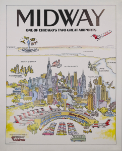
This is a 1985 Midway Airlines promotional pictorial view of Chicago, done in the style of Saul Steinberg's New Yorker covers, such as The World from 9th Avenue. Though Midway Airlines went bankrupt in 1991, it is credited with reviving the fortunes of Midway Airport, which was underutilized until the airline began operating. (more details)
U.S. Navy's largest training center - celebrating Christmas and New Years.
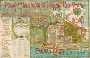
Merry Christmas! And Happy New Year! A Cartoon Map of the U.S. Naval Training Center at Great Lakes, Illinois.
$600.00
Acquire
- Digital Map Information
- Suitable for large format printing
- Full resolution TIFF file
- ICC color profile embedded
- Delivered instantly via download link
This is a 1949 Robert William Gadbois and Theodore J. Ritter cartoon pictorial map of the U.S. Naval Training Center Great Lakes. This example features overprinting wishing the viewer a 'Merry Christmas and Happy New Year from Great Lakes' and an illustration of Santa in his sleigh with some reindeer and holly. (more details)
Building warplanes in Chicago during WWII.
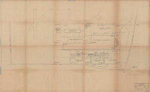
Douglas Aircraft Company, Inc. Chicago Plant Plant Layout. Factory Bldg. Plot Plan.
$550.00
Acquire
- Digital Map Information
- Suitable for large format printing
- File Size: 35.45 MB
- File Type: ZIP / TIFF
- ICC color profile embedded
- Delivered instantly via download link
This is a 1944 plan or map of the Douglas Aircraft Company plant in Chicago, Illinois. At the time of construction, the plant (now part of O'Hare International Airport) was the largest all-timber structure in the world. The plant built hundreds of transport aircraft to help the United States and the other Allied powers win World War II (1939 - 1945) and was constructed out of timber because steel was a strategically critical resource. (more details)
Tools for Victory.
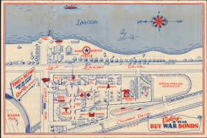
Weapons of War An Exhibit of the Army Service Forces Contrasting America's War Equipment with that of the Axis.
$550.00
Acquire
- Digital Map Information
- Suitable for large format printing
- Full resolution TIFF file
- ICC color profile embedded
- Delivered instantly via download link
This is a 1944 Army Corps of Engineers pictorial map of the Weapons of War exhibition in Grant Park in Chicago. The exhibition was intended to display the spoils of war, rally support for the U.S. effort in the conflict, and, above all, sell war bonds. (more details)
Land of Lincoln.
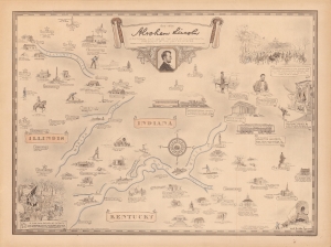
Abraham Lincoln, a pictorial outline of the life of the sixteenth president of the United States.
$500.00
Acquire
- Digital Map Information
- Suitable for large format printing
- File Size: 52.94 MB
- File Type: ZIP / TIFF
- ICC color profile embedded
- Delivered instantly via download link
A curious historical 1934 Karl Smith pictorial map of portions of Kentucky, Illinois, and Indiana, along with Washington, D.C. It traces the momentous life of Abraham Lincoln, from his childhood, to his presidency, through the Civil War, to his final resting place in Springfield, Illinois. (more details)
Early Days of Interstate 80.
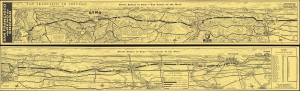
San Francisco via Reno to Chicago / Direct Routes to Reno - 'Fun Center of the West'.
$450.00
Acquire
A whimsical two-sided pictorial strip map of highway routes between San Francisco and Chicago drawn by Gerald Eddy in 1961 for Harold's Club casino in Reno. Among other features, it is notable for showcasing Interstate 80, only designated five years prior. It is part of series of similar strip map issued by Eddy for Herod's Club, but by far the rarest. (more details)
Includes Illinois' first railroad.
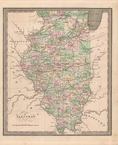
Illinois.
$350.00
Acquire
- Digital Map Information
- Suitable for large format printing
- Full resolution TIFF file
- ICC color profile embedded
- Delivered instantly via download link
This is Jeremiah Greenleaf's 1849 map of Illinois. It appeared in his Universal Atlas and is notable for its level of detail. (more details)
Depicts the Illinois and Michigan Canal which helped establish Chicago as a transportation hub before railroads became the dominant form of transportation.
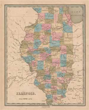
Illinois.
$350.00
Acquire
- Digital Map Information
- Suitable for large format printing
- DPI: 300
- File Size: 4.09 MB
- File Type: ZIP / TIFF
- ICC color profile embedded
- Delivered instantly via download link
This is an 1846 Thomas G. Bradford map of Illinois. The map depicts the region from Iowa (labeled Wisconsin) and Missouri to Indiana and Kentucky and from Lake Michigan and Wisconsin to Missouri and Kentucky. Highly detailed, each county is labeled and shaded a ... (more details)
Fascinating Early Road Map of Wisconsin.
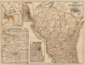
Mendenhall's Guide and Road Map of Wisconsin.
$300.00
Acquire
- Digital Map Information
- Suitable for large format printing
- File Size: 51.89 MB
- File Type: ZIP / TIFF
- ICC color profile embedded
- Delivered instantly via download link
A scarce large-format road map of Wisconsin from the early days of automobile travel, produced and published in 1907 by C. S. Mendenhall. It demonstrates the development of (mostly dirt) automobile roads in the state as a growing alternative to railroads. (more details)
Illinois-Wisconsin Lead Boom.
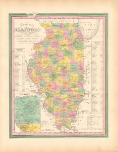
A New Map of Illinois with its Proposed Canals, Roads and Distances from Place to Place along the Stage and Steam Boat Routes.
$250.00
Acquire
- Digital Map Information
- Suitable for large format printing
- File Size: 8.6 MB
- File Type: ZIP / TIFF
- ICC color profile embedded
- Delivered instantly via download link
This is an uncommon 1846 map of Illinois by S. Augustus Mitchell. It highlights the early 19th-century Lead Boom around Galena. (more details)
Mid 19th century map of Illinois.
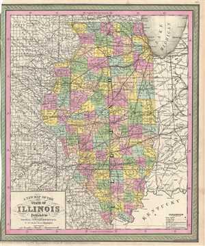
A New Map of the State of Illinois.
$250.00
Acquire
- Digital Map Information
- Suitable for large format printing
- DPI: 300
- File Size: 8.45 MB
- File Type: ZIP / TIFF
- ICC color profile embedded
- Delivered instantly via download link
A fine example of Thomas Cowperthwait and S. A. Mitchell's 1854 map of Illinois. The whole is engraved and colored in Mitchell's distinctive style with green border work and vivid pastels. Political and topographical features are noted and color coded with ... (more details)
Creates a visual comparison of the industrial strength of the North versus the weakness of the South in relation to the number of constructed and proposed railroad lines.
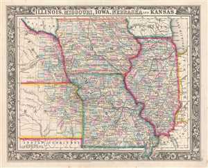
Illinois, Missouri, Iowa, Nebraska, and Kansas.
$200.00
Acquire
- Digital Map Information
- Suitable for large format printing
- File Size: 4.88 MB
- File Type: ZIP / TIFF
- ICC color profile embedded
- Delivered instantly via download link
This is an 1861 Samuel Augustus Mitchell, Jr. map of Illinois, Missouri, Iowa, Nebraska, and Kansas. The map depicts the region from Nebraska and Kansas to Indiana and Kentucky and from Dacotah, Iowa, and Wisconsin to the Indian Territory, Missouri, and ... (more details)
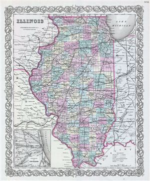
Illionois.
$150.00
Acquire
- Digital Map Information
- Suitable for large format printing
- File Size: 9.57 MB
- File Type: ZIP / TIFF
- ICC color profile embedded
- Delivered instantly via download link
An excellent 1855 first edition example of Colton's map of Illinois. Like most of Colton's state maps, this map was derived from an earlier wall map of North America produced by Colton and D. Griffing Johnson. The map depicts the state of Illinois ... (more details)
Attractive map showing Indian tribes in Mississippi.
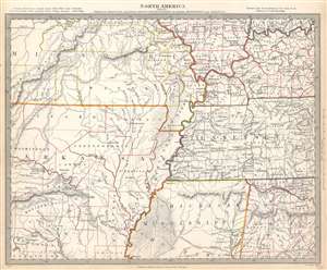
North America Sheet X Parts of Missouri, Illinois, Kentucky, Tennessee, Alabama, Mississippi and Arkansas.
$125.00
Acquire
- Digital Map Information
- Suitable for large format printing
- Full resolution TIFF file
- ICC color profile embedded
- Delivered instantly via download link
This is an 1833 Society for the Diffusion of Useful Knowledge or S.D.U.K. map of Arkansas, Missouri, Mississippi, Kentucky, Tennessee, Alabama and Illinois. The map depicts the region from the Ozark Mountains to Rome, Indiana and Huntsville, Alabama and from Mount Leansboro, Illinois to Columbus, Mississippi. The states are outlined in different colors to allow for easy differentiation, along with individual counties within each state, which are also labeled. Cities, towns, and villages are identified throughout, including Little Rock, Arkansas. Rivers, mountains, Indian villages, and topographical features are also noted throughout, with relief shown by hachure. (more details)
Map of Illinois with a view of the Chicago Courthouse.
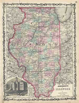
Johnson's Illinois.
$125.00
Acquire
- Digital Map Information
- Suitable for large format printing
- File Size: 10.11 MB
- File Type: ZIP / TIFF
- ICC color profile embedded
- Delivered instantly via download link
This is a beautiful example of A. J. Johnson and R. Browning's 1861 map of Illinois. It covers the entire state as well as portions of the adjacent states of Iowa, Missouri and Indiana. The map is color coded according to county and notes several ... (more details)
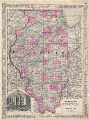
Johnson's Illinois.
$100.00
Acquire
- Digital Map Information
- Suitable for large format printing
- File Size: 10.47 MB
- File Type: ZIP / TIFF
- ICC color profile embedded
- Delivered instantly via download link
This is Johnson and Ward's 1863 map of Illinois. This map shows cities, topographical features, railways, ferries and roads with color coding at the county level. Covers the entire state as well as portions of the adjacent states of Iowa, ... (more details)
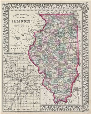
County map of the state of Illinois.
$100.00
Acquire
- Digital Map Information
- Suitable for large format printing
- File Size: 7.07 MB
- File Type: ZIP / TIFF
- ICC color profile embedded
- Delivered instantly via download link
A beautiful example of the legendary American map publisher Samuel Augustus Mitchell Jr.'s 1872 map of the state of Illinois. The map covers the state of Illinois as well as portions of the adjacent states of Iowa, Missouri, Kentucky and ... (more details)
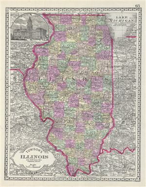
Tunison's Illinois.
$100.00
Acquire
- Digital Map Information
- Suitable for large format printing
- File Size: 7.32 MB
- File Type: ZIP / TIFF
- ICC color profile embedded
- Delivered instantly via download link
This is a beautiful example of the 1887 Tunison map of Illinois. It covers the entire state as well as portions of the adjacent states of Missouri, Kentucky and Indiana. The upper left quadrant contains a beautiful illustration of the ... (more details)