
World War II (sold)
A rare limited edition serio comic map of Europe just after the outbreak of World War II.
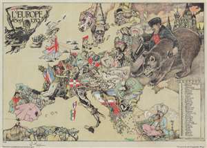
L'Europe en Sept. 1939.
sold
- Digital Map Information
- Suitable for large format printing
- Full resolution TIFF file
- ICC color profile embedded
- Delivered instantly via download link
This is a striking 1939 André Vlaanderen serio-comic map of 'Europe in September 1939' just after the outbreak of World War II - hand colored and signed by the author in a limited release of 150 (this is no. 10). Vlaanderen adopts the serio-comic map genre to convey the violence, chaos, and fear then enveloping Europe. He pays tribute to Fred Rose, the popularizer of the serio-comic map, by drawing Norway and Sweden (Nos. 13 and 14) as dogs, following Rose's 1899 Angling in Troubled Waters. Instead of providing our own explication of this map, we offer Vlaanderen's words in translation from a French version of the accompanying typewritten Dutch text. (more details)
Nazi General's presentation atlas of Operation Barbarossa - before it all went to hell.
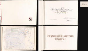
Der Feldzug gegen die Sowiet-Union / Kriegsjahr 1941 / Bearbeitet in der Führungsabteilung des Oberkommandos der Heeresgruppe Nord.
sold
A proof-state white-kid-bound 1941 World War II German general's presentation atlas, here in its only known example, chronicling the first 6 months of Operation Barbarossa. It was lavishly published on Christmas Eve 1941 by the General Staff of Army Group North as a gift to members of Army Group North's General Staff participating in the invasion. This atlas appeared at a high point in the Nazi campaign to conquer the Soviet Union, and the bravado that accompanied their early successes is evident. The present example, 'proof no. 2', is the only known surviving copy. (more details)
Japanese war propaganda.
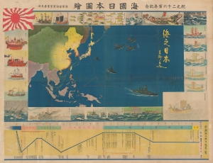
海國日本圖繪 紀元二千六百年紀念 / [Depiction of Maritime Japan, to Commemorate the 2600th Anniversary of the Imperial Family].
sold
- Digital Map Information
- Suitable for large format printing
- File Size: 477.31 MB
- File Type: ZIP / TIFF
- ICC color profile embedded
- Delivered instantly via download link
A rare, huge, and brilliantly-colored propaganda work issued by the Imperial Japanese Navy (IJN) on the eve of the Pearl Harbor attack, this 1940 map celebrates the history of Japan's maritime ventures and the strength of the IJN. It also celebrates the 2600th anniversary of the Japanese imperial family that year, which was accompanied by an outpouring of hypernationalist propaganda. (more details)
Unique archive of the vitriolic public dispute between celebrity journalist Walter Winchell and conspiracy theory fascist Joseph Kamp.
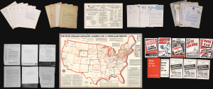
The Fifth Column Conspiracy in America. Authentic Map and DIrectory. / Archive of Kamp's Phamplets and Correspondence with Walter Winchell. / The Hour. / [Letters and Documents], Etc.
sold
This is a c. 1940 - 1944 archive chronicling the vitriolic feud between the conspiracy theorist and pamphleteer Joseph Peter Kamp and the celebrity-journalist Walter Winchell, including Kamp's powerful, persuasive map The Fifth Column Conspiracy in America. It captures fear, misinformation, and ambiguity of the home front during World War II (1939 - 1945), where the internal threats of communism and fascism loomed as large as the war abroad. The fearmongering and propaganda foreshadowed Senator Joseph McCarthy and his 'Second Red Scare' (1950 - 1954). The archive was assembled by Walter Winchell to record Kamp's attacks on himself and, in Winchell's view, on American democracy. (more details)
Extraordinary manuscript satirical map of Europe during World War II with Chinese Text.
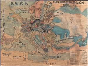
Mapa Humoristico Da Europa - Guerra - 1939 / 歐戰现像
sold
- Digital Map Information
- Suitable for large format printing
- File Size: 8.5 MB
- File Type: ZIP / TIFF
- ICC color profile embedded
- Delivered instantly via download link
An exceptional zoomorphic satirical map of Europe in 1939, here in manuscript form with all text translated into Chinese. This map is based upon a map drawn by the artist António Soares and published by Livraria Franco just weeks after the October 1939 outbreak ... (more details)
Pre-invasion manuscript planning map of Guadalcanal - a decisive WWII battle.
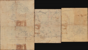
Guadalcanal Island.
sold
- Digital Map Information
- Suitable for large format printing
- Full resolution TIFF file
- ICC color profile embedded
- Delivered instantly via download link
This is a 1942 four-sheet manuscript World War II map of Guadalcanal, Solomon Islands, prepared ship-board in anticipation of the decisive August 7, 1942, landing on Guadalcanal that began the Guadalcanal Campaign. It is one of the few surviving maps from the ad hoc Marine effort to gather critical reconnaissance on Guadalcanal days before the impending invasion. It is thus unique record of one of the most decisive and pivotal battles in the World War II (1939 - 1945) Pacific Theater. (more details)
Spectacular pictorial world map illustrating Post-WII situation in Europe and America.
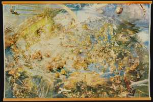
[Oliver Neerlands Bildkarta]
sold
- Digital Map Information
- Suitable for large format printing
- Full resolution TIFF file
- ICC color profile embedded
- Delivered instantly via download link
This is an utterly stunning 1949 pictorial color lithograph wall map of the northern part of the western world by the Norwegian artist Oliver Neerland. The map covers all of North America, the North Atlantic, and Europe as far east as the Caspian Sea, as well as from the North Pole to the Amazon River and Liberia. Lavish illustration depicts historic figures, monuments, art and architecture, animals, airplanes, dirigibles, sailing ships of all types, aircraft characters, and more. (more details)
Unique record of Mayfair WWII nightlife at the height of the Blitz.
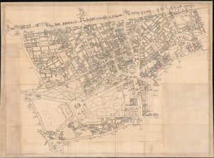
[Mayfair / Soho, London]
sold
- Digital Map Information
- Suitable for large format printing
- Full resolution TIFF file
- ICC color profile embedded
- Delivered instantly via download link
An extraordinary artifact of wartime London, this unique 1941 manuscript map captures the theaters, nightclubs, restaurants, hotels, pubs, illicit establishments, and air-raid shelters of Mayfair, Soho, and the West End at the height of the Blitz. It documents London balanced precariously between pleasure and destruction: orchestras played, couples danced, and fashionable clubs welcomed servicemen, aristocrats, refugees, actors, diplomats, and intelligence officers even as blackout curtains smothered windows and German bombs fell overhead. Its remarkable annotations offer an intimate, street-level portrait of London nightlife under siege. (more details)
Optimism and danger in Post-WWII Europe and America.
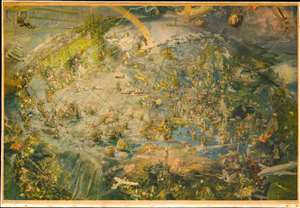
[Oliver Neerlands Bildkarta].
sold
- Digital Map Information
- Suitable for large format printing
- Full resolution TIFF file
- ICC color profile embedded
- Delivered instantly via download link
This is an utterly stunning 1949 pictorial color lithograph wall map of the northern part of the western world by the Norwegian artist Oliver Neerland. The map covers all of North America, the North Atlantic, and Europe as far east as the Caspian Sea, as well as from the North Pole to the Amazon River and Liberia. Lavish illustration depicts historic figures, monuments, art and architecture, animals, airplanes, dirigibles, sailing ships of all types, aircraft adventurers, and more. (more details)
Six WWII Propaganda maps.
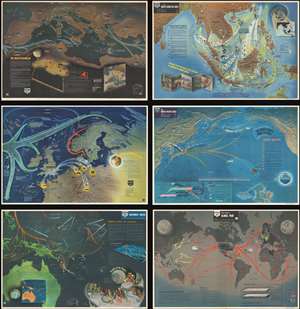
NavWarMap No. 1 The Mediterranean. / NavWarMap No. 2 The South China Sea Area. / NavWarMap No. 3 World War 2 in the North Sea Area. / NavWarMap No. 4 The North Pacific Area. / NavWarMap No. 5. Southwest Pacific. / NavWarMap No. 6 We Fight a Global War.
sold
This is a full set of all six 1944 Navy Department pictorial maps of the worldwide battlefronts during World War II. (more details)
Using aerial photography to make maps during WWII.
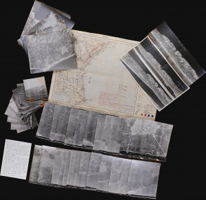
This is a 1943 World War II archive of 39 aerial photographs and a map of Sicily used in planning Operation Ladbroke, the first Allied invasion based on the mass use of gliders. This archive provides insight into how Allied war planners developed operations and integrated new technologies. Aerial photographic interpretation was a cutting-edge field for military planners. This archive represents the advancement of military planning and innovation of cartography through advanced aircraft and photographic technology. (more details)
Monumental and rare World War II route map.
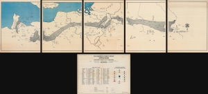
Operations from Omaha Beach to Elbe River.
sold
- Digital Map Information
- Suitable for large format printing
- Full resolution TIFF file
- ICC color profile embedded
- Delivered instantly via download link
This is a monumental and impressive 1945 John A. LeDonne route map of Europe tracing the movements of the 1115th Engineer Combat Group during World War II. It is the largest and most impressive 'Route Map' to emerge out of World War II (1939 - 1945). (more details)
A manuscript map of a POW camp for Italian prisoners in East Africa during World War II.
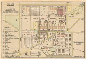
Plan of Mandera Evacuation Camp.
sold
- Digital Map Information
- Suitable for large format printing
- File Size: 7.46 MB
- File Type: ZIP / TIFF
- ICC color profile embedded
- Delivered instantly via download link
A once-in-a-lifetime discovery, this is a 1942 manuscript map of the Mandera Evacuation Camp in British Somaliland (modern-day northwestern Somalia) drawn by Dino Memmo, an Italian military engineer who was tasked by the British to organize the Mandera. The Mandera Camp was created by the British to house Italian POWs and civilian internees during and after the British campaign in Italian East Africa. Despite the harsh conditions, the existence of the camps remains little more than a side note in history - here illustrated perhaps for the only time. (more details)
An exceedingly rare anti-British collaborationist propaganda poster from Vichy France.
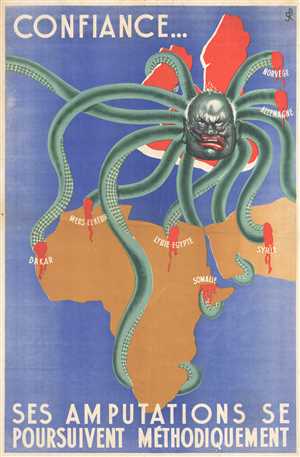
Confiance…Ses Amputations Se Poursuivent Méthodiquement. (Faith…[His] Amputations are Proceeding Methodically).
sold
- Digital Map Information
- Suitable for large format printing
- File Size: 31.88 MB
- File Type: ZIP / TIFF
- ICC color profile embedded
- Delivered instantly via download link
An exceedingly rare find, this c. 1942 collaborationist Vichy French propaganda poster demonizes Britain and her efforts to wrest control of French and Italian territorial possessions from Axis control. Per War Map , 'propaganda pieces produced by defeated and ... (more details)
Monumental and rare World War II route map.
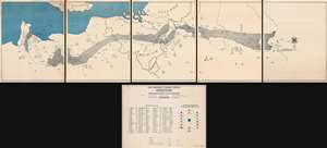
Operations from Omaha Beach to Elbe River.
sold
- Digital Map Information
- Suitable for large format printing
- Full resolution TIFF file
- ICC color profile embedded
- Delivered instantly via download link
This is a monumental and impressive 1945 John A. LeDonne route map of Europe tracing the movements of the 1115th Engineer Combat Group during World War II. It is the largest and most impressive 'Route Map' to emerge out of World War II (1939 - 1945). (more details)
'Imagine the tragedy to you and your family if an invader had ravaged America...'
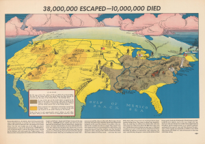
38,000,000 Escaped - 10,000,000 Died...
sold
- Digital Map Information
- Suitable for large format printing
- Full resolution TIFF file
- ICC color profile embedded
- Delivered instantly via download link
This is Elliott Means' powerful c. 1943 World War II pictorial persuasive map of the United States of America under partial Nazi occupation, produced for the organization Russian War Relief. The poster highlights the effects of the war on the Soviet Union by finding American parallels in terms of area of land occupied, cities destroyed, and industries forced to relocate. (more details)
Fearmongering Japanese Propaganda suggesting an American Surprise attack on Japan - 7 years before WWII!

太平洋攻防戰略圖 / [Sketch Map of Pacific Warfare].
sold
- Digital Map Information
- Suitable for large format printing
- Full resolution TIFF file
- ICC color profile embedded
- Delivered instantly via download link
An astonishing 1935 Kagaku no Nihon Japanese propaganda map of the Pacific demonizing the United States and predicting an American attack on Japan. The map was part of internal Japanese pre-war propaganda efforts intended to establish a clear line of threat and thus promote Imperial Japanese expansionist goals as essential to national security - particularly Hawaii, which is central to this piece and, as the map suggests, key to controlling the Pacific. The cartographer assiduously documents the relative strength of the various powers in the region and their overlapping spheres of influence, presaging the Pacific War that would come seven years later. (more details)
British propaganda celebrating 'victory' in the Battle of the Atlantic.
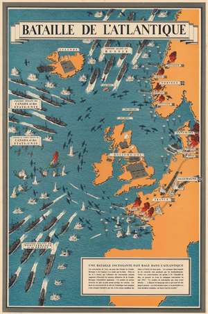
Bataille de l'Atlantique.
sold
- Digital Map Information
- Suitable for large format printing
- File Size: 84.51 MB
- File Type: ZIP / TIFF
- ICC color profile embedded
- Delivered instantly via download link
This is a 1943 Frederick Donald Blake pictorial propaganda broadside of the Battle of the Atlantic - one of the longest and bloodiest campaigns of World War II (1939 - 1945). (more details)
A list of ships participating in the invasion of Iwo Jima that was supposed to be destroyed!
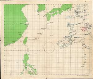
This is a 1945 manuscript annotated map of the final Pacific World War II combat voyage of the aircraft carrier U.S.S. Saratoga. The map, executed by an unknown member of Saratoga's crew, features manuscript annotation that chronicles the Saratoga's movements from February 14, 1945 through February 22, 1945. (more details)
WWII in the Pacific: drafted to discharged.
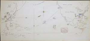
[Untitled Manuscript Pacific War Route Map].
sold
- Digital Map Information
- Suitable for large format printing
- File Size: 2.77 MB
- File Type: ZIP / TIFF
- ICC color profile embedded
- Delivered instantly via download link
A remarkable survival, this is a c. 1947 manuscript pictorial route map of the Pacific War following the World War II service of a U.S. Navy man. Pictorial vignettes highlight the sailor's wartime experience: swearing in, working at the Charleston Navy Yard, surveying the Pacific, weathering typhoons, mine sweeping, good times in Shanghai, and the voyage home. Dated lines trace his travels, with red dates marking wartime movements and yellow dates identifying his return. (more details)
Saving Indochine from Algiers
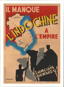
Il Manque l'Indochine à l'Empire.
sold
- Digital Map Information
- Suitable for large format printing
- File Size: 42.43 MB
- File Type: ZIP / TIFF
- ICC color profile embedded
- Delivered instantly via download link
This is a striking 1943 propaganda poster designed by R. Danyach for the Commissariat à l'Information and the Service Géographique Militaire en Afrique of the Free French government-in-exile during World War II. Produced in Algeria, headquarters of the Free French government before the liberation of Paris the following year, the map focuses on resisting Japanese control over Indochina, reflecting concerns that the war would ultimately lead to the end of France's overseas empire. (more details)
Likely created by American intelligence officials from a Japanese map captured on Okinawa, this map illustrates Japanese defensive positions in southern Okinawa during the Battle of Okinawa.
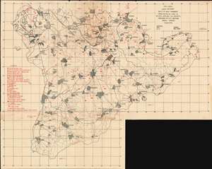
XXIV Corps. Enemy Defenses South of Naha-Yohabaru. From Photos of 1 April to 28 April 1945 and TICC Reports.
sold
- Digital Map Information
- Suitable for large format printing
- File Size: 29.55 MB
- File Type: ZIP / TIFF
- ICC color profile embedded
- Delivered instantly via download link
A rare 1945 World War II military intelligence map of southern Okinawa likely created by American intelligence officers from a captured Japanese map. This 1945 XXIV Corps Intelligence Section map was prepared to support what would become the last major battle of the Pacific War. Red overprinting highlights the known Japanese defensive positions from Yonabaru to the southern tip of the island. A legend situated along the left border details twenty-six types of Japanese military installations, including coastal guns, three different types of artillery emplacements, pillboxes, mortars, machine guns, and command posts. Japanese trenches and anti-tank defenses are also marked. Two text notes printed along the coastline near Itarashiku and Mesato, respectively, read 'Suicide Boat Area', which refer to Japanese Shin'yō-class motorboats. These boats were part of a Japanese program to create suicide craft, which included kamikaze planes, kaiten submarines, fukuryu suicide divers, and the shinyo boats. They were operated by one man, could travel up to thirty knots, and carried up to 300 kilograms (660 pounds) of explosives in their bow, which could either be detonated by the driver or on impact. (more details)
Pre-Invasion British Intelligence reconnaissance of Rangoon.
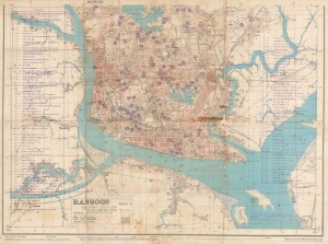
HIND 1036 Rangoon Sheet 2. Third Edition.
sold
- Digital Map Information
- Suitable for large format printing
- File Size: 40.31 MB
- File Type: ZIP / TIFF
- ICC color profile embedded
- Delivered instantly via download link
A unique survivor, this is an April 1945 Allied Land Forces South East Asia (ALFSEA) World War II pre-invasion intelligence map of Rangoon, Burma, identifying enemy locations. ALFSEA overprinting anticipates the May 1945 British assault on Rangoon, highlighting 122 key locations one month before the British retook the city: Indian National Army barracks and camps, Japanese military installations, Burmese government offices, a prisoner-of-war camp, and the barracks and headquarters of the Rani of Jhansi Regiment, the only women's regiment of the Indian National Army. (more details)
Spreading the Word about Sinking Axis Ships.
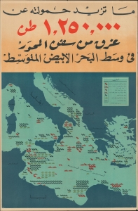
ما ترر حمولة من 1,250,000 طن من سفن المحور في وسط البحر الأبيض المتوسط / [Over 1,250,000 tons of Axis shipping sunk in the central Mediterranean].
sold
- Digital Map Information
- Suitable for large format printing
- File Size: 28.98 MB
- File Type: ZIP / TIFF
- ICC color profile embedded
- Delivered instantly via download link
A vibrant c. 1943 chromolithographed Arabic-language propaganda poster, cheering the Allied war effort and celebrating the sinking of Axis ships in the Mediterranean. (more details)
Details the U.S. government forced internment of over 100,000 Japanese Americans.
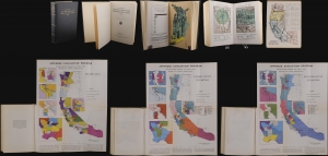
This is a 1943 U.S. government report detailing the forced internment of west-coast Japanese Americans during World War II (1939 - 1945). The reports offers disturbing insights into the racist policies and unfounded paranoia that gripped the nation in the wake of the 1941 attack on Pearl Harbor. (more details)
Issued on the very day the Taiwan-based Japanese Southern Army finalized plans to invade the Philippines.
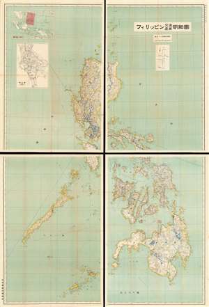
Philippines Detailed Traffic and Industry Map. / フィリッピン交通產業明細圖
sold
- Digital Map Information
- Suitable for large format printing
- File Size: 179.57 MB
- File Type: ZIP / TIFF
- ICC color profile embedded
- Delivered instantly via download link
An impressive 1941 Showa 16 Japanese map of the Philippines. This enormous production covers the entirety of the Philippines in incredible detail. It was issued by the Japanese Bureau of Information just months before the December 1941 invasion of the Philippines. The focus of the map is the Philippine transportation network. The level of detail evident in this map illustrates the extreme interest the Japanese had in the Philippines, not only as a source of personnel and resources, but as a stepping stone to Southeast Asia and Melanesia. (more details)
Administrative map issued at the height of the WWII Japanese occupation fo the Philippines.
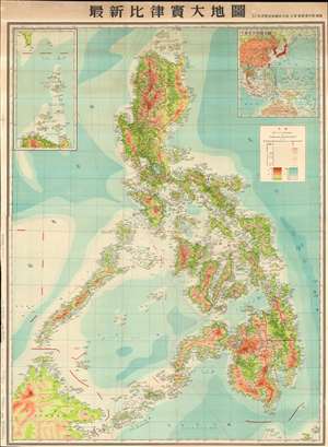
New Large Map of the Philippines. / 圖地大質律比新最
sold
- Digital Map Information
- Suitable for large format printing
- File Size: 122.27 MB
- File Type: ZIP / TIFF
- ICC color profile embedded
- Delivered instantly via download link
A scarce 1943 or Showa 18 Japanese World War II Era wall map of the Philippines. This is the largest single map of the Philippines we have encountered from the period of the Japanese occupation. Based upon earlier American maps, this massive chart focuses on topography and infrastructure, illustrating roads, existing railroads, nautical routes, and more. It was intended for administrative and management use, rather than active military aggression and advocates for the Philippines as an active part of the Greater East Asia Co-Prosperity Sphere. In addition, the map shows an international boundary, drawn along part of the 117th meridian, that indicates Japan’s claim of sovereignty over the Spratly Islands, which the Japanese occupied in 1939 and administered from Taiwan. (more details)
A Hungarian anti-fascist poster printed soon after the liberation of Budapest.
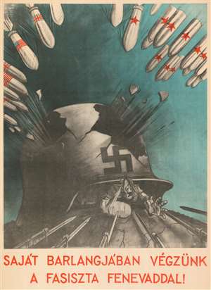
Saját Barlangjában Végzünk a Fasiszta Fenevaddal! / We'll Finish the Fascist Beast in His Own Cave!
sold
- Digital Map Information
- Suitable for large format printing
- File Size: 135.86 MB
- File Type: ZIP / TIFF
- ICC color profile embedded
- Delivered instantly via download link
This is a 1945 Sándor Ék anti-fascist propaganda poster created shortly after the liberation of Budapest by the Soviet Red Army. Centered on a large Nazi helmet with significant sections missing, Ék is making it apparent that the Nazis are losing the war. Large numbers of Allied bombs are illustrated in the top corners, with American and British bombs on the left and Soviet bombs on the right. Graphically, this poster is definitely pro-Soviet (which is not surprising, seeing as it was made by a Red Army soldier), suggesting that the forces brought to bear by the Soviet armed forces outweigh those of the other Allies. Hitler is illustrated with a broken hand and arm trying to escape from underneath the destroyed helmet and is met by a phalanx of sharpened bayonets. There would be no escape. (more details)
Enormous World War II map of the Philippines.
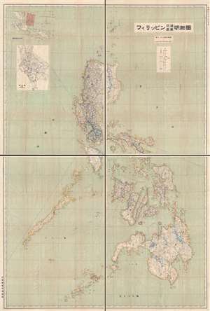
フィリッピン交通產業明細圖 / Philippines Detailed Traffic and Industry Map.
sold
- Digital Map Information
- Suitable for large format printing
- File Size: 62.52 MB
- File Type: ZIP / TIFF
- ICC color profile embedded
- Delivered instantly via download link
An important November 15, 1941 (Showa 16) wall map of the Philippines published by the Taiwan Governor's Office intelligence division on the day the Southern Expeditionary Army (南方軍) confirmed its plans to invade the archipelago. The December 1941 invasion of the Philippines followed shortly thereafter. As such, this is arguably one of the most important Japanese maps of the Philippines published in the 20th century.
The focus of the map is the Philippine transportation network. The level of detail evident in this map illustrates the extreme interest the Japanese had in the Philippines, not only as a source of personnel and resources, but as a steppingstone to Southeast Asia and Melanesia. (more details)
The focus of the map is the Philippine transportation network. The level of detail evident in this map illustrates the extreme interest the Japanese had in the Philippines, not only as a source of personnel and resources, but as a steppingstone to Southeast Asia and Melanesia. (more details)
Japan's vision for the Pacific during World War II.
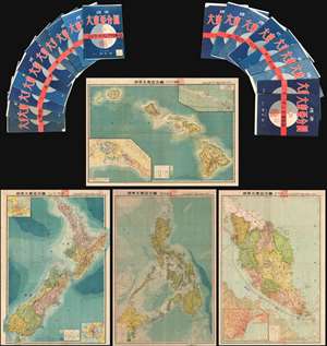
This is an important and rare full set of 20 maps from the 1943 Showa 18 World War II (WWII) Greater East Asian Co-Prosperity Sphere series. The series of maps covers from India to Hawaii and from Japan to Australia. Those areas of particular interest and ... (more details)
Charter for a better world...
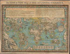
The 'Time and Tide' Map of The Atlantic Charter.
sold
- Digital Map Information
- Suitable for large format printing
- File Size: 70.3 MB
- File Type: ZIP / TIFF
- ICC color profile embedded
- Delivered instantly via download link
This is a 1942 MacDonald Gill pictorial map of the world celebrating the announcement of the Atlantic Charter, a statement of joint American and British goals for the world after World War II. The map depicts the world using Gall's stereographic projection and places Europe and Africa at center with the Americas to the left and Asia to the right. Pictorial symbols highlight resources, giving the map an air of strategic importance, since natural resources were key to the global conflict then raging. Circular vignettes provide insight into the daily lives of people from walks of life, including a Canadian lumberjack, an American farmer, an Arabian trader, and an Australian rancher. Countries are labeled, as are cities and towns, some with banners, others with text. (more details)
Ground Zero of the Holocaust in Poland.
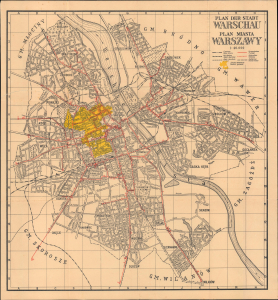
Plan der Stadt Warschau / Plan miasta Warszawy.
sold
- Digital Map Information
- Suitable for large format printing
- Full resolution TIFF file
- ICC color profile embedded
- Delivered instantly via download link
This is a scarce and haunting c. 1941 German-Polish map of Warsaw, prepared during the World War II (1939 - 1945) Nazi occupation. Although ostensibly produced to trace public transit routes, it highlights the city's Jewish Ghetto, the largest such area in Europe and a key site in the perpetration of the Holocaust. (more details)