
Cook, James (sold)
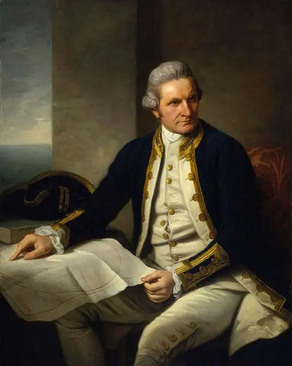
Captain James Cook (7 November 1728 - 14 February 1779) is a seminal figure in the history of cartography for which we can offer only a cursory treatment here. Cook began sailing as a teenager in the British Merchant Navy before joining the Royal Navy in 1755. He was posted in America for a time where he worked Samuel Holland, William Bligh, and others in the mapping of the St. Lawrence River and Newfoundland. In 1766 Cook was commissioned to explore the Pacific and given a Captaincy with command of the Endeavour. What followed were three historic voyages of discovery, the highlights of which include the first European contact with eastern Australia, the discovery of the Hawaiian Islands (among many other Polynesian groups), the first circumnavigation of New Zealand, some of the first sightings of Antarctica, the first accurate mapping of the Pacific Northwest, and ultimately his own untimely death at the hands of angry Hawaiians in 1779. The influence of Cook work on the mapping and exploration of the Pacific cannot be understated.
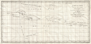
Carte Des Isles Decouvertes Aux Environs D'Otahiti, dans Plusieurs Voyages Faits Autour Du Monde Par Les Capitaines Byron, Wallis, Carteret & Cook. En 1765, 1767,1769.
sold
- Digital Map Information
- Suitable for large format printing
- DPI: 300
- File Size: 18.4 MB
- File Type: ZIP / TIFF
- ICC color profile embedded
- Delivered instantly via download link
This is a fine map shows the explorations of Captain Cook, Captain Byron, Captain Wallis and Captain Carteret in the vicinity of Tahiti and the Society Islands from 1765 to 1769. Extends from Is. Scilly [i.e. the Scilly Islands] in the west and to I. Whitsunday ... (more details)
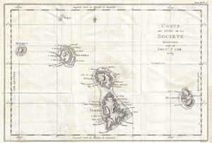
Carte des Isles de la Societe decouvertes parle Lieut. J. Cook. 1769.
sold
- Digital Map Information
- Suitable for large format printing
- DPI: 300
- File Size: 5.37 MB
- File Type: ZIP / TIFF
- ICC color profile embedded
- Delivered instantly via download link
This is a fine example of the first published map of the Society Islands, composed by James Cook on his first voyage. Consists of the islands of Maurua, Tubai, Bolabola, Otaha, Ulietéa and Huaheine. This group was identified by Cook in 1769, when he wrote in ... (more details)
The first map of New South Wales Australia!
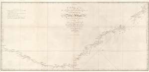
A Chart of New South Wales, or the East Coast of New-Holland. Discovered and explored by Lieutenant J. Cook, Commander of His Majesty's Bark Endeavour, in the year MDCCLXX.
sold
- Digital Map Information
- Suitable for large format printing
- DPI: 600
- File Size: 17.29 MB
- File Type: ZIP / TIFF
- ICC color profile embedded
- Delivered instantly via download link
This seminal 1773 first edition map by James Cook is the first map of New South Wales, Australia. Oriented to the West, the map extends from Cape York, Prince of Wales Island, and the Endeavour Straits to Point Hicks (Victoria). The map is a product of Cook's search for the often speculated upon southern continent or 'Terra Australis,' which scholars from the 16th century on believed, based upon ancient Greek texts, must exist at the base of the world.
After observing the Transit of Venus on June 3, 1769, Cook sailed westward, planning to return to England via the Cape of Good Hope, as he believed the Endeavour would not survive a second trip around Cape Horn. Instead he sailed west, where he hoped to discover Terra Australis. He sailed around New Zealand and headed for Tasmania, intending to follow up on Abel Tasman's work, when gales forced him northward. On April 19, 1770, his second, Zachary Hicks, signed land, what Cook immediately named Point Hicks. While Cook was most certainly aware he had not discovered 'Terra Australis', he did spend several months, from April 19 to August 22, 1770, mapping long sought east coast of New Holland (Australia), what he came to call New South Wales. He proceeded northwards, navigating the coast with great care, naming notable locations along the way.
It is of note that the coasts between Cape Flattery and Weymouth remains unmapped. This area is so full of small islands and dangerous reefs that Cook aptly named it 'The Labyrinth.' Just as he entered this area, near Cape Tribulation, the Endeavour struck a reef. On our map there is a note reading, 'On this ledge the ship laid 23 hours.' Rather than risk his ship further Cook sailed the Endeavour further out to sea, around the perilous reefs, landing at Cape York to officially name New South Wales and claim the land for England,
After observing the Transit of Venus on June 3, 1769, Cook sailed westward, planning to return to England via the Cape of Good Hope, as he believed the Endeavour would not survive a second trip around Cape Horn. Instead he sailed west, where he hoped to discover Terra Australis. He sailed around New Zealand and headed for Tasmania, intending to follow up on Abel Tasman's work, when gales forced him northward. On April 19, 1770, his second, Zachary Hicks, signed land, what Cook immediately named Point Hicks. While Cook was most certainly aware he had not discovered 'Terra Australis', he did spend several months, from April 19 to August 22, 1770, mapping long sought east coast of New Holland (Australia), what he came to call New South Wales. He proceeded northwards, navigating the coast with great care, naming notable locations along the way.
It is of note that the coasts between Cape Flattery and Weymouth remains unmapped. This area is so full of small islands and dangerous reefs that Cook aptly named it 'The Labyrinth.' Just as he entered this area, near Cape Tribulation, the Endeavour struck a reef. On our map there is a note reading, 'On this ledge the ship laid 23 hours.' Rather than risk his ship further Cook sailed the Endeavour further out to sea, around the perilous reefs, landing at Cape York to officially name New South Wales and claim the land for England,
I now once more hoisted English Coulers and in the Name of His Majesty King George the Third took possession of the whole Eastern Coast from the above Latitude [38] down to this place by the name of New South Wales, together with all the Bays, Harbors, Rivers, and Island s situate upon the said coast. (Cook, J., Journal, August 22, 1770)Until this time it was assumed that Australia, or New Holland as it was known, was a barren wasteland, as the Dutch navigators had explored only a small part of the arid western coast. Cook on the other hand, sailed up the fertile east coast, and was impressed by what he saw. It was Cook who recommended settlement and persuaded Joseph Banks to argue for using the remote continent as a penal colony. This map is significant for Australia collectors as the first definitive mapping of the coasts of New South Wales. Cook's nomenclature largely remains in use today. The map notes both Botany Bay and Port Jackson. (more details)
The first official map of Cook's first voyage - the best map of the Australia, the South Pacific, and New Zealand of it time.
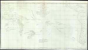
Chart of part of the South Sea, Shewing the Tracts and Discoveries made by His Majesty's Ships Dolphin, Commodore Byron, and Tamer, Captn. Mouat, 1765. Dolphin, Captn., Wallis, and Swallow, Captn. Carteret, 1767. And Endeavour, Lieutenant Cooke, 1769.
sold
- Digital Map Information
- Suitable for large format printing
- File Size: 18.3 MB
- File Type: ZIP / TIFF
- ICC color profile embedded
- Delivered instantly via download link
This is a rare 1773 map of the South Pacific issued to illustrates English voyages of exploration in this region between 1765 and 1769, including the voyages of John Byron (1723 - 1786), Samuel Wallis (1728 - 1795), Philip Carteret (1733 - 1796), and James Cook (1728 - 1779). At the time of publication this was the most accurate extant map of this region, unveiling a wealth of new information to curious Europeans. Coverage extends from Sumatra to South America, and from Baja California and Taiwan to Tierra del Fuego, including all of Australia, Polynesia, New Zealand, the Philippines, Melanesia, and eastern Indonesia. Tasmania or Van Diemen's Land is notably attached to the Australian mainland. Tracks drawn from ship's original logs detail with precision the routes taken by Commodore Byron and Captain Mouat (1765), Captain Carteret (1767), Captain Wallis (1767), and Lieutenant James Cook (1769). (more details)
One of the earliest detailed maps of New Zealand, following Cook's first voyage.
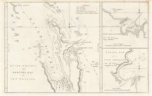
River Thames and Mercury Bay..., Bay of Islands..., Tolaga Bay...
sold
- Digital Map Information
- Suitable for large format printing
- DPI: 600
- File Size: 23.73 MB
- File Type: ZIP / TIFF
- ICC color profile embedded
- Delivered instantly via download link
This is an important map of the bays of northern New Zealand (Mercury, Tolaga, Bay of Islands, and the Firth of Thames) published by John Hawkesworth in his An account of the voyages undertaken, a 1773 book recounting recent British voyages to the Pacific, including the first voyage of Captain James Cook. The map is based on Cook's papers and sketches and constitutes the first detailed map of these bays. (more details)
French Edition of the First Mapping of the Society Islands
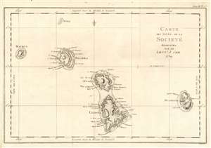
Carte des Isles de la Societé découvertes par le Lieutt. J. Cook 1769.
sold
- Digital Map Information
- Suitable for large format printing
- DPI: 600
- File Size: 10.65 MB
- File Type: ZIP / TIFF
- ICC color profile embedded
- Delivered instantly via download link
This is a 1774 map of the Society Islands - the French edition of the first map revealing the exploration of these islands by then-Lieutenant James Cook during his first Pacific voyage. Now part of French Polynesia, the map shows the islands of Maupiti (Maurua on the map), Tupai (Tubai), Bora Bora (Bolabola),Tahaa (Otaha), Raiatea (Ulieta) and Huaheine. Cook's visit was the Islands' first contact with Europeans; Cook discussed in his journal the naming of the 'Society Islands:
'So call'd by the Natives and it was not thought advisable to give them any other names but these three together with Huaheine, Tubai, and Maurua as they lay contiguous to one another I have named Society Isles .'Topography of each of the islands is shown pictorially, including reefs, mountains, and valleys. Depth soundings and anchorages are shown for Huaheine, Raiatea and Otaha. Engraved by Bernard for the 1774 French edition of John Hawkesworth's Account of the Voyages…, in which this was contained as Plate 1 in Volume III. (more details)
Fascinating Chart Tracking Four Great Circumnavigators' Passage through the Society Islands
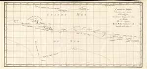
Carte Des Isles Decouvertes Aux Environs D'Otahiti, dans Plusieurs Voyages Faits Autour Du Monde Par Les Capitaines Byron, Wallis, Carteret et Cook. En 1765, 1767,1769.
sold
- Digital Map Information
- Suitable for large format printing
- DPI: 600
- File Size: 10.93 MB
- File Type: ZIP / TIFF
- ICC color profile embedded
- Delivered instantly via download link
This is a 1774 map showing the explorations of Captains Cook, Byron, Wallis and Carteret in the vicinity of Tahiti and the Society Islands from 1765 to 1769. The chart extends from the Scilly Islands in the west to Whitsunday Island in the east, and from Tepoto Island in the north to Oheiroa in the south. Each of the circumnavigators' tracks are shown as they tacked through the islands. Tahiti, Bora Bora, Otaha, Marma, Ulietea, and other islands are named and shown. These voyages represented the first recorded European contacts with many of these remote places. (more details)
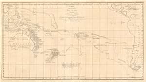
Carte d'une partie de la Mer du Sud Contenant les Découvertes des Vaisseaux de sa Majesté le Dauphin, Commodore Byron, La Tamar, Capit.ne Mouats, 1765. Le Dauphin, Capit.ne Wallis, Le Swallow, Capit.ne Carteret, 1767. et l'Endeavour, lieutenant Cook, 1769.
sold
- Digital Map Information
- Suitable for large format printing
- DPI: 600
- File Size: 20.32 MB
- File Type: ZIP / TIFF
- ICC color profile embedded
- Delivered instantly via download link
This is a 1774 map of the South Pacific Ocean, comparing the routes taken during three great circumnavigations of the 18th century: Byron and Mouat's 1763 journey aboard HMS Dolphin and Tamar; the 1767 circumnavigation of Wallis and Carteret aboard HMS Dolphin and the Swallow; and the 1769 voyage of the Endeavor under then - Lieutenant James Cook. To the East, the map shows the coasts of southern Mexico, part of the Caribbean islands, Central America and South America, including Tierra del Fuego and the Falklands. The western extremes of the map include part of China, Cochinchina, and the East Indies as far as Sumatra. Revealed in the ocean between are the late discoveries in the South Pacific, especially those of Cook, which provided the first detailed charting of Australia and New Zealand since Tasman's 1642 voyage. (more details)
Considered to be the most important map of New Zealand, it was created by Captain Cook in the 1770s and consulted into the twentieth century.
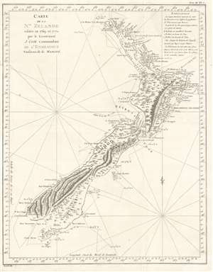
Carte de la Nle. Zelande visitée en 1769 et 1770 par le Lieutenant J. Cook Commandant de l'Endeavour vasseau de sa Majesté.
sold
- Digital Map Information
- Suitable for large format printing
- DPI: 600
- File Size: 12.72 MB
- File Type: ZIP / TIFF
- ICC color profile embedded
- Delivered instantly via download link
Recognized as the most important map in the history of New Zealand, this is the first French edition of Captain James Cook's landmark map of New Zealand. The first map to prove that New Zealand is composed of two islands, Cook's course through what is still known as Cook's Strait separating the two islands, is depicted as well. (more details)
French Edition of some of New Zealand's First European Anchorages.
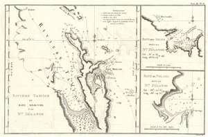
Riviere Tamise de Baye Mercure a la Nle. Zélande/ Baye des Isles dans la Nle. Zélande. / Baye de Tolaga dans la Nle. Zélande.
sold
- Digital Map Information
- Suitable for large format printing
- DPI: 600
- File Size: 8.51 MB
- File Type: ZIP / TIFF
- ICC color profile embedded
- Delivered instantly via download link
This is the 1774 first French edition of the first map of New Zealand's North Island, navigated by then-Lieutenant James Cook during his first voyage of discovery aboard the H.M.S. Endeavor. (more details)
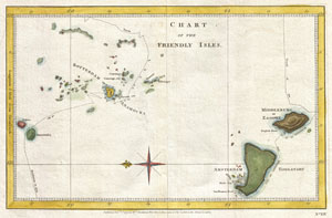
Chart of the Friendly Isles.
sold
- Digital Map Information
- Suitable for large format printing
- DPI: 300
- File Size: 4.06 MB
- File Type: ZIP / TIFF
- ICC color profile embedded
- Delivered instantly via download link
A highly uncommon chart of the Friendly Islands, or Tonga, from 1777. Oriented to the East, this map depicts the Tongatapu Island Group and the Ha'Apai Group that make up the Kingdom of Tonga. Shows the routes of the Resolution and the Adventure on Captain ... (more details)
The quest for Terre Australis.
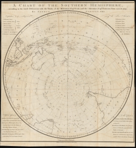
A Chart of the Southern Hemisphere according to the latest Discoveries with the Tracks of the Resolution, Cap.n Cook; and the Adventure, Cap.n Furneaux; from 1772, to 1775.
sold
- Digital Map Information
- Suitable for large format printing
- DPI: 600
- File Size: 68.68 MB
- File Type: ZIP / TIFF
- ICC color profile embedded
- Delivered instantly via download link
A rare 1777 George Forster map of James Cook's second voyage of exploration to the South Pole, from 1772 to 1775. (more details)
A French edition of Cook's map of the South Pacific Islands which he 'discovered' during his Second Voyage.
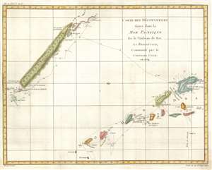
Carte des Découvertes faites dans la Mer Pacifique sur le Vaisseau de Roi, la Resolution, Commandé par the Capitaine Cook en 1774.
sold
- Digital Map Information
- Suitable for large format printing
- DPI: 600
- File Size: 12.14 MB
- File Type: ZIP / TIFF
- ICC color profile embedded
- Delivered instantly via download link
This is a 1778 Robert Bénard and James Cook map of New Caledonia and Vanuatu. Depicting the islands from the north, the map depicts New Caledonia and the Isle of Pines on the top left and several of the islands in the Vanuatu archipelago, including Espiritu Santo, on the lower right. Discovered during his second voyage, Cook called Vanuatu the New Hebrides, the name that was used until 1980 when the Republic of Vanuatu was established. Cook's route through Vanuatu and around New Caledonia is traced here and there are even references to specific dates where he and his crew landed. Both island groups had been completely unknown to Europeans before Cook's arrival in 1774, although Europeans had 'discovered' Espiritu Santo twice before. A Portuguese explorer sailing for the Spanish Crown landed on the island in 1606, and a French explorer arrived in 1768, but it was Cook's discovery and name that history remembers. (more details)
Scarce first edition of the official map of Captain Cooks seminal discoveries in Alaska.
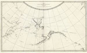
Chart of the N.W. Coast of America and N.E. Coast of Asia explored in the Years 1778 & 1779.
sold
- Digital Map Information
- Suitable for large format printing
- DPI: 300
- File Size: 13.79 MB
- File Type: ZIP / TIFF
- ICC color profile embedded
- Delivered instantly via download link
A scarce 1794 first edition example of the official record of Captain Cook's discoveries in the Pacific Northwest, Alaska, and the Behring Strait. The map covers the northeast part of Asia and the northwest part of North America from the Sea of Okotsk to ... (more details)
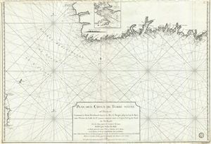
Plan des Cotes de Terre Neuve IIIe. Feuille Contenant la Partie Meridionale depuis les Iles de Bergeo jusqu au Cap de Raye, avec l'Entrée du Golfe de St. Laurent comprise entre ce Cap et le Cap de Nord de l'Ile Royale.
sold
- Digital Map Information
- Suitable for large format printing
- DPI: 300
- File Size: 32.57 MB
- File Type: ZIP / TIFF
- ICC color profile embedded
- Delivered instantly via download link
A scarce 1794 map of the southwest coast of Newfoundland, Canada, issued by the Depot de la Marine and surveyed by Captain Cook. This map, the third in this series, covers from Cape Anguille on the Gulf of St. Lawrence, southwards to Channel-Port aux ... (more details)
The first official map of Cook's voyages.
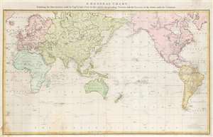
A General Chart: Exhibiting the Discoveries made by Captn. James Cook in this and his two preceding Voyages; with the Tracks of the Ships under his Command.
sold
- Digital Map Information
- Suitable for large format printing
- DPI: 600
- File Size: 28.22 MB
- File Type: ZIP / TIFF
- ICC color profile embedded
- Delivered instantly via download link
An attractive full original color example of Henry Robert's 1784 map of the world drawn to exhibit Captain James' Cook's voyages. This is the official chart of the voyages, published with the official account, and when it was issued, was the most sophisticated map of the world yet introduced, exhibiting heretofore unknown discoveries in the high arctic, and elsewhere. Coverage, as the title suggests, is expansive, underscoring the extensiveness of Cook's voyages ranging from the polar extremes to the Equator and circumnavigate the globe. The tracks of all three voyages are noted, with dating identifying important moments and annotations in Cook's journals. (more details)
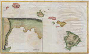
Chart of the Sandwich Islands.
sold
- Digital Map Information
- Suitable for large format printing
- DPI: 300
- File Size: 3.97 MB
- File Type: ZIP / TIFF
- ICC color profile embedded
- Delivered instantly via download link
Offered here is an extraordinary and important map of the Hawaiian Islands (Sandwich Islands) printed by G. Nicol and T. Cadell for the 1785 edition of Captain James Cook and James King's, A Voyage to the Pacific Ocean…in the Years 1776, 1777, 1778, ... (more details)
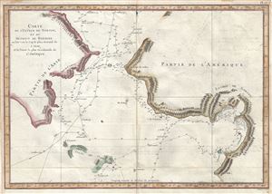
Carte de l'Entrée de Norton, et du Detroit de Bhering ou Von vou le Cap le plus oriental de l'Asie, et la Pointe la plus occidentale de l'Amerique.
sold
- Digital Map Information
- Suitable for large format printing
- Full resolution TIFF file
- ICC color profile embedded
- Delivered instantly via download link
This is a scarce and important 1785 map of the Pacific Northwest, Alaska and the Bering Strait depicting the two expeditions of Captain Cook. It covers the Bering Strait from the Chukchi Sea north of Cape Prince of Wales south to St. Lawrence Island ... (more details)
Charting Cook's travels along the Alaska coast.
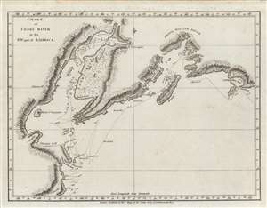
Chart of Cooks River in the N.W. part of America.
sold
- Digital Map Information
- Suitable for large format printing
- DPI: 600
- File Size: 14.04 MB
- File Type: ZIP / TIFF
- ICC color profile embedded
- Delivered instantly via download link
An important c. 1784 nautical chart or map of the Cook Inlet and Prince William Sound along the Kenai Peninsula, just south of Anchorage, Alaska. It was the product of the third and final Pacific voyage of Captain James Cook, and was published in George William Anderson and Alexander Hogg's A New, authentic, and complete collection of voyages round the world, undertaken and performed by royal authority.... (more details)
Iconic early map of Hawaii after Cook.
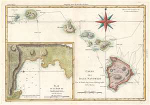
Carte des Isles Sandwich.
sold
- Digital Map Information
- Suitable for large format printing
- DPI: 600
- File Size: 17.9 MB
- File Type: ZIP / TIFF
- ICC color profile embedded
- Delivered instantly via download link
This is a 1788 Rigobert Bonne map of the Hawaiian Islands, a result of the third and final voyage of Captain James Cook. The map includes the entire archipelago: Hawaii, Maui, Lanai, Molokai, Oahu, Kauai, and Nihau. The route followed by Cook's expedition appears along with dates. An inset map of the Bay of Karakakooa is situated in the lower left. (more details)
Cook's Journeys In Search of the Southern Continent.
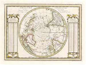
Emisfero Terrestre Meridionale Delineato secondo le ultime Osserrvazioni Con i Viaggi, e nuove Scoperte del Cap. Cook.
sold
- Digital Map Information
- Suitable for large format printing
- DPI: 600
- File Size: 13.41 MB
- File Type: ZIP / TIFF
- ICC color profile embedded
- Delivered instantly via download link
A superb example for Giovanni Maria Cassini's elegantly engraved map of the Southern Hemisphere. The map shows the tracks of all four of Captain Cook's famous voyages, including the return track taken by his survivors after his 1779 death in Hawaii. The map shows Cook's mapping of Australia and New Zealand (from his first voyage of 1768 - 1771) and his circumnavigation of the Antarctic Circle, in search of the still-undiscovered southern continent (Terre Australis). The map is flanked with tables (decorated with birds, beasts and vines) giving the distances between meridians at different latitudes. (more details)
Possibly the most beautiful map of Cook's travels in the Arctic.
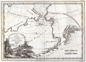
Le Coste Nord Ovest Dell' America e Nord Est Dell' Asia Delineate sulle ultime Osservazioni del Cp. Cook.
sold
- Digital Map Information
- Suitable for large format printing
- DPI: 300
- File Size: 9.03 MB
- File Type: ZIP / TIFF
- ICC color profile embedded
- Delivered instantly via download link
An extraordinarily fine example of Cassini's 1798 map of Alaska, the Bering Strait, and Siberia. Cassini issued this map in his 1798 atlas to illustrate the discoveries made by James Cook. Cook was the first to accurately chart the Alaskan ... (more details)