
NEW ACQUISITIONS
The earliest acquirable European mapping of Korea based on firsthand report.
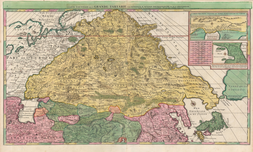
Carte Nouvelle de la Grande Tartarie.
$3,500.00
Acquire
- Digital Map Information
- Suitable for large format printing
- DPI: 600
- File Size: 123.4 MB
- File Type: ZIP / TIFF
- ICC color profile embedded
- Delivered instantly via download link
This is a stunning, original-color example of Pierre Mortier's 1696 two-sheet map of northern Asia, Siberia, and Tartary. It is drawn primarily from two sources: Hubert Jaillot's 1695 six-sheet wall map of Asia and Nicolaes Witsen's 1687 map of Tartary. As a result, this map represents the most up-to-date cartography of central and northeastern Asia of the seventeenth century, which would not be significantly improved upon until the maps of Strahlenberg thirty years later. (more details)
He Penned a Declaration...
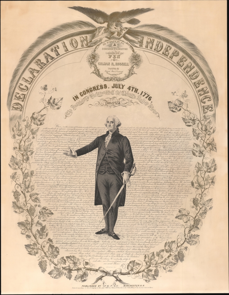
Declaration of Independence. The Original of this was Designed and Executed entirely with a Pen by Gilman R. Russell.
$2,500.00
Acquire
- Digital Map Information
- Suitable for large format printing
- Full resolution TIFF file
- ICC color profile embedded
- Delivered instantly via download link
This is a large 1856 Gilman R. Russell commemorative broadside of the Declaration of Independence. It consists of a two-color lithograph with the text of the Declaration appearing in finely executed calligraphy around an image of George Washington. The text is surrounded by a wreath of acanthus leaves, and surmounted by a title banner and a powerful eagle. The broadside was published on the 80th anniversary of the Declaration's signing. It served both as an income-generating patriotic image for sale to the general public, and as a promotion for Russell's penmanship and calligraphy classes. (more details)
On the cusp of the American Revolutionary War.
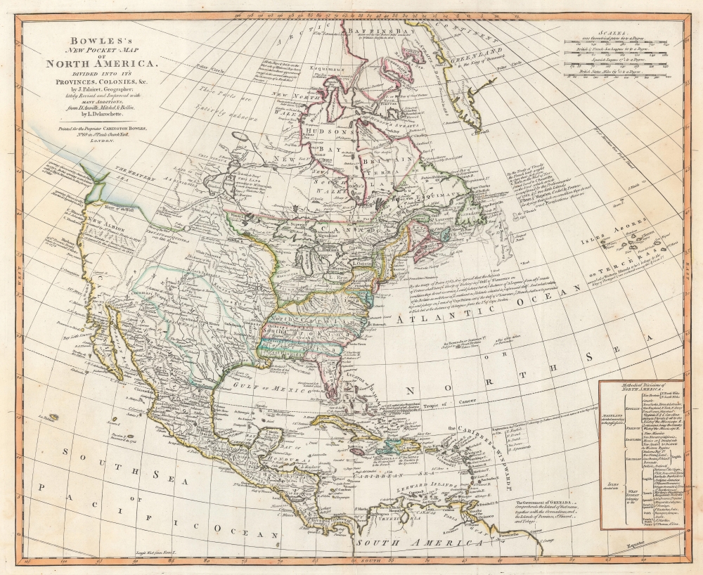
Bowles's New Pocket-Map of North America, Divided into it's Provinces, Colonies, etc,. by J. Palairet, Geographer; lately Revised and Improved with Many Additions from D'Anville, Mitchell, and Bellin, by L. Delarochette.
$2,500.00
Acquire
- Digital Map Information
- Suitable for large format printing
- DPI: 600
- File Size: 46.4 MB
- File Type: ZIP / TIFF
- ICC color profile embedded
- Delivered instantly via download link
This is a c. 1771 Carington Bowles map of North America, published just 4 years prior to the American Revolutionary War (1775 - 1783). The map depicts the increasingly complex and unstable political situation following the French and Indian War (1754 - 1763). It further illustrates ambitions for an inland Northwest Passage via Hudson Bay, and speculations about a great 'Sea of the West' dominating the Pacific Northwest - one of the last and greatest cartographic myths of the 18th century. (more details)
'Duty, Honor, Country'.
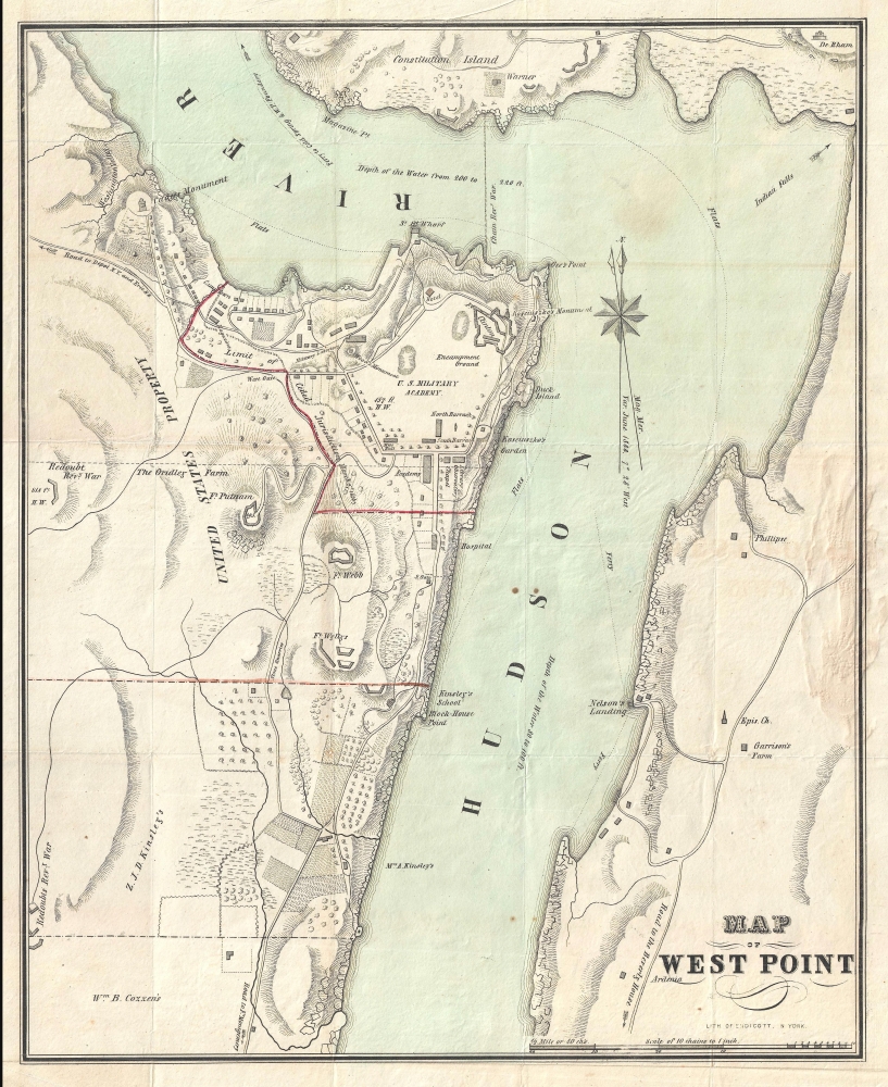
Map of West Point.
$1,250.00
Acquire
- Digital Map Information
- Suitable for large format printing
- Full resolution TIFF file
- ICC color profile embedded
- Delivered instantly via download link
A rare 1844 guide and map of the U.S. Military Academy at West Point, New York by J. H. Colton. The map is centered on the academy grounds and covers from Constitution Island to Garrison, just across the Hudson River. In identifies academy buildings as well as the surrounding terrain. Nearby farms and homeowners are also identified. (more details)
Early, gorgeous chart of the East Indies.
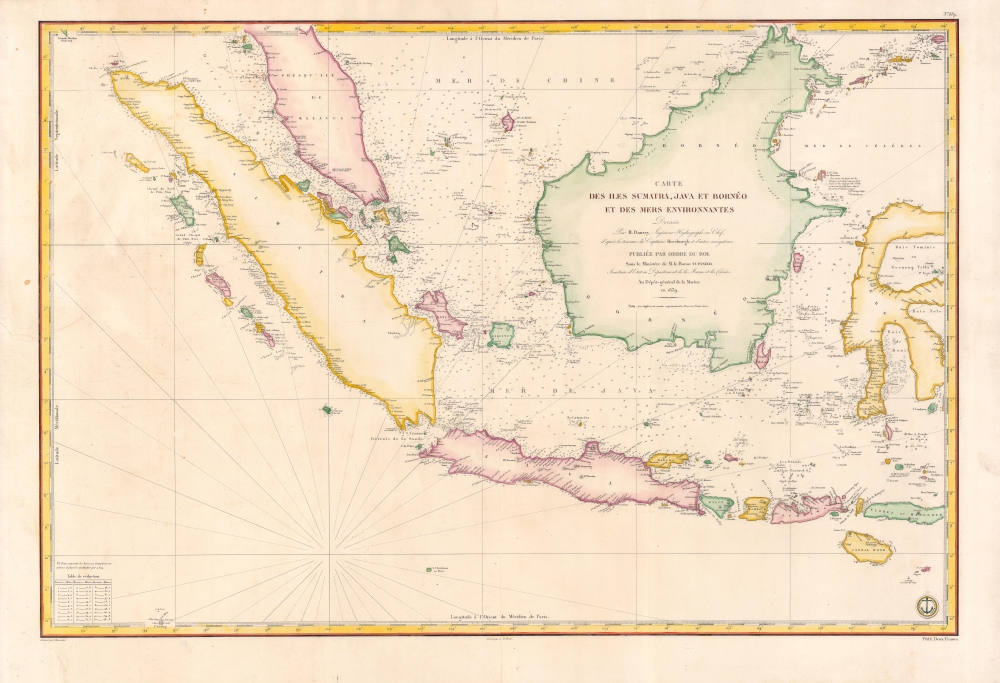
Carte des Iles Sumatra, Java et Borneo et des mers Environnantes...
$1,000.00
Acquire
- Digital Map Information
- Suitable for large format printing
- Full resolution TIFF file
- ICC color profile embedded
- Delivered instantly via download link
A beautiful and rare 1839 French Depot-General de la Marine nautical chart or maritime map of the East Indies or Insular Southeast Asia - including Singapore. The size and level of detail is impressive, reflecting the importance of the chart as representing the pinnacle of hydrographical knowledge at the time. (more details)
Victorian London.
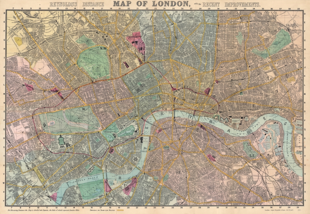
Reynolds's Distance Map of London, with the Recent Improvements.
$600.00
Acquire
- Digital Map Information
- Suitable for large format printing
- File Size: 121.48 MB
- File Type: ZIP / TIFF
- ICC color profile embedded
- Delivered instantly via download link
This is an 1887 James Reynolds city map of London. Centered on the Thames, coverage embraces London from Notting Hill and West Kensington to the West India Docks and the Isle of Dogs, and from Highbury and Kentish Town to Peckham and Battersea. A grid of quarter-mile squares is superimposed over the map, illustrating distances. Omnibus and tram-car routes are shaded yellow, while railroad stations are colored pink. Streets, parks, government buildings, rail stations, palaces, and churches are all labeled. Several specific sites are identified as well, including the British Museum, the Museum of Natural History, and the Royal Horticultural Gardens. (more details)
Before the exploration of the American West.
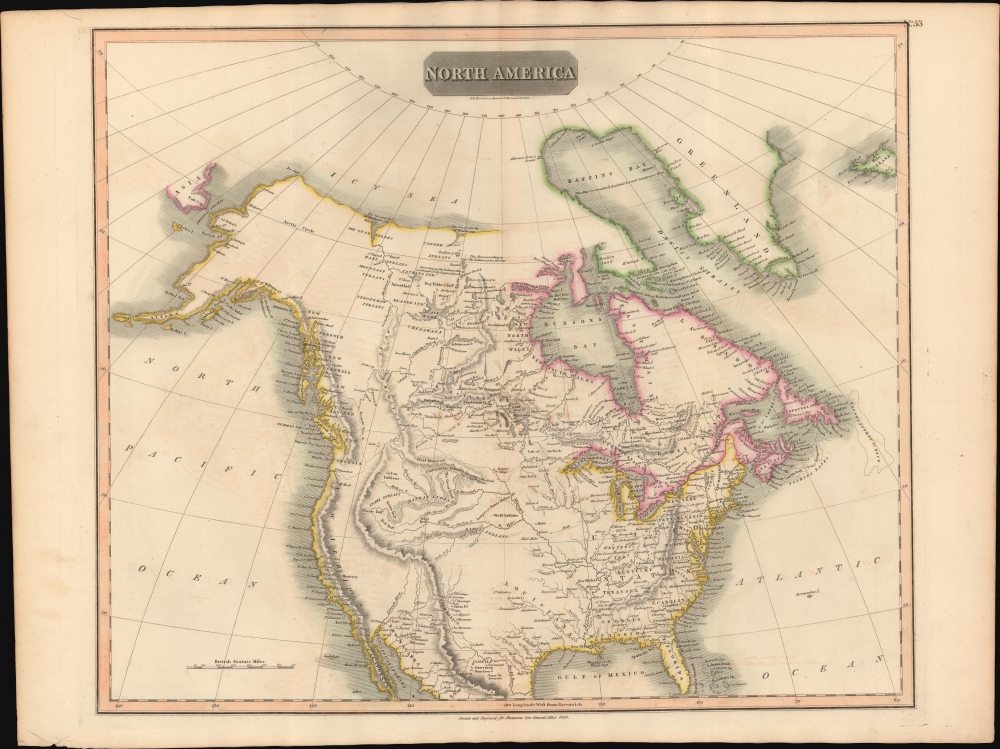
North America.
$500.00
Acquire
- Digital Map Information
- Suitable for large format printing
- DPI: 600
- File Size: 64.65 MB
- File Type: ZIP / TIFF
- ICC color profile embedded
- Delivered instantly via download link
This is John Thomson's 1814 map of North America. It is perhaps the best general atlas map of North America to appear in the 19th century. (more details)
Colorful and unique map of Ceylon.
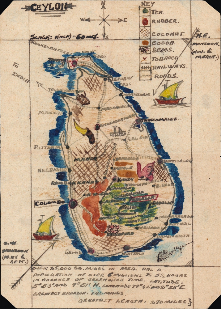
Ceylon.
$500.00
Acquire
- Digital Map Information
- Suitable for large format printing
- File Size: 3.77 MB
- File Type: ZIP / TIFF
- ICC color profile embedded
- Delivered instantly via download link
A charming c. 1900 small-format map of Ceylon (Sri Lanka), produced by an unknown cartographer. Despite its size, the map provides detail on the island's climate, topography, economy, infrastructure, demographics, and more. (more details)
You can't see it from space, but you can see it here.
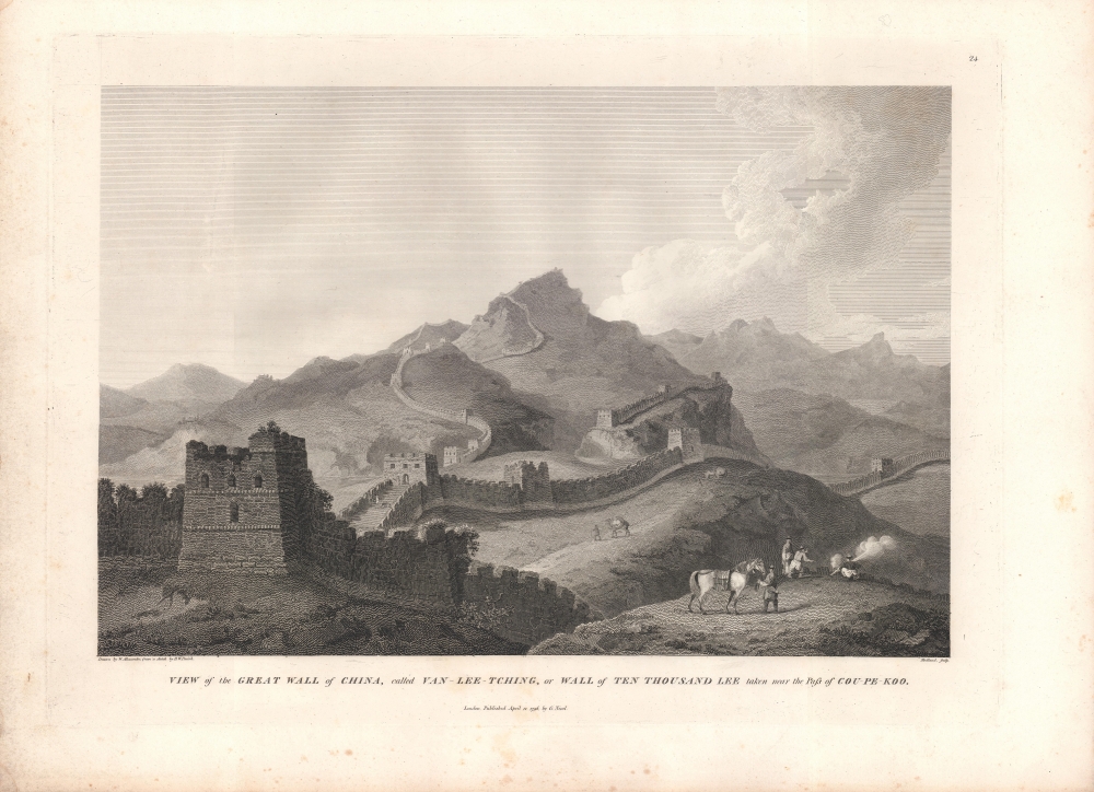
View of the Great Wall of China, called Van-Lee-Tching, or Wall of Ten Thousand Lee taken near the Pass of Cou-Pe-Koo.
$500.00
Acquire
- Digital Map Information
- Suitable for large format printing
- Full resolution TIFF file
- ICC color profile embedded
- Delivered instantly via download link
An intricately engraved view of the Great Wall of China drawn by William Alexander based on a sketch by Henry William Parish and engraved by Thomas Medland for inclusion in George Leonard Staunton's An Authentic Account of an Embassy from the King of Great Britain to the Emperor of China. This view was important in developing the aura of the Great Wall in the Western imagination of China, but it also reveals how the wall had become unimportant in China itself. (more details)
Outline of the Macartney Embassy.
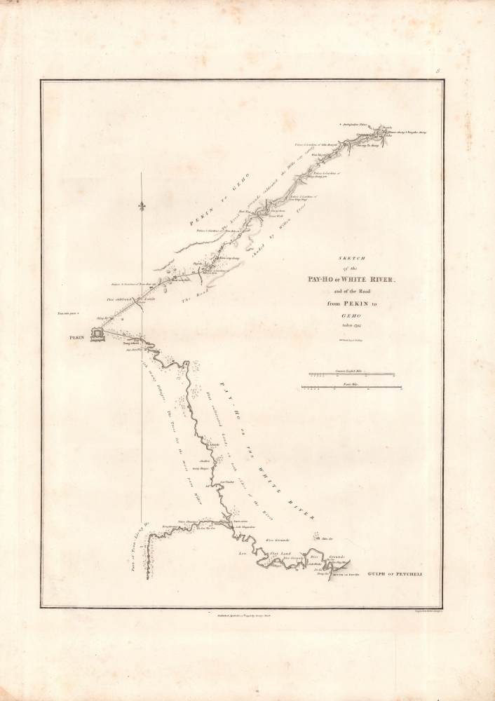
Sketch of the Pay-Ho or White River and of the road from Pekin to Geho.
$400.00
Acquire
- Digital Map Information
- Suitable for large format printing
- Full resolution TIFF file
- ICC color profile embedded
- Delivered instantly via download link
This 1793 sketch map of Beijing and vicinity by Henry William Parish was engraved by Benjamin Baker and included in the first edition of George Leonard Staunton's 1797 An Authentic Account of an Embassy from the King of Great Britain to the Emperor of China. It depicts the vicinity around Beijing, in North Zhili Province (北直隸, roughly today's Hebei), highlighting the areas traversed by the Macartney Embassy in 1793. (more details)
Lovely place to summer.
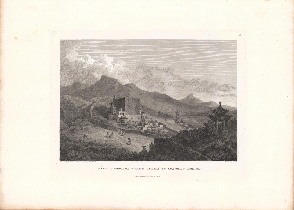
A view of Poo-Ta-La or Great Temple near Zhe-Hol in Tartary.
$400.00
Acquire
- Digital Map Information
- Suitable for large format printing
- Full resolution TIFF file
- ICC color profile embedded
- Delivered instantly via download link
An impressive view of the Putuo Zongcheng Temple drawn by William Alexander based on a sketch by Henry William Parish and engraved by Benjamin Pouncy for inclusion in George Leonard Staunton's An Authentic Account of an Embassy from the King of Great Britain to the Emperor of China. It depicts the Putuo Zongcheng Temple (普陀宗乘之庙) at Rehe (here as Zhe-hol, now Chengde), the Qing summer palace where the British Macartney embassy met with the Qianlong Emperor in 1793. (more details)
A quick stop at Da Nang on the way to Beijing.
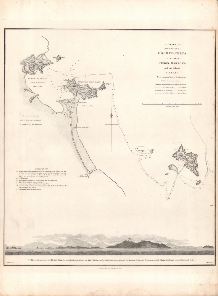
A Chart of part of the Coast of Cochin-China including Turon Harbour and the Island Callao.
$350.00
Acquire
- Digital Map Information
- Suitable for large format printing
- DPI: 600
- File Size: 12.22 MB
- File Type: ZIP / TIFF
- ICC color profile embedded
- Delivered instantly via download link
A map central Vietnamese coast near Da Nang and Hoi An, drawn in 1793 by John Barrow and Henry William Parish, engraved by Benjamin Baker, and included in the first edition of George Leonard Staunton's 1797 An Authentic Account of an Embassy from the King of Great Britain to the Emperor of China. (more details)
A lovely palace, before it was burned and looted.
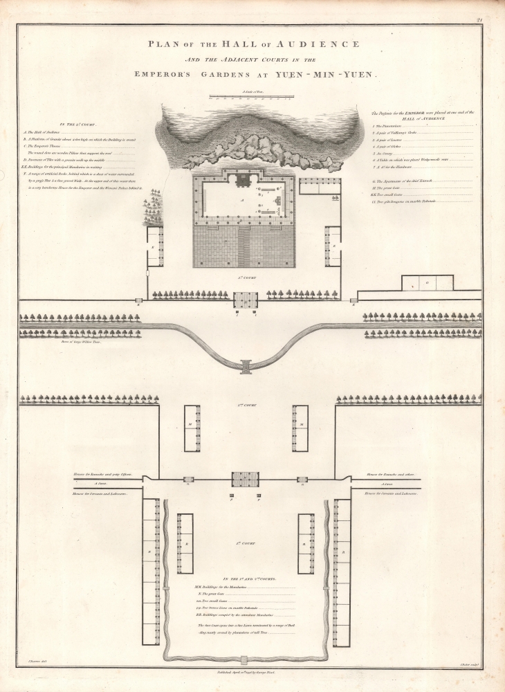
Plan of the Hall of Audience and the Adjacent Courts in the Emperor's Gardens at Yuen-Min-Yuen.
$250.00
Acquire
- Digital Map Information
- Suitable for large format printing
- DPI: 600
- File Size: 10.99 MB
- File Type: ZIP / TIFF
- ICC color profile embedded
- Delivered instantly via download link
A lovely example of Sir John Barrow's 1796 schematic of the main audience hall of the Yuanmingyuan or 'Old Summer Palace,' an impressive complex of palaces and gardens built for the Qing emperors just outside of Beijing. It appeared in George Leonard Staunton's An Authentic Account of an Embassy from the King of Great Britain to the Emperor of China, recounting the Macartney Embassy, a failed British attempt to gain expanded trading and diplomatic rights in China. (more details)
The Bank of Italy in Los Angeles.
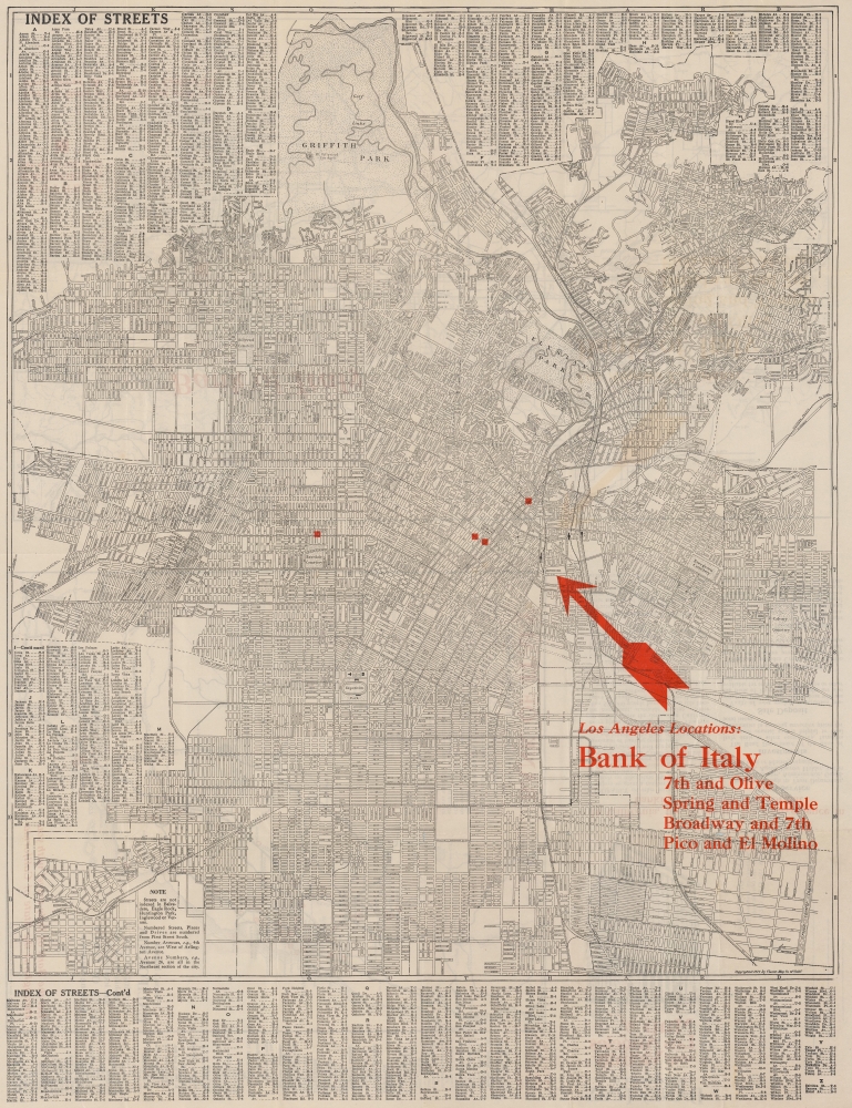
Map of Los Angeles and Vicinity Compliments of Bank of Italy.
$225.00
Acquire
- Digital Map Information
- Suitable for large format printing
- Full resolution TIFF file
- ICC color profile embedded
- Delivered instantly via download link
This is a 1924 Clason Map Company city plan or map of Los Angeles, California, issued for the Bank of Italy. Depicting from Griffith Park to Iowa Avenue and from Holt Street to the Flood Control Channel, streets throughout are labeled. Red overprinting highlights the four Bank of Italy branches in Los Angeles and red text provides the cross streets where each branch is located. A street index occupies both upper corners and the entire section below the border. (more details)
Documenting the westward expansion.
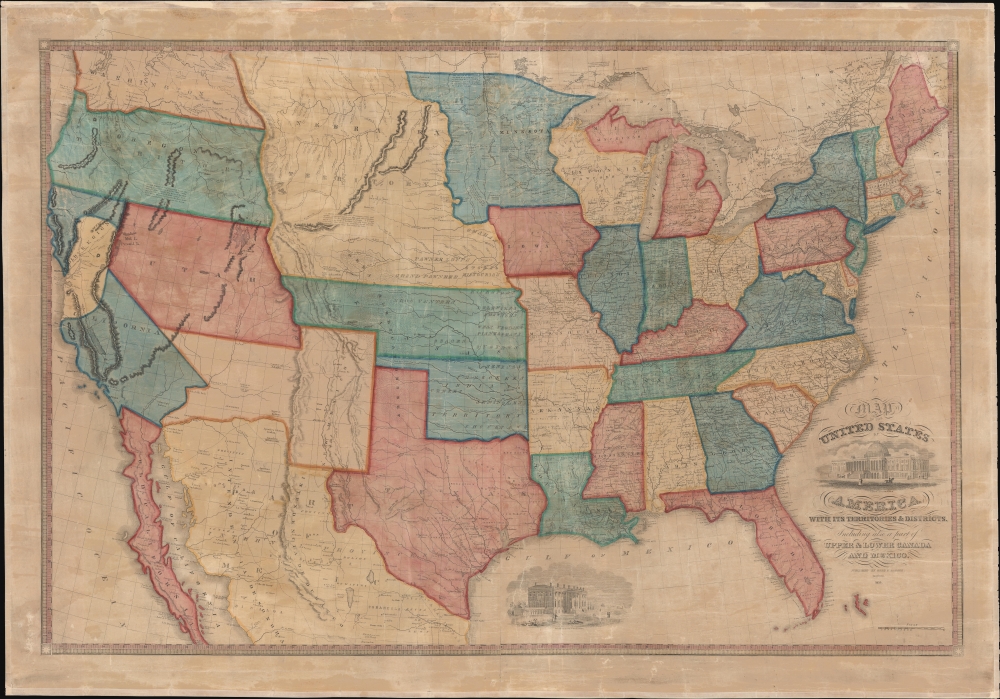
Map of the United States of America with its Territories and Districts. Including also a part of Upper and Lower Canada and Mexico.
$4,500.00
Acquire
- Digital Map Information
- Suitable for large format printing
- File Size: 195.5 MB
- File Type: ZIP / TIFF
- ICC color profile embedded
- Delivered instantly via download link
A most attractive 1855 Reed and Barber wall map of the United States reflecting a nation in flux. This is likely the last edition of this map, ending its long and fascinating documentation of American westward expansion. The present map is, according to our research, the only known example of the 1855 issue. (more details)
Between Bucharest and Brașov.
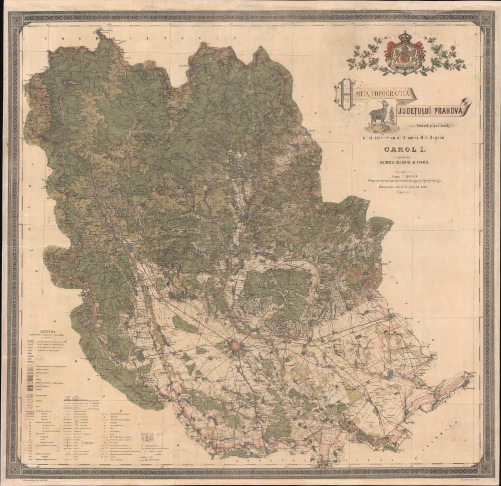
Harta Topografica Judetului Prahova.
$1,500.00
Acquire
- Digital Map Information
- Suitable for large format printing
- File Size: 232.7 MB
- File Type: ZIP / TIFF
- ICC color profile embedded
- Delivered instantly via download link
A rare 1904 chromolithograph wall map of Prahova and Transylvania, Romania issued by the Romanian Army Geographic Institute (Institutul Geografic al Armatei). Coverage embraces from just south of Brașov, Transylvania to the Ialomița River, just north of Bucharest. This includes the stunning Parcut Natural Bucegi (Bucegi Natural Park), with its rugged mountain scenery, unusual rock formations, and famous wild Black Goats - one of which is pictured in the title of this map. At a scale of 1:100000, the detail is stupendous, with individual properties, roads, and buildings noted. An extensive scale in the lower left details the elaborate coding through the map, where everything from factories, to mines, cemeteries, ruins, telegraph lines, and much more are identified. (more details)
1817 Thomson Map of the Southeastern United States: Georgia, Carolina, Virginia, Tennessee, Kentucky
A young nation looking west.
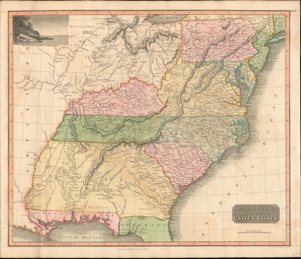
Southern Provinces of the United States.
$950.00
Acquire
- Digital Map Information
- Suitable for large format printing
- DPI: 600
- File Size: 633.59 MB
- File Type: ZIP / TIFF
- ICC color profile embedded
- Delivered instantly via download link
A scarce first edition of John Thomson's 1817 map of the southeastern part of the United States. Thomson prepared this map during a transitional period of expansion shortly following the American Revolutionary War and is among most thorough treatments of this region prior to the U.S. Government Surveys. It records early U.S. efforts to acquire and assimilate American Indian territories west of the Appalachian Mountains. (more details)
Pre-war isolationism to post-war imperialism.
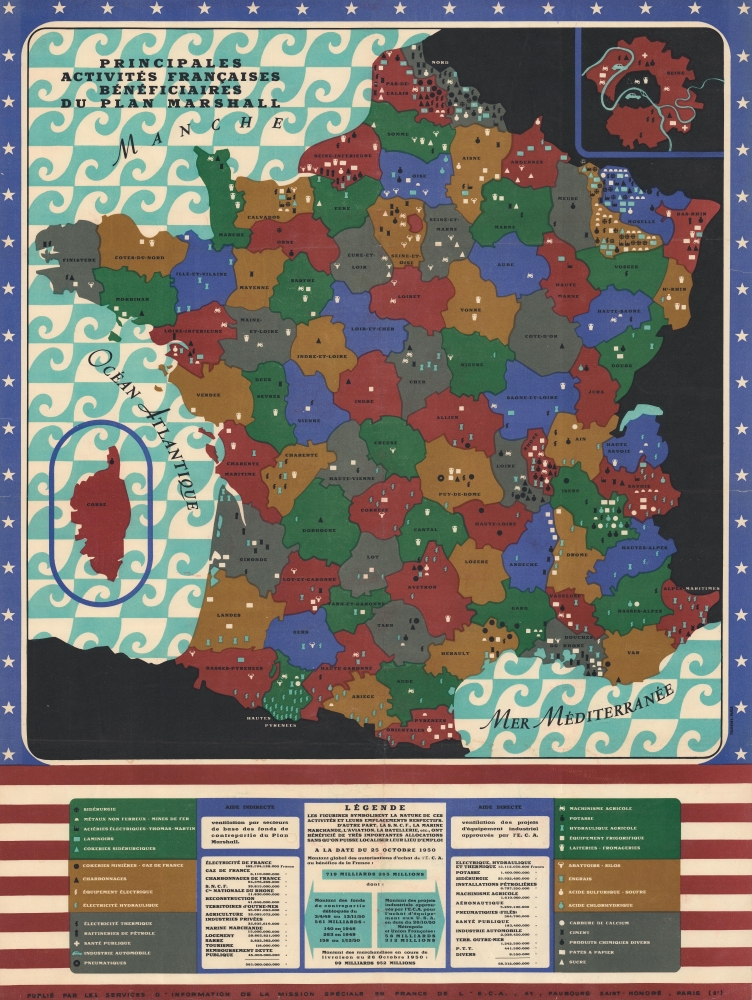
Principales Activités Françaises Bénéficiaires du Plan Marshall.
$800.00
Acquire
- Digital Map Information
- Suitable for large format printing
- File Size: 81.78 MB
- File Type: ZIP / TIFF
- ICC color profile embedded
- Delivered instantly via download link
This is a striking 1950 map of France published by the Economic Cooperation Administration (ECA) to highlight the achievements of the Marshal Plan - which at the time was in progress. The Marshall Plan was a post-World War II American-run economic stimulus initiative that infused some 13 billion USD into the Western European economy. While the effectiveness of the Marshall Plan has been debated, the inauguration of the plan marked a transition of American foreign policy from pre-war isolationism to post-war economic imperialism. The imperialist message underpinning this map is not subtle, with the map of France set against a backdrop of, and wholly contained within, an American Flag. (more details)
The 'District of Maine' and the Connecticut Western Reserve!
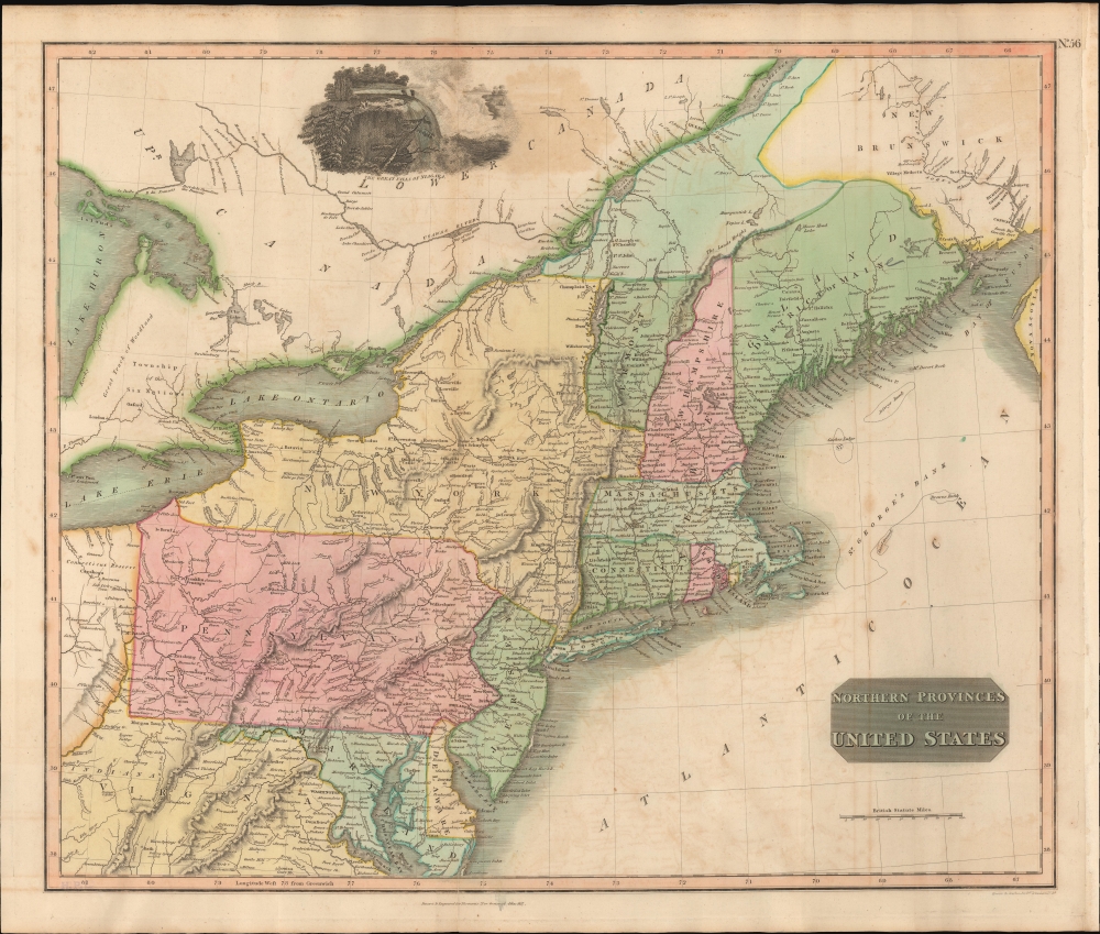
Northern Provinces of the United States.
$450.00
Acquire
- Digital Map Information
- Suitable for large format printing
- DPI: 600
- File Size: 631.07 MB
- File Type: ZIP / TIFF
- ICC color profile embedded
- Delivered instantly via download link
A scarce first edition example of John Thomson's 1817 map of the northeastern parts of the United States, including New York, Massachusetts, Connecticut, Vermont, New Hampshire, Maine, Pennsylvania, New Jersey, Maryland, Rhode Island, and parts of adjacent Virginia, Canada, and the Great Lakes. There appears a large inset of Niagara Falls along the top border. (more details)
British expansion in India.
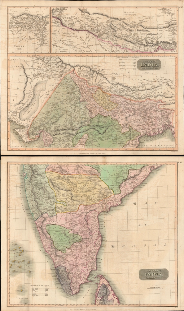
British India, Northern Part. British India, Southern Part.
$400.00
Acquire
- Digital Map Information
- Suitable for large format printing
- Full resolution TIFF file
- ICC color profile embedded
- Delivered instantly via download link
This is a stunning set of two 1817 maps of India and Nepal by Edinburgh cartographer John Thomson. As a whole, the maps illustrate India when the British East India Company had expanded their control - here in pink - from coast to coast. Color coding, with a key on the lower sheet, defines spheres of influence, including both British allies and enemies. (more details)