
NEW ACQUISITIONS
Spectacular flag chart emphasizing the reach of the British Empire.
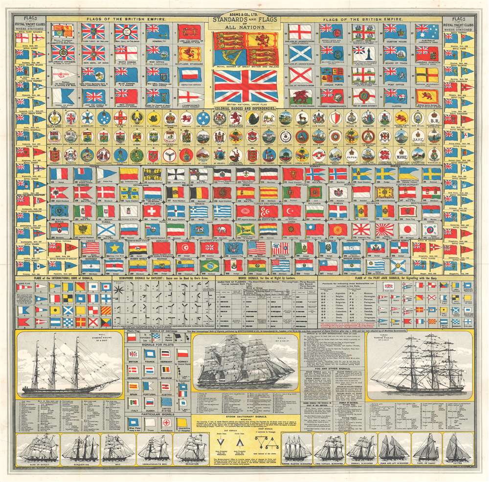
Adams and Co. Ltd. Standards and Flags of All Nations.
$950.00
Acquire
- Digital Map Information
- Suitable for large format printing
- Full resolution TIFF file
- ICC color profile embedded
- Delivered instantly via download link
A stunning c. 1914 Adams and Company Ltd. and 'Brown Son and Ferguson' chromolithograph vexillology chart illustrating the 'flags of all nations'. This chart was issued in 1914 or 1915 at the outset of World War I. Underscoring the maritime might of the British Empire, the chart his heavily Anglo-focused, with dozens of flags associated with the British Empire, its vast private and naval fleets, and its colonial dependencies. The chart also offers flags for dozens of other countries. Among these are detailed keys to standards used by European powers, including France, Germany, Norway, Austria-Hungary, and Russia. Multiple flags from China, Turkey, Japan, and the United States are included as well. Flags from Royal Yacht Clubs line the left and right sides. Along the bottom of the chart there is additional information useful to the armchair mariner regarding the identification of different types of ships, and the complex naming of ship rigging. (more details)
American Philippines.

The Rand-McNally New Library Atlas Map of Philippine Islands.
$900.00
Acquire
- Digital Map Information
- Suitable for large format printing
- Full resolution TIFF file
- ICC color profile embedded
- Delivered instantly via download link
An uncommon 1913 Rand McNally folding pocket map of the Philippines. The map covers all of the Philippine Islands during the American period (1899 - 1946), reaching from Luzon to Mindanao and from Palawan to Samar. Insets illustrate Manila Bay, Manila, the China Sea situation, the Sulu Archipelago, and the Batan Islands north of Luzon. Maritime routes to and from major ports (Hong Kong, Singapore, Guam, etc.), are noted. (more details)
'Victory Vacation Year!'
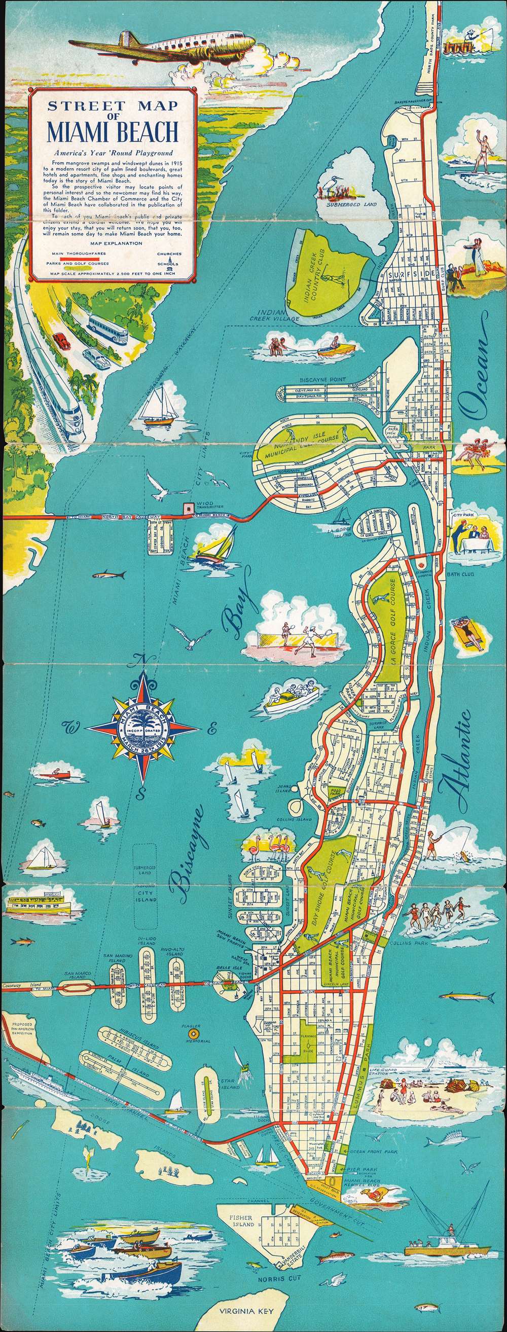
Street Map of Miami Beach.
$400.00
Acquire
- Digital Map Information
- Suitable for large format printing
- Full resolution TIFF file
- ICC color profile embedded
- Delivered instantly via download link
This is a 1945 Miami Beach Chamber of Commerce city map or plan of Miami Beach, Florida, issued to entice post-war tourism. Numerous vignettes of surfers, dancing couples, fishermen, sailing, and sunbathing highlight the leisure life of Miami Beach. All streets are labeled, along with important buildings, including police stations, churches, post offices, and schools. Main thoroughfares, are noted by thick red lines, so 'the visitor and the newcomer may find [their] way.' A wonderful title cartouche in the upper left corner promotes every possible means of arriving in Miami Beach: air, train, car, and bus. (more details)
Russian naval history at the beginning of the Cold War.

The Russian Navy.
$250.00
Acquire
- Digital Map Information
- Suitable for large format printing
- File Size: 55.82 MB
- File Type: ZIP / TIFF
- ICC color profile embedded
- Delivered instantly via download link
This is a 1945 LIFE Magazine map of the Eastern Hemisphere highlighting Russian naval history and Soviet naval capability. This map was published only months after the end of World War II (1939 - 1945) as relations between the Western Allies and the Soviet Union were rapidly deteriorating. Red stars with anchors mark Soviet naval bases, each of which is labeled. Two potential Soviet naval bases in Libya and Eritrea, are labeled as well. A dashed line along the coast of Siberia traces the Northeast Passage, a key transportation route during World War II. (more details)
Religious and secular sites around Jerusalem.

ירושלים. / [Jerusalem.]
$250.00
Acquire
This is a 1969 Radu Vero pictorial map of Jerusalem in Hebrew. With the Old City just to the right of center, illustrations of Jerusalem's many sites dominate the piece. Shaded brown, the Old City stands in stark contrast to the rest of the city, which appears in tan with green highlighting the city's gardens and parks. The Dome of the Rock, the Western Wall, Al-Aqsa Mosque, 'David's Tower', and the Church of the Holy Sepulcher are among the historic sites named. Numerous additional locations are illustrated outside the Old City and range from government ministries, hotels, schools, convents, and synagogues to famous sites, such as the Hebrew University, the Israel Museum, and the Knesset. Religious sites including the Tombs of the Prophets, David's Tomb, the Sanhedrin Tombs, and the Tomb of the Kings are illustrated and labeled as well. Intriguingly, numerous sites appear outside the map's 'borders', including Yad Vashem, the British Military Cemetery, several hospitals, and a pair of monasteries. (more details)
Tourism during the Second Arab-Israeli War.
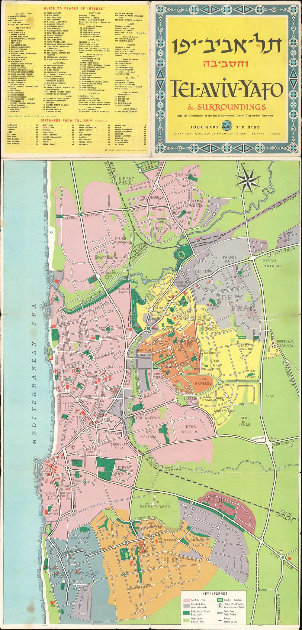
.תל - אביב - יפו והסביבה / Tel-Aviv-Yafo and Surroundings.
$250.00
Acquire
This is a 1956 Tour Ltd. map of Tel Aviv-Yafo, Israel and vicinity. Despite promoting tourism, the map was issued during a time of political unrest, just prior to the outbreak of the Second Arab-Israeli War. The map depicts from the Tel Baruch neighborhood of Tel Aviv south to Holon and Bat Yam. 141 locations throughout the region are numerically identified and correspond with an index situated in the upper left. A bilingual English-French key appears along the bottom and explains the coding. (more details)
Beautifully Engraved 17th Century View of Damascus.
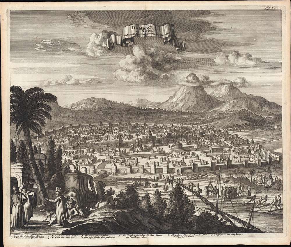
Damascus in Syrien Volgens des Afteeckening gedaen in 't Iaer 1668.
$750.00
Acquire
- Digital Map Information
- Suitable for large format printing
- Full resolution TIFF file
- ICC color profile embedded
- Delivered instantly via download link
This is a beautiful example of Jacob Meurs' engraved view of the Syrian city of Damascus, printed in 1681 as part of Olfert Dapper's history of Asia Minor and the Holy Land. The view is intended to portray the contemporaneous Muslim walled city; its mosques prominent. Some churches illustrated as well, though one of these, the Church of Saint Paul, is in ruins. In the foreground, noblemen in Ottoman styles converse as footmen lead their camels, replete with a covered chaise, towards the city. Before the walls of the city, the view presents a bustling scene of nobles, fishermen, cattle herders and soldiers. (more details)
Treasure of the Sierra Madre.
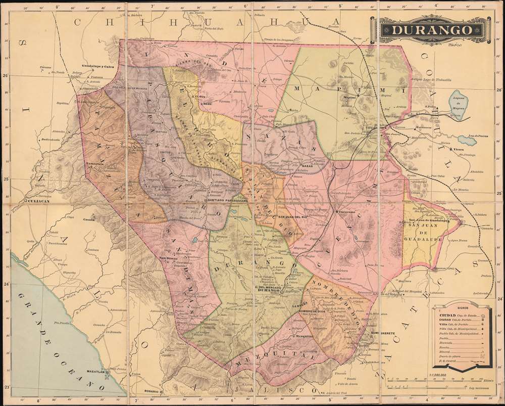
Durango.
$550.00
Acquire
- Digital Map Information
- Suitable for large format printing
- File Size: 16.45 MB
- File Type: ZIP / TIFF
- ICC color profile embedded
- Delivered instantly via download link
This is an 1886 Antonio Garcia y Cubas map of Durango, Mexico. When it was published, this was the best generally obtainable map of Durango - then a center of mineral wealth. Note the little pickaxe icons scattered throughout - indicators of gold, silver, and copper deposits. (more details)
Lovecraft inspiration!
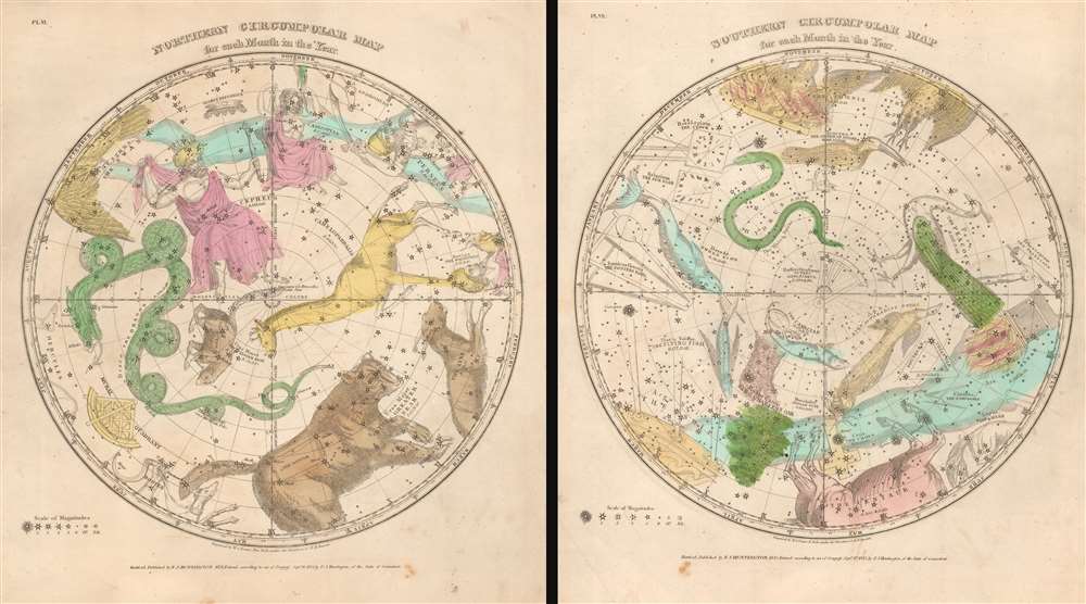
Northern Circumpolar Map for each Month in the Year. Southern Circumpolar Map for each Month in the Year.
$500.00
Acquire
- Digital Map Information
- Suitable for large format printing
- Full resolution TIFF file
- ICC color profile embedded
- Delivered instantly via download link
This is a beautiful hand-colored set of the 1835 Elijah Burritt northern and southern circumpolar celestial maps. This pair illustrates the night sky and constellations of both the northern hemisphere and southern hemisphere respectively. Constellations are drawn in detail and include depictions of the zodiacal figures (more details)
900 miles further up Yangtze than any previous Westerner.
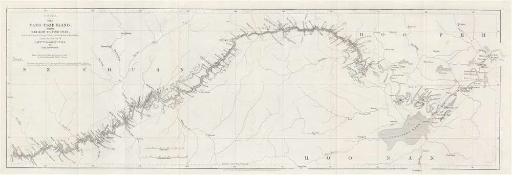
China. The Yang-Tsze Kiang, from Han-Kow to Ping-Shan; reduced from the large Chart (of which this is the Index) from the Survey of Captain T. Blakiston R.A.
$125.00
Acquire
- Digital Map Information
- Suitable for large format printing
- File Size: 6.32 MB
- File Type: ZIP / TIFF
- ICC color profile embedded
- Delivered instantly via download link
This is an 1862 John Arrowsmith map of the Yangtze River, China. Coverage extends from Hankou (Hankow) to Pingshan. The map follows 1861 Thomas Wright Blakiston (December 27, 1832 - October 15, 1891) Yangtze River Expedition. Blakiston's expedition traveled over 900 miles further up the river than any previous Western navigation. Blakiston also conducted detailed surveys of the Yangtze and produced a landmark map of the river. The present map acts as a key for Blakiston's larger map. Cities and towns of varying size are labeled throughout. Additional notations mark the now submerged Yangtze Gorges and other physical features. (more details)
China's terrain.
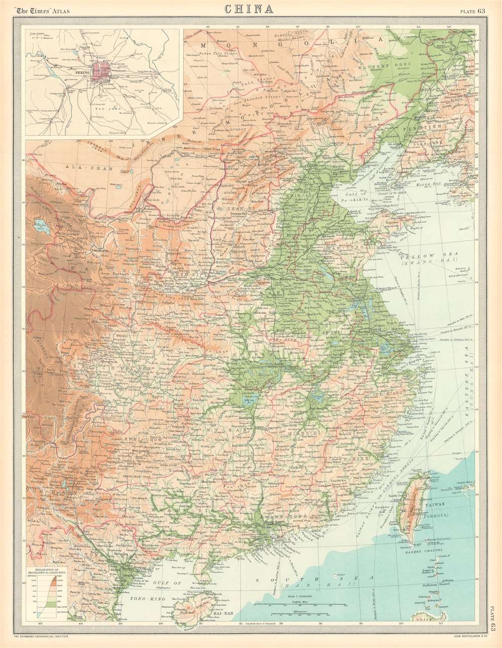
China.
$100.00
Acquire
- Digital Map Information
- Suitable for large format printing
- File Size: 25.48 MB
- File Type: ZIP / TIFF
- ICC color profile embedded
- Delivered instantly via download link
This is a 1922 J.G. Bartholomew terrain map of China. Depicting eastern China from Mongolia to Hainan, Bartholomew employs color to differentiate between six ranges in elevation from sea level to 12,000 feet and above. He also uses color to illustrate ocean depth. Chinese provinces are illustrated and labeled, and cities, town, and villages are identified. An inset map in the upper left corner details Beijing (Peking) and its environs. (more details)
A complete set of 79th Infantry Division route maps from World War II - maps created by the soldiers for the soldiers.
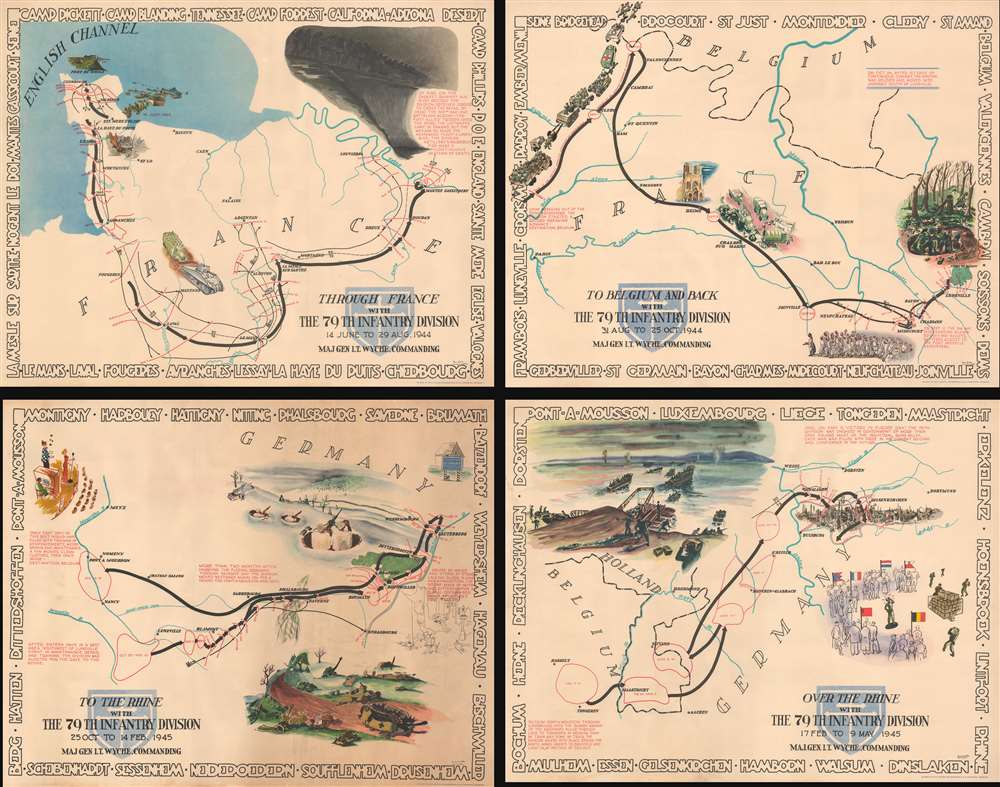
Through France with the 79th Infantry Division 14 June to 29 Aug, 1944. Maj Gen I.T. Wyche, Commanding. / To Belgium and Back wit the 79th Infantry Division 31 Aug to 25 Oct, 1944 Maj. Gen. I. T. Wyche, Commanding. / To the Rhine with the 79th Infantry Division 25 Oct to 14 Feb. 1945 Maj Gen I.T. Wyche, Commanding. / Over the Rhine with the 79th Infantry Division 17 Feb to 9 May 1945 Maj. Gen. I. T. Wyche, Commanding.
$2,200.00
Acquire
- Digital Map Information
- Suitable for large format printing
- Full resolution TIFF file
- ICC color profile embedded
- Delivered instantly via download link
This is a set of four Steve Kaliher and Harry D. White pictorial World War II route maps of the 79th Infantry's advance from Normandy to Germany. Presented on four separate sheets, a detailed summary of the division's progress across northern Europe from Utah Beach (one of the four Normandy beaches assaulted by Allied troops only eight days on what has become known as D-Day) to Mulheim, Germany. Each map traces a sequence of a few months in the combat history of the 79th with red lines labeled with dates marking the advance week by week and sometimes day to day. Text blocks narrate parts of the advance, providing insight into what the division accomplished during their over 300 days of combat. Cities and towns are identified throughout all four maps, as are rivers. Each map is framed by the names of cities and towns that the division passed through on their advance, fought for, and liberated, adding yet another level of memory to each piece. (more details)
The most detailed chart of the Caspian Sea of the mid-18th century.
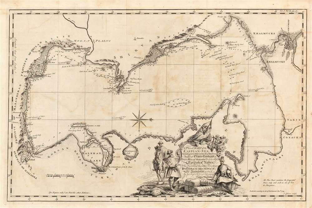
A Plain Chart of the Caspian-Sea, According to the Observations of Capt. John Elton, Author of Elton's Quadrant, and Thomas Woodroofe, Master of the British Ship Empress of Russia, Who navigated this Sea three years; Presented to Mr. Jonas Hanway of St. Petersburgh in 1745 by his most Obedient Servant Thomas Woodroofe.
$650.00
Acquire
- Digital Map Information
- Suitable for large format printing
- Full resolution TIFF file
- ICC color profile embedded
- Delivered instantly via download link
This superbly detailed chart of the Caspian Sea, engraved by John Gibson in 1753, was the first detailed charting of that sea following the work of Carl Van Verden, and arguably the better chart. It was produced for inclusion in Jonas Hanway's An Historical Account of the British Trade Over the Caspian Sea and relies on details provided Hanway by captains John Elton and Thomas Woodroofe, whose accounts have been preserved nowhere but in Hanway's work. (more details)
Attractively Engraved Map of the African Continent.
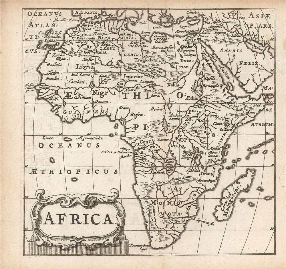
Africa.
$250.00
Acquire
- Digital Map Information
- Suitable for large format printing
- Full resolution TIFF file
- ICC color profile embedded
- Delivered instantly via download link
This is a finely-engraved miniature map of Africa, printed in a 1661 Elzevir edition of Philipp Cluver's introduction to geography. Cluver's work appeared in editions produced by many different houses, and with maps of wildly differing characteristics. (more details)
The Good Life - Florida.
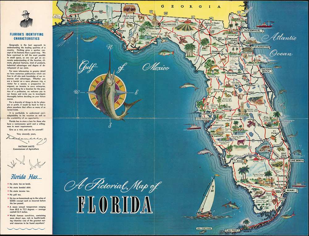
A Pictorial Map of Florida.
$150.00
Acquire
- Digital Map Information
- Suitable for large format printing
- Full resolution TIFF file
- ICC color profile embedded
- Delivered instantly via download link
A charming 1954 pictorial map of Florida issued by John Nathan Mayo (1876 - 1960), Florida Commissioner of Agriculture from 1923 to 1960. The map promotes emigration to Florida, advertising the state's 'no tax' policies, warm weather, and sunshine. Maps are printed on both sides. The primary map features rich pictorial content emphasizing Florida's flora, fauna, and agricultural potential. The verso map features highway data, populations tables, and a milage chart. (more details)
Trade routes between London and Persia.
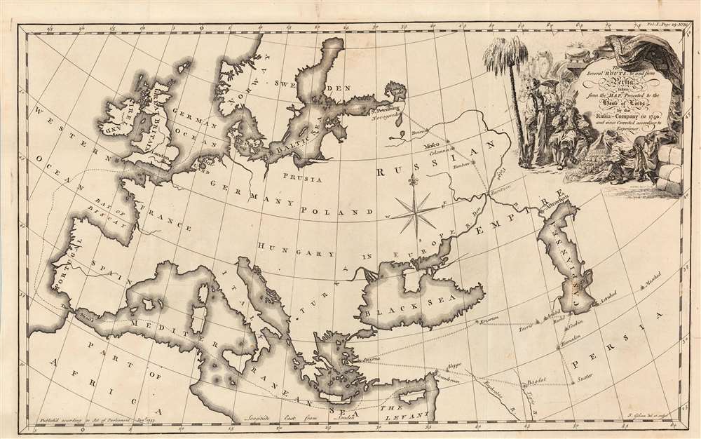
The Several Routs, to and from Persia taken from the Map, presented to the House of Lords by the Russia Company in 1740 and since Corrected according to Experience.
$450.00
Acquire
- Digital Map Information
- Suitable for large format printing
- Full resolution TIFF file
- ICC color profile embedded
- Delivered instantly via download link
This elegant 1753 Jonas Hanway map of Europe and the Near East illustrates the trade routes of British Russia Company, as proposed to the House of Lords in 1740. It was engraved in 1753 by John Gibson to accompany Jonas Hanway's account of his journey from Russia to Persia. Although not himself a company member, the merchant Hanway entered into partnership with member Robert Dingley (1710 - 1780). Thus, Hanway's routes taken in his 1743 journey hewed closely to the northern one proposed here. This route ran by sea to St. Petersburg and then by land to Tsaritsyn, Astrakhan and the Caspian Region. A southern route was also presented, from London via the Mediterranean to Syrma, and then to Persia via Asia Minor. (more details)
Celebrates Northern Ireland's contributions to the Allied victory during World War II.
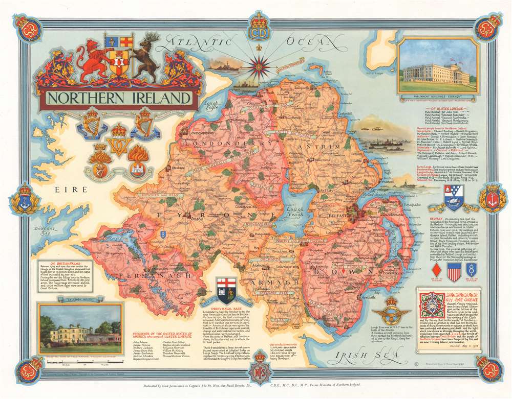
Northern Ireland.
$250.00
Acquire
- Digital Map Information
- Suitable for large format printing
- File Size: 25.15 MB
- File Type: ZIP / TIFF
- ICC color profile embedded
- Delivered instantly via download link
Published immediately after World War II, this is a 1947 Ernest Clegg pictorial map of Northern Ireland. The map celebrates Northern Ireland's role in securing an Allied victory in Europe during World War II. (more details)
Trade routes between London and Russia.
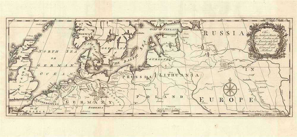
The Author's Routs from London as far as Zaritzen and back through Russia Germany and Holland.
$250.00
Acquire
- Digital Map Information
- Suitable for large format printing
- Full resolution TIFF file
- ICC color profile embedded
- Delivered instantly via download link
This is an example of John Gibson's rare map of Northern Europe, engraved in 1753 to accompany Jonas Hanway's account of his journey from Russia to Persia. It shows the track Hanway took in 1743 to northern Persia via Russia, as well as his return in 1750 via Germany and the Netherlands. Although its intent is simply to visually support Hanway's narrative, it highlights the important trade routes of Northern Europe between Britain and the East. (more details)
Key Port in the Atlantic Slave Trade; also, Mermaids, err umm.. Manatees.
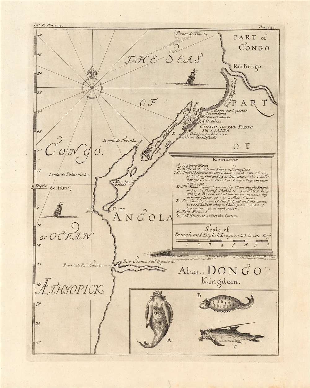
[Part of Congo / Part of Angola Alias Dongo Kingdom]
$500.00
Acquire
- Digital Map Information
- Suitable for large format printing
- Full resolution TIFF file
- ICC color profile embedded
- Delivered instantly via download link
This is a 1732 map of the coast of Angola, printed by Awnsham and John Churchill to accompany Jean Barbot's posthumously-published A description of the coasts of north and south-Guinea, and of Ethiopia inferior, vulgarly Angola. The map covers the Angolan coast from the Bengo River to the Cuanza river, but is in many respects a chart, only focusing on coastal detail. Its primary focus is on Luanda, its several navigational threats, and its fortifications; with particular detail regarding coastlines suitable for landing, the location of fresh water, and the vicinity of the Portuguese custom house. The map is centered on the island and fortress of Luanda, which is now the capital of Angola. Founded by the Portuguese in 1576, it is one of the oldest colonial cities in Africa: the center of the slave trade to Brazil before its abolition. Barbot's account was a description of the Atlantic Slave Trade, and this map presents details needed for ships to land, and take on their human cargo. (more details)
Campaign to retake the Philippines.
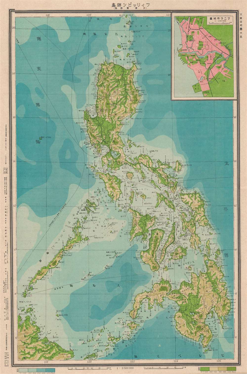
Philippine Islands. / フィリッピン群島
$350.00
Acquire
- Digital Map Information
- Suitable for large format printing
- Full resolution TIFF file
- ICC color profile embedded
- Delivered instantly via download link
An uncommon Showa 19 or 1944 Japanese World War II map of the Philippines. This map was issued in Japan during WWII at the outset of the Philippine Campaign (October 20, 1944 - September 2, 1945), the Allied invasion that retook the Philippines. There is an inset of Manila in the upper right corner. (more details)