
Coronelli, Vincenzo Maria (sold)
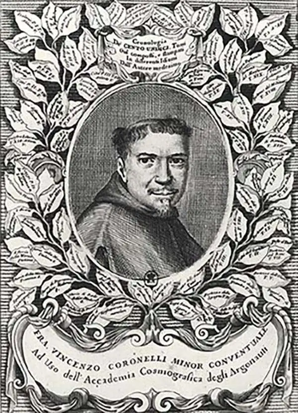
Vincenzo Maria Coronelli (August 16, 1650 - December 9, 1718) was an important 17th-century cartographer and globe maker based in Venice. Coronelli was born the fifth child of a Venetian tailor. Unlikely to inherit his father's business, he instead apprenticed in Ravenna to a woodcut artist. Around 1663, Coronelli joined the Franciscan Order and, in 1671, entered the Venetian convent of Saint Maria Gloriosa dei Frari. Coronelli excelled in the fields of cosmography, mathematics, and geography. Although his works include the phenomenal Atlante Veneto and Corso Geografico, Coronelli is best known for his globes. In 1678, Coronelli was commissioned to make his first major globes by Ranuccio II Farnese, Duke of Parma. Each superbly engraved globe was five feet in diameter. Louis IV of France, having heard of the magnificent Parma globes, invited Coronelli to Paris, where from 1681-83 he constructed an even more impressive pair of globes measuring over 12 feet in diameter and weighing 2 tons each. The globes earned him the patronage of Louis XIV and privileged access to French cartographic information from Jesuit sources in the New World, particularly Louisiana. Coronelli returned to Venice and continued to publish globes, maps, and atlases, which were admired all over Europe for their beauty, accuracy, and detail. He had a particular fascination for the Great Lakes region, and his early maps of this area were unsurpassed in accuracy for nearly 100 years after their initial publication. He is also well known for his groundbreaking publication of the first accurate map depicting the sources of the Blue Nile. At the height of his career, Coronelli founded the world's first geographical society, the Accademia Cosmografica degli Argonauti, and was awarded the official title Cosmographer of the Republic of Venice. In 1699, in recognition of his extraordinary accomplishment and scholarship, Coronelli was also appointed Father General of the Franciscan Order. The great cartographer and globe maker died in Venice at the age of 68. His extraordinary globes can be seen today at the Bibliothèque Nationale François Mitterrand in Paris, Biblioteca Marciana in Venice, the National Library of Austria, the Globe Museum in Vienna, the Library of Stift Melk, the Special Collections Library of Texas Tech University, as well as lesser works in Trier, Prague, London, and Washington D.C. Coronelli's work is notable for its distinctive style, which is characterized by the high-quality white paper, dark intense impressions, detailed renderings of topographical features in profile, and numerous cartographic innovations.
Earliest Acquirable Accurate Map of the Southwest?
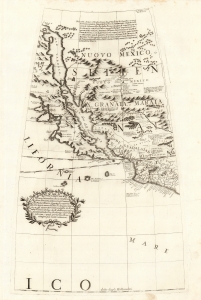
[Untitled Globe Gore of Western North America from the Equator to approximately 50º north].
sold
- Digital Map Information
- Suitable for large format printing
- Full resolution TIFF file
- ICC color profile embedded
- Delivered instantly via download link
This is the globe gore focusing on the American southwest, engraved in 1688 for Vincenzo Coronelli's 42-inch (3 1/2 foot) terrestrial globe, reprinted in 1697 for inclusion in his Libro dei Globi and Isolario. This beautiful engraving is striking in its presentation of the insular California, but this is not its most important feature. Rather it represents the earliest correct depiction of the Rio Grande generally acquirable to the collector. (more details)
The Heart of North America from the Finest Globemaker of the 17th Century.
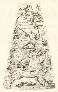
[Untitled Globe Gore of North America from the Tropic of Cancer to the Arctic Circle].
sold
- Digital Map Information
- Suitable for large format printing
- Full resolution TIFF file
- ICC color profile embedded
- Delivered instantly via download link
This is a beautiful 1688 Vincenzo Maria Coronelli globe gore focused on North America east of the Mississippi and west of the Chesapeake, engraved Coronelli's masterpiece 3 1/2 foot globe. The copperplate was adapted in 1697 for inclusion in Coronelli's bound atlases, masked off between the Tropic of Cancer and the Equator to fit book format. The gore covers most of North America east of the Mississippi, spanning from the Tropic of Cancer to the Arctic Circle. Thus, it shows the northern Gulf Coast, Florida, Chesapeake Bay, the Mississippi River (after La Salle), the Great Lakes, and Hudson's Bay. The geography is substantively the same as that on Coronelli's two-sheet America Settentrionale. Although that map bears the date 1688, it was not actually published any earlier than 1690 and it is very probable that the globes represent the earlier appearance of this geographical information. (more details)
The Caribbean and American East Coast from the Finest Printed Globe of the 17th Century.
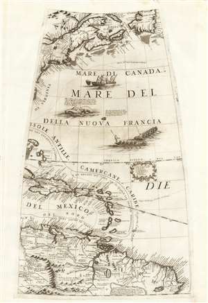
[Untitled Globe Gore of Eastern North and South America from the Equator to approximately 50º north].
sold
- Digital Map Information
- Suitable for large format printing
- Full resolution TIFF file
- ICC color profile embedded
- Delivered instantly via download link
This scarce, beautiful engraving is the globe gore presenting a map of the American northeast, the West Indies, and Terra Firma in South America, engraved in 1688 for Vincenzo Coronelli's 42-inch (3 1/2 foot) terrestrial globe, reprinted in 1697 for inclusion in his Libro dei Globi and Isolario. The map spans from the Equator in the south to Newfoundland in the north, centered on the Tropic of Cancer. It includes Canada in the vicinity of the Saint Lawrence River and Acadia, New England and New York, and part of the coastline around the Chesapeake Bay. The West Indies are shown from the Bahamas to Trinidad, stretching from the eastern part of Cuba to Barbados, including the imaginary island of Fonseca. The gore's southern extents show the northern parts of South America, from modern day Venezuela to the Orinoco Delta and the Guianas, and the fabled city of El Dorado. (more details)
South America from the Finest Globemaker of the 17th Century.
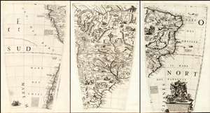
(Set of three Globe Gores of South America from the Equator to 50º south).
sold
- Digital Map Information
- Suitable for large format printing
- Full resolution TIFF file
- ICC color profile embedded
- Delivered instantly via download link
This is a matched trio of globe gore sections covering most of South America, issued by Vincenzo Maria Coronelli in 1697. They are printed from the plates of Coronelli's 1688 3 1/2 foot Terrestrial globe. Coronelli considered the 1688 terrestrial and celestial globe pair to be his greatest work in print. He was not without justification: their superb engraving and encyclopedic geographic detail, not to mention their great size, set them easily amongst the finest globes produced in the 17th century. Desiring to display the quality of these works to a broader audience, and to challenge any potential competition, Coronelli published in 1697 a volume variously titled Libro dei Globi or Palestra Litteraria containing his globe gores (The title page bore a date of 1693, but the earliest known printing of the book was four years later.) 1697 was busy: Coronelli also included most of the gores from his terrestrial globe among conventional maps in his Atlante Veneto and Isolario that same year. In this case, less a product of the mapmaker's braggadocio and more a sensible reuse of expensively-produced copperplates. (more details)
The Caribbean and American East Coast from the Finest Printed Globe of the 17th Century.
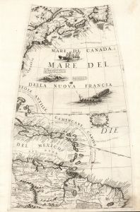
[Globe Gore Map of Eastern North and South America from the Equator to approximately 50º north].
sold
- Digital Map Information
- Suitable for large format printing
- Full resolution TIFF file
- ICC color profile embedded
- Delivered instantly via download link
This is the 1688 / 1697 Vincenzo Coronelli globe gore map of the American northeast, the West Indies, and northern South America. It was initially engraved for Coronelli's 42-inch (3 1/2 foot) terrestrial globe, here in the 1697 printing prepared for the Libro dei Globi and Isolario. (more details)
A gore from one of the greatest globes ever made.
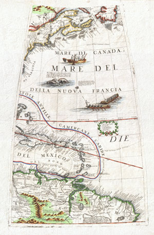
New England, the West Indies, Northeastern South America (Unitled Globe Gore).
sold
- Digital Map Information
- Suitable for large format printing
- DPI: 300
- File Size: 9.77 MB
- File Type: ZIP / TIFF
- ICC color profile embedded
- Delivered instantly via download link
A fine example of Vincenzo Coronelli's extremely rare 1688 globe gore of Eastern America. Covers from Newfoundland south along the New England and Virginia coastlines to the Bahamas (Gigante) and the West Indies, showing parts of Cuba and all of Hispaniola, Porto ... (more details)
Full set of Africa gores engraved for the finest printed globe of the 17th century.
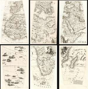
[Africa Globe Gores].
sold
- Digital Map Information
- Suitable for large format printing
- Full resolution TIFF file
- ICC color profile embedded
- Delivered instantly via download link
This is a complete set of Maria Coronelli's 1697 globe gore sections pertaining to Africa. They are printed from the plates engraved for Coronelli's 1688 3.5 foot terrestrial globe. These were the largest printed globes to date, and Coronelli himself considered them his greatest work in print. Their superb engraving and encyclopedic geographic detail, not to mention their great size, set them amongst the finest globes of the 17th century. (more details)
An Essential, Rare Caribbean.
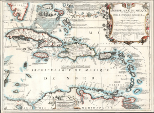
Archipelague du Mexique ou Sont les Isles de Cuba, Espagnole, Jamaique, etc. avec les Isles Lucayes, et les Isles Caribes, conniies sous le nom d’Antilles…
sold
- Digital Map Information
- Suitable for large format printing
- File Size: 21.73 MB
- File Type: ZIP / TIFF
- ICC color profile embedded
- Delivered instantly via download link
This grand, scarce map of the Caribbean and West Indies, produced by Vincenzo Coronelli and Jean-Baptiste Nolin in 1688, is the largest and most beautiful of Coronelli's maps dedicated to the West Indies. (more details)
'Probably the best 17th-century representation of the geography of eastern Canada and the eastern seaboard of America.' -Kershaw
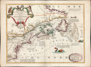
Partie Orientale du Canada ou de la Nouvelle France...
sold
- Digital Map Information
- Suitable for large format printing
- File Size: 27.19 MB
- File Type: ZIP / TIFF
- ICC color profile embedded
- Delivered instantly via download link
This is Vincenzo Coronelli and Jean Baptiste Nolin's separately-published map of Eastern Canada and the Northeastern part of the British Colonies in North America, in an attractive example. It is an essential Canadianum, incorporating up-to-date sources from both the French and English, whilst presenting pro-French territorial claims aggressively. (more details)
On the cusp of the Siamese Revolution of 1688.
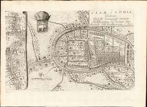
Siam, ò Iudia, Dedicata Dal P. Cosmografo Coronelli All'Illustrissimo Sig: Giouanni Emo.
sold
- Digital Map Information
- Suitable for large format printing
- DPI: 600
- File Size: 13.18 MB
- File Type: ZIP / TIFF
- ICC color profile embedded
- Delivered instantly via download link
This is V. Coronelli's rare and important 1689 map of Ayutthaya. representing the Siamese capital at the height of the Ayutthaya Period (1351 - 1767), considered a golden age for Thailand. At the time Ayutthaya was the largest most sophisticated city in the world, with a population exceedingly 1,000,000 people. The cartography here immediately predates the 1688 Siamese Revolution, and thus includes foreign settlements, churches, and schools, all of which were violently expelled shortly after. As such, this map also reflects the most sophisticated mapping of the Siamese capital through the 18th century. (more details)
On the cusp of the Siamese Revolution of 1688.
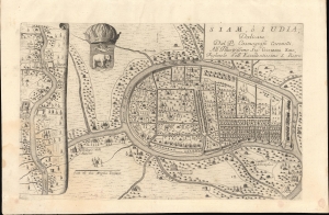
Siam, ò Iudia, Dedicata Dal P. Cosmografo Coronelli All'Illustrissimo Sig: Giouanni Emo.
sold
- Digital Map Information
- Suitable for large format printing
- Full resolution TIFF file
- ICC color profile embedded
- Delivered instantly via download link
This is Coronelli's important 1689 map of Ayutthaya, representing the Siamese capital at the height of the Ayutthaya Period (1351 - 1767), considered a golden age for Thailand. At the time, Ayutthaya was the world's largest, most sophisticated city, with a population exceeding 1,000,000. The cartography here immediately predates the 1688 Siamese Revolution, and thus includes foreign settlements, churches, and schools. All of these were violently expelled in the Revolution's aftermath. As such, this map reflects the most sophisticated European mapping of the Siamese capital through the 18th century - the Siamese themselves did not make maps as such. (more details)
Spectualry image and map of the Lofoten Maelstrom or Moskenstraumen!
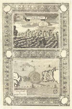
Voragine Di Moskestroom. / Onde Formate dalla Voragine di Moskestrom.
sold
- Digital Map Information
- Suitable for large format printing
- DPI: 300
- File Size: 6.15 MB
- File Type: ZIP / TIFF
- ICC color profile embedded
- Delivered instantly via download link
An uncommon page from Vincenzo Coronelli's Isolario dell' Atlante Veneto illustrating the remarkable phenomena of Norway's Lofoten Maelstrom or, the Moskenstraumen . By far the world's most famous whirlpool, the Lofoten Maelstrom is a system of tidal eddies and ... (more details)
The first map to accurately depict Abyssinia and the source of the Blue Nile.
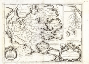
Abissinia, doue sono le Fonti del Nilo descritta secondo le relationi de P.P. Mendez, Almeida, Pais, Lobo, e Lodulfo del P. M. Coronelli M.C. Cosmografo della Seren. Rep. di Ventia…
sold
- Digital Map Information
- Suitable for large format printing
- DPI: 300
- File Size: 13.87 MB
- File Type: ZIP / TIFF
- ICC color profile embedded
- Delivered instantly via download link
This is Coronelli's important 1690 map of Ethiopia (Abyssinia) showing the source of the Blue Nile. This map, focusing on Lake Tana (Tzana Dembea) covers the Ethiopian highlands from Derbeta on the Red Sea south as far as the tribal kingdoms of Sugame, ... (more details)
Stunning two part map of Holland.
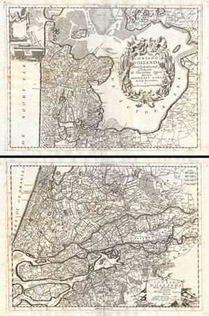
Contado d'Ollanda Parte Settentrionale. - Contado d'Ollanda Parte Meridionale.
sold
- Digital Map Information
- Suitable for large format printing
- Full resolution TIFF file
- ICC color profile embedded
- Delivered instantly via download link
A spectacular example of Coronelli's two part map of Holland or the Netherlands. The upper sheet covers from Friesland to Amsterdam including all of the Zuyder Zee. The southern map covers from the Haarlem Meer south to Breeda and east to Batenborg. ... (more details)
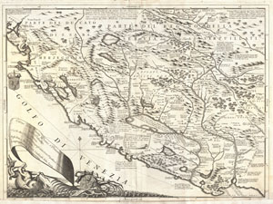
Corso delli Fiumi Drino, e Boiana nella Dalmatia, descrito dal P. Mro Coronelli Cosmografo della Seren. Republica di Venezia dedicato - Agli Em; e Reu; Signori Cardinali della Sacra congregatione de Propaganda Fide.
sold
- Digital Map Information
- Suitable for large format printing
- DPI: 300
- File Size: 14.01 MB
- File Type: ZIP / TIFF
- ICC color profile embedded
- Delivered instantly via download link
This is Vincenzo Maria Coronelli's 1690 map of Montenegro. Covers the Dalmatian coast from Dubrovnik to Gjiri i Drinit, including all of modern day Montenegro as well as parts of adjacent Croatia, Albania, and Bosnia Herzegovina. Most of Coronelli's ... (more details)
Detailed map of the Dalmatian Coast drawn during the Sixth Ottoman-Venetian War.
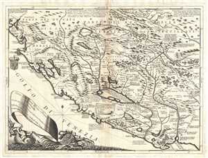
Corso delli Fiumi Drino, e Boiana nella Dalmatia, descrito dal P. Mro Coronelli Cosmografo della Seren. Republica di Venezia dedicato - Agli Em; e Reu; Signori Cardinali della Sacra congregatione de Propaganda Fide.
sold
- Digital Map Information
- Suitable for large format printing
- DPI: 300
- File Size: 12.51 MB
- File Type: ZIP / TIFF
- ICC color profile embedded
- Delivered instantly via download link
This is Vincenzo Maria Coronelli's 1690 map of Montenegro. The map covers the Dalmatian coast from Dubrovnik to Gjiri i Drinit, including all of modern day Montenegro as well as parts of adjacent Croatia, Albania, and Bosnia Herzegovina. Most of ... (more details)
Outstanding map of southern Scotland, including Edinburgh and Glasgow.
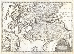
Scotia, Parte Meridionale …
sold
- Digital Map Information
- Suitable for large format printing
- Full resolution TIFF file
- ICC color profile embedded
- Delivered instantly via download link
This is Vincenzo Maria Coronelli's 1690 map of southern Scotland. Covers the southern part of Scotland from New Aberdone and Kiltre south as far as the Isle of Man, including adjacent parts of England and Ireland. The major cities of Glasgow and ... (more details)
Depicts the Great Wall of China.
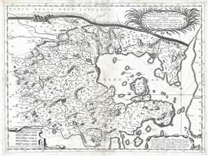
Xantung, e Peking Provincie della China, divise nelle sue Reggioni.
sold
- Digital Map Information
- Suitable for large format printing
- DPI: 300
- File Size: 9.92 MB
- File Type: ZIP / TIFF
- ICC color profile embedded
- Delivered instantly via download link
This is a c. 1690 Vincenzo Maria Coronelli map of the Xantung (Shandong) and Peking (Hebei) provinces in China. The map depicts the region from Henan and Shanxi Provinces to the Korean Peninsula and from Inner Mongolia to Shandong Province. ... (more details)
The most dramatically engraved and presented map of Africa of the 17th century.
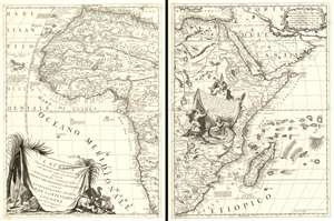
L'Africa Divisa nelle sue Parti secondo le Piùu moderne relationi colle scoperte dell' origine, e coro del NILO, descritta dal P.M. Coronelli M.C. Cosmografo della Serenissima Republica di Veneia è dedicata all' Eccellenza del Signor Gran Contestabile Colonna gia Vce. Rè d' Aragona, poi Vce Rè di Napoli.
sold
- Digital Map Information
- Suitable for large format printing
- Full resolution TIFF file
- ICC color profile embedded
- Delivered instantly via download link
This is Vincenzo Maria Coronelli's magnificent 1691 two-sheet map of Africa: it is among the most distinctive maps ever printed of the continent, and one boldly presenting the groundbreaking revision of the mapping of the River Nile. The size of the map, as well as Coronelli's distinctive and elegant style, establish this map among the most sought-after antique maps of Africa. It is rich in historical detail, noting dates on which different regions were first reached by European explorers. (more details)
The most dramatically engraved and presented map of Africa of the 17th century.
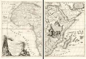
L'Africa Divisa nelle sue Parti secondo le Piùu moderne relationi colle scoperte dell' origine, e coro del NILO, descritta dal P.M. Coronelli M.C. Cosmografo della Serenissima Republica di Veneia è dedicata all' Eccellenza del Signor Gran Contestabile Colonna gia Vce. Rè d' Aragona, poi Vce Rè di Napoli.
sold
- Digital Map Information
- Suitable for large format printing
- Full resolution TIFF file
- ICC color profile embedded
- Delivered instantly via download link
This is Vincenzo Maria Coronelli's magnificent 1691 two-sheet map of Africa: it is among the most distinctive maps ever printed of the continent, and one boldly presenting the groundbreaking revision of the mapping of the River Nile. The size of the map, as well as Coronelli's distinctive and elegant style, establish this map among the most sought-after antique maps of Africa. It is rich in historical detail, noting dates on which different regions were first reached by European explorers. (more details)
Coronelli's map of the Mughal Empire under Emperor Aurangzeb Alamgir. Shows the apocryphal Lake Chiamay.
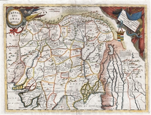
Impero Del Gran Mogol descritto e didicato all' Illustrissimo et Eccellentisimo S. Girolamo Correr, Sauio Grande dal P. Cosmografo Coronelli
sold
- Digital Map Information
- Suitable for large format printing
- DPI: 300
- File Size: 15.16 MB
- File Type: ZIP / TIFF
- ICC color profile embedded
- Delivered instantly via download link
A colorful example of Vincenzo Coronelli's 1691 map of the Mughal Empire under the Emperor Aurangzeb Alamgir (1618 – 1707). The map covers what is today Northern India, as well as parts of Pakistan, Bangladesh, Nepal, Bhutan, Burma, and ... (more details)
The Mogul Empire.
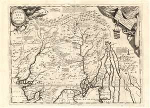
Impero Del Gran Mogol descritto e dedicato all' Illustrissimo et Eccellentisimo S. Girolamo Correr, Sauio Grande dal P. Cosmografo Coronelli.
sold
- Digital Map Information
- Suitable for large format printing
- Full resolution TIFF file
- ICC color profile embedded
- Delivered instantly via download link
This is Vincenzo Maria Coronelli's large 1691 map of India under Mughal Empire during the rule of Emperor Aurangzeb Alamgir (1618 - 1707). The map is a step beyond most maps of this region in the 17th century, most of which are derivative of the 1619 Baffin map of the Mogul Empire. This map depicts what is today Northern India, as well as parts of Pakistan, Bangladesh, Nepal, Bhutan, Burma, and Thailand. It extends from the Himalayas to the Bay of Bengal and from the Indus Valley to the Mekong River.
Many of Coronelli's maps were derived from the geographical information that appeared on his globes - notably his 1688 42-inch terrestrial globe. This map is able to offer more detail than what can be found on either of the two globe gores that encompass this region. (more details)
Many of Coronelli's maps were derived from the geographical information that appeared on his globes - notably his 1688 42-inch terrestrial globe. This map is able to offer more detail than what can be found on either of the two globe gores that encompass this region. (more details)
Scarce map of the Pacific showing California as an Island as well as early exploration of New Zealand and Australia.
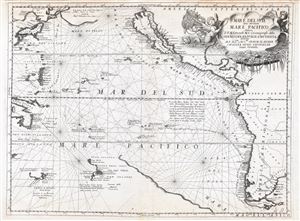
Mare del Svd, detto altrimenti Mare Pacifico.
sold
- Digital Map Information
- Suitable for large format printing
- DPI: 300
- File Size: 14.22 MB
- File Type: ZIP / TIFF
- ICC color profile embedded
- Delivered instantly via download link
An exceptional 1691 nautically styled map of the Pacific Ocean by the Venetian cartographer Vincenzo Maria Coronelli. Coronelli's map covers the Pacific from Japan to New Zealand and from New Guinea to Tiera Del Fuego and the Yucatan. ... (more details)
Speculative Pacific Cartography, w/ California as an Island.
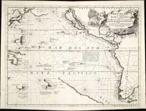
Mare del Svd, detto altrimenti Mare Pacifico.
sold
- Digital Map Information
- Suitable for large format printing
- Full resolution TIFF file
- ICC color profile embedded
- Delivered instantly via download link
An exceptional 1691 nautically styled map of the Pacific Ocean by the Venetian cartographer Vincenzo Maria Coronelli. The map features much of note, including a presentation of California as an Island, an illustration of a speculative Terra de Yesso (Hokkaido), and early speculative mappings of Australia, Tasmania, New Zealand, and New Guinea. (more details)
Unrecorded, unique details from unidentified sources.
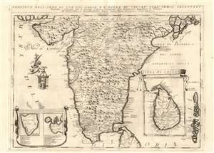
Penisola dell'Indo di qua del Gange, e L'Isola di Ceilan Nell'Indie Orientali.
sold
- Digital Map Information
- Suitable for large format printing
- Full resolution TIFF file
- ICC color profile embedded
- Delivered instantly via download link
This is Vincenzo Maria Coronelli's large 1692 map of the Indian peninsula, presenting detail not appearing on any prior map.. Many of Coronelli's maps, even most of them, were derived from his globes - notably his 1688 42-inch terrestrial globe. However, the details here do not refer to his printed gores. Coronelli intended his initial atlases - his Atlante Veneto and Corso Geografico Universale - to be extensions of Blaeu's great atlas. Thus it makes sense that in the first volume of his work, Coronelli focused on peninsular India, a region neglected by Blaeu. While Blaeu had produced a map of the Mogul Empire based on the 1619 Baffin map, the full extent of India south of the Moguls was included only in Blaeu's general map of the East Indies. Coronelli was not the only mapmaker after Blaeu to address the region, but he was the first to present it in so grand a format. (more details)
The Jesuit Reports of the Far East.
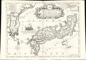
Isola Del Giapone e Penisola Di Corea.
sold
- Digital Map Information
- Suitable for large format printing
- Full resolution TIFF file
- ICC color profile embedded
- Delivered instantly via download link
This is the 1692 Vincenzo Coronelli map of Japan and Korea. With bold engraving typical of Coronelli, this is among the most visually distinctive maps of the Japanese Islands produced in the 17th century. Moreover, it introduces unique new cartographic knowledge derived from the most up-to-date Jesuit sources. (more details)
Best early map of the Great Lakes.
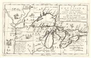
La Louisiana, Parte Settentrionalle, Scoperta sotto la Protettione di Luigi XIV, Re di Francia et Descritta, e Dedicata Dal P. Cosmografo Coronelli, All'Illustriss, et Eccellentiss, S. Zaccaria Bernardi su dell Ecc. S. Francesco.
sold
- Digital Map Information
- Suitable for large format printing
- Full resolution TIFF file
- ICC color profile embedded
- Delivered instantly via download link
This rare 1694 production by Venetian cartographer Vincenzo Coronelli is the earliest and most important obtainable map of the Great Lakes and the headwaters of the Mississippi. Coronelli's map centers on Lake Superior, but covers all five Great Lakes and extends westward as far as the Upper Mississippi River Valley. Cartographically this map is essentially an elaboration upon the 1688 Nolin/Coronelli map, Partie Occidentale du Canada ou de la Nouvelle France. Coronelli was particularly fascinated with the Great Lakes region and this map includes numerous updates and elaborations. (more details)
The earliest obtainable specific map of the Great Lakes.
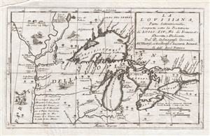
La Louisiana, Parte Settentrionalle, Scoperta sotto la Protettione di Luigi XIV, Re di Francia et Descritta, e Dedicata Dal P. Cosmografo Coronelli, All'Illustriss, et Eccellentiss, S. Zaccaria Bernardi su dell Ecc. S. Francesco.
sold
- Digital Map Information
- Suitable for large format printing
- DPI: 300
- File Size: 5.43 MB
- File Type: ZIP / TIFF
- ICC color profile embedded
- Delivered instantly via download link
This rare 1694 production by Venetian cartographer Vincenzo Coronelli is the earliest and most important obtainable map of the Great Lakes and the headwaters of the Mississippi. Coronelli's map centers on Lake Superior, but covers all ... (more details)
The earliest obtainable specific map of the Great Lakes.
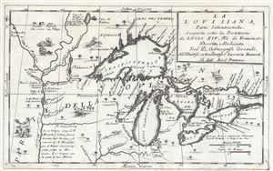
La Louisiana, Parte Settentrionalle, Scoperta sotto la Protettione di Luigi XIV, Re di Francia et Descritta, e Dedicata Dal P. Cosmografo Coronelli, All'Illustriss, et Eccellentiss, S. Zaccaria Bernardi su dell Ecc. S. Francesco.
sold
- Digital Map Information
- Suitable for large format printing
- DPI: 300
- File Size: 6.07 MB
- File Type: ZIP / TIFF
- ICC color profile embedded
- Delivered instantly via download link
This rare 1694 production by Venetian cartographer Vincenzo Coronelli is the earliest and most important obtainable map of the Great Lakes and the headwaters of the Mississippi. Coronelli's map centers on Lake Superior, but covers all ... (more details)
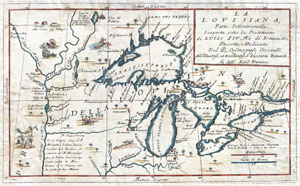
La Louisiana, Parte Settentrionalle, Scoperta sotto la Protettione di Luigi XIV, Re di Francia et Descritta, e Dedicata Dal P. Cosmografo Coronelli, All'Illustriss, et Eccellentiss, S. Zaccaria Bernardi su dell Ecc. S. Francesco.
sold
- Digital Map Information
- Suitable for large format printing
- DPI: 300
- File Size: 6.87 MB
- File Type: ZIP / TIFF
- ICC color profile embedded
- Delivered instantly via download link
This exceedingly rare 1694 map by Vincenzo Coronelli is the most important depiction of the Great Lakes and the headwaters of the Mississippi River to appear in the late 17th century. Covers all five Great Lakes and extends westward ... (more details)
Arabian Sea and the Indian Ocean from the finest 17th Century Globemaker.
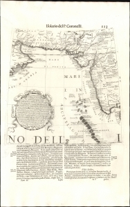
Avvertimento Al Navigli Che Partono Da Goa Per Andare Al Capo Di Buona Speranza Per Il Di Fuori Di Madagascar.
sold
- Digital Map Information
- Suitable for large format printing
- File Size: 7.84 MB
- File Type: ZIP / TIFF
- ICC color profile embedded
- Delivered instantly via download link
This is Vincenzo Coronelli's 1688 / 1696 globe gore, presenting a map of western India, coastal Persia, and the eastern extreme of the Arabian Peninsula. It was initially engraved in 1688 for Coronelli's 42-inch (3 1/2 foot) terrestrial globe but was repurposed for publication in Coronlli's 1696 Libro dei Globi and Isolario. (more details)
Remarkable Caucasus Cartography.
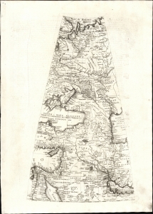
[Globe Gore, Middle East, Caucasus, Russia].
sold
- Digital Map Information
- Suitable for large format printing
- Full resolution TIFF file
- ICC color profile embedded
- Delivered instantly via download link
This is Vincenzo Coronelli's 1688 / 1696 globe gore, spanning from the Barents Sea in the north to the Tropic of Cancer in the south. The map thus embraces the Lower Nile, the northern part of the Arabian Peninsula, and the Persian Gulf; the eastern Mediterranean Sea, Cyprus, the Holy Land, and the Fertile Crescent; the eastern Black Sea, the western Caspian Sea, and Georgia between; the northern Caucasus region, and Russia. It was initially engraved in 1688 for Coronelli's 42-inch (3 1/2 foot) terrestrial globe. Repurposed for publication in Coronlli's 1696 Libro dei Globi and Isolario, the plate was masked off to excise the portion from the Equator to the Tropic of Cancer in order to fit the format of the book. (more details)
One of the largest and most beautiful maps of Crete.
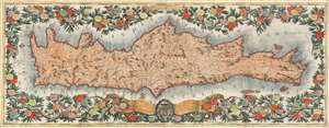
Isola e regno di Candia.
sold
- Digital Map Information
- Suitable for large format printing
- DPI: 600
- File Size: 166.62 MB
- File Type: ZIP / TIFF
- ICC color profile embedded
- Delivered instantly via download link
This is a brilliantly-colored example of Vincenzo Coronelli's monumental, two-sheet 1696 map of the Island and Kingdom of Crete. It divides the island into the four regions of Canea, Rettimo, Candia, and Setia. (more details)
Richly detailed map revealing early European settlement and administration.
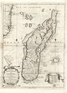
Isola di Madagascar, o di S. Lorenzo scoperta da Portoghesi nell'Anno 1506, Descritta dal P. Mrō Coronelli M.C. Cosmografo della Seren.ma Rep: Di Venetia, Dedicata All' Ill.mo Sigr. Antonio Magliabecchi, Bibliotecario dell' A. Serenissima Del Gran Duca di Toscana.
sold
- Digital Map Information
- Suitable for large format printing
- Full resolution TIFF file
- ICC color profile embedded
- Delivered instantly via download link
This is Vincenzo Maria Coronelli's 1697 map of Madagascar, the most sophisticated 17th century map of the island. While the southeastern portion of the island reflects the cartography of Étienne de Flacourt (1607 - 1660), who from 1648 to 1653 was French East India’s Governor of Madagascar, and who in 1658 published the first natural history of the island, this map includes detail beyond any of the French or Dutch maps sourced from Flacourt's manuscripts. Typical of Coronelli's meticulously researched work, the map provides a granular catalogue of the island's coastline toponymy. The interior has been broken into administrative regions, including tribal names not present on any earlier printed maps. (more details)
A richly detailed map revealing early European settlement and administration.
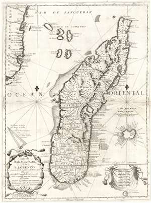
Isola di Madagascar, o di S. Lorenzo scoperta da Portoghesi nell'Anno 1506, Descritta dal P. Mrō Coronelli M.C. Cosmografo della Seren.ma Rep: Di Venetia, Dedicata All' Ill.mo Sigr. Antonio Magliabecchi, Bibliotecario dell' A. Serenissima Del Gran Duca di Toscana.
sold
- Digital Map Information
- Suitable for large format printing
- DPI: 600
- File Size: 29.33 MB
- File Type: ZIP / TIFF
- ICC color profile embedded
- Delivered instantly via download link
This is Vincenzo Maria Coronelli's 1697 map of Madagascar. It is the most detailed of the 17th century maps of the island. While the southeastern portion of the island reflects the cartography of Étienne de Flacourt, who from 1648 to 1653 was French East India’s Governor of Madagascar, and who in 1658 published the first natural history of the island, this map includes detail beyond that which appeared in any of the French or Dutch maps sourced from Flacourt's manuscripts. Typical of Coronelli's meticulously researched work, the map provides a granular catalogue of the toponymy of the island's coastline. The interior has been broken into administrative regions and includes tribal names not present on any earlier printed maps of which we are aware. (more details)
Dramatic Islands of the Gulf of Venice
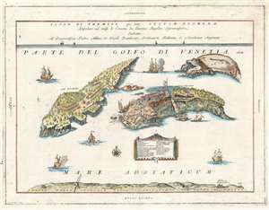
Isole di Tremiti, giá dette Insulae Dionedae, Possedute nel golfo di Venetia da Eanonici Regolari Lateranensi.
sold
- Digital Map Information
- Suitable for large format printing
- Full resolution TIFF file
- ICC color profile embedded
- Delivered instantly via download link
This is the 1697 Vincenzo Coronelli map of the Isole Tremiti. These rocky islands have a long history of settlement, despite the frequent earthquakes that give the islands their name. The map shows both of the main islands - San Domino, and San Nicola - but also the uninhabited La Carara (Capraia) Credazza (Cretaccio) and the diminuitive La Vecchia (an island so small that while its name appears on digital maps the island itself seldom does.) San Domino is shown with cultivated fields, terraces, a church, and neatly ordered dwellings. San Nicola is dominated by its great, fortified monastery. At the bottom of the map is shown 'Part of the Beach of the Capitaniata of the Kingdom of Naples,' 'Capitaniata' being an early term for the Province of Foggia. (more details)
A Richly Decorative Engraving of a Theater of the Sixth Ottoman-Venetian War.
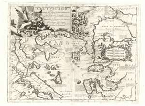
Paralello Geografico Dell'Antico Col Moderno Arcipelago Per Instruzione dell'Istoria dell'Isole contenute in esso.
sold
- Digital Map Information
- Suitable for large format printing
- Full resolution TIFF file
- ICC color profile embedded
- Delivered instantly via download link
This is a rare 1697 Vincenzo Coronelli map of the northern Greek Archipelago, showing Thessalia and north-western Turkey. The map focuses on the northern Aegean Sea and the Sea of Thrace, the Sea of Marmora, and their connection to the Black Sea via the Bosporus Strait. The Negroponte and Constantinople are prominent. Rich detail through offers historical notes illuminating both the recent history of the region, as well as the remote classical era, in order to lay the background for the momentous events celebrated in the map’s cartouche. (more details)
Stunning view of Venice.
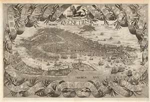
Venetien.
sold
- Digital Map Information
- Suitable for large format printing
- Full resolution TIFF file
- ICC color profile embedded
- Delivered instantly via download link
This beautiful, rare engraving is an unrecorded variant of Vincenzo Coronelli's bird's-eye view of Venice. While the work is unsigned, it has been attributed to the Dutch engraver Jan Lamsvelt (or Lansvelt.) The city's unmistakable, archipelagic layout is portrayed in meticulous detail, and the waters around the city are teeming with ships and galleys (including the state barge of the Doge of Venice, Il Bucintoro). The engraving is a reduced (approximately 2/3) version of Vincenzo Coronelli's 1693 Citta di Venezia, which combined Matthias Merian's meticulous bird's-eye view with a superbly-composed ribbon-and-laurel border, embellished with the coats of arms of the various dominions of the Venetian Republic. In addition to the change of scale, the engraver has translated the bulk of the text in the body of the map from the original Italian to French, to conform to the language of the 1699 Voyages du Mr. Du Mont printed in the Hague, for which this engraving was intended. At some point that year, the plate was amended, changing the title and the two instances of the name for the Venetian Lagoon from French to Dutch. This rather hasty alteration was made for the inclusion of the plate in the Dutch edition of Du Mont's Voyages printed in Utrecht, also in 1699. None of the rest of the French text has been changed, and the plate numbering engraved in the upper left corner is unchanged between the two states of the view. That the plate was first engraved in the French, followed with the minor alteration to create a Dutch version, seems self-evident. (more details)
A scarce map of the world after Coronelli.
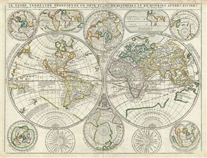
Le Globe Terrestre Represente en Deux Plans - Hemispheres, et en Diverses Autres Figures.
sold
- Digital Map Information
- Suitable for large format printing
- Full resolution TIFF file
- ICC color profile embedded
- Delivered instantly via download link
A scarce example of Jean Baptiste Nolin's 1742 map of the world in two hemispheres. The main map is surrounded by ten additional maps showing the world on various projections and at various periods. Cartographically this map ... (more details)