
Sayer, Robert (sold)

Robert Sayer (1725 - January 29, 1794) was an important English map publisher and engraver active from the mid to late 18th century. Sayer was born in Sunderland, England, in 1725. He may have clerked as a young man with the Bank of England, but this is unclear. His brother, James Sayer, married Mary Overton, daughter-in-law of John Overton and widow of Philip Overton. Sayer initially worked under Mary Overton, but by December of 1748 was managing the Overton enterprise and gradually took it over, transitioning the plates to his own name. When Thomas Jefferys went bankrupt in 1766, Sayer offered financial assistance to help him stay in business and, in this way, acquired rights to many of the important Jefferys map plates as well as his unpublished research. From about 1774, he began publishing with his apprentice, John Bennett (fl. 1770 - 1784), as Sayer and Bennett, but the partnership was not formalized until 1777. Bennett retired in 1784 following a mental collapse and the imprint reverted to Robert Sayer. From 1790, Sayer added Robert Laurie and James Whittle to his enterprise, renaming the firm Robert Sayer and Company. Ultimately, Laurie and Whittle partnered to take over his firm. Sayer retired to Bath, where, after a long illness, he died. During most of his career, Sayer was based at 53 Fleet Street, London. His work is particularly significant for its publication of many British maps relating to the American Revolutionary War. Unlike many map makers of his generation, Sayer was a good businessman and left a personal fortune and great estate to his son, James Sayer, who never worked in the publishing business.
An unrecorded variant of Senex's large map of North America.

North America corrected from the observations communicated to the Royal Society at London, and the Royal Academy at Paris.
sold
- Digital Map Information
- Suitable for large format printing
- DPI: 300
- File Size: 21.34 MB
- File Type: ZIP / TIFF
- ICC color profile embedded
- Delivered instantly via download link
An exceptional and influential 1710 British map of North America by John Senex. Hands down the most ambitions British mapping of North America produced thus far, Senex's large format map covers all of North America from the unexplored high arctic to Panama and the ... (more details)
Engraved after a painting by Canaletto.
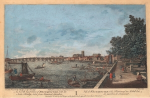
A North East View of Westminster with the New Bridge, taken from Somerset Garden. / Vue de Westminster et du Pont-neuf au Nord-Est du Jardin de Somerset.
sold
- Digital Map Information
- Suitable for large format printing
- DPI: 600
- File Size: 26.51 MB
- File Type: ZIP / TIFF
- ICC color profile embedded
- Delivered instantly via download link
This is a c. 1751 Robert Sayer view of the Thames River, Westminster Bridge, and Westminster Abbey in London, England. Boats occupy the foreground with Somerset Garden on the right. Westminster Bridge spans the Thames in the middle ground with Westminster Abbey rising above the London skyline to its right. Referred to here as 'the New Bridge', Westminster Bridge opened on November 18, 1750. (more details)
Crossing the Thames in style.
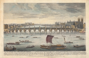
A South View of Westminster Bridge. / Vue du Pont de Westminster du cotte du sud.
sold
- Digital Map Information
- Suitable for large format printing
- Full resolution TIFF file
- ICC color profile embedded
- Delivered instantly via download link
A hand-colored 1751 view of Westminster Bridge, Westminster Abbey, London. It was produced in the wake of the bridge's opening the previous year, which significantly alleviated traffic over existing bridges across the Thames River. (more details)
One of the greatest British lordly estates.
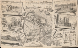
Plan du chateau, Jardin et Parc de Wilton la Terre du Comte de Pembroke, située dans la comté de Wilts. à 75 miles de Londres par J. Rocque… / An Exact Survey of the Beautiful and Magnificent House, Garden and Park of the Right Honble. the Earl of Pembroke with the ancient town of Wilton 3 miles from Salisbury…
sold
- Digital Map Information
- Suitable for large format printing
- DPI: 600
- File Size: 376.18 MB
- File Type: ZIP / TIFF
- ICC color profile embedded
- Delivered instantly via download link
A striking c. 1770 John Rocque / Robert Sayer map and illustration of Wilton House, seat of the Earls of Pembroke. The map, originally issued in 1754, follows a major reworking of the gardens under Capability Brown, one of the greatest landscape designers in British history. The map takes in Wilton House, its gardens, and the nearby town of Wilton. Surrounding vignettes detail architectural features of the Wilton Gardens as well as a floor plan of the Palladian manor house. (more details)
The rarest and earliest state of a seminal map.
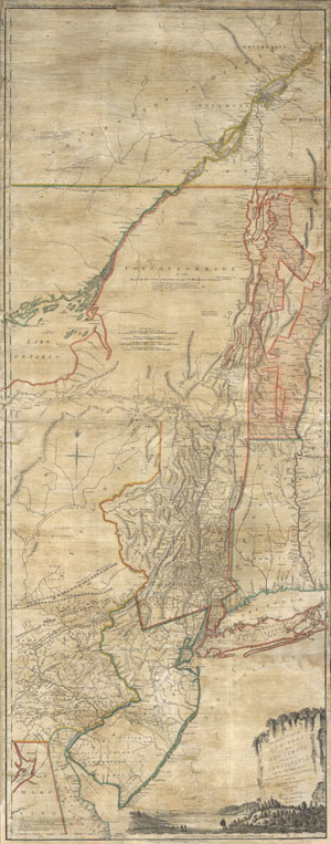
The Provinces of NEW YORK and NEW JERSEY with part of PENSILVANIA, and the Governments of TROIS RIVIERES, and MONTREAL: drawn by Capt. Holland. / A Chorographical Map of the Country between Albany, Oswego, Fort Frontenac, and Les Trois Rivieres; Exhibing all the Grands made by the French Governors on Lake Champlain; & between that Lake & Montreal.
sold
- Digital Map Information
- Suitable for large format printing
- Full resolution TIFF file
- ICC color profile embedded
- Delivered instantly via download link
A first issue first edition example of a seminal map. This is a rare and unusual version of the 1768 first edition of Holland and Jefferys seminal map of New York and New Jersey. Depicts the important trade corridor between New York and Montreal, specifically ... (more details)
Capital of New England - one of the earliest views of Boston based on actual observation.
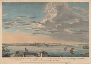
A View of the City of Boston the Capital of New England, in North America. / Vue de la Ville de Boston Capitale de la Nouvelle Angleterre, dans l'Amérique Septemtrionale.
sold
- Digital Map Information
- Suitable for large format printing
- DPI: 600
- File Size: 387.91 MB
- File Type: ZIP / TIFF
- ICC color profile embedded
- Delivered instantly via download link
This is the rare Thomas Pownall view of Boston, published in 1768. It is one of the earliest obtainable views of Boston offering a look at the city shortly after the French and Indian War (1754 - 1763). (more details)
Scarce 1775 English Map Prefiguring A British Colonial Presence in Central America.
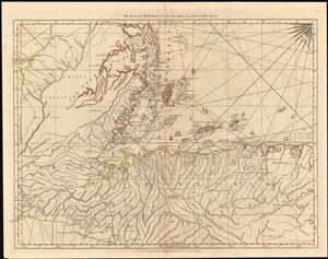
The Bay of Honduras. By Thos. Jefferys Geographer to His Majesty.
sold
- Digital Map Information
- Suitable for large format printing
- DPI: 600
- File Size: 51 MB
- File Type: ZIP / TIFF
- ICC color profile embedded
- Delivered instantly via download link
This 1775 Jefferys map of Belize, Honduras, Guatemala and El Salvador is the earliest, acquirable, detailed map to focus on the region. It is informationally rich, showing anchorages, depth soundings and common sailing routes (replete with dozens of ships.) The region’s plentiful reefs, islands and lagoons are shown and named. This map brings into sharp focus coastal Belize and Honduras where English privateers and merchants had long operated – shortly after Spain began to tolerate their presence, but just prior to Britain’s official administration of Belize as a colony. (more details)
Remarkable map showing Alaska as an Island.
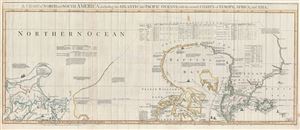
A Chart of North and South America, including the Atlantic and Pacific Oceans, with the nearest Coasts of Europe, Africa, and Asia. Chart containing part of the Icy Sea with the adjacent Coast of Asia and America. Chart comprizing Greenland with the Countries and Islands about Baffins Bay and part of Hudsons Bay.
sold
- Digital Map Information
- Suitable for large format printing
- DPI: 300
- File Size: 28.3 MB
- File Type: ZIP / TIFF
- ICC color profile embedded
- Delivered instantly via download link
A wonderful 1775 map of the Arctic regions of the Western Hemisphere by John Green or Braddock Mead. Focusing on Alaska (Bering Strait) and the Canadian Arctic, map covers from the Sea of Okhotsk (Penschinaska Guba) to Iceland and the east coast of Greenland; ... (more details)
Best British Chart of the St. Lawrence on the Eve of the American Revolution.
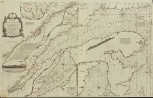
An Exact Chart of the River St. Laurence from Fort Frontenac to the Island of Anticosti shewing the Soundings, Rocks, Shoals and c with Views of the Lands and all necessary Instructions for navigating that River to Quebec.
sold
- Digital Map Information
- Suitable for large format printing
- File Size: 2028.51 MB
- File Type: ZIP / TIFF
- ICC color profile embedded
- Delivered instantly via download link
This significant 1775 chart of the St. Larence River appeared in Thomas Jefferys' The American Atlas, the most important 18th-century atlas for America. (more details)
Most important late 18th century map of Cuba. Illustrates the Spanish Treasure Fleet wreck of the 'Santiago el Grande.'
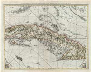
The Island of Cuba with part of the Bahama Bank and the Martyrs.
sold
- Digital Map Information
- Suitable for large format printing
- Full resolution TIFF file
- ICC color profile embedded
- Delivered instantly via download link
A rare and important 1775 Thomas Jeffreys and Robert Sayer sea chart or nautical map of Cuba, the Florida Keys, and the Grand Bahama Bank. The map's coverage extends from just west of Havana down to the Sierra Maestra, the Cayman Islands (in the lower left), ... (more details)
New York, New Jersey, and the Hudson Valley on the brink of the American Revolutionary War.
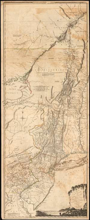
The Provinces of NEW YORK, and NEW JERSEY; with part of PENSILVANIA, and the Governments of TROIS RIVIERES, and MONTREAL: drawn by Capt. Holland. / A Chorographical Map of the Country between Albany, Oswego, Fort Frontenac, and Les Trois Rivieres; Exhibiting all the Grants made by the French Governors on Lake Champlain; and between that Lake and Montreal.
sold
- Digital Map Information
- Suitable for large format printing
- DPI: 300
- File Size: 32.59 MB
- File Type: ZIP / TIFF
- ICC color profile embedded
- Delivered instantly via download link
One of the most important, influential, and comprehensive American Revolutionary War Era maps of New York, New Jersey, Vermont, and the Hudson Valley corridor, this is an early 1775 edition of Capt. Samuel Holland and Thomas Jeffrey's Provinces of New York and New Jersey… Holland's map illustrates the important strategic and trade corridor between New York and Montreal, specifically detailing from Delaware Bay northward including parts of eastern Pennsylvania, New Jersey, Long Island, New York, Connecticut, Massachusetts and Vermont as well as the Iroquois League, the Trois Rivieres territories, and Montreal, as far as Lac St. Pierre in modern-day Quebec. In the lower right, a scenic cartouche illustrates the wide and easily navigable expanse of the Hudson River - surely an enticement to the region. (more details)
Revelatory map of the Americas.
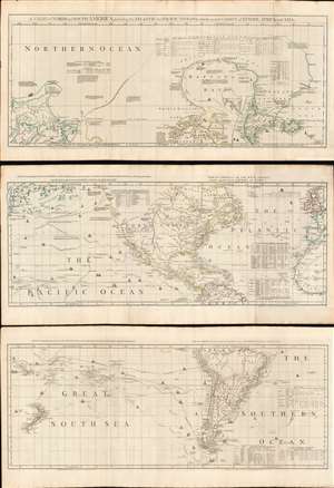
A Chart of North and South America, including the Atlantic and Pacific Oceans, with the nearest Coasts of Europe, Africa, and Asia.
sold
- Digital Map Information
- Suitable for large format printing
- Full resolution TIFF file
- ICC color profile embedded
- Delivered instantly via download link
A wonderful 1775 map of the Americas or Western Hemisphere by John Green, also known as Braddock Mead. The map in fact consists of three related maps covering, from top: Canada and the Arctic; the modern day United States, Central America, and the West Indies; and South America. The map is a masterpiece of late 18th century cartography by one of the least understood and most controversial cartographers of his age. Mead composed the map in protest to what he believed to be the flagrantly spurious and irresponsible speculative cartography of Frenchmen Joseph-Nicolas De l'Isle (1688 - 1768) and Phillipe Buache (1700 - 1773). (more details)
One the eve of the American Revolution.
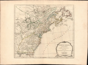
North America from the French of Mr. D'Anville improved with The English Surveys made since the Peace.
sold
- Digital Map Information
- Suitable for large format printing
- File Size: 26.39 MB
- File Type: ZIP / TIFF
- ICC color profile embedded
- Delivered instantly via download link
This is the 1775 Sayer and Bennett edition of Thomas Jefferys' map of the British Colonies in America, published on the eve of the American Revolutionary War (1775 - 1783). When this map was issued in June 1775, the Battles of Lexington and Concord had already occurred, and a formal Declaration of War from the Continental Congress was imminent. (more details)
The first English map of the Mississippi River.
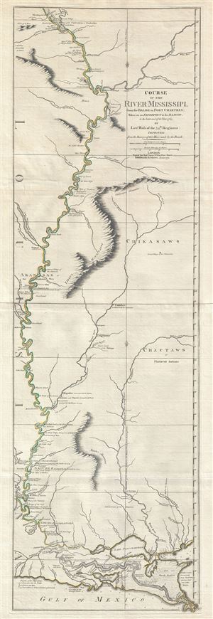
Course of the River Mississipi, from the Balise to Fort Chartres; Taken on an Expedition to the Illinois, in the latter end of the Year 1765.
sold
- Digital Map Information
- Suitable for large format printing
- DPI: 300
- File Size: 15.95 MB
- File Type: ZIP / TIFF
- ICC color profile embedded
- Delivered instantly via download link
A scarce, important, and dramatic map of the Mississippi River Valley from the Gulf of Mexico to Fort Chartres (Illinois). Set on the meridian of New Orleans, this map covers the Mississippi Valley from the Delta of the Mississippi where it joins the Gulf ... (more details)
The first English publication of Muller's seminal map of the Arctic.
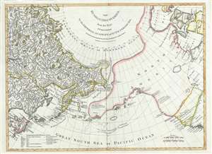
The Russian Discoveries, from the Map Published by the Imperial Academy of St. Petersburg.
sold
- Digital Map Information
- Suitable for large format printing
- DPI: 300
- File Size: 12.04 MB
- File Type: ZIP / TIFF
- ICC color profile embedded
- Delivered instantly via download link
A beautiful example of Robert Sayer's 1775 map of the Pacific Northwest, Alaska, the Bering Strait and Siberia, this is considered to be the first English edition of Fredrich Muller's seminal map. Issued after the seminal explorations of Vitus Bering ... (more details)
Recording the First Naval Battle of the American Revolution.
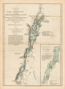
A Survey Of Lake Champlain, including Lake George, Crown Point And St. John. /A Particular Plan of Lake George.
sold
- Digital Map Information
- Suitable for large format printing
- DPI: 600
- File Size: 60.66 MB
- File Type: ZIP / TIFF
- ICC color profile embedded
- Delivered instantly via download link
This is William Furness Brasier's 1762 map of Lakes Champlain and George, in its 1776 second state. The map overall is the first separate map of Lake Champlain and Lake George. Both this and its earlier state would certainly have been in the hands of the British officers leading the Fall 1777 campaign during the American Revolutionary War (1775 - 1783) culminating in a pivotal American victory at Saratoga. (more details)
Recording the First Naval Battle of the American Revolution.
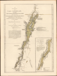
A Survey Of Lake Champlain, including Lake George, Crown Point And St. John. /A Particular Plan of Lake George.
sold
- Digital Map Information
- Suitable for large format printing
- File Size: 22.53 MB
- File Type: ZIP / TIFF
- ICC color profile embedded
- Delivered instantly via download link
This is a premier example of William Furness Brasier's 1762 map of Lakes Champlain and George, in its 1776 second state. The map overall is the first separate map of Lake Champlain and Lake George. Both this and its earlier state would certainly have been in the hands of the British officers leading the Fall 1777 campaign during the American Revolutionary War (1775 - 1783) culminating in a pivotal American victory at Saratoga. (more details)
Scarce final issue of the important Holland-Jefferys Map New York, New Jersey, and the Hudson Valley on the brink of the American Revolutionary War. The best obtainable Revolutionary War Era map of this region.
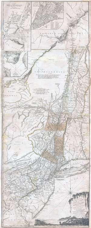
The Provinces of NEW YORK, and NEW JERSEY; with part of PENSILVANIA, and the Governments of TROIS RIVIERES, and MONTREAL: drawn by Major Holland, Surveyor General, of the Norther District in America. / A Chorographical Map of the Country between Albany, Oswego, Fort Frontenac, and Les Trois Rivieres; Exhibiting all the Grants made by the French Governors on Lake Champlain; & between that Lake & Montreal.
sold
- Digital Map Information
- Suitable for large format printing
- DPI: 300
- File Size: 26.6 MB
- File Type: ZIP / TIFF
- ICC color profile embedded
- Delivered instantly via download link
One of the most important, influential, and comprehensive American Revolutionary War Era map of New York, New Jersey, Vermont, and the Hudson Valley corridor, this is an final 1776 state of Major Samuel Holland and Thomas Jeffrey's Provinces of New ... (more details)
One month after the Declaration of Independence.
The Provinces of NEW YORK, and NEW JERSEY; with part of PENSILVANIA, and the Governments of TROIS RIVIERES, and MONTREAL: drawn by Capt. Holland. / A Chorographical Map of the Country between Albany, Oswego, Fort Frontenac, and Les Trois Rivieres; Exhibiting all the Grants made by the French Governors on Lake Champlain; and between that Lake and Montreal.
sold
- Digital Map Information
- Suitable for large format printing
- File Size: 55.63 MB
- File Type: ZIP / TIFF
- ICC color profile embedded
- Delivered instantly via download link
This is one of the most important, influential, and comprehensive American Revolutionary War Era maps of New York, New Jersey, Vermont, and the Hudson Valley corridor. It was issued a little over one month after the adoption of the Declaration of Independence and represents the most contested theaters of the American Revolutionary War (1775 - 1783). (more details)
Definitive field Atlas of the Revolutionary War.
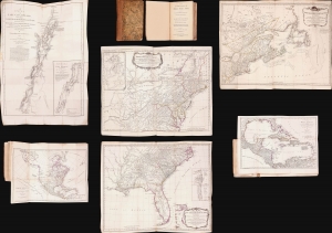
The American Military Pocket Atlas; being An approved Collection of Correct Maps, both General and Particular, of The British Colonies; Especially those which now are, or probably may be The Theatre of War.
sold
This is Sayer and Bennet's 1776 'Holster Atlas', one of the most sought-after cartographic works of the American Revolution. It was published at the beginning of the Revolution and presented as a collection of maps approved by British military authorities for use in the field. (more details)
Revolutionary War Map for the Hessian Market.
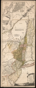
The Provinces of NEW YORK, and NEW JERSEY; with part of PENSILVANIA, and the Province of Quebec. Drawn by Major Holland, Surveyor General, of the Northern District in America. Corrected and Improved, from the Original Materials, By Governr. Pownall, Member of Parliament. Published by Harry Lodowick Broenner, Book-seller to Franckfort upon the Mayn. 1777.
sold
- Digital Map Information
- Suitable for large format printing
- DPI: 600
- File Size: 162.27 MB
- File Type: ZIP / TIFF
- ICC color profile embedded
- Delivered instantly via download link
This is a rare, separately issued German edition of the best-informed map available focusing on the northern theatre of the American Revolution: Samuel Holland's 1775 map of The Provinces of New York and New Jersey, in its final version corrected by Governor Thomas Pownall. This map was published by the heirs of Harry Lodowick Broenner, a Frankfurt-am-Main bookseller, whose forays into cartography were characterized by the swift reproduction of up-to-date maps, topically relevant to Frankfurter interests. As the Holland-Pownall map provided the best available view of the American war zone in which Hessian mercenaries were expected to be active, it would have been an apt target for the Broenners. (more details)
First edition to name the United States.
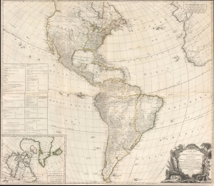
A New Map of the Whole Continent of America, divided into North and South and West Indies, wherein are exactly Described the United States of North America as well as the Several European Possessions according to the Preliminaries of the Peace singed at Versailles Jan. 20 1783.
sold
- Digital Map Information
- Suitable for large format printing
- DPI: 600
- File Size: 97.78 MB
- File Type: ZIP / TIFF
- ICC color profile embedded
- Delivered instantly via download link
A scarce 1783 Sayer and Bennett wall map of America issued shortly after the American Revolutionary War (1775 - 1783). This map followed closely on the Treaty of Versailles, which ended the Revolutionary War and established British recognition of the independent United States. This is the first issue of this map to name the United States - here, including all territory north of Florida, South of the Great Lakes (except Michigan), and east of the Mississippi. (more details)
Superb 18th century mapping of an area largely unknown to Europeans.
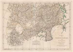
A Map of Chinese Tartary, with Corea.
sold
- Digital Map Information
- Suitable for large format printing
- Full resolution TIFF file
- ICC color profile embedded
- Delivered instantly via download link
This is an uncommon 1786 Samuel Dunn map of Korea, Manchuria, Hokkaido, Mongolia, and Chinese Tartary. Coverage extends from Tibet and Independent Tartary to Sakhalin, Hokkaido, and Japan. It extends south roughly as far as China's eastern Shandong Province. Korea exhibits a distinctly square base, and, as with much of this map, is consistent with the innovative cartography of J. B. B. D'Anville, one of the preeminent mapmakers of the period. The sea between Japan and Korea, alternately called the Sea of Korea or the Sea of Japan, depending on the mapmaker, is here settled in favor of Korea. The great wall is noted. (more details)
A good chart of the Pearl River - at last!
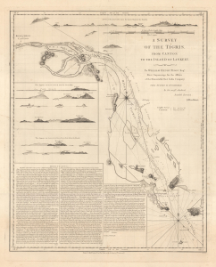
A Survey of the Tigris, from Canton to the Island of Lankeet.
sold
- Digital Map Information
- Suitable for large format printing
- File Size: 21.91 MB
- File Type: ZIP / TIFF
- ICC color profile embedded
- Delivered instantly via download link
This is Joseph Huddart's 1786 hydrographic map of the Pearl River, China. This rare chart is a result of novel 1785 surveys personally completed by Huddart, who was frustrated with the incompetence of for-hire Macanese Pearl River pilots. (more details)
One of the earliest obtainable English language maps to name the United States.
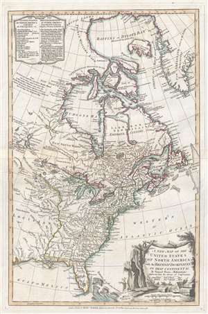
A New Map of the United States of North America with the British Dominions on that Continent…
sold
- Digital Map Information
- Suitable for large format printing
- DPI: 300
- File Size: 6.7 MB
- File Type: ZIP / TIFF
- ICC color profile embedded
- Delivered instantly via download link
This rare 1786 map of the United States by Samuel Dun and Robert Sayer is one of the earliest obtainable English maps to embrace the term 'United Sates.' The map was prepared by Samuel Dunn, a British mathematician, based upon earlier maps by ... (more details)
The most important map of Africa printed in the 18th century.
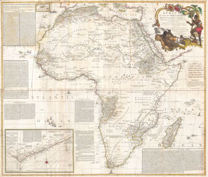
Africa, with all its States, Kingdoms, republics, Regions, Islands, & cca. Improved and Inlarged form D’Anville’s Map to which has been added A particular Chart of the Gold Coast wherein are Distinguished all the European Forts, and Factories by S. Boulton.
sold
- Digital Map Information
- Suitable for large format printing
- Full resolution TIFF file
- ICC color profile embedded
- Delivered instantly via download link
This is most likely the most important map of Africa produced in the 18th century. Printed at the height of the slave trade in 1787 by the Robert Sayer firm of London, England. Largely based upon the earlier D'Anville map, this map has been ... (more details)
Combining science and cartography.
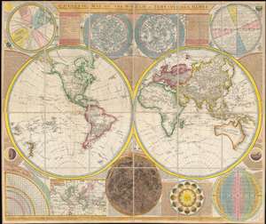
A General Map of the World, or Terraqueous Globe with all the New Discoveries and Marginal Delineations, Containing the Most Interesting Particulars in the Solar, Starry and Mundane System, by Sam. Dunn, Mathematician.
sold
- Digital Map Information
- Suitable for large format printing
- DPI: 600
- File Size: 127.69 MB
- File Type: ZIP / TIFF
- ICC color profile embedded
- Delivered instantly via download link
An absolutely stunning and monumental double hemisphere wall map of the world by Samuel Dunn dating to 1794. This extraordinary map is so large and so rich in detail that it is exceptionally challenging to do it full justice in either ... (more details)
British Foothold in the African Slave Trade.
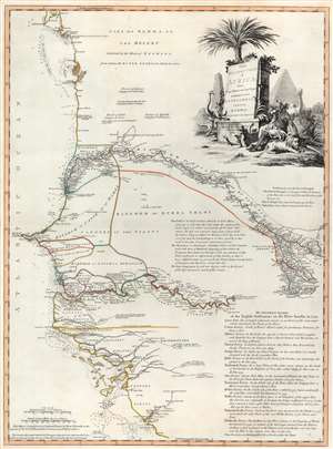
The Western Coast of Africa from Cape Blanco to Cape Vigo, Exhibiting Senegambia Proper by T. Jefferys, Geographer to His Majesty.
sold
- Digital Map Information
- Suitable for large format printing
- DPI: 600
- File Size: 29.76 MB
- File Type: ZIP / TIFF
- ICC color profile embedded
- Delivered instantly via download link
This is a beautiful example of Robert Sayer's 1789 map of western coastal Africa. It is focused on Senegal, but includes parts of modern Mauritania, Mali, Guinea-Bissau, and Guinea. It reaches from as far north as Cap Blanco and the Arguin Banks to the mouth of the Rio Nuñez and Cap Virgo in the south. The map traces the course of the Senegal River as far east as the Felou Rocks, present site of the Félou Hydroelectric Plant in Mali. (more details)
Logwood and the cusp of change.
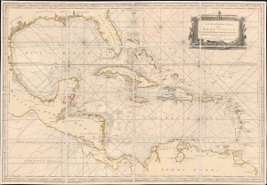
A New General Chart of the West Indies From the latest Marine Journals and Surveys, Regulated and Ascertained by Astronomical Observations.
sold
- Digital Map Information
- Suitable for large format printing
- File Size: 46.27 MB
- File Type: ZIP / TIFF
- ICC color profile embedded
- Delivered instantly via download link
This is Robert Sayer's exceptional 1790 nautical map of the West Indies and Gulf of Mexico. This map emerged, much updated, on the cusp of significant regional upheaval, including conflicts related to the French Revolutionary Wars (1792 - 1802) and the Haitian Revolution (1791 - 1804), events that disrupted shipping, provoked privateering and blockades, and reshaped the patterns of trade. (more details)
An unusual early case map of London.
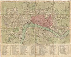
The London Directory or a New & Improved Plan of London, Westminster & Southwark; with the adjacent Country, the New Buildings, the New Roads and the late alterations by Opening of New Streets, & Widening of others 1790.
sold
- Digital Map Information
- Suitable for large format printing
- DPI: 300
- File Size: 15.2 MB
- File Type: ZIP / TIFF
- ICC color profile embedded
- Delivered instantly via download link
A highly appealing 1790 map of London by Robert Sayer. Centered on the Thames River, this map details central London from Islington to Shadwell and from Newington Butts to Tyburn. Only three bridges cross the Thames: Westminster ... (more details)
One of the rarest and finest Revolutionary War era maps of Charleston, South Carolina.
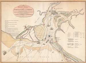
An Exact Plan of Charleston Bar and Harbour From an Actual Survey.
sold
- Digital Map Information
- Suitable for large format printing
- Full resolution TIFF file
- ICC color profile embedded
- Delivered instantly via download link
This is the 1791 Robert Sayer map of Charleston, South Carolina, one of the rarest and best Revolutionary War maps of that city. The map was issued to illustrate the 1776 Battle of Sullivan's Island, the first decisive American victory over the seemingly invincible British Royal Navy - the achievement shocked the world and protected Charleston during a critical early stage of the American Revolution (1775 - 1783). The British did not again attempt to retake the southern colonies until 1778. Moreover, unlike smaller plans by Faden which illustrate only the Attack on Fort Sullivan, this plan provides a detailed account of the British movements throughout the battle and captures significantly more information. (more details)
Scarce pocket map of London in its first edition.
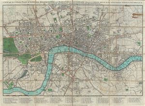
A New and Accurate Plan of London, Westminster and Borough of Southwark; Wherein is Distinctly Inserted All the Additional Streets, Squares and c in and Round the Metropolis and Extended to Chelsea, Walworth …
sold
- Digital Map Information
- Suitable for large format printing
- Full resolution TIFF file
- ICC color profile embedded
- Delivered instantly via download link
A scarce Robert Sayer plan or map of London, England presented here in its 1792 first edition. The map covers from Pentonville to Stepney Church and from Walworth to the Serpentine (Hyde Park). The City of London is highlighted ... (more details)
An Essential American Revolutonary War map rvised to reflect the independence of the United States.
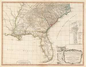
A New and General Map of the Southern Dominions Belonging to The United States of America, viz: North Carolina, South Carolina, and Georgia: with the Bordering Indian Countries, and The Spanish Possessions of Louisiana and Florida.
sold
- Digital Map Information
- Suitable for large format printing
- DPI: 600
- File Size: 24.8 MB
- File Type: ZIP / TIFF
- ICC color profile embedded
- Delivered instantly via download link
A scarce 1794 map of the southeastern part of the United States and Florida issued by the London firm of Laurie and Whittle. The coverage extends from North Carolina to the Florida Keys and from just beyond the Mississippi River to the Atlantic seaboard and the Bahamas. It encompasses the modern-day states of North Carolina, South Carolina, Georgia, Kentucky, Tennessee, Alabama, Mississippi, Louisiana (very little detail), and Florida. At right, there are inset detail maps of Charleston and St. Augustine. (more details)
Best general map of the Southeast of the 18th Century.
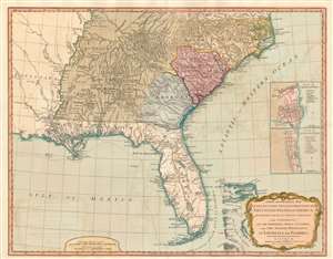
A New and General Map of the Southern Dominions Belonging to The United States of America, viz: North Carolina, South Carolina, and Georgia: with the Bordering Indian Countries, and The Spanish Possessions of Louisiana and Florida.
sold
- Digital Map Information
- Suitable for large format printing
- DPI: 600
- File Size: 24.34 MB
- File Type: ZIP / TIFF
- ICC color profile embedded
- Delivered instantly via download link
A scarce 1794 Laurie and Whittle / Sayer map of the southeastern part of the United States and Florida. This is the second edition of Sayer's map of the southeast, and the first to recognize the United States as an independent nation. At the time of initial publication, it represented the finest general cartography of the southeast obtainable. (more details)
Between the First and Second Anglo-Carib Wars.
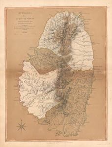
St. Vincent, from an Actual Survey made in the year 1775, after the Treaty with the Caribs.
sold
- Digital Map Information
- Suitable for large format printing
- File Size: 23.74 MB
- File Type: ZIP / TIFF
- ICC color profile embedded
- Delivered instantly via download link
This is the 1794 Laurie and Whittle map of Saint Vincent according to the treaty that ended the First Carib War (1769 - 1773) and a year before the outbreak of the Second Carib War (1795 - 1797). (more details)
The New British Frontier
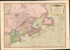
A New And Correct Map Of The British Colonies In North America.
sold
- Digital Map Information
- Suitable for large format printing
- Full resolution TIFF file
- ICC color profile embedded
- Delivered instantly via download link
A significant 1794 Laurie and Whittle map of the northeastern United States and eastern Canada, capturing North America at a pivotal moment between the American Revolutionary War (1775 - 1783) and the War of 1812 (1812 - 1815). The map reflects the geopolitical order created by American Independence: the 1783 Treaty of Paris boundary divides the United States from British Canada, while Vermont, admitted to the Union only three years earlier, appears in one of its earliest dated cartographic representations. The map offers a striking cartographic portrait of redrawn political boundaries that remained far from settled. (more details)
Best general map of the Southeast of the 18th Century.
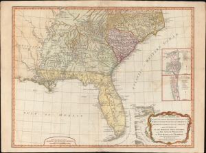
A New and General Map of the Southern Dominions Belonging to the United States of America, viz: North Carolina, South Carolina, and Georgia: with the Bordering Indian Countries and The Spanish Possessions of Louisiana and Florida.
sold
- Digital Map Information
- Suitable for large format printing
- DPI: 600
- File Size: 723.14 MB
- File Type: ZIP / TIFF
- ICC color profile embedded
- Delivered instantly via download link
A scarce 1794 Laurie and Whittle / Sayer map of the southeastern part of the United States and Florida. This is the second edition of Sayer's map of the southeast, and the first to recognize the United States as an independent nation. At the time of initial publication, it represented the finest general cartography of the southeast obtainable. (more details)