
A whimsical mid-century map of San Francisco.

Thomas Bros. Map of The City and County of San Francisco.
sold
- Digital Map Information
- Suitable for large format printing
- File Size: 31.77 MB
- File Type: ZIP / TIFF
- ICC color profile embedded
- Delivered instantly via download link
This is the c. 1945 pictorial pocket map or plan of the city of San Francisco by Thomas Brothers. (more details)
A charming cartifact of Scenic Utah.
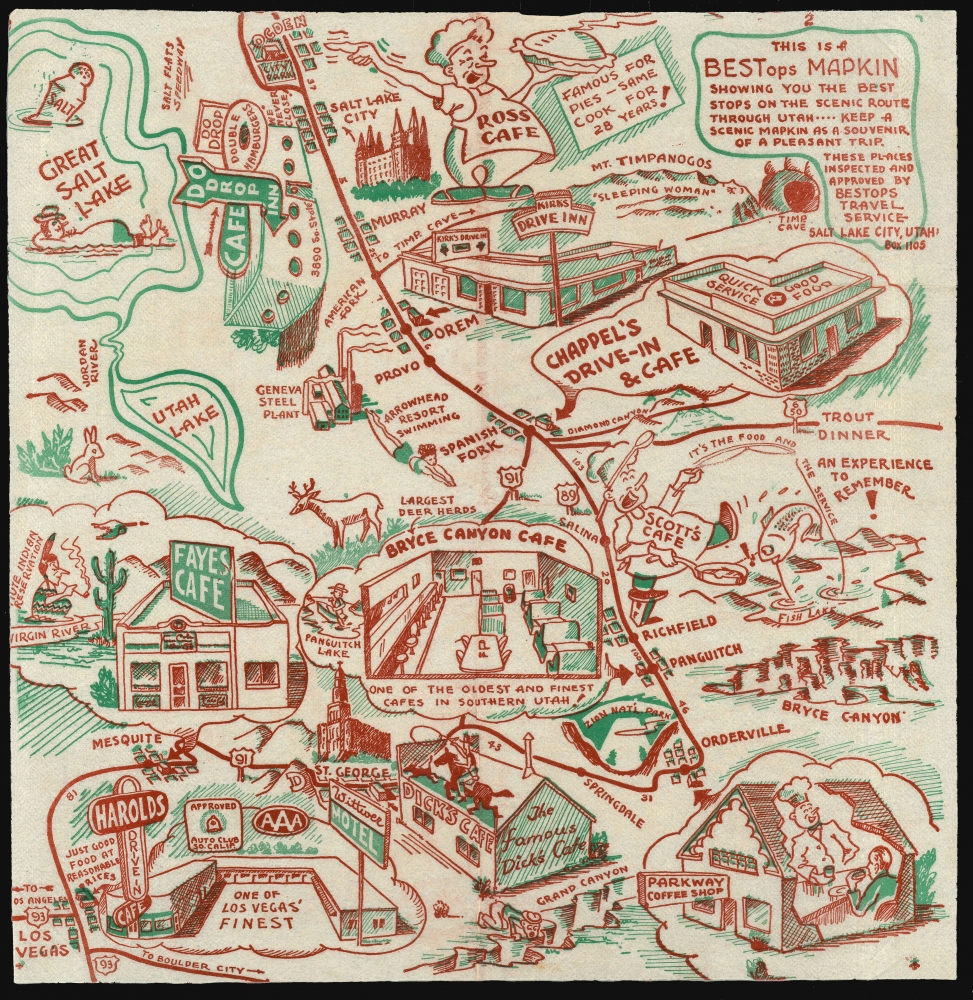
This Is A BESTops MAPKIN Showing you the best stops on the scenic route through Utah ---- keep a scenic Mapkin as a souvenir of a pleasant trip. These Places inspected and approved by BEStops Travel Service Box Salt Lake City Utah. Box 1105.
sold
- Digital Map Information
- Suitable for large format printing
- File Size: 28.76 MB
- File Type: ZIP / TIFF
- ICC color profile embedded
- Delivered instantly via download link
A rare survival: a 1948 map of parts of Arizona, Utah and Nevada, printed in two colors on a diner napkin. This 'Mapkin' represents a pictorial icon of the pre-interstate road trip, focusing specifically on the region from Las Vegas (here misspelled 'Los Vegas') and the Grand Canyon in the south, to the Great Salt Lake, Salt Lake City, and Mount Timpanogos in the north. The region's natural monuments were the draw for postwar tourists, but the primary focus of this map is on the area's restauranteurs. Throughout are interspersed a charming array of iconic travelers' destinations: historical sites and monuments, natural landmarks, and recommendable eateries to support the hungry tourists en route between. (more details)
1961/68 Guide To Southern Dialect and Customs with a Map of the United States in a Southerner's Eyes
The South, Presented for Northern Consumption.

Colonel Horsepasture's Guide Book and Dixie Dictionary.
sold
This is a 1968 novelty guide book for northern travelers visiting the southern United States, lampooning southern language, attitudes, and culture. Its author, J. Beauregard Horsepasture, was the Nom de Plume of Charles Fenstermacher Clark (1915 - 1988) whose novelty company (Tip'n Twinkle of Roanoke, Virginia) published the guide as well as other such items as the placemat map The United States of Dixie. (more details)
Classic Dutch Double Hemisphere World in Original Color.
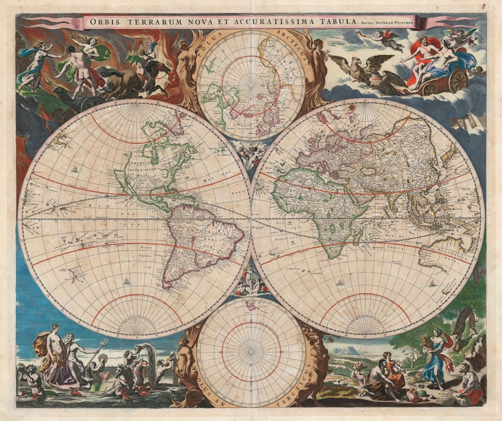
Orbis Terrarum Nova et Accuratissima Tabula. Auctore Nicolao Visscher.
sold
- Digital Map Information
- Suitable for large format printing
- Full resolution TIFF file
- ICC color profile embedded
- Delivered instantly via download link
This is Nicolas Visscher's classic 1658 double hemisphere map of the world, in beautiful original color. It epitomizes, both aesthetically and geographically, the Dutch World map of the second part of the 17th century. As such, according to Rodney Shirley, it is the 'master fore-runner' of the highly decorative style of Dutch world map that characterized the latter part of the Dutch Golden Age of Mapmaking. (more details)
Iconic Map of America of the Dutch Golden Age of Cartography.

Americae Nova Tabula. Auct. Guilielmo Blaeuw.
sold
- Digital Map Information
- Suitable for large format printing
- Full resolution TIFF file
- ICC color profile embedded
- Delivered instantly via download link
The essential Dutch map of America: Willem Janszoon Blaeu's 1635 carte-á-figures map of the Western Hemisphere. This is among the most desirable printed maps, encapsulating in one piece the most sought-after aesthetic qualities of the Dutch Golden Age of Cartography. In particular, it is the prime example of the carte-á-figures, or 'figured map,' displaying in its upper border the most important cities in the mapped region, and in its left and right borders finely-engraved depictions of the peoples native to it. The cities thus depicted are (from left) Havana, Santo Domingo, Cartagena, Mexico, Cusco, Potosi, La Mocha, Rio de Janeiro, and Olinda. The denizens of the Americas here depicted include Greenlanders, Virginians, Floridians, Californians (specifically, the King and Queen of Nova Albion) Mexicans, Peruvians, Brazilians, Chileans, and the natives of Magellanica (these last, possibly intended to be the giants reported by the survivors of Magellan's voyage). The decorative elements of the map are not limited to the borders: the seas are sailed by no fewer than eight ships. (more details)
Texas, showing Stephen F. Austin's geography.
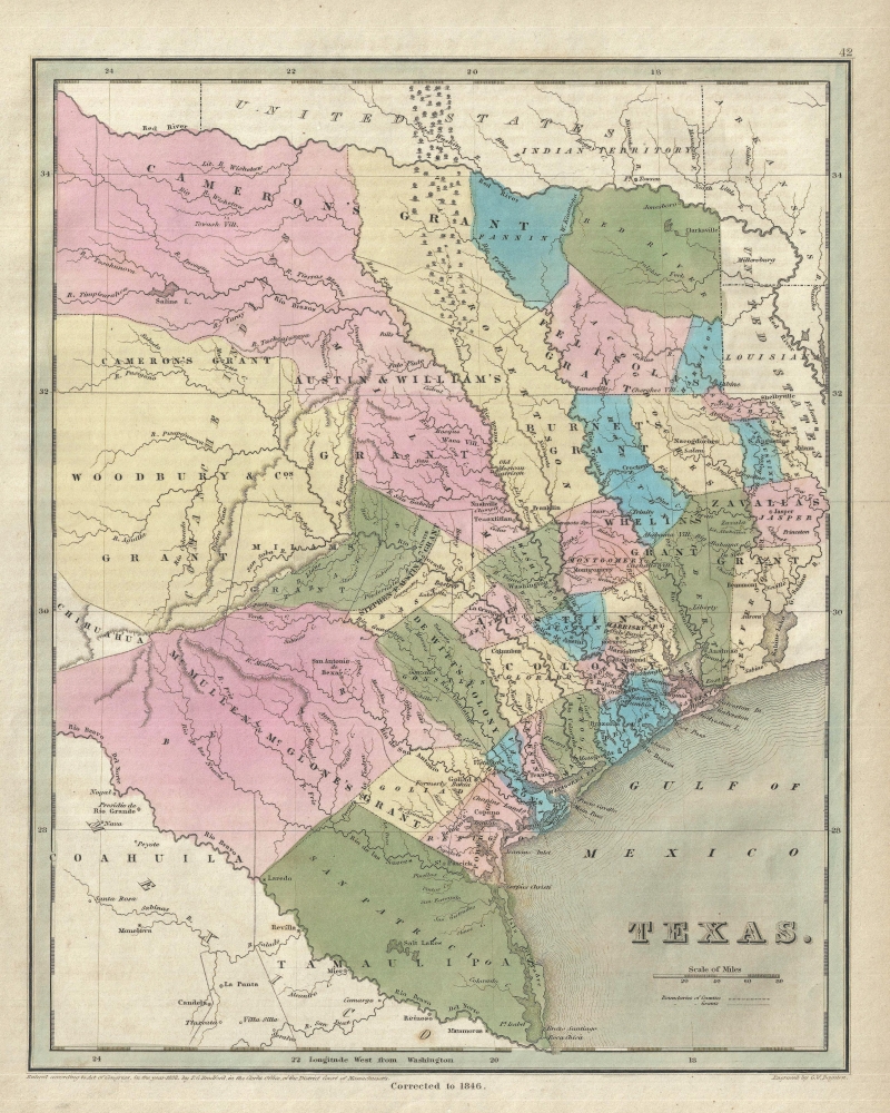
Texas.
sold
- Digital Map Information
- Suitable for large format printing
- DPI: 300
- File Size: 5.26 MB
- File Type: ZIP / TIFF
- ICC color profile embedded
- Delivered instantly via download link
This is Thomas Gamaliel Bradford's important 1846 map of Texas, issued at the end of the Republic of Texas period and of the Mexican American War (1846 - 1848). The map covers the eastern three-fourths of modern Texas, extending from the Red River to the Rio Grande and from Mexico to Lake Sabine and the United States. (more details)
How a wood and paper city burns.

帝都大震火災系統地圖 / Map of the Fire of Tokyo.
sold
- Digital Map Information
- Suitable for large format printing
- File Size: 70.51 MB
- File Type: ZIP / TIFF
- ICC color profile embedded
- Delivered instantly via download link
An infographic masterpiece detailing the ignition and development of the Great Fire of Tokyo following the 1923 Great Kanto Earthquake. This partially bilingual 1923 map of the Great Tokyo Fire was issued by the Relief Information Bureau of Tokyo Imperial University just four months after the disaster. It focuses on ignition points and on the strong winds that coincided with the earthquake, which caused fire to spread rapidly and eventually burn down much of the dense wooden city. (more details)
Distinctive Woodcut map of Africa.
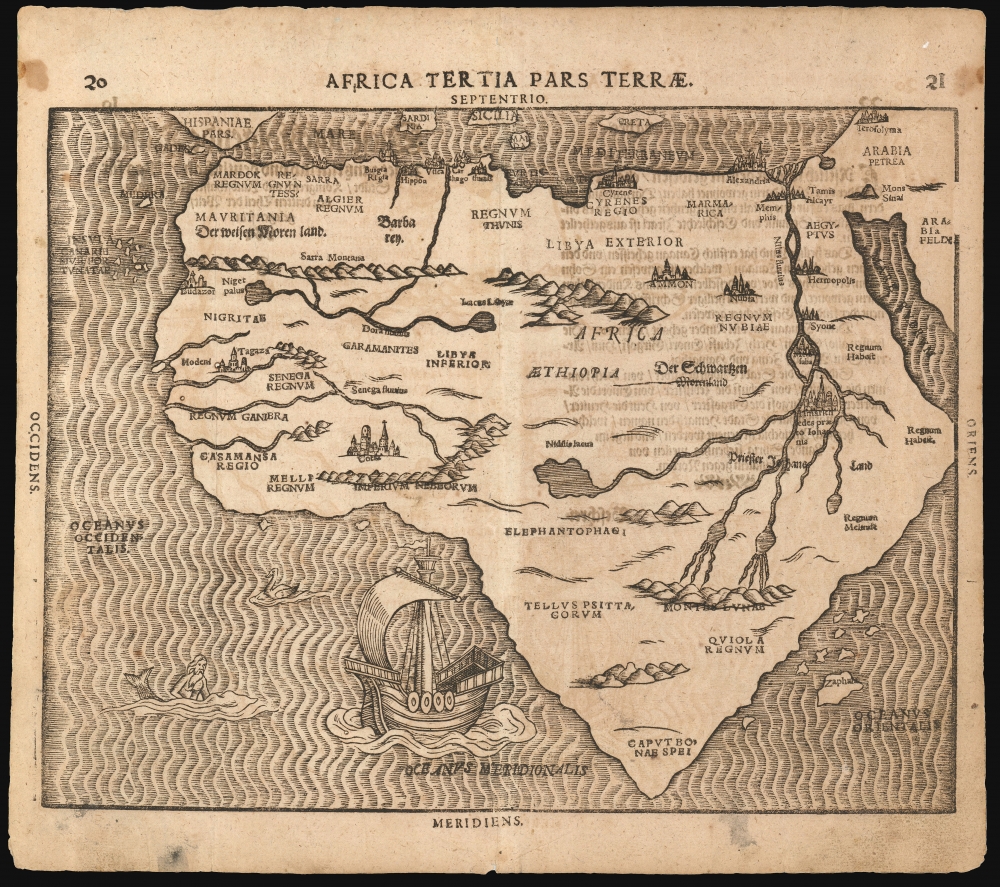
Africa Tertia Pars Terrae.
sold
- Digital Map Information
- Suitable for large format printing
- Full resolution TIFF file
- ICC color profile embedded
- Delivered instantly via download link
This is Heinrich Bünting's 1589 map of the continent of Africa. This striking woodcut appeared in Bünting's Itinerarium Sacrae, the first and for many years the only complete work of biblical geography. (more details)
First cartographic reconnaissance of the Chao Phraya River.

Royaume de Siam Cours du fleuve Me-Nam (Mè Năm Chào Phăja).
sold
- Digital Map Information
- Suitable for large format printing
- File Size: 13.53 MB
- File Type: ZIP / TIFF
- ICC color profile embedded
- Delivered instantly via download link
An important 1879 Émile Lombard missionary map of the Chao Phraya River, Thailand (Siam). It is significant as the first major upgrade to Siamese inland cartography since the 1828 John Crawfurd Map (SoutheastAsiaSiam-crawfurdwalker-1828-3). It is the first map to accurately identify towns and villages along the Chao Phraya, and the first we are aware of to use the term 'Chao Phraya'. It is of note that, while in most cases we would emphasize this work as the 'first European mapping' of the region, in this case, indigenous Siamese mapmaking is extremely limited and practically unknown until the 20th century, so this work marks the first time most of these villages appeared in any cartographic context. (more details)
San Francisco's late 19th century urbanization.
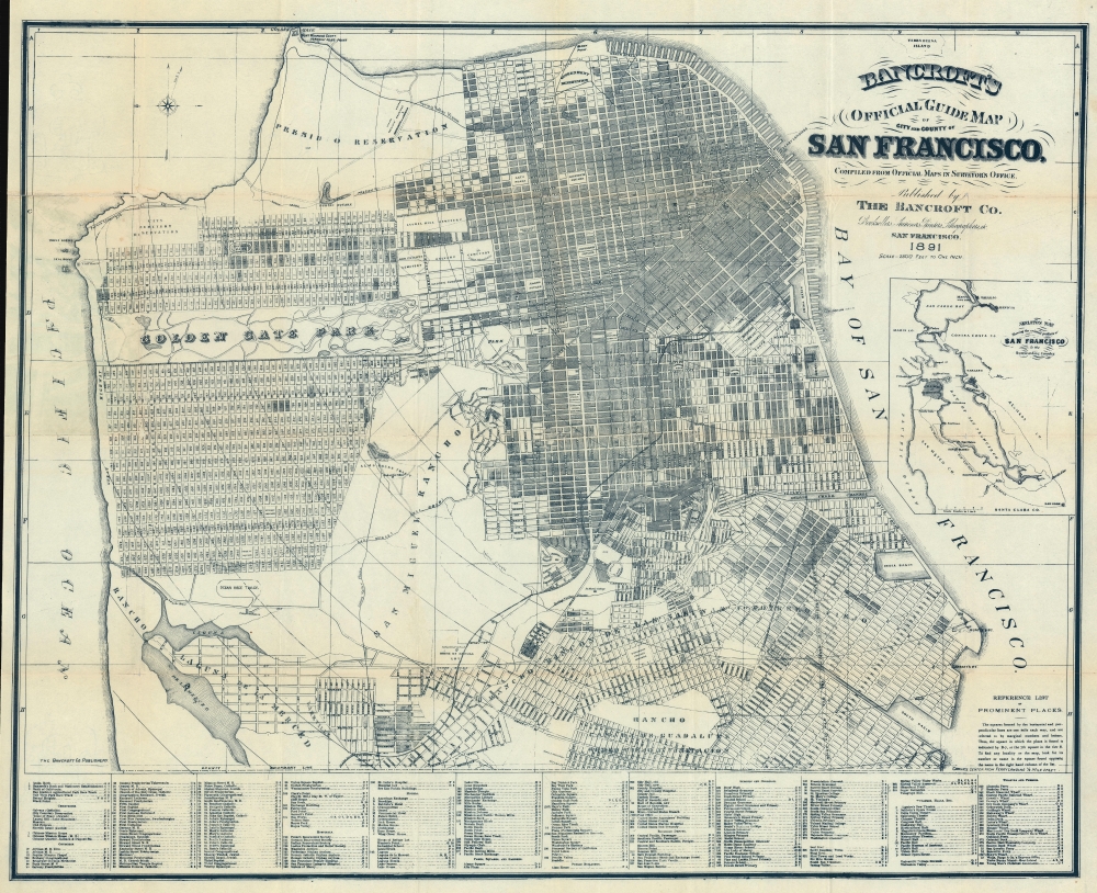
Bancroft's Official Guide Map of City and County of San Francisco, Compiled from Official Maps in Surveyor's Office.
sold
- Digital Map Information
- Suitable for large format printing
- File Size: 64.62 MB
- File Type: ZIP / TIFF
- ICC color profile embedded
- Delivered instantly via download link
A stunning 1891 example of Bancroft's important city map of San Francisco, California. This map, and the Bancroft series in general, represent the finest commercially obtainable cartographic record of San Francisco's urbanization. (more details)
Brazzaville as an expanding colonial capital.
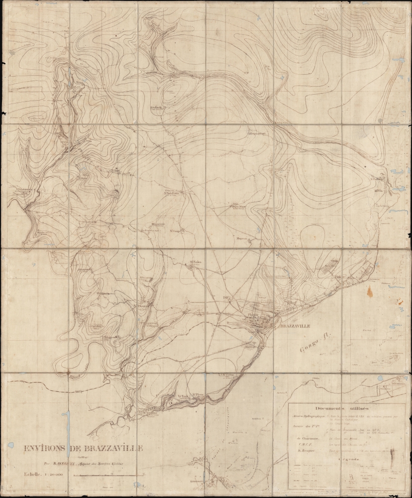
Environs de Brazzaville.
sold
- Digital Map Information
- Suitable for large format printing
- File Size: 39.99 MB
- File Type: ZIP / TIFF
- ICC color profile embedded
- Delivered instantly via download link
A unique survivor, this is a 1915 map of Brazzaville and its environs by Raymond Bouquet, a French colonial administrator. The ferro-gallic print process suggests it was issued in Brazzaville for administrative use, likely in less than 10 examples. Encompassing the Congo River, numerous villages, and a telegraph line, this map captures Brazzaville at the end of a period of explosive urban development, but also during World War I (1914 - 1918), when it became a staging point for French troops to wage war against German Cameroon. (more details)
Speculation on the Transhimalaya.
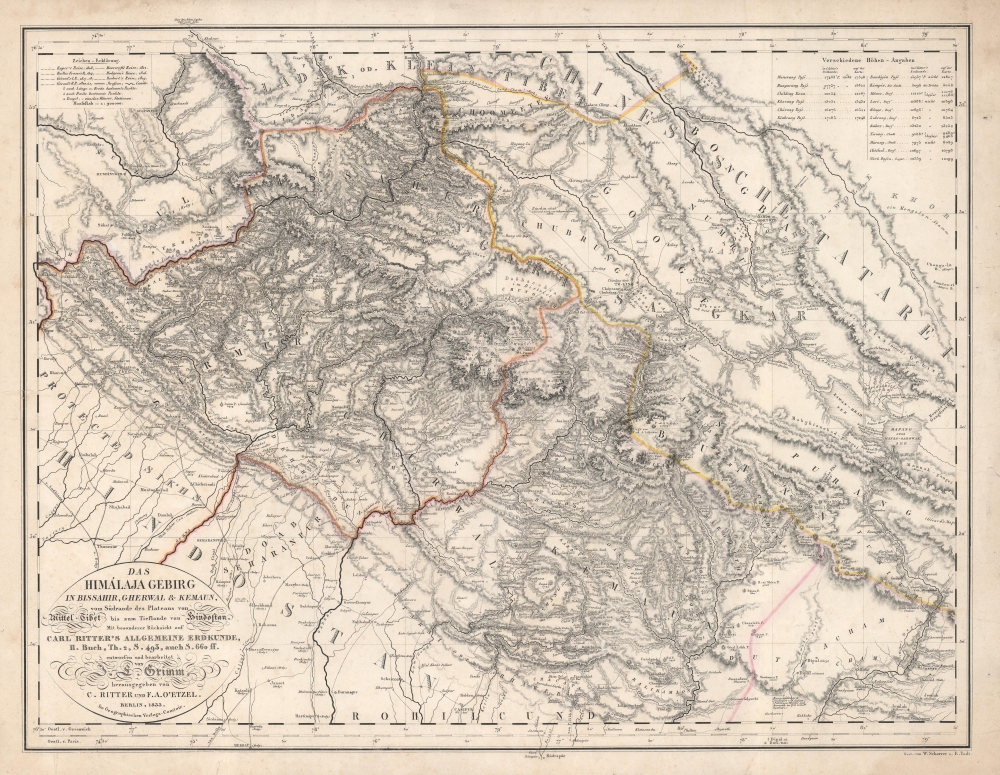
Das Himálaja Gebirg in Bissahir, Gherwal und Kemaun, von Südrande des Plateaus von Mittel-Tibet biz zum Tieflande von Hindostan.
$975.00
Acquire
- Digital Map Information
- Suitable for large format printing
- DPI: 600
- File Size: 56.07 MB
- File Type: ZIP / TIFF
- ICC color profile embedded
- Delivered instantly via download link
This is Carl Ritter and Julius Ludwig Grimm's 1833 map of parts of the Himalayas, the Tibetan Plateau, Nepal, Uttar Pradesh, Uttarakhand, and Dera Dun. This map was compiled at a time when Europeans knew little of this region, and so, this map is a dense amalgam of explorers' accounts and speculation expounded through the lens of Ritter's German Romantic theories of the Earth as a 'cosmic individual'. The work is novel as Ritter correctly deduced that the Transhimalaya is the eastern continuation of the Karkorum system. (more details)
Philippines Campaign, WWII.
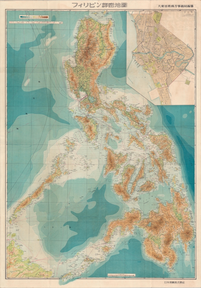
フィリピン詳密地圖 / Detailed Map of the Philippines. / Firipin shomitsu chizu.
sold
- Digital Map Information
- Suitable for large format printing
- Full resolution TIFF file
- ICC color profile embedded
- Delivered instantly via download link
A rare 1944 Showa 19 Japanese large format map of the Philippines issued just 5 days after the WWII Philippines Campaign (1944 - 1945) began. The map is an expansion on a similar map issued for the 1942-3 'Greater East Asia Co-Prosperity Sphere' map series, which it stylistically resembles despite being four times the size. This map was issued to satisfy an increased Japanese need for information and reconnaissance following General Douglas MacArthur's landing at Leyte. (more details)
Shanghai on the Eve of Transformation.

上海市市区图 / [Map of the Urban Districts of Shanghai Municipality].
sold
A very large 1990 indexed street map of the urban districts of Shanghai produced by the Shanghai Institute of Surveying and Mapping. It provides a great deal of information on the city's administrative, transportation, and demographic geography in the early days of Shanghai's economic transformation. (more details)
100 years of progress.

Illinois One Hundred Years Ago.
sold
- Digital Map Information
- Suitable for large format printing
- File Size: 28.5 MB
- File Type: ZIP / TIFF
- ICC color profile embedded
- Delivered instantly via download link
This is a 1934 Northern Trust Company and William Mark Young pictorial map of Illinois. A pictorial border surrounds a historic map of the state created by J. H. Young and published by S. A. Mitchell. (more details)
Northeastern limits of Ptolemy's landlocked Indian Ocean.
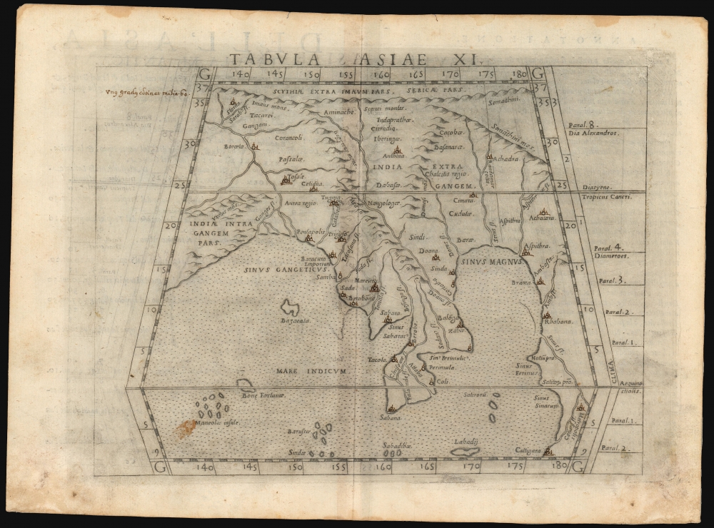
Tabula Asiae XI.
sold
- Digital Map Information
- Suitable for large format printing
- Full resolution TIFF file
- ICC color profile embedded
- Delivered instantly via download link
This is a handsome example of Girolamo Ruscelli's 1561 / 1574 map of Southeast Asia and the Malay Peninsula. The region was known to ancient geographers as 'India Extra Gangem,' or 'India Beyond the Ganges'. (more details)
Stepping Stones to the New World.
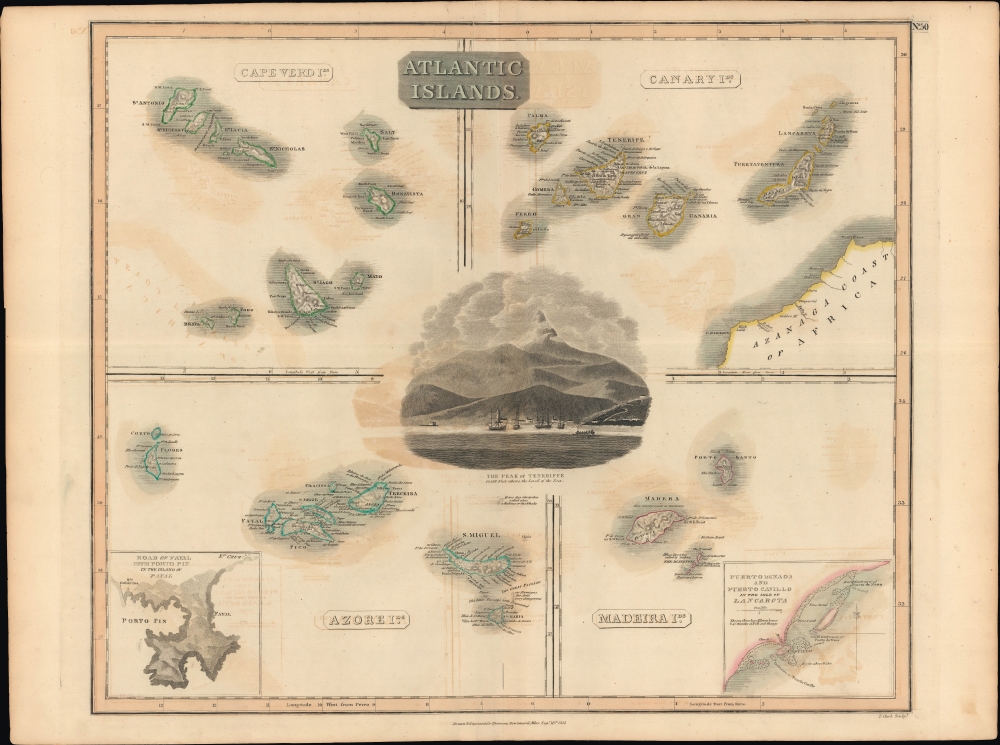
Atlantic Islands.
sold
- Digital Map Information
- Suitable for large format printing
- Full resolution TIFF file
- ICC color profile embedded
- Delivered instantly via download link
A hand colored 1814 map by John Thomson depicting the Atlantic islands of Cape Verde, the Canary Islands, Madeira, and the Azores, with insets of the ports of Fayal and Lancarota (Lanzarote). Though magnets of tourism today, in the 19th century and earlier, these islands were essential steppingstones on the trans-Atlantic shipping lanes between Europe and America. (more details)
Wonderland of Mountains and Forests (without the Forests).
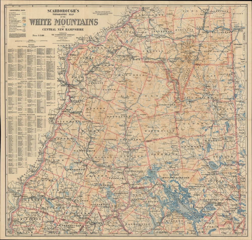
Scarborough's Topographic Map of the White Mountains and Central New Hampshire.
sold
- Digital Map Information
- Suitable for large format printing
- File Size: 77.98 MB
- File Type: ZIP / TIFF
- ICC color profile embedded
- Delivered instantly via download link
This large and impressive map of the White Mountains and central New Hampshire was published by the Scarborough Company, successor to the National Publishing Company, in 1903. It displays the region on the eve of the automobile era, when it was a favorite retreat of well-heeled tourists from Boston, New York, and beyond. (more details)
Visit sites across New England!
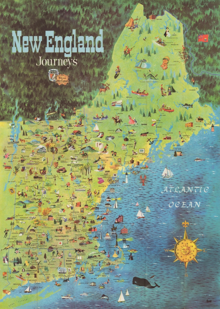
New England Journeys.
sold
This is a 1954 pictorial map of New England published by the Ford Dealers of New England. The piece uses the scenic beauty and historical attractions of New England to capitalize on a new era of mobility that defined American Automobile Craze - and in fact, the rise of auto-tourism in the United States directly correlates with the Federal-Aid Highway Act of 1956, just two years after this piece was issued. (more details)
Bucolic charm of Northwestern Connecticut.
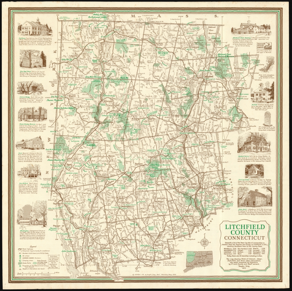
Litchfield County, Connecticut.
sold
This is an attractive, 1975 Vaughn Surber Gray pictorial map of bucolic Litchfield County, in northwestern Connecticut. The map is bordered by Massachusetts and New York to the north and west, with the counties of Hartford, New Haven, and Fairfield bordering the east and south. (more details)