
Revealing Dutch Secrets in the East.
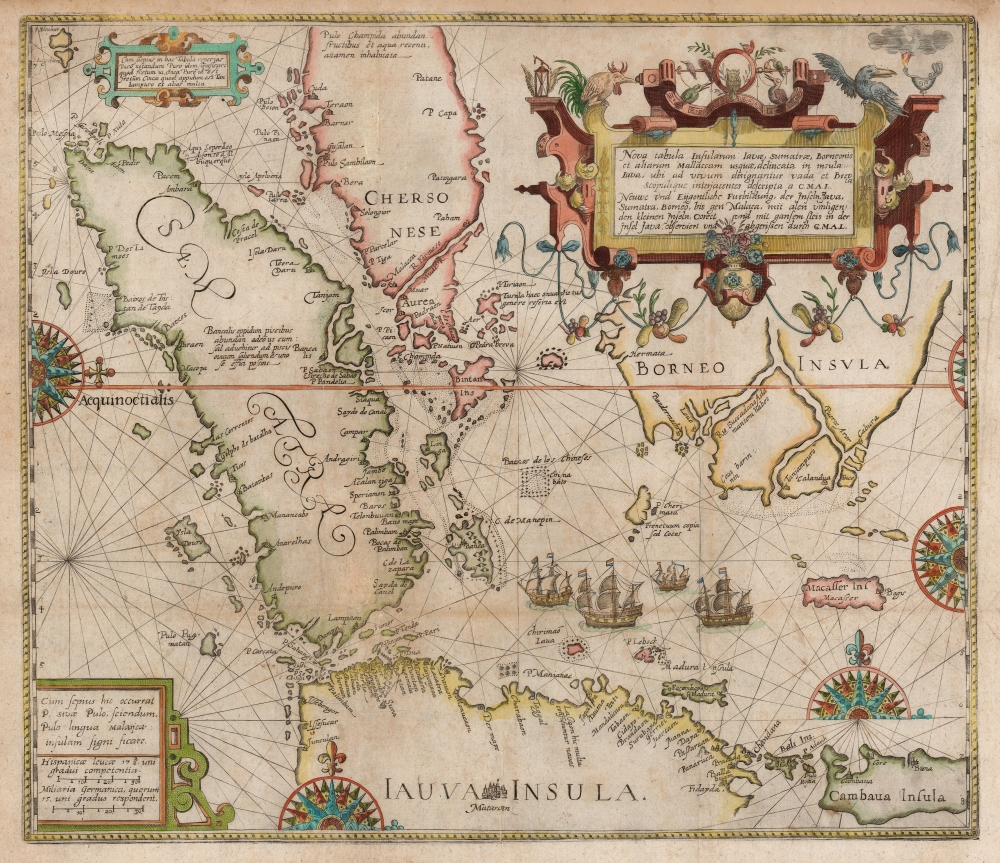
Nova Tabula Insularum Javae, Sumatrae, Borneonis et Aliarum Mallaccam usquae delineate in insula Iava...
sold
- Digital Map Information
- Suitable for large format printing
- DPI: 600
- File Size: 34.83 MB
- File Type: ZIP / TIFF
- ICC color profile embedded
- Delivered instantly via download link
This scarce, beautiful map of the East Indies is Theodore De Bry's 1598 edition of the suppressed work of Cornelis Claesz and Willem Lodewijcksz. The map represents the first Dutch voyage to the Spice Islands and thus the dawn of the Dutch ascendency as a global trade powerhouse. It is also among the earliest printed maps to include Bali. (more details)
Sumatra during the pepper trade.
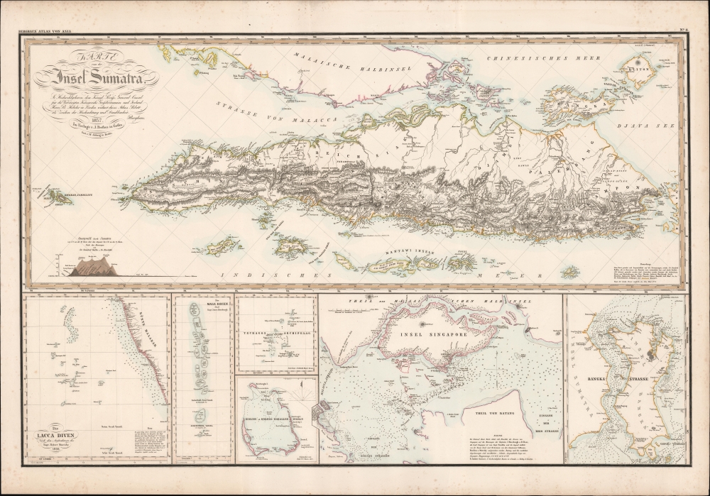
Karte von der Insel Sumatra.
sold
- Digital Map Information
- Suitable for large format printing
- DPI: 600
- File Size: 97.9 MB
- File Type: ZIP / TIFF
- ICC color profile embedded
- Delivered instantly via download link
This is a striking 1837 Heinrich Berghaus map of Sumatra with important insets of Singapore and the Maldives. It was issued for Berghaus' looseleaf Atlas von Asien, the best informed general cartographic work on Asia to appear in the mid-19th century. (more details)
The Most Unique Early Map of the World.
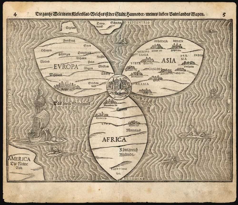
Die gantze Welt in ein Kleberblat, Welches ist der Stadt hannover / meines lieben Vaterlandes Wapen.
sold
- Digital Map Information
- Suitable for large format printing
- Full resolution TIFF file
- ICC color profile embedded
- Delivered instantly via download link
This is Heinrich Bünting's 1585 / 1597 iconic map of the world, dramatically presented as a clover leaf. This beautiful woodcut appeared in Bünting's Itinerarium Sacrae, the first and for many years the only complete work of biblical geography. (more details)
Dramatic 18th century wall map!
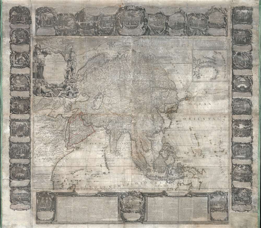
L'Asie Dressée Sur Les Nouvelles Observations Faites En Toutes Les Parties De La Terre Et Rectifiées.
$5,000.00
Acquire
This is an impressive and rare 1749 decorative wall map of Asia by Jean-Baptiste Nolin. It offers both decorative appeal and significant cartographic interest: Witsen's Peninsula, Lake Chiamay, Gamaland, ethnographic commentary, and more. (more details)
Earliest and most desirable printed map of Taiwan / Formosa.
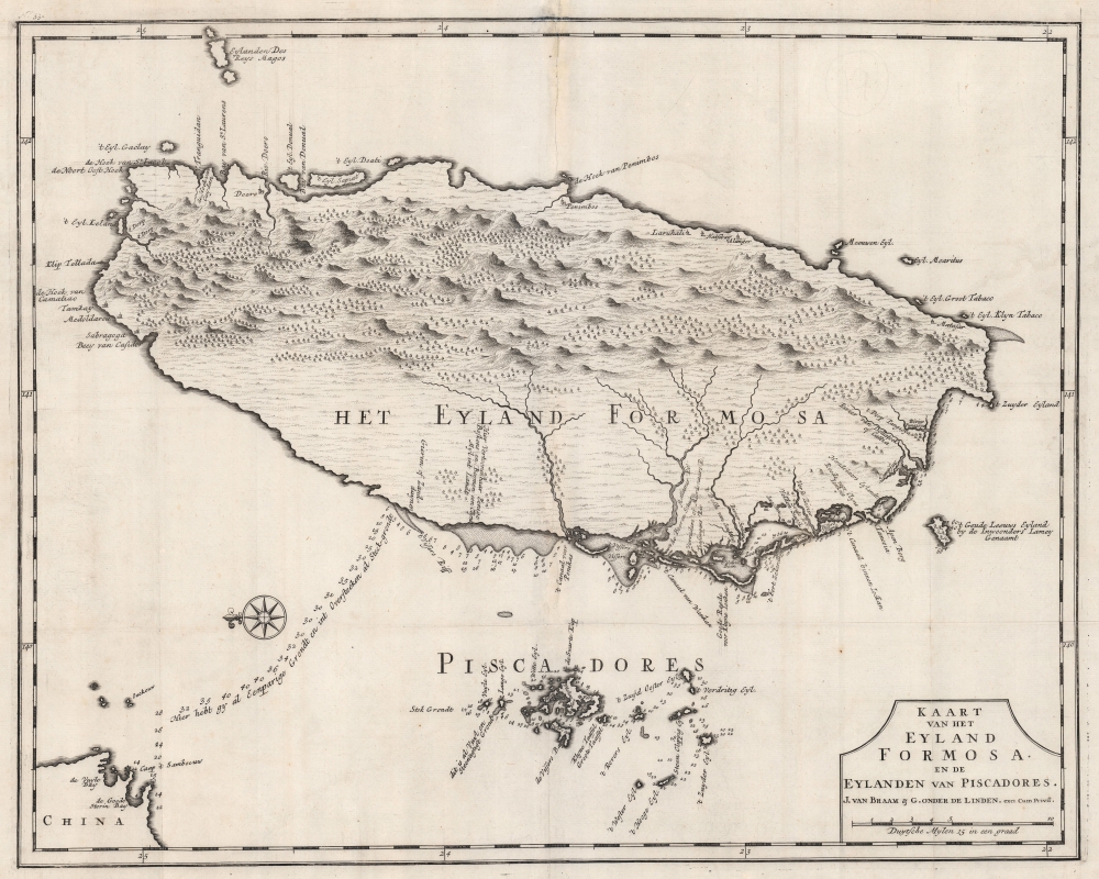
Kaart van het Eyland Formosa en de Eylanden van Piscadores.
sold
- Digital Map Information
- Suitable for large format printing
- DPI: 600
- File Size: 45.16 MB
- File Type: ZIP / TIFF
- ICC color profile embedded
- Delivered instantly via download link
Printed in 1726 by Francois Valentijn, this is the earliest and most desirable printed map of Taiwan or Formosa. It is considered the first specific printed map of Formosa. Oriented to the east, with north at the left, Valentijn's map covers the entire island was well as the nearby Pescadores, now known as the Penghu Islands, and the nautical route to the Chinese coastal province of Fujian. Soundings appear around the Pescadores, along the west coast of Taiwan, and extend to the Chinese coast. (more details)
Opening of the Brooklyn Bridge!
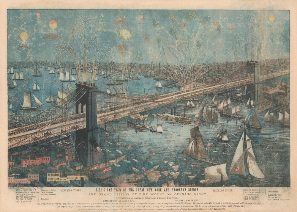
Bird's-Eye View of the Great New York and Brooklyn Bridge, and Grand Display of Fire Works on Opening Night.
sold
- Digital Map Information
- Suitable for large format printing
- File Size: 37.46 MB
- File Type: ZIP / TIFF
- ICC color profile embedded
- Delivered instantly via download link
The most dynamic and dramatic Brooklyn Bridge View, this is the 1883 A. Major four-color chromolithograph bird's-eye view of the Brooklyn Bridge during its opening day celebrations. Then known as the 'New York and Brooklyn Bridge' or the 'East River Bridge' (it would not be officially renamed the Brooklyn Bridge until 1915), fireworks erupt from both stone towers and the center span. Individuals on rooftops and passengers set off additional celebratory fireworks. Steamers, sailboats, and three-masted schooners fill the East River, creating a visual spectacle emphasizing New York's significance as a port. Pedestrians cross the bridge, some in elegant carriages. The bridge's designer, engineers, draughtsmen, and other important individuals are recognized along the bottom border and a short text summarizes the bridge's specifications and its cost: $15,000,000. (more details)
'Secret' contingency map in case Germany did not comply with the Armistice.
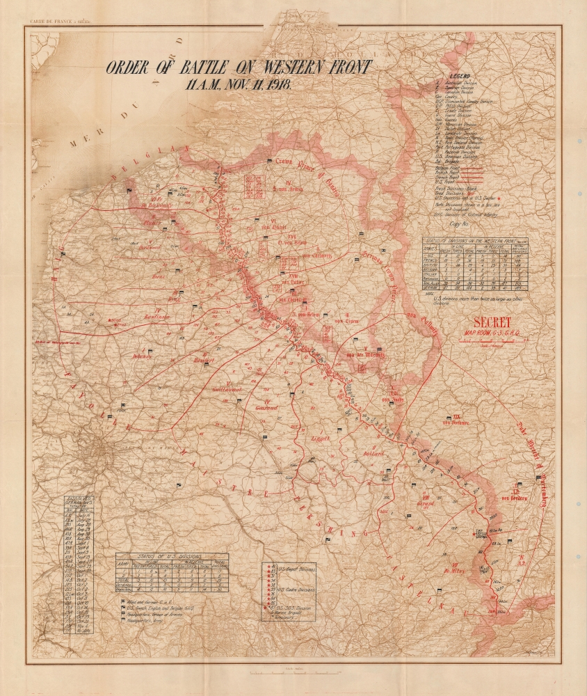
Order of Battle on Western Front 11 A.M., Nov. 11, 1918.
sold
- Digital Map Information
- Suitable for large format printing
- File Size: 81.23 MB
- File Type: ZIP / TIFF
- ICC color profile embedded
- Delivered instantly via download link
This is a c. 1918 General Headquarters 'Secret' map of France, Belgium, Luxembourg, and parts of the Netherlands and Germany, depicting the Western Front on the when fighting stopped, ending World War I (November 11, 1918). The map records the 'eleventh hour of the eleventh day of the eleventh month' of 1918, when the armistice signed between the Allies and Germany at Compiègne, France, called for the cessation of hostilities on the Western Front. It was created in the Map Room of the Operations Section (G-3) of the General Headquarters staff on the contingency that German forces did not comply with the terms of the armistice and the war resumed. According to the Library of Congress, an example of this map was used at the Paris Peace Conference of 1919. (more details)
Ruins in Manassas Junction after the Confederate evacuation.
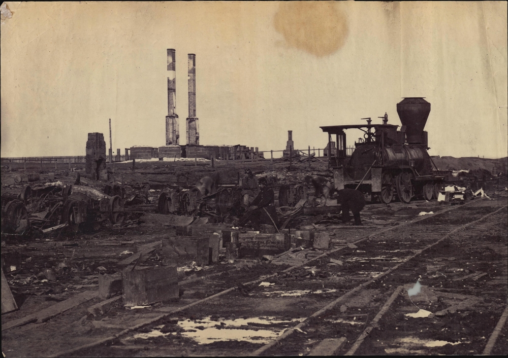
Manassas Junction, Va., after its evacuation by the Confederates, March 1862.
sold
This is a striking 1862 Mathew Brady American Civil War albumen photograph of the ruins of Manassas Junction following Johnston’s scorched-earth evacuation of Confederate forces. The photograph presents the burnt out remains of a train and warehouse. Brady's photo-documentation of the Civil War is significant and played a role much like television journalism did during the Vietnam War - it brought the horrors and violence of the war to the home front, informing public opinion. (more details)
A Modern Pilgrim's Views of the Holy Land.

Iherusalem Turcis Cusembareich. / Nazareth. / Ramma Antiquitissimum in Palestina oppidum.
sold
- Digital Map Information
- Suitable for large format printing
- Full resolution TIFF file
- ICC color profile embedded
- Delivered instantly via download link
This rare 1657 engraving compiles Jan Jansson's views of Jerusalem, Nazareth, and Ramallah - which, as the title suggests, is 'the oldest town in Palestine'. (more details)
Promoting businesses throughout Douala!

Douala Cameroun.
sold
This is the only known example of a c. 1982 J.C.A. pictorial map of Douala, Cameroon - published in Cameroon. While this style of local-focused promotions map is common in the United States and Europe, it is the first time we have seen the cartographic model applied to a west African city - marking this as a unique a significant piece. (more details)
On the Eve of the Mexican-American War.
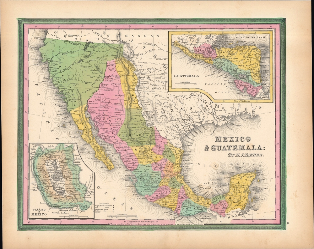
Mexico and Guatemala.
sold
- Digital Map Information
- Suitable for large format printing
- Full resolution TIFF file
- ICC color profile embedded
- Delivered instantly via download link
This is Samuel Augustus Mitchell's 1846 map of Mexico and Central America, with Texas as a republic and near its fullest extent, based on an earlier map by Henry Schenck Tanner. It is especially significant as it coincides with the incorporation of Texas into the Union and the beginning of the Mexican-American War (1846 - 1848), which would significantly alter the borders displayed here. (more details)
Earliest map of Czech, earliest map with a key!
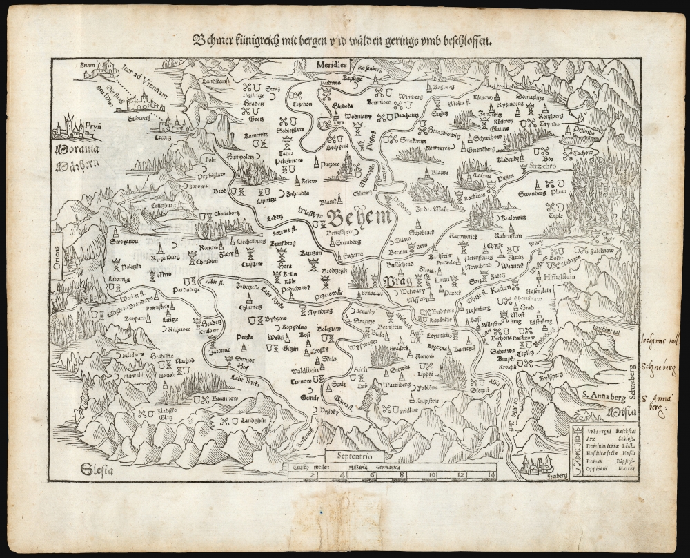
Behmer kunigreich mit bergen und waelden gerings umb beschlossen.
sold
- Digital Map Information
- Suitable for large format printing
- Full resolution TIFF file
- ICC color profile embedded
- Delivered instantly via download link
This is Munster's 1545 map of Bohemia, the earliest acquirable printed map of what is now the Czech Republic. This map appeared in the 1572 Latin edition Munster’s Cosmographia Universalis, a work notable for presenting to a broad lay audience many of the first printed maps based on contemporaneous surveys and toponymy, rather than data from classical sources. Munster’s source for this map was Nicolaus Claudianus’ 1518 map of Bohemia, which now exists in only one known surviving example. Munster's map is the only version of Claudianus' map available to the collector. (more details)
Trekking Kathmandu to Lhasa.
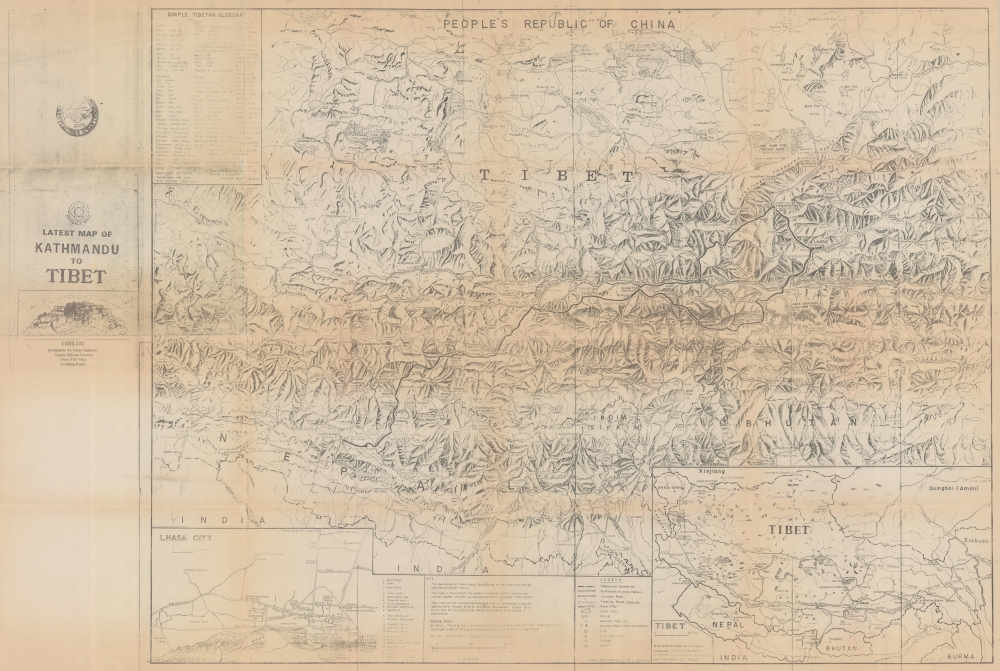
Latest Map of Kathmandu to Tibet.
$600.00
Acquire
This is a c. 1988 Mandala Maps trekking map of Nepal and Tibet, highlighting a trekking route between Kathmandu and Lhasa. (more details)
Surveying the Spice Islands.

East India Archipelago [Eastern Passages to China and Japan] [Chart No. 5].
sold
- Digital Map Information
- Suitable for large format printing
- Full resolution TIFF file
- ICC color profile embedded
- Delivered instantly via download link
A large-format 1884 James Imray blueback chart of a portion of the Spice Islands, along with Palau and parts of Mindanao and New Guinea, centered on the Halmaheira (Halmahera) Sea. (more details)
One of the Earliest Depictions of Discovery-Era India.
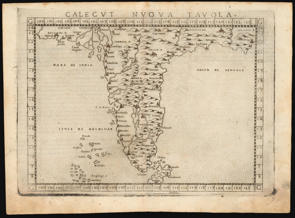
Calecut Nuova Tavola.
$400.00
Acquire
- Digital Map Information
- Suitable for large format printing
- Full resolution TIFF file
- ICC color profile embedded
- Delivered instantly via download link
This is Girolamo Ruscelli's 1561 / 1574 map of India. It is among the earliest printed, modern maps of India - most earlier maps being iterations of Claudius Ptolemy's geographical information of the 2nd century. (more details)
French mapping of Siam, Malaya and Cochinchina.
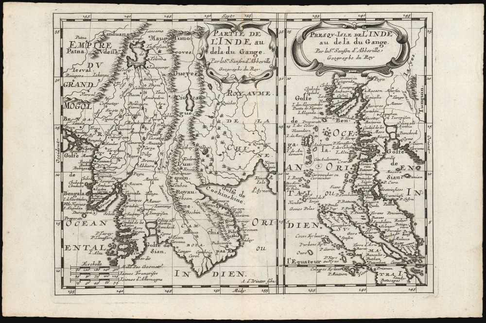
Partie de l'Inde au delà du Gange/ Presqu-Isle de L'Inde au delà du Gange.
$350.00
Acquire
- Digital Map Information
- Suitable for large format printing
- DPI: 600
- File Size: 12.06 MB
- File Type: ZIP / TIFF
- ICC color profile embedded
- Delivered instantly via download link
These, on one sheet, are Nicolas Sanson's 1653 maps of Southeast Asia, here re-engraved for its first Dutch edition of 1683. Coverage includes Siam (Thailand), Vietnam, Cambodia, Laos, Burma, Malaya, and parts of China and Sumatra, a region then generally known as 'India beyond the Ganges. (more details)
The results of the American Revolution, printed during the French Revolution.
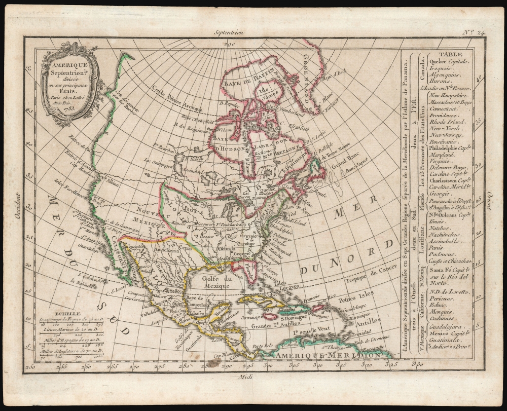
Amerique Septentrionale diviseé en ses principaux Etats. A Paris chez Lattré Avec priv... 1783.
sold
- Digital Map Information
- Suitable for large format printing
- DPI: 600
- File Size: 10.95 MB
- File Type: ZIP / TIFF
- ICC color profile embedded
- Delivered instantly via download link
This is an attractively-engraved 1793 Jean Lattré map of North America, showing the new political divisions of the continent following the American Revolution. (more details)
Featuring a mighty sea battle!
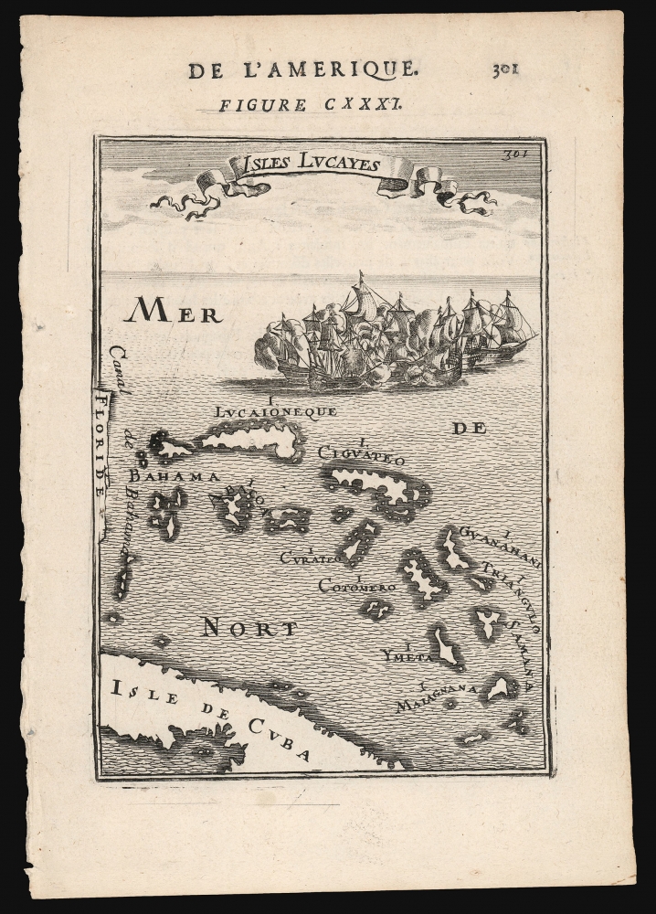
Isles Lucayes.
sold
- Digital Map Information
- Suitable for large format printing
- DPI: 600
- File Size: 6.07 MB
- File Type: ZIP / TIFF
- ICC color profile embedded
- Delivered instantly via download link
This is a 1683 Alain Manesson Mallet map of the Bahamas: one of the earliest maps to focus on the archipelago. The map pictures the islands separated from Florida by the 'Canal de Bahama', and with part of the island of Cuba marking the map's southern extreme. The islands are presented and named after the c.1631 chart of the Dutch Hessel Gerritsz, whose depiction of the Caribbean provided the main model for the region followed by virtually every cartographer of the 17th century.
The engraving is attractively done: the plate is topped with a flowing title banner, and is decorated with a mighty sea battle: after all, the Canal de Bahama was the safe passage out of the Gulf of Mexico used by the Spanish treasure fleets, and the Bahamas provided Dutch, English and French pirates ample safe harbor in which to lie in wait for the fat Spanish galleons. (more details)
The engraving is attractively done: the plate is topped with a flowing title banner, and is decorated with a mighty sea battle: after all, the Canal de Bahama was the safe passage out of the Gulf of Mexico used by the Spanish treasure fleets, and the Bahamas provided Dutch, English and French pirates ample safe harbor in which to lie in wait for the fat Spanish galleons. (more details)
United States from 'Fawt Sumtah' to 'Tinasee Ernie Fode's Home.'

The United States of Dixie
sold
This is a 1966 novelty Tip'n Twinkle placemat map of the United States, good naturedly lampooning southern language, attitudes, and culture. (more details)
Waning Days of Ottoman Control over the Balkans.
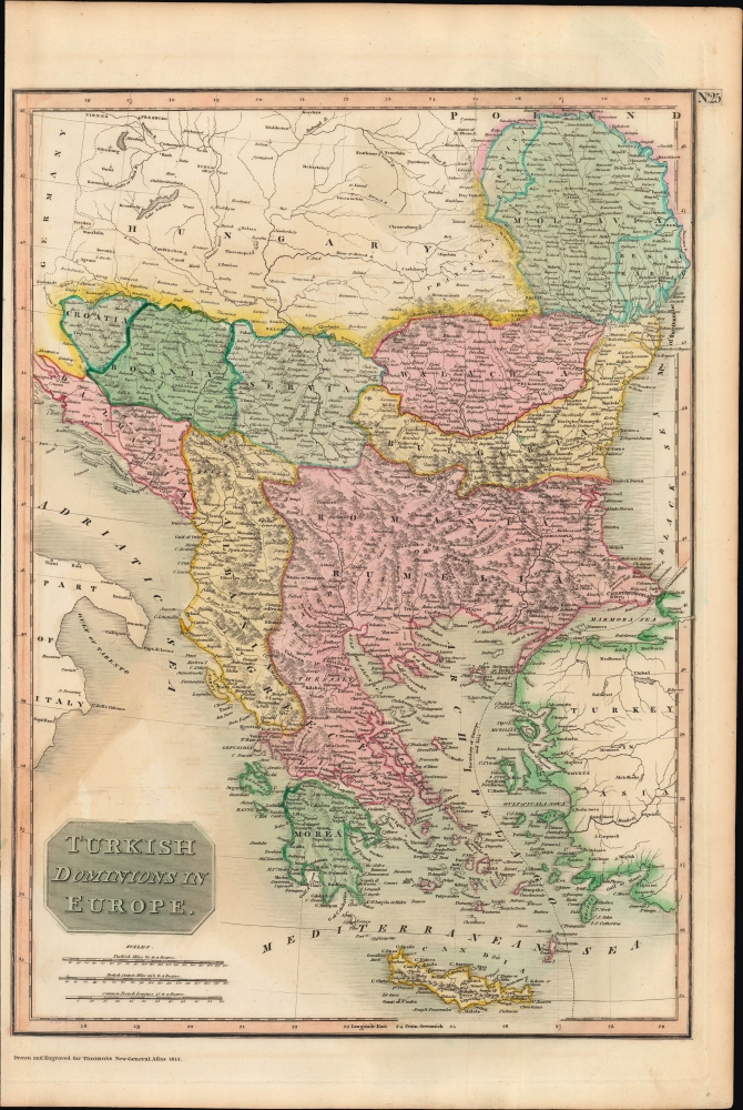
Turkish Dominions in Europe.
sold
- Digital Map Information
- Suitable for large format printing
- Full resolution TIFF file
- ICC color profile embedded
- Delivered instantly via download link
A lovely example of John Thomson's 1815 map of 'Turkey in Europe,' that is, the European portion of the Ottoman Empire. Though Ottoman rule of Southeastern Europe was long-established, by this time cracks were appearing that would spell the rapid retreat of Ottoman power and the rise of new kingdoms and nation-states. (more details)