
Campus of the Sun.

Florida Southern College: Frank Lloyd Wright's 'Child of the Sun'.
sold
A whimsical 1990 pictorial view of the campus of Florida Southern College, published by International Caricature Productions. In addition to providing a map of the campus and city of Lakeland, and promoting local businesses, the view highlights the 'Child of the Sun' building complex designed by Frank Lloyd Wright. (more details)
Opening Up Oaxaca.
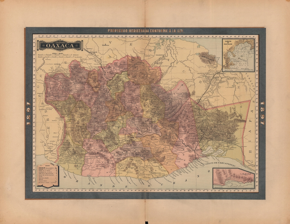
Oaxaca.
sold
- Digital Map Information
- Suitable for large format printing
- File Size: 34.51 MB
- File Type: ZIP / TIFF
- ICC color profile embedded
- Delivered instantly via download link
A lovely map of Oaxaca, Mexico, published in 1897 as part of the Atlas Geográfico de los Estados Unidos Mexicanos. It highlights the significant changes taking place in the state at the time, including the construction of a railway linking the Atlantic and Pacific Oceans across the Isthmus of Tehuantepec. (more details)
The Film Capital of Florida.

South Florida, Production and Post Production Hot Spot.
sold
A large-format promotional pictorial map of South Florida published c. 1994 to publicize the region's film industry. (more details)
Presenting Americans with the North Parts of the World.

A Map of the Countries situate about the North Pole as far as the 50th Degree of North Latitude.
sold
- Digital Map Information
- Suitable for large format printing
- DPI: 600
- File Size: 13.01 MB
- File Type: ZIP / TIFF
- ICC color profile embedded
- Delivered instantly via download link
This is Mathew Carey's 1795 map of the North Pole and the surrounding seas. The map illustrates the extent of exploration, as well as the may uncertainties, of polar region to the date of publication. (more details)
Playful map of the West Indies.

The Story Map of the West Indies.
sold
- Digital Map Information
- Suitable for large format printing
- File Size: 18.37 MB
- File Type: ZIP / TIFF
- ICC color profile embedded
- Delivered instantly via download link
This is a 1936 Colortext pictorial story map of the West Indies. The map depicts the region from Florida and the Gulf of Mexico and the Yucatan Peninsula to the Leeward Islands and Georgetown, Guyana and from New York and Chicago to northern South America. Each island is labeled, along with multiple locations including cities and towns, such as Havana, Port-au-Prince, and San Juan. Flags are used in the Leeward Islands to identify which European country claimed suzerainty. The British Union Jack, for example, appears next to Bermuda and the Bahamas. Numerous vignettes populate the map, including native birds, animals, and fish, pirates and pirate ships, and locals dressed in indigenous costumes. Historical events are also chronicled, such as Ponce de Leon's first settlement on Puerto Rico and the naval battle of Santiago. Cities in the United States are also noted, including New York City (illustrated by its famous skyline), Washington, D.C. (marked by the U.S. Capitol), Detroit, Chicago, and Miami. The whole is surrounded by a decorative border motif derived from indigenous tropical fruits and West Indian handicraft. (more details)
The Center of the World.

The United States of New York.
sold
A scarce and entertaining 1978 pictorial view of New York City (and 'environs') by the illustrator Tony Graham. Depicting the New Yorker's, or more accurately the Manhattanite's, view of the United States, it devotes considerable attention to the neighborhoods, shops, and attractions of Manhattan while relegating less important parts of the city, and country, to the margins. (more details)
Earliest Lithograph of the Singapore Strait.
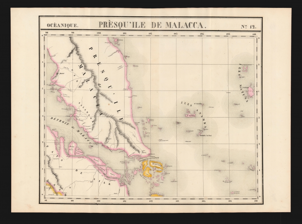
Presqu'ile de Malacca. Oceanique no. 12.
sold
- Digital Map Information
- Suitable for large format printing
- DPI: 600
- File Size: 60.05 MB
- File Type: ZIP / TIFF
- ICC color profile embedded
- Delivered instantly via download link
This is the 1827 Vandermaelen map of Singapore and the Malay Peninsula. It is the first large-scale atlas map to focus on the area, and the first to be executed in lithography. The map shows Singapore Island, Bintan, Kepulauan Anambas, Kepulauan Natuna Besar, and part of Sumatra. The interior details of Malacca - particularly the attractively hachured mountains appearing on the Malay Peninsula - reveal that despite the presence for nearly eight years of an English colony on Singapore, European knowledge of this part of the world remained scant. In all fairness, this ignorance cannot be laid entirely at Vandermaelen's feet: the Jackson plan itself would not be published for still another year, in 1828, and it was the first map to show the colony. (more details)
Anglesey, Wight and the Channel Islands from Contemporary Sources.
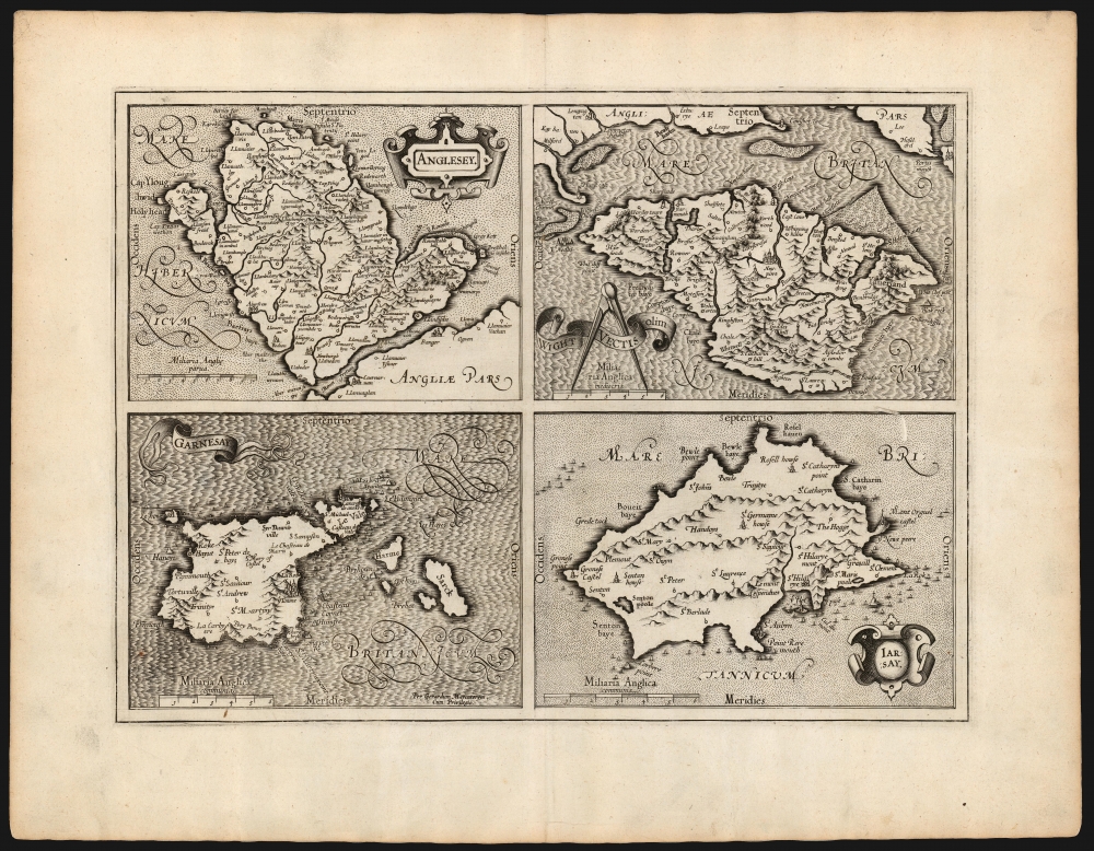
Anglesey/ Wight Vectis olim/ Garnesay/ Jarsey.
sold
- Digital Map Information
- Suitable for large format printing
- DPI: 600
- File Size: 53 MB
- File Type: ZIP / TIFF
- ICC color profile embedded
- Delivered instantly via download link
This is the 1595 first edition of Gerard Mercator's map of the Isle of Wight, Anglesey, Guernsey and Jersey. It was the first map to provide detailed focus on these islands to appear in a general atlas. All four maps are sharply detailed, with towns and topography indicated throughout; each individual map is provided its own scale, and each is titled within an elegant cartouche. The seas around Anglesey and Jersey are stippled, while those around Wight and Guernsey are hachured: the composition overall thus gives a pleasing checkerboard effect. (more details)
Final years of the American railroad-boom.
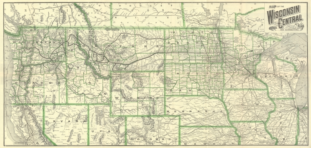
Map of the Wisconsin Central and Connections.
sold
- Digital Map Information
- Suitable for large format printing
- Full resolution TIFF file
- ICC color profile embedded
- Delivered instantly via download link
This is an 1890 Wisconsin Central Railroad map of the northern United States. It traces the last years of the American Railroad boom leading up to the Panic of 1893. (more details)
Andiamo!

L'Autostrada sugli Appennini.
sold
A stunning c. 1960 view of the Apennine Mountains produced by Fratelli Fabbri Editori. The view highlights the recently constructed highway (Autostrada A1), a major feat of postwar Italian infrastructure. (more details)
Visit southern Morocco!
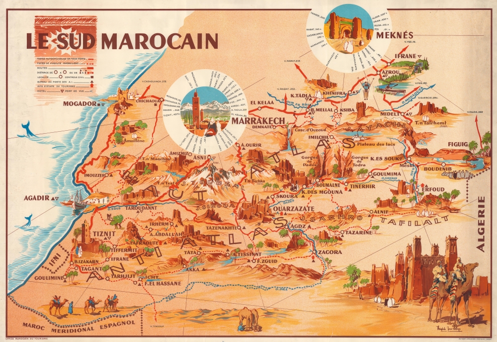
Le Sud Marocain.
sold
This is a c. 1954 Théophile-Jean Delaye pictorial map of southern Morocco. Oases, gorges, mountain peaks, and other wonders lure tourists with the region's enchanting mystique. (more details)
The railroad comes to the Granite State.
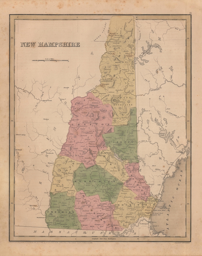
New Hampshire.
sold
- Digital Map Information
- Suitable for large format printing
- Full resolution TIFF file
- ICC color profile embedded
- Delivered instantly via download link
An appealing and scarce 1842 map of New Hampshire, produced by Thomas Bradford and Samuel Goodrich for their Illustrated Atlas. As is prevalent among many maps in Bradford's atlas, the state's nascent rail network is highlighted. (more details)
Pro-colonial Fascist Propaganda, for Kids.

Ricchezze dell'Etiopia.
sold
- Digital Map Information
- Suitable for large format printing
- File Size: 28.84 MB
- File Type: ZIP / TIFF
- ICC color profile embedded
- Delivered instantly via download link
This is a c. 1936 Italian pictorial map of Ethiopia. Although a seemingly innocuous work intended for children filled with depictions of animal life and economic products, this map was likely meant to justify Fascist Italy's unprovoked invasion of Ethiopia, precipitating the Second Italo-Ethiopian War (1935 - 1937). (more details)
Don't Mess with Denmark.
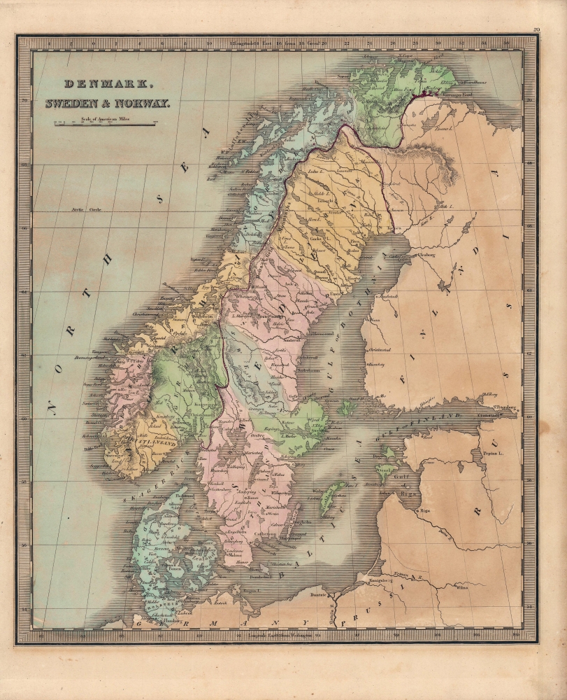
Denmark, Sweden and Norway.
sold
- Digital Map Information
- Suitable for large format printing
- Full resolution TIFF file
- ICC color profile embedded
- Delivered instantly via download link
A lovely map of Scandinavia (Denmark, Sweden, and Norway) published in the 1849 edition of Jeremiah Greenleaf's Universal Atlas. (more details)
News Map of the 'Phoney War.'
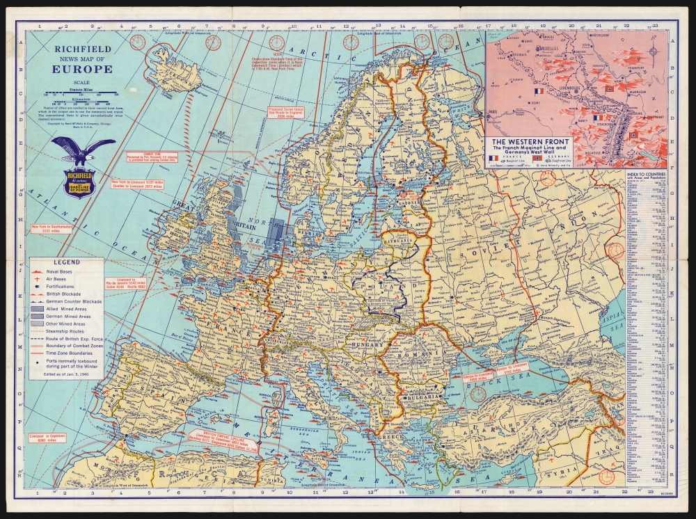
Richfield European News Map. / Richfield News Map of Europe.
sold
- Digital Map Information
- Suitable for large format printing
- Full resolution TIFF file
- ICC color profile embedded
- Delivered instantly via download link
This is a January 1940 Rand McNally Map of Europe, published for the Richfield Oil Corporation as a promotional item, probably for distribution at the company's service stations. It is an information-rich map, presenting the European theater of war to an American audience. Although it was nearly two years before the United States entered the war, the proliferation of such maps as this reveals the intense interest and unease with which Americans perceived the war. (more details)
Covered wagons in the Rockies - on the overland trail.
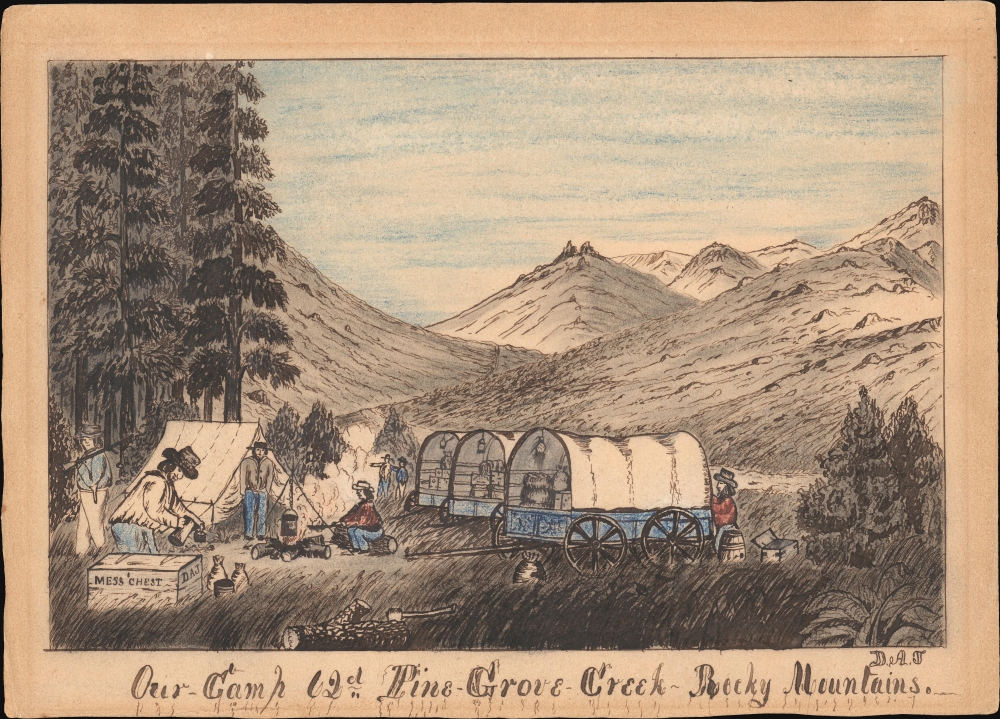
Our-Camp 62d Pine-Grove-Creek Rocky Mountains.
sold
- Digital Map Information
- Suitable for large format printing
- File Size: 86.98 MB
- File Type: ZIP / TIFF
- ICC color profile embedded
- Delivered instantly via download link
An exceptional discovery, this is a Daniel A. Jenks' original 1859 pen-and-ink drawing depicting a camp in the Platte Valley, in the Rocky Mountains of modern-day Wyoming, composed on his overland journey to California. It is part of a series of drawings Jenks composed trail-side covering his Transmississippi travels from 1849 to 1865. This is the only known example of one of Jenks' individual drawings appearing on the market. (more details)
A call for brotherhood against the hated English.
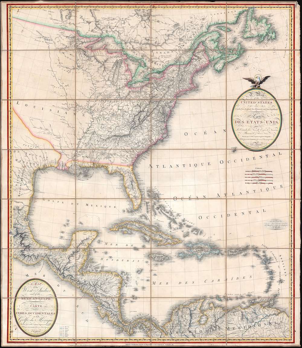
A Map of the United States and Canada, New-Scotland, New-Brunswick and New-Foundland. / Carte des Etats-Unis, avec le Canada, La Nouvelle Ecosse, Le Nouveau Brunswick et Terre-Neuve. / A Map of the West-Indies and of the Mexican-Gulph. / Carte des Indies Occidental et du Golfe du Méxique.
sold
- Digital Map Information
- Suitable for large format printing
- Full resolution TIFF file
- ICC color profile embedded
- Delivered instantly via download link
A lavish, large-scale French map of the United States and West Indies issued in September of 1812 - shortly after the outbreak of the War of 1812 (1812 - 1815). This is one of the few major French cartographic productions not focused on Europe to appear during the Napoleonic Wars (1803 - 1815) and needs to be addressed in this context to be fully understood. With titles both in English and French, it calls for brotherhood and alliance against the hated English. (more details)
'The primary map of this period... influenced the cartography of Canada for the next fifty years.' - Kershaw

Le Canada, ou Nouvelle France...
sold
- Digital Map Information
- Suitable for large format printing
- Full resolution TIFF file
- ICC color profile embedded
- Delivered instantly via download link
This is Nicolas Sanson's 1656 map of Canada, the Northeast, and the Great Lakes, in an attractive, untrimmed example. It ranks among the most influential and important maps of the north part of the Americas to be printed in the 17th century - its depiction of Canada was not superseded until De l'Isle's 1703 Carte du Canada, and it features the finest depiction of the Great Lakes until the 1687 Coronelli-Nolin. It is among the first printed maps to be informed by the reports of French Jesuit explorers, whose exploration of the Great Lakes region after Champlain's initial explorations was stalled by the 1648 escalation of the Beaver Wars (1603 - 1701) with the Iroquois Confederacy. Following the 1653 pause in the war, Jesuit and French fur traders resumed their push west, gradually revealing the form of the Great Lakes. (more details)
Early days of the California Gold Rush.

California Gold Diggers, Mining Operations on the Western shore of the Sacramento River.
sold
- Digital Map Information
- Suitable for large format printing
- Full resolution TIFF file
- ICC color profile embedded
- Delivered instantly via download link
A fascinating c. 1849 early view of the California Gold Rush, prepared by Kellogg and Comstock and printed by Ensign and Thayer. Displaying a portion of the Sacramento River, it reveals the ad hoc and multicultural environment of the Gold Rush. (more details)
A rare painted view of of Detroit, Michigan as it would have appeared in 1818.

Detroit in 1818 after a sketch by Gen. Alex. Macomb.
sold
- Digital Map Information
- Suitable for large format printing
- File Size: 9.07 MB
- File Type: ZIP / TIFF
- ICC color profile embedded
- Delivered instantly via download link
This is a 1931 C. P. Mithoff pictorial painting view and map of Detroit, Michigan, as it appeared in 1818. The view overlooks Detroit from the northwest across the Detroit River. Surrounded by a stockade, Fort Shelby occupies the northernmost portion of the fortified area and is illustrated with several buildings and a flagpole. Numerous streets appear and are identified, including Shelter Street, Woodbridge Street, Griswold Street, Jefferson Avenue, Woodward Avenue, and Randolph Street. Cass Street and Brush Street are outside the stockade, and Jefferson Avenue and Woodward Avenue continue past the stockade. The soldier's burial ground is illustrated along the stockade's northwest wall. Ninety-five locations both inside and outside the stockade are labeled numerically, although unfortunately the corresponding index is not present. (more details)