
The Carolana Grant and British plans to settle the Mississippi.
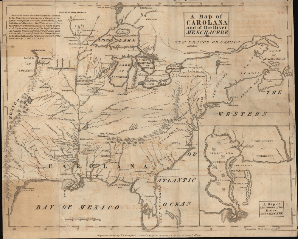
A Map of Carolana and the River Meschacebe.
sold
- Digital Map Information
- Suitable for large format printing
- DPI: 600
- File Size: 418.08 MB
- File Type: ZIP / TIFF
- ICC color profile embedded
- Delivered instantly via download link
An utterly fascinating map by Daniel Coxe illustrating the British colony of Carolana, a little-known period in American history. The map was issued for and accompanies the 1840 edition of Coxe's 1722 book A Description of the English Province of Carolana. It features a mishmash of speculative and wishful cartography intended to support Coxe's grant, as well as suggest opportunities for growth and commerce if his proposition to settle the Mississippi Valley with Englishmen were to be followed. While not a landmark of cartography, the book and map influenced geographical thought regarding the Transmississippi and theories of parallel geography. (more details)
Most sophisticated 19th century map of Molokai.
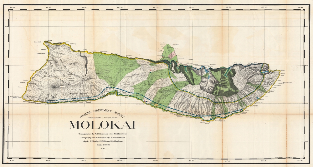
Hawaiian Government Survey. Molokai.
sold
- Digital Map Information
- Suitable for large format printing
- File Size: 154.9 MB
- File Type: ZIP / TIFF
- ICC color profile embedded
- Delivered instantly via download link
This 1897 Christopher Willis map of Molokai is the most sophisticated 19th century mapping of the island. Surveyors from the Hawaiian Government Survey mapped the length and breadth of Molokai and, per Moffat and Fitzpatrick, the map 'represents the final stage in the process of understanding and correctly illustrating the shape of this elongated island between O'ahu and Maui'. (more details)
Pearls and gold.
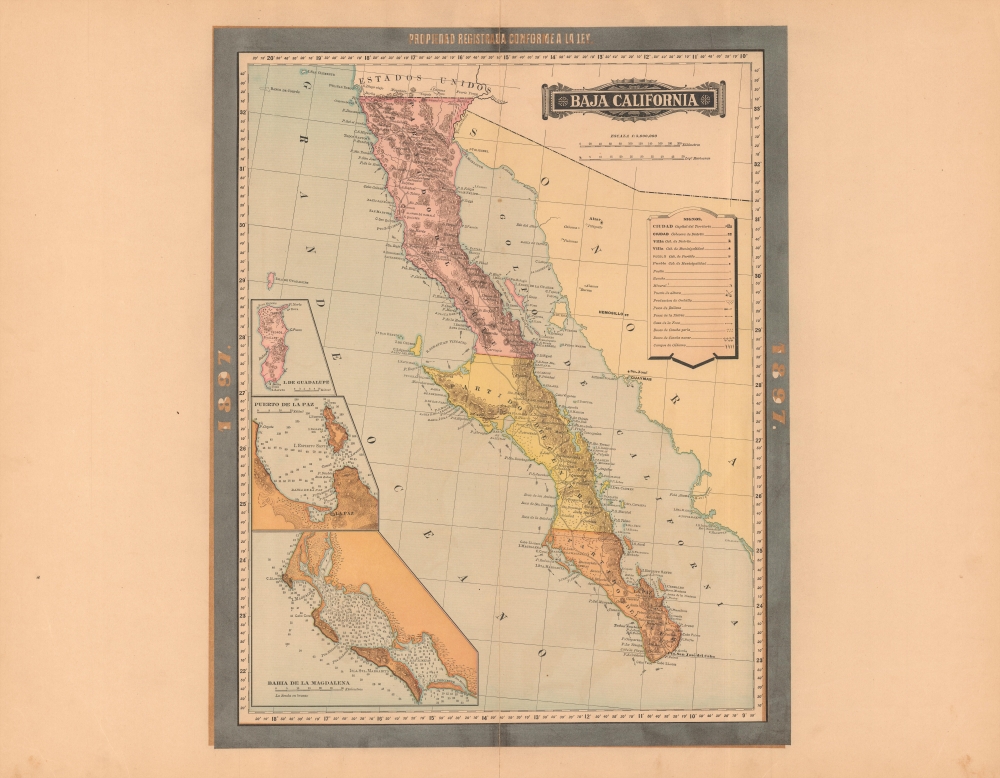
Baja California.
sold
- Digital Map Information
- Suitable for large format printing
- File Size: 59.56 MB
- File Type: ZIP / TIFF
- ICC color profile embedded
- Delivered instantly via download link
A rare 1897 color lithograph map of the Baja California by Antonio García Cubas and Vega. A year after this map was made, Baja became the seat of one of several revolutions against the government of Porfirio Díaz. Also around this time, major gold discoveries in the Santa Clara Valley fueled the economy of northern Baja. (more details)
France's Northern and Southern Footholds in North America.
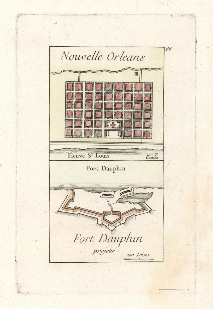
Nouvelle Orleans/ Fort Dauphin projetté.
sold
- Digital Map Information
- Suitable for large format printing
- DPI: 600
- File Size: 4.72 MB
- File Type: ZIP / TIFF
- ICC color profile embedded
- Delivered instantly via download link
This is George Louis le Rouge's scarce 1755 engraving of the French settlement at New Orleans, and the projected Fort Dauphin, on Ile Royale, now Cape Breton Island in Nova Scotia. These two outposts, apparently remote, bookended the territory in the New World for which the French were contending against the British at the time this map was produced and represented important coastal strongpoints for the French efforts to control the interior of North America. (more details)
Marking the New Borders with the Ottoman Empire.
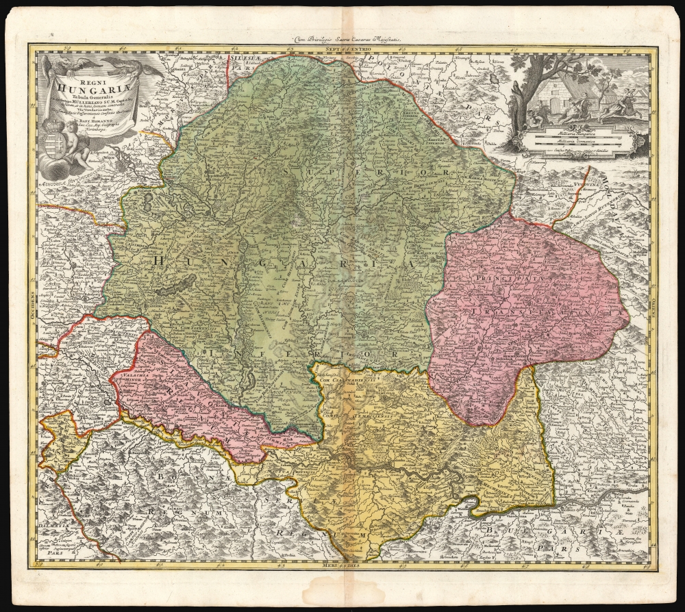
Regni Hungariae tabula generalis ex archetypo Mülleriano SCM capit. et ing.
sold
- Digital Map Information
- Suitable for large format printing
- DPI: 600
- File Size: 73.65 MB
- File Type: ZIP / TIFF
- ICC color profile embedded
- Delivered instantly via download link
This is Johann Baptist Homann's 1724 map of the Kingdom of Hungary, based on the comprehensive 1699 surveys of Johann Christoph Müller. These were undertaken to measure the bounds of Hungary following the Ottoman Empire's surrender at the treaty of Karlowitz. Consequently, this represented the new frontier with the Ottoman Empire following the treaty. (more details)
The United States at the turn of the 20th century.
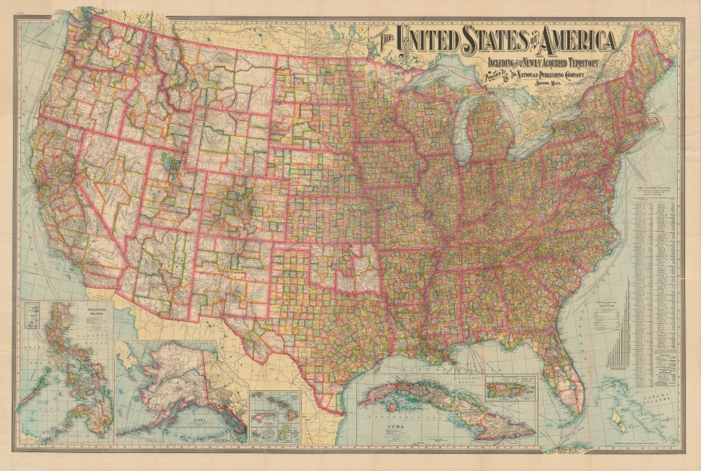
The United States of America Including All Its Newly Acquired Territory.
sold
- Digital Map Information
- Suitable for large format printing
- Full resolution TIFF file
- ICC color profile embedded
- Delivered instantly via download link
This is a first edition 1901 National Publishing Company map of the United States that features a typographically elaborate title. It was issued in the wake of the Spanish-American War and consequently was updated to reflect American occupation of the Philippines. (more details)
The White Mountains including Mount Washington.

White Mountains of New Hampshire.
sold
This is a striking c. 1960 Claude Brusseau bird's-eye view or map of the White Mountains, New Hampshire. Overlooking the mountains from a fictional point high above Lake Winnipesaukee, Mount Washington and the Presidential Range is illustrated to the right while the Franconia Range is on the left. The Mount Washington Cog Railway appears on the left side of Mount Washington where the train makes its way up the mountain (This train formerly operated on Mount Desert Island). Pink dots mark popular activities and sites, including the Cannon Mountain Aerial Tramway, 'The Flume', 'Story Land', 'Santa's Village', and the 'Wildcat Mountain Gondolas'. Several towns, including Littleton, Jefferson, Conway, and Plymouth, are labeled and the region's highways are identified. (more details)
Visit Nantucket!
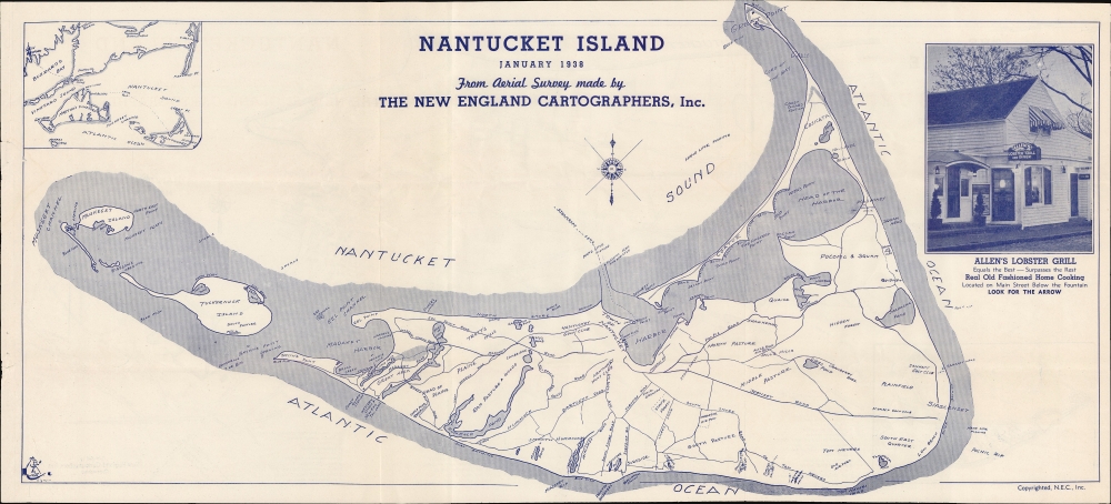
Nantucket Island. January 1938.
sold
- Digital Map Information
- Suitable for large format printing
- Full resolution TIFF file
- ICC color profile embedded
- Delivered instantly via download link
Promoting tourism on the brink of war, this 1938 New England Cartographic map of Nantucket presents prospective visitors with all the information necessary to enjoy their vacation. (more details)
The Orange Bowl and city parks.
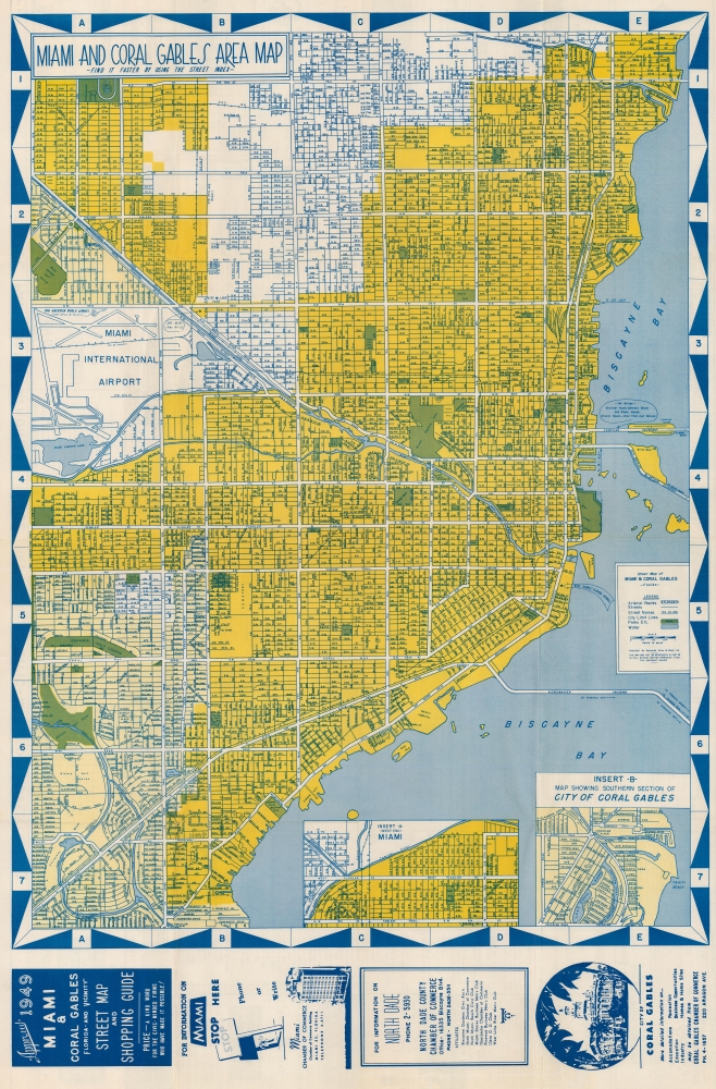
Miami and Coral Gables Area Map.
sold
This is a striking 1949 'Approved Atlas and Maps' city map of Miami and Coral Gables, Florida. Streets are labeled throughout, along with the Florida East Coast Railroad. Golf courses, city parks, and the Orange Bowl are marked. Two insets focus on the West End of Miami and southern Coral Gables. Ads below the bottom border promote the Miami, North Dade County, and Coral Gables Chambers of Commerce. More advertisements and street indexes of Miami and Coral Gables occupy the verso. (more details)
The rise of American resort travel.
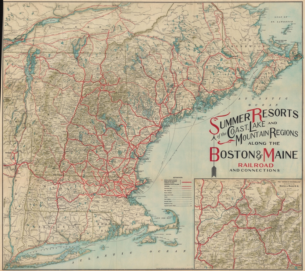
Summer Resorts of the Coast, Lake and Mountain Regions along the Boston and Maine Railroad and Connections.
sold
- Digital Map Information
- Suitable for large format printing
- File Size: 136.38 MB
- File Type: ZIP / TIFF
- ICC color profile embedded
- Delivered instantly via download link
This is a decorative c. 1910 Matthews-Northrup map of New England. The map reflects the influence of railroads on the rise of summer resort travel in the early 20th century. (more details)
Ride the Rails in Canada at the height of the Roaring Twenties.
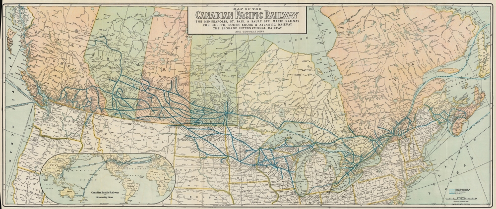
Map of the Canadian Pacific Railway The Minneapolis, St. Paul and Sault Ste. Marie Railway The Duluth, South Shore and Atlantic Railway The Spokane International Railway and Connections.
sold
- Digital Map Information
- Suitable for large format printing
- Full resolution TIFF file
- ICC color profile embedded
- Delivered instantly via download link
Travel across Canada in style at the height of the Roaring Twenties with this 1926 Poole Brothers and Canadian Pacific Railway map. Using eye-catching blue ink, the map highlights the Canadian Pacific Railway's extensive rail network and its connections into the United States. (more details)
Colorful and culturally rich Oaxaca.
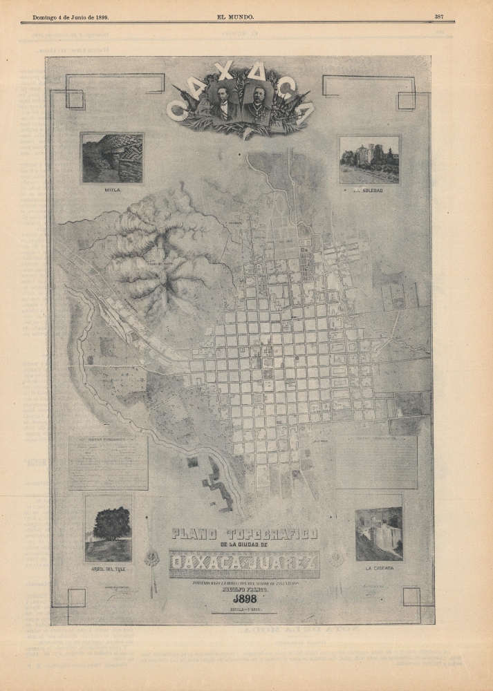
Oaxaca / Plano Topografico de la Ciudad de Oaxaca de Juarez.
sold
- Digital Map Information
- Suitable for large format printing
- Full resolution TIFF file
- ICC color profile embedded
- Delivered instantly via download link
A scarce 1898 city plan or map of Oaxaca (de Juárez) in southern Mexico, published the following year in the periodical El Mundo. It highlights the city's modernization, guided by two of its native sons, Presidents Benito Juárez and Porfirio Díaz. (more details)
Comparing a Viet Cong POW and US Army analysis of Vietnam War battle.

9th U.S. Inf. Div. Contact with 261. B Bn From 111255H to 120600H March 69.
sold
- Digital Map Information
- Suitable for large format printing
- Full resolution TIFF file
- ICC color profile embedded
- Delivered instantly via download link
A one-of-a-kind archive of manuscript maps accompanied by a report by Viet Cong prisoner of war, Pham Xuan Quy, and the U.S. Army 9th Infantry Division Col. Ira Hunt, to illustrate conflicting perspectives on the 1969 Vietnam War Battle of Thanh Phu, fought in the Mekong Delta southwest of Saigon. The collection consists of a large manuscript map, drawn by the Vietnamese Kot Mai, that provides an overview of the battle from start to finish, supplemented by 8 smaller manuscript maps detailing the battle's progression. The archive is significant for being a comparison of both the western and the Viet Cong perspective on the same battle - both of which are preserved in this, the Harris Report. (more details)
Manuscript of the finest map of the Bosporus in the year of the Great Istanbul Earthquake.

[Bosporus / Istanbul].
sold
- Digital Map Information
- Suitable for large format printing
- Full resolution TIFF file
- ICC color profile embedded
- Delivered instantly via download link
A unique 1766 manuscript map of Istanbul and the Bosporus drawn by the Slovenian surveyor and engineer Anton Mrak (1739 - 1801). This map represents the state-of-the-art mapping of the region in the year of the disastrous Great Istanbul Earthquake. The finely executed hand-drawn map is oriented loosely to the north, and covers the entirety of the Bosporus, the walled city of Istanbul, and the surrounding communities. Istanbul itself is mapped with great care, with coverage detailing the Sultanahmet, Eminoönü, Beyazit, and Fatih districts. Locations along the Bosporus are noted with detail. Curiously, the map is in Italian, but the alphanumeric key appearing along the left is in a combination of German and Ottoman Turkish. (more details)
Citrus boomtowns. Modern ghost towns.
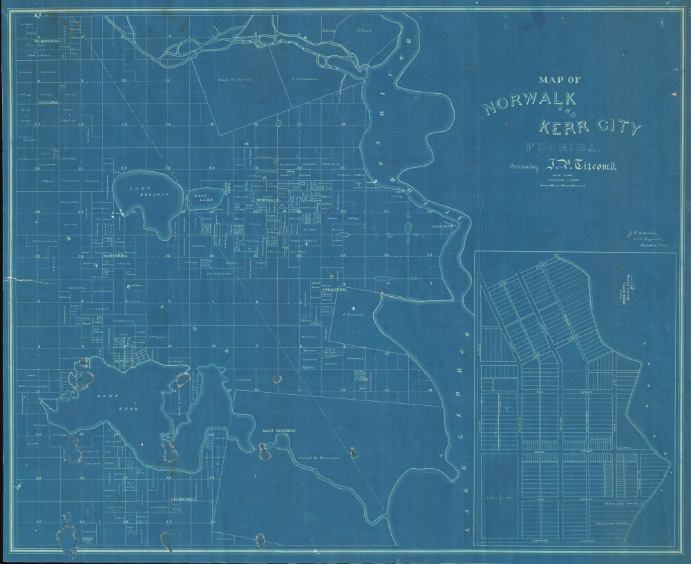
Norwalk and Kerr City Florida.
sold
- Digital Map Information
- Suitable for large format printing
- File Size: 930.67 MB
- File Type: ZIP / TIFF
- ICC color profile embedded
- Delivered instantly via download link
This is a unique c. 1886 cyanotype map of Norwalk and Kerr City, Marion County, north central Florida, by Civil Engineer John Poore Titcomb. The map provides a unique overview of the short-lived Citrus Boom communities west of the St. John's River before the disastrous freezes of 1894-95, highlighting property owners, including the mapmaker, throughout. (more details)
A beautiful example of a plan of Moscow's 'fortress'.

КРЕМЛЁН ГРАД. / Kremlenagrad, Castellum Urbis Moskvæ.
sold
- Digital Map Information
- Suitable for large format printing
- DPI: 300
- File Size: 11.39 MB
- File Type: ZIP / TIFF
- ICC color profile embedded
- Delivered instantly via download link
This is a 1642 Hessel Gerritsz map of the Kremlin, Moscow, Russia. (more details)
A reformed 'Republic of Pirates'.
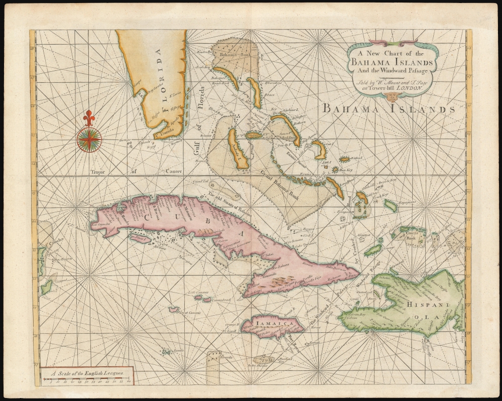
A New Chart of the Bahama Islands and the Windward Passage.
sold
- Digital Map Information
- Suitable for large format printing
- DPI: 600
- File Size: 20.26 MB
- File Type: ZIP / TIFF
- ICC color profile embedded
- Delivered instantly via download link
A rare 1737 map of the Bahamas, Florida, Cuba, and Jamaica issued by Mount and Page for the first edition of The English Pilot: The Fourth Book. The map, based upon a 1698 work by Samuel Thornton, illustrates the Bahamas during the 'Republic of Pirates' era (1698 - 1718), but has here been re-engraved by Mount and Page to capitalize on British interest in this region following increased Anglo-Franco-Spanish tensions surrounding the 1732 the founding of Georgia. (more details)
One of the earliest specific maps of Tennessee.
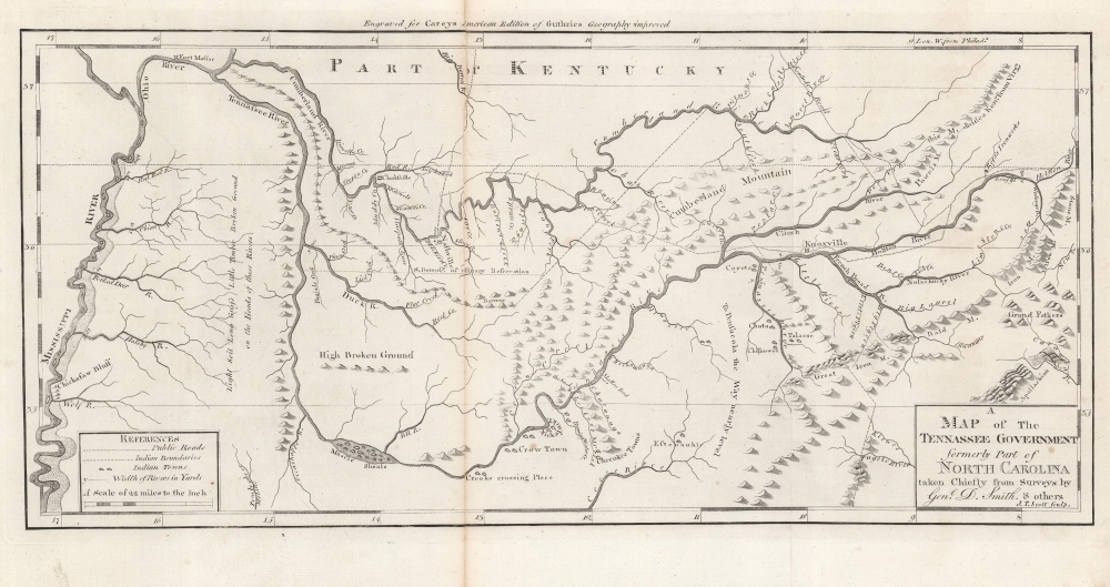
A Map of The Tennassee Government formerly Part of North Carolina taken Chiefly from Surveys by Genl. D. Smith and others.
sold
- Digital Map Information
- Suitable for large format printing
- Full resolution TIFF file
- ICC color profile embedded
- Delivered instantly via download link
This is a c. 1796 Mathew Carey map of the 'Tennessee Government', considered one of the earliest specific maps of Tennessee. (more details)
San Francisco in the early days of the gold rush.

Vue de San Francisco.
$1,200.00
Acquire
- Digital Map Information
- Suitable for large format printing
- DPI: 600
- File Size: 28.07 MB
- File Type: ZIP / TIFF
- ICC color profile embedded
- Delivered instantly via download link
This is a rare c. 1854 Louis Le Breton view of San Francisco in its early days as an American city. It depicts the settlement in the immediate wake of the California Gold Rush, as its population was rapidly increasing, attracting migrants from throughout the United States and the across the world. (more details)
Charting the Gulf Coast of Alabama and Northern Florida.
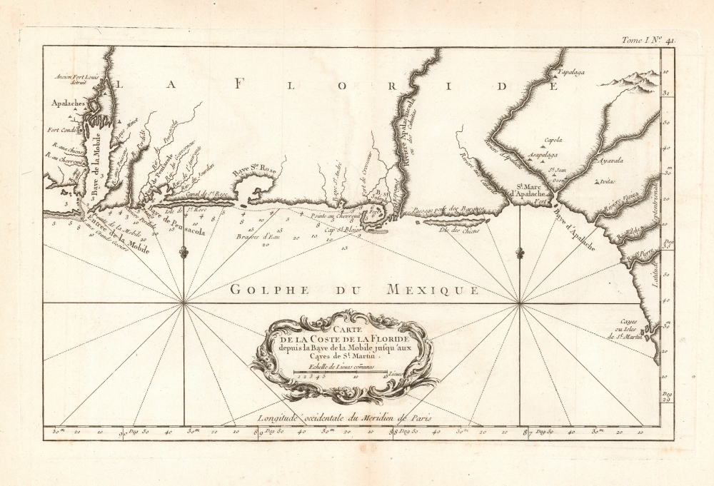
Carte de la Coste de la Floride depuis la Baye de la Mobile jusqu'aux Cayes de St. Martin.
sold
- Digital Map Information
- Suitable for large format printing
- Full resolution TIFF file
- ICC color profile embedded
- Delivered instantly via download link
This is a 1764 Jacques-Nicolas Bellin map of the Gulf Coast of Alabama and Florida, from Mobile Bay to St. Martin's Keys. (more details)