
Highlights the romantic activities of high society individuals in an imaginary France known as the Country of Love.
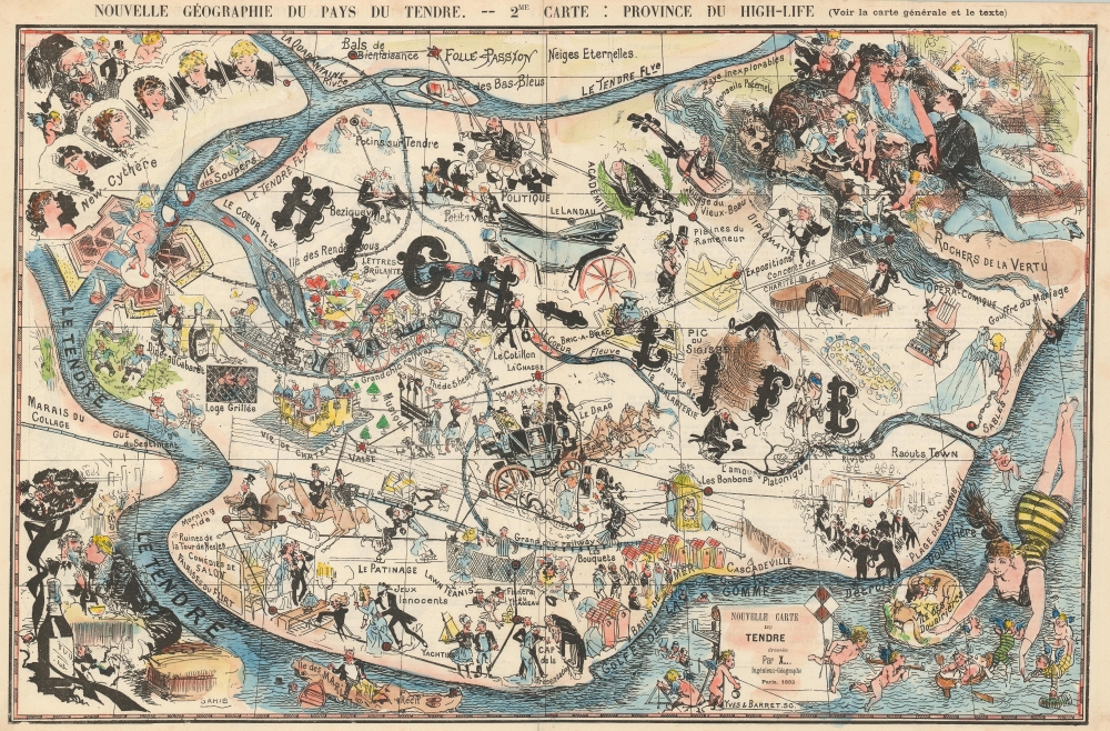
Nouvelle Géographie du Pays du Tendre. -- 2me Carte: Province du High-Life.
sold
- Digital Map Information
- Suitable for large format printing
- Full resolution TIFF file
- ICC color profile embedded
- Delivered instantly via download link
This is an 1881 Sahib pictorial map of the province of High Society or High-Life in the Country of Love or Pays du Tendre, and illustrates possible activities in the love lives of high-class individuals, and high society in general. New-Cythère, the capital of the Pays du Tendre, is situated in the upper left corner and is occupied by no less than six 'Venuses', which references the fact that Cythère, in mythology, is the island where Aphrodite appears after she is born from the sea. The River of Love (Le Tendre Fleuve) practically encircles High-Life which contains numerous different sites. Leisure activities of the upper crust, such as ice skating, lawn tennis, and yachting, are referenced, as are staples of romance in high society, including bouquets of flowers and candy (les bonbons). Music, dancing, 'castle life' (vie de chateau), and dinner at a cabaret are other highlights of life here. The Heart River (Le Coeur Fleuve) nearly cuts the province in two, with a different genre of activities illustrated above the river than below. Above the river, one finds politics, academia, diplomacy, art exhibitions, charity concerts, and the opéra-comique, and below the river 'innocent games' (jeux innocents), swimming, music, and dancing appear. Other sites throughout the map include the 'Rocks of Virtue' (Rochers de la Vertu), the 'River of Platonic Love' (L'amour Platonique Riviere), the Chasm of Marriage (Gouffre du Mariage), and the 'Swamp of Collage (Marais du Collage). Collage is a French slang term which is defined as 'living as husband and wife in an unmarried state'. The whole provides an intriguing commentary on romance in high society. (more details)
The long, brutal war for Florida.
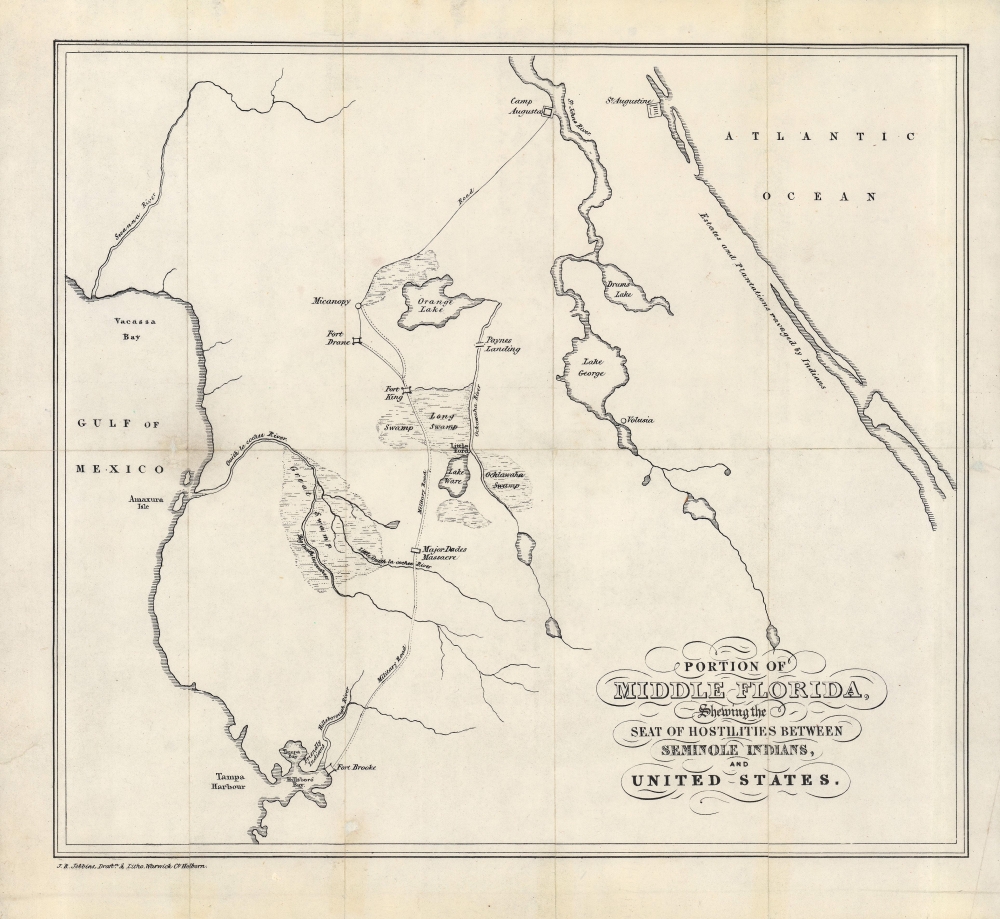
Portion of Middle Florida, Shewing the Seat of Hostilities between Seminole Indians, and United States.
sold
- Digital Map Information
- Suitable for large format printing
- Full resolution TIFF file
- ICC color profile embedded
- Delivered instantly via download link
A rare 1839 map of central Florida, produced during the Second Seminole War (1835 - 1842), by John Richard Jobbins for Frederick Marryat's A Diary in America, with Remarks on Its Institutions. (more details)
Created and owned by the Office of Strategic Services - the predecessor of the CIA.
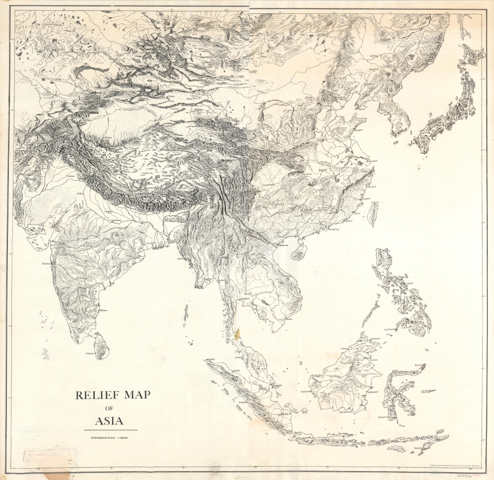
Relief Map of Asia.
$600.00
Acquire
- Digital Map Information
- Suitable for large format printing
- File Size: 71.57 MB
- File Type: ZIP / TIFF
- ICC color profile embedded
- Delivered instantly via download link
This is a 1942 Office of Strategic Services Map Information Section skeleton map of Asia and bears Office of Strategic Services catalog stamps in two places. (more details)
Different soil in and around Jacksonville.

Soil Map. Florida. Jacksonville Sheet.
sold
- Digital Map Information
- Suitable for large format printing
- File Size: 58 MB
- File Type: ZIP / TIFF
- ICC color profile embedded
- Delivered instantly via download link
This is a 1910 U.S. Bureau of Soils soil map of Jacksonville, Florida, and environs. Various colors highlight different types of soil throughout the region. (more details)
New York City on the Eve of World War II.
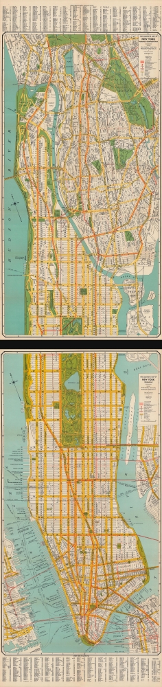
The complete map of New York (Manhattan) / The complete map of New York and Southwestern Bronx.
sold
- Digital Map Information
- Suitable for large format printing
- Full resolution TIFF file
- ICC color profile embedded
- Delivered instantly via download link
A rare, large-format two-sheet 1939 folding map of Manhattan and the southern Bronx issued by the Geographia Map Company. Although falling squarely within the 'age of anxiety' defined by the Great Depression and geopolitical tensions, the map also highlights the great advances made in the city's urban planning and transportation infrastructure in the preceding years. It also coincides with the 1939 - 1940 New York World's Fair, an expensive and well-promoted event that was meant to lift spirits and the economy. (more details)
Only known example. The 1911 burning of Hankow and reconstruction plans.
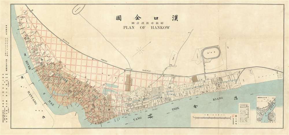
漢囗全圖 / Complete Map of Hankou. / 附新市街設計圖 / Attached Map of New City Street Design.
sold
- Digital Map Information
- Suitable for large format printing
- File Size: 26.55 MB
- File Type: ZIP / TIFF
- ICC color profile embedded
- Delivered instantly via download link
This is a rare 1912 Chinese-English bilingual map of Hankow (Hankou), part of modern Wuhan, China. The map was issued by the English-language Hankou based newspaper, Hankow Daily News, shortly following the 1911 burning of Hankou by Qing loyalist forces during the Xinhai Revolution (October 18 - December 1, 1911). Oriented to the northwest, the map covers from the conjunction of the Han and Yangtze Rivers northward to the tracks of the Hankow-Peking Railway or Jinghan Railway (京漢鐵路). The map labels the foreign concessions established to the east of the older Chinese city of Hankou, among them British, Russian, French, German, and Japanese. The lands to the west of the concessions are overprinted with a grand grid structure in red - reflecting plans to rebuild the Chinese part of Hankou after its total immolation one year earlier. (more details)
Describing the moon.

Figura Pro Nomenclatura, Et Libratione Lunari Nec Homines Lunam incolunt. Nec Anime in Lunam migrant.
sold
- Digital Map Information
- Suitable for large format printing
- Full resolution TIFF file
- ICC color profile embedded
- Delivered instantly via download link
An important work in the development of lunar geography (selenography) and astronomy more broadly, this 1665 map of the near side of the moon was drawn by Francesco Maria Grimaldi and appeared in Giovanni Battista Riccioli's work Astronomia Reformata. Building on his paradigm-setting 1651 work Almagestum Novum, Riccioli used the Astronomia Reformata to correct errors, summarize findings, and include updated information. (more details)
The Mosquito Kingdom question.

Map of Central America 1851.
sold
- Digital Map Information
- Suitable for large format printing
- DPI: 600
- File Size: 25.59 MB
- File Type: ZIP / TIFF
- ICC color profile embedded
- Delivered instantly via download link
A rare map easily dismissed but of great significance, this is J. H. Coton's 1851 separate-issue map of Central America illustrating the Mosquito Coast / Miskito Kingdom conflict associated with the development of an interoceanic canal. (more details)
One of the first trigonometric charts of Puerto Rico.
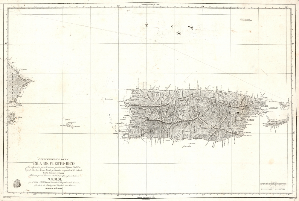
Carta Esferica De La Isla De Puerto-Rico y las adyacentes, que a la misma pertenecen Vicques, Culebra, Cajades Muertos, Mona, Monito y Desecho, con partie de las islas de Santa Domino y Saona…
sold
- Digital Map Information
- Suitable for large format printing
- DPI: 600
- File Size: 37.27 MB
- File Type: ZIP / TIFF
- ICC color profile embedded
- Delivered instantly via download link
A stunning 1840 first edition nautical map of Puerto Rico (Porto Rico) by Miguel Moreno of the Spanish Depósito Hidrográfico. It is one of the earliest trigonometric charts of the island. (more details)
Roads and Shipping in the Holy Roman Empire.
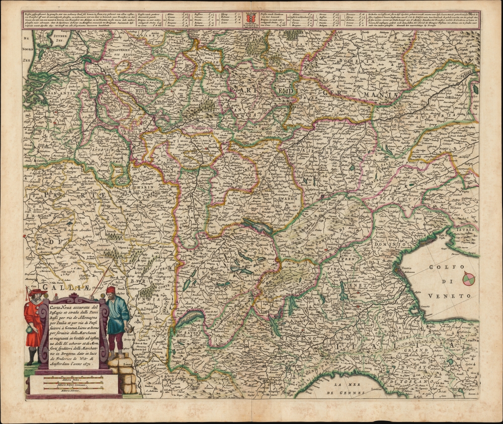
Carta Noua accurata del Passagio et strada dalli Paesi Bassi per via de Allemagna per Italia et per via di Paesi svizeri à Geneva, Lione et Roma per servizio delli Marchanti et viagianti in Genāle ad instanza delli Ss. scherer et sdi Momforti speditori delli Marchantie in Bregens. Dato in luce da Frederico de Wit di Amsterdam l'anno 1671.
sold
- Digital Map Information
- Suitable for large format printing
- DPI: 600
- File Size: 57.46 MB
- File Type: ZIP / TIFF
- ICC color profile embedded
- Delivered instantly via download link
This is a scarce road map engraved by Cornelis Danckerts in 1651, embellished and completed by Frederic De Wit for its most attractive edition, printed in 1671. It illustrates the land routes throughout the Holy Roman Empire connecting the Netherlands, France, Germany, Italy, Switzerland, Austria and Bohemia. It is a remarkable instance of a map commissioned by a specific mercantile concern, in this case the shippers Scherer and Montefort of Bregenz, on the Boden Zee in modern-day Austria. Maps depicting roads, particularly at this level of detail and at this scale, are unusual for this period; this one provides a unique glimpse on the business of transporting goods, and of travel in general, in the seventeenth century. (more details)
Setting the stage for thirty years of war.
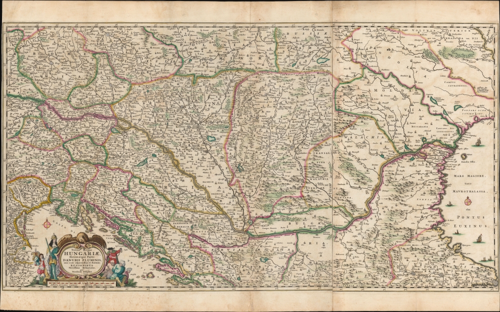
Totius Regni Hungariae, Maximaeque Partis Danubii Fluminis, una cum adjacentibus et finitimis Regionibus Novissima Delineatio, per Nicolaum Visscher.
sold
- Digital Map Information
- Suitable for large format printing
- DPI: 600
- File Size: 95.75 MB
- File Type: ZIP / TIFF
- ICC color profile embedded
- Delivered instantly via download link
This is a beautiful, contemporary-color example of Nicolas Visscher I's 1658 map of the course of the Danube, extending from Vienna to the Black Sea. The map encompasses much of what would soon become the seat of war between Christian European powers and the Turkish Empire. (more details)
Only a few years before the Japanese invasion.
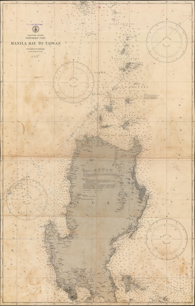
Philippine Islands. Northern Part. Manila Bay to Taiwan.
sold
- Digital Map Information
- Suitable for large format printing
- Full resolution TIFF file
- ICC color profile embedded
- Delivered instantly via download link
This is a 1938 U.S. Coast and Geodetic Survey nautical map of Luzon, the Philippines. It represents one of the best nautical charts of Luzon predating World War II (1939 - 1945). (more details)
Exploring Mt. Kilimanjaro.
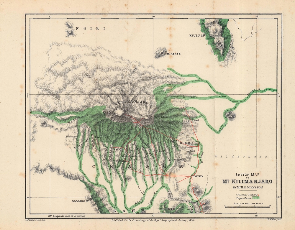
Sketch Map of Mt. Kilima-Njaro.
sold
- Digital Map Information
- Suitable for large format printing
- File Size: 12.08 MB
- File Type: ZIP / TIFF
- ICC color profile embedded
- Delivered instantly via download link
This is an 1884 Henry Johnston map of Mount Kilimanjaro, Tanzania. It is one of the earliest obtainable specific maps of Kilimanjaro. The Johnston expedition was set against the colonial backdrop of conflict between German and British claims in East Africa. (more details)
Cosmography Explained.
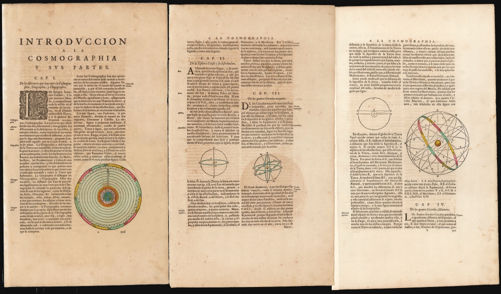
Introduccion a la Cosmographia y sus Partes (Chapters 1-4).
sold
- Digital Map Information
- Suitable for large format printing
- Full resolution TIFF file
- ICC color profile embedded
- Delivered instantly via download link
These are the first four chapters of the introduction to Cosmography published in the first volume of Joan Blaeu's 1659 Spanish-text Nuevo Atlas. It includes elegantly-engraved charts illustrating the text's descriptions of important concepts, the most beautiful of which are the two planispheres depicting the Ptolemaic, geocentric system and the Copernican solar system. These represent the only separate celestial charts to appear in Blaeu atlases. (more details)
Starting off on the wrong foot.

Le Capitaine Wallis est attaqué dans le Dauphin par les Otahitiens.
sold
- Digital Map Information
- Suitable for large format printing
- Full resolution TIFF file
- ICC color profile embedded
- Delivered instantly via download link
This is Robert Benard's view of the ship HMS Dolphin under attack off Tahiti, which appeared in the 1774 French translation of the book, An Account of the Voyages…, published the previous year by John Hawkesworth. Wallis was likely the first European to discover Tahiti (Spanish and Portuguese mariners might have reached it earlier) and, despite this incident, came to regard the island and those around it highly. (more details)
The largest-scale pioneering aerial map of New York City.

Hamilton Aerial Map Manhattan.
sold
- Digital Map Information
- Suitable for large format printing
- File Size: 164.67 MB
- File Type: ZIP / TIFF
- ICC color profile embedded
- Delivered instantly via download link
This is the rare William L. Hamilton 1927 aerial map of Manhattan, New York City. It is one of the earliest and certainly the largest aerial map of New York produced in the pioneering days of aerial cartography. The map was issued as a loose-leaf folio atlas of thirty-one sheets. (more details)
'Next Year, In Jerusalem!'
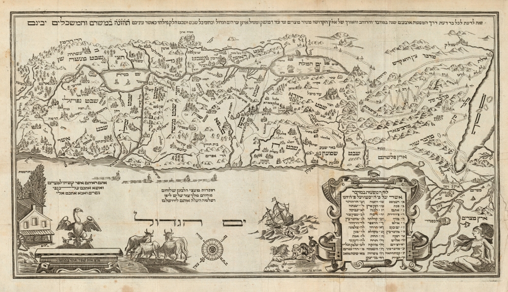
Seder Haggadah Shel Pasah.
sold
- Digital Map Information
- Suitable for large format printing
- DPI: 600
- File Size: 30.74 MB
- File Type: ZIP / TIFF
- ICC color profile embedded
- Delivered instantly via download link
This is Abraham bar Yaaqov's 1695 map of the Holy Land - the first acquirable such map in Hebrew. It stands distinct from most other Holy Land maps produced in the 17th century, not only in its Hebrew text, but also the map's iconography which adheres to themes from the Torah, applying specifically to the Passover story. It was printed to accompany the famous Amsterdam Haggadah, the most lavishly illustrated printed Haggadah to date. Both thematically and aesthetically, it would set the standard for printed Haggadot to follow. (more details)
The 'Barefoot Fathers' on the Malabar Coast.
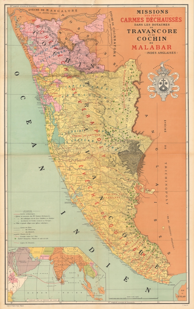
Carte des missions des pères Carmes Déchaussés dans les Royames de Travancore et de Cochin au Malabar (Indes Anglaises).
sold
- Digital Map Information
- Suitable for large format printing
- File Size: 221.56 MB
- File Type: ZIP / TIFF
- ICC color profile embedded
- Delivered instantly via download link
An impressive 1892 chromolithograph map of the Malabar Coast, including Travancore and Cochin, India, illustrating the missions of the Discalced 'barefoot' Carmelite Fathers. The map was likely issued to celebrate the founding of the Thiruvananthapuram Monastery. (more details)
The thriving capital of Tokugawa Japan.

[Edo - Tokyo].
sold
- Digital Map Information
- Suitable for large format printing
- Full resolution TIFF file
- ICC color profile embedded
- Delivered instantly via download link
This is a large, colorful, and highly detailed 1854 Takashiba San'yū map of Edo, now Tokyo, the capital of the Tokugawa Shogunate. It depicts the sprawling urban center of Edo and its environs on the eve of dramatic changes that would unsettle Japanese society and lead to the downfall of the Tokugawa. (more details)
Celebrates George Washington and details his estate at Mount Vernon.
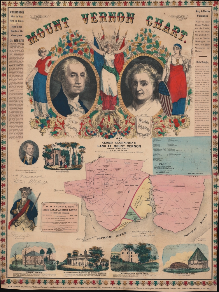
Mount Vernon Chart.
sold
- Digital Map Information
- Suitable for large format printing
- File Size: 124.39 MB
- File Type: ZIP / TIFF
- ICC color profile embedded
- Delivered instantly via download link
This is H. H. Lloyd's broadside map of Mount Vernon, Virginia, George Washington's home, published only months before the outbreak of the American Civil War (1861 - 1865). Created as a patriotic celebration of the 'Father of his Country', the broadside includes portraits of Martha and George Washington alongside maps of Washington's estate and the surrounding county. (more details)