
Changing borders in southeastern Europe.
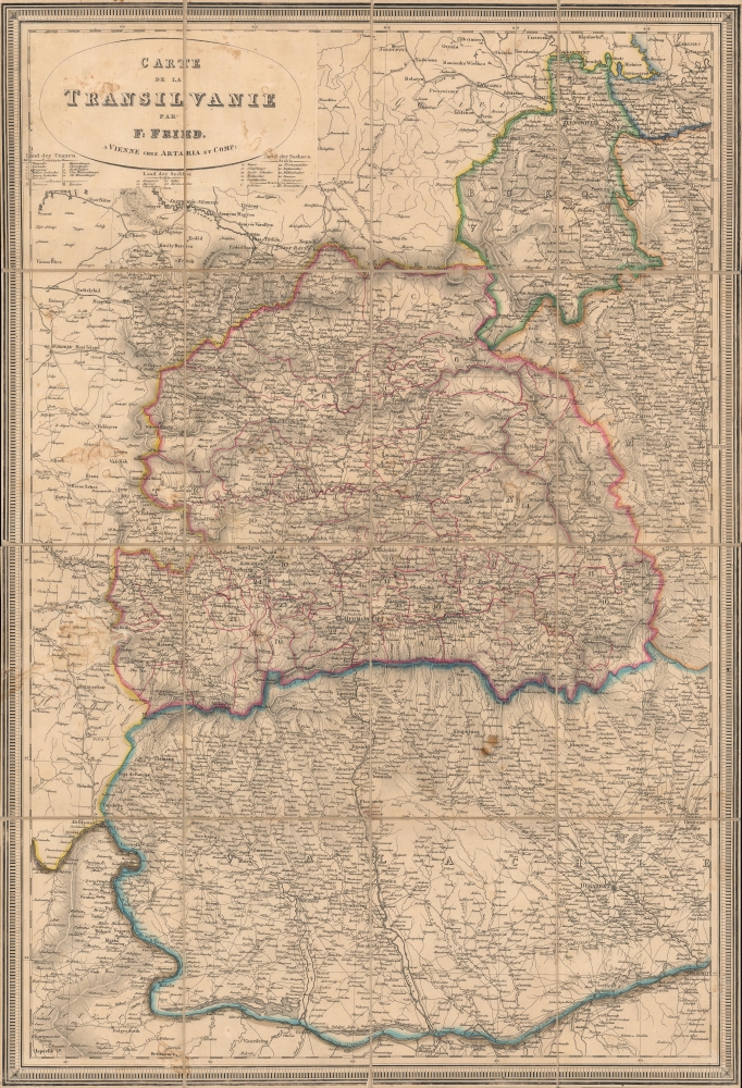
Carte de la Transilvanie.
sold
- Digital Map Information
- Suitable for large format printing
- Full resolution TIFF file
- ICC color profile embedded
- Delivered instantly via download link
A finely engraved c. 1830 folding map of Wallachia, Transylvania, and surrounding regions, largely correspondent with the present-day country of Romania. It was produced by F. Fried, a Vienna-based cartographer about whom little is known. (more details)
The growth of an international capital.
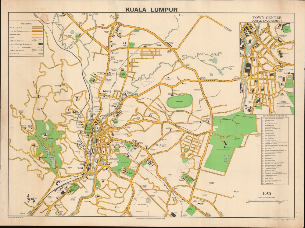
Kuala Lumpur.
sold
- Digital Map Information
- Suitable for large format printing
- File Size: 1352.77 MB
- File Type: ZIP / TIFF
- ICC color profile embedded
- Delivered instantly via download link
This is a large-scale 1950 map of Kuala Lumpur produced by the Survey Department of the Federation of Malaya. It showcases the city as Malaya (Malaysia) transitioned towards independence, with Kuala Lumpur as its capital. It showcase a multi-ethnic, multidenominational city as reflected in the buildings: Confucian, Malay, and Islamic schools; Masonic, Chinese, and Malay Assembly Halls; and houses of worship for Christians, Muslims, Sikhs, and more. (more details)
Texas when it declared independence from Mexico.
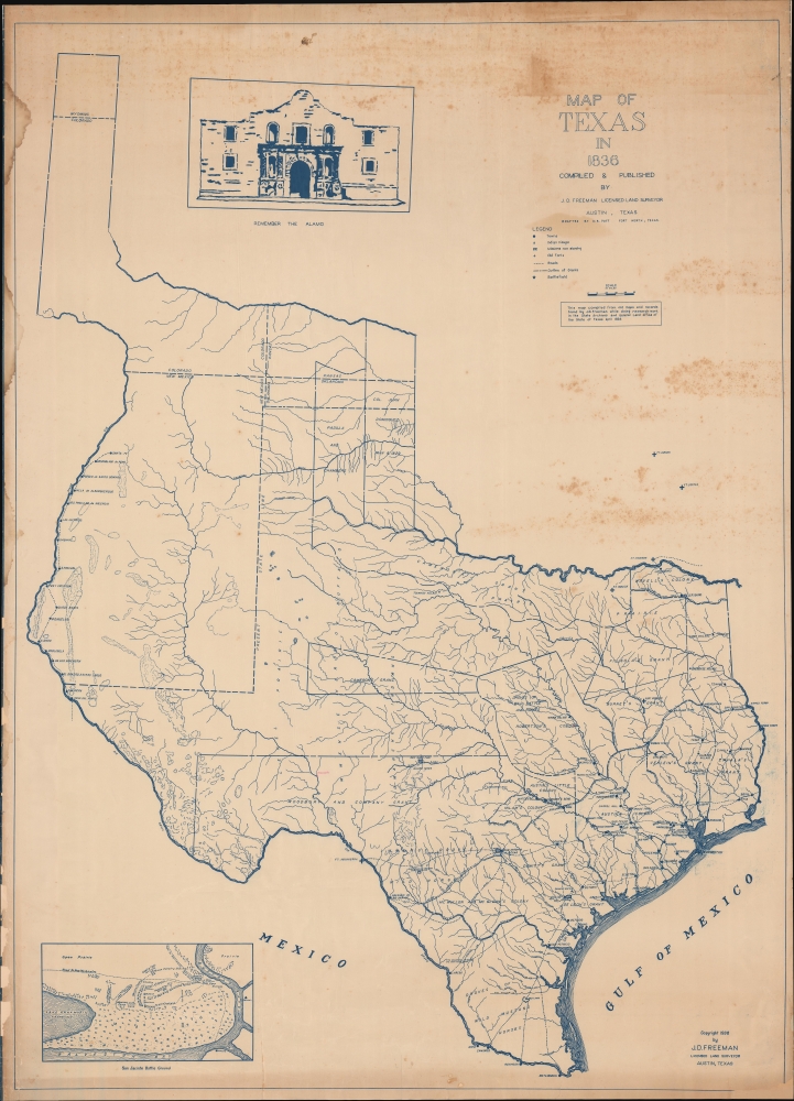
Map of Texas in 1836.
sold
- Digital Map Information
- Suitable for large format printing
- File Size: 93.61 MB
- File Type: ZIP / TIFF
- ICC color profile embedded
- Delivered instantly via download link
This is a rare diaziotype map of Texas as it appeared in 1836, when Texas declared its independence. The map was issued in 1938, the result of meticulous research in the Texas State Archives and General Land Office by John D. Freeman, surveyor. (more details)
Identifies the Sea of Korea.
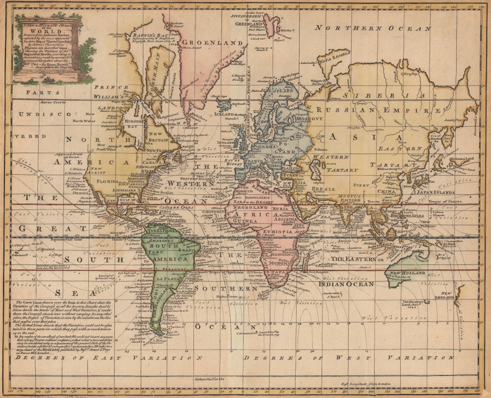
A New and Accurate Chart of the World.
sold
- Digital Map Information
- Suitable for large format printing
- DPI: 600
- File Size: 28.23 MB
- File Type: ZIP / TIFF
- ICC color profile embedded
- Delivered instantly via download link
This is a 1747 Emanuel Bowen map of the world. This map presents the world on Mercator's projection predating the landmark voyages of Cook, Vancouver, Wilkes, and others. The map offers limited inland detail, but major cities, geographical landmarks, and regions are noted. In the tropics, ocean currents are identified, and continents are color coded. The lines of magnetic declination are illustrated and a note on the 'variation of the compass' appears in the lower left. (more details)
American college football.

Albert Richard Football Map: Pigskin Panorama News.
sold
- Digital Map Information
- Suitable for large format printing
- Full resolution TIFF file
- ICC color profile embedded
- Delivered instantly via download link
This is a 1939 F. E. Cheeseman pictorial map of U.S. college football. The map is part of a series that appeared as football was increasingly becoming a national pastime. It an era before television, most followed their teams through radio and newspapers. The 'Pigskin Panorama' was a way for sport fans to connect not only with the colors and mascots of their favorite teams, but also to visualize the increasingly complex network of regional and national leagues. The series was updated annually from roughly 1939 to 1950. (more details)
'Domino theory.'

The Big Bite.
sold
A c. 1954 original manuscript political cartoon by George White for the Tampa Morning Tribune. It highlights the influence of 'Red China' in Southeast Asia, most noticeably in Vietnam, from which Communist influence spread throughout the region. (more details)
Before the Great Galveston Hurricane.

Coast Chart No. 105 Galveston Bay to Oyster Bay Texas.
sold
- Digital Map Information
- Suitable for large format printing
- File Size: 62.38 MB
- File Type: ZIP / TIFF
- ICC color profile embedded
- Delivered instantly via download link
This is the 1870 edition of the U.S. Coast Survey nautical map of Galveston Bay, Texas. When this map was made Galveston was one of the most important American ports on the Gulf of Mexico. In just thirty years, it would be destroyed by the 1900 Great Galveston Hurricane, considered the deadliest natural disaster in United States history and the third-deadliest Atlantic hurricane. (more details)
An award-winning map!
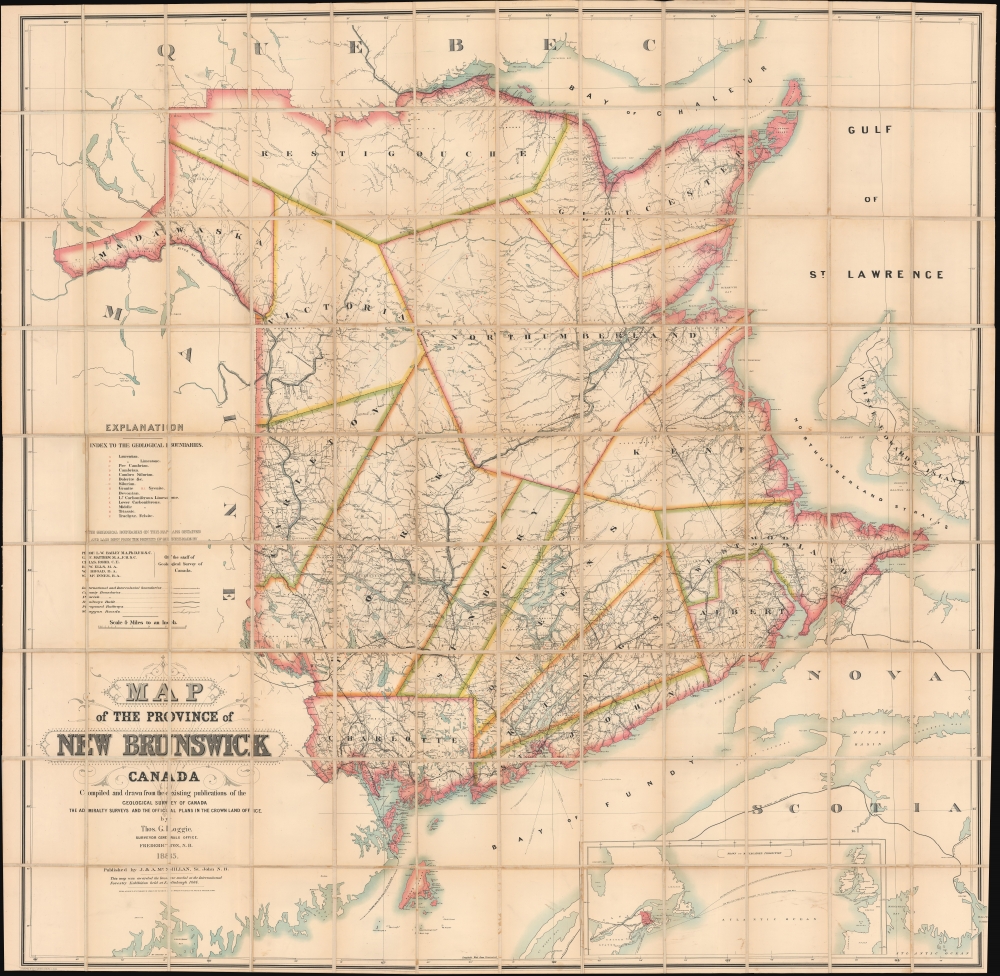
Map of the Province of New Brunswick, Canada.
sold
- Digital Map Information
- Suitable for large format printing
- File Size: 504.46 MB
- File Type: ZIP / TIFF
- ICC color profile embedded
- Delivered instantly via download link
A monumental piece, this is the 1885 Thomas Loggie wall map of New Brunswick, Canada. Awarded the bronze medal at the First International Forestry Exhibition (a world's fair held in Edinburgh in 1884), detail abounds with cities, towns, and villages labeled throughout the province. Several railways crisscross New Brunswick, including the Northern and Western Railway, the New Brunswick Railway, the Caraquette Railway, and the Intercolonial Railway. Major roads appear as well. Rivers, lakes, and other physical features are illustrated. Pale blue dotted and dashed lines labeled alphabetically delineate geological boundaries and correspond with an index along the left side above the title. (more details)
New perspective on East Asia.
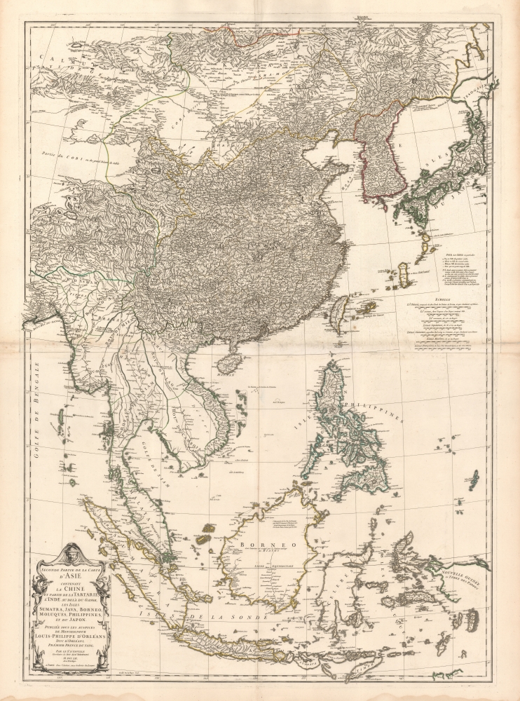
Seconde partie de la Carte d'Asie contenant La Chine et Partie de la Tartarie, L'Inde au de la du Gange, les Isles Sumatra, Java, Borneo, Moluques, Philippines, et du Japon.
sold
- Digital Map Information
- Suitable for large format printing
- DPI: 600
- File Size: 160.89 MB
- File Type: ZIP / TIFF
- ICC color profile embedded
- Delivered instantly via download link
A beautiful example of French cartographer J. B. B. d'Anville's 1752 map of the East Indies, China, Korea, and Japan. This influential map redefined European perceptions of East Asia and remained the dominant cartographic assessment of the region until the early 19th century. (more details)
The Holy City for the Armchair Pilgrim.
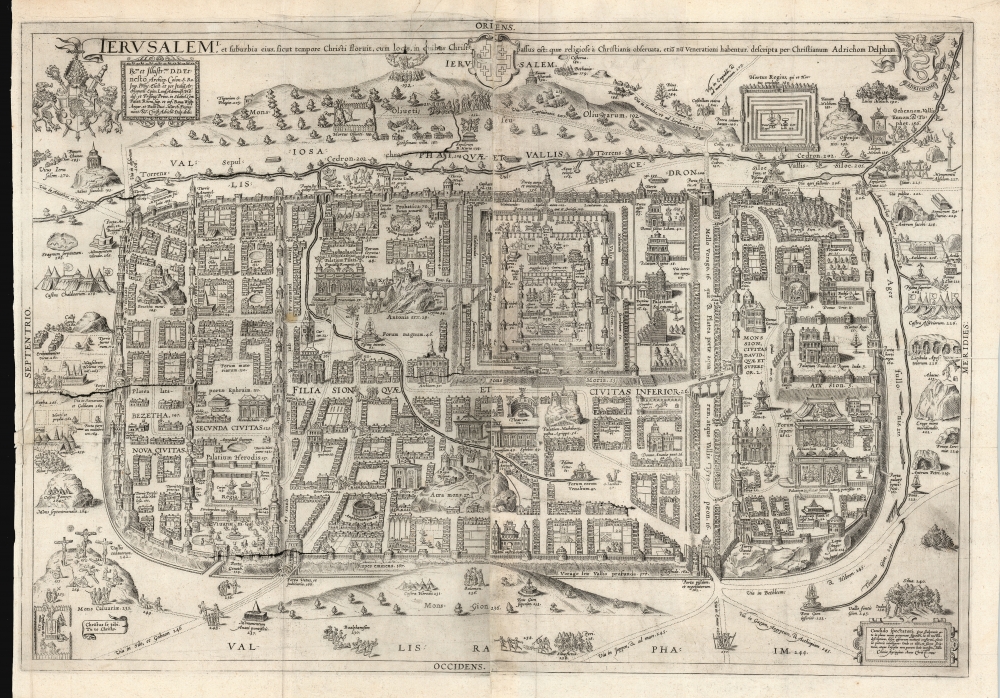
Ierusalem, et suburbia eius, sicut tempore Christi floruit ... descripta per Christianum Adrichom Delphum.
sold
- Digital Map Information
- Suitable for large format printing
- DPI: 600
- File Size: 108.93 MB
- File Type: ZIP / TIFF
- ICC color profile embedded
- Delivered instantly via download link
This is an elegant example of Christian van Adrichem's influential 1584 plan of the Biblical Jerusalem. It was included in his 1584 Theatrum Terrae Sanctae, a Biblical atlas intended to provide visual structure to Catholic catechism - not only to inform the religious scholar, but to provide the basis for a sort of 'virtual pilgrimage' to the holy sites of Jerusalem when actual travel there was, for most, utterly impossible. (more details)
Monumental map of Boston.
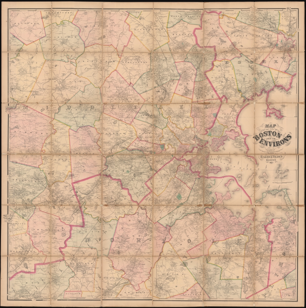
Map of the City of Boston and its Environs.
sold
- Digital Map Information
- Suitable for large format printing
- Full resolution TIFF file
- ICC color profile embedded
- Delivered instantly via download link
This is an 1867 Henry Francis Walling and Ormando W. Gray map of Boston, Massachusetts, and environs. Boston appears to the right of center, with East Boston and South Boston both labeled. Boston Common and the Public Garden are labeled in Boston, along with streets, wharves, railroad lines, and a handful of buildings. Outside Boston, the map depicts from Wilmington, Danvers, and North Beverly south to West Medway and Walpole Centre and from Ashland Center east to Marblehead, Salem, and Beverly. Hundreds (if not thousands) of private residences are identified by the owner's name throughout, along with banks, schools, railroad stations, churches, and cemeteries. Roads, railroads, hills, lakes, rivers, and other physical features are noted. (more details)
Tolkienana!

Middle Earth Inspired by J.R.R. Tolkien.
sold
This is an extremely rare 1976 map of J. R. R. Tolkien's Middle Earth drawn by Larry Jannoff and Nicklas Aquila Jr. The map can be considered 'Fan Art' as it was neither commissioned by or drawn in conjunction with Tolkien or his publishers. Nonetheless, it followed closely on the Ballentine paperback release of the Lord of the Rings and is considered one of the better and rarer bits of Tolkienana. (more details)
One of the earliest Acquirable Post-Magellan Maps of Southeast Asia.
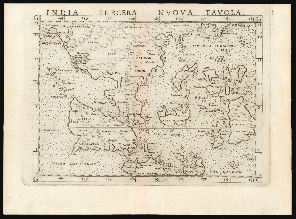
India Tercera Nuova Tavola.
sold
- Digital Map Information
- Suitable for large format printing
- Full resolution TIFF file
- ICC color profile embedded
- Delivered instantly via download link
This is a superb example of the first state of Girolamo Ruscelli's 1561 map of the East Indies and Southeast Asia. It is among the earliest maps of Southeast Asia. Although based on Giacomo Gastaldi's 1548 map of the same title, it is roughly twice the size, and overall, a superior engraving. This was the third of the modern regional Asia maps of this edition of Ptolemy, hence 'Tercera'. (more details)
Social Realism and Zionism.

Second Year of the State of Israel. / שנת שתיים למדינת ישראל
sold
- Digital Map Information
- Suitable for large format printing
- File Size: 29.11 MB
- File Type: ZIP / TIFF
- ICC color profile embedded
- Delivered instantly via download link
A rare and striking 1950 Joseph Szapiro (Shapiro) Zionist map of Israel in Hebrew, with striking Social Realist imagery, celebrating the second anniversary of Israel's 1948 founding. The map depicts the region from the Mediterranean Sea to Jordan (Transjordan) and Syria and from Lebanon to Egypt and the Gulf of Eilat (Gulf of Aqaba). Highly detailed, cities, towns, and villages are labeled throughout, with Jerusalem and Tel Aviv given prominence. (more details)
1871 Reissue of a seminal 1841 map.

Map of the Oregon Territory by the U.S. Ex. Ex.
sold
- Digital Map Information
- Suitable for large format printing
- File Size: 113.73 MB
- File Type: ZIP / TIFF
- ICC color profile embedded
- Delivered instantly via download link
This is the 1871 U.S.H.O. reissue of Commodore Wilkes' 1841 U.S. exploring expedition map of Oregon Territory, the finest and most important map of Oregon of the 19th century. The reissue was prepared from the original copper plate and is on higher quality paper than the original 1841 report issue. (more details)
Hit the Strip!
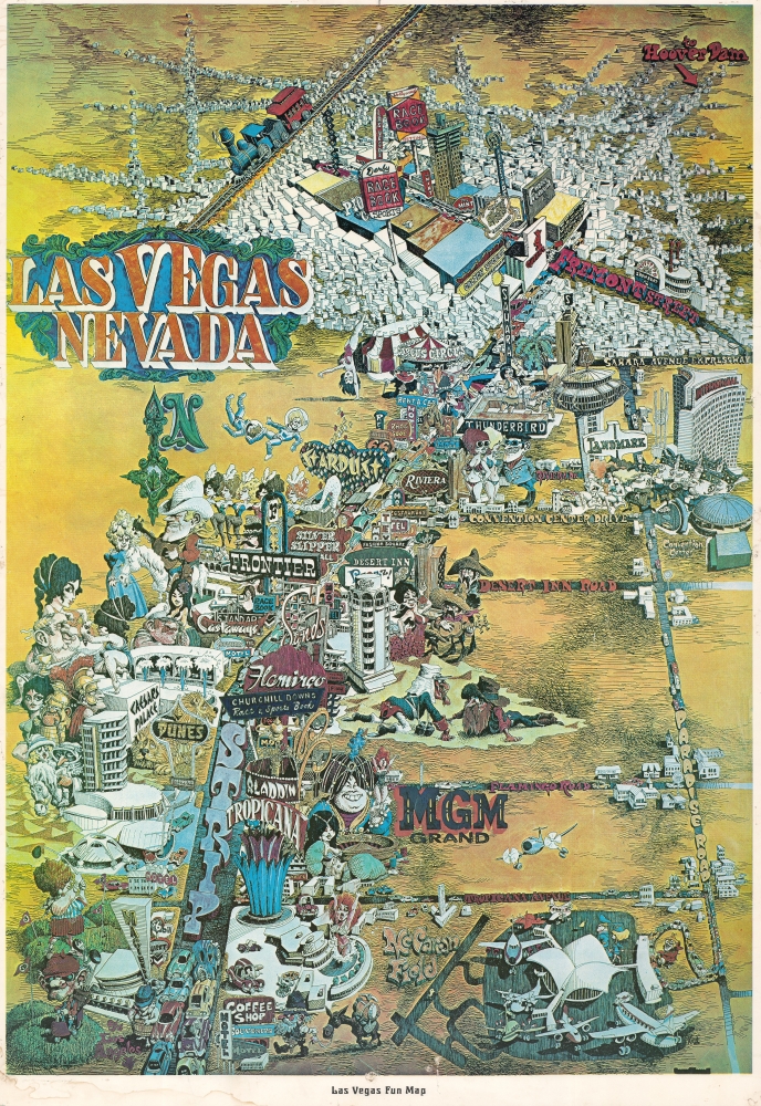
Las Vegas Fun Map.
sold
A dramatic pictorial view of Las Vegas issued by 'King' in 1960. The view looks north on Las Vegas, following South Las Vegas Blvd. (the Strip) towards its intersection with Fremont Street (Old Las Vegas). Various old-time casinos are labeled, ranging from the Tropicana, to MGM, to Caesar's Palace and the Dunes. The airport is at bottom right and a sign at upper left points southeast towards Hoover Dam. Those not gambling play gulf, prospect for gold, or explore the many varied 'entertainments' the city has to offer. (more details)
Futile peace talks fail to halt the Chinese Civil War.
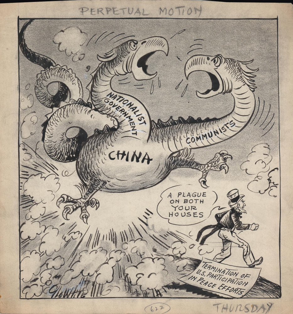
Perpetual Motion.
sold
- Digital Map Information
- Suitable for large format printing
- File Size: 7.57 MB
- File Type: ZIP / TIFF
- ICC color profile embedded
- Delivered instantly via download link
A c. 1947 original art manuscript political cartoon by George White, reflecting American frustrations in attempting to negotiate between rival forces in the Chinese Civil War. It is a relic of the early Cold War, as the U.S. government and American public sought the best approach for confronting the threat of global Communism. This work was later published in the Tampa Morning Tribune. (more details)
British ascendence in South and Southeast Asia.
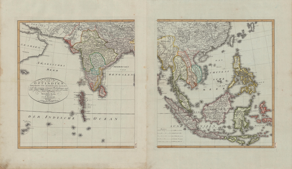
Charte von Ostindien diesseits und jenseits des Ganges.
$600.00
Acquire
- Digital Map Information
- Suitable for large format printing
- Full resolution TIFF file
- ICC color profile embedded
- Delivered instantly via download link
A beautiful 1804 German-language two-sheet map of the East Indies by J. C. M. Reinecke. It depicts the region as British power was ascendant, displacing both indigenous kingdoms and European rivals. (more details)
An elegant early 19th century world map.
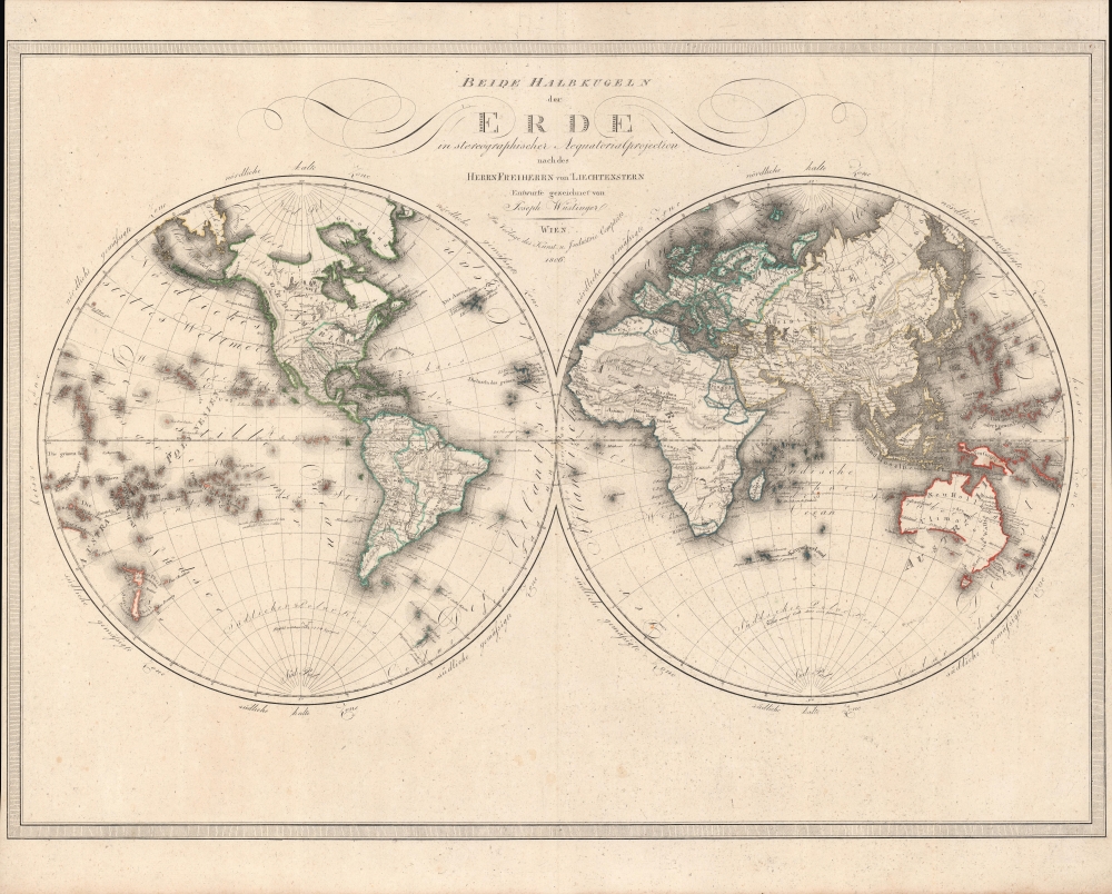
Beide Halbkugeln der Erde : in stereographischer Aequatorialprojection nach des Herrn Freiherrn von Liechtenstern.
sold
- Digital Map Information
- Suitable for large format printing
- Full resolution TIFF file
- ICC color profile embedded
- Delivered instantly via download link
An elegant 1806 world map in two hemispheres by Joseph Wüstinger with outline hand-coloring. It depicts the world with recent discoveries incorporated, including the voyages of Cook and Vancouver. (more details)
Home Ports of the Spanish Treasure Fleet.

Hispalensis Conventus Delineatio Auctore Hieronÿmo Chiaves.
sold
- Digital Map Information
- Suitable for large format printing
- Full resolution TIFF file
- ICC color profile embedded
- Delivered instantly via download link
This is an attractive, original color example of Abraham Ortelius' 1581 map of Seville and its surroundings, Andalusia, Spain. This map details the most crucial home ports of the Spanish Empire, based on the report of Geronimo de Chavez (1523 - 1574), the chief geographer of Spain's Casa de Contratación at the peak of its power. It centers on a pictorial representation of the walled city of Seville and its cathedral on the Guadalquivir River. The vital port and city of Cadiz, home port of the Spanish treasure fleet, appears at bottom center. The region's mountainous terrain is dramatically and artfully depicted. Off the coast of Cadiz a sea battle rages, while hungry sea monsters prowl the waters. (more details)