
The Middle Earth 'Wilderness'.

[Lord of the Rings / Middle Earth / Wilderness].
sold
This is the rare 1965 Ballantine 'Wilderness' poster by Barbara Remington issued for the American release of the paperback edition of J. R. R. Tolkien's Lord of the Rings. The artwork was used as the cover art for each of the three volumes such that, set together, they formed a triptych. The artwork was also issued, as here, in an enormous panoramic poster wherein all three images are joined as one. Remington's work played a significant role in popularizing Tolkien's work worldwide. (more details)
Strait of Magellan, and the imagined lands to the south.
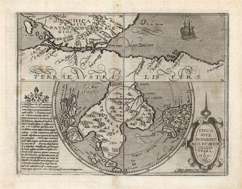
Chica Sive Patagonica et Australis Terra. MDC.
sold
- Digital Map Information
- Suitable for large format printing
- DPI: 600
- File Size: 19.86 MB
- File Type: ZIP / TIFF
- ICC color profile embedded
- Delivered instantly via download link
This scarce and fascinating map is Matthias Quad's 1600 depiction of the Straits of Magellan and the southern polar regions, including Terre Australis - the massive continent believed by many sixteenth and seventeenth century geographers to cover the south part of the world. It is closely derived from a 1597 map by Cornelis Wytfliet, but is much scarcer than the earlier work. (more details)
A perilous course through Siam.

Outline Sketch to Illustrate Remarks.
$2,000.00
Acquire
- Digital Map Information
- Suitable for large format printing
- File Size: 39.93 MB
- File Type: ZIP / TIFF
- ICC color profile embedded
- Delivered instantly via download link
This is a scarce 1883 folding map of the Isthmus of Kra, including the border between British Burma and Siam, and its surrounding waters that appeared in Alfred John Loftus' book Notes of a Journey across the Isthmus of Kra. Although remarkably detailed in some respects, it also demonstrates the challenges in surveying the dense jungle and mountain terrain. (more details)
Commemorating, mythologizing, and critiquing Columbus.
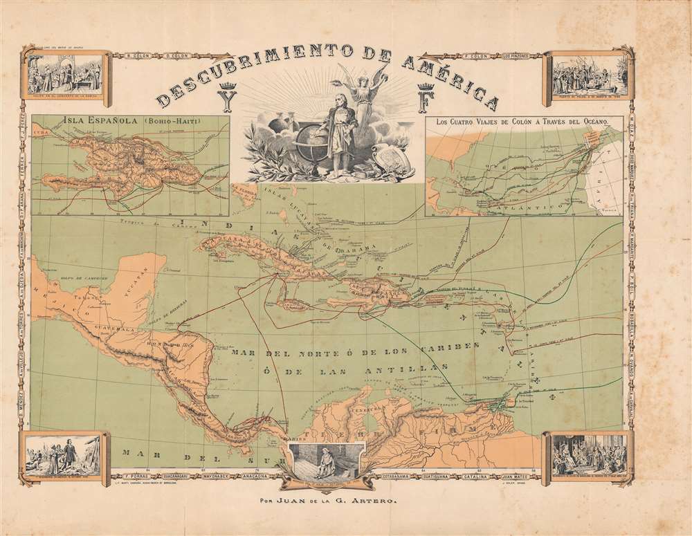
Descubrimiento de América.
sold
- Digital Map Information
- Suitable for large format printing
- File Size: 71.29 MB
- File Type: ZIP / TIFF
- ICC color profile embedded
- Delivered instantly via download link
This is a rare and symbolically complex c. 1892 map of the Caribbean, produced by the Spanish geographer Juan de la Gloria Artero González to commemorate the quatercentenary (400-year anniversary) of Christopher Columbus' landing in the New World. Though broadly celebratory, Artero also highlights some of the more controversial aspects of Columbus' actions in the Americas, while maintaining the importance of the voyages as a hallmark event in the history of the Spanish nation. (more details)
The foundation for the seventeenth century mapping of Russia.
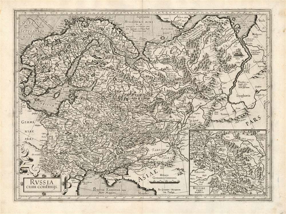
Russia cum confinijs.
sold
- Digital Map Information
- Suitable for large format printing
- Full resolution TIFF file
- ICC color profile embedded
- Delivered instantly via download link
This is a fine example of Gerard Mercator's first map of Russia, in its first atlas edition of 1595. It is overall the second atlas map of Russia, following the 1570 Ortelius, and is in virtually every respect superior to that precursor. Its detail set the standard for maps of Russia, to the extent that Tsarevich Fyodor Godunov would base his own map on it - and his map provided the basis for the maps of Hessel Gerritz and Isaac Massa, which would dominate the 17th century. (more details)
Successfully stopping an epidemic.

Typhus Fever Control Map 1940 - 1941.
sold
- Digital Map Information
- Suitable for large format printing
- Full resolution TIFF file
- ICC color profile embedded
- Delivered instantly via download link
This is a unique 1941 city plan or map of Savannah, Georgia, with typewritten and manuscript content highlighting typhus fever cases from 1940 and 1941. The map was used and updated by Georgia's Typhus Control Service to effectively stem a potential epidemic. (more details)
A Harvard education consists of what you learn at Harvard while you are not studying.
- J. B. Conant

A Prospect of Harvard University and of Radcliffe College.
sold
- Digital Map Information
- Suitable for large format printing
- File Size: 79.31 MB
- File Type: ZIP / TIFF
- ICC color profile embedded
- Delivered instantly via download link
This is a 1935 Edwin J. Schruers pictorial map of Harvard University and Radcliffe College created to commemorate the Harvard's tercentenary. The map depicts from Radcliffe College to Dunster House and from Andover Hall across the Charles River to the Business School and the stadium. Wonderfully illustrated in a bird's-eye view style, buildings throughout campus are named, including Lowell House, Widener Library, the Fogg Museum of Art, Memorial Church, the University Museum, the law school, and Langdell Hall. Streets around campus are also labeled. The armorial crests of various houses are situated in the upper right, and a version of Harvard's crest decorates the compass rose. A view of Harvard College in 1726 is included in the upper left, along with a depiction of a statue of John Harvard. The seal of Radcliffe College is also present. (more details)
Vienna's many buildings and monuments illustrated in monumental fashion.

Wien aus der Vogelschau Plan von Wien mit sämtlichen Monumental-Bauten.
sold
- Digital Map Information
- Suitable for large format printing
- Full resolution TIFF file
- ICC color profile embedded
- Delivered instantly via download link
This is a beautiful c. 1907 Hartleben pictorial monumental map of Vienna, Austria. 155 locations are illustrated pictorially and numerically identified throughout the city, including St. Stephen's Cathedral (No. 1), the Rathaus (No. 41), and the Arsenal (No. 105). Forty-nine more locations (many of which are monuments) are illustrated and alphabetically identified. The extensive indexes occupy the left and right margins outside the map. Prominent red lines trace Vienna's tram network. (more details)
Created by a beloved artist who spent over fifty years on Barbados.

Barbados.
sold
This is a c. 1980 Jill Walker pictorial tourist map of Barbados. Effortlessly combining the practical with charming detail, red lines trace roads across the island and yellow boxes highlight tourist sites. Towns and villages are identified throughout, and hotels, convention centers, yacht clubs, lighthouses, and numerous other locations are labeled as well. A circular inset focusing on Bridgetown occupies the upper right. Wonderful illustrations of fish, birds, tourist sites, local activities, and other vignettes relating to life on Barbados fill the ocean around the island and create a charming pictorial border for the whole piece. (more details)
The last days of Russian America.
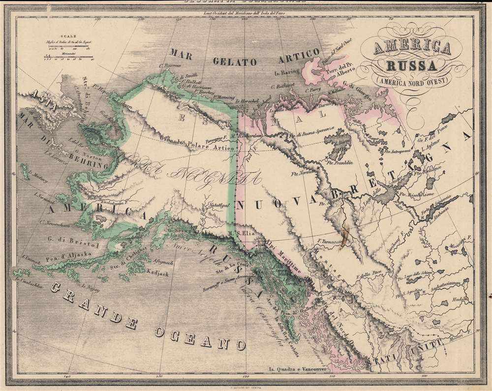
America Russa. (America Nord Ovest).
sold
- Digital Map Information
- Suitable for large format printing
- File Size: 25.16 MB
- File Type: ZIP / TIFF
- ICC color profile embedded
- Delivered instantly via download link
An appealing Italian map of Alaska, northwest Canada, and the Bering Strait produced by Francesco Marmocchi for his 1858 work Il Globo Atlante di Carte Geografiche. It depicts 'Russian America' in its final days, when the Tsarist government began considering proposals to sell the territory. (more details)
The Height of the Scramble for Africa.
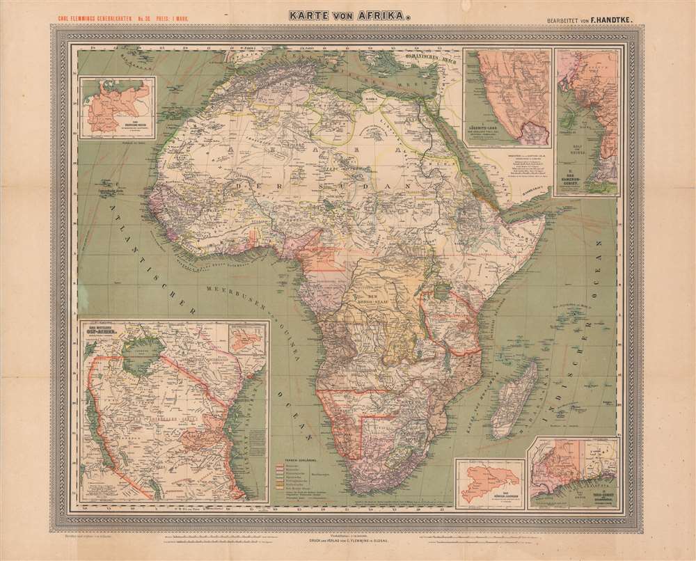
General-Karte von Afrika.
sold
- Digital Map Information
- Suitable for large format printing
- Full resolution TIFF file
- ICC color profile embedded
- Delivered instantly via download link
This is a large-format 1889 German map of Africa from the height of the 'Scramble for Africa' drawn by Friedrich Handtke and published by Carl Flemming. It depicts both European colonies and indigenous kingdoms and confederations, and in particular highlights the recently-established German colonies on the continent. (more details)
One of the most influential maps of the 16th century.
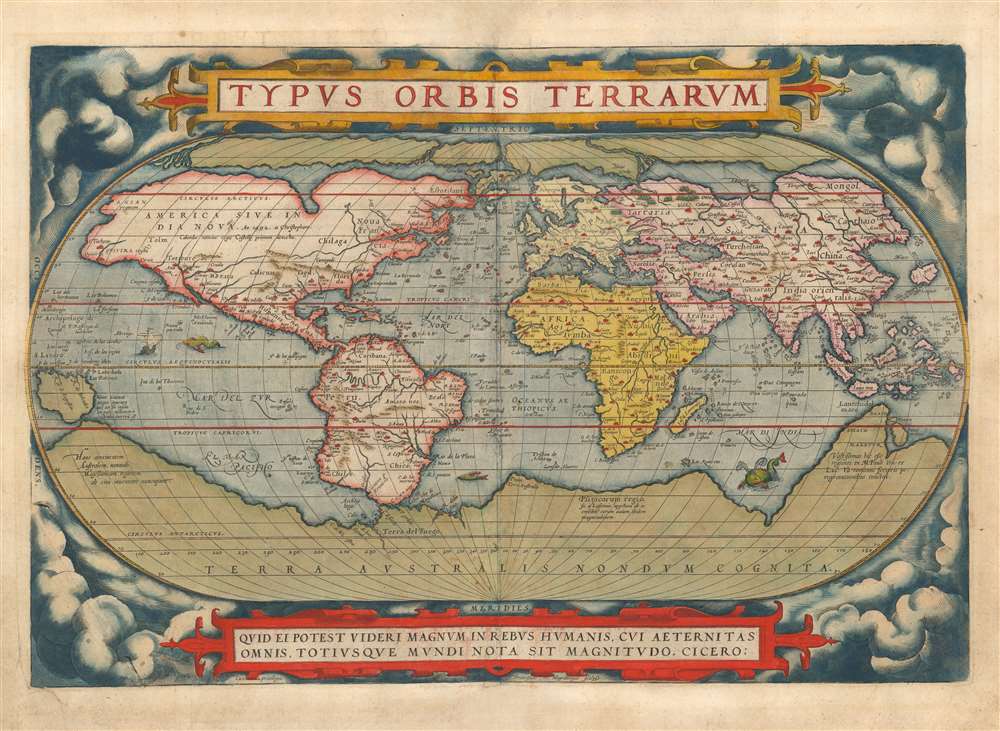
Typus Orbis Terrarum.
sold
- Digital Map Information
- Suitable for large format printing
- Full resolution TIFF file
- ICC color profile embedded
- Delivered instantly via download link
This is a beautiful example of Abraham Ortelius' iconic 1570 map of the world, here in a 1579 edition of the first plate. This map is the first map of the world to appear in a standard atlas and is thus of fundamental importance to the history of cartography. It was one of the most widely-seen, and most influential printed maps of the world produced in the sixteenth century. (more details)
First edition of influential Texas map.
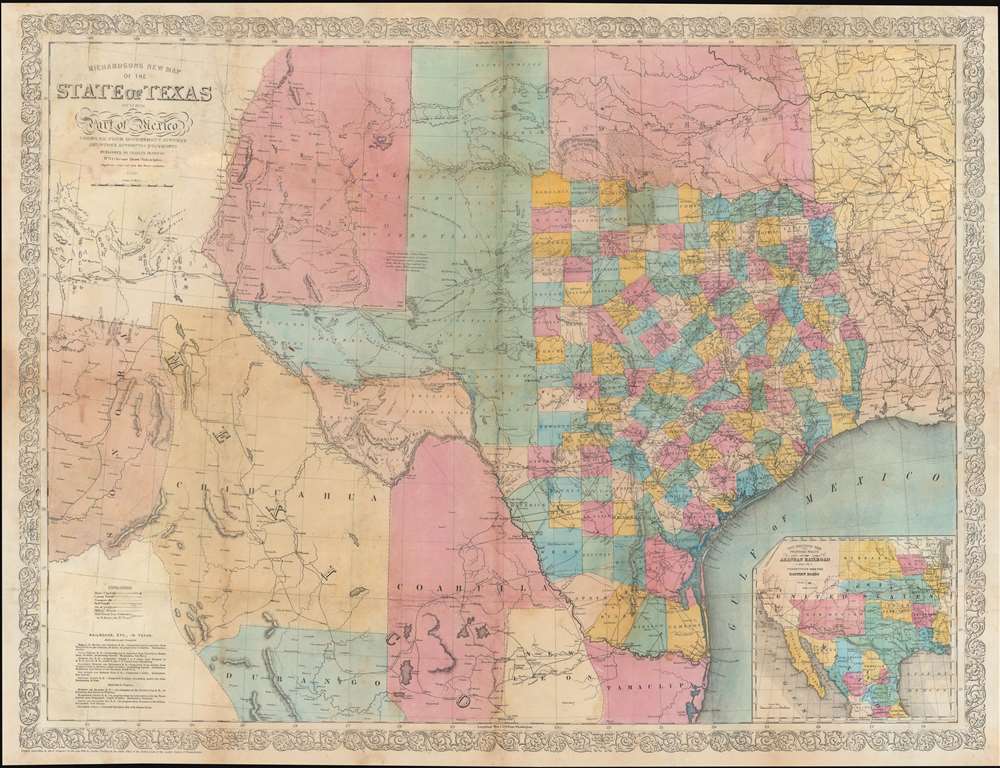
Richardson's New Map of the State of Texas including Part of Mexico.
sold
- Digital Map Information
- Suitable for large format printing
- Full resolution TIFF file
- ICC color profile embedded
- Delivered instantly via download link
This is the rare 1858 / 59 first edition of the large-format Willard Richardson / Charles DeSilver map of Texas. This is the most influential separately-issued map of Texas on the eve of the American Civil War (1861 - 1865). The map is noteworthy not only for its size and detail, but for its exception breakdown of railroads, both extant and under construction. An inset in the lower right details the proposed route of the Arkansas Railroad. (more details)
British propaganda celebrating 'victory' in the Battle of the Atlantic.
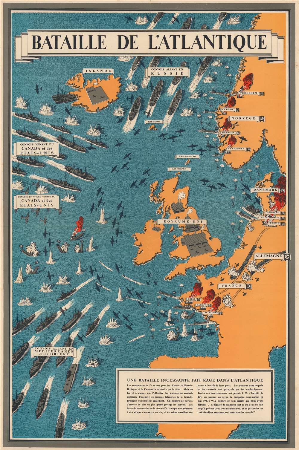
Bataille de l'Atlantique.
sold
- Digital Map Information
- Suitable for large format printing
- File Size: 84.51 MB
- File Type: ZIP / TIFF
- ICC color profile embedded
- Delivered instantly via download link
This is a 1943 Frederick Donald Blake pictorial propaganda broadside of the Battle of the Atlantic - one of the longest and bloodiest campaigns of World War II (1939 - 1945). (more details)
First Double-Hemisphere World in a Printed Atlas.
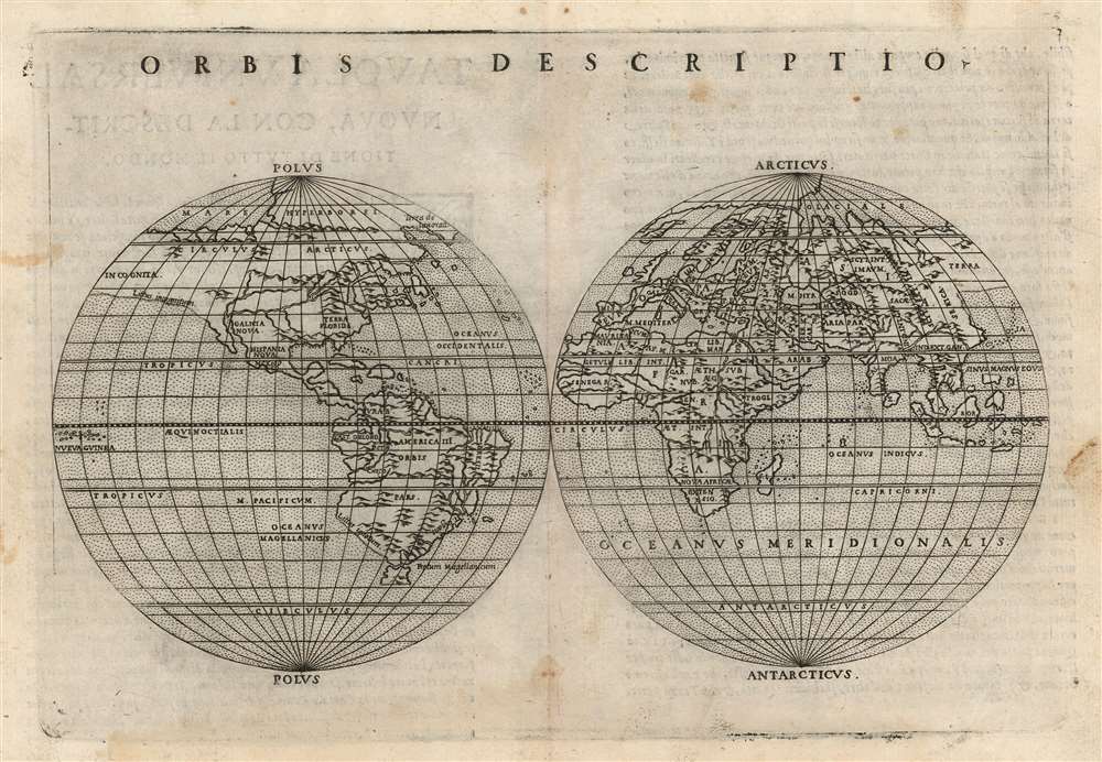
Orbis Descriptio.
sold
- Digital Map Information
- Suitable for large format printing
- Full resolution TIFF file
- ICC color profile embedded
- Delivered instantly via download link
This is Girolamo Ruscelli's 1561 double hemisphere map of the world in its second state of 1574. It is the earliest acquirable world map in this format and is the first such to appear in a printed atlas. Many of its geographic details were derived from the world maps appearing in Giacomo Gastaldi's 1548 Ptolemy, but Ruscelli's double-hemispherical projection transforms this map into a fully new composition. Amongst printed maps, the only earlier map using this projection is the unacquirable 1555 Georgio Sideri 'Calapoda' map. (more details)
Capturing the Geography of the Virtually Unobtainable First State Mercator Arctic.
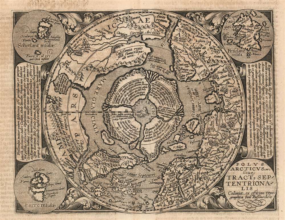
Polus Arcticus sive Tractus Septentrionalis.
sold
- Digital Map Information
- Suitable for large format printing
- DPI: 600
- File Size: 19.18 MB
- File Type: ZIP / TIFF
- ICC color profile embedded
- Delivered instantly via download link
This is a scarce 1600 Matthias Quad map of the Arctic, a beautifully engraved reduction of Gerard Mercator's seminal 1595 Septentrionalium Terrarum descriptio. The timing of the engraving is of great importance: Quad's model was not the relatively ubiquitous 1606 edited version of Mercator's map, but the extremely rare 1595 first state. Although the smaller size of Quad's copperplate necessitated the excision of some place names in Greenland, Norway and Russia, the central Arctic details of the map are very faithfully preserved from the Mercator original - thus making a virtually unobtainable map's cartography available to the more casual collector. Despite the flaws of many of Mercator's sources, his map (and Quad's faithful rendition of it here) presents a fascinating portrait of the best 16th century European conceptualization of the north parts of the world. (more details)
On the Orono.

University of Maine.
sold
- Digital Map Information
- Suitable for large format printing
- File Size: 25.45 MB
- File Type: ZIP / TIFF
- ICC color profile embedded
- Delivered instantly via download link
A rare 1909 Richard Rummell sepia-toned bird's-eye view of the University of Maine, founded in 1865. This is one of the rarest Rummell views, here in its original sepia 'Littig' photogravure edition. (more details)
Geological diversity of China.

中华人民共和国地质图 / [Geological Map of the People's Republic of China].
sold
A very large-format 1976 map of the People's Republic of China, including claimed territory in the South China Sea, Taiwan, and along the border with India, produced by the Chinese Academy of Geological Sciences. It was published in the waning days of the Cultural Revolution and can be seen as representative of a wider revival of the sciences in the mid-1970s following the ideological attacks of the late-1960s and early 1970s. (more details)
Most trafficked and contested part of the West Indies.
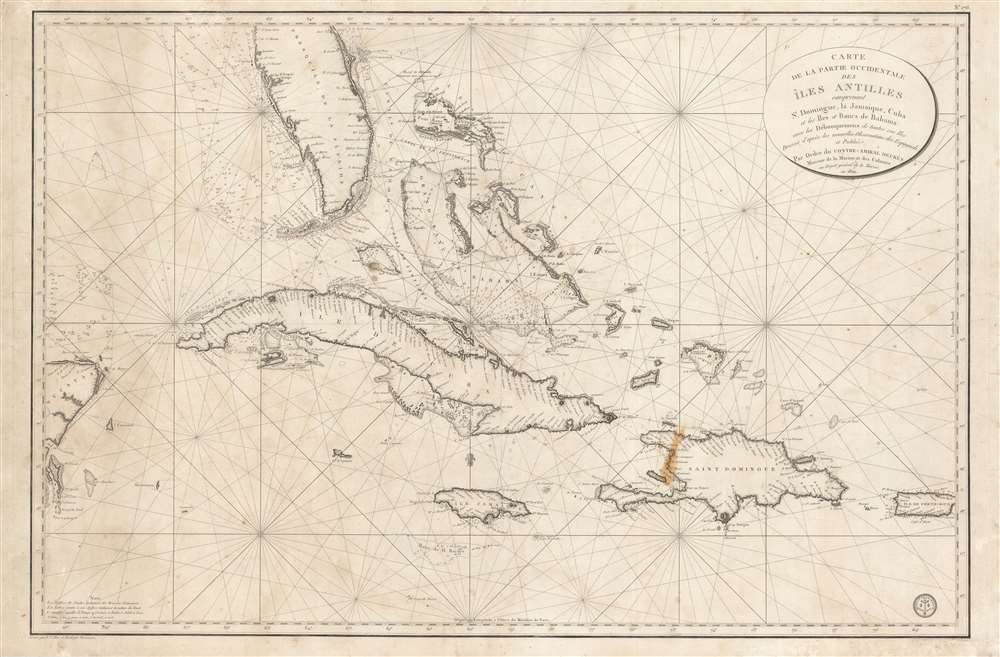
Carte de la Partie Occidentale des Îles Antilles Comprenant St. Domingue, La Jamaique, Cuba et Îles et Bancs de Bahama avec les Débouqumens de toutes ces Îles Dressée d'apres les nouvelles Observations des Espagnols et Publiée Par Ordre du Xontre-Amiral Decrès Ministre de la Marine et des Colonies au Dépôt général de la Marine, en 1801.
sold
- Digital Map Information
- Suitable for large format printing
- DPI: 600
- File Size: 39.35 MB
- File Type: ZIP / TIFF
- ICC color profile embedded
- Delivered instantly via download link
A scarce and elegantly engraved 1801 nautical map of Florida and the Greater Antilles, including Cuba, the Bahamas, Santo Domingo, Puerto Rico, and Jamaica, issued by the official French hydrographic office, the Dépôt de Marine. The map covers from the eastern Yucatan to Puerto Rico and from just north of Cape Canaveral, Florida, to the banks south of Jamaica - thus embracing the most heavily trafficked and contested waters in the West Indies. (more details)
Philadelphia's grand exposition.

The Centennial-balloon view of the grounds...
sold
- Digital Map Information
- Suitable for large format printing
- File Size: 148.3 MB
- File Type: ZIP / TIFF
- ICC color profile embedded
- Delivered instantly via download link
This spectacular bird's-eye view of the 1876 Philadelphia Centennial Exposition appeared as a special supplement to Harper's Weekly on September 30, 1876. Taking in the entire grounds, it displays the grand scale and vast ambitions of the exposition. (more details)